1-3 DAY
See our new “Forecast FAQ” which explains the maps as well as the POTENTIAL and CONFIDENCE meanings.
Thursday
No tornadic activity expected.
UPDATE: Isolated tornadoes are possible in Michigan today as some storms have grown mature enough in a high instability, low/moderate shear environment. A severe thunderstorm watch is currently in effect in eastern Michigan.
Friday
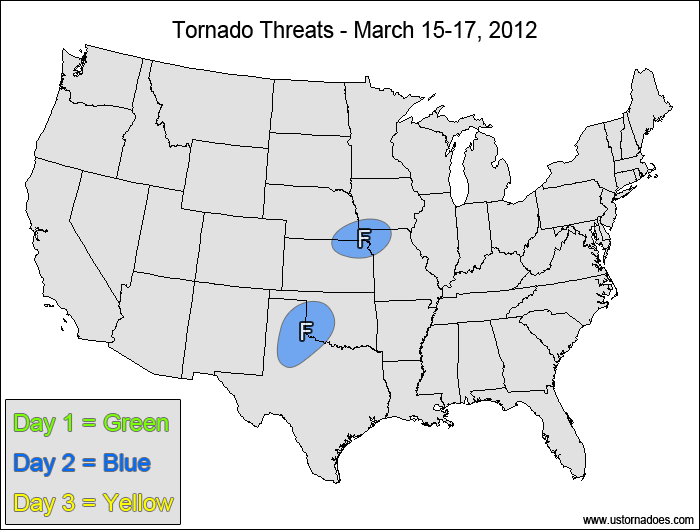
Central Plains — POTENTIAL: Very low — CONFIDENCE: Normal
A high amount of instability on the order of 2000-3000+ J/kg and moderate low-level shear will facilitate tornadic potential in mature storms, but weak upper-level dynamics and speed shear will inhibit storms from becoming tornadic.
Southern Plains — POTENTIAL: Very Low — CONFIDENCE: Normal
Storms firing along a dry line will have moderate low level shear and enough instability to produce rotating storms, however high LCLs and an elevated mix layer will work against tornadic development.
Saturday
No tornadic activity expected.
4-7 DAY
Sunday
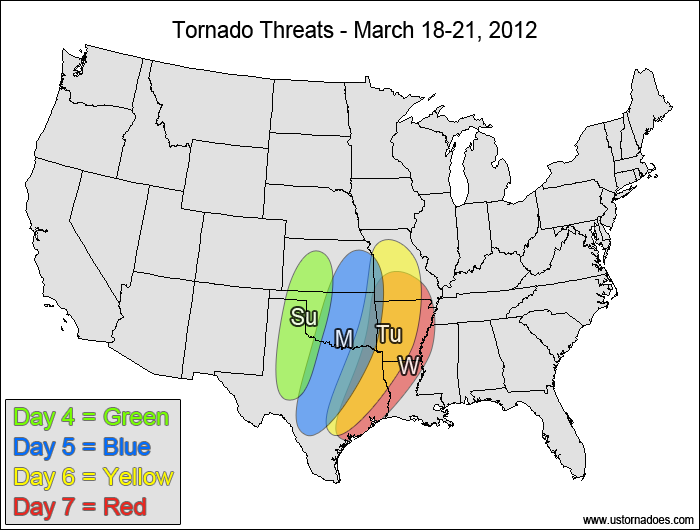
Southern and central Plains — POTENTIAL: High — CONFIDENCE: Normal
An upper-level trough will push into the Southwest on Sunday, and height falls over the dry line Sunday evening and Sunday night will allow for storms to develop in an environment with 750-1500 J/kg CAPE and moderate shear. A few tornadoes will be possible within the risk area.
Monday
Southern and central Plains — POTENTIAL: High — CONFIDENCE: High
Storms will push eastward throughout the day Monday as the upper-level disturbance stalls over the Rockies and western Plains. There is some potential for a tornado outbreak, but the potential is limited by the storms being displaced from the strongest dynamics as well as the trough turning neutral to negative tilt, which will cause backing winds aloft.
Tuesday
ArkLaTex, southwestern Midwest — POTENTIAL: High— CONFIDENCE: Normal
The tornadic potential remains heading into Tuesday as the storms slowly progress eastward, with the upper-level trough catching up with the surface and low-level features to create widespread severe storms. While not an ideal setup, this day is showing the greatest potential for a tornado outbreak during the forecast period. The timing and placement of the disturbance starts to become a more serious issue as model agreement and run-to-run model consistency starts to become poor.
Wednesday
ArkLaTex, southwestern Midwest — POTENTIAL: Medium — CONFIDENCE: Low
By the time we reach Wednesday, confidence in the storm evolution has become low as the system cuts-off over the Plains, but there is enough evidence that tornadic development will continue that a risk area for Wednesday is needed.
Latest posts by Mark Ellinwood (see all)
- Spring 2023 seasonal tornado outlook - March 1, 2023
- Spring 2022 seasonal tornado outlook - March 1, 2022
- Spring 2021 seasonal tornado outlook - March 1, 2021
One thought on “Tornado Threat Forecast – Mar 15-21, 2012”