1-3 DAY
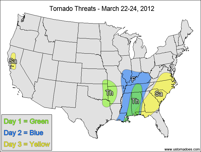
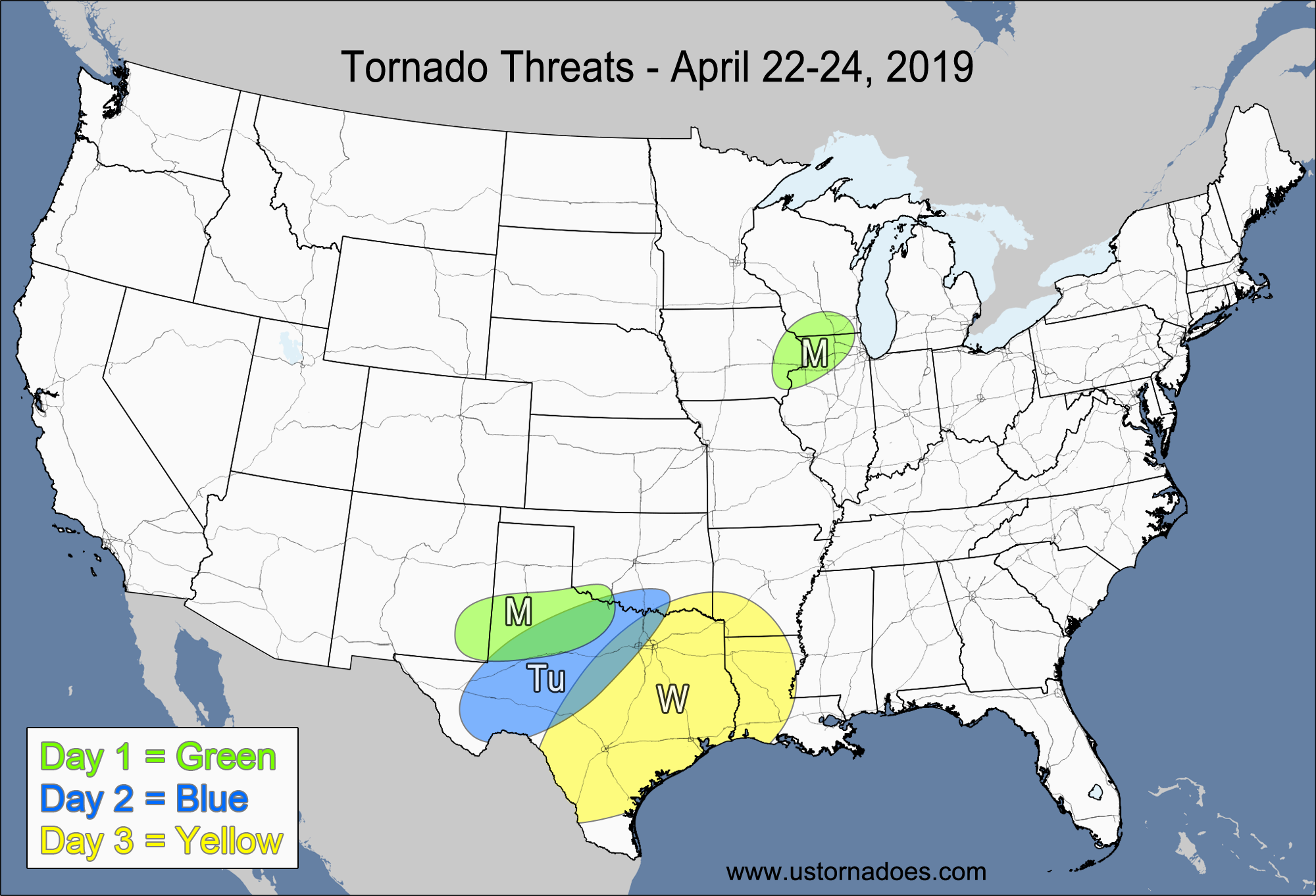
Thursday
Southeast, southern Plains — POTENTIAL: Medium — CONFIDENCE: High
The highest tornado potential comes with the line of storms working their way through the Southeast today, with a low risk of tornadoes overnight in eastern LA and southern MS as a new line of storms forms. Tornadic activity is possible with the cold core low later this afternoon into the overnight hours as it moves into eastern OK and the ArkLaTex region. Low to moderate instability in the risk areas along with extensive cloud cover will work against tornado formation today.
Friday
Southeast, southern Midwest — POTENTIAL: Medium — CONFIDENCE: Normal
As the disturbance starts to pick up speed, it will bring the tornado risk further north and east as some tornadic potential also lags behind with the upper-level low. At this point, the storm system isn’t terribly organized, which in addition to widespread cloud cover and scattered showers will keep the potential and confidence down.
Saturday
Southeast, southern Mid-Atlantic — POTENTIAL: Medium — CONFIDENCE: Normal
The storm system tries to get its act together upon reaching the East Coast on Saturday, but with only low to moderate amounts of CAPE and mostly unidirectional wind shear the tornadic threat will be limited. Strong dynamics and a very low amount of CAPE provide a low risk for tornadoes in CA.
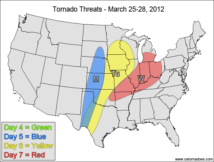
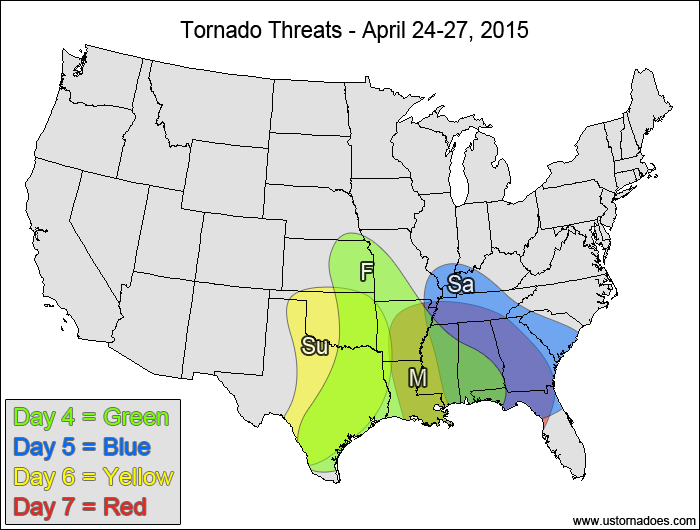
4-7 DAY
No tornadic activity expected.
Monday
Plains — POTENTIAL: Low — CONFIDENCE: Normal
A new disturbance working into the Plains will bring a low tornadic threat as the upper-level vorticity maximum moves into the northern Plains. Confidence in the placement of the risk area is near normal, but an elevated mix layer will provide a sizable cap over the Plains, which will prove to be hard to break. A dry line will help with surface wind convergence in the central and southern Plains, with the cold front advancing into the northern Plains.
Tuesday
Plains, Midwest — POTENTIAL: Low — CONFIDENCE: Low
Uncertainty in the timing and position of the disturbance keeps confidence low heading into Tuesday as the tornadic potential remains similar to Monday, with the cap continuing to limit tornadic potential. The best chance for tornadoes will be in the Midwest, where the strongest dynamics and height falls are.
Wednesday
Midwest — POTENTIAL: Very Low — CONFIDENCE: Low
The storms will try to become better organized along and ahead of the advancing cold front on Wednesday, but a lack of directional wind shear in the low-levels and low to moderate instability makes the tornadic potential very low. The uncertainty in the timing and location of the disturbance and the trailing cold front continues to be an issue, keeping the confidence low.
Latest posts by Mark Ellinwood (see all)
- Spring 2023 seasonal tornado outlook - March 1, 2023
- Spring 2022 seasonal tornado outlook - March 1, 2022
- Spring 2021 seasonal tornado outlook - March 1, 2021


