1-3 DAY
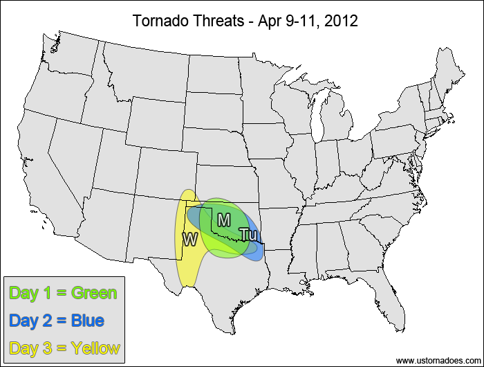
Monday
Southern Plains — POTENTIAL: Medium — CONFIDENCE: Normal
Initially-capped atmosphere will give way to moderate CAPE and low to moderate shear in the southern Plains this afternoon into the overnight hours. Good directional shear throughout the column will enhance the tornado potential, but the modest low and mid level speed shear will inhibit tornado development.
Tuesday
Oklahoma, northern Texas — POTENTIAL: Low — CONFIDENCE: Normal
A stalled frontal boundary will help trigger storms and will enhance low-level directional shear in a region with CAPE exceeding 1500-2000 J/kg. High LCLs to the south of the boundary along with weak speed shear will inhibit the tornado potential.
Wednesday
Southern High Plains, OK/TX border — POTENTIAL: Very Low — CONFIDENCE: Normal
Aside from a good veering wind profile involving southeasterly winds and the surface and westerly winds aloft, there is not much support for tornado development. CAPE will on the lower side, with most areas limited to 1000-1500 J/kg or less. In addition, the tornado potential will be limited by weak speed shear, weak upper-level support and high LCLs.
4-7 DAY
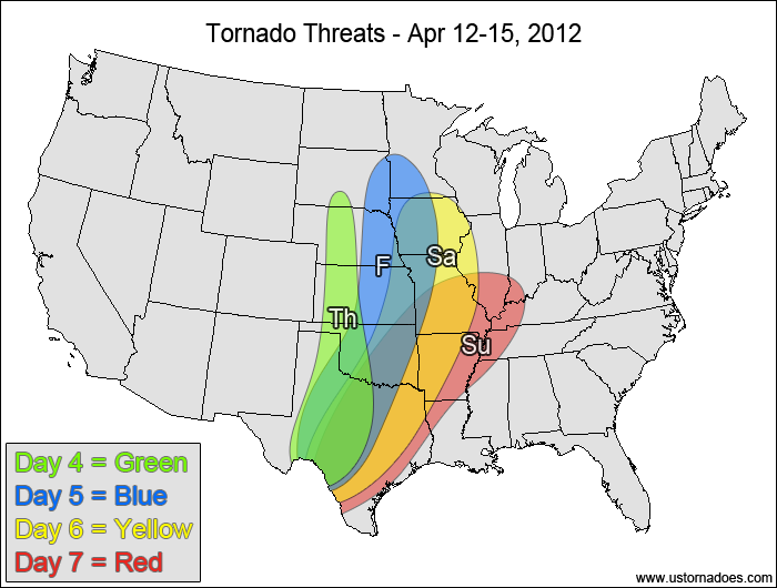
Central and southern Plains — POTENTIAL: Medium — CONFIDENCE: Normal
Confidence will remain limited as the model solutions start to significantly diverge at this range. A narrow corridor of low to moderate CAPE will develop along the dry line, with moderate to strong shear allowing for the potential for a tornado outbreak. However, with the spread in the model solutions and potential capping issues, a medium potential (one to several tornadoes) seems like the best forecast at this time.
Friday
Plains, western Midwest — POTENTIAL: High — CONFIDENCE: Normal
The tornado potential increases on Friday as stronger, more organized upper-level forcing moves into the Plains. Capping issues remain a concern farther south in Texas, but the cap is expected to erode north of Texas as height falls overtake the dry line and push eastward into the central Plains. Ongoing showers and storms could inhibit the instability within the risk area, but enough clearing is expected for at least pockets of storms with tornadic potential to develop. If enough clearing can occur, a tornado outbreak will be possible.
Saturday
Central and southern Plains, western Midwest — POTENTIAL: High — CONFIDENCE: Normal
Moderate to strong upper-level forcing and strong shear will work with low to moderate CAPE to provide the potential for a tornado outbreak on Saturday across the central Plains and southwestern Midwest. The southern Plains will have less shear and some capping to deal with, but instability is forecast to be in the moderate to high range, approaching 3000+ J/kg CAPE in some areas. This higher CAPE along with good directional wind shear in the low-levels will allow for the the potential for tornadoes despite the weaker speed shear.
Sunday
Southern Plains, southwestern Midwest, ArkLaTex — POTENTIAL: Medium — CONFIDENCE: Low
Low to moderate CAPE and shear will remain over the southern Plains, southwestern Midwest and in the ArkLaTex region, but weakening upper-level dynamics and weaker low-level directional shear will lower the overall tornado threat. Ongoing showers and storms in the risk area during the morning and afternoon hours will also lower the tornado potential.
Latest posts by Mark Ellinwood (see all)
- Spring 2023 seasonal tornado outlook - March 1, 2023
- Spring 2022 seasonal tornado outlook - March 1, 2022
- Spring 2021 seasonal tornado outlook - March 1, 2021


