If you don’t follow us on Twitter or Facebook, you may have wondered why we have not updated the site in a few days, which is fairly unusual. Well, Mark Ellinwood and myself left the East Coast on Wednesday for our chasecation in the Plains, joined by Jason Foster. Compared to last year, the trip has been quite busy for the first few days. We’ve seen storms every day, but also a few busts (on the 24th in Wisconsin and the 26th in Nebraska).
However, May 25 was a big day for us in southwest Kansas as a disturbance interacted with quality shear and a dry line/warm front intersection to create a handful of supercells that dropped tornadoes.
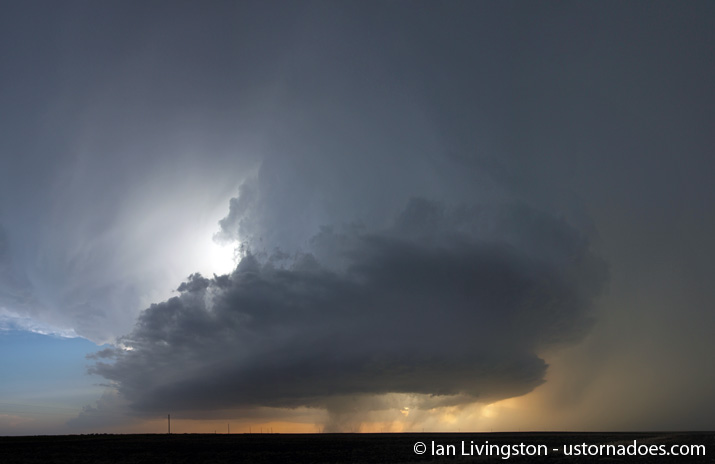
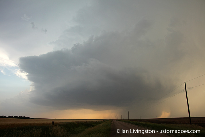
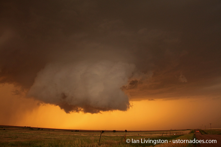
The first storm formed as we were heading west to our target after leaving Waterloo, Iowa that morning. While it dropped a tornado or two, we decided to run for storms developing to its south. First we hit the middle supercell and saw several gustnados as well as a brief and weak tornado. The storm weakened a bit while we were on it, so we decided to run for the developing “tail end Charley.” Initially the storm remained rather high based, though the structure on it was fantastic and we were treated to quite a show.
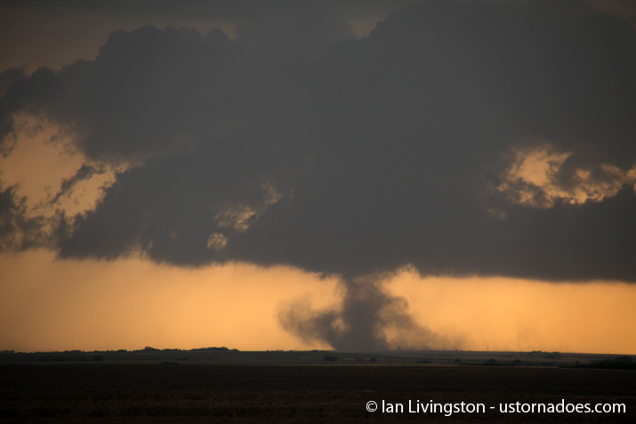
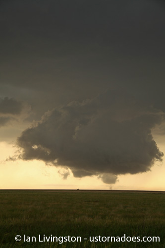
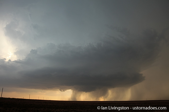
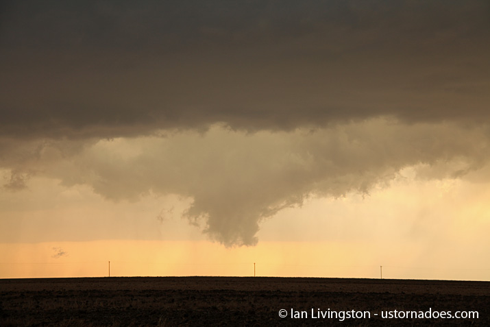
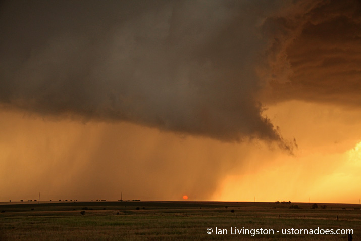
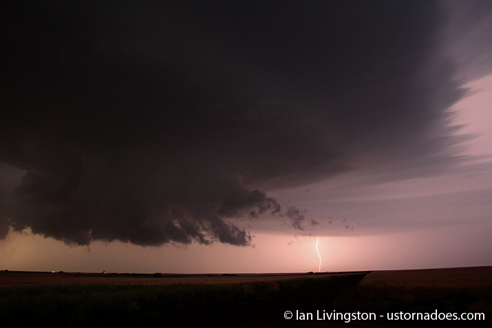
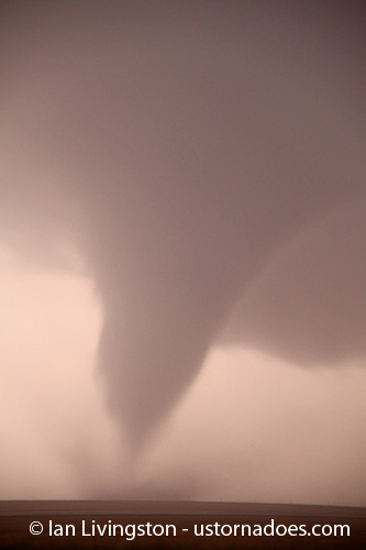
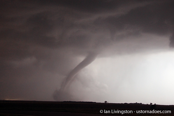
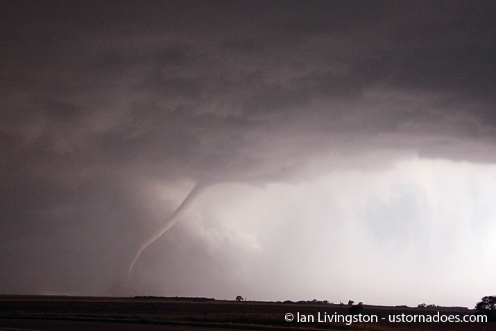
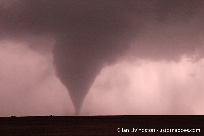
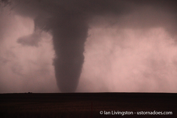
As sunset approached, bases lowered and a new wall cloud rapidly formed very low to the ground. The colors of sunset provided brilliant views while the storm came closer and closer to producing tornadoes. Finally, as twilight began to wane and darkness set in, tornadoes began to drop.
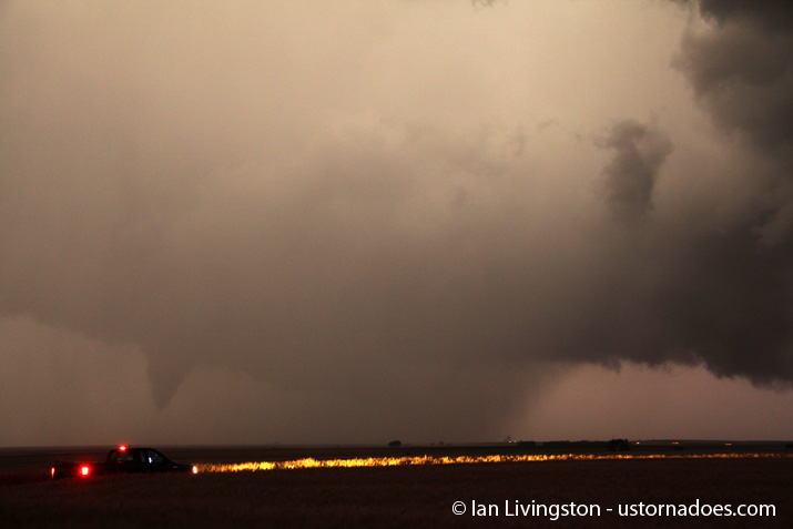
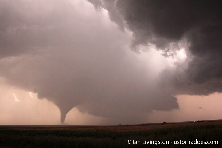
The first tornado on the southern cell touched down around 9:15 p.m., with additional ones cycling through at least 10:30 or so. We finally called off the chase after watching the wall cloud not produce for about 20 minutes.
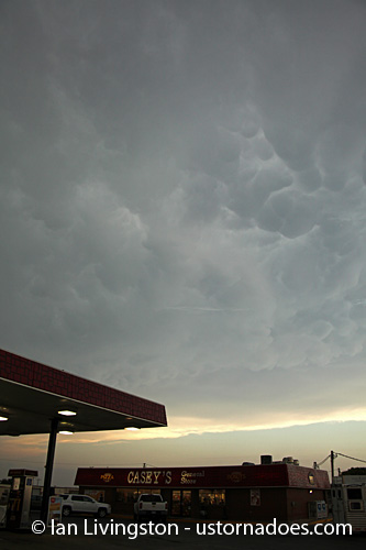
Below is a sample of imagery from the chase…
Latest posts by Ian Livingston (see all)
- Top tornado videos of 2023 - January 1, 2024
- March 31, 2023 tornado outbreak videos - March 31, 2023
- Top tornado videos of 2022 - December 31, 2022

One thought on “May 25, 2012 Storm Chase”