A potent upper-level disturbance currently working into the Southwest will push northeastward through the weekend, bringing a tornado potential to the Plains and western Midwest tomorrow and Saturday. While this system has a lot going for it in terms of the dynamics and winds, there are a few things that could limit the tornado potential. It’s been difficult trying to combine all the parameters of Friday and Saturday into a clear tornado outlook, with each day having different things both going for and going against it.

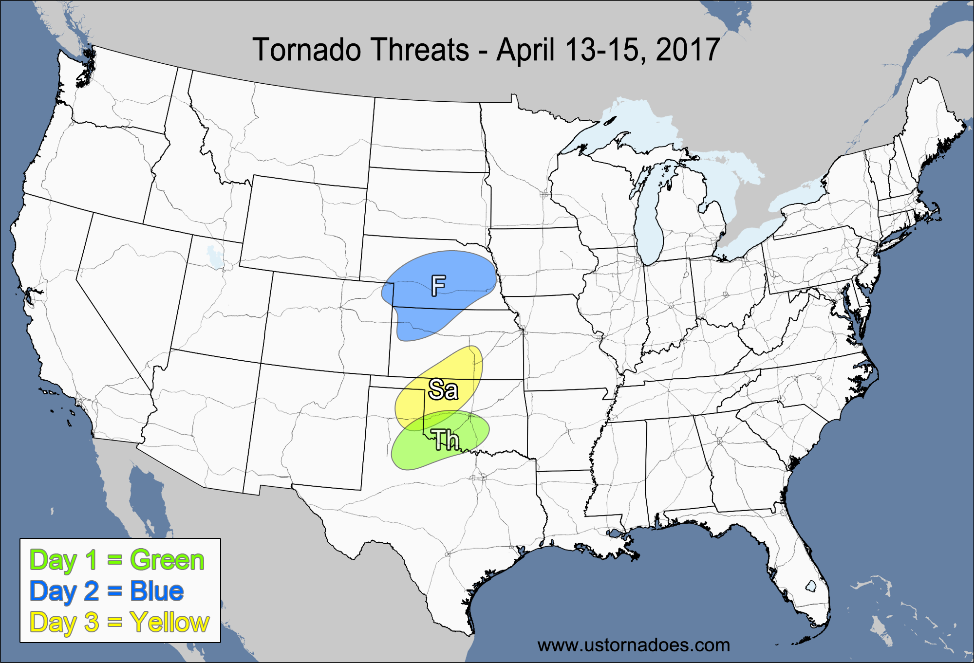
Friday
Southern High Plains — POTENTIAL: Medium — CONFIDENCE: Normal
Saturday
Central Plains, southwestern Midwest — POTENTIAL: Medium — CONFIDENCE: Low
Slower storm motion, more isolated activity and better low-level directional shear make Friday a safer bet than Saturday with regards to the tornado potential. Both days will have low to moderate CAPE, but earlier clouds and rain could hinder activity in the Midwest on Saturday. Friday is missing a solid surface low, which would help back the winds at the surface, but right now it looks like the surface winds will already be out of the south/south-southeast within the risk area, so it is not as critical to have the surface low in this case. Some cloudiness could limit the heating potential within the risk area, but there appears to be sufficient instability even with the cloud cover to warrant a medium risk. Additional backing of the surface winds provides a low threat near the warm front in north-central Oklahoma and southwestern Kansas, but storms may struggle to form in the warm sector and could quickly slide north of the warm front after they form, making the potential very limited.
Saturday will have a stronger wind field compared to Friday, and while it does look impressive from a general severe weather perspective, the directional shear could be lacking, limiting storm rotation and tornado potential. It looks more like a potential severe wind outbreak as a squall line develops, with isolated tornado potential within the squall and with any supercells that could form ahead of the squall line. The greatest potential appears to be in southern Iowa, northwestern Missouri and far eastern Kansas. If the parameters come together better than expected on Saturday, the tornado potential could increase. A tornado outbreak is not out of the question, but the setup isn’t clear enough to make such a call at this time.
Latest posts by Mark Ellinwood (see all)
- Spring 2023 seasonal tornado outlook - March 1, 2023
- Spring 2022 seasonal tornado outlook - March 1, 2022
- Spring 2021 seasonal tornado outlook - March 1, 2021