Early Sunday afternoon, Mark posted this tornado threat forecast for the system that will affect the southern United States from the 24th through the 26th. Let’s take a closer look at the scenario.
As with each good forecast, let’s start with the here and now. The main jet streak that will be associated with the Christmas system is just beginning to propagate ashore along the West Coast. A weak shortwave is located in the central United States, which is aiding in weak warm air advection (WAA) across the Gulf Coast region. This WAA is supplying plenty of moisture along the Gulf Coast and especially into Texas. This moisture will be easy to transport northward as the main system evolves on Christmas Day.
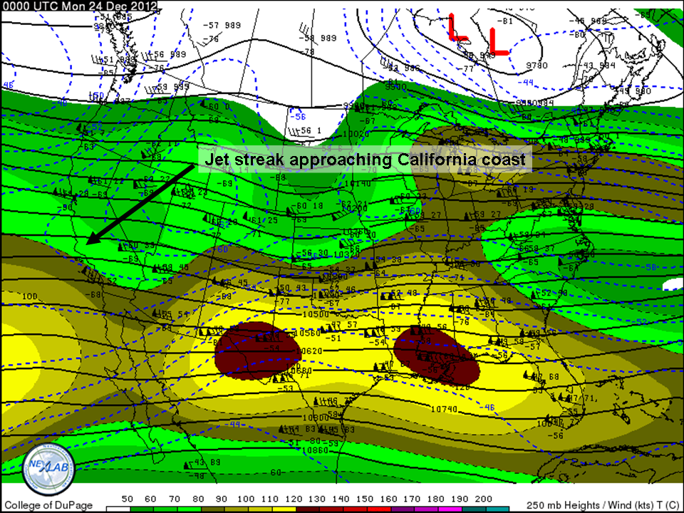
Figure 1: 24/0000 UTC 250 hPa analysis. Note the wind maximum across the southern High Plains region and the major jet axis off the West Coast.
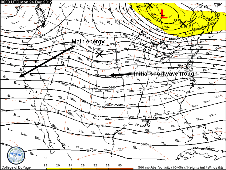
Figure 2: 24/0000 UTC 500-hPa heights, wind, and vorticity. Note the shortwave over the Plains and the main energy off the West Coast.
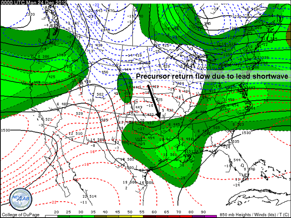
Figure 3: 24/0000 UTC 850-hPa analysis showing WAA across TX and LA.
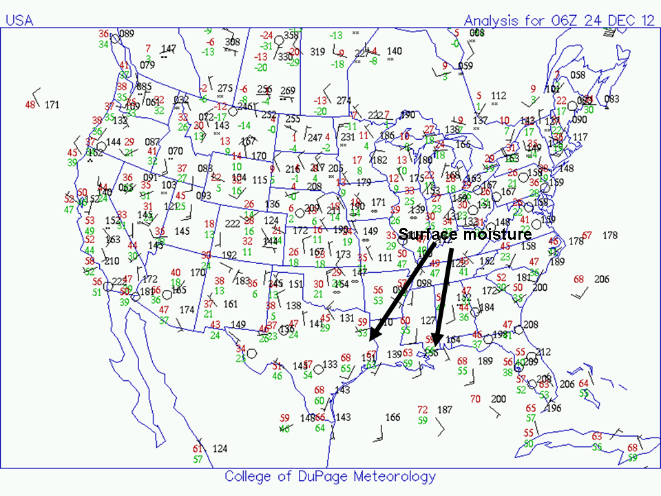
Figure 4: 24/0600 UTC surface analysis showing plentiful moisture across TX, LA, and the northern Gulf.
With the jet energy coming ashore along the West Coast and significant moisture return to the Gulf Coast, the players are in place for a significant severe weather episode. Now, let’s get a taste for how the model output evolves this system. Though I generally dislike using the NAM beyond 48h, I’ll be using its 24/0000 UTC iteration in this post to show a more detailed evolution of the surface low since agreement between the NAM, GFS, and Euro is generally rather high as of now.
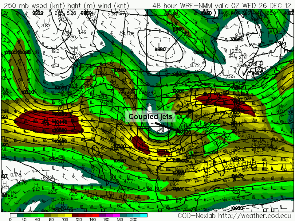
Figure 5: 26/0000 UTC to 27/0000 UTC NAM 250-hPa winds and heights from the 24/0000 UTC NAM. Note the coupled left-exit and right-entrance regions of the jet streaks and the intensification of the system.
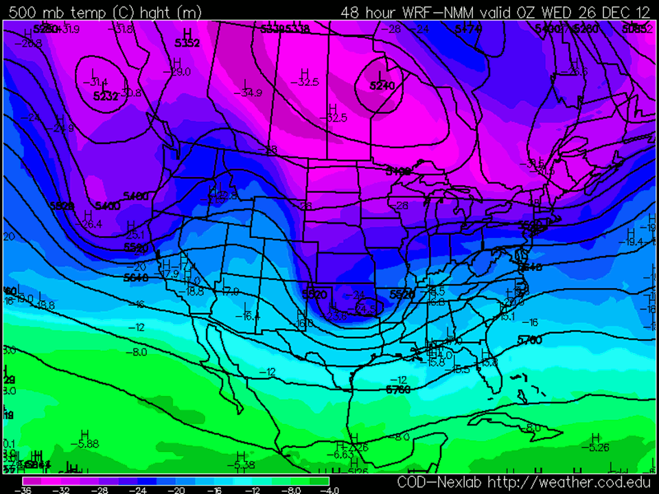
Figure 6: 26/0000 UTC to 27/0000 UTC NAM 500-hPa heights and temperatures. Note that temps will be on the order of -14 to -16°C across the warm sector. These values are cold, even by December standards, for a warm sector of a system in the southern United States, and will aid in fueling sufficient instability for severe storms.
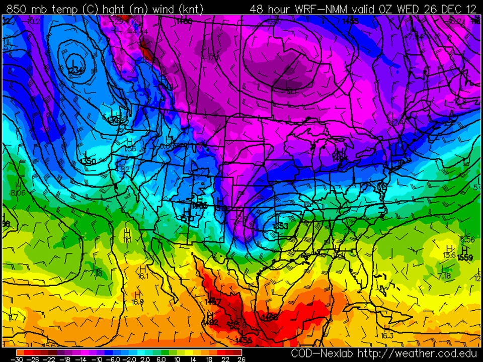
Figure 7: 26/0000 UTC to 27/0000 UTC NAM 850-hPa winds, heights, and temps. Note the strong WAA ahead of the low, with 40-45 kt winds in the warm sector. These winds will advect warm, humid air northward from the Gulf of Mexico, as well as be responsible for very high values of low-level wind shear, which will aid in tornado formation.
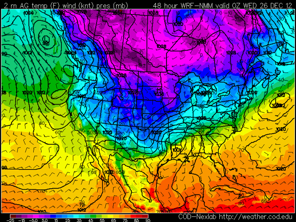
Figure 8: 26/0000 UTC to 27/0000 UTC NAM surface pressure, winds, and temps. Note the deepening of the primary low as it propagates toward the Ohio Valley. Also of great interest is the secondary low formation it depicts in the Piedmont of the Carolinas. The Euro and GFS also indicate this. This secondary low formation would lend to higher low-level shear on Wednesday in the Carolinas and yet an additional higher-end severe weather threat day.
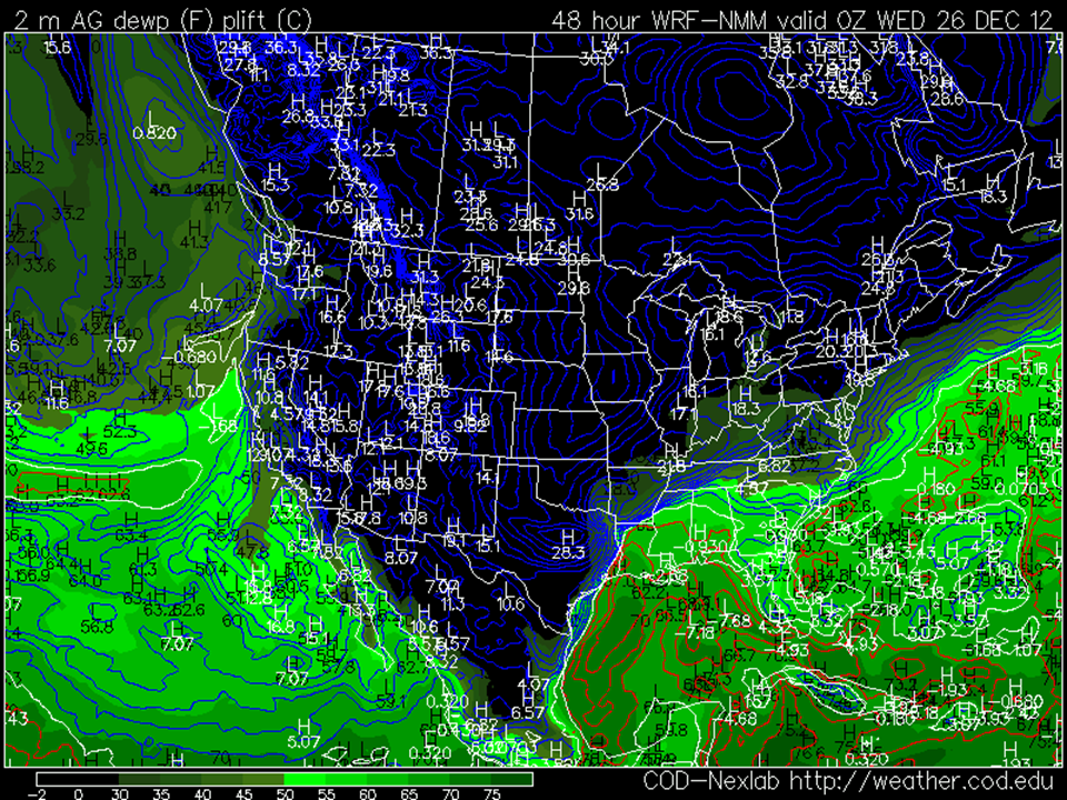
Figure 9: 26/0000 UTC NAM surface dewpoints and lifted indices. Note the breadth of the warm sector consisting of dewpoints of 55-65°F.
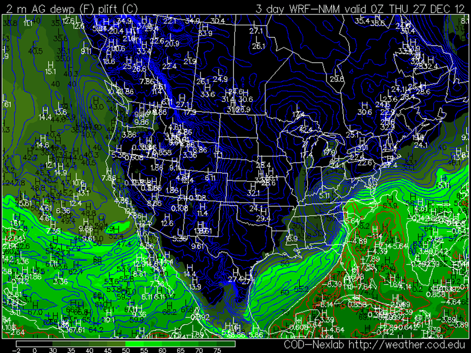
Figure 10: As in Figure 9, for 27/0000 UTC.
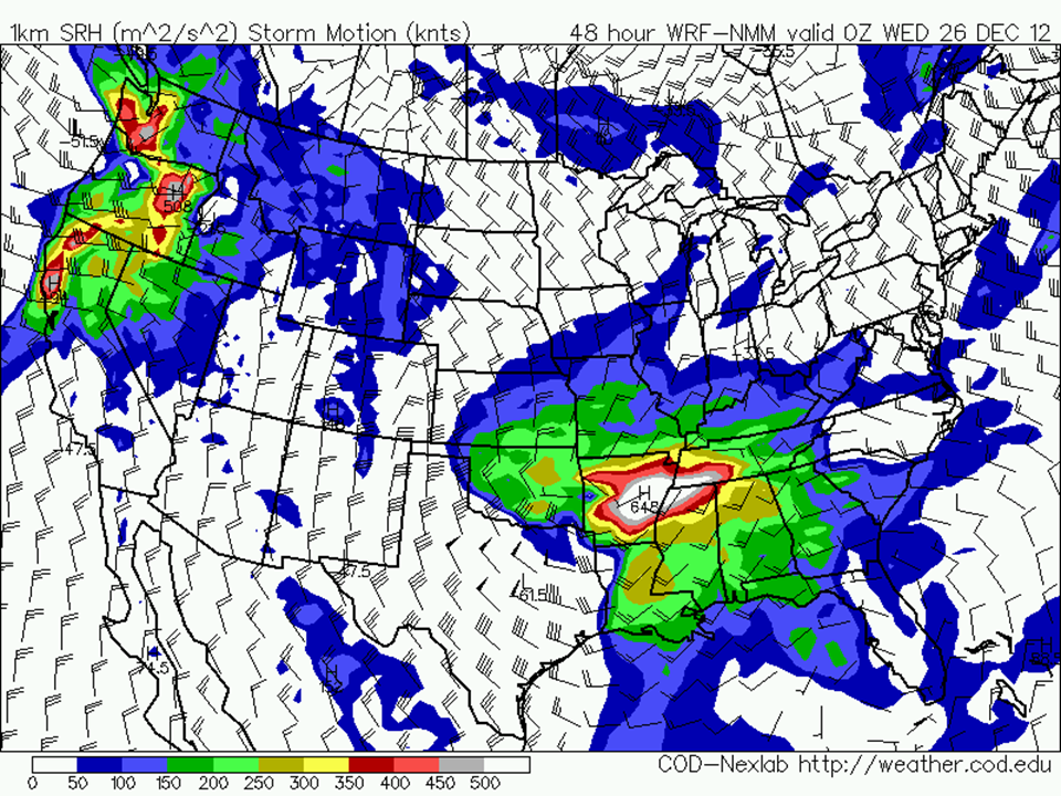
Figure 11: 26/0000 UTC NAM 0-1km SRH. Values over 150 m^2 s^-2 have been found to be supportive of tornado activity. Note the high values in the warm sector of the system.
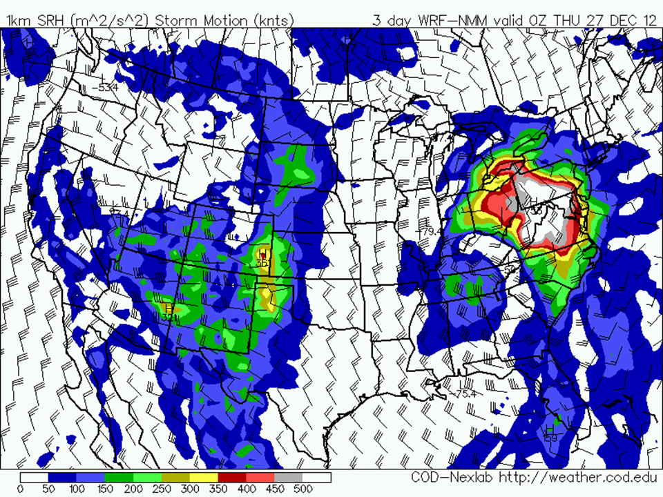
Figure 12: As in Figure 11, only for 27/0000 UTC.
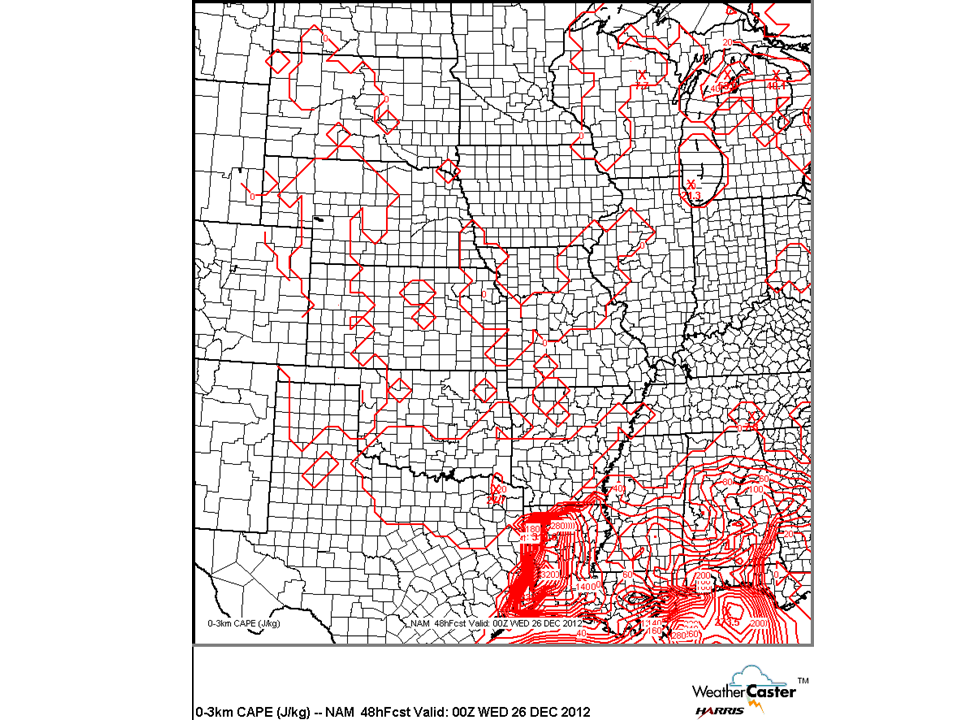
Figure 13: 26/0000 UTC 0-3km CAPE. This value for CAPE can serve as a good judgement of the rate at which a convective updraft will be able to accelerate near to the surface. In the case of a supercell, this low-level acceleration can lead to enhanced low-level vorticity stretching and an increased likelihood of tornadoes. Values of 75 J/kg or higher are usually supportive of tornadoes, with values 150 J/kg or higher often supportive of significant tornadoes. In conjunction with sufficient mid-level instability and strong shear, the values above are quite alarming.
Bottom Line
This is a classic, synoptically-evident severe weather/tornado outbreak setup. As mentioned in an earlier tweet, one similar past setup to this event was the 21 February 1971 tornado outbreak (see link below), which was a very similar synoptic setup focused a bit to the northwest of this upcoming storm’s threat area. Areas from LA across central and southern MS, all of AL, southern Middle/East TN, GA, northern FL, and the Carolinas need to pay special attention to this, as there is the potential for numerous tornadoes, some of which could be long-tracked and destructive. Additionally, a squall line accompanying the cold front may serve to pose a widespread damaging wind threat. Because it’s the Christmas holiday, we urge you to make sure family and friends in the threatened areas are aware of the threat and have a way to receive NWS watches and warnings.
TL
Related posts
The Mississippi Valley Outbreak of 1971 and February’s only F5 tornado
Christmas Eve and Christmas Day Tornado History
Tony Lyza
Latest posts by Tony Lyza (see all)
- 2014’s EF3+ tornado drought: The latest in the year on record without one - April 8, 2014
- Tornado Damage Surveys and Ratings: Why Pictures Don’t Tell the Whole Story - February 19, 2013
- Quick Update: Tornado Outbreak Likely Christmas Morning through the 26th - December 24, 2012
Very nicely done!
Seems like the wind up in North Alabama is more favorable for rotating storms yet the instability is further south. Regardless, the environment is sufficient all over Alabama, but I think we may see tornadoes up into North Alabama since it will take less to get the storm spinning. What do you think?
Northern areas definitely have better shear, but if the storms are not surface-based (where there is instability) then it will be very difficult to get tornadoes. The warm sector could eventually get into northern AL, but that will probably have to wait until the Christmas evening into the overnight hours.