April 2011 was a defining month in terms of tornado climatology. The most talked about event which took place during this month was the Super Outbreak of April 25th-28th that devastated parts of the southeast. The magnitude of that late-April event often overshadows a separate historic tornado outbreak that occurred earlier in the month, from April 14-16.
Here I focus on the April 16 portion of the event, which unfolded mainly across the Carolinas and Mid-Atlantic.
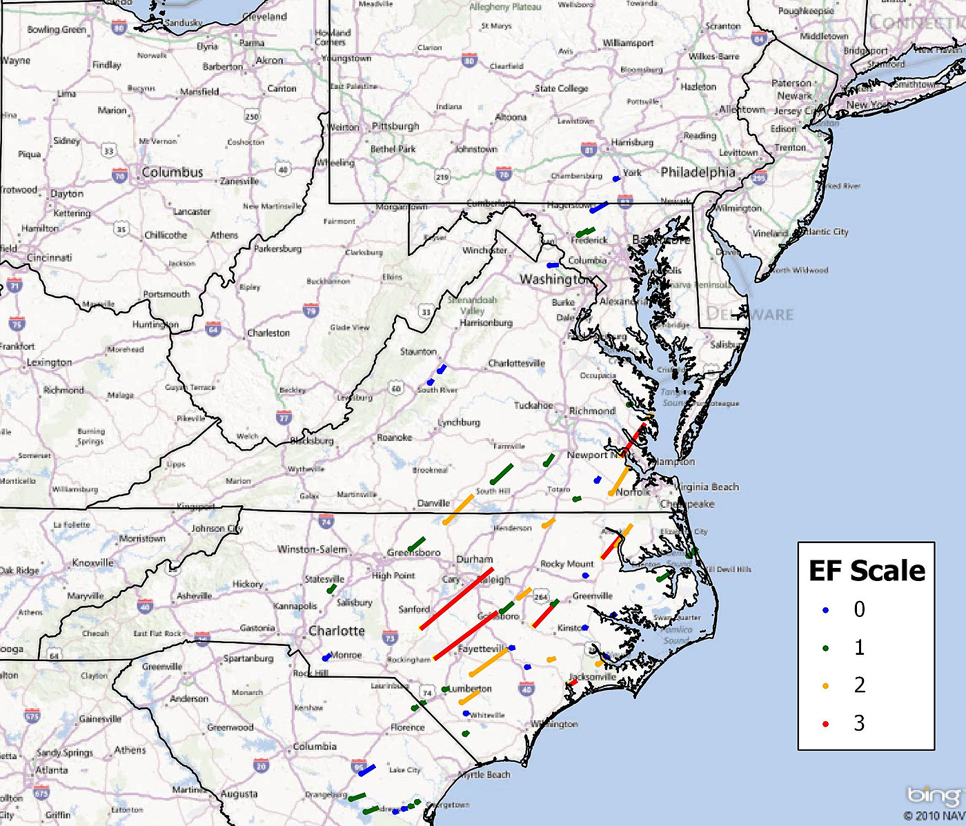
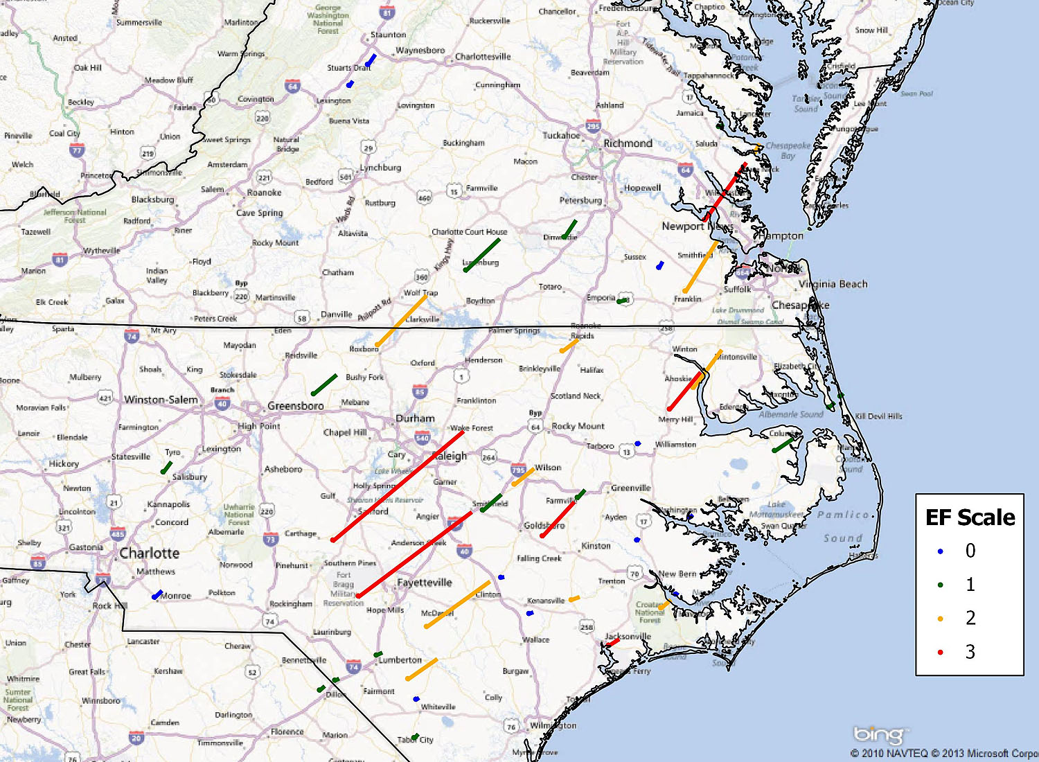
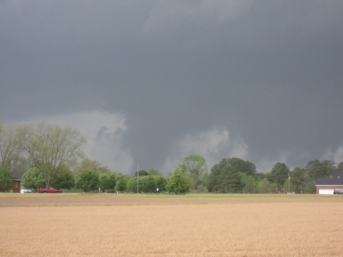
April 16 produced 57 tornadoes (including two close to midnight separate from the main barrage), with North Carolina the hardest hit state. One of the most striking aspects of this event was how many tornadoes went through major urban areas including Fayetteville, North Carolina off of Interstate 95 and of course downtown Raleigh, North Carolina.
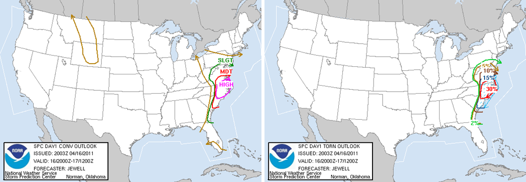
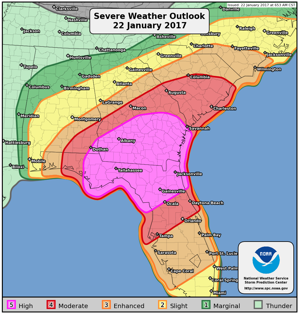
The Storm Prediction Center was monitoring this region for a possible severe weather outbreak that day. They bumped a Moderate Risk up to a High Risk by the 4 p.m. update. Within the High Risk, they included a 30% hatched tornado probability area for eastern North Carolina. (The “hatched” symbolization indicates a chance of significant tornadoes of EF2 or greater.)
Tornadoes by State:
North Carolina: 31
Virginia: 11
South Carolina: 8
Maryland: 4
Georgia: 2
Pennsylvania: 1
Tornadoes by EF-category:
EF0: 17
EF1: 24
EF2: 10
EF3: 6 (5 which were in North Carolina, 1 in Virginia)
Radar Images:
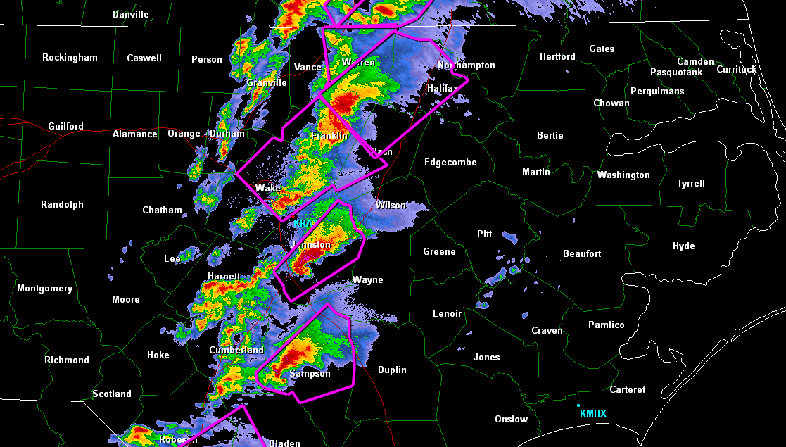
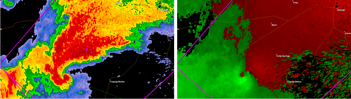
Maps
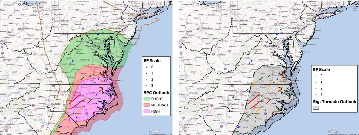
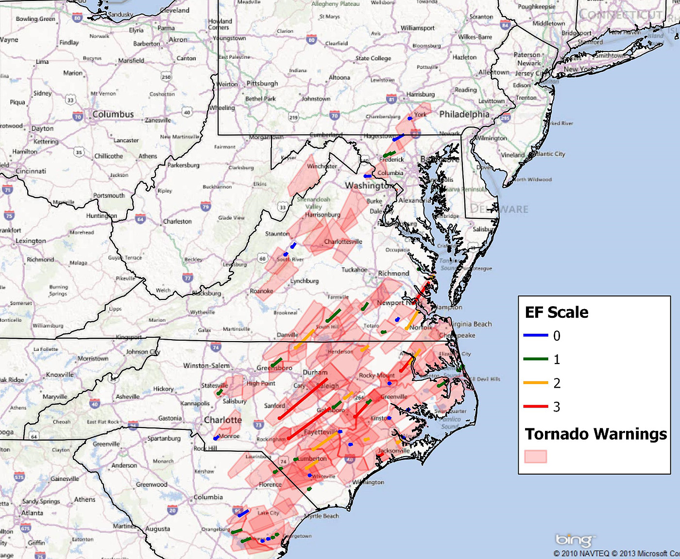
Reviewing the maps above, this event was well forecast by meteorologists, both from the Storm Prediction Center posting the watches and outlooks and local National Weather Service forecast offices in issuing the various warnings.
Photos
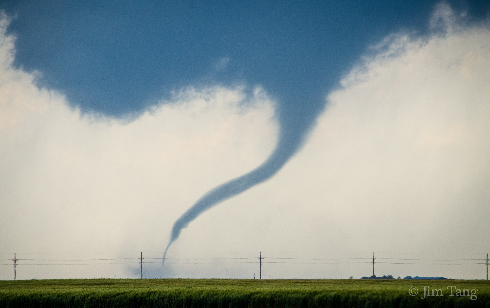
This impressive photo of a tornado was taken by my good friend and fellow storm chaser Andrew Smith near Kenly, NC.
Video
Above is perhaps one of the most well known videos from the event. It’s a good example of what NOT to do if a tornado is nearby. That guy was pretty lucky.
Video of the Wilson, NC tornado shot by Jeremy Gilchrist.
USTornadoes.com lead meteorologist Mark Ellinwood chased the event with Jason Foster. He got some footage of the aftermath of one of the tornadoes that was eventually rated EF3.
Conclusion
While April 16, 2011 may not top the charts for tornado outbreaks on a national scale, it was the worst tornado outbreak in North Carolina history in terms of total number of tornadoes (31) and the number of strong tornadoes with 16 rated as EF2 and EF3. It surpassed a the previous daily total record for the state, the 20 tornadoes which occurred on May 7, 1998. (Note: The March 1984 Outbreak had more violent tornadoes, but only 14 total in North Carolina itself).
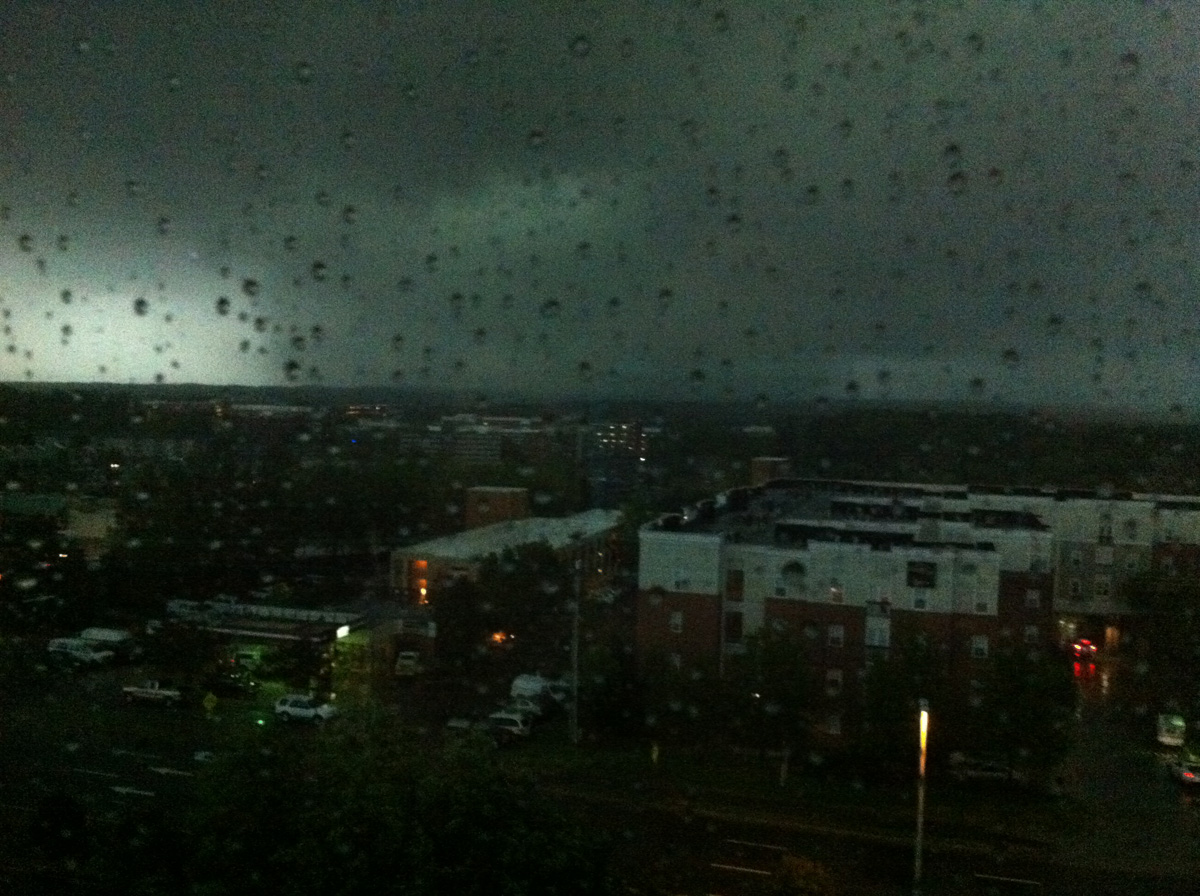
Casey Letkewicz, a PhD student studying atmospheric science at North Carolina State University and photographer of the opening picture, offers this first-hand account of her experience that day:
“I knew it was going to be a big day, since I had been following the forecast all week. […] once I saw that storms were developing, I decided to head to my school’s building, since the top floor has the best view around. Turns out, I wasn’t the only one with that idea! There were a few other grad students (my officemates), and my adviser. […] I was really amazed to see the line of storms break up into supercells–a truly unique experience! Seeing that made me think that something big was going to happen. Once we identified a storm that had a track towards Raleigh, we all kept a close eye on it. While we weren’t in an ideal position to see the tornado (located north of the storm), that didn’t stop us from looking out the window! After the storm passed, we knew the tornado had passed by really close to our building (maybe a mile or two away). I wanted to see the damage, so I went out and drove around downtown. It was definitely a surreal experience, as it was my first time seeing tornado damage in person.”
Ian Livingston contributed to this post.
Latest posts by Kathryn Prociv (see all)
- Halloween tornadoes: The spooky historical facts - October 28, 2013
- From domestic to international: Tornadoes around the world - July 25, 2013
- U.S. tornadoes that occur outside the U.S. … the continental U.S. that is! - June 26, 2013
Good writeup KP! My only regret that day was that I was fighting a tremendous head cold and did not go chasing. However I was feeling fine on April 27th and had a good time chasing that setup!
Thank you Chris! I remember you telling me how being under the weather kept you out of the weather (pun intended). Bummer! Good thing we had Andrew out there to represent!
March 28 1984 remains the most violent and deadly outbreak in NC since 1884.
EF-2 and EF-3 tornadoes do not qualify as a violent outbreak . Only F4 and F5 tornadoes constitute . 1984 is ranked as the tenth most violent US tornado outbreak since 1880 . 2011 does not even make any list for violent outbreaks. Five rated as EF3 compared to 7 F4 tornadoes back in 1984. Remember also that 57 died in the Carolinas in that with 42 in eastern NC . We had 1248 injuries in the 1984 event with 800 of those in NC.
2011 saw 445 injuries in the two Carolinas with 24 deaths in our state . Damage in 2011 was $388 million in the Carolinas compared to $578 million in 1984. Also remember that 1984 brought the third widest tornado in US on record through Robeson county of 2.5 miles wide . The CAPE in 2011 wasn’t nearly as strong as in 1984 . 2011 was just over 2000 jkg compared to 1984 at 3200 jkg. One must remember that the 1984 rampage stayed mostly in rural areas and only a few small towns hit. Even so ..it still caused greater damage losses and failure of 25.000 acres of timber . There were seven tornadoes in the 1984 outbreak that reached a mile wide or greater .
These were both horrible tornado outbreaks but comparing their intensity is like apples and oranges .A greater number of tornadoes in 2011 did not actually constitute a worse event than 1984. More than 80 percent of the 1984 outbreak was actually strong to violent whereas over half of the 2011 event was rated as weak.
It is believed by many that the Enigma Outbreak of February 19 1884 may have been the most deadly in NC history although official press numbers estimate 50 fatalities in the Carolinas with 31 of those in our Tar Heel state .