It’s “tornado season” again, maybe. March has been extremely quiet any way you cut it when it comes to severe weather — winter just keeps on coming. However, as we got through the last week of March, spring storms became more commonplace. With that, we rev Tornado Digest back up. Never heard of it? It used to be called Tornado Weekly.
While we’ll probably mainly focus on peak season again this year, the name change will allow for Tornado Digests to show up for reasons other than just a weekly recap.
Anyway, on to this past week’s show, and a brief look to the future.
California visited by supercells on two days
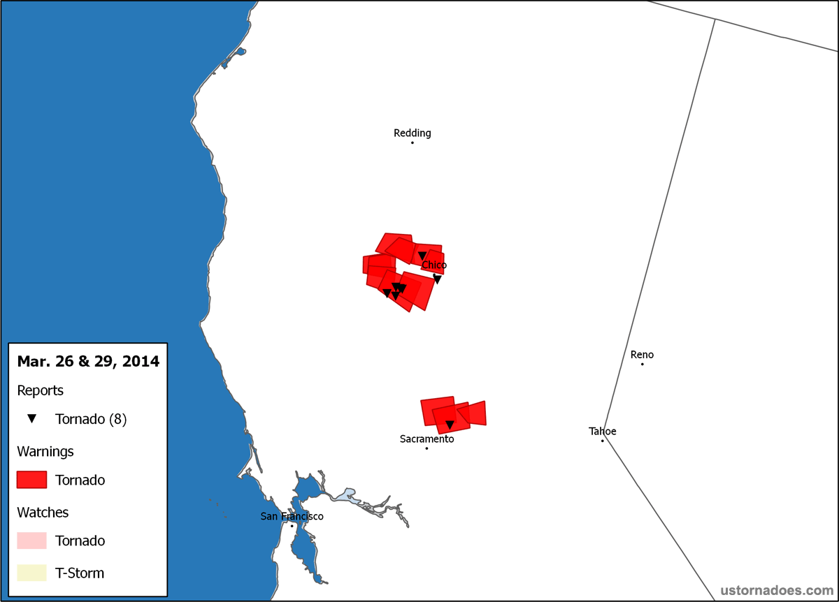
March 26…
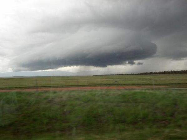
As a shortwave trough came ashore during the day, active weather sprung up across the state. March is the peak of tornado season in California many years. Two dominant supercells formed in the northern part of the Central Valley, with a number of tornadoes reported, including three confirmed EF1s in Glenn County, CA.
3/26 Northern Cell…
Northern California Supercell? Tornado? Okay. #CAwx pic.twitter.com/Tj6Fa9YCFd
— Rob Bradley (@WxRobBradley) March 26, 2014
Picture shot earlier from David Plank as it tore through an orchard! Incredible and rare catch! pic.twitter.com/4XmqgF2lmm
— MIDSCAR (@MIDSCAR) March 27, 2014
Final #tornado summary for Glenn Cty. 3 tornadoes touched down btwn 5:30-6 pm on 3/26/14 #cawx pic.twitter.com/1AyyfZavP7
— NWS Sacramento (@NWSSacramento) March 28, 2014
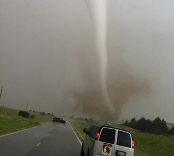
3/26 Southern Cell…
Southern cell, north of Sacramento RT @laffeyc: Another tornado! pic.twitter.com/5BDoyi48uc
— U.S. Tornadoes (@USTornadoes) March 27, 2014
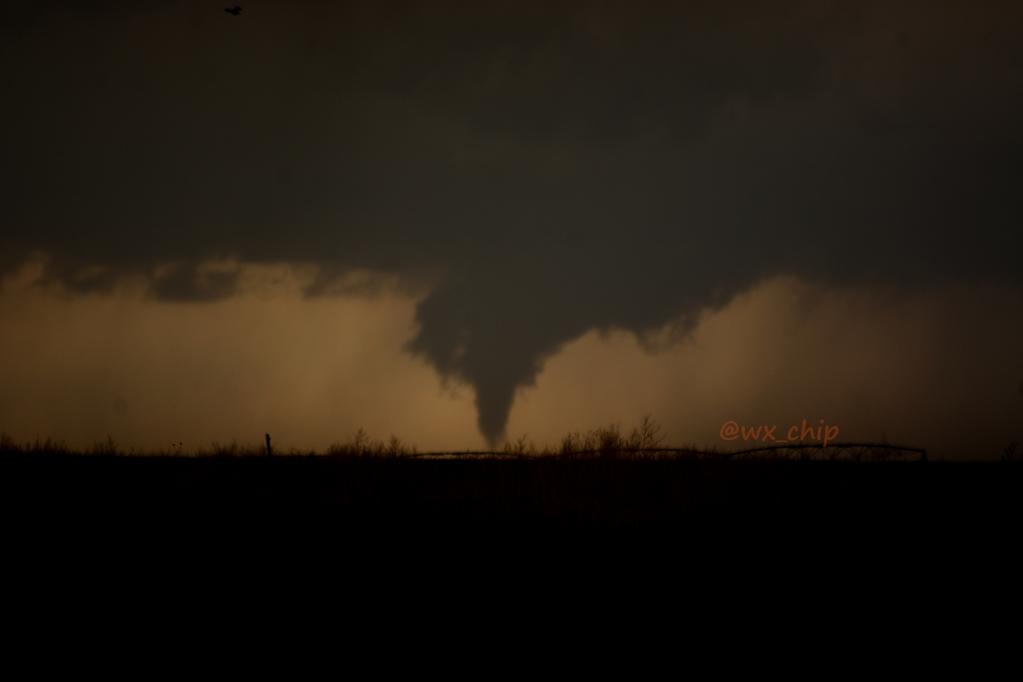
March 29…
Severe weather visited the same general region as on March 26, but the storm of the day was a little north of the one which produced a tornado near Willows, Ca. earlier in the week.
Tornado Warning in Glenn & Tehama Counties #NorCalWx pic.twitter.com/vOiEfQo4p4
— D.Wilson (@ButteWxSpotter) March 30, 2014
Current view of the tornado-warned storm in Tehama County. Funnel clouds have been reported. Take shelter. #cawx pic.twitter.com/hsOwlmOxh5
— NWS Sacramento (@NWSSacramento) March 30, 2014
From 6pm: #Funnel cloud that was observed west of I-5, taken north of Orland. By NWS forecaster. #cawx pic.twitter.com/a3CK5UGJOZ
— NWS Sacramento (@NWSSacramento) March 30, 2014
First minor severe weather event of the spring
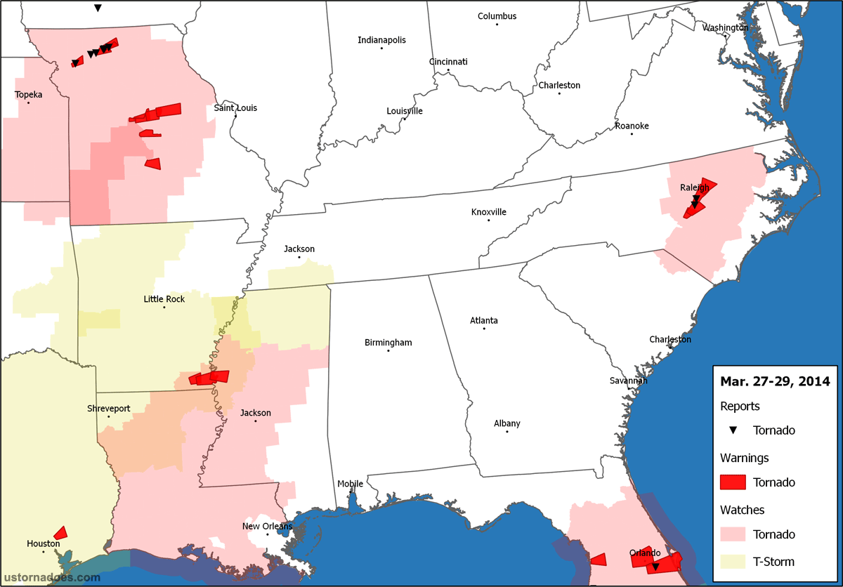
Tornado activity with the first system to drop a twister in California spread into the Ozarks and surrounds on March 27, spinning up three tornadoes across north-central Missouri among other reports in places like Iowa. Severe weather continued south and east through the next two days, with tornado touchdowns confirmed around Orlando, FL. and Raleigh, NC. late on the 29th.
March 27…
Supercell north of Jamesport, MO just before 330 CDT and before a short lived tornado. #mowx pic.twitter.com/97eDHIpxyB
— James G. LaDue (@JLaDue) March 27, 2014
via Luke Gibson from the south edge of Trenton https://t.co/xr1axirCf2 @BryanBusbyKMBC @ErinLittleKMBC @NevilleKMBC pic.twitter.com/sirFPOh3iK
— KMBC (@kmbc) March 27, 2014
I shot this photo of a #tornado near Trenton, MO tonight. What a day! #mowx @weatherchannel @WeatherNation pic.twitter.com/XrzgNERfQq
— Steve Blum (@weatherweenies) March 28, 2014
March 29…
“@weatherchannel: 1:30 pm ET: #Tornado warning for the #Orlando area until 2:30 pm ET: pic.twitter.com/aZheSiQDyS” pic.twitter.com/N6siWT6AWP
— Sarah Dillingham (@THESarahD29) March 29, 2014
8:48pm ET: #Tornado-warned cell continues to show Doppler-indicated rotation 20 miles S/SW of #Raleigh. #NC #NCwx pic.twitter.com/LCPWxjjj7d
— TWC Breaking (@TWCBreaking) March 30, 2014
Ramping up?
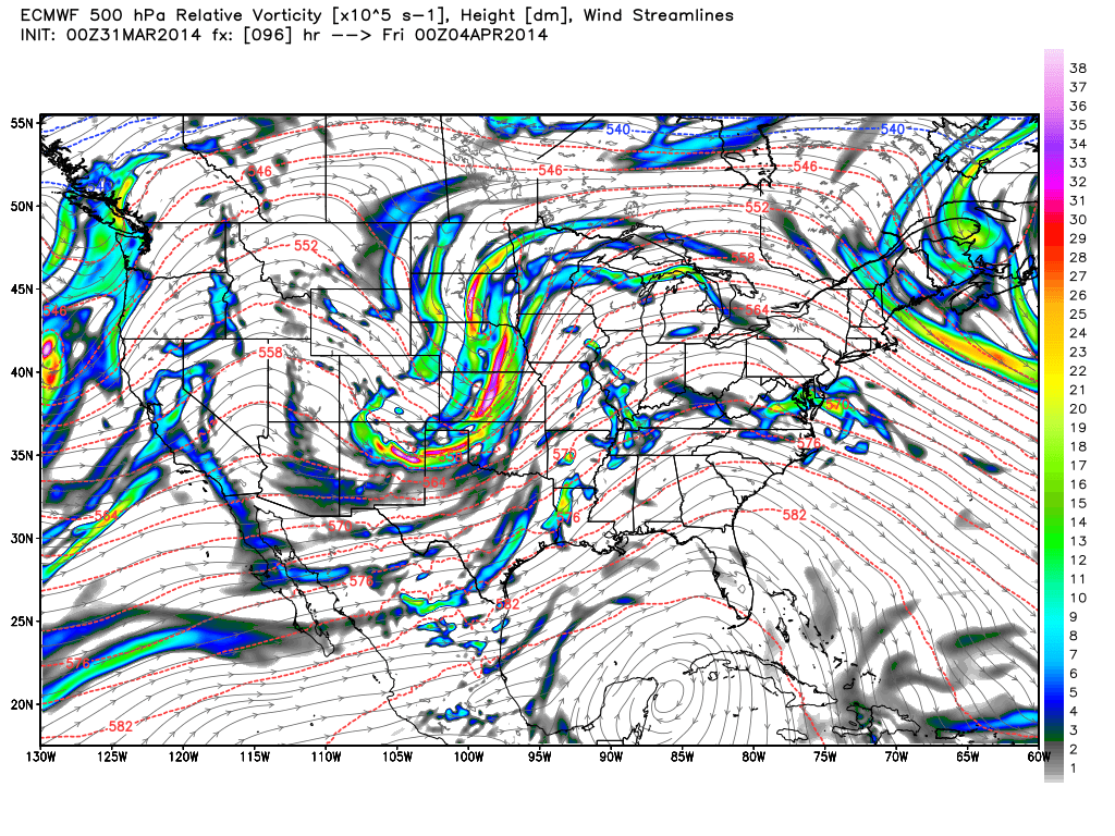
This coming week promises to be active. An upper-level trough pushing through the western United States eventually ejects out past the Rockies as we get toward mid-to-late in the work week.
Depending on moisture return and capping, supercells become possible in the Plains as soon as Tuesday, with the tornado threat edging up in the days to follow. A crescendo of activity may occur on Thursday across parts of the eastern Plains into the Mid South, but Wednesday may be extra tornadic as well. Severe weather is also likely to persist east into at least Friday.
Latest posts by Ian Livingston (see all)
- Top tornado videos of 2023 - January 1, 2024
- March 31, 2023 tornado outbreak videos - March 31, 2023
- Top tornado videos of 2022 - December 31, 2022