Last month, we showed you the basic ingredients needed for tornadoes to form. In part two of our series, we will take a look at the atmosphere in the horizontal to figure out where tornadic storms may form. This almost always means finding a boundary. Some boundaries are harder to find than others.
Most boundaries represent some sort of converging wind shift at the surface and in the lower levels of the atmosphere, which forces two different types of air masses together. When this happens, the converging air has no where to go but up. Rising air helps initiate cloud development. Under the right circumstances, these clouds can develop into tornadic thunderstorms.
Forecast basics Identifying and understanding ingredients | Search for boundaries and gradients | Looking for what could go wrong :: Radar watching Basic tornadic signatures | Advanced tornadic signatures :: Spotting basics Tornado shapes and sizes
The low-level winds along a boundary can provide storms with a continuous feed of warm, moist air, and can also enhance a storm’s low-level rotation in some cases.
NOTE: This is NOT a guide to storm chasing. It is meant for forecasting purposes only. The series reflects what is needed for a typical supercell tornado, and does not necessarily match what is needed for landspouts or waterspouts.
Fronts and Dry Lines
One of the most common trigger for tornadic storms are your typical large-scale fronts that delineate between either warm air and cold air, or moist air and dry air. Warm, cold, occluded, and stationary fronts, as well as dry lines, all fall under this category.
While all of these typical boundaries can produce tornadic storms, the likelihood of each one to actually produce tornadoes is highly dependent on the atmosphere they are surrounded by and by how quickly they are moving. PhysicalGeography.net shows how air interacts along the most common fronts.
While fronts can cause tornadic storms, they can also serve to decrease tornado chances. Fronts do this by either forcing the storms to become more linear (i.e. “line out”), or they can undercut the warm, moist air flowing into the storm, disrupting the storm’s inflow (the flow of air into the storm’s updraft).
Dry lines can become a focus for stronger, more isolated storms. One of the key features of dry lines is that they typically do not move quickly, unless they become attached to a low pressure system and are forced eastward. This helps reduce the issue of the boundary cutting off the storm’s inflow, and it also allows storms to stay more isolated for longer periods of time. The more isolated a storm is, the less likely it is for the storm’s inflow to get disrupted by another storm.
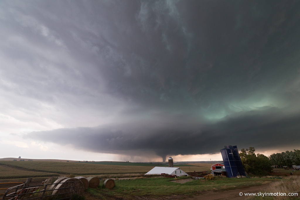
Back in the early days of U.S. Tornadoes, we analyzed a dry line that was a bit early in the storm season, but had a fairly typical look to it nonetheless. The dry line extended from Texas into Nebraska and South Dakota and sparked multiple tornadic storms that day, including the tornadoes near Willow, OK, seen in the video above.
Outflow, AKA Mesoscale Boundaries
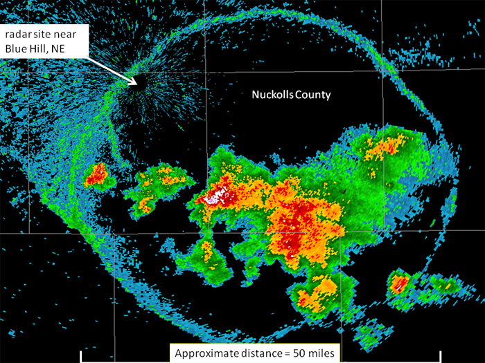
Outflow boundaries could be described as “miniature cold fronts” in how they behave. Instead of being found at intersections of large, differing air masses, these boundaries are usually on a smaller scale and are the result of cold air rushing away from a storm.
When a thunderstorm matures, the rain (and hail) from the storm drags down cold air from higher up in the atmosphere while also cooling it through evaporation (and sublimation). This cold hits the Earth’s surface and spreads outward from the storm, creating a “cold pool,” which basically acts as a small cold front.
Source
As this cold pool’s outflow boundary expands, it forces the surrounding warm air up, which can trigger more storms to form. Unless there is presence of a warm “capping inversion,” and it is very strong, you can usually see cold pools triggering new storms after the first storm of the day goes up and matures.
Given favorable wind shear, a cluster/line of these storms can form a Mesoscale Convective System (MCS), which can go on for several hours or even days, laying out a continuous outflow boundary as it progresses.
These boundaries are especially useful in more subtle setups when there is no typical front around, or when trying to find an area where two boundaries meet, i.e. a triple point, where storms would be most likely to form.
Orographic Boundaries
These boundaries are found near mountains, plateaus, and river valleys as an example. Pretty much any orographic feature that represents a notable height change can act as focal points for storm initiation.
When air moves over a land mass that has a quick rise in elevation (of several hundred feet or more), air pushing up against the land mass can go up and over it, thus creating lift. Often you’ll see storms form near a mountain range when other conditions are met, and these storms can then be pushed by the winds off of the mountain.
In addition to creating lift, orographic features can create a wind convergence through valley areas, and can also help steer the low-level flow going into a storm. Or, if the winds aren’t strong enough to push up and over the land mass, they can be forced to one of the sides of the feature.
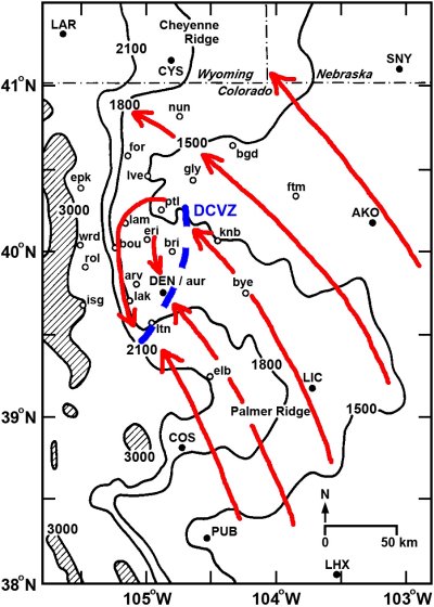
The Denver Convergence Vorticity Zone (DCVZ) is a great example of how orography can influence storm formation. The low-level wind structure can be seen using the arrows in the graphic below. Southeasterly surface winds push up against the mountain range and get redirected southward, creating a cyclonic loop and an area of low-level convergence that could help initiate storms.
Air interaction between land and sea also generally fall under this category, in the form of sea breezes and land breezes.
As air near the land surface heats faster than the air over the water surface, the air over the land will rise, and the air over the water will move in to replace it. This creates a circular system in which air rises over land and sinks over the water, continually feeding storms until the temperature over the land cools off. Sea breeze storms are common in places like Florida.
Other Features
Other parameters can also be used to find areas of more favorable storm formation if some of the more common boundaries are difficult to find. CAPE, potential temperature (theta-e), frontogenesis, height falls, etc. can all be utilized.
The key is finding areas that have sharp changes in the parameter’s values, which often indicates that one air mass is converging into another air mass.
You don’t always need boundaries for storms to form, but if you are looking for strong, potentially tornadic storms, boundaries are one of the first things you want to find.
Look for part three in early March!
Latest posts by Mark Ellinwood (see all)
- Spring 2023 seasonal tornado outlook - March 1, 2023
- Spring 2022 seasonal tornado outlook - March 1, 2022
- Spring 2021 seasonal tornado outlook - March 1, 2021
Great article! Minor correction though – the radar reflectivities from outflow boundaries are usually clear air returns from dust/insects kicked up or from the density gradient.
Thank you, Kyle. I have updated the article accordingly.