Tornado highlights covering the week of May 10-16, and a brief look ahead.
While it wasn’t as consistently active as the week prior, the second full week of May lived up to what we’d expect during the month for the most part.
The week began with the end of an outbreak that occurred May 9-10. It ended with another outbreak, one which included a particularly well-documented tornado which was on the ground for about 35 miles in southern Oklahoma.
No major changes to the pattern appear to be ahead this week, so we’re likely to see the tornado numbers continue to climb.
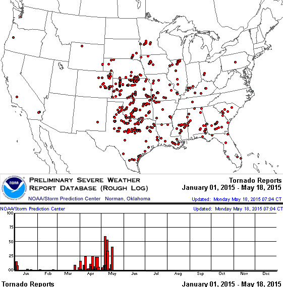
Last week’s summary map
And a few stats
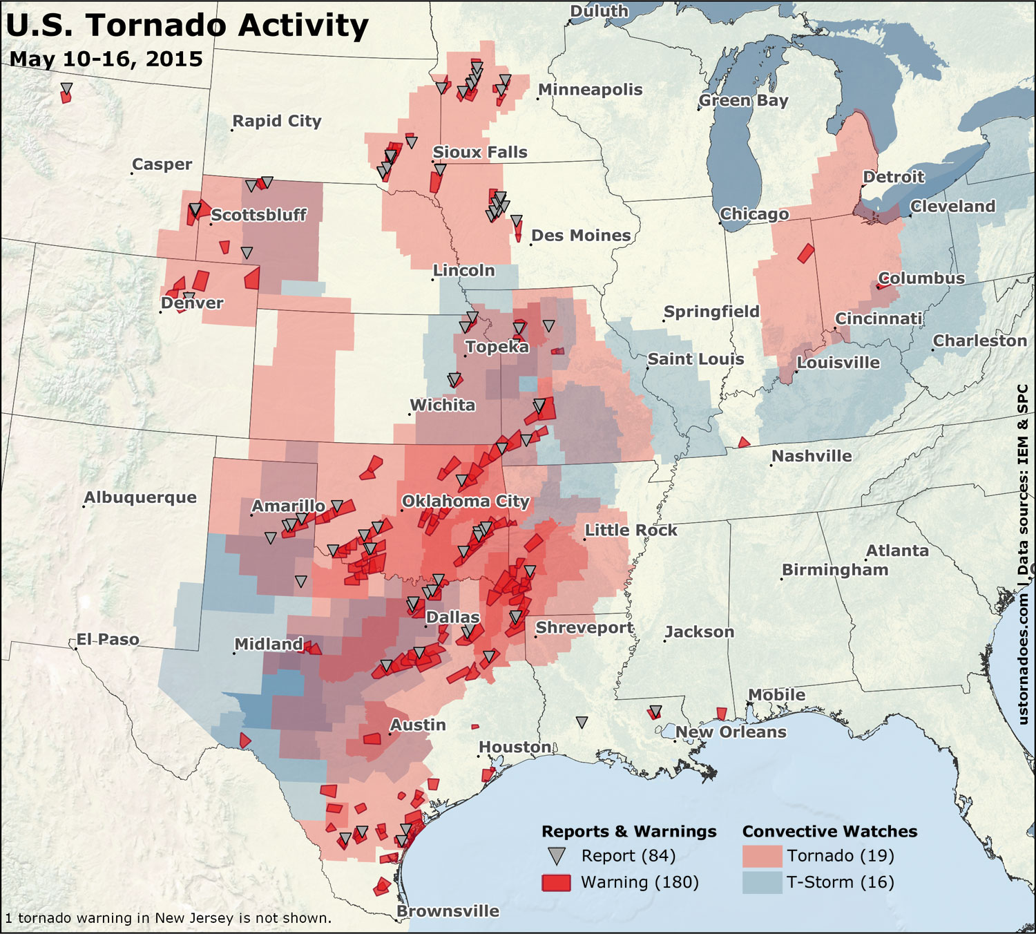
With two significant systems, and one “day before the day” plus some other scraps, it was a busy week for watches. 35 were issued. A slight edge went to tornado boxes, with 19 of those during the week.
The 180 warnings and 84 preliminary and filtered reports rank up there close to last week, which was the busiest of the year thus far on both counts.
Related: Tornado Digest archives
May 10: Southern and northern Plains
An outbreak that started the day prior rolled on. The day began early with a big tornado (later rated an EF2) near Delmont, South Dakota.
Tornado near Delmont SD around 1035a CDT, pic via @jlkokes. h/t @wxSpinner89 http://t.co/llcNweuXIP https://t.co/9NqxbbRvaJ
— U.S. Tornadoes (@USTornadoes) May 10, 2015
As the outbreak closed, tornadoes were focused in the Iowa/South Dakota area, and down in the Arklatex region and northeast Texas.
Lake City, Iowa tornado video by Jacob Dickey.
Two deadly tornadoes occurred after dark. One in Van, Texas and another in Nashville, Arkansas.
Quite a bit of damage in and near Van, TX #dfwwx #txwx pic.twitter.com/r9J2E0X4Xm
— Mark Fox (@FTWMet) May 11, 2015
May 11-14: A smattering during the reload
Tornadoes on down days
As the first system of the week cleared the East Coast, it brought more severe weather before exit on the 11th, along with a smattering of tornadoes mainly in the east and south. May 12 was a rare tornado report free day in recent times. The 13th was supposed to be a down day, but this happened:
Guthrie, Texas tornado video by Chris Kridler.
A tornado was also reported on the 14th in Missouri after dark.
May 15: Northern Plains and South Texas
Tornadoes were reported across Colorado, Wyoming and Nebraska. Perhaps the most notable was the Torrington, Wyoming tornado which was rated EF1.
Image of the Torrington tornado this afternoon (via @andrewtowne29) #wywx pic.twitter.com/nRk61YoyT3
— CBS NewsChannel 5 (@kgwntv) May 16, 2015
Tornado 212pm pic.twitter.com/N7yfhG2NZ0
— Mike Umscheid (@mikeumsc) May 15, 2015
Additional tornadoes were reported across parts of South Texas, mainly near the coast.
May 16: Southern Plains and Minnesota – Low-end large outbreak
Much like the tornado outbreak last week, this one was tempered by morning convection taking out a sizable chunk of the main risk area. That didn’t stop tornadoes from occurring all together.
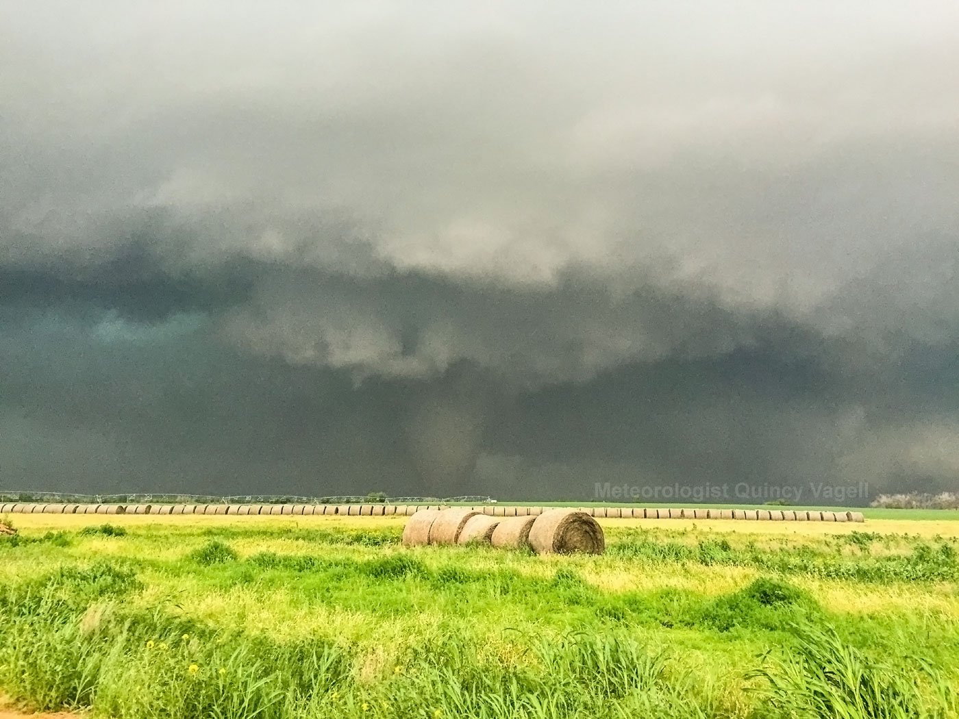
The big one of the day is the (so far, and probably because it didn’t hit much) EF2 that tracked just north of the Red River from around Elmer to Tipton in Oklahoma.
Big #tornado becoming rain wrapped SW of Elmer, Oklahoma. #OKwx #storm pic.twitter.com/N9jsyAWxEx
— Jason Cooley (@operation_chase) May 16, 2015
Massive tornado right now. 5 miles east of Elmer, OK. pic.twitter.com/UYUlYxXQDL
— Michael Seger (@MichaelSeger) May 16, 2015
Video of the Elmer, Oklahoma tornado by Justin Drake and Simon Brewer.
Additional tornadoes were scattered about the southern Plains and then again up focused on Minnesota.
Heck of a chase day for #mnwx 8 #tornadoes in all between Danvers, MN and Wesport, MN. All video captues. pic.twitter.com/KPz2MzOapE
— Bill Doms (@Bill_Doms) May 17, 2015
Despite being one of the larger outbreaks of the year, it had fairly minimal societal impact compared to many. Fortunately the bigger tornadoes mostly missed hitting things.
#BREAKING: May likes being May
More tornadoes are likely in the week ahead
There’s still no let up in the general pattern, though at this point in time there’s not necessarily as large of a trough on the plate in the near term. That might not mean too much for tornado production.
Issues we’ve had this year with the “big potential” days include a lot of forcing, early trough ejection, and minimal capping to hold back storms as instability builds. The next few events appear to be a little more subtle but also have good potential. As an example, May 6 was more of a subtle event, and it produced a lot of tornadoes.
As the weekend system heads east and out of the country, moisture begins to pool back up in Texas and ready its move north. Today is likely a fairly small-end one, but it could still bring some tornadoes. Tomorrow has considerably higher potential, though the region of impact is relatively small.
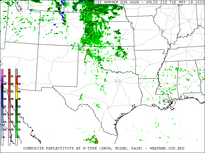
While model conditions appear ripe for tornadoes across the Texas panhandle and surrounding areas, there are a number of questions about early convection once again as well as whether or not moisture will overlap with the best wind shear. This likely won’t be resolved until we start the day tomorrow and see the players on the field.
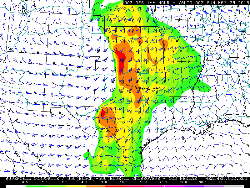
Later in the week, another mid-level trough is expected to push into the southwest U.S. before heading east. This should set the stage for increased severe weather and tornado potential, especially in the Friday through Saturday time-frame, but perhaps into Sunday as well. At this point, the southern and central Plains seem favored for much of the period.
Beyond that, signs that the general pattern we’ve seen continues are a little weaker than in prior weeks.
However, high pressure should still remain dominant for a while over the Southeast/Eastern U.S., which would tend to favor southwest or west wind flow aloft out over the heartland. This over potentially abundant moisture, at least at times. With this in mind, occasional to frequent severe weather episodes appear likely through the end of the month and into the beginning of June.
Note: We (Mark Ellinwood, James Hyde and myself) are headed out on our two-week chasecation this week. In the past I’ve not done the updates on the road, but I may try to do so this year. Potentially without maps if they’re too much of a pain to make –I’ll do so upon return if that’s the case! Wish us luck…
Latest posts by Ian Livingston (see all)
- Top tornado videos of 2023 - January 1, 2024
- March 31, 2023 tornado outbreak videos - March 31, 2023
- Top tornado videos of 2022 - December 31, 2022