…The Warm-Up To Actually Making Seven Day Forecasts edition…
We have a setup across the south-central U.S. on Sunday that could prove to be one of the biggest tornado producing days of the year, to date. However, there are multiple limiting factors that could throw various-sized wrenches into the system, which could prevent it from reaching its maximum tornado potential. Let’s dive in.
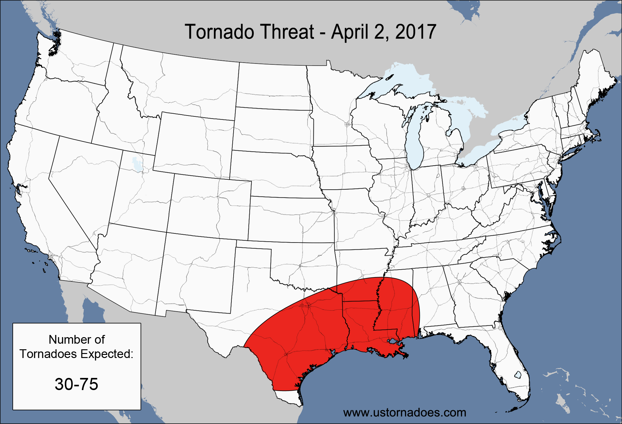
NUMBER OF TORNADOES EXPECTED: 30-75 – CONFIDENCE: Normal
Tornado Hot-spot: Eastern Texas, Louisiana
Pros: Moderate to high instability, good/excellent speed and directional shear, decent upper-level dynamics, and excellent low-level moisture.
Cons: Extensive cloud cover, some low-level capping, potential for veer-back-veer wind profiles in the western parts of the threat area, and potential for storms to grow upscale quickly. All risk limiting the amount of long-lived supercells.
Latest posts by Mark Ellinwood (see all)
- Spring 2023 seasonal tornado outlook - March 1, 2023
- Spring 2022 seasonal tornado outlook - March 1, 2022
- Spring 2021 seasonal tornado outlook - March 1, 2021
April 1. Like clockwork. I may be wrong, but looks like the season has begun and its going to be a classic year on the books.