Note: A tornado watch was issued for much of this area shortly after the post below was made.
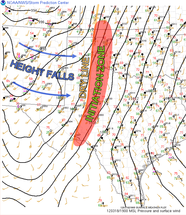
Instability is growing and we are getting closer to storm initiation along the dry line this afternoon as a low pressure system brings forcing and height falls eastward into the southern Plains.
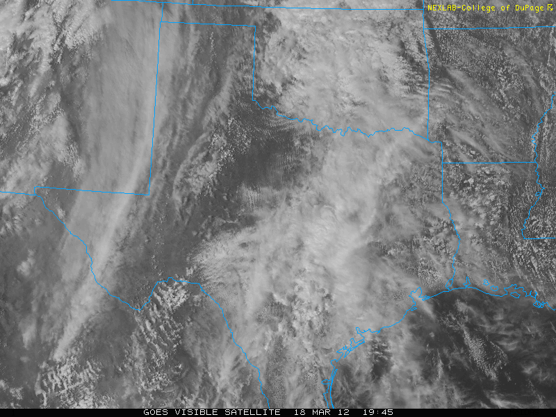
You can see the main forcing on the visible satellite where an arcing cloud band is working eastward into the Texas Panhandle:
Once the forcing reaches the dry line, storms with tornadic potential will start to form within the initiation zone. Storms are expected to initialize within the next few hours.
{ "@context": "https://schema.org", "@type": "Article", "mainEntityOfPage": { "@type": "WebPage", "@id": "https://ustornadoes.com/2026/07/30/claiming-mega-wins-free-spins-deals-for-uk-players/" }, "headline": "Claiming Mega…
Getting Started with Daytonaspin: A Guide for UK Players For players in the United Kingdom…
{ "@context": "https://schema.org", "@type": "Article", "mainEntityOfPage": { "@type": "WebPage", "@id": "https://ustornadoes.com/2026/07/30/pink-lady-casino-registration-in-the-united-kingdom-guide/" }, "headline": "Pink Lady…
Understanding Your Payment Options at Extreme Spins Navigating the financial landscape of an online casino…
Understanding the MySpins Welcome Bonus in the United Kingdom For players in the United Kingdom,…
It's peak tornado season. We briefly examine the top outbreaks from April-June.