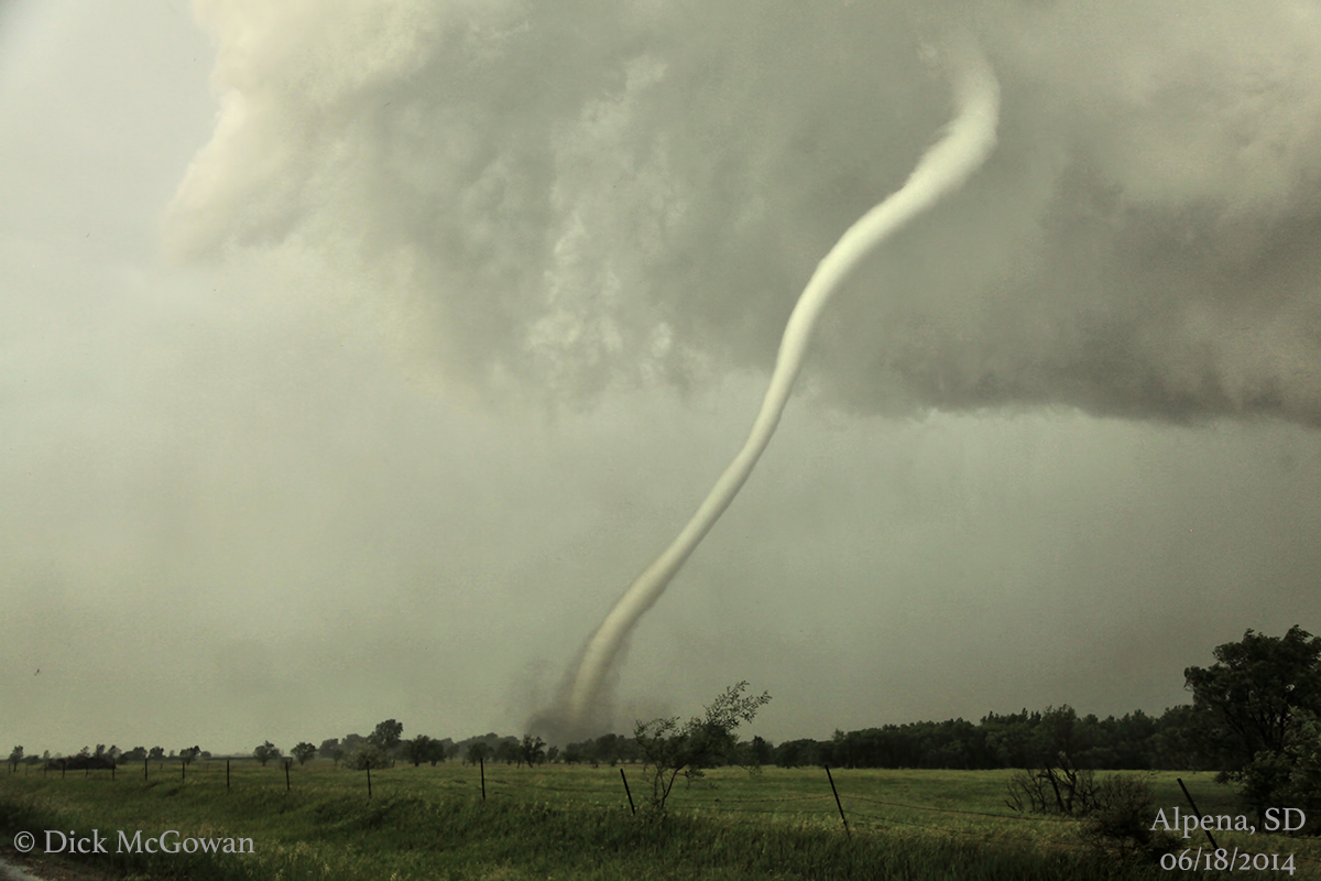
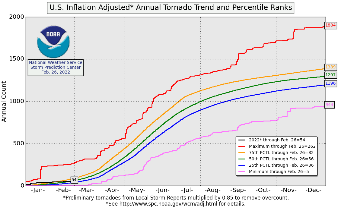
The year started off with fireworks as the opening volley of tornadoes for 2022 developed on its first day. The rest of the month through February saw a quieter pattern develop, with just four tornado days in the month just ended. Typical winter stuff.
As we head into March, it looks like a more active pattern is setting up. But will this lead to an active spring overall?
In the short-term, the first several days of the month do not provide much, if any, tornado opportunities. However, a pattern shift heading into this weekend and next week could provide multiple chances for tornadoes.
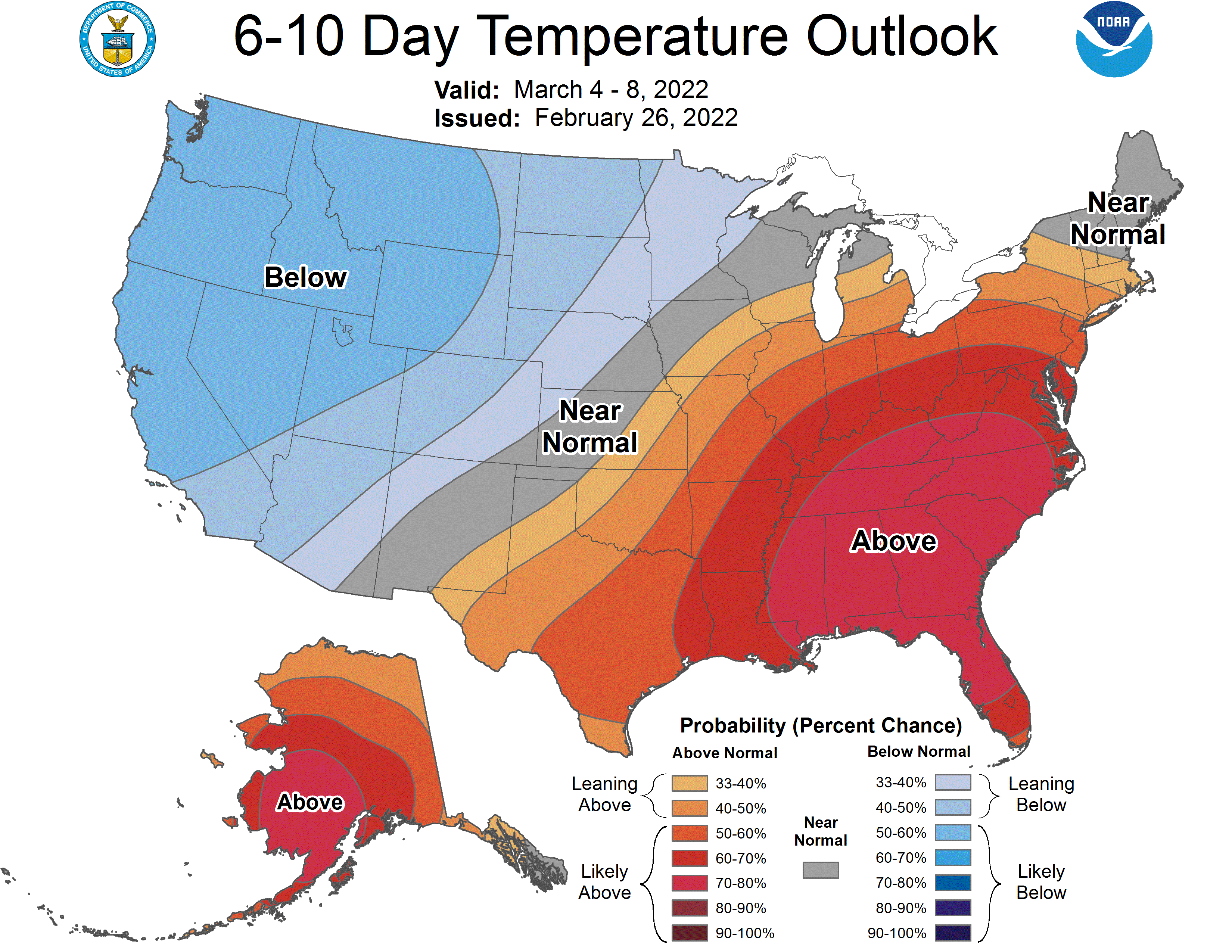
There is pretty good model agreement that the upper-level high pressure over the western U.S. at the close of February will break down late this week, allowing storm systems to dig into the West. This will pull cooler temperatures into the region and warmer temperatures into the South and East.
With the addition of wetter than normal conditions expected over the central U.S., the atmosphere seems primed for some early-season tornado activity.
This in mind, it is unclear how long this pattern will hold together over the country.
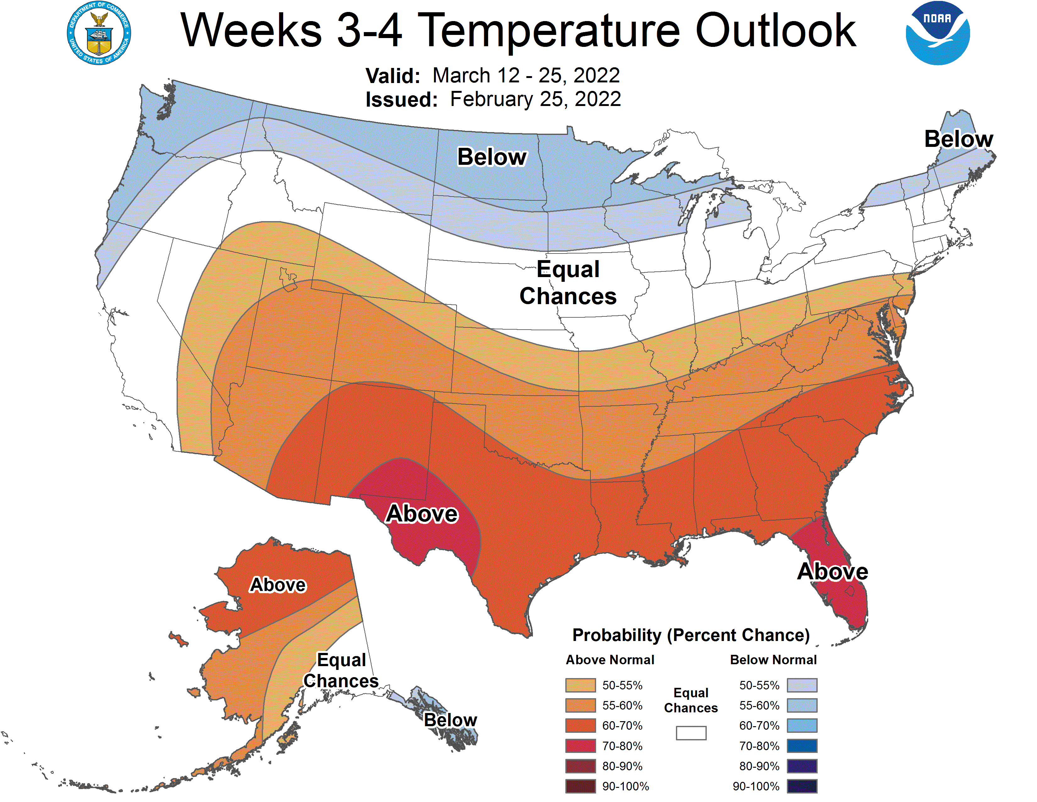
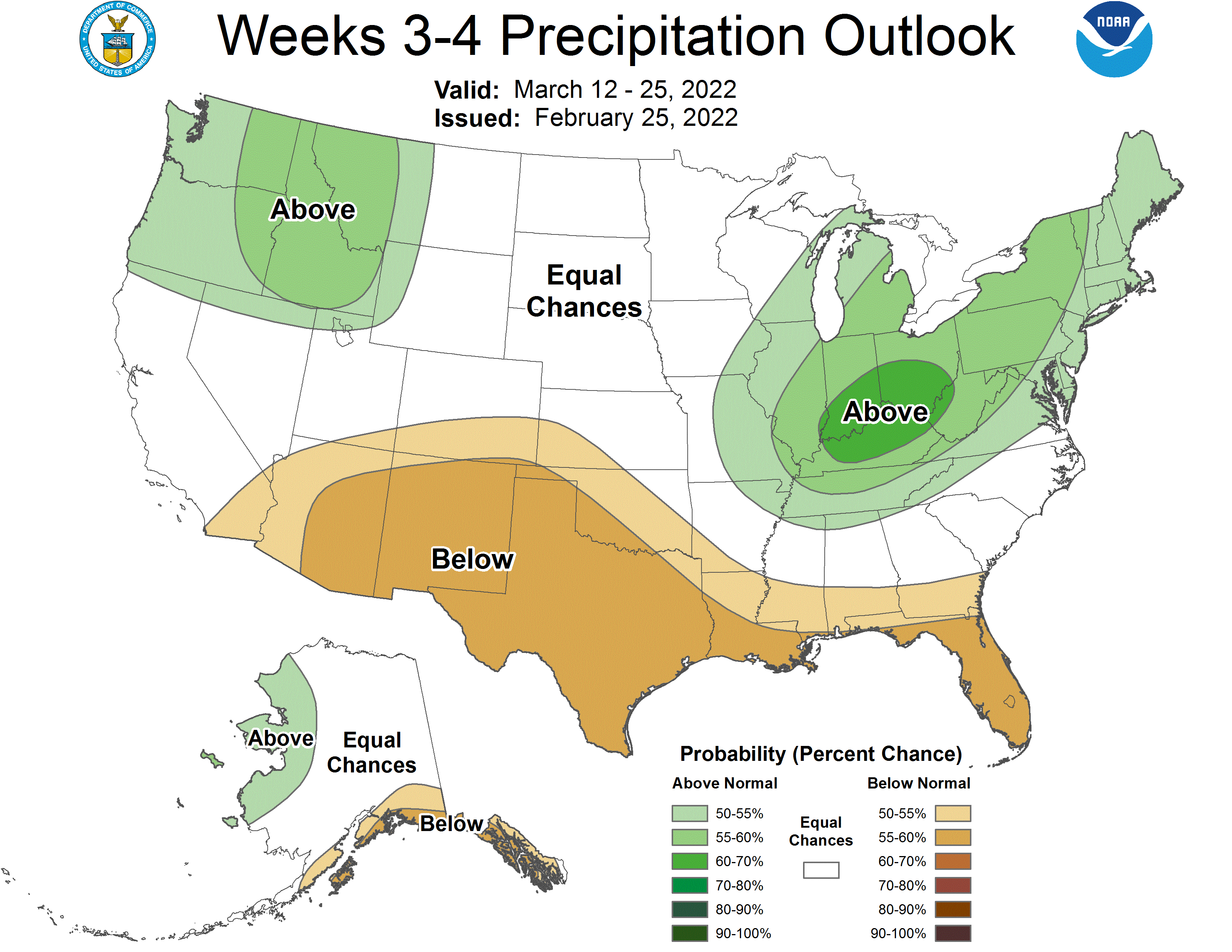
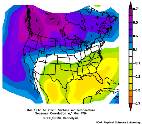
The Climate Prediction Center’s forecast for the back half of March is showing a somewhat less favorable pattern for tornadoes. For now, it seems that an active, though probably not record-breaking, March is possible. The forecast lines up well with some of the teleconnection indices, including the negative phase of the Pacific North American pattern (PNA), seen below.
For April and May, more reliance is placed on the El Niño Southern Oscillation and other long-range indicators like the Atlantic Multidecadal Oscillation (AMO) and Pacific Decadal Oscillation (PDO).
Coming off our second-straight La Niña winter, the lingering effects set the stage for a drier, warmer South as the general storm track favors wetter conditions in the Ohio and Tennessee Valleys. The typical La Niña pattern lines up fairly well with the overall pattern we have seen this winter.
The AMO is currently positive, and this phase of the AMO tends to reinforce warmer air and drier conditions across the South. The PDO is in its negative phase, which helps create warmer conditions in the southern and eastern U.S. while creating cooler conditions along the West Coast.
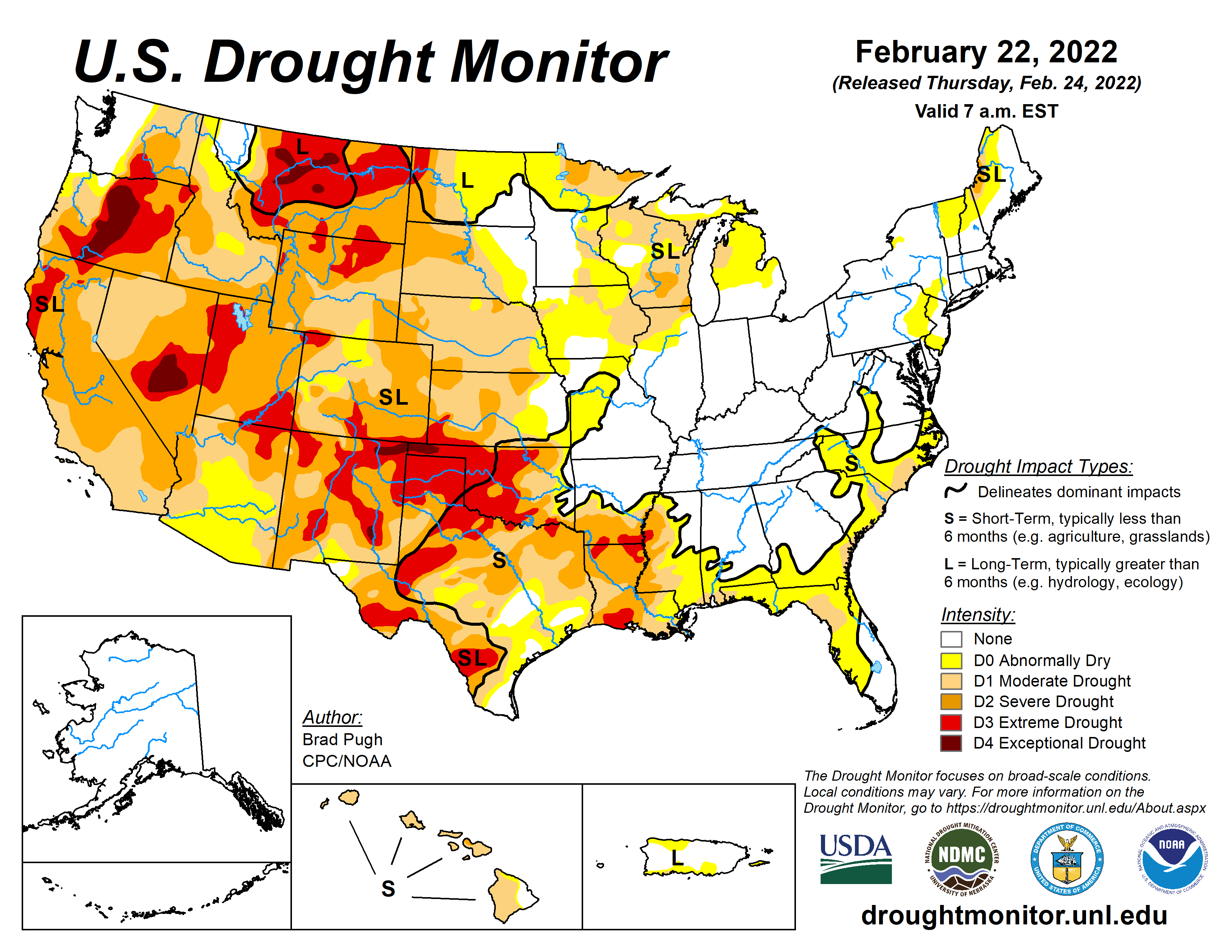
Drought can sometimes have an effect on the overall weather pattern as well. Widespread drought over the western half of the nation could help keep warmer, drier conditions locked in for longer periods. This could lead to a less active tornado season, at least in the Plains.
With all this data in mind, I went through previous years and found some analogs based on long-term patterns. These were weighted based on how strong of an overall correlation each variable had with this year.
Below, weighted temperature and precipitation analog maps:
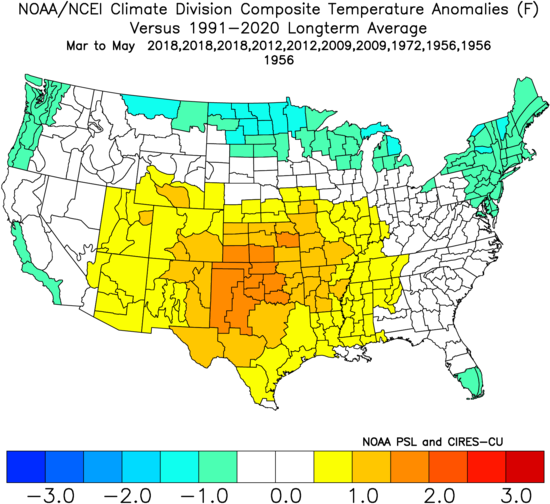
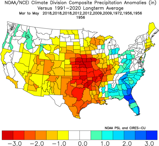
The overall seasonal pattern based on the analogs shows warmer than normal conditions in the heart of the nation, with slightly cooler than normal temperatures in the northern U.S. Much of the central U.S. is also notably drier than normal, while the Southeast could see wetter than normal conditions.
Of these analogs, 2012 and 2009 had an active start to the season, with over 100 tornadoes each in March. These years also had a more active than normal April before turning quieter in May. On the flip side, another analog, 2018 was consistently quieter across the three-month period.
Bottom Line
The medium range seems favorable for an active tornado period in March, but long-term signals are showing a quieter overall pattern for spring.
While March could prove to be active, a quicker transition to a summer-like pattern and abnormally dry conditions across the Plains could keep the tornado count down in the back half of the season. Historically, an active early season and quieter late season generally brings the overall number of tornadoes down, so I would lean slightly toward a quieter season overall.
Odds of the tornado count ending up below/near/above the normal of 511 tornadoes (NOAA) for meteorological spring:
Below normal: 40% (less than 470 tornadoes)
Near normal: 35% (between 470 and 550 tornadoes)
Above normal: 25% (above 550 tornadoes)
Long term forecasts, while generally providing added value to climatology, are still very broad-brush outlooks and do not offer a very consistent level of skill. This forecast only hopes to capture some of the most reliable information available to provide a best guess as to what spring may bring.
Latest posts by Mark Ellinwood (see all)
- Spring 2023 seasonal tornado outlook - March 1, 2023
- Spring 2022 seasonal tornado outlook - March 1, 2022
- Spring 2021 seasonal tornado outlook - March 1, 2021