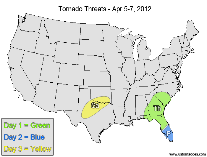
1-3 DAY
Thursday
Southeast — POTENTIAL: Low — CONFIDENCE: Normal
Low to moderate instability and good upper-level dynamics provide a low tornado threat in the Southeast today and tonight. Mostly unidirectional shear and extensive cloud cover will limit the tornado potential. One area to watch will be South Carolina, where storms forming along a stationary boundary will get some extra low-level directional shear to help support rotating storms.
Friday
Southern Florida — POTENTIAL: Very Low — CONFIDENCE: High
Enough instability and wind speed shear will be present that, if storms can form off of a mesoscale feature that increases the directional shear, they could potentially produce a tornado. Otherwise, the flow will be very unidirectional, keeping the threat to a minimum.
Saturday
Southern Plains — POTENTIAL: Very Low — CONFIDENCE: High
Storms forming along and ahead of a cold front will have low to moderate CAPE and directional wind shear to provide the potential for tornadoes, however weak to moderate wind speed shear, high LCLs and a lack of upper-level support will inhibit tornado formation.
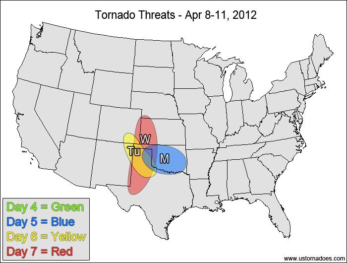
4-7 DAY
No tornadic activity expected.
Monday
Southern Plains — POTENTIAL: Low — CONFIDENCE: Normal
Low to moderate instability and fairly good directional wind shear will give storms rotation, but weak wind speed shear in the low to mid levels and a lack of upper-level forcing will limit the tornado potential.
Tuesday
Southern High Plains — POTENTIAL: Very Low — CONFIDENCE: Normal
Moderate directional shear and CAPE on the order of 500-1000 J/kg could produce a tornado in the southern High Plains, but the low amount of instability and a lack of upper-level forcing will keep the threat to a bare minimum.
Wednesday
Southern and central High Plains — POTENTIAL: Medium — CONFIDENCE: Low
A disturbance will work into the Plains on Wednesday, with storms expected to fire along and ahead of a cold front late in the day into the overnight hours. Timing and a lack of instability will work against tornadic storm formation, but moderate to high shear will be able to make storms rotate fairly easily if enough instability is present. Storms that form north and east of the risk area are expected to be elevated, posing no tornado threat.
It's peak tornado season. We briefly examine the top outbreaks from April-June.
A dip in the jet stream is blasting toward the central United States and poised…
A historic storm system swept through the central, southern and eastern U.S. from Friday through…
In a field historically dominated by men, Jen Walton has emerged as a transformative figure…
Jason Persoff, MD, SFHM, is recognized globally for his expertise in storm chasing. He earned…
Tornado numbers were near or above average. A chase season peak in June provided numerous…