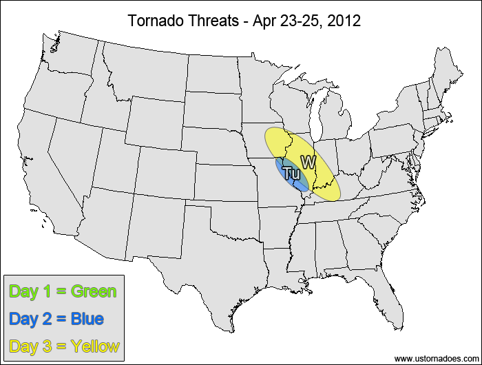
1-3 DAY
No tornadic activity expected.
Tuesday
Eastern Missouri, southwestern Illinois — POTENTIAL: Very Low — CONFIDENCE: Normal
There will be a narrow window for tornadic activity if storms can form south of a stationary front, but drier low-level air and high LCLs will not only inhibit tornadic potential but will inhibit any sort of storm formation.
Wednesday
Southern Midwest— POTENTIAL: Low — CONFIDENCE: Normal
Storms forming south of a warm front will be in a low to moderate shear and moderate CAPE environment, but they will be working against a cap and weak forcing.
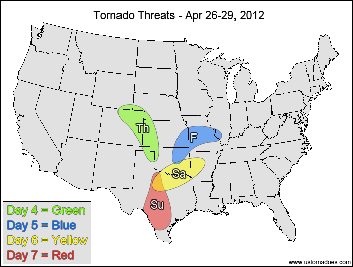
4-7 DAY
Central High Plains — POTENTIAL: Medium — CONFIDENCE: Normal
A disturbance working across the Southwest will move into the central High Plains late on Thursday, with moderate shear and upper-level dynamics moving into an environment with low to moderate CAPE. This area could produce one to several tornadoes if the disturbance arrives early enough to take advantage of the higher amounts of CAPE. A slower storm progression would result in later initiation with a lower tornado threat.
Friday
East-central Plains, Missouri — POTENTIAL: Low — CONFIDENCE: Low
The disturbance moving into the central Plains is expected to weaken as it runs into a cold front that is pressing down from the north. There is enough instability and directional shear left in the warm sector to warrant a low tornadic potential.
Saturday
Southern Plains, Arkansas — POTENTIAL: Low — CONFIDENCE: Low
The models start to have significant differences in the pattern evolution at this range, but there is enough instability and directional shear in vicinity of a cold front to create a low tornado potential.
Sunday
Southern Plains — POTENTIAL: Very Low — CONFIDENCE: Low
The 00z European operational model brings the next Plains disturbance in much more quickly than the GFS, which would allow storms with tornadic potential to form in the northern risk areas and even up into western Oklahoma, but the more agreed upon potential lies in southern and central Texas where low to moderate CAPE will be present with some directional shear. Wind speed shear will be on the low side, which will limit the tornado potential on Sunday.
It's peak tornado season. We briefly examine the top outbreaks from April-June.
A dip in the jet stream is blasting toward the central United States and poised…
A historic storm system swept through the central, southern and eastern U.S. from Friday through…
In a field historically dominated by men, Jen Walton has emerged as a transformative figure…
Jason Persoff, MD, SFHM, is recognized globally for his expertise in storm chasing. He earned…
Tornado numbers were near or above average. A chase season peak in June provided numerous…