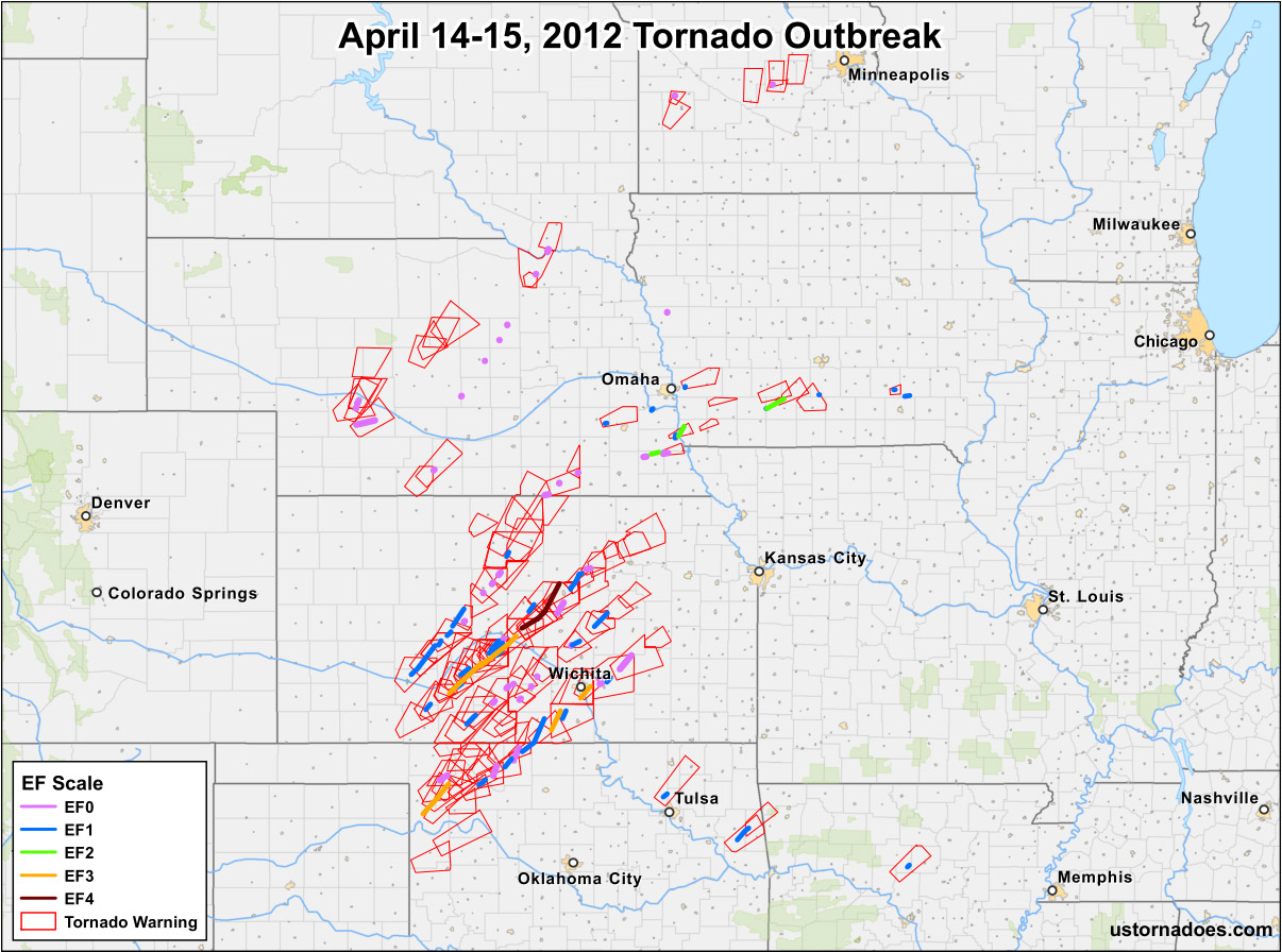
Map by Katie Wheatley. Data: SPC, IEM, ESRI.
A year ago today, the largest tornado outbreak in 2012 occurred, and it included one violent EF4 tornado which tracked across Kansas. In addition to the map above that shows tornado tracks, their intensity, and the tornado warnings issued by the National Weather Service, here are some quick stats on the event:
Related: Event videos | Radar and satellite | Debris balls | Verification | Reports are reports
Note: To categorize this outbreak, we’ve followed the no break longer than 6 hour rule. Some places count tornadoes in the outbreak sequence but outside this period as part of the same outbreak.
It's peak tornado season. We briefly examine the top outbreaks from April-June.
A dip in the jet stream is blasting toward the central United States and poised…
A historic storm system swept through the central, southern and eastern U.S. from Friday through…
In a field historically dominated by men, Jen Walton has emerged as a transformative figure…
Jason Persoff, MD, SFHM, is recognized globally for his expertise in storm chasing. He earned…
Tornado numbers were near or above average. A chase season peak in June provided numerous…