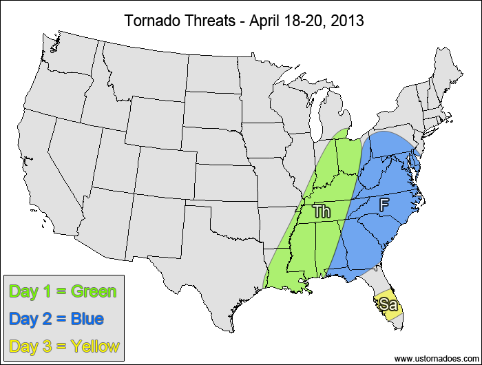
1-3 DAY
Southeastern Midwest, western Southeast — POTENTIAL: High — CONFIDENCE: Normal
The main/only risk for tornadoes will be embedded supercells within the squall line along the cold front. Pre-frontal discrete storms look less likely than they did previously, with the latest hi-res models producing little to no sustainable convection capable of producing tornadoes out ahead of the main line. This is a high shear/low CAPE setup that will depend greatly on the storm’s dynamics to make up for the lack of instability.
Friday
Mid-Atlantic, eastern Southeast — POTENTIAL: Low — CONFIDENCE: Normal
The threat for embedded supercells capable of producing tornadoes along the cold front will continue on Friday as the storm reaches the East Coast. The best potential appears to be in southern Virginia into the Carolinas where low to moderate instability develops ahead of the front, along with the chance for pre-frontal supercells. However, less low-level directional shear will help keep storm rotation limited.
Saturday
Southern Florida — POTENTIAL: Very Low — CONFIDENCE: Normal
There is enough instability and directional shear ahead of the dying cold front that mature storms could rotate, allowing for the possibility of a tornado.
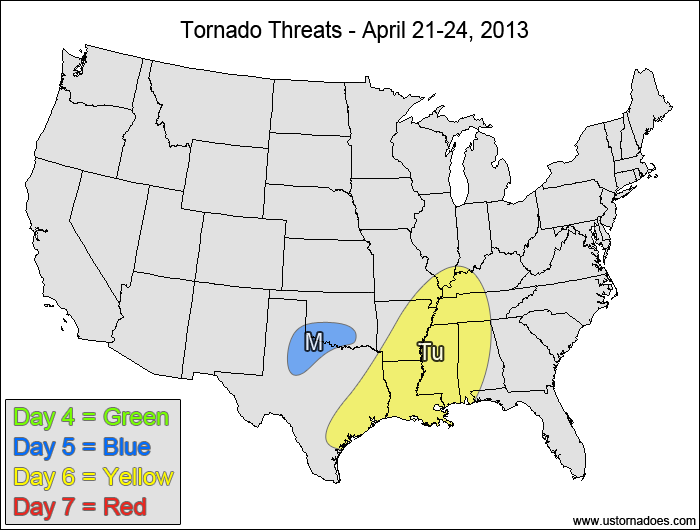
4-7 DAY
No tornadic activity expected.
Monday
North-central Texas, southern Oklahoma — POTENTIAL: Low — CONFIDENCE: Normal
As the next system dives into the Plains, there will be low to moderate CAPE and favorable shear to allow storms to possibly form within the risk area. Should these storms form, they would be capable of becoming tornadic. However, storm coverage is expected to be limited with a trough orientation that is far from ideal, which will keep the overall risk will be fairly low.
Tuesday
ArkLaTex, western Southeast — POTENTIAL: Medium — CONFIDENCE: Normal
Storms will become more organized on Tuesday as a cold front sweeps through the risk area, with favorable directional shear and low to moderate CAPE providing an atmosphere capable of producing tornadoes. The overall potential will be limited due to weak speed shear and mostly linear storm mode, with pre-frontal convection in the southern parts of the risk area providing the best chance for tornado development.
Wednesday
No tornadic activity expected.
It's peak tornado season. We briefly examine the top outbreaks from April-June.
A dip in the jet stream is blasting toward the central United States and poised…
A historic storm system swept through the central, southern and eastern U.S. from Friday through…
In a field historically dominated by men, Jen Walton has emerged as a transformative figure…
Jason Persoff, MD, SFHM, is recognized globally for his expertise in storm chasing. He earned…
Tornado numbers were near or above average. A chase season peak in June provided numerous…