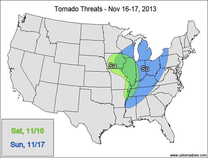
A strong disturbance will work into the Midwest today into tomorrow, with the threat of a tornado outbreak looming on Sunday. As is typical with these cold season threats, this system has a high shear/low CAPE environment with conditional risks to both sides. Regardless of the risks, tomorrow’s setup looks prime for widespread severe winds and some tornadoes.
Central Mississippi Valley — POTENTIAL: Low — CONFIDENCE: Normal
Pros: Strong shear (both directional and speed), left-exit region of an upper-level jet.
Cons: Very little instability, weak lapse rates.
Sunday
Midwest, Tennessee Valley — POTENTIAL: High — CONFIDENCE: Normal
Pros: Very strong speed shear, good directional shear, very strong forcing, improving mid-level lapse rates, surface dewpoints in the 60s, pre-frontal supercells possible.
Cons: Instability could be limited by widespread cloud cover and rain in the warm sector. Storms could turn linear faster, which would limit the supercell potential.
It's peak tornado season. We briefly examine the top outbreaks from April-June.
A dip in the jet stream is blasting toward the central United States and poised…
A historic storm system swept through the central, southern and eastern U.S. from Friday through…
In a field historically dominated by men, Jen Walton has emerged as a transformative figure…
Jason Persoff, MD, SFHM, is recognized globally for his expertise in storm chasing. He earned…
Tornado numbers were near or above average. A chase season peak in June provided numerous…