Skip to content

ustornadoes.com

United States Tornadoes

  • Tornado Tracking
  • [Retired] Case Archive
  • Annual Tornadoes
  • Violent Tornadoes

Tag: County Map

Map: July Tornadoes in the United States

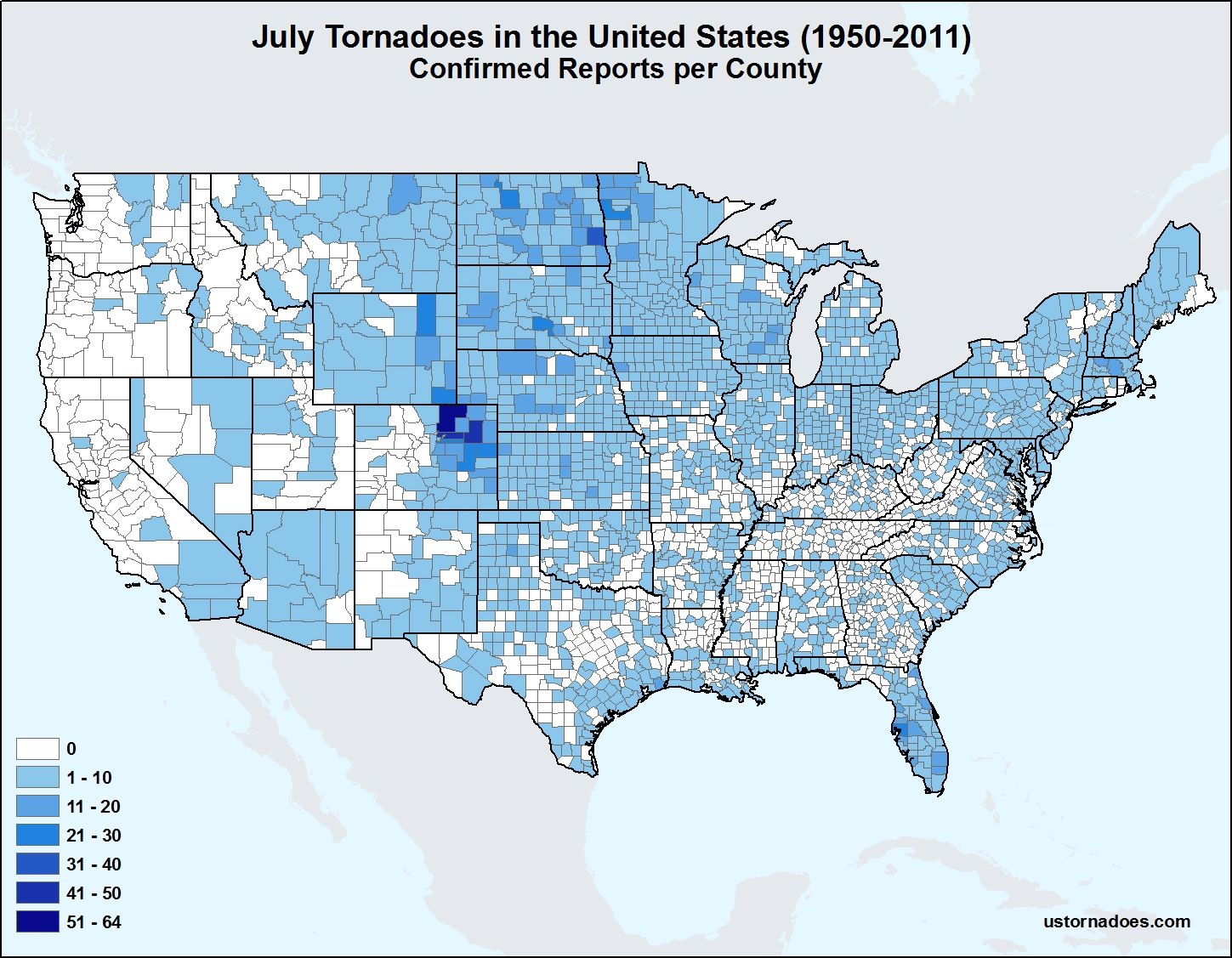
Map: July Tornadoes in the United States

The high Plains and northern Plains are favored areas for July tornadoes. Our county map gives more detail to areas…
Katie Wheatley
Map: June Tornadoes in the United States

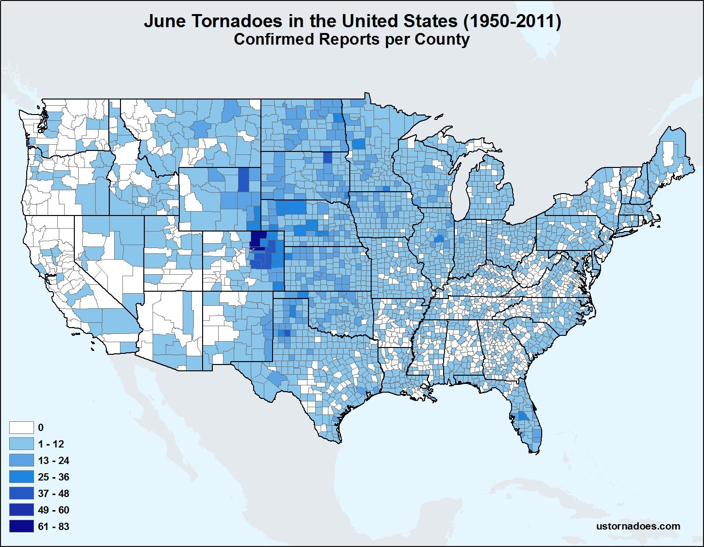
Map: June Tornadoes in the United States

June is near peak tornado activity, with the Plains and Midwest as hotsposts. Our county map gives more detail to…
Katie Wheatley
Map: U.S. Tornadoes by County, 1950-2011

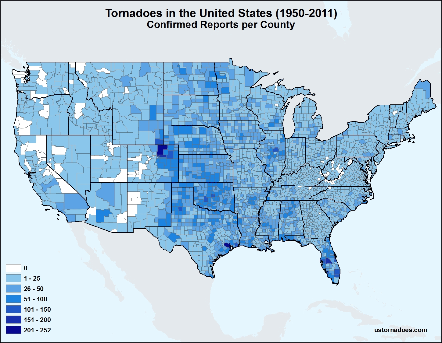
Map: U.S. Tornadoes by County, 1950-2011

Almost the entire United States has been impacted by tornadoes in modern history. Our county map for all months gives…
Katie Wheatley
Map: May Tornadoes in the United States

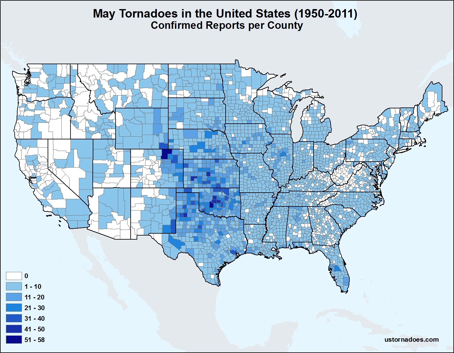
Map: May Tornadoes in the United States

May is the tornado peak. While much of the country has seen a May tornado, the Plains is favored. Our…
Katie Wheatley
Map: April Tornadoes in the United States

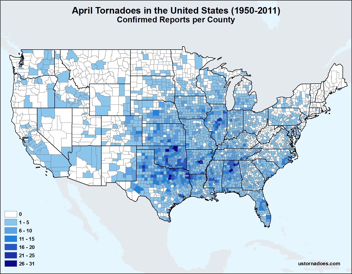
Map: April Tornadoes in the United States

Tornado peak begins in April, with the South, the southern Plains and Midwest all favored areas. Our county map gives…
Katie Wheatley

Recent Tweets

Tweets by @USTornadoes

Must Reads

  • Sounding and case archive of famous tornadoes and selected severe weather eventsSounding and case archive of famous tornadoes and selected severe weather eventsMarch 22, 2021
  • The month with the most tornadoes by countyThe month with the most tornadoes by countyApril 22, 2015

Data Sources

  • Monthly Tornado Reports
  • SPC Tornado Summaries
  • Storm Events Database
  • Violent Outbreak Interface

Site tools

  • Log in
  • Entries feed
  • Comments feed
  • WordPress.org

Search Form

More

  • Forecast FAQ
  • About / Contact
  • Site Guide
  • [Retired] Case Archive

Wedges

  • Tornado Tracking
  • Violent Tornadoes
  • Annual Tornadoes
  • [Retired] Case Archive
WordPress Theme: BlogGrid by TwoPoints.