**This page is retired, and may be deleted soon**. Head on over to the new Chase Archive!!
This page is a useful bookmark for past “famous” tornadoes, supercells, and other storms in the United States and Canada. The list was procured by how impactful the storms were to civilization, how abnormal they were for the area, or how memorable they were to storm chasers.
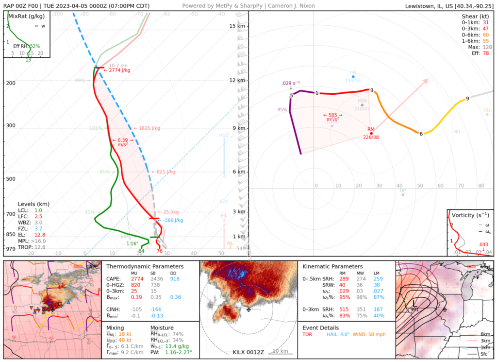
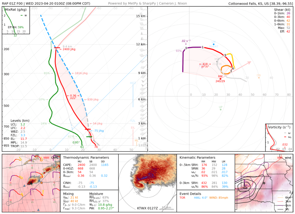
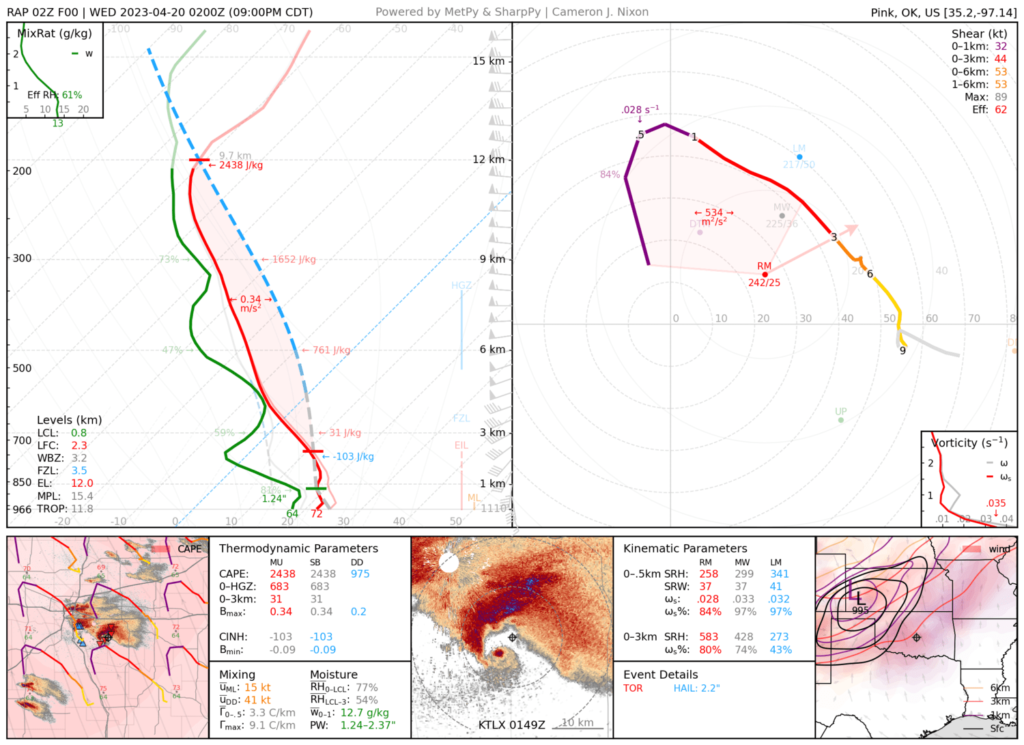
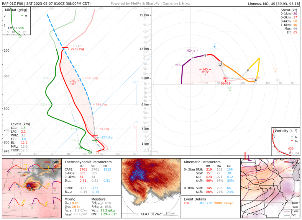
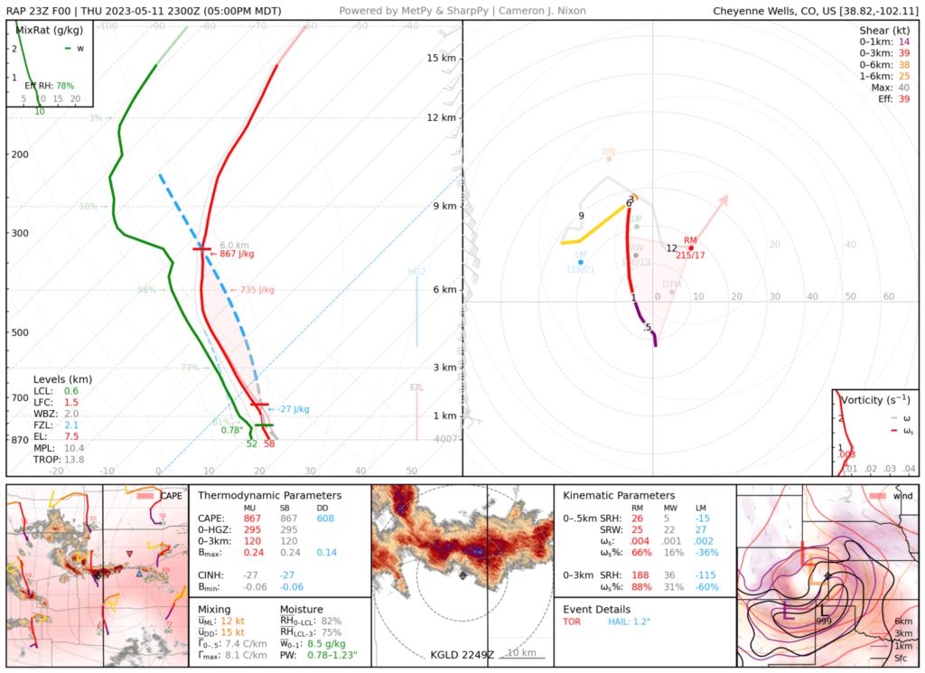
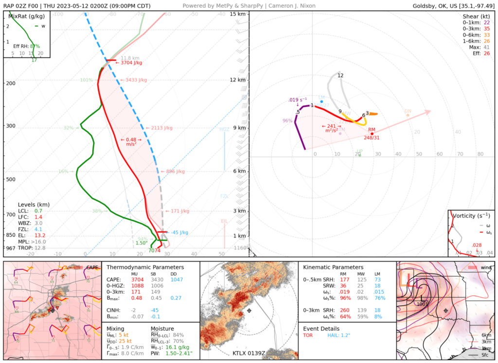
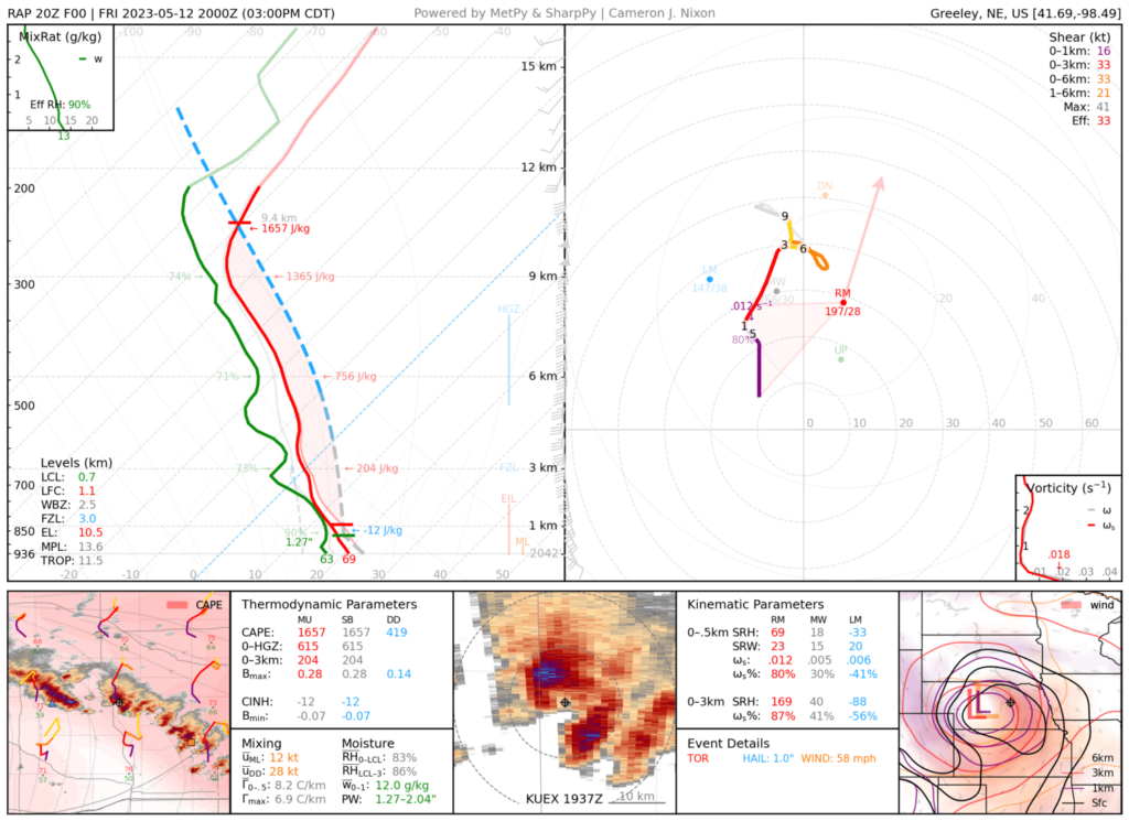
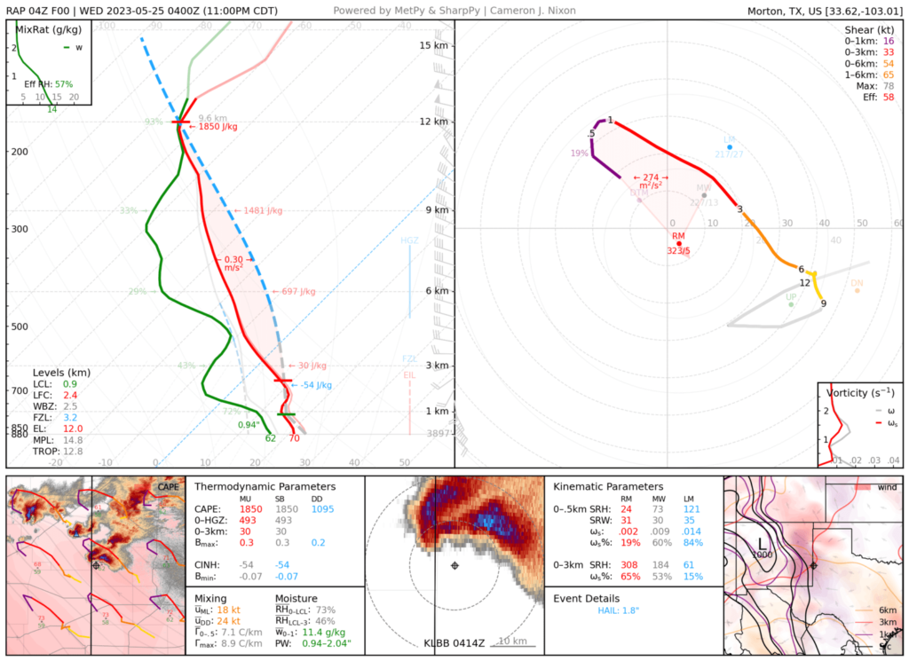
Each case comes with documentation, a proximity sounding from unmodified RAP and ERA5 reanalysis, (see disclaimer), and storm-centered NEXRAD imagery. Data are valid at the time nearest the climax of the event (e.g., when a tornado was reported, or when the most well-known photographs were taken).
This archive sparks the question, “why did this happen?” Similar environments make similar storms, but a storm’s environment isn’t just skew-Ts and hodographs. If you’re wondering “how did this sounding do that?“, remember to check for boundaries, cell mergers, and chaos!
Created and maintained by Cameron Nixon and Kyle Gillett. Additional cases will be added. Here’s a guide.
Go to: 2000 | 2001 | 2002 | 2003 | 2004 |2005 | 2006 | 2007 | 2008 | 2009 | 2010 | 2011 | 2012 | 2013 | 2014 | 2015 | 2016 | 2017 | 2018 | 2019 | 2020 | 2021 | 2022 | 2023
*NEW* Can’t find a case? Make your own soundings in seconds on SounderPy!
Search the case index below for cases by state, month, year, location, and other key info.
2000
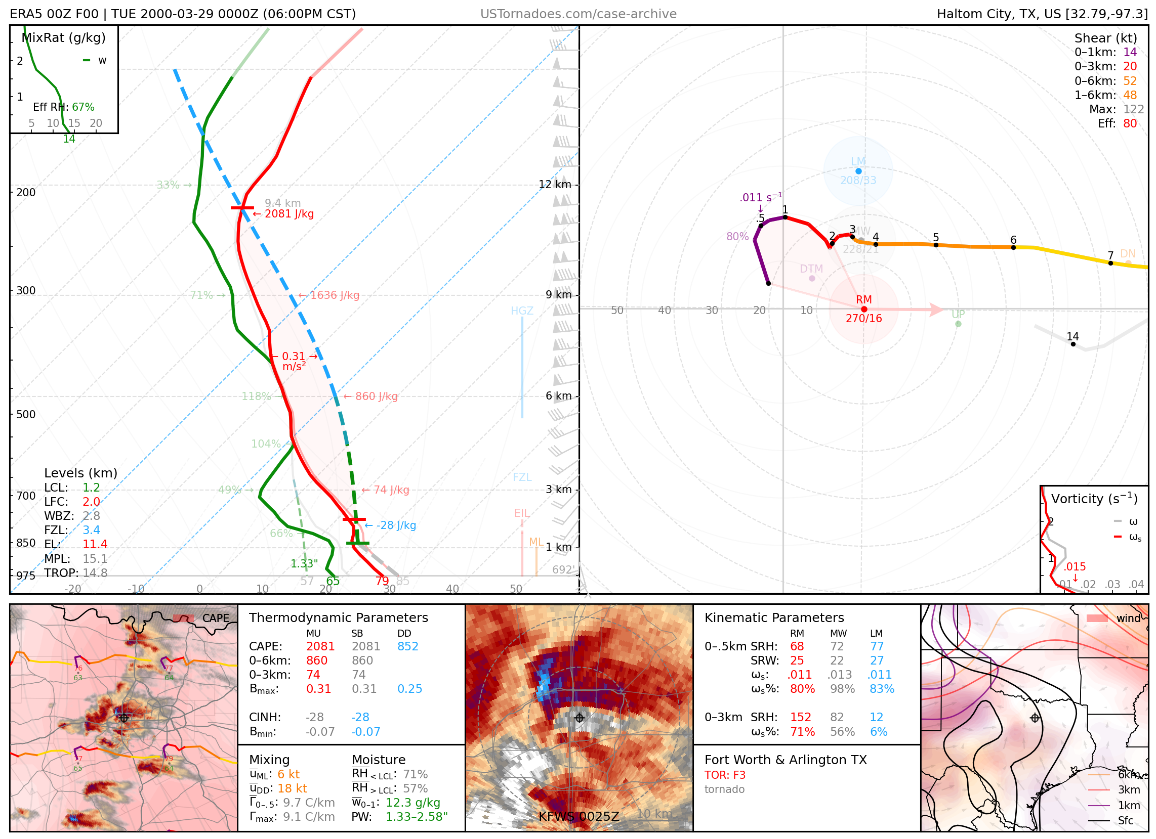
March 28, 2000: Fort Worth & Arlington, Texas
Localized outbreak of tornadoes within the DFW metro, including two F3s. The Fort Worth tornado hit downtown, damaging several high-rise buildings.
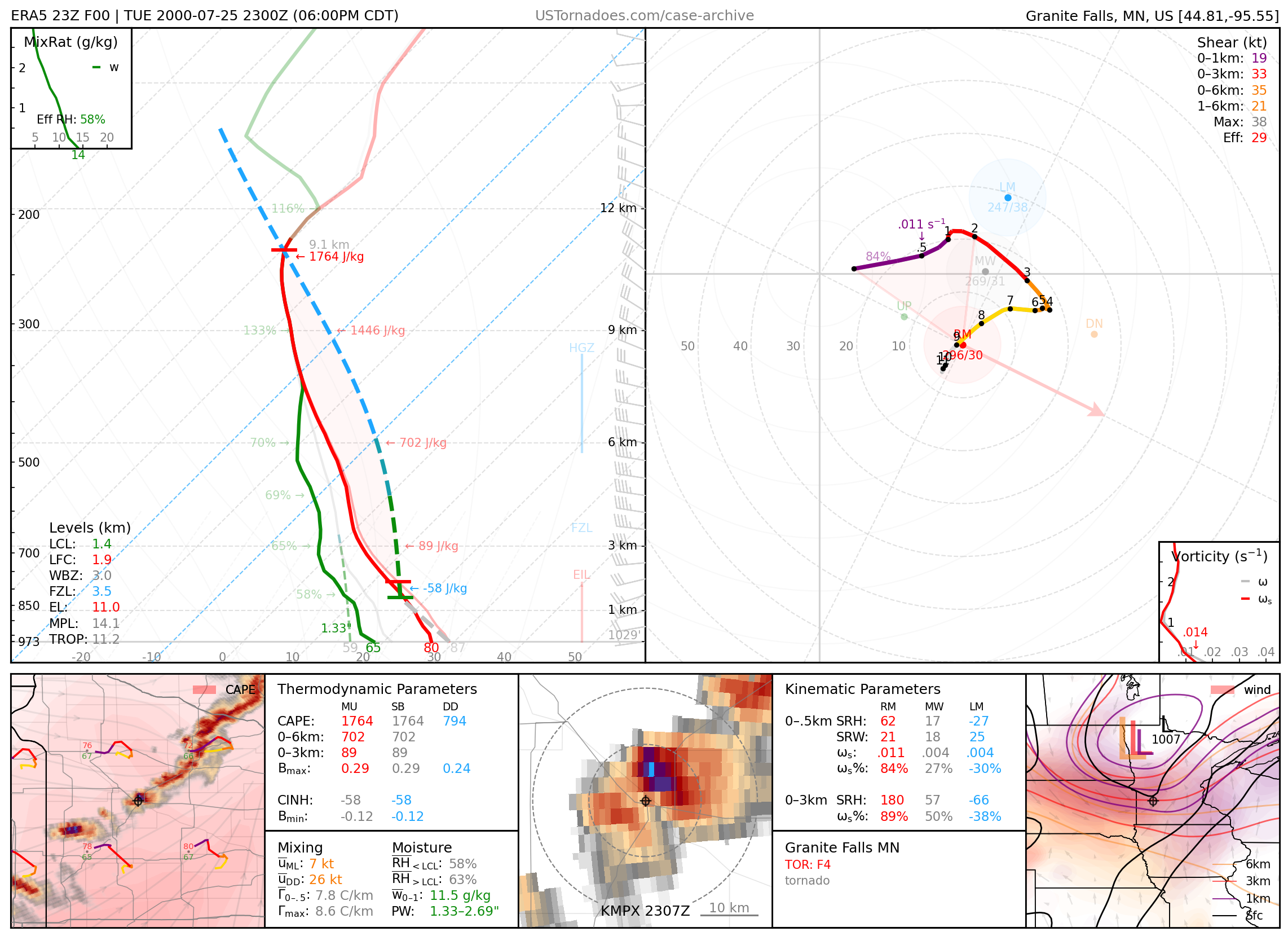
July 25, 2000: Granite Falls, Minnesota
F4 tornado that tore through Granite Falls, damaging over one third of the town. Snowplows had to be enlisted to clear the way for first responders.
2001
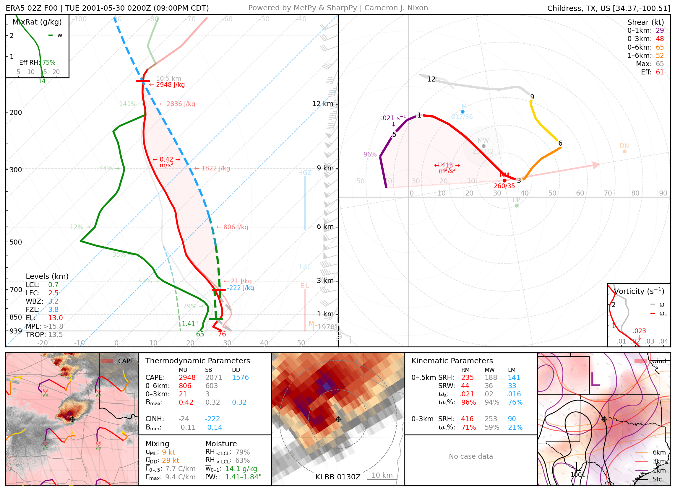
May 29, 2001: Turkey–Childress, Texas
Particularly photogenic high-precipitation mothership supercell.
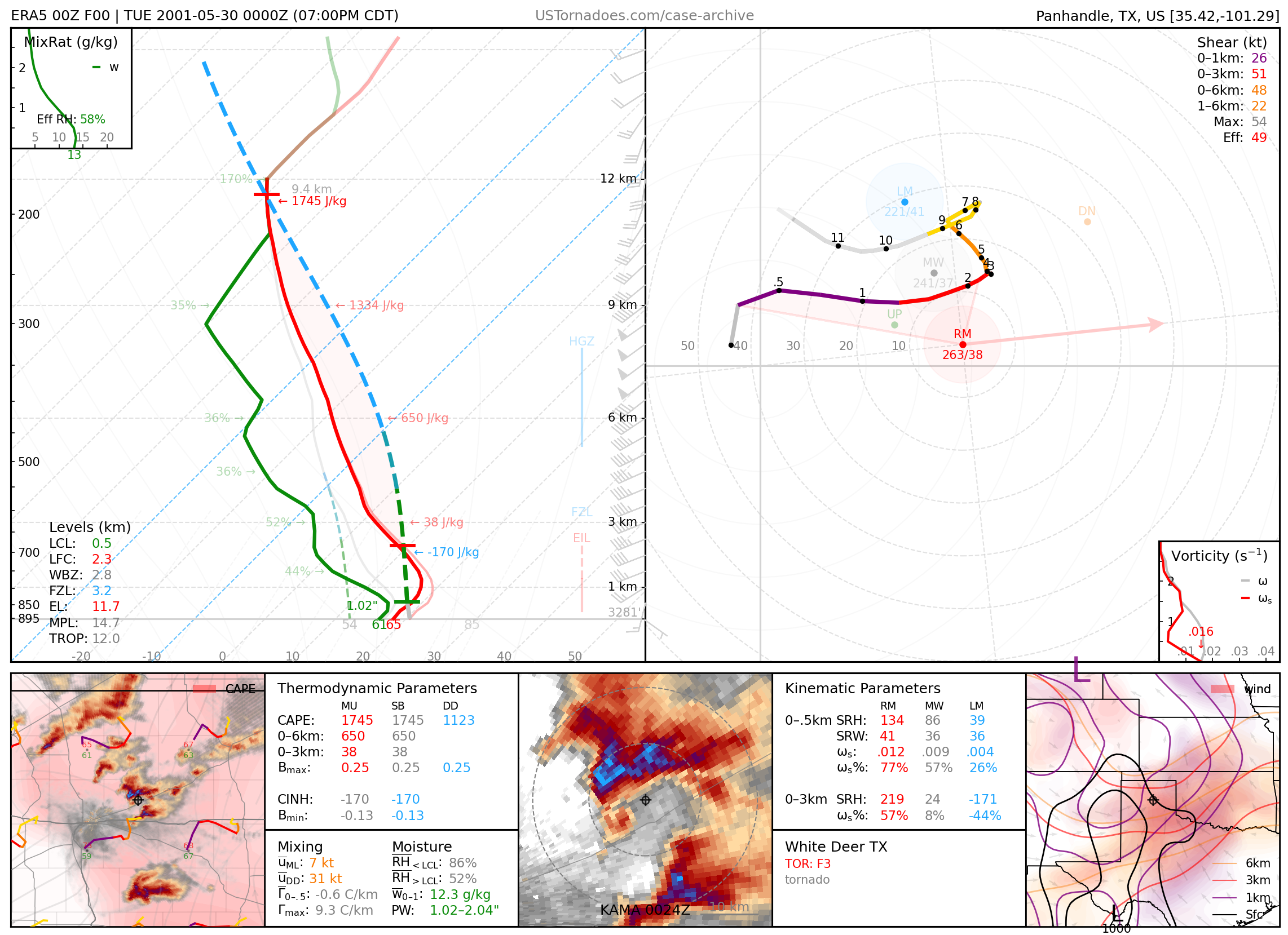
May 29, 2001: White Deer, Texas
Large and photogenic F3 tornado.
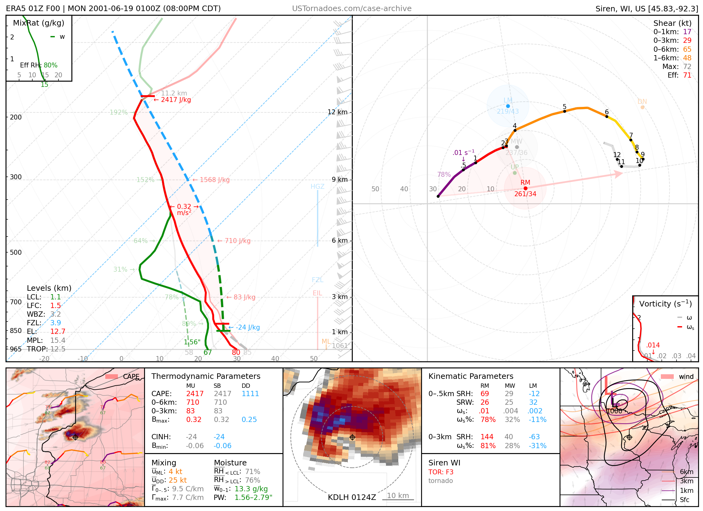
June 18, 2001: Siren, Wisconsin
Long-lived F3 tornado that killed 2 people. The aptly named town’s tornado siren was struck by lightning earlier that year, and was set to be replaced the next week.
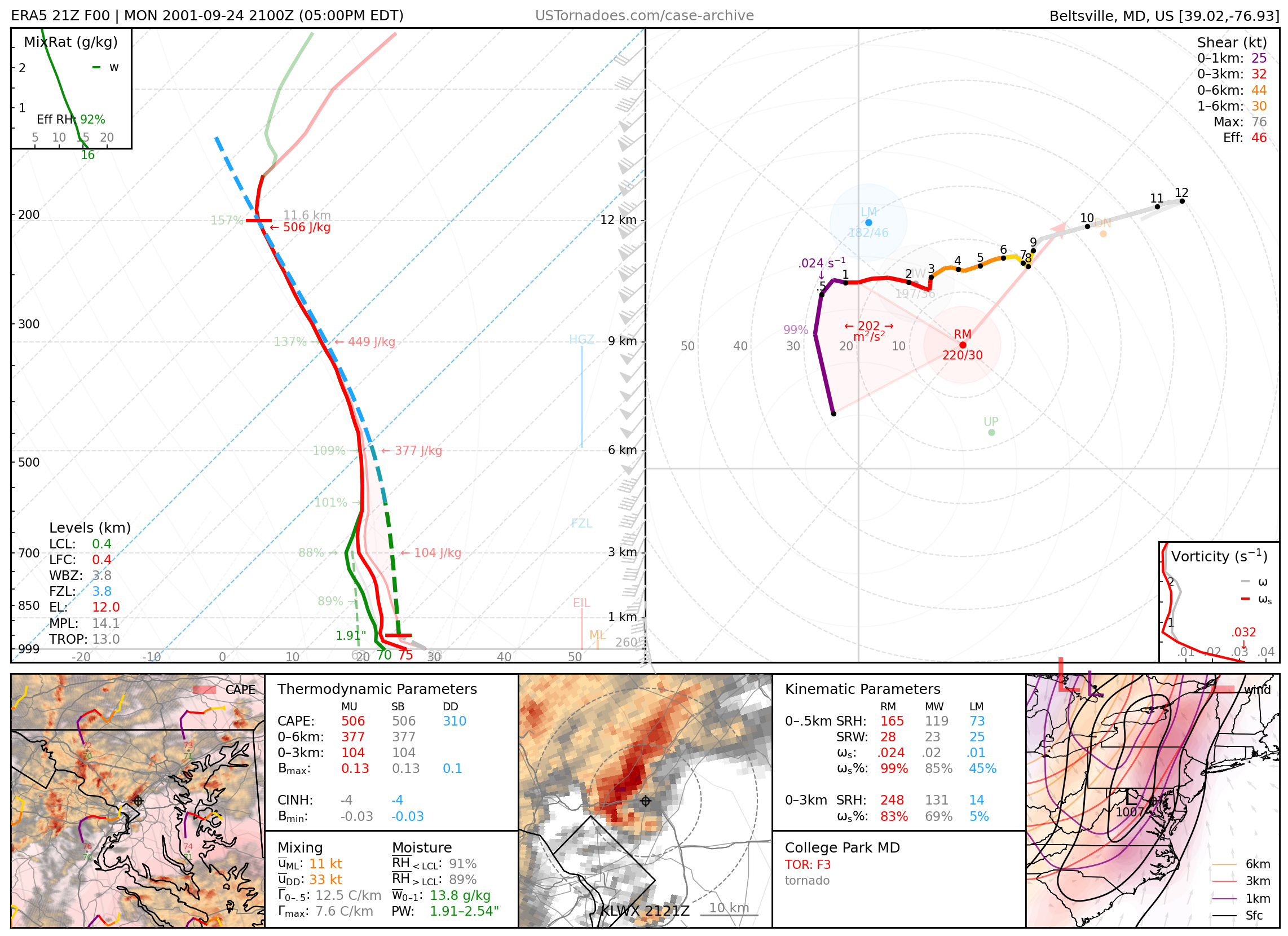
September 24, 2001: College Park, Maryland
F3 tornado that hit the University of Maryland, College Park campus, killing two people.
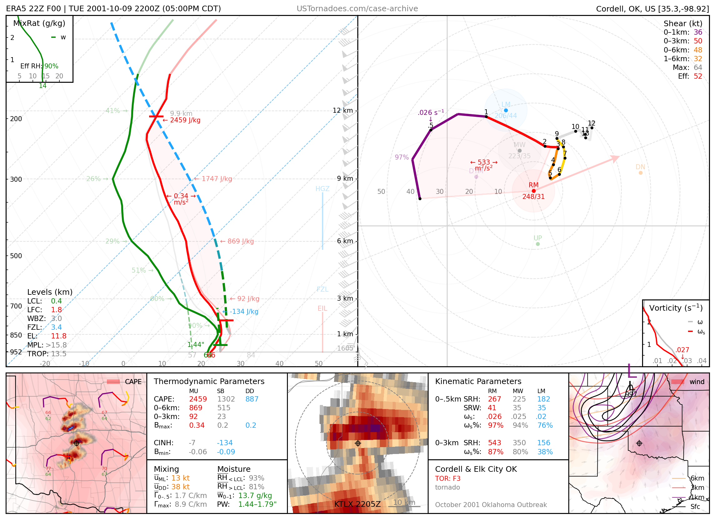
October 9, 2001: Cordell & Elk City, Oklahoma
Photogenic F3 tornadoes, part of one of Oklahoma’s largest October tornado outbreaks.
2002
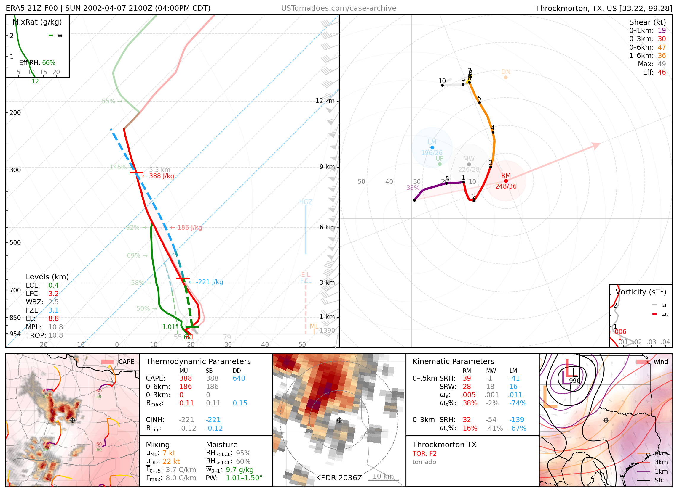
April 7, 2002: Throckmorton, Texas
Large wedge tornado rated F2.
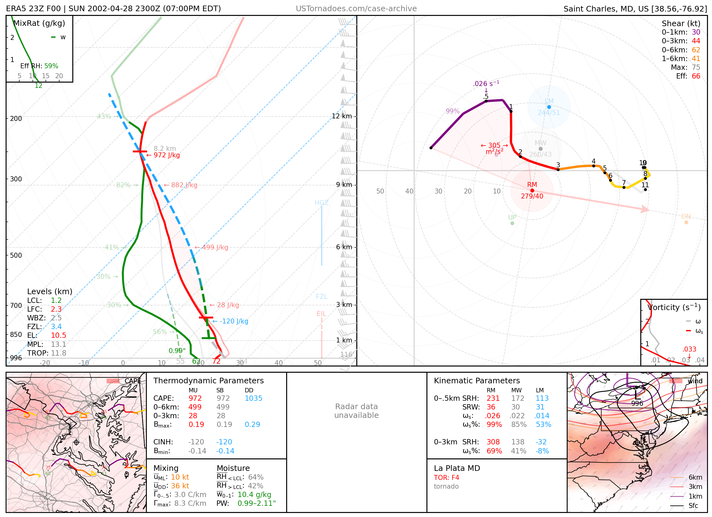
April 28, 2002: La Plata, Maryland
Powerful F4 tornado that killed 5 people, one of the strongest to hit the greater Washington, D.C., area. Part of a larger outbreak of tornadoes in the Mid-Atlantic.
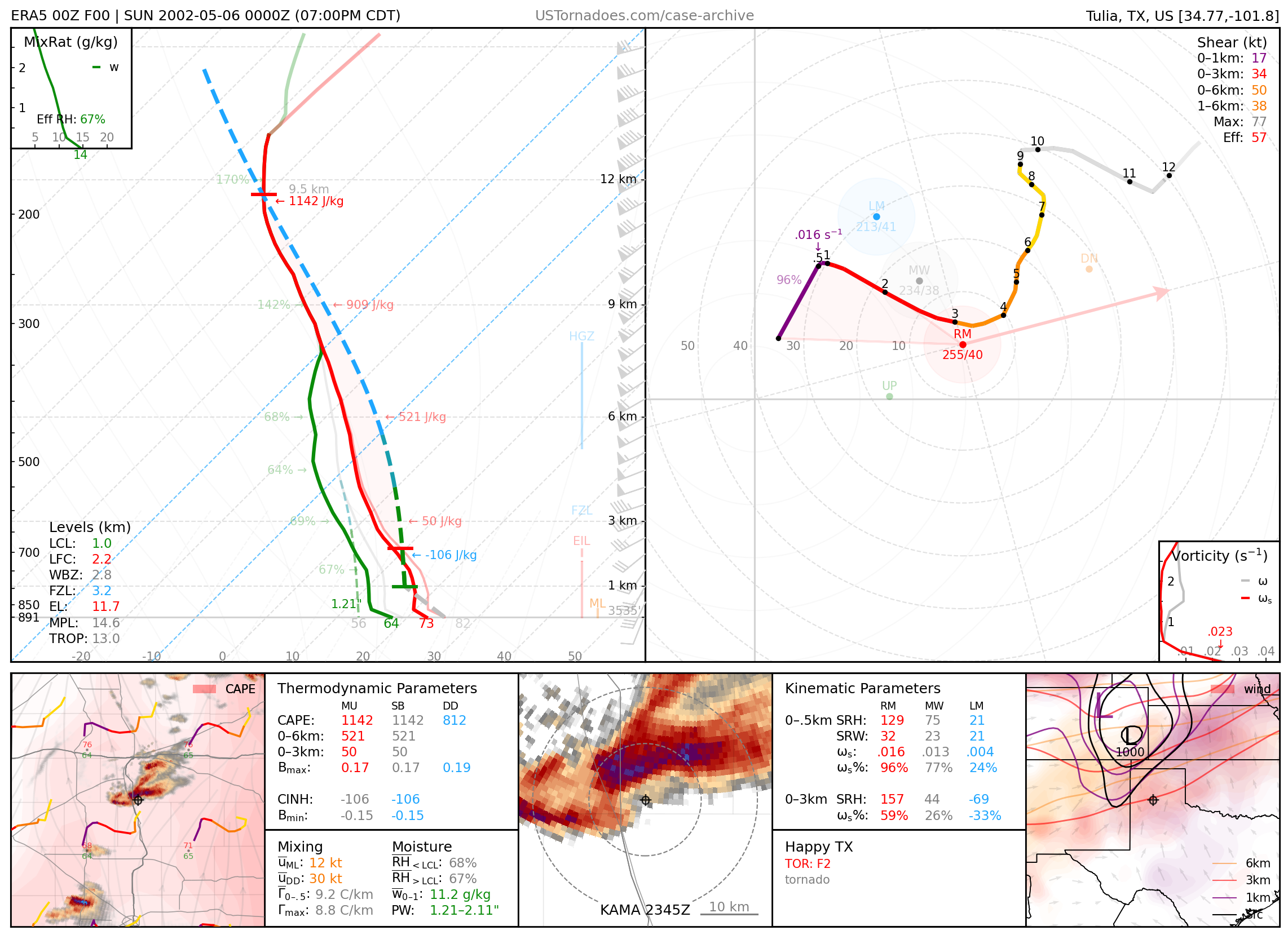
May 5, 2002: Happy, Texas
Destructive F2 tornado that killed 2 people in its circular track around town.
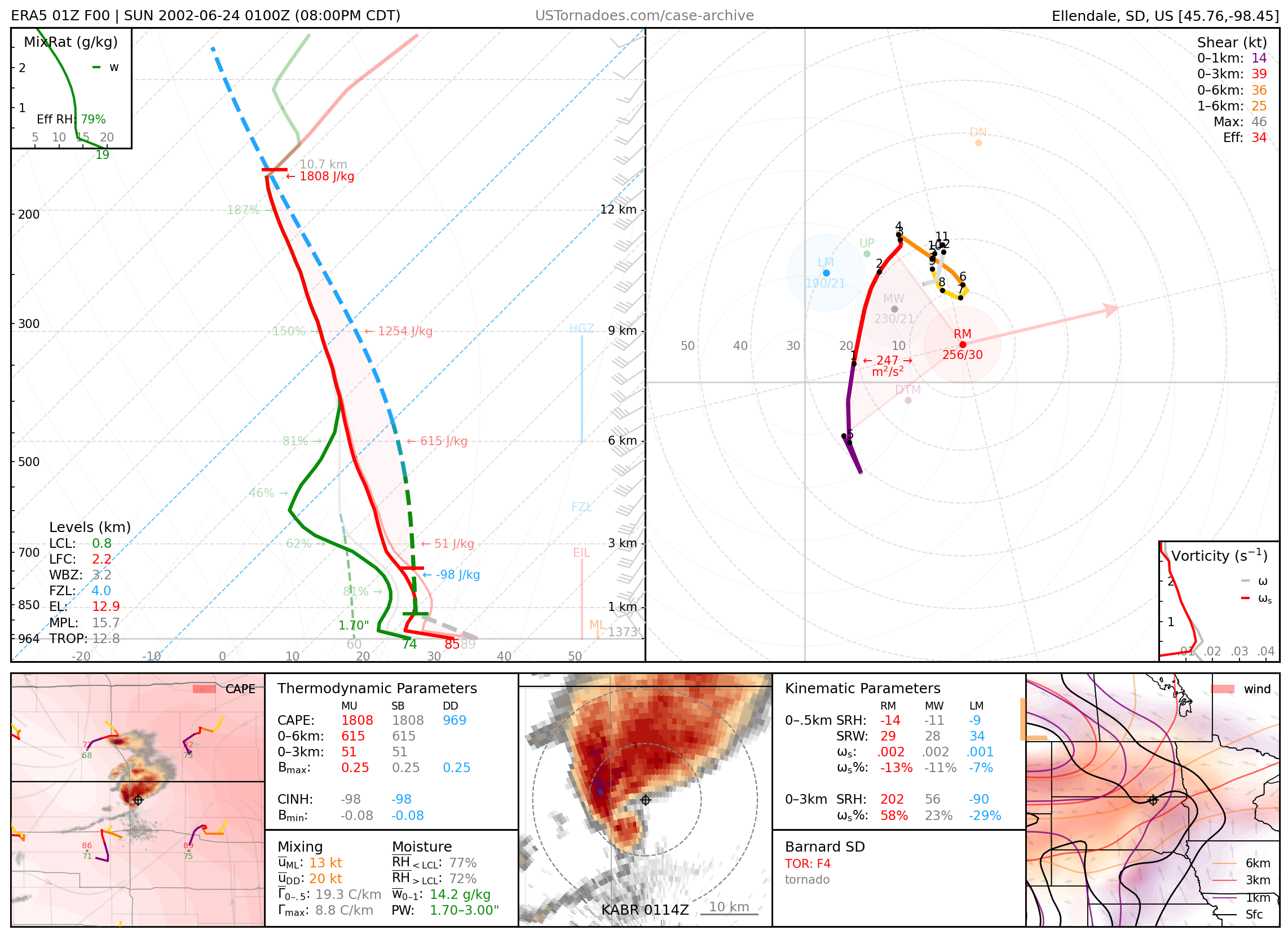
June 23, 2002: Barnard, South Dakota
Long-lived F4 tornado from a cyclic supercell that produced 6 total.
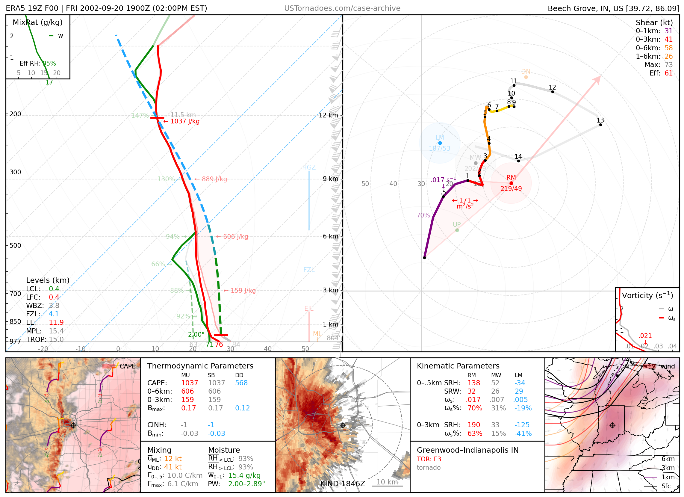
September 20, 2002: Greenwood / Indianapolis, Indiana
Long track F3 from a QLCS that produced 5 other tornadoes in Indiana. This tornado has the longest track in Indiana history at 112 miles.
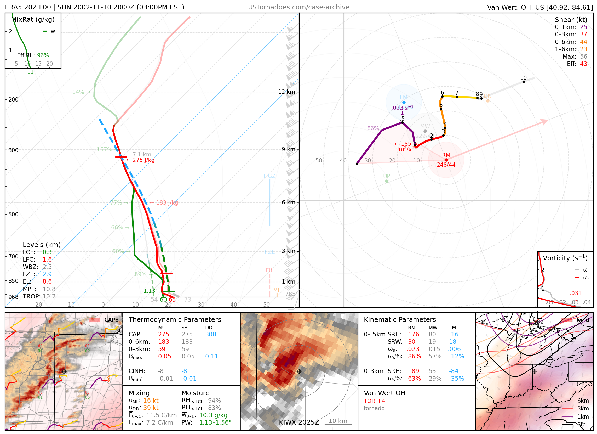
November 10, 2002: Van Wert, Ohio
Deadly long track F4, part of the larger Veteran’s Day Outbreak of 2002.
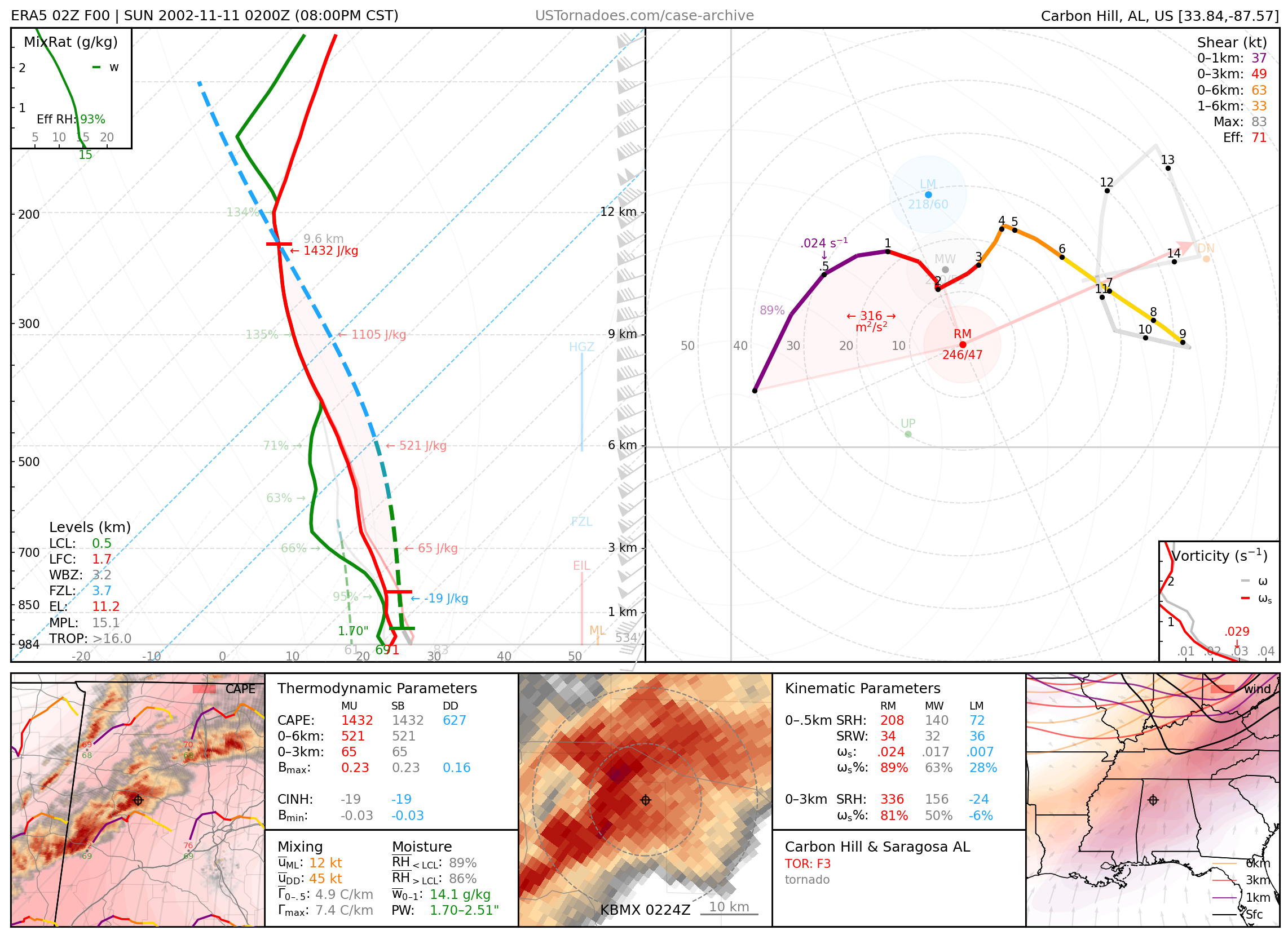
November 11, 2002: Carbon Hill & Saragossa, Alabama
Two long track damaging F3 tornadoes, from two separate supercells that tracked within miles of each other along a parallel path through northern Alabama for over 40 miles.
2003
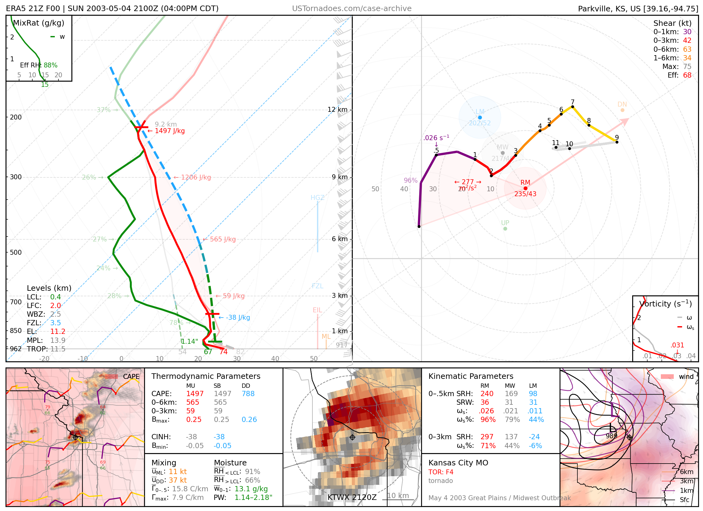
May 4, 2003: Kansas City, Missouri
Large damaging F4 tornado, part of a succession of 4 tornadoes to hit the northern suburbs of the Kansas City metro area.
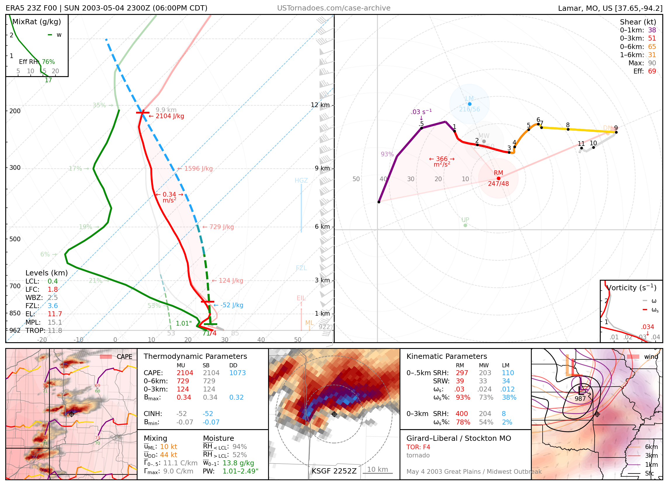
May 4, 2003: Girard / Liberal / Stockton & Carl Junction & Pierce City Missouri
Numerous high-end, large, long track tornadoes. Out of an outbreak of 15 total tornadoes, 4 were rated F3 and one an F4. Some tracked for 20-80 miles.
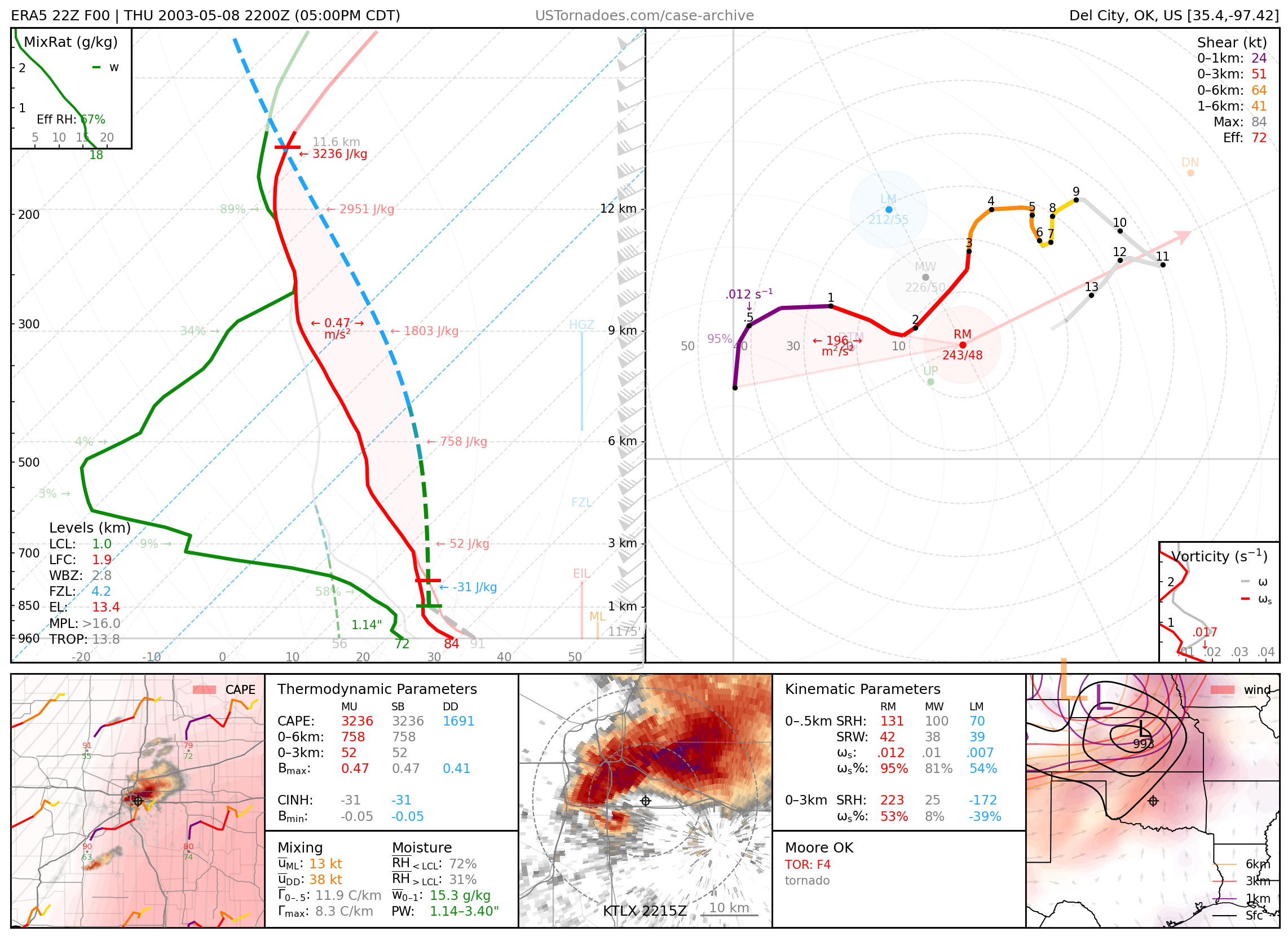
May 8, 2003: Moore, Oklahoma
Damaging F4 tornado that struck Moore, Oklahoma and caused significant damage. This was part of a larger outbreak of 26 tornadoes from Oklahoma to Nebraska.
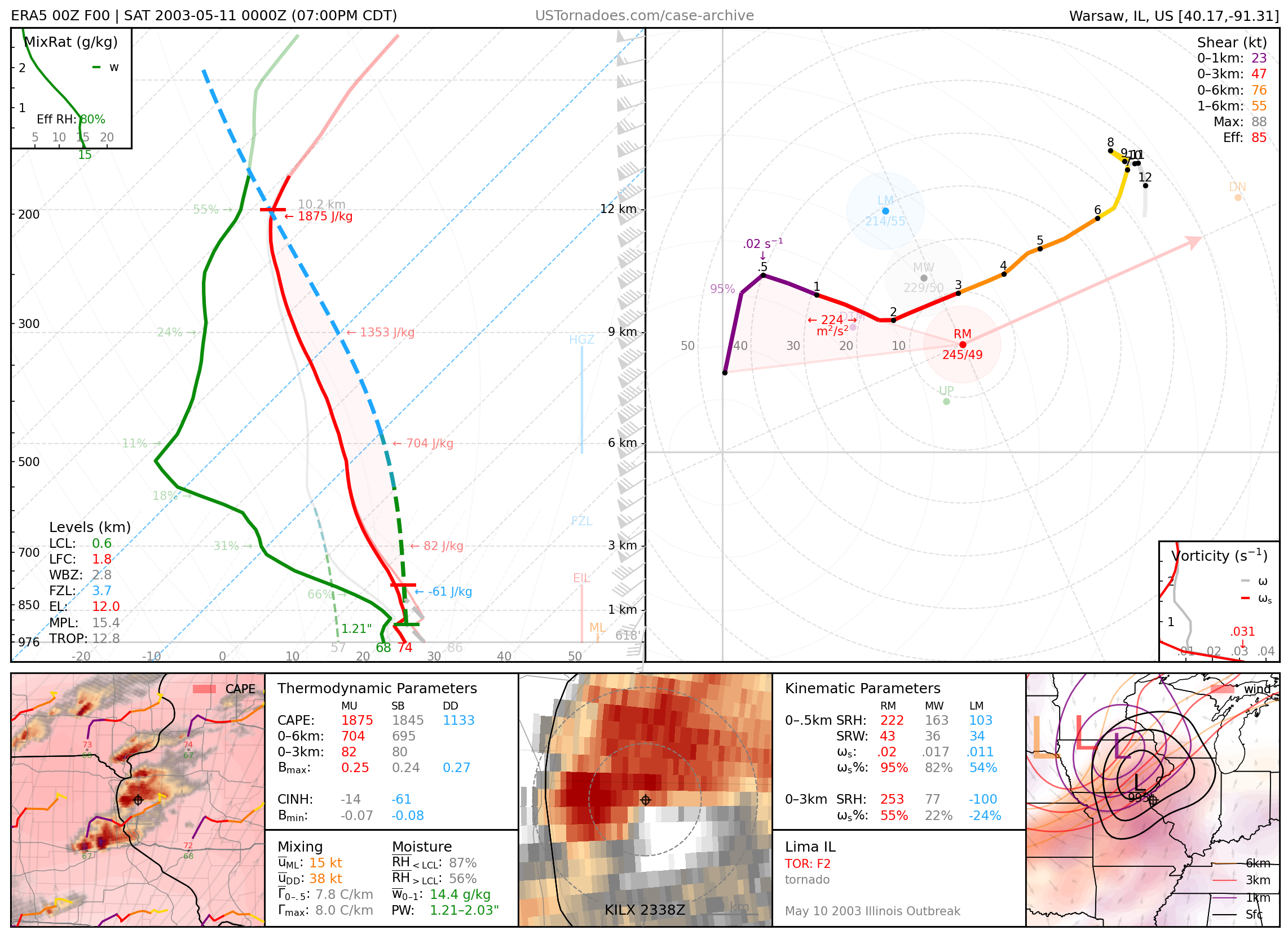
May 10, 2003: Lima, Illinois
Damaging and long-tracked F2 wedge tornado, part of a larger regional outbreak of 43 tornadoes.
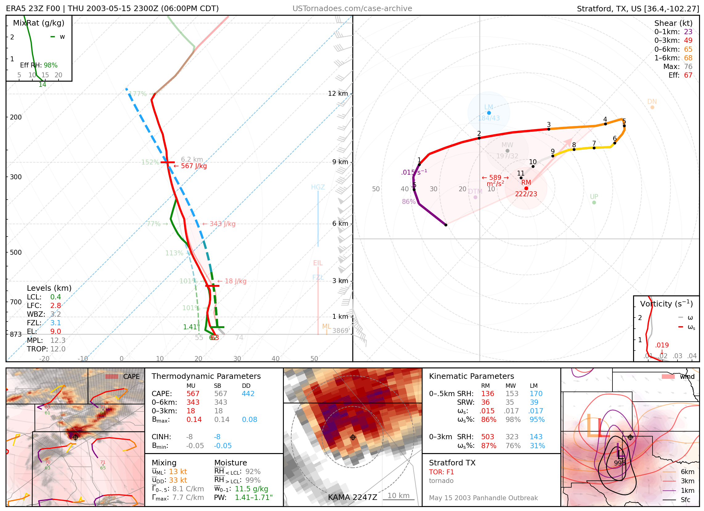
May 15, 2003: Stratford, Texas
Numerous photogenic tornadoes associated with a larger outbreak of 26 tornadoes.
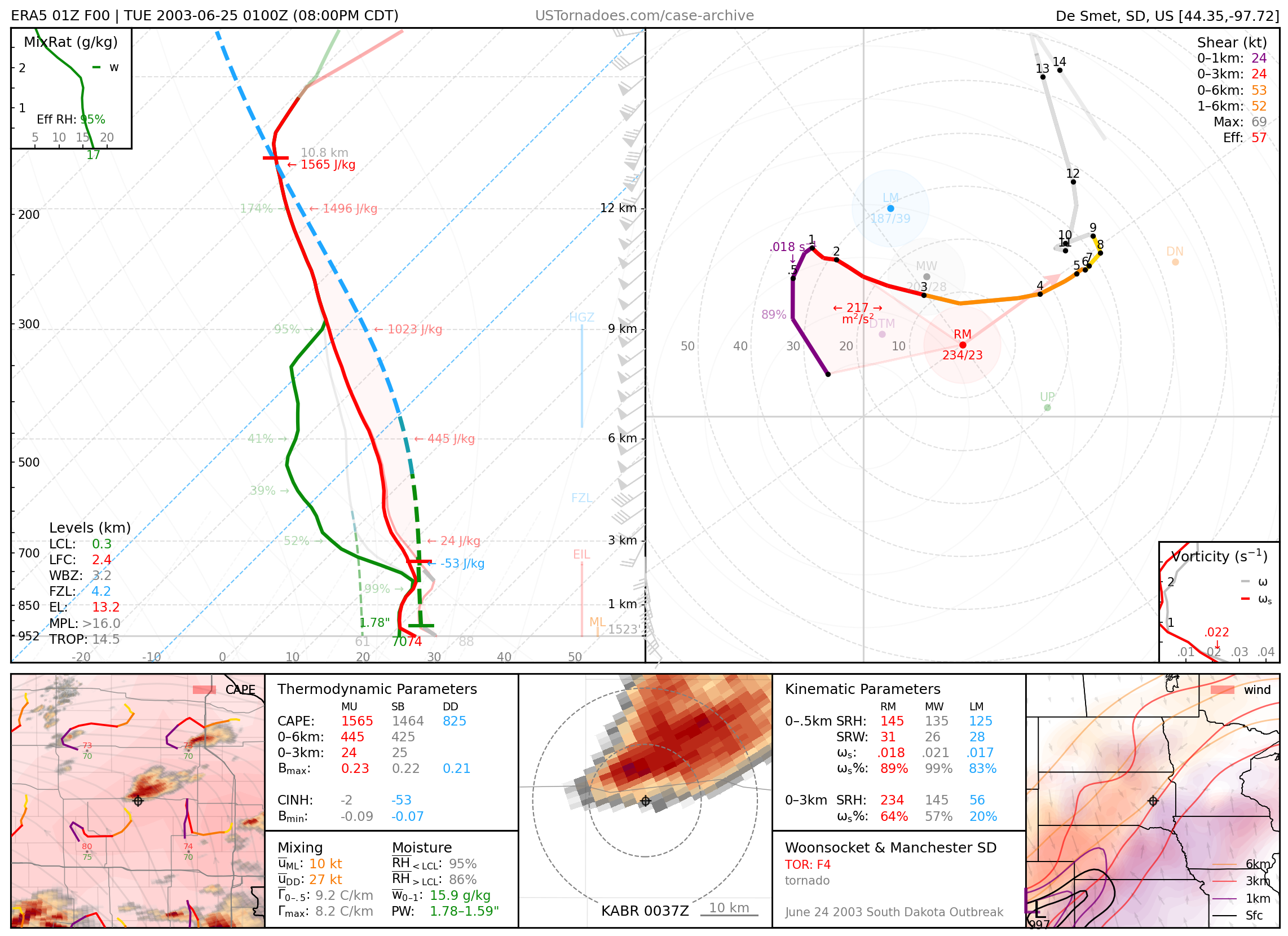
June 24, 2003: Manchester, South Dakota
Violent multi-vortex wedge F4, part of South Dakota’s largest tornado outbreak, featuring 66 confirmed tornadoes. This outbreak remains the largest tornado outbreak ever recorded during astronomical summer not related to a tropical system. Manchester, South Dakota was completely destroyed and remains a ‘tornado ghost town’.
2004
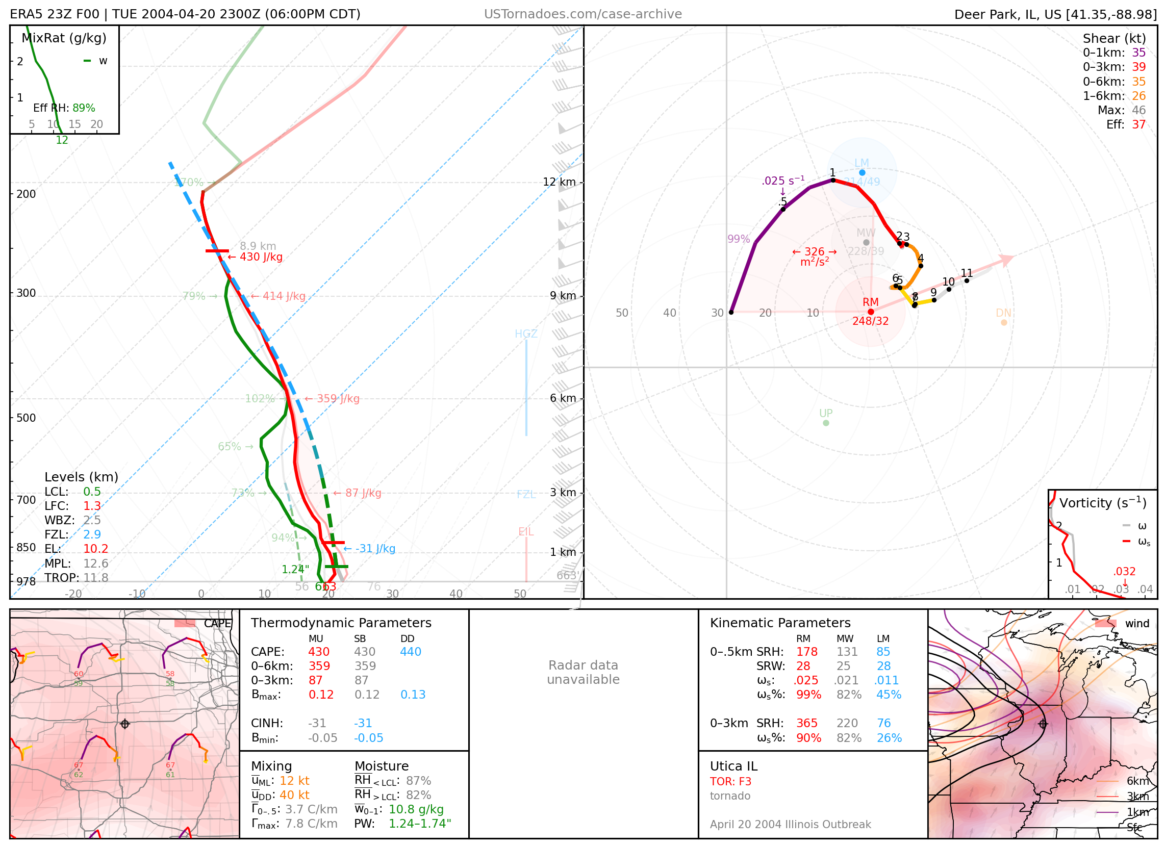
April 20, 2004: Utica, Illinois
Deadly F3 tornado, part of an outbreak of 29 tornadoes produced by mini-supercells across Iowa, Illinois and Indiana, that was largely a “surprise”.
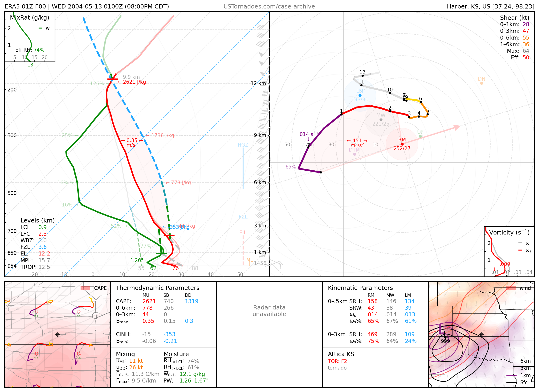
May 12, 2004: Attica, Kansas
Particularly photogenic tornado produced by a cyclic supercell. 11 tornadoes struck Harper County, Kansas alone. This supercell also produced giant hail over 5” in diameter.
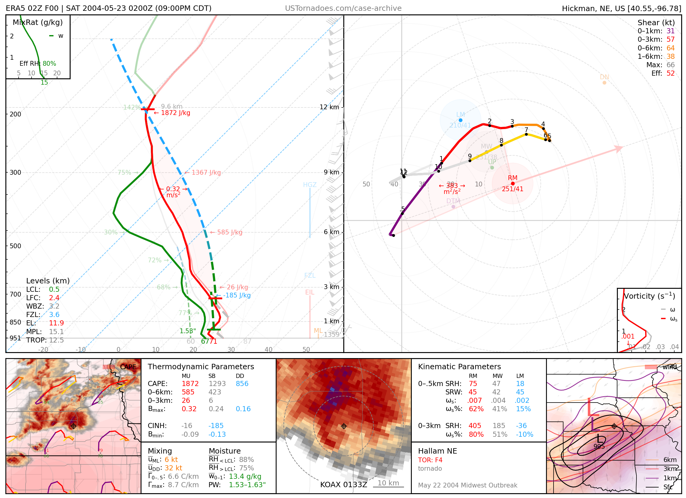
May 22, 2004: Hallam, Nebraska
Massive, highly destructive, long-track F4. Former largest tornado on record (2.5 miles wide) until El Reno, Oklahoma EF3 in May 2013 (2.6 miles wide).
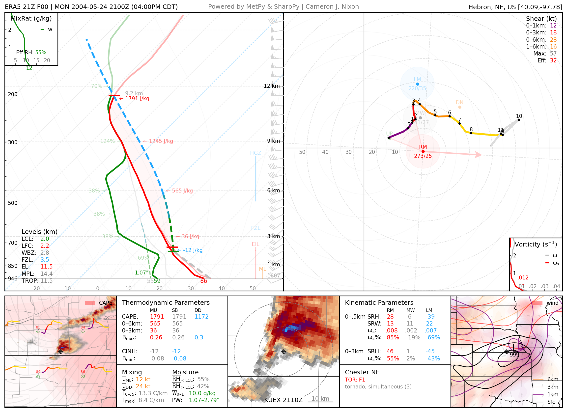
May 24, 2004: Chester, Nebraska
Cyclic supercell that produced several tornadoes during a localized outbreak of 16 tornadoes, most of which were weak but photogenic.
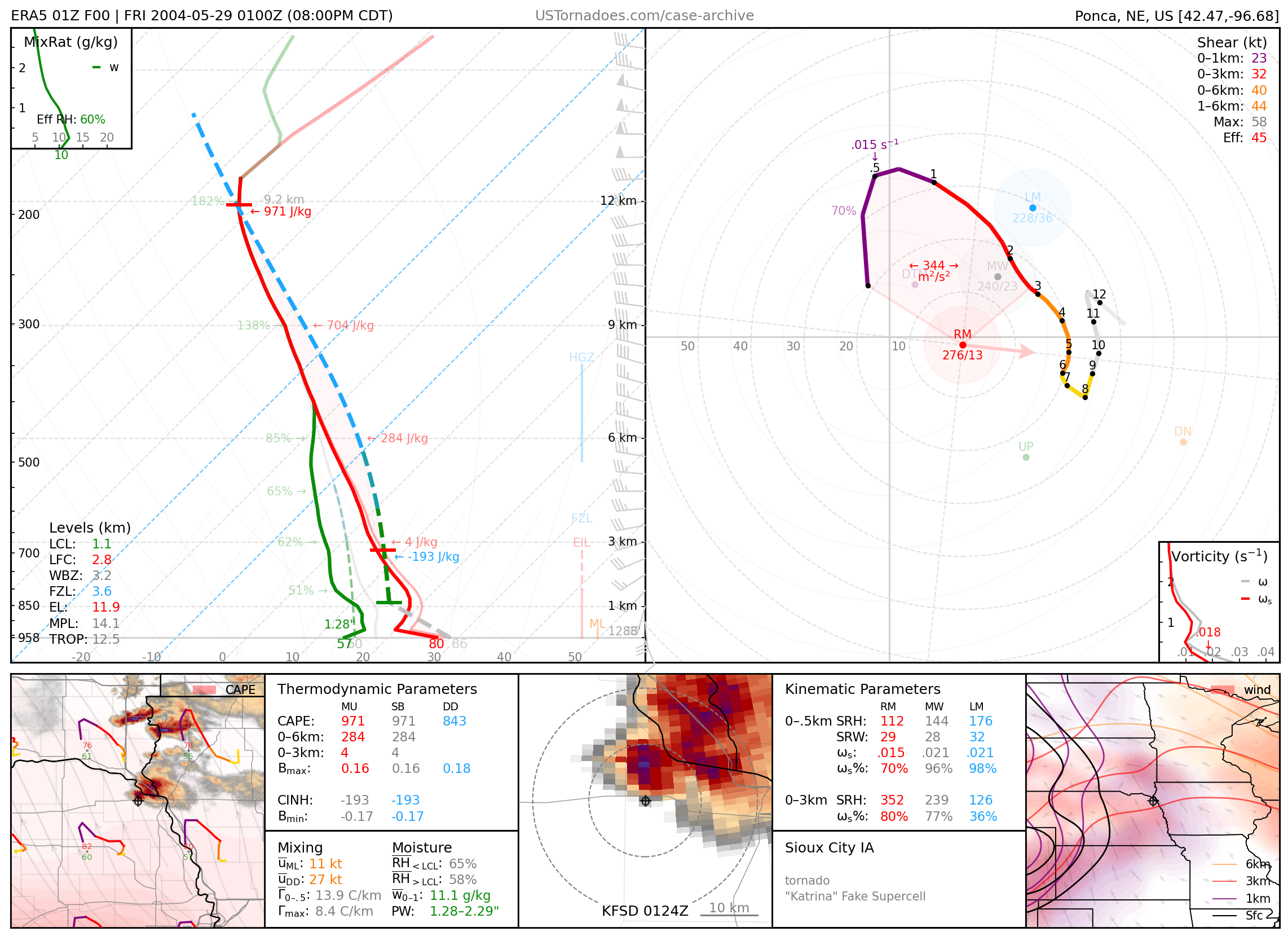
May 28, 2004: Sioux City, Iowa
“Mothership” supercell that ultimately became the subject of many “Independence Day” references and hurricane Katrina fakes.
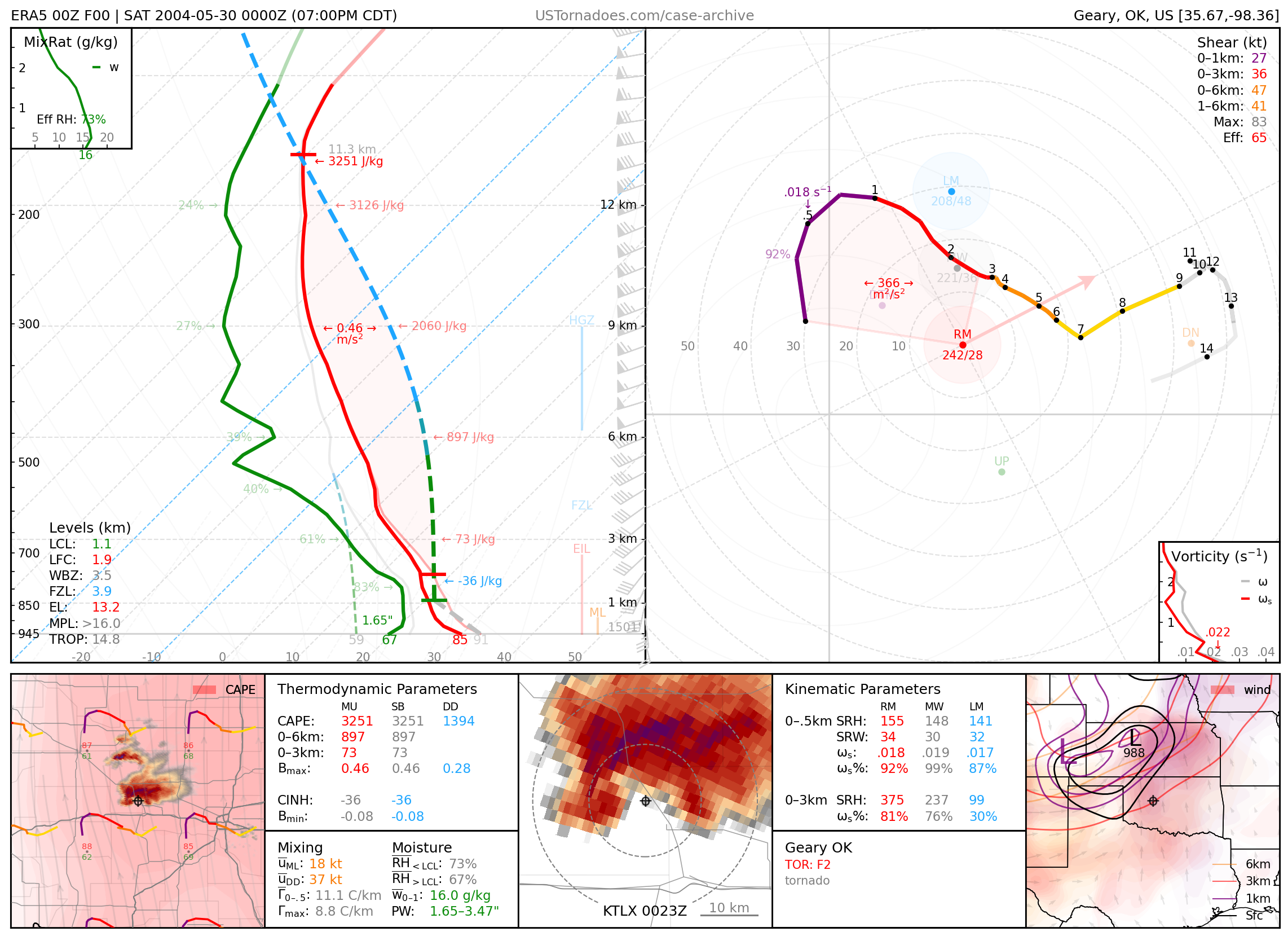
May 29, 2004: Geary, Oklahoma
Cyclic supercell that produced 16 tornadoes, and hail over 4”. A DOW team measured maximum wind gusts of 157kts.
June 12, 2004: Mulvane, Kansas
One of the most classic tornado/rainbow combos of chasing history, a photogenic F3 tornado, part of a localized family of 5 tornadoes.

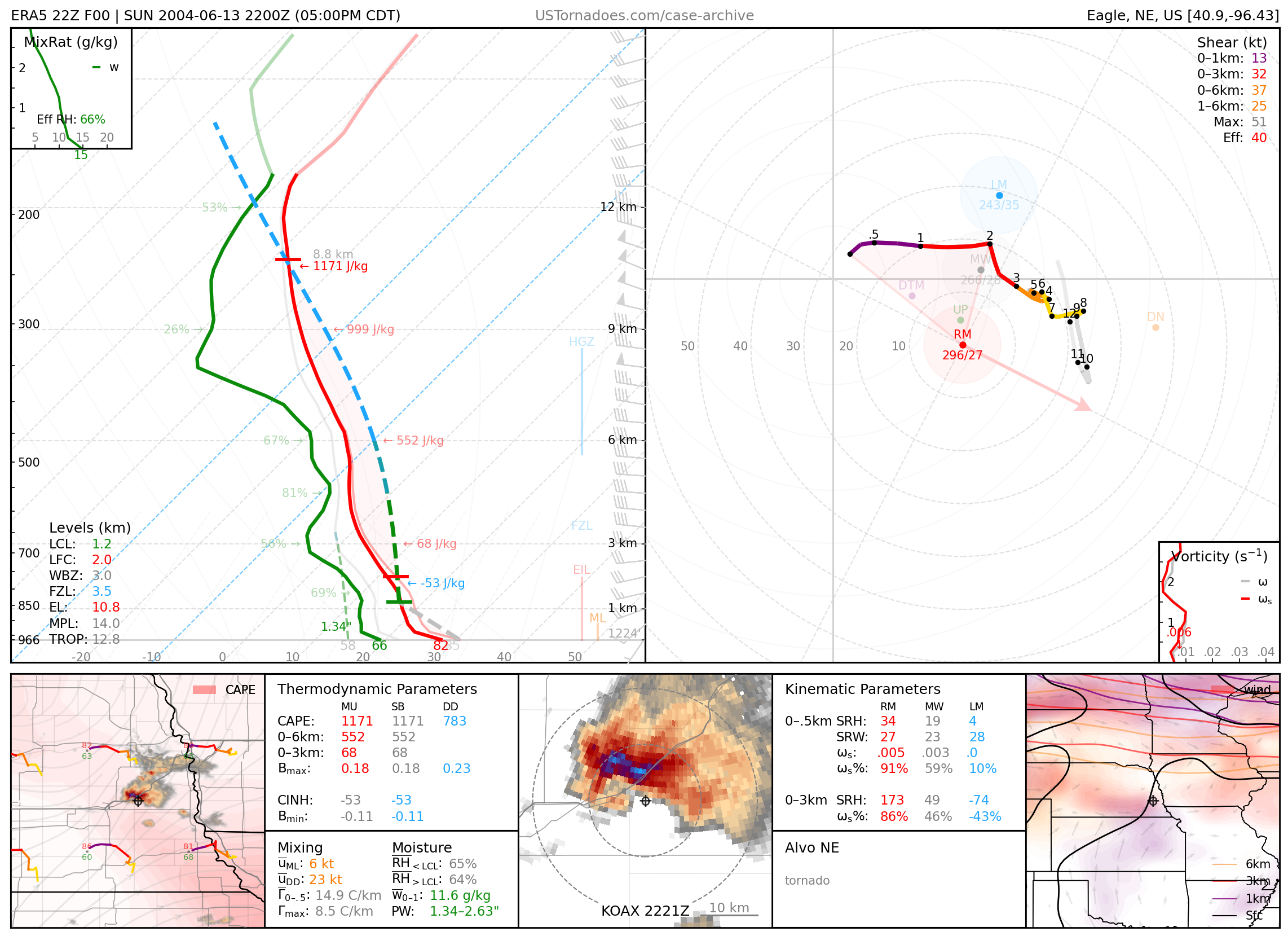
June 13, 2004: Alvo, Nebraska
Incredibly photogenic mothership/barberpoll supercell that produced a few brief tornadoes.
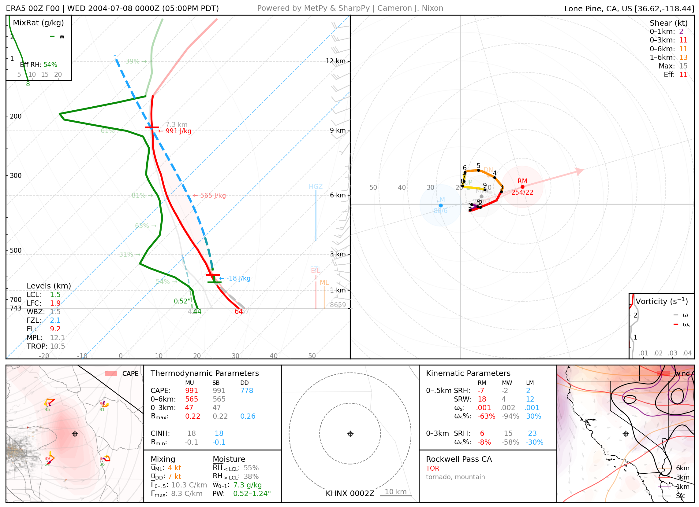
July 7, 2004: Rockwell Pass, California
Considered to currently be the ‘highest elevation tornado’ documented in the United States, this highly photogenic F0 tornado existed for only a short time at a staggering elevation of 11,600 ft. Severe hail was also documented.
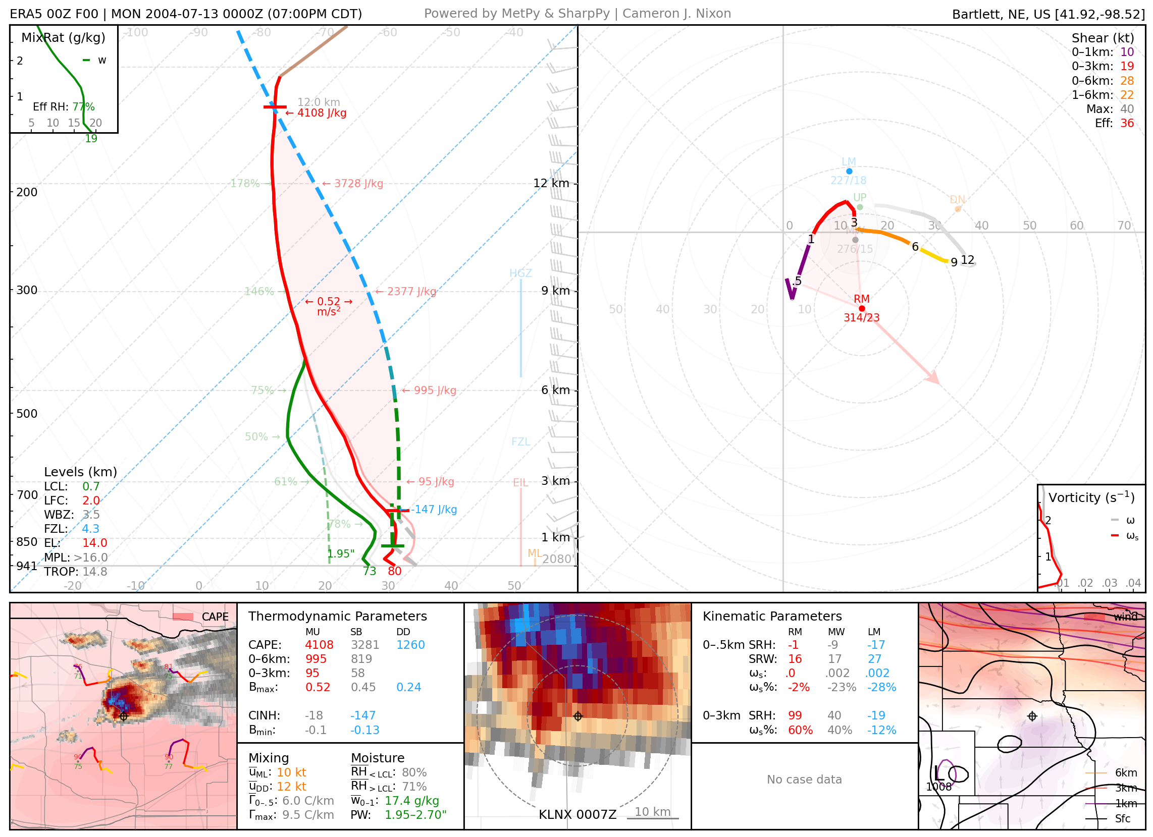
July 12, 2004: Bartlett, Nebraska
Series of 4 photogenic tornadoes (rated up to F2) from massive and well-structured supercell storm.
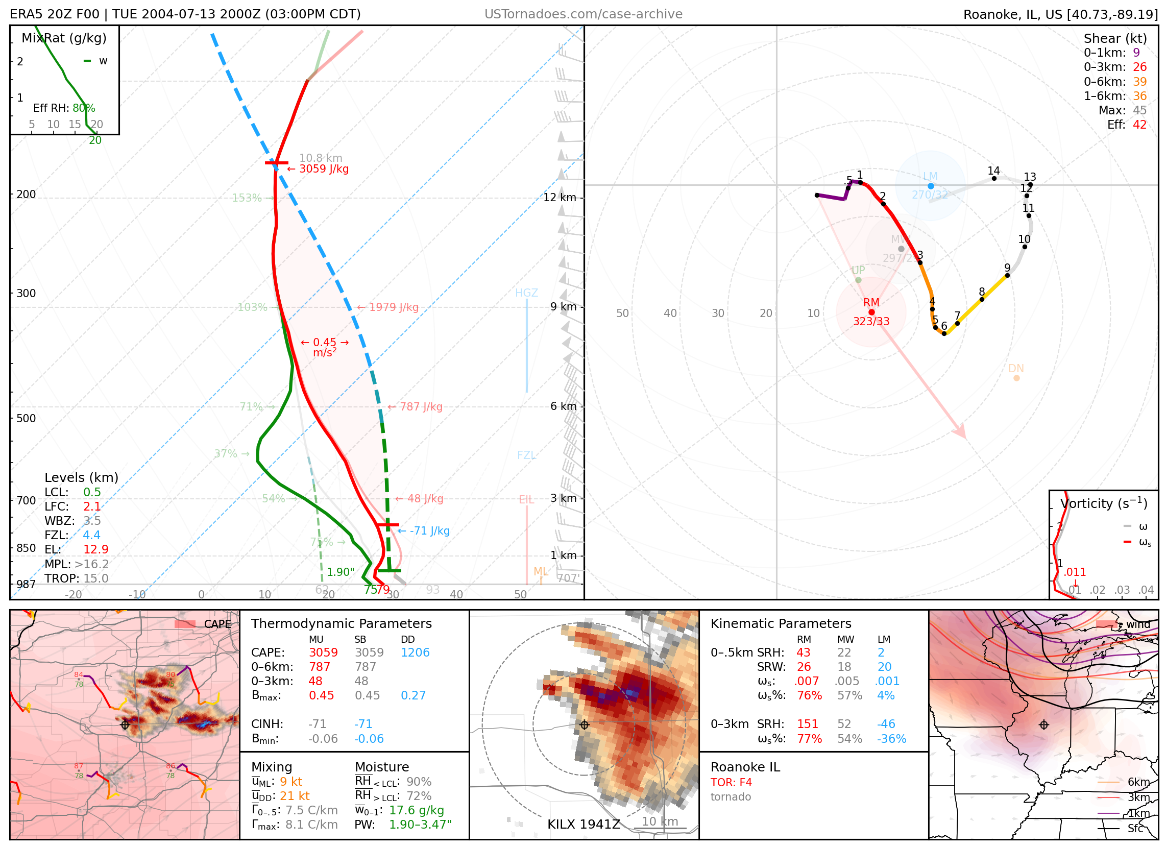
July 13, 2004: Roanoke, Illinois
Photogenic and highly destructive F4 tornado. Amazingly, only 3 injuries and 0 fatalities were reported, even though this tornado struck the Parsons Manufacturing Plant that had over 140 employees in the building.
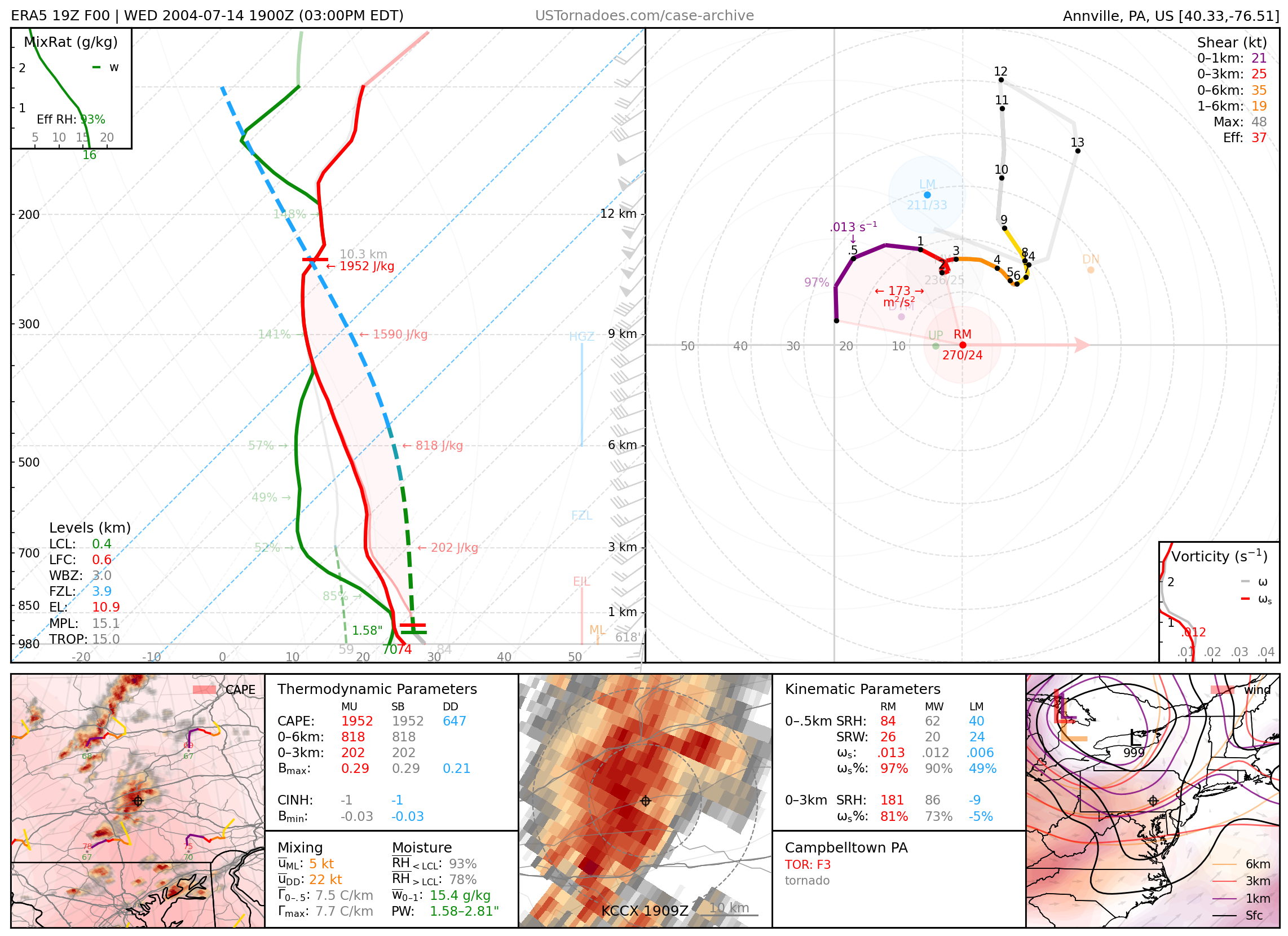
July 14, 2004: Campbelltown, Pennsylvania
Strong F3 tornado that struck a densely populated portion of Campbelltown.
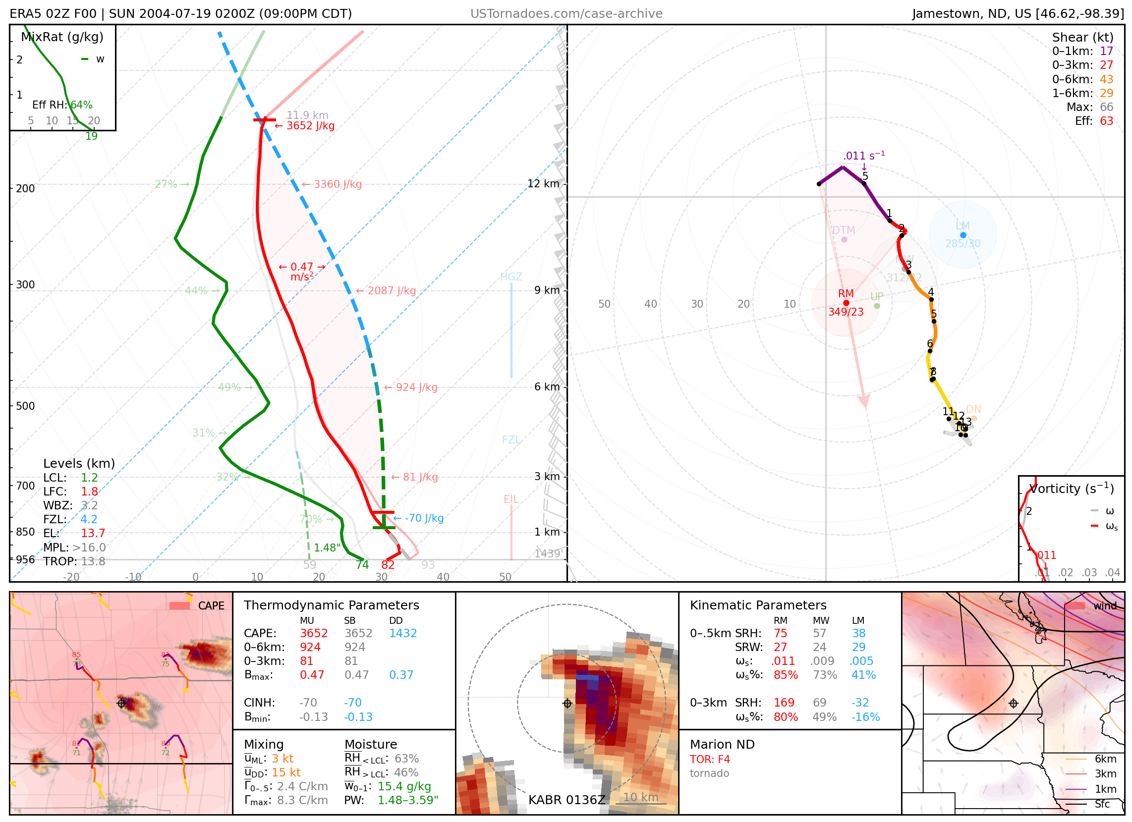
July 19, 2004: Marion, North Dakota
Considered one of the strongest tornadoes during the 2000s, this high-end F4 (also known as the “Noot Farm” tornado) was an uncanny Doppelgänger to that which occurred in Roanoke, IL, just a week before, and among 8 tornadoes confirmed in North Dakota.
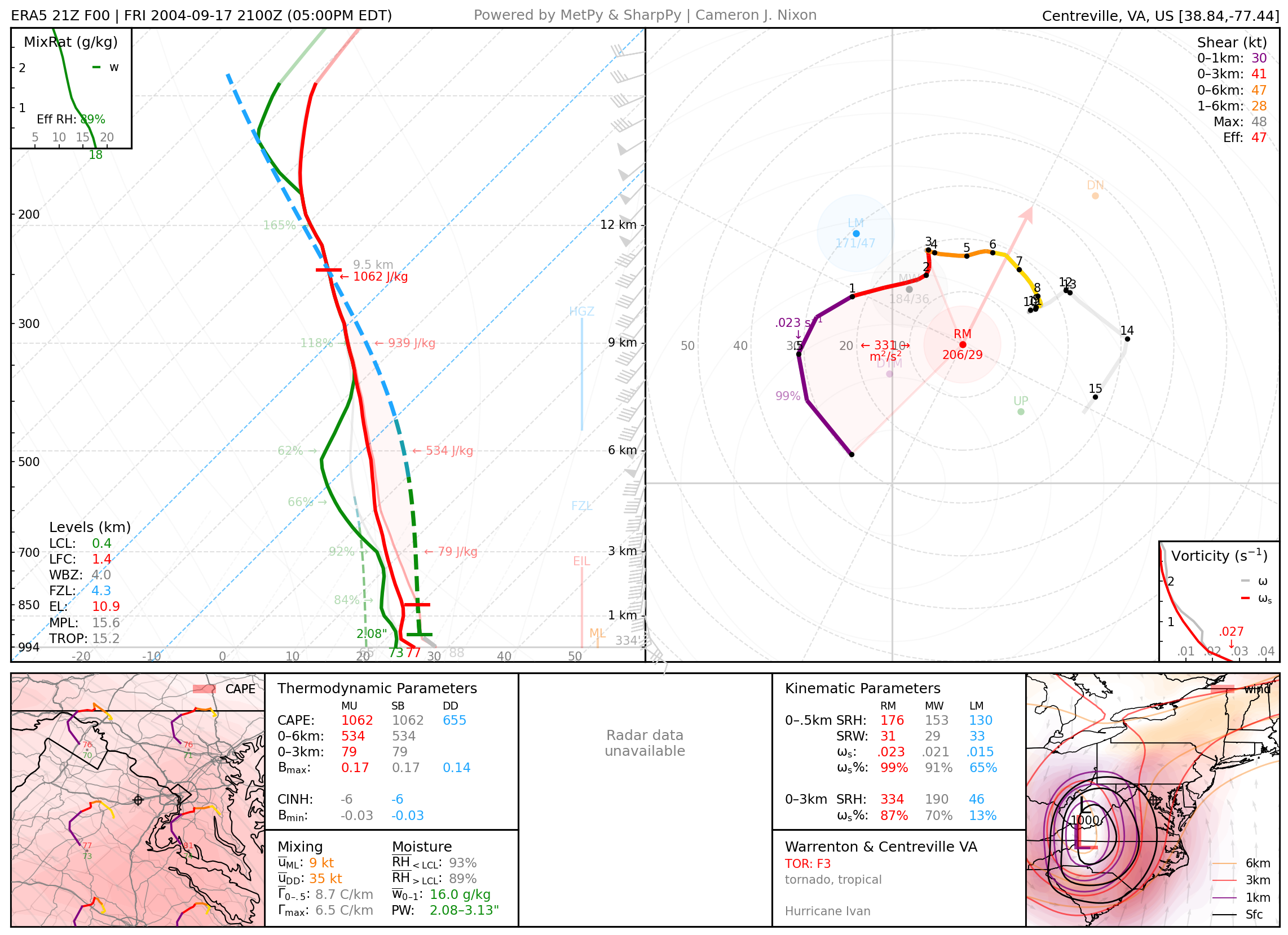
September 17, 2004: Remington / Warrenton & Centreville, Virginia
F3 wedge tornado beneath a well structured supercell. This tornado was part of an outbreak of 118 tornadoes associated with Hurricane Ivan, the single most tornadoes associated with a tropical cyclone in the United States.
2005
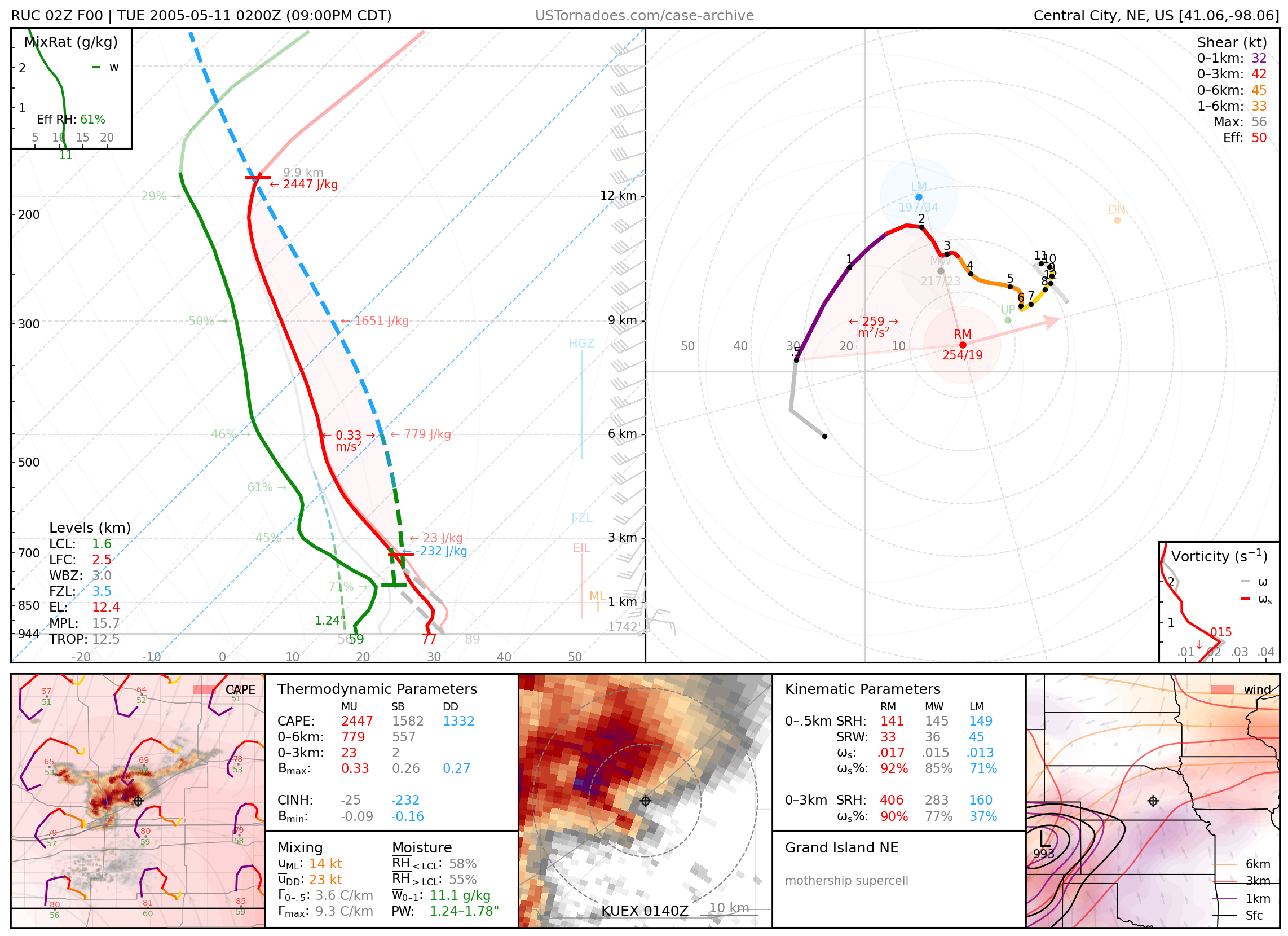
May 10, 2005: Grand Island, Nebraska
A particularly photogenic “mothership” supercell.
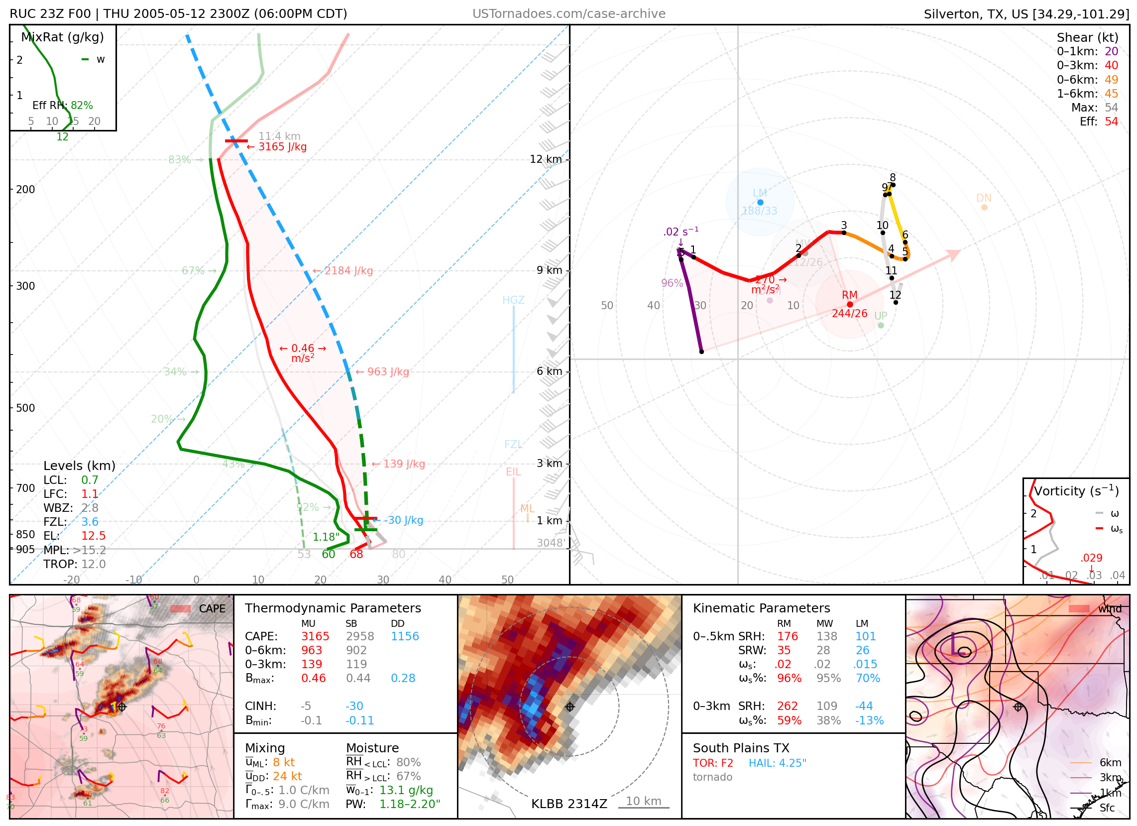
May 12, 2005: South Plains, Texas
F2 tornado and softball-sized hail.
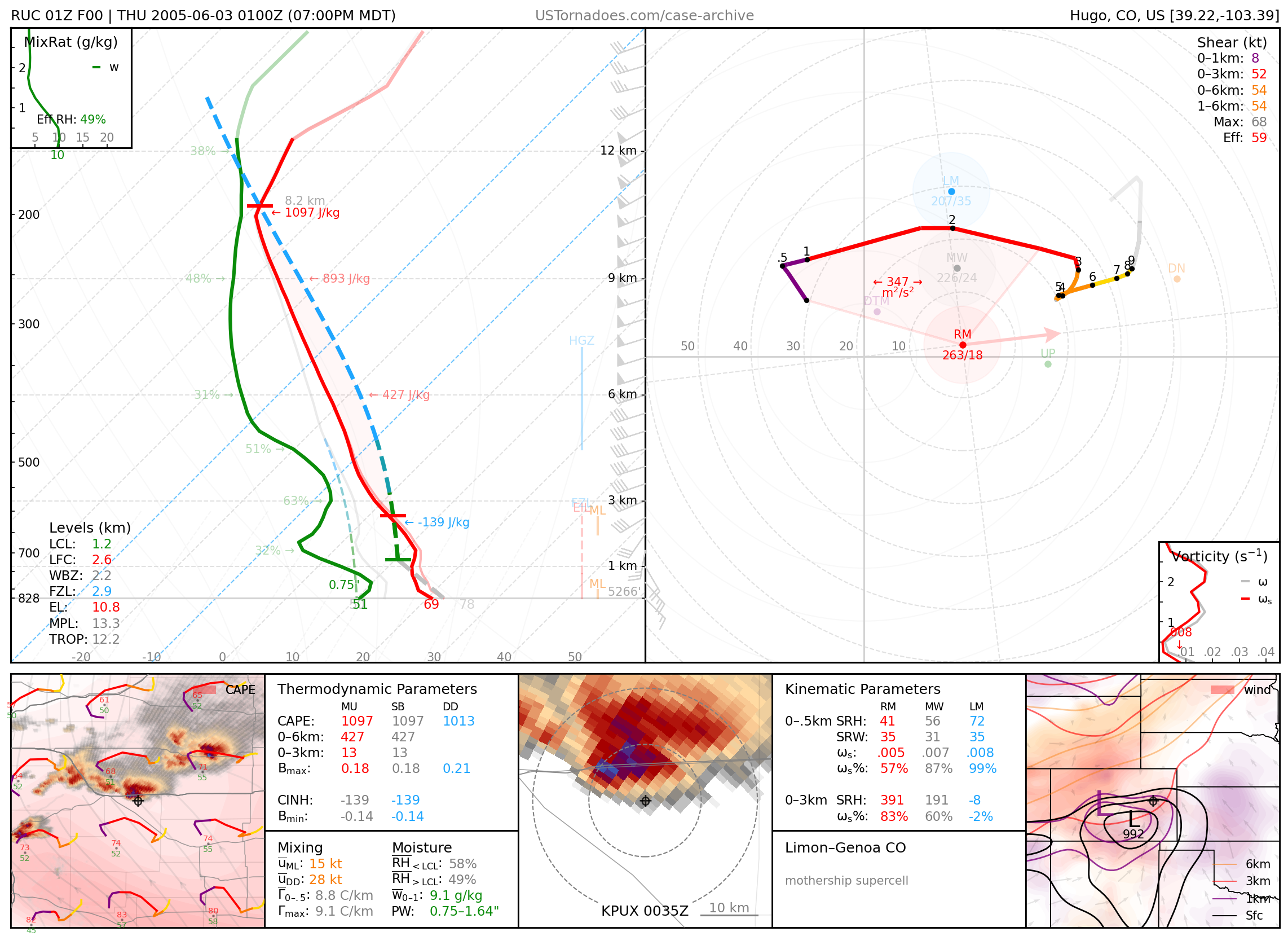
June 2, 2005: Limon, Colorado
Massive “mothership” supercell.
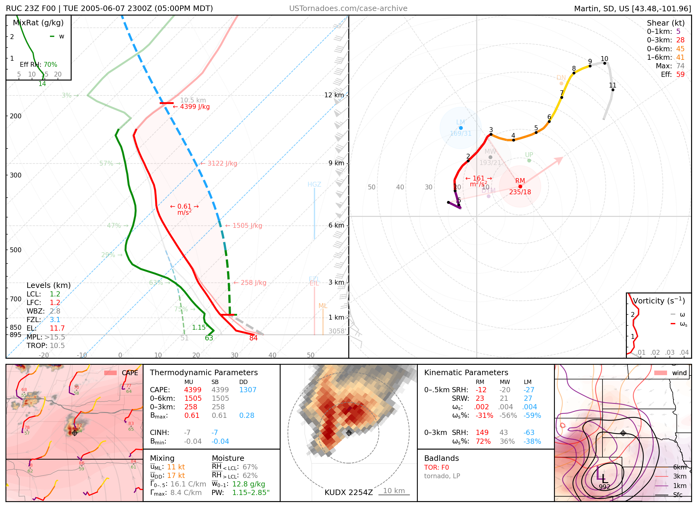
June 7, 2005: Badlands, South Dakota
Particularly photogenic tornado from LP supercell.
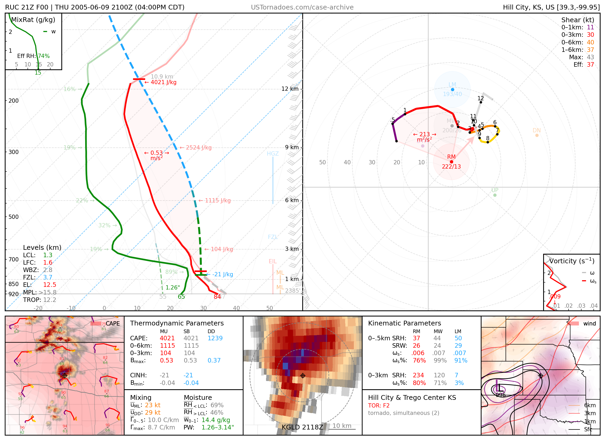
June 9, 2005: Hill City, Kansas
Cyclic tornadic supercell (up to F2).
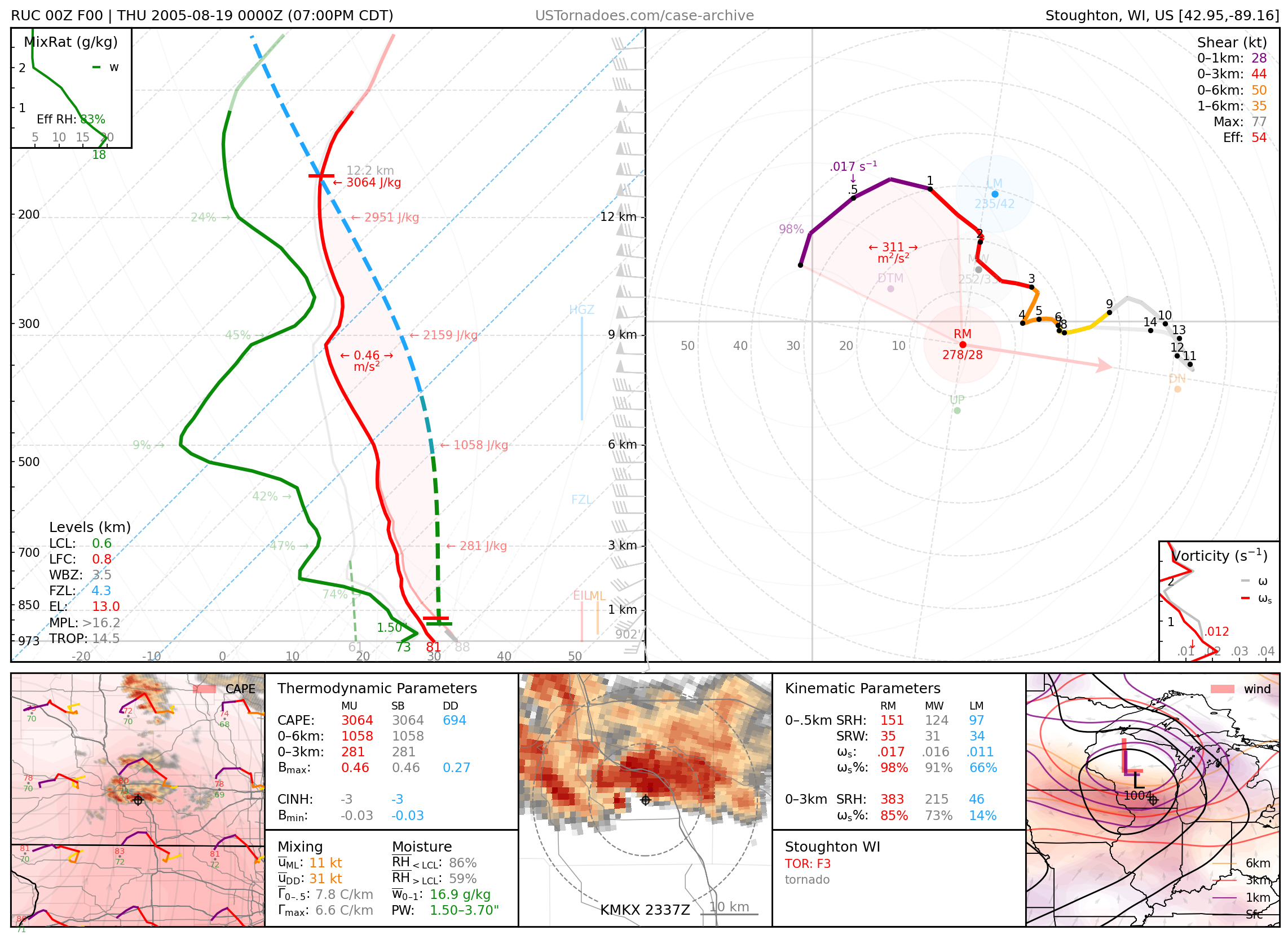
August 18, 2005: Stoughton, Wisconsin
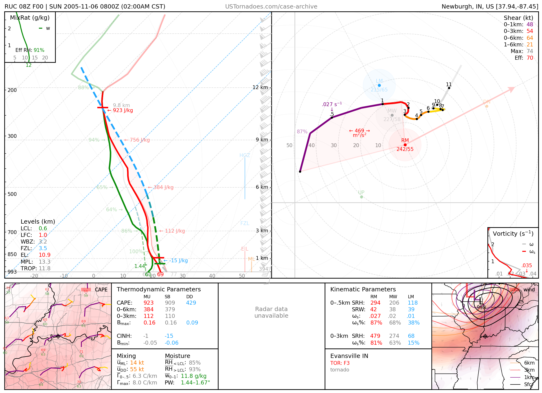
November 6, 2005: Evansville, Indiana
F3 tornado that killed 24 people.
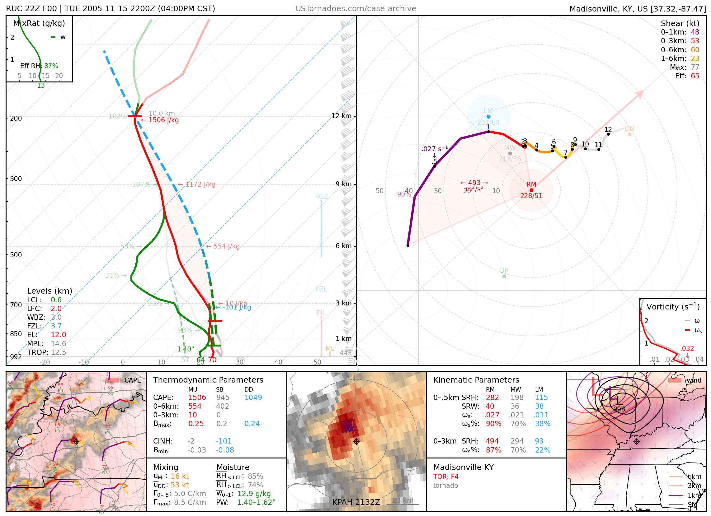
November 15, 2005: Madisonville, Kentucky
2006
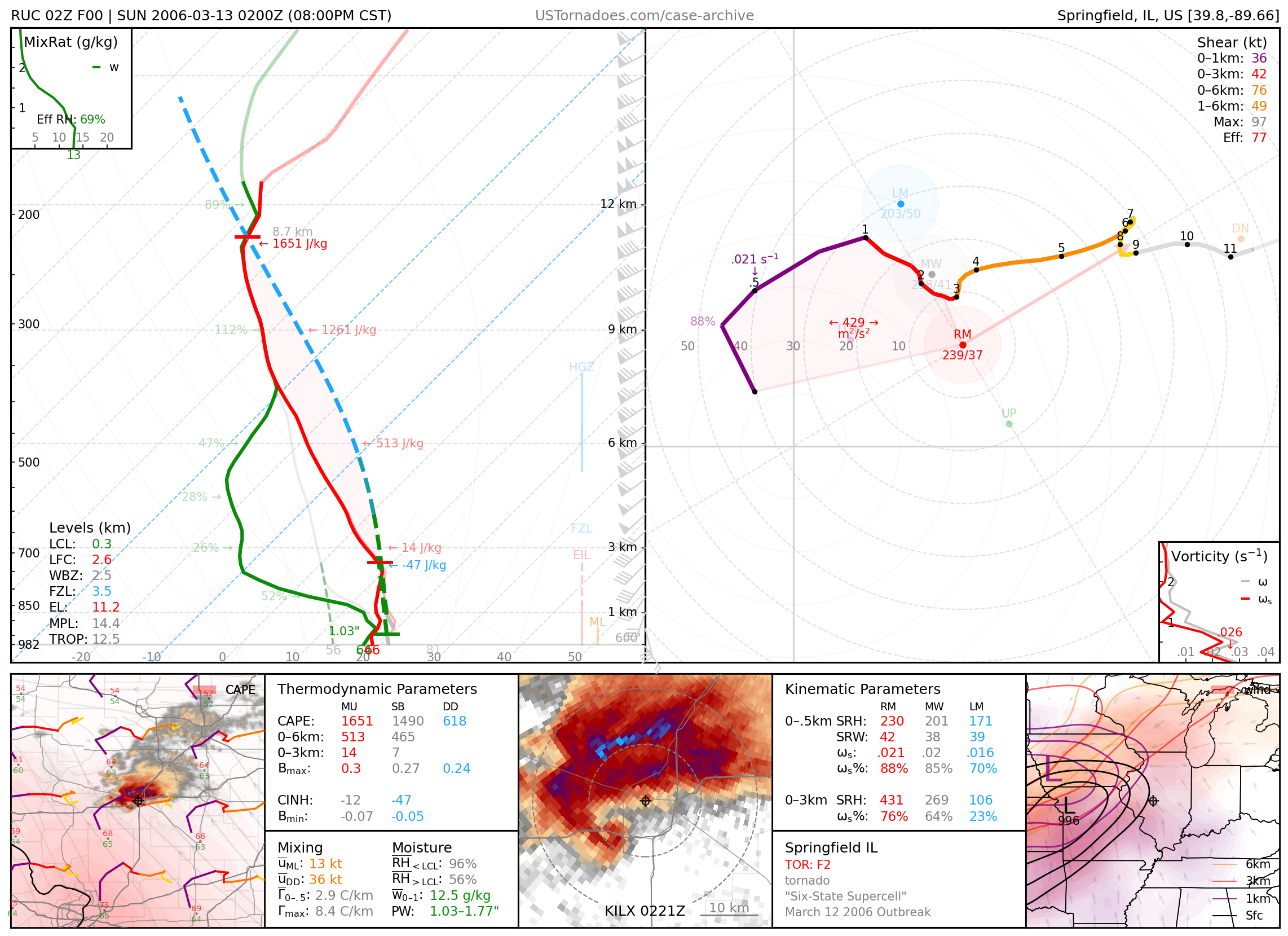
March 12, 2006: Springfield, Illinois
Long-tracked F2 tornado associated with the “Six-State” supercell, which lasted over 17 hours and travelled nearly 800 miles from Oklahoma to Michigan. Part of a large-scale outbreak of tornadoes.
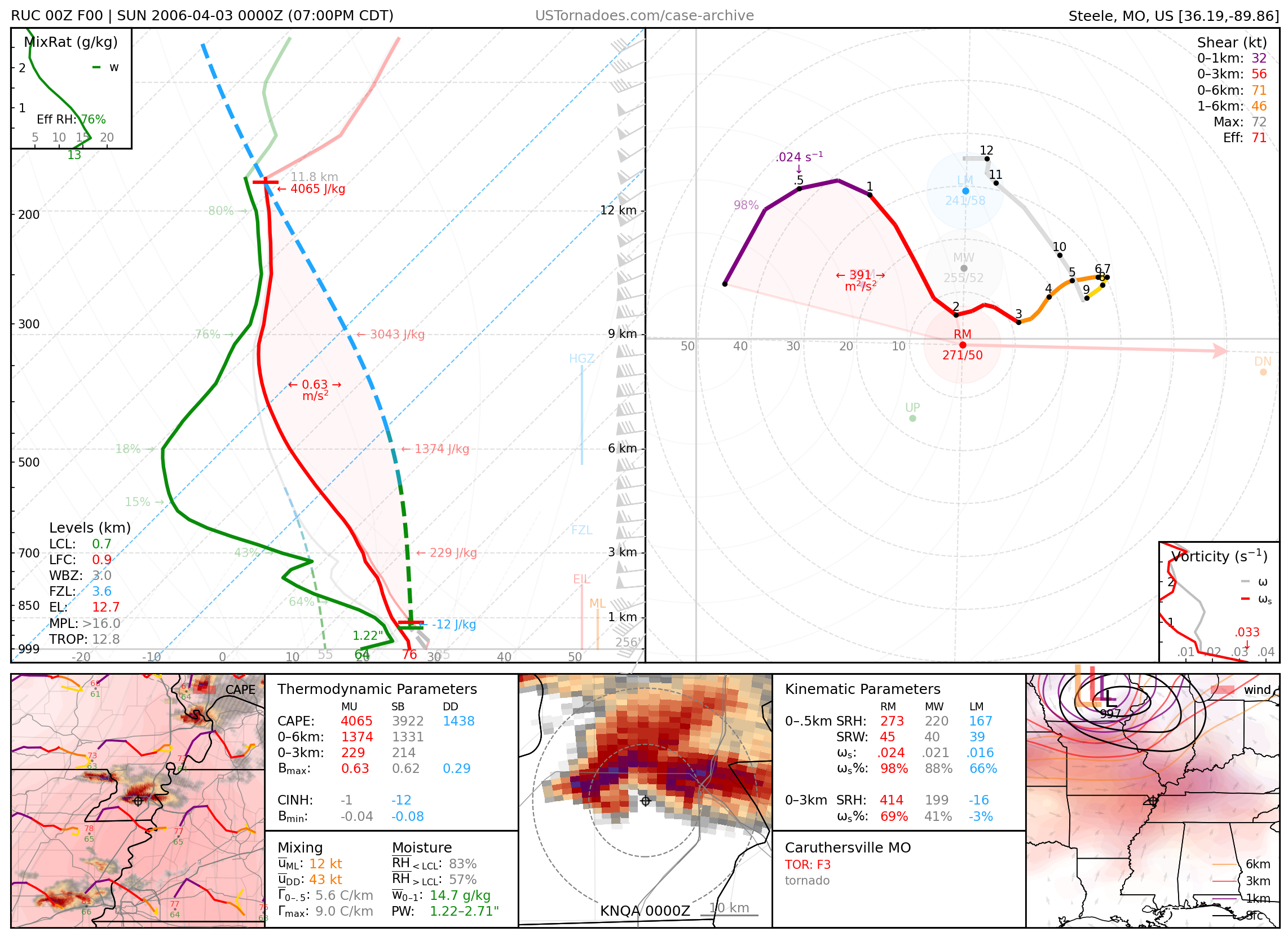
April 2, 2006: Marmaduke, Arkansas / Caruthersville, Missouri
Long-tracked F3 tornado.
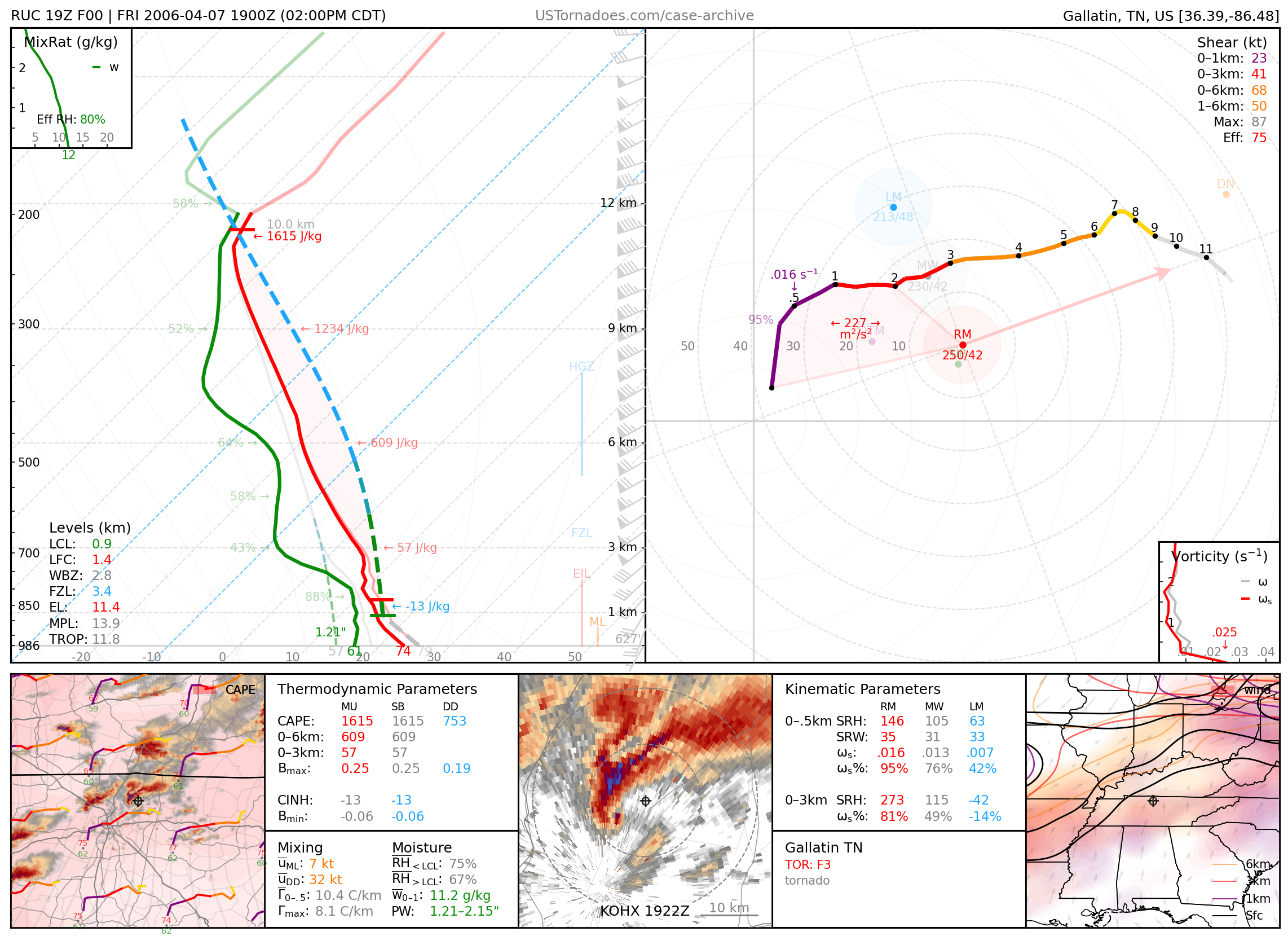
April 7, 2006: Gallatin, Tennessee
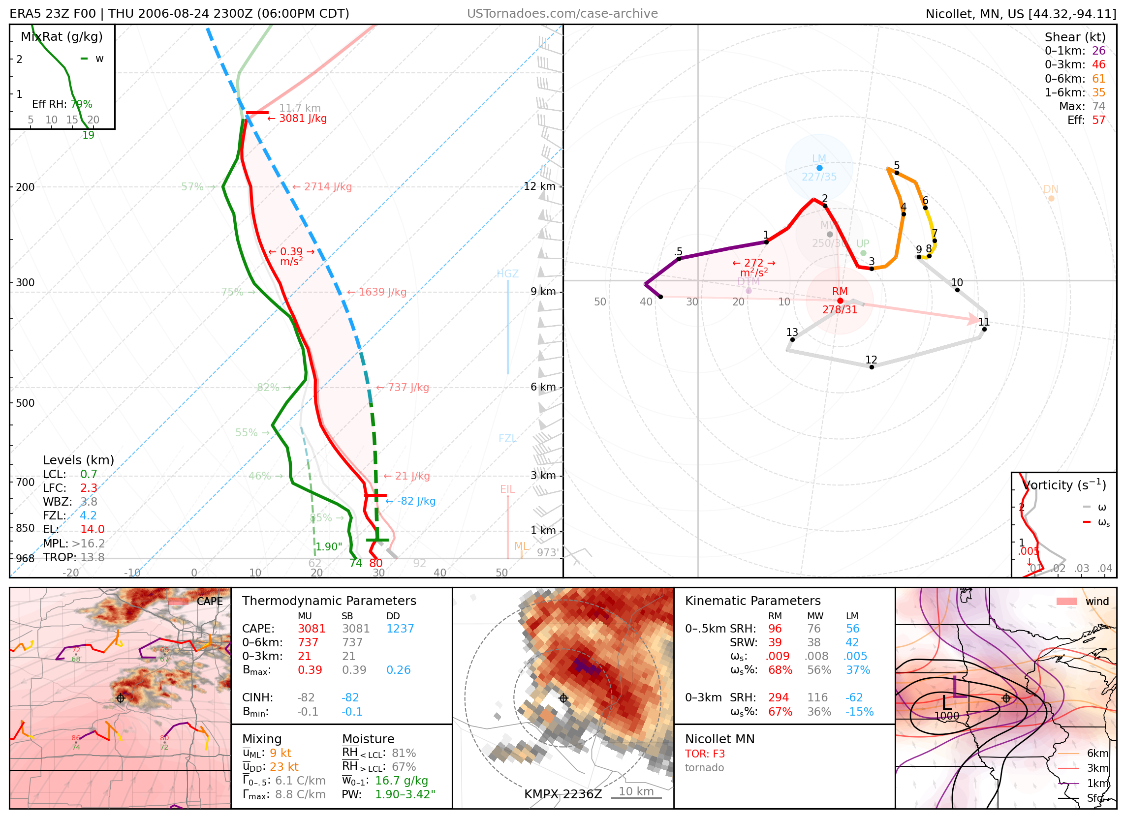
August 24, 2006: Nicollet, Minnesota
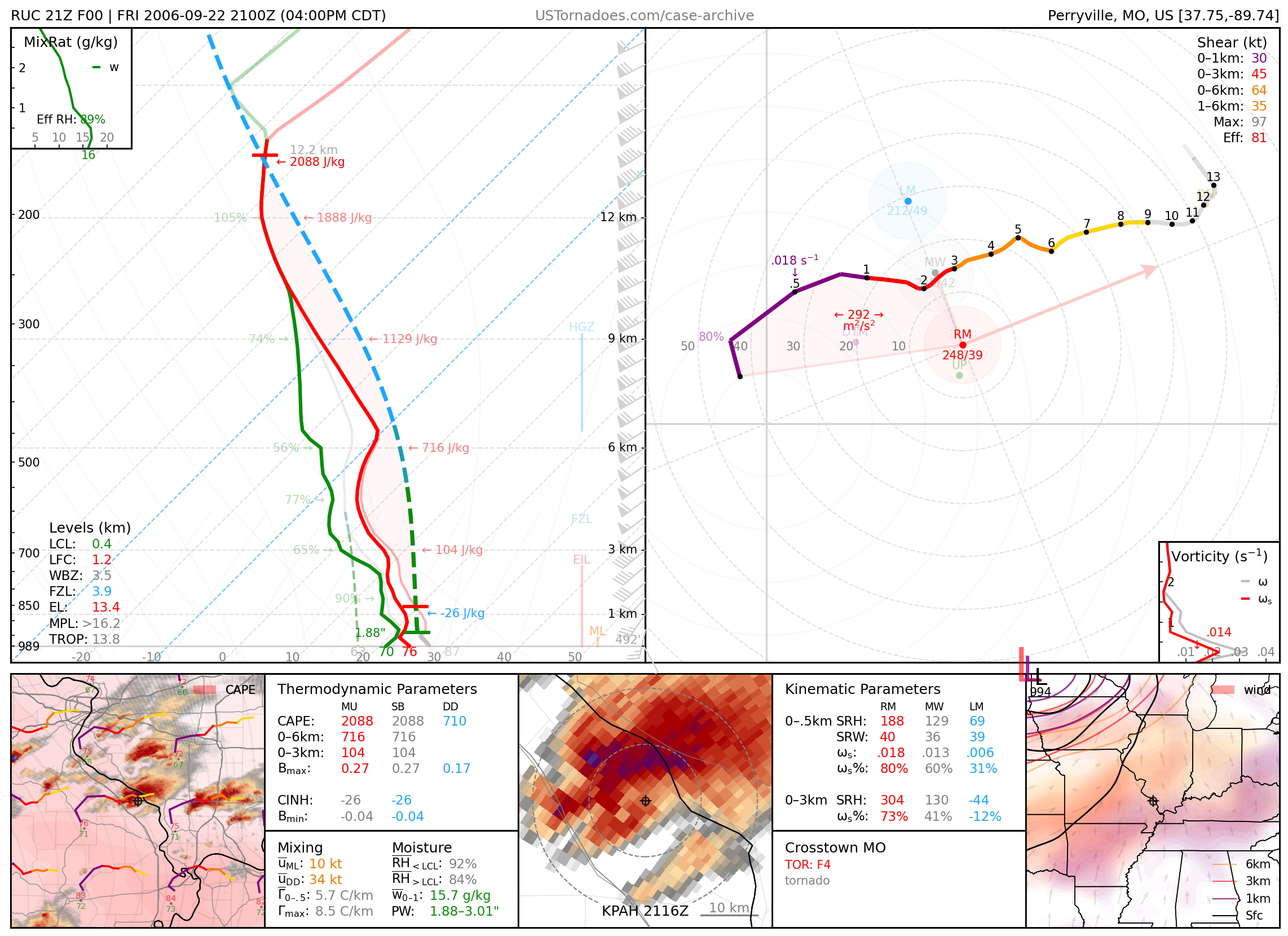
September 22, 2006: Crosstown, Missouri
2007
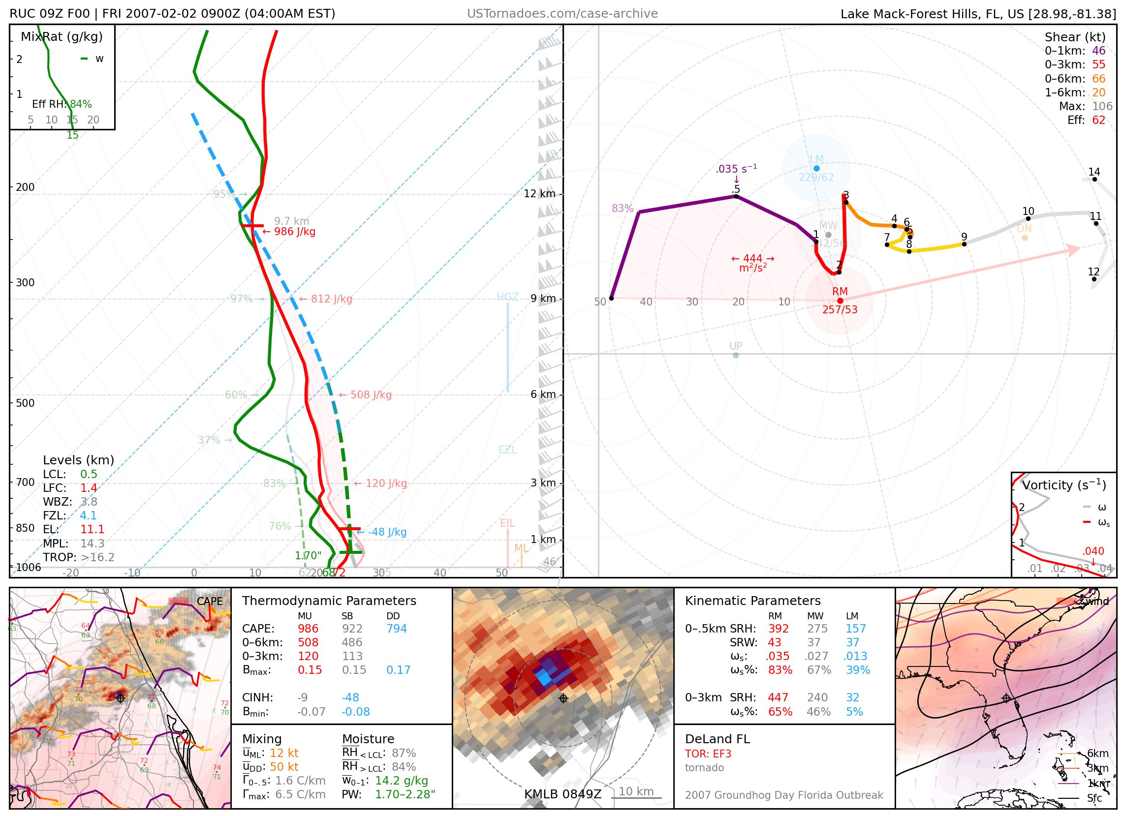
February 2, 2007: DeLand, Florida
EF3 tornado, part of the Groundhog Day Florida tornado outbreak.
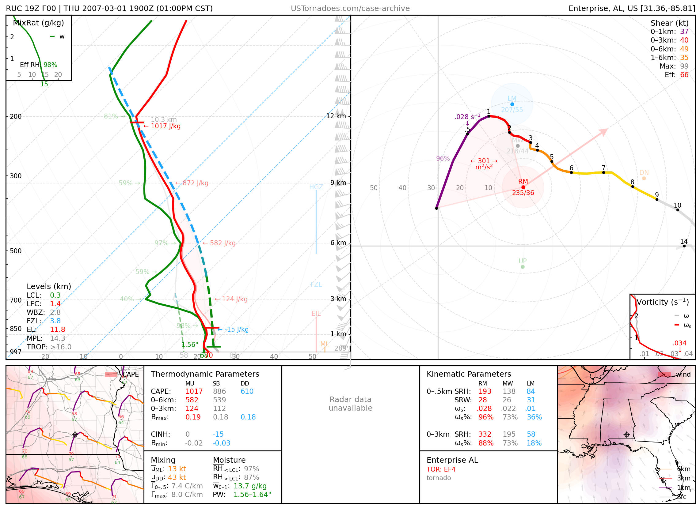
March 1, 2007: Enterprise, Alabama
EF4 tornado that killed 8 high school students.
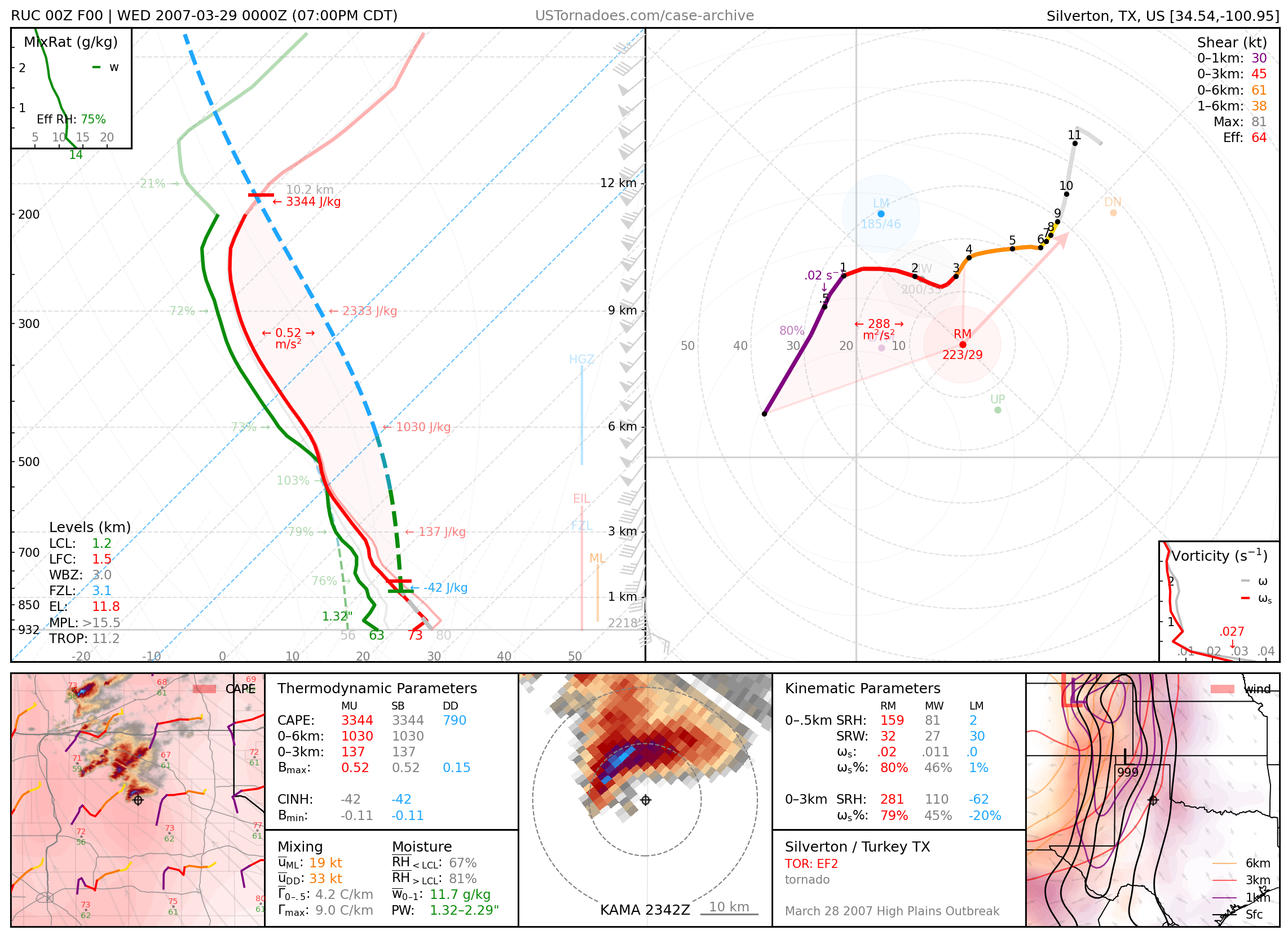
March 28, 2007: Silverton / Jericho, Texas
Photogenic tornado family (up to EF3), part of a tornado outbreak over the TX Panhandle produced largely by a few cyclic supercells.
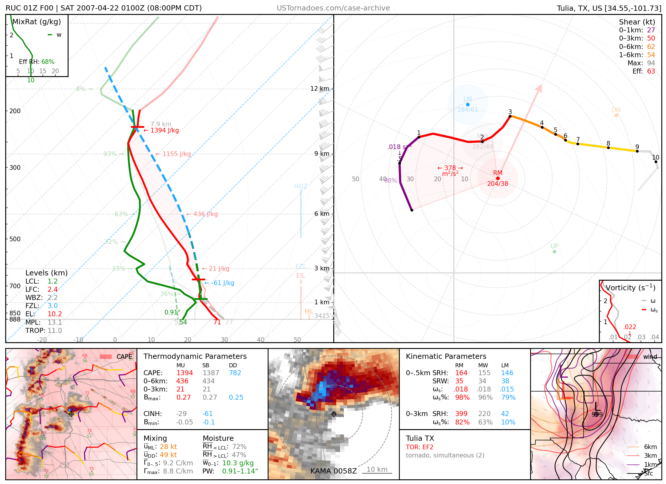
April 21, 2007: Tulia, Texas
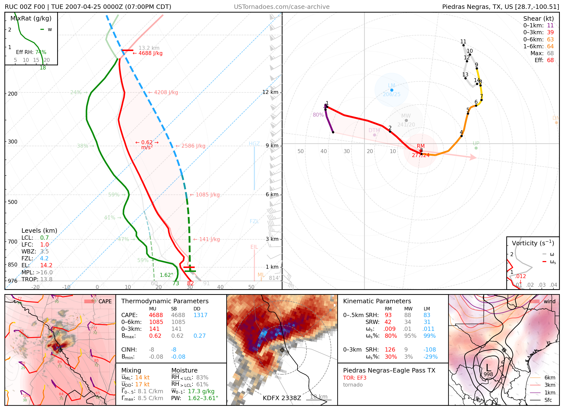
April 24, 2007: Eagle Pass, Texas / Piedras Negras, CH, Mexico
EF3 tornado that killed 7 people in a town with no siren system.
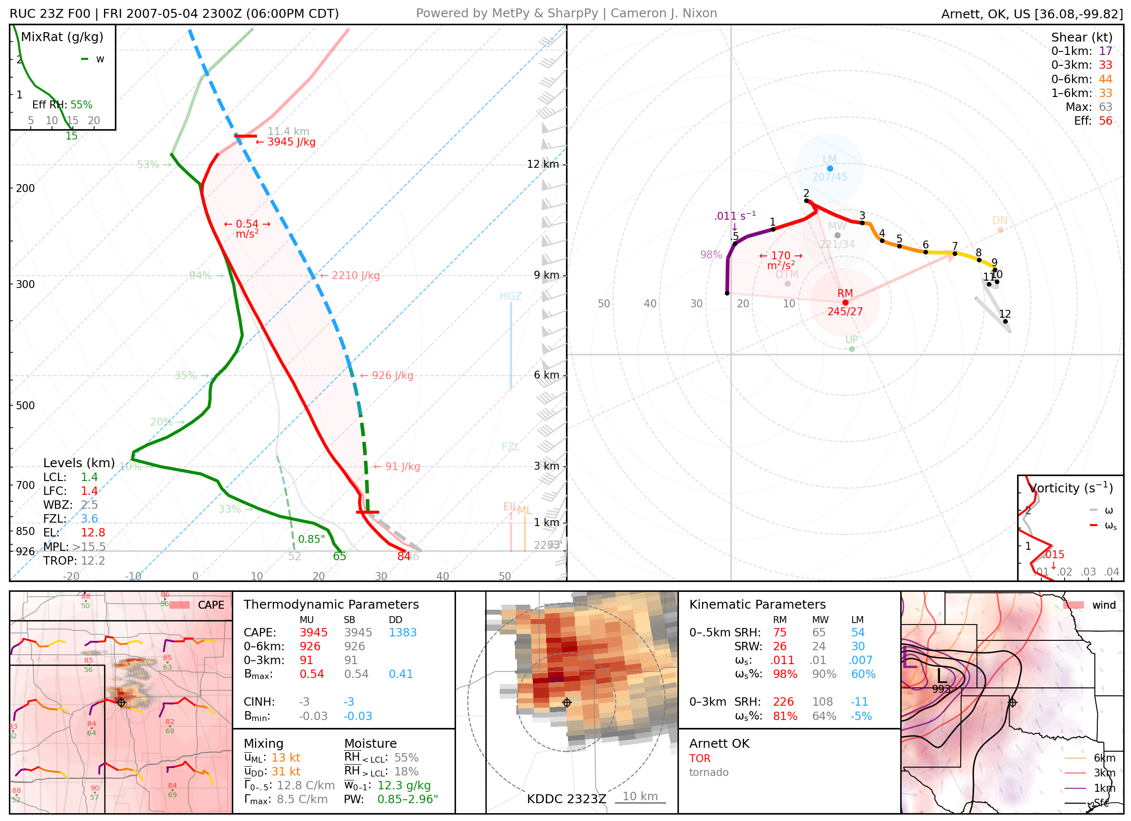
May 4, 2007: Arnett, Oklahoma
Particularly photogenic tornado.
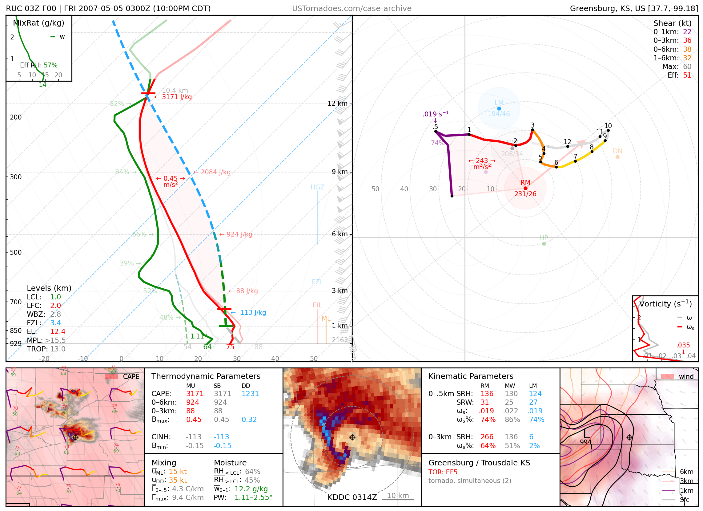
May 4, 2007: Greensburg, Kansas
Infamous first EF5 tornado that killed 11 people and destroyed 95% of the town. Associated with a supercell which produced 22 tornadoes across central KS, including one likely wider and stronger than the Greensburg EF5.
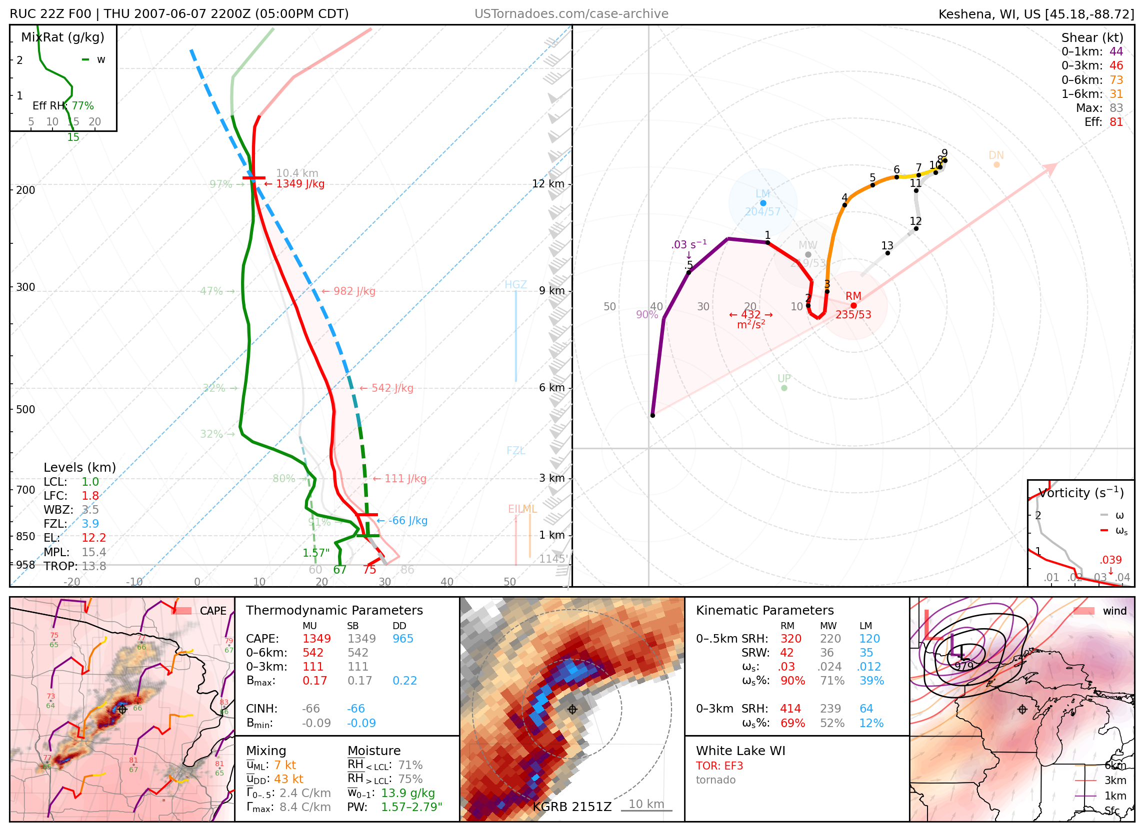
June 7, 2007: White Lake, Wisconsin
Long-tracked EF3 tornado and 5” hail that dealt the Northwoods’ distinguishable damage scar.
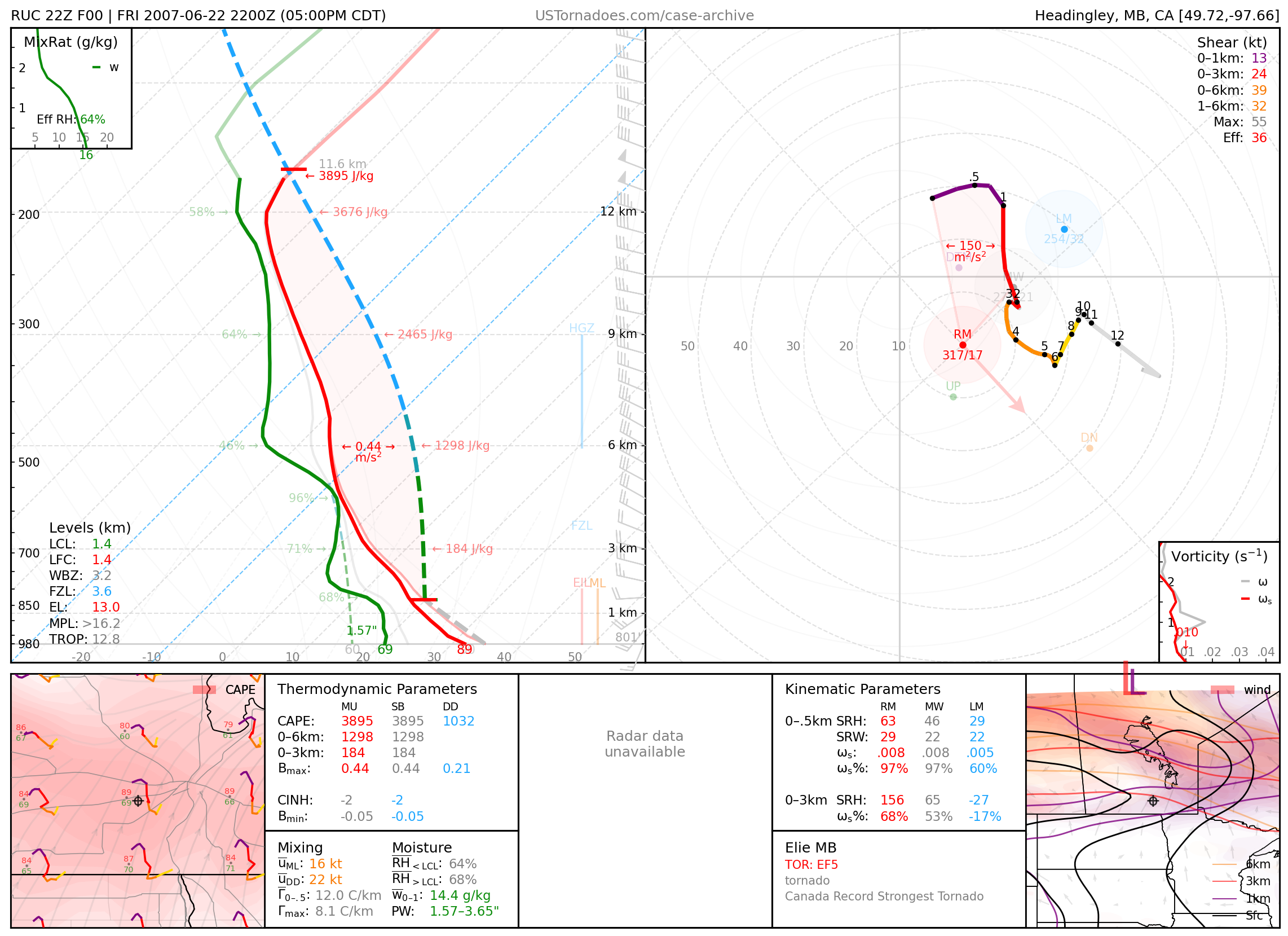
June 22, 2007: Elie, MB, Canada
Canada’s only (particularly photogenic) EF5 tornado.
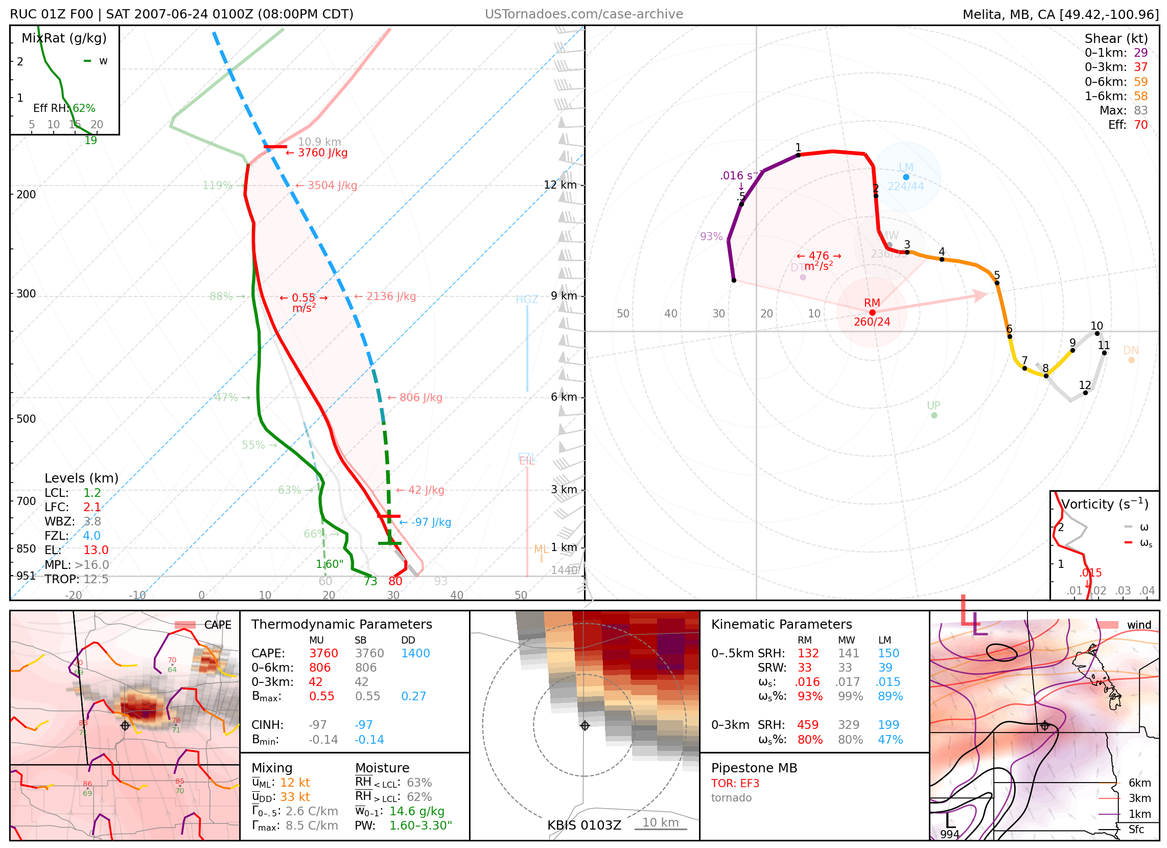
June 23, 2007: Pipestone, MB, Canada
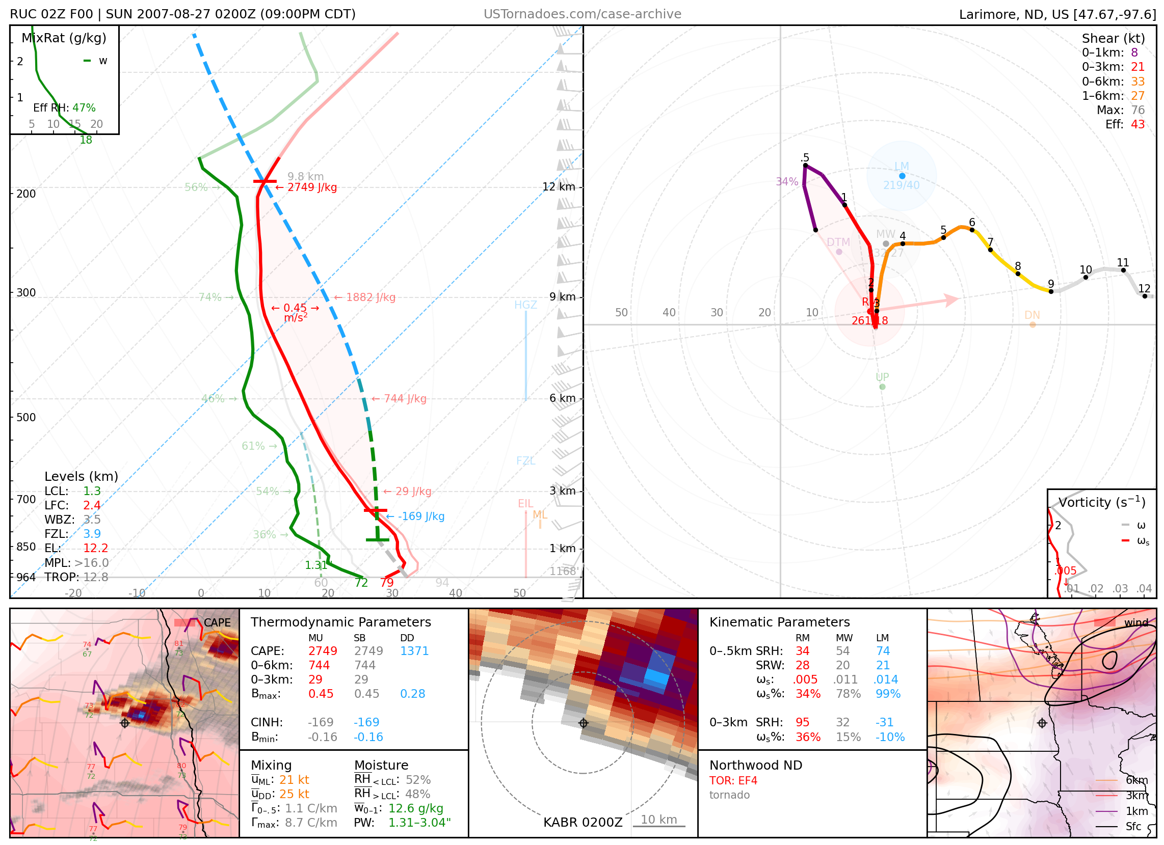
August 26, 2007 Northwood, North Dakota
EF4 tornado, part of a localized outbreak of tornadoes
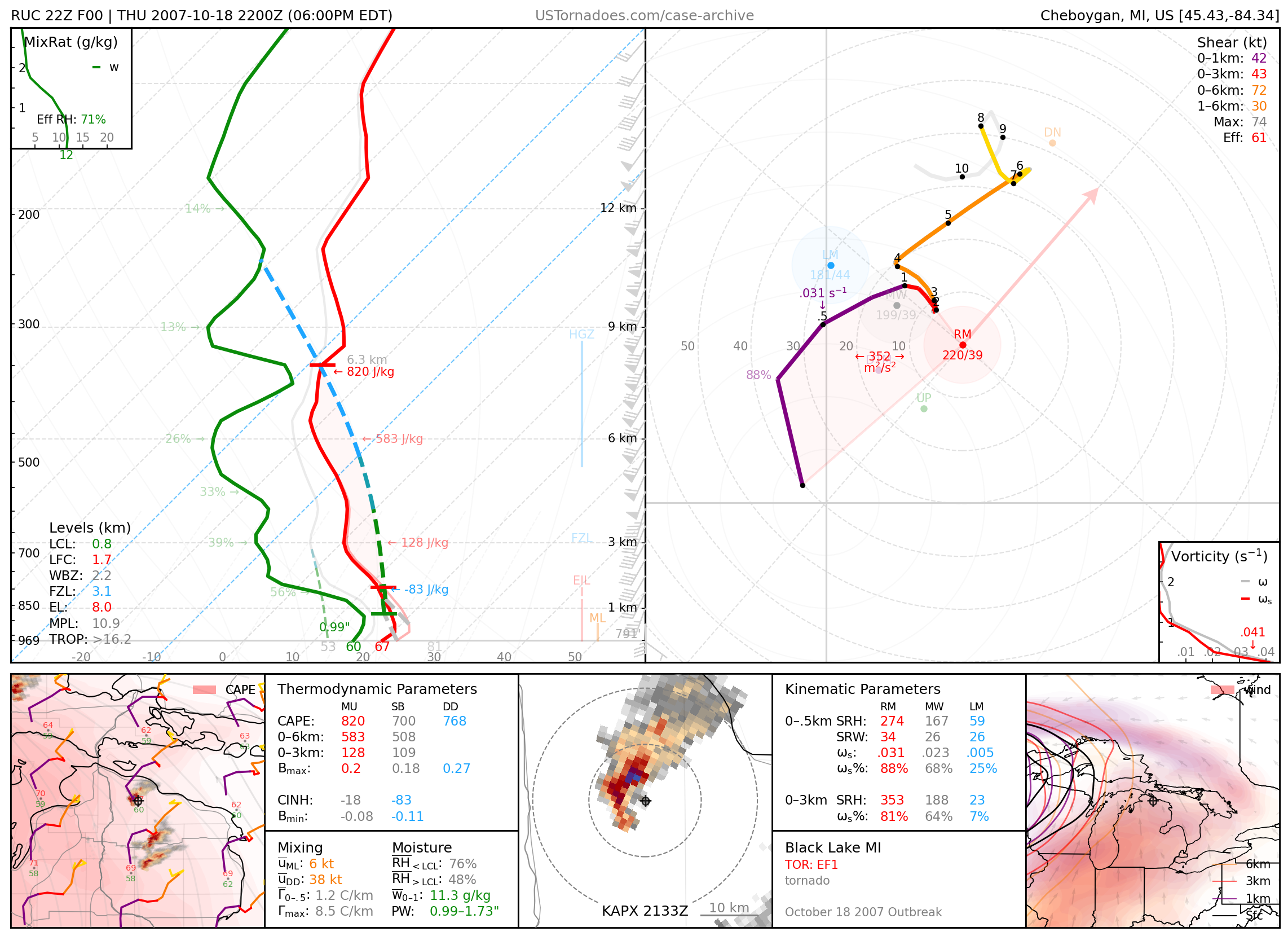
October 18, 2007: White Lake, Michigan
Particularly photogenic tornadic waterspout, part of a large-scale tornado outbreak.
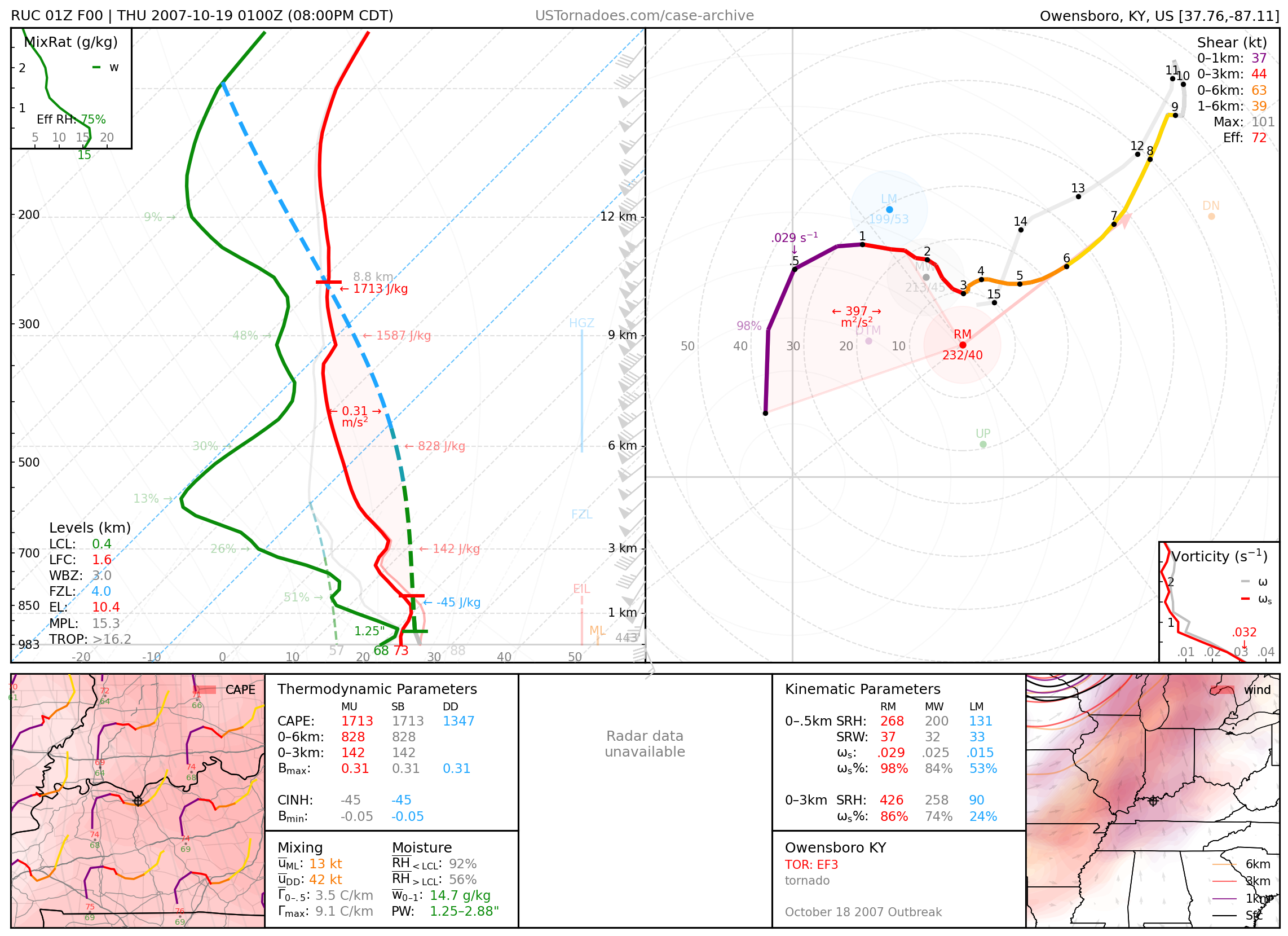
October 18, 2007: Owensboro, Kentucky
EF3 tornado, part of a large-scale tornado outbreak.
2008
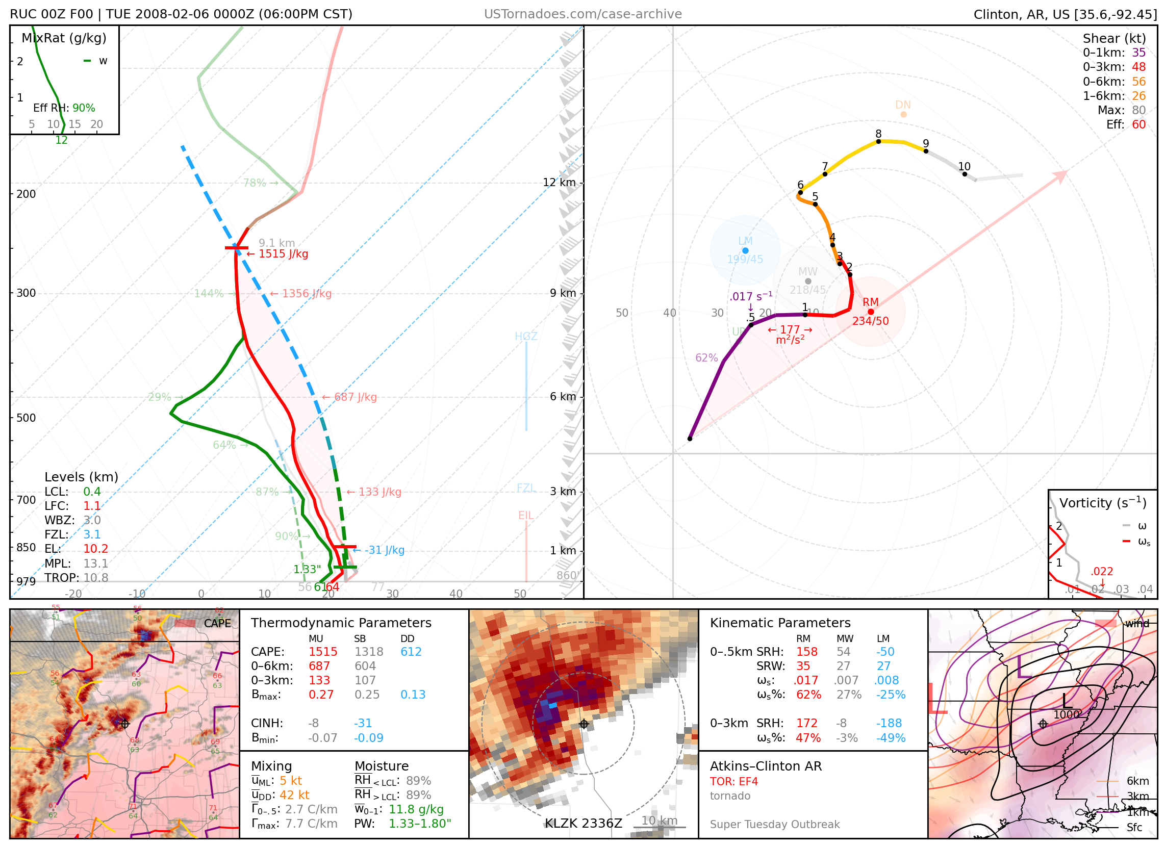
February 5, 2008: Atkins / Clinton, Arkansas
Long-tracked EF4 tornado, part of the Super Tuesday Outbreak.
February 5, 2008: Jackson and Clifton, TN
Two EF-4 tornadoes from separate supercells, killing 3 people. Both supercells were very long-lived, one producing over 10 tornadoes, many significant and deadly.

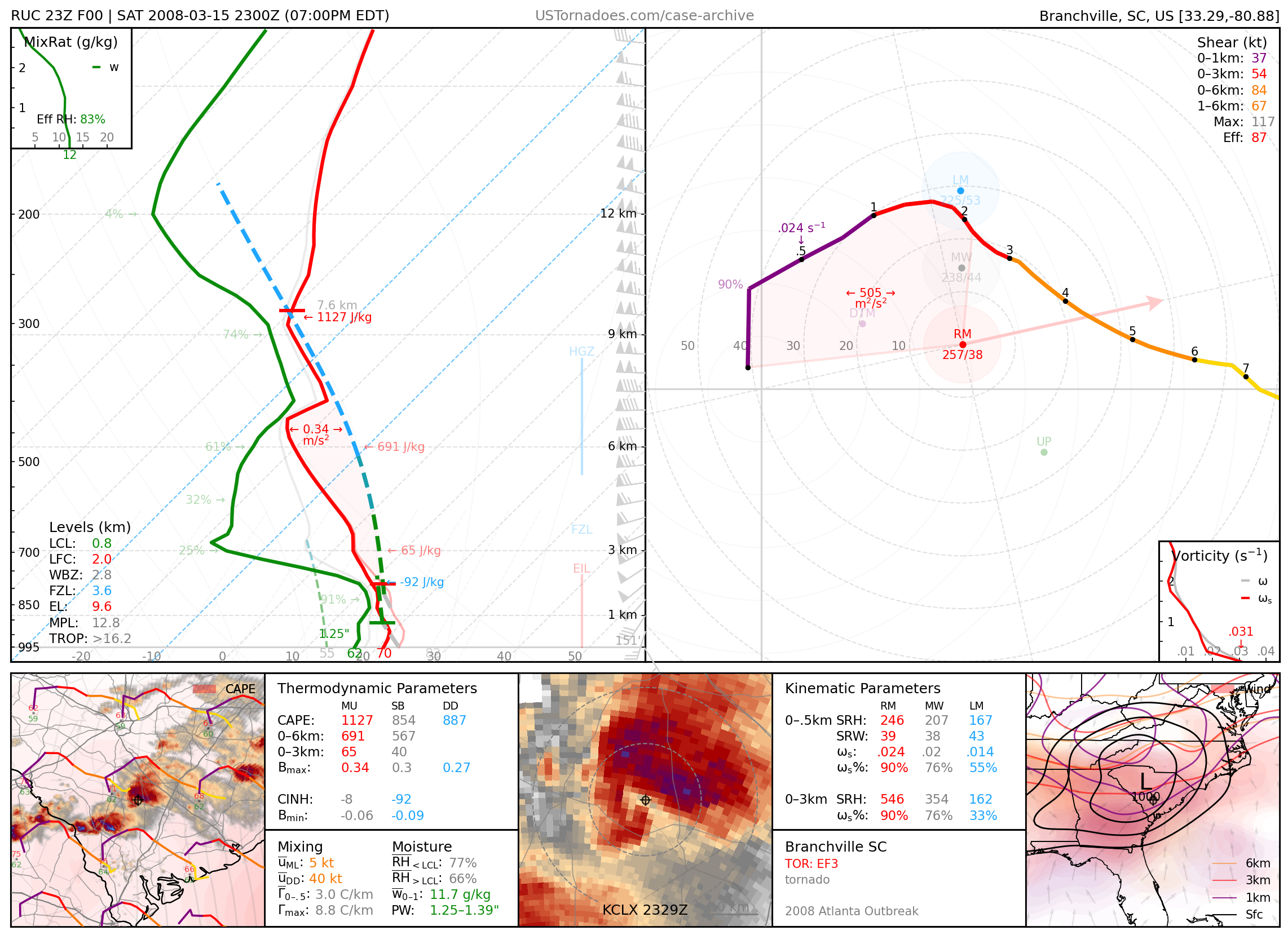
March 15, 2008: Branchville, South Carolina
EF3 tornado from long-tracked supercell storm, part of an anomalous severe weather outbreak from Georgia into South Carolina.
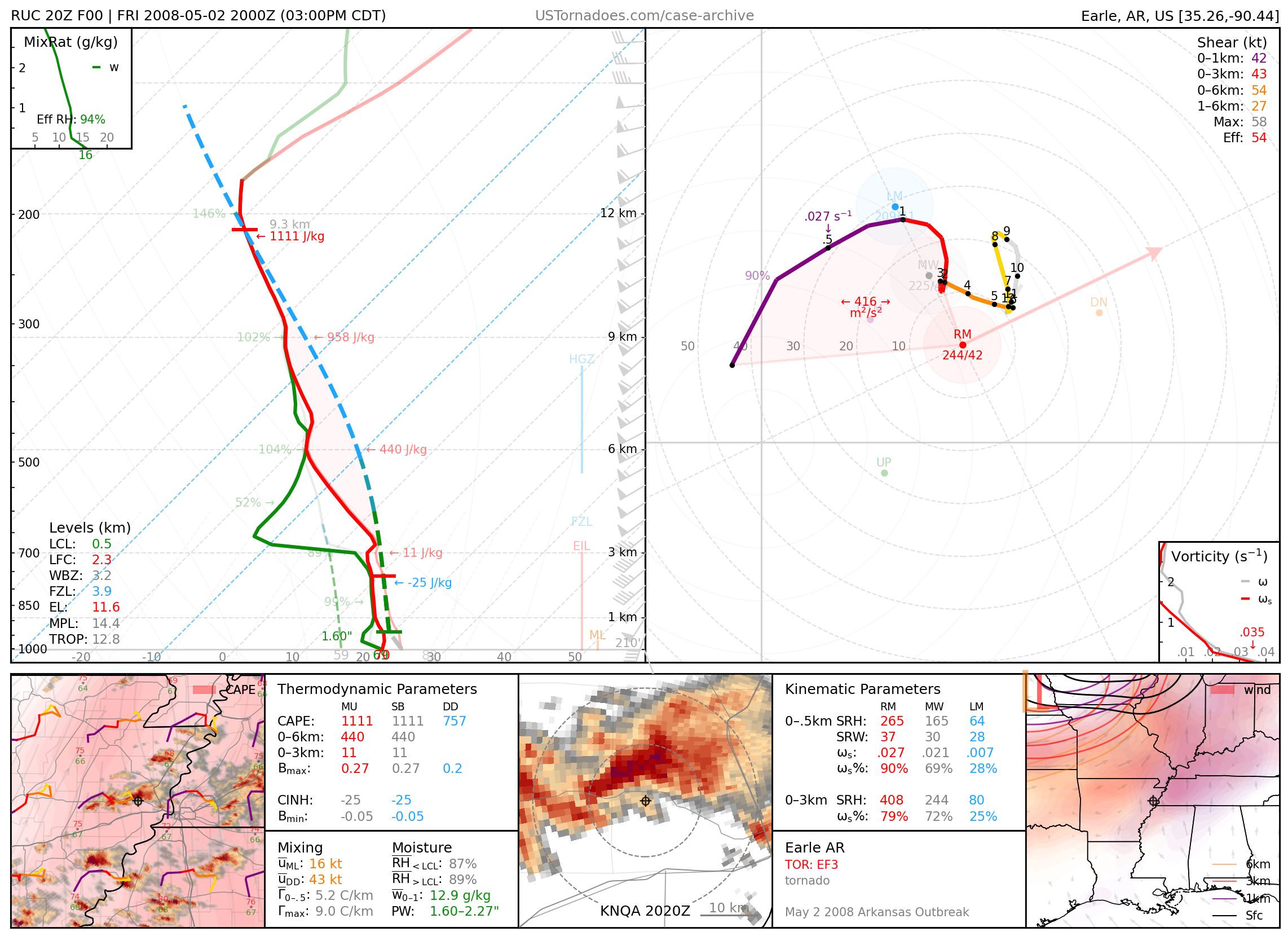
May 2, 2008: Earle, Arkansas
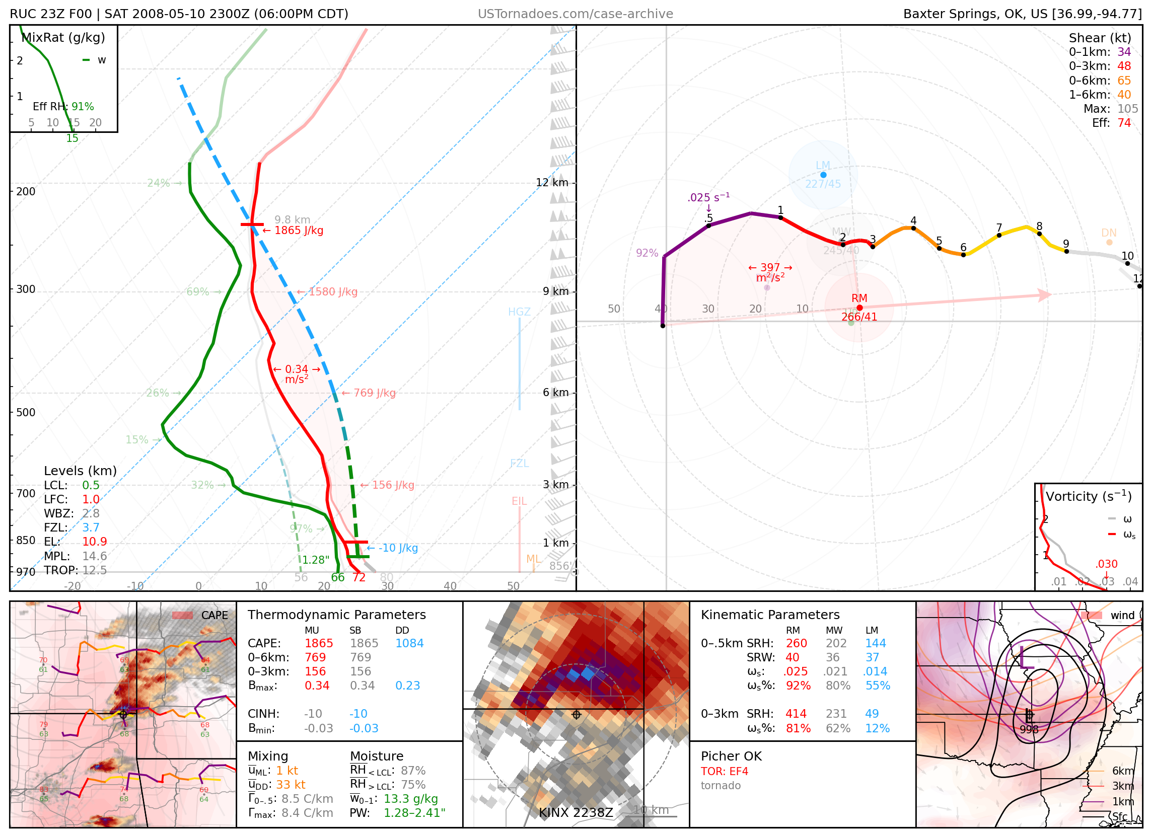
May 10, 2008: Picher, Oklahoma
Infamous long-tracked EF4 tornado that killed 6 people and destroyed an already decaying town.
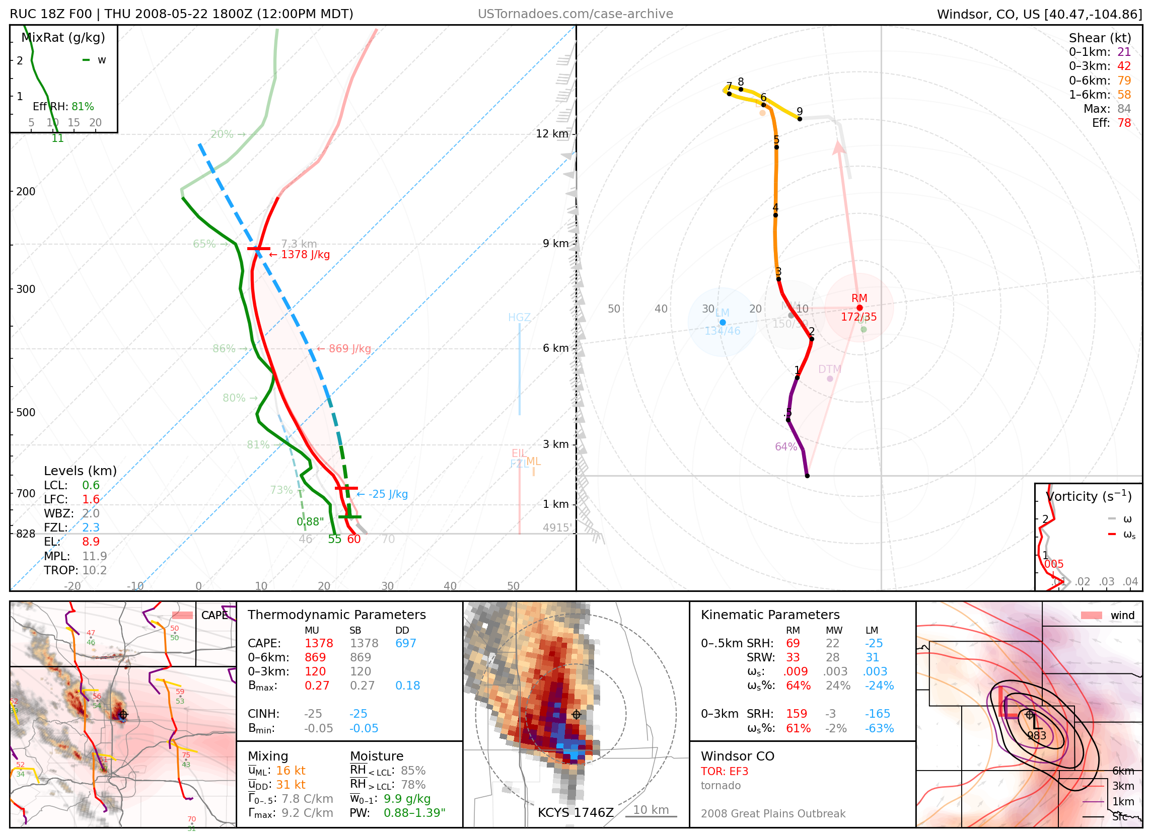
May 22, 2008: Windsor, Colorado
EF3 wedge tornado, particularly long-tracked, wide, and at an early time of day for the area.
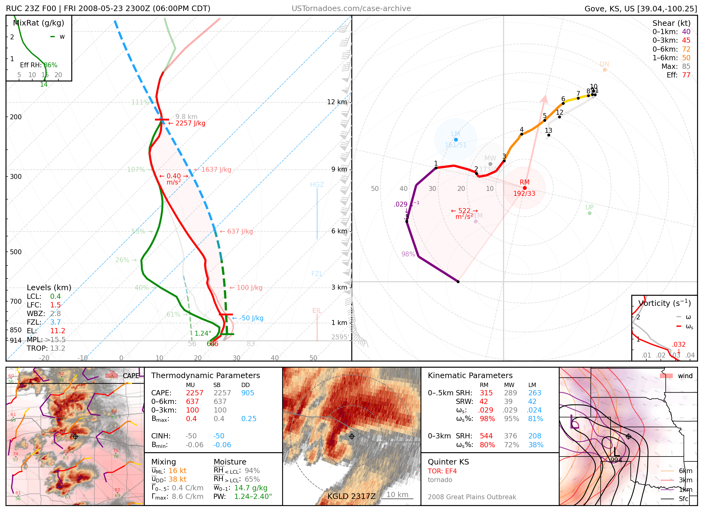
May 23, 2008: Quinter, Kansas
EF4 wedge tornado, part of an infamous outbreak of tornadoes across western Kansas.
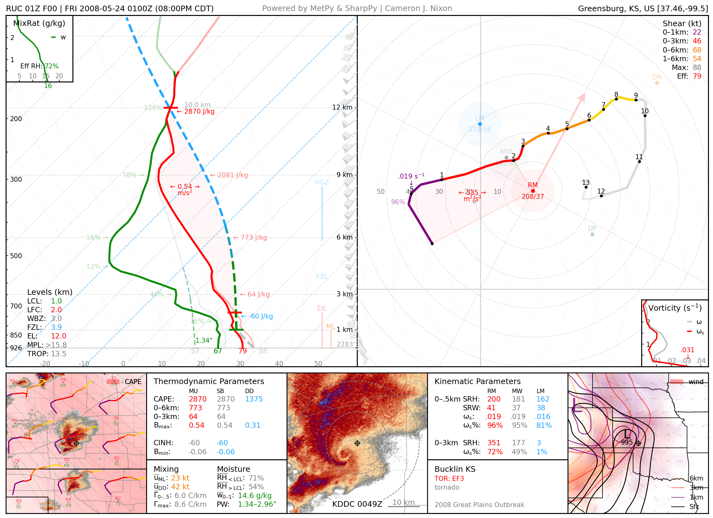
May 23, 2008: Bucklin–Mullinville, Kansas
1.8-mile-wide EF3 tornado, part of an infamous outbreak of tornadoes across western Kansas.
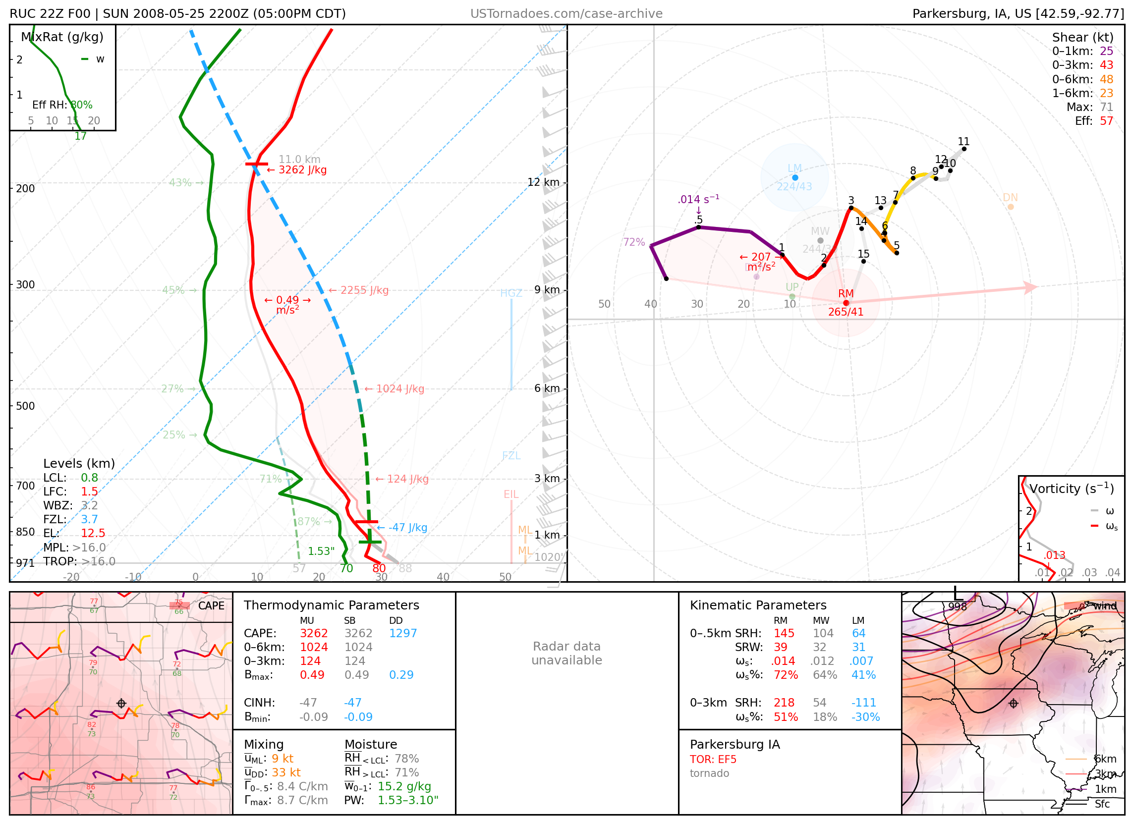
May 25, 2008: Parkersburg, Iowa
Long-tracked EF5 wedge tornado that killed 9 people.
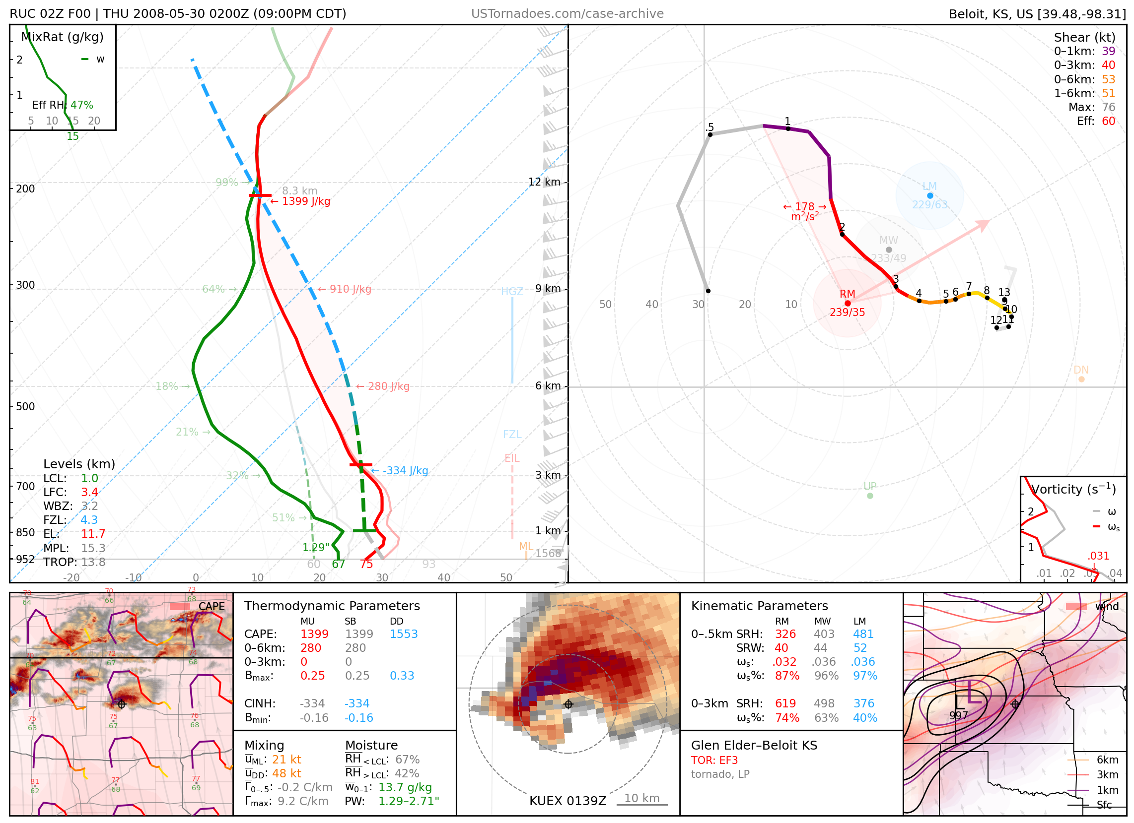
May 29, 2008: Glen Elder, Kansas
Particularly photogenic, cyclic tornadic supercell (up to EF3).
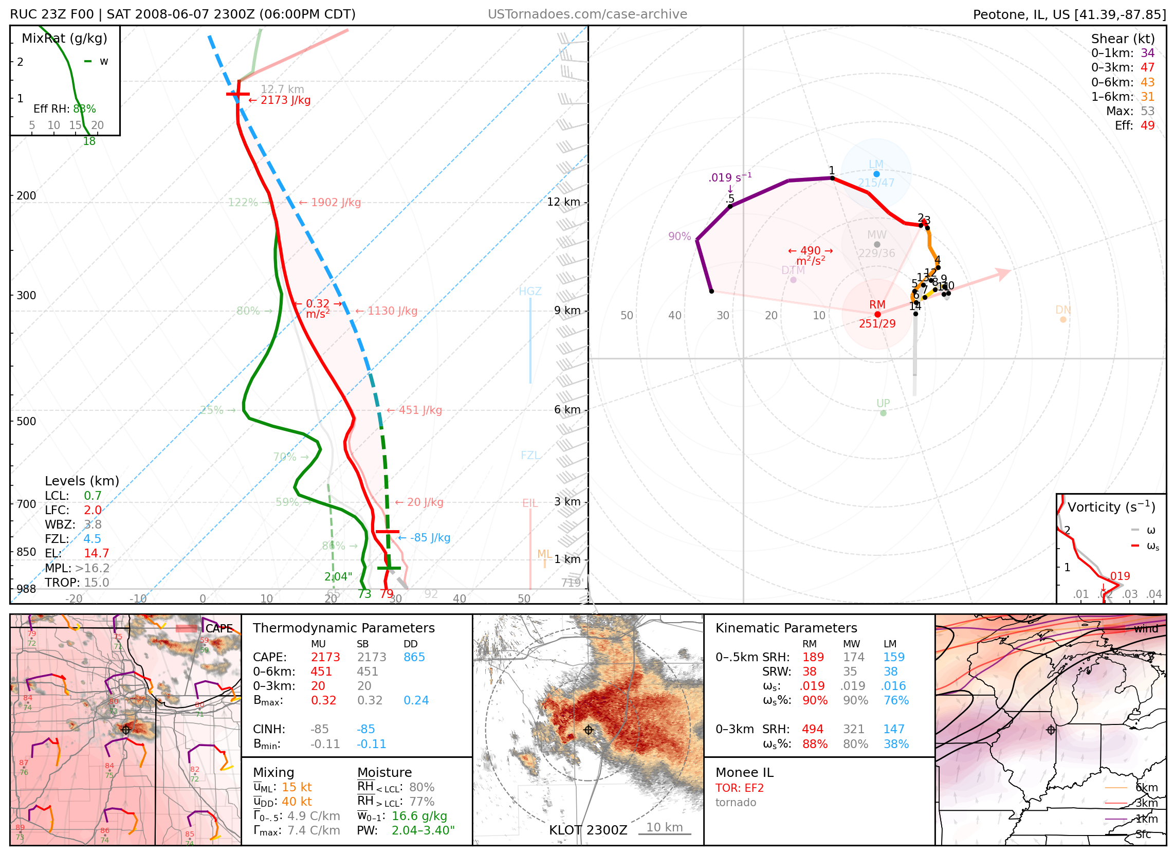
June 7, 2008: Will County, Illinois
Tornado family (up to EF2).
2009
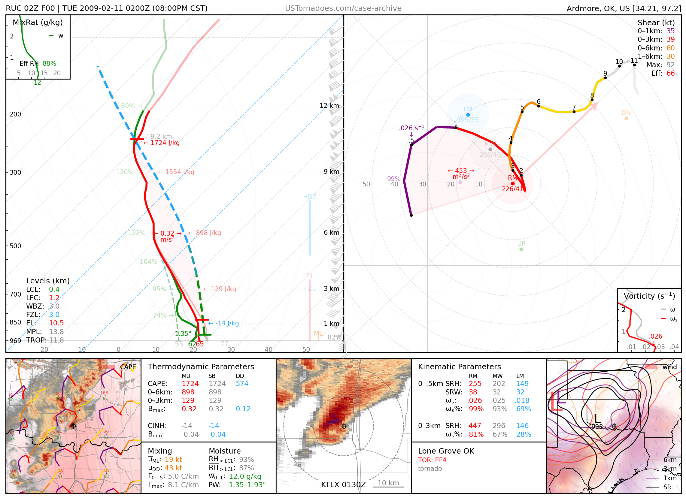
February 10, 2009: Lone Grove, Oklahoma
Long-tracked EF4 tornado that killed 8 people, the strongest February tornado on record in Oklahoma.
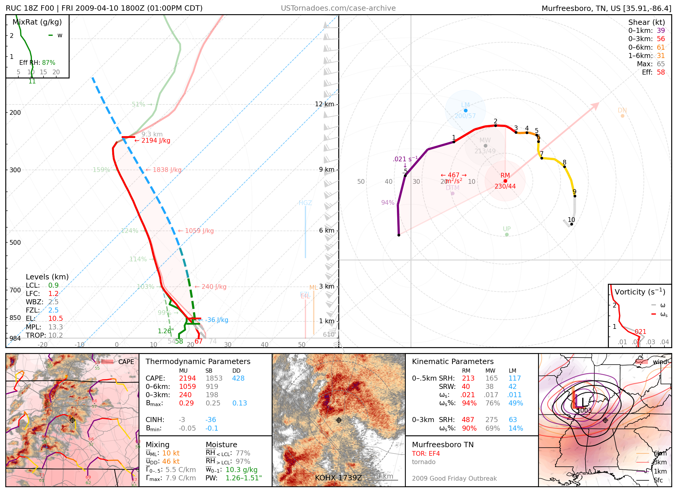
April 10, 2009: Murfreesboro, Tennessee
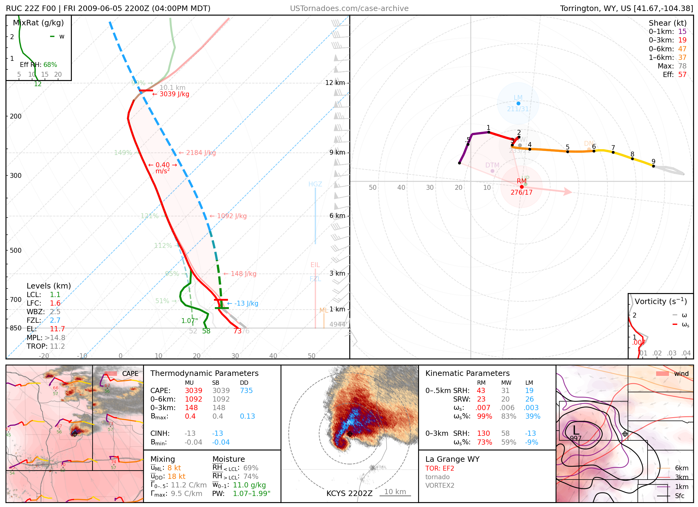
June 5, 2009: Goshen County, Wyoming
EF2 tornado, well-documented and heavily-studied by VORTEX2.
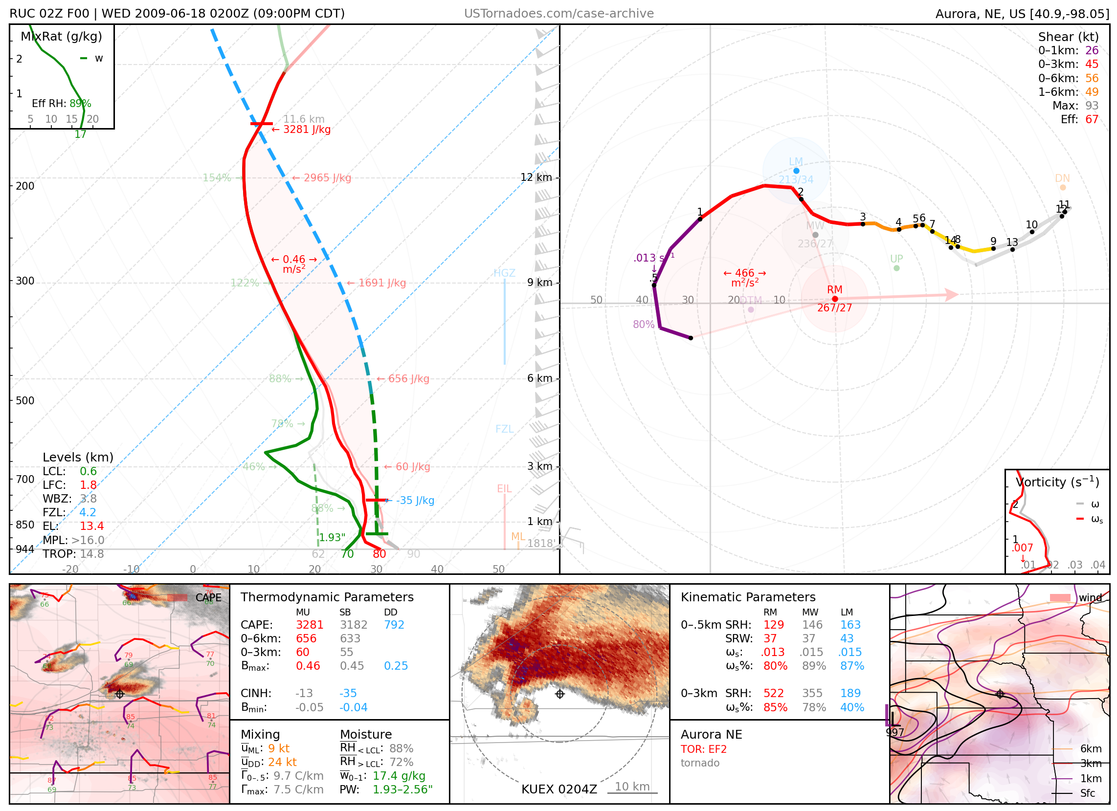
June 17, 2009: Aurora, Nebraska
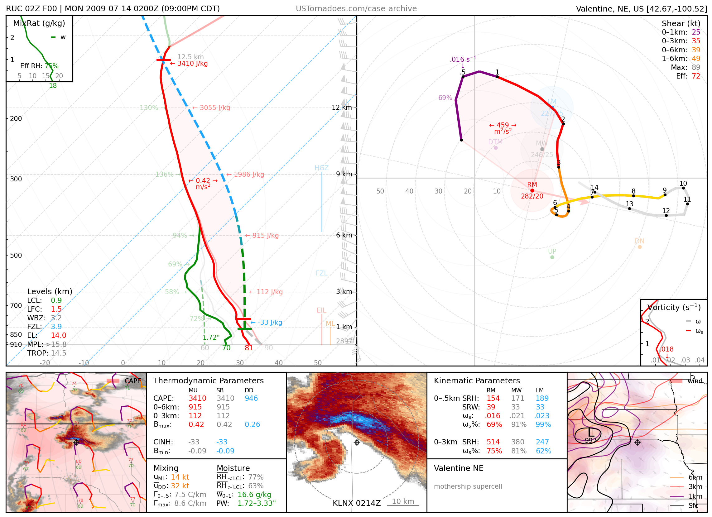
July 13, 2009: Valentine, Nebraska
Massive, long-lived, high-precipitation supercell that produced a few tornadoes and very large hail.
2010
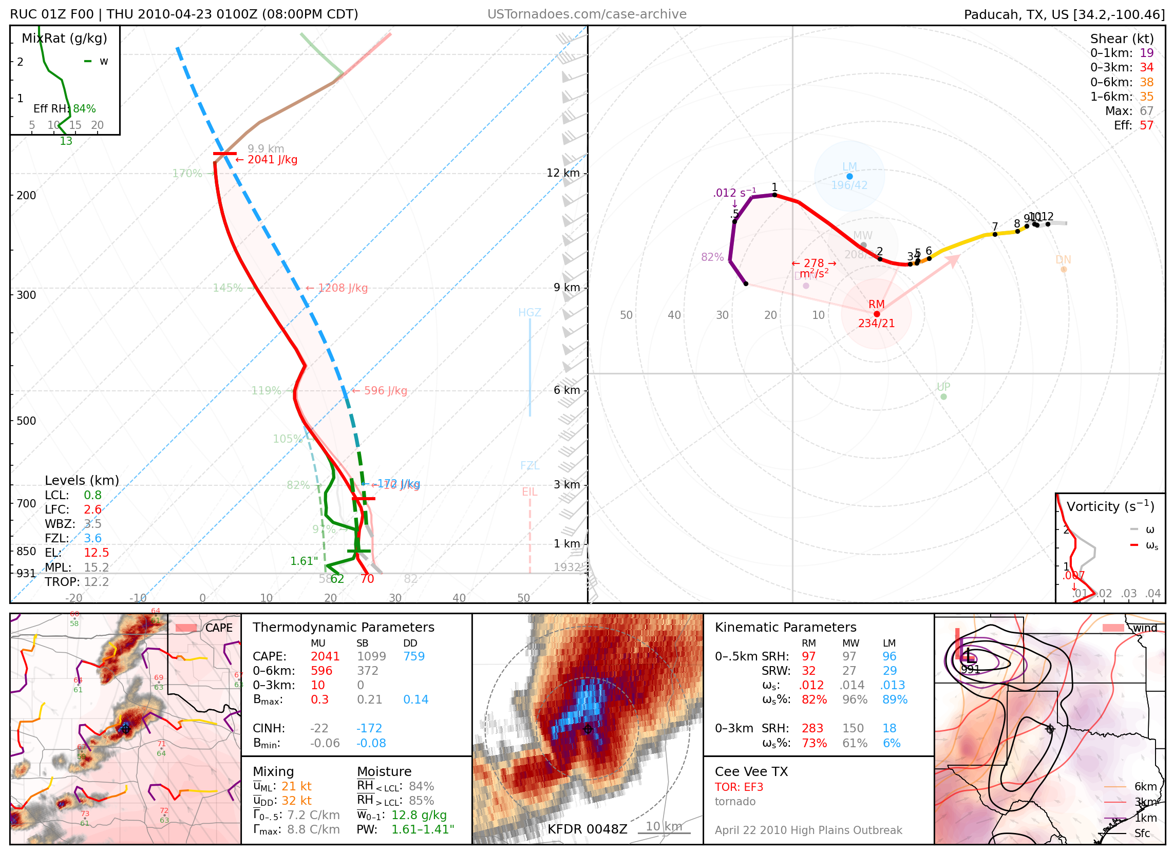
April 22, 2010: Cee Vee, Texas
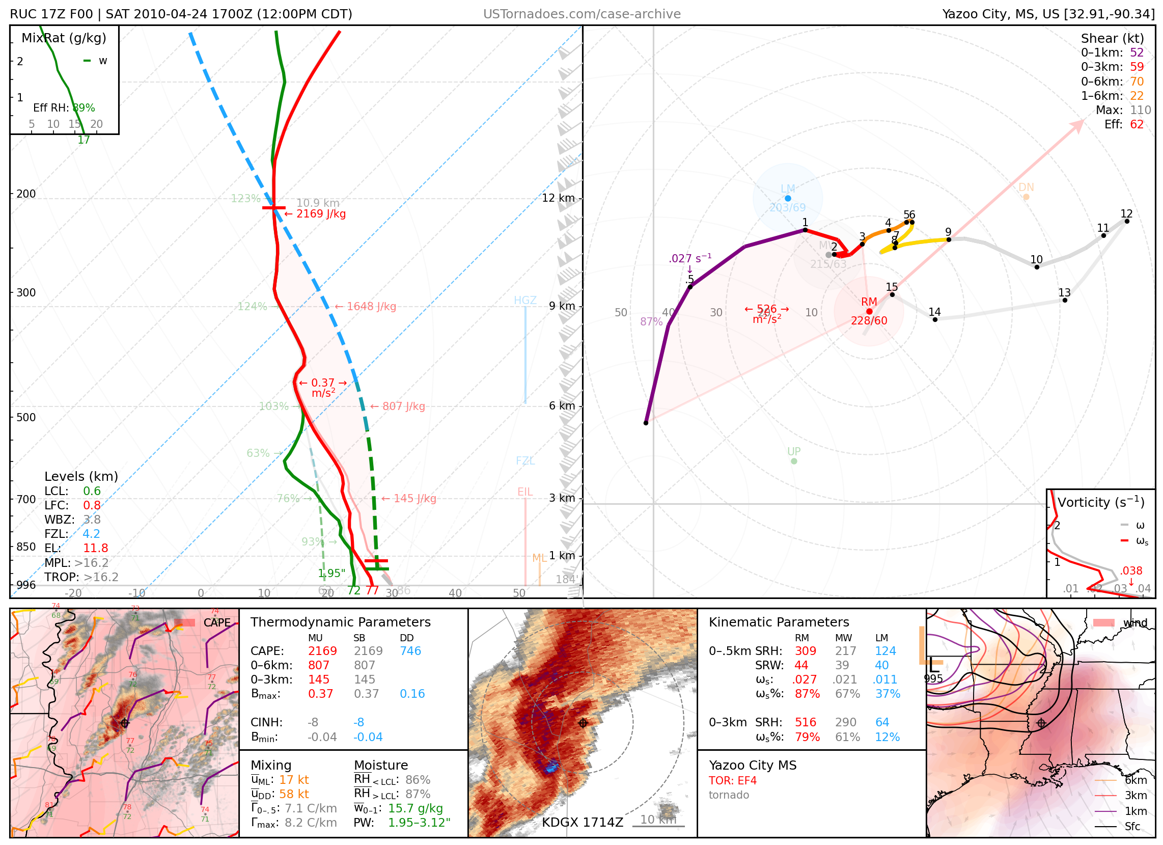
April 24, 2010: Yazoo City, Mississippi
149-mile-long EF4 tornado that killed 10 people.
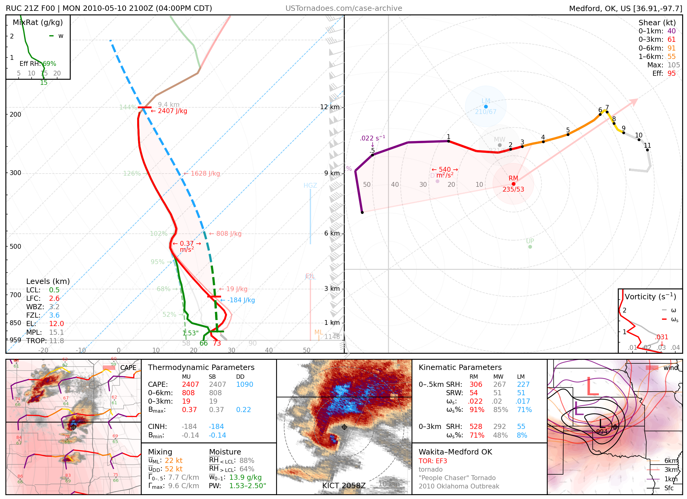
May 10, 2010: Wakita / Medford, Oklahoma
Multi-vortex tornado, known for “chasing” storm chasers, that went on to become a long-lived EF3.
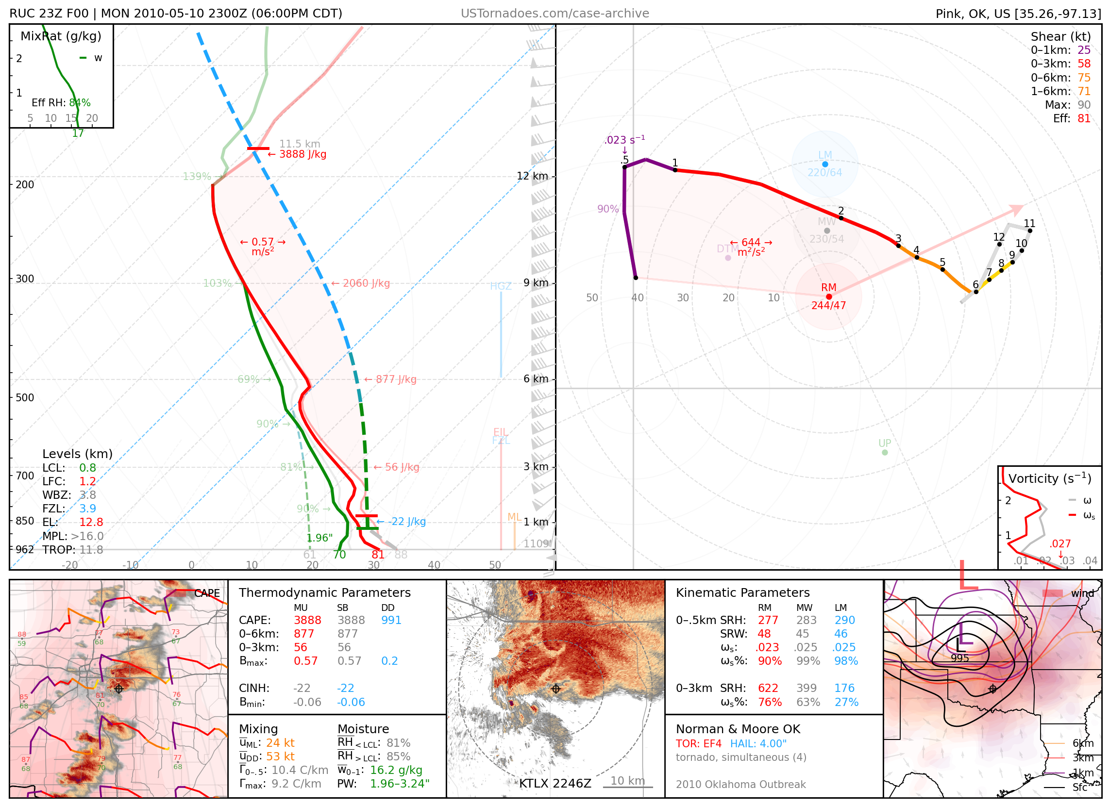
May 10, 2010: Norman, Oklahoma
EF4 tornado that occurred simultaneously with 3 other tornadoes, including another other EF4, and associated with a supercell that went on to produce 20 tornadoes across central OK.
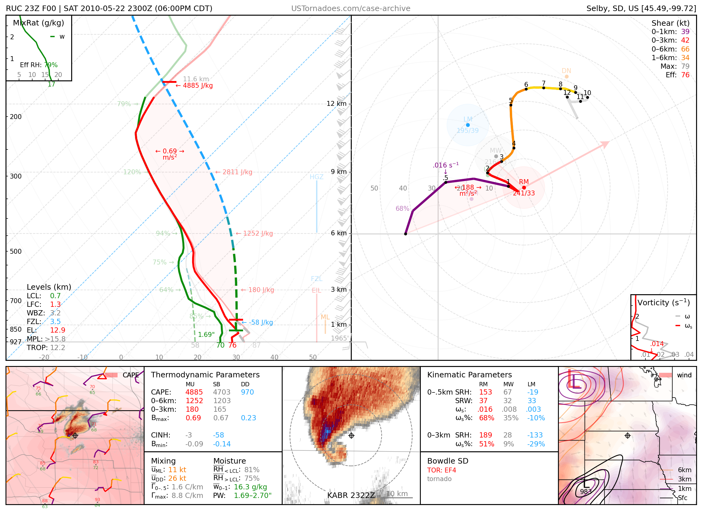
May 22, 2010: Bowdle, South Dakota
EF4 wedge tornado associated with a cyclic supercell.
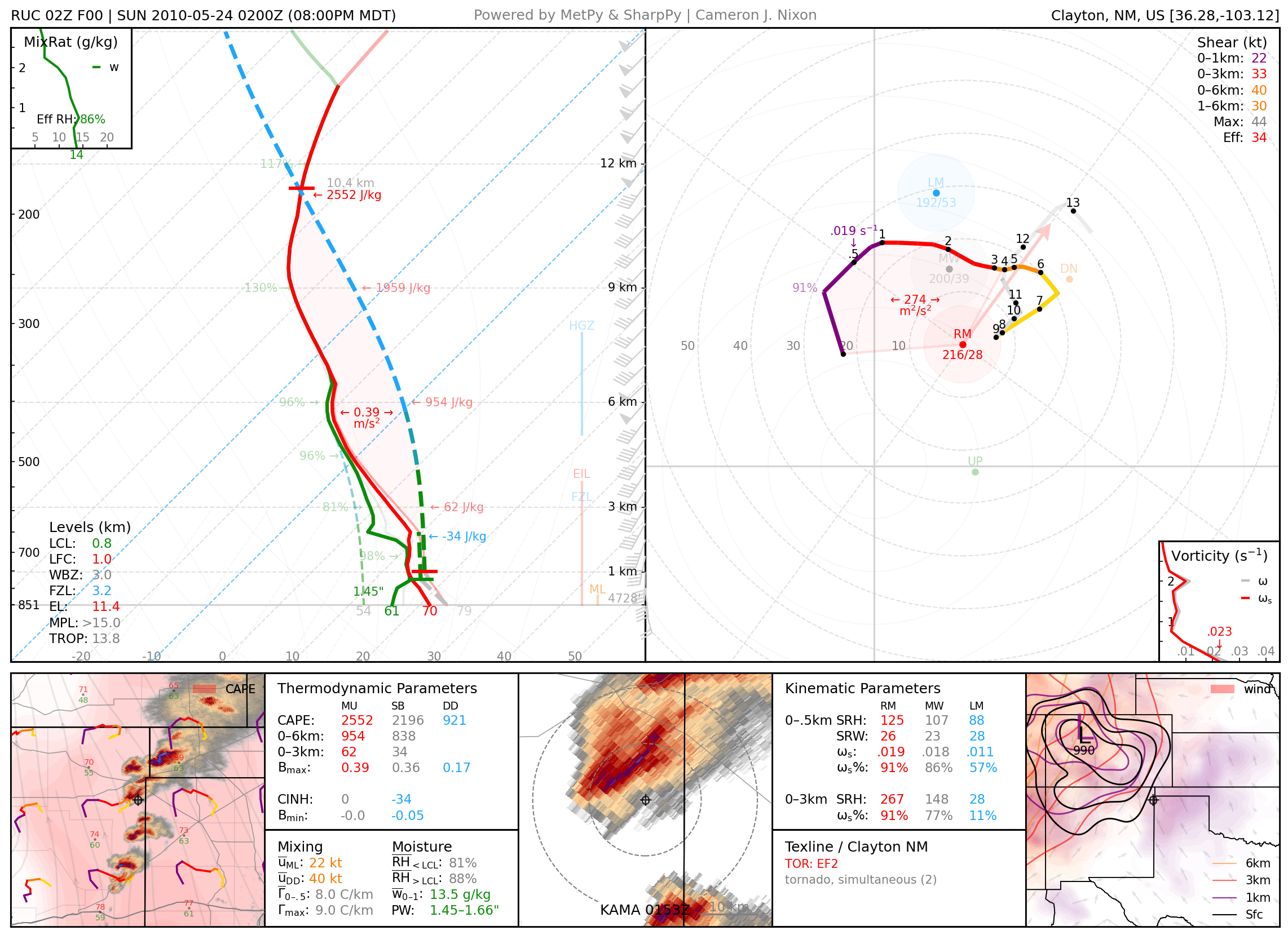
May 23, 2010: Texline–Clayton, New Mexico
Family of photogenic tornadoes, with twins at times.
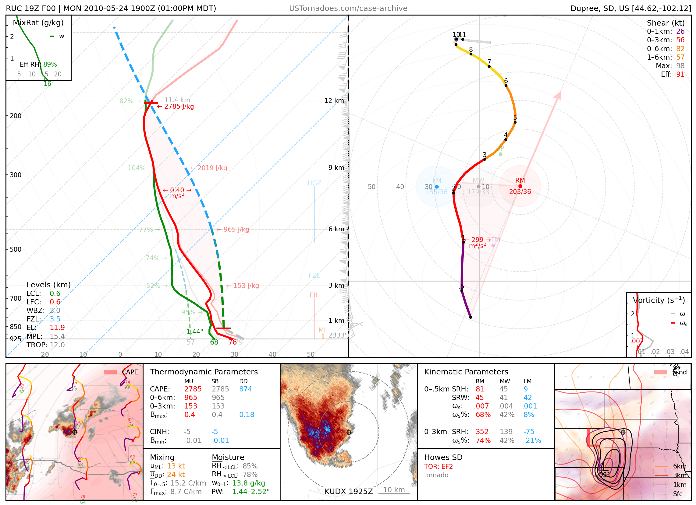
May 24, 2010: Howes, South Dakota
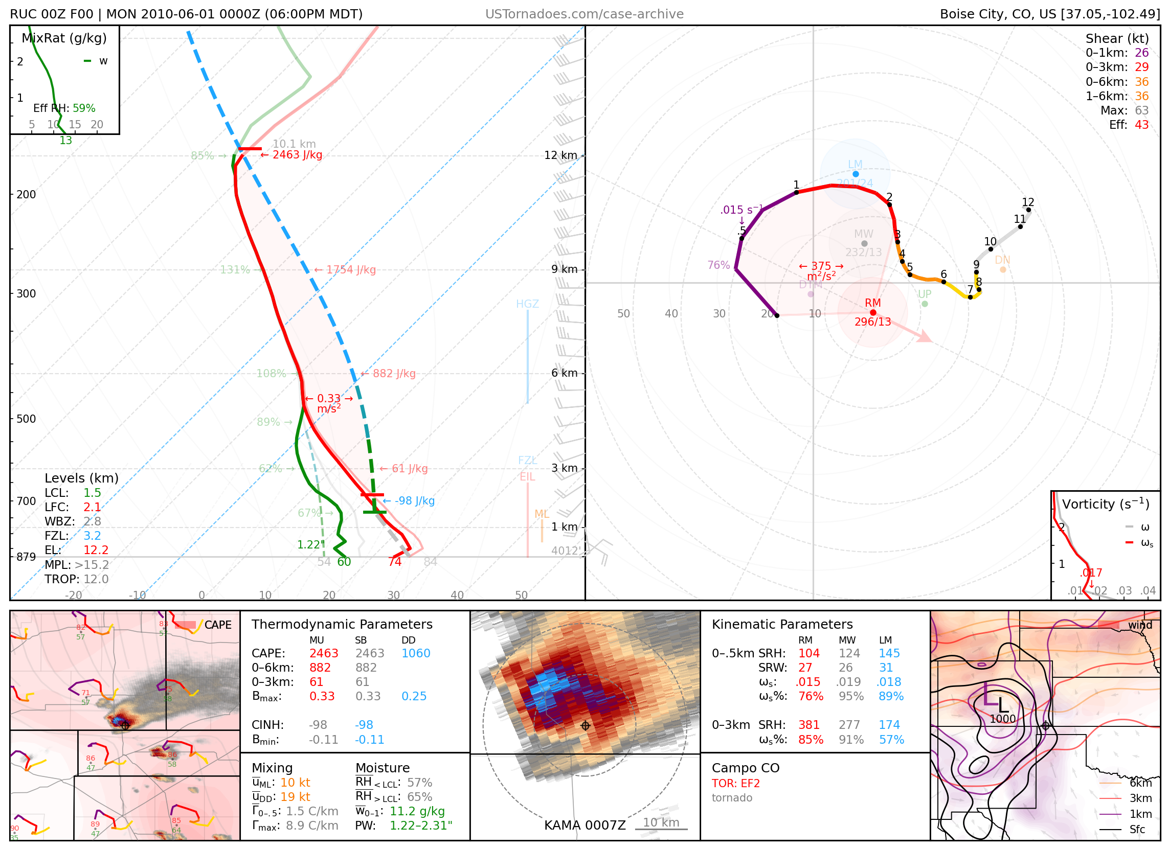
May 31, 2010: Campo, Colorado
Particularly photogenic EF2 tornado.
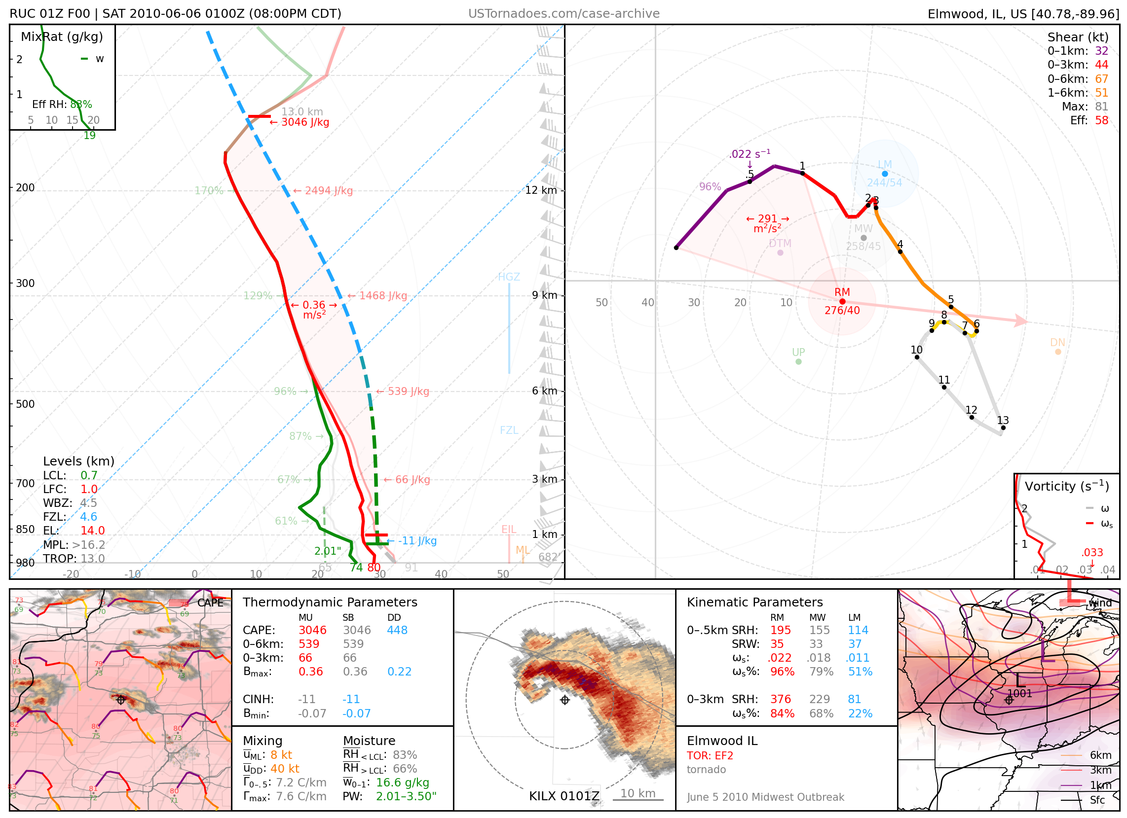
June 5, 2010: Elmwood, Illinois
EF2 tornado, part of an outbreak of tornadoes across north-central IL into OH.
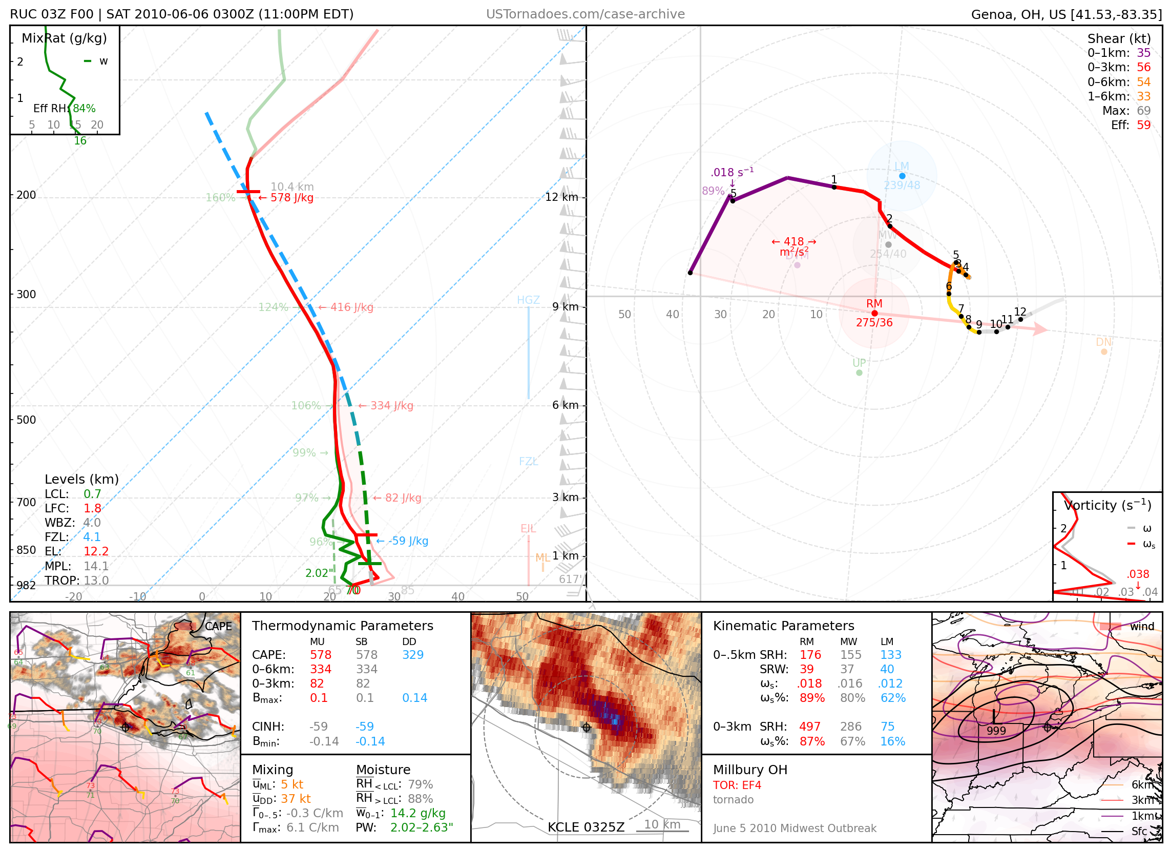
June 5, 2010: Millbury, Ohio
EF4 tornado that killed 7 people.
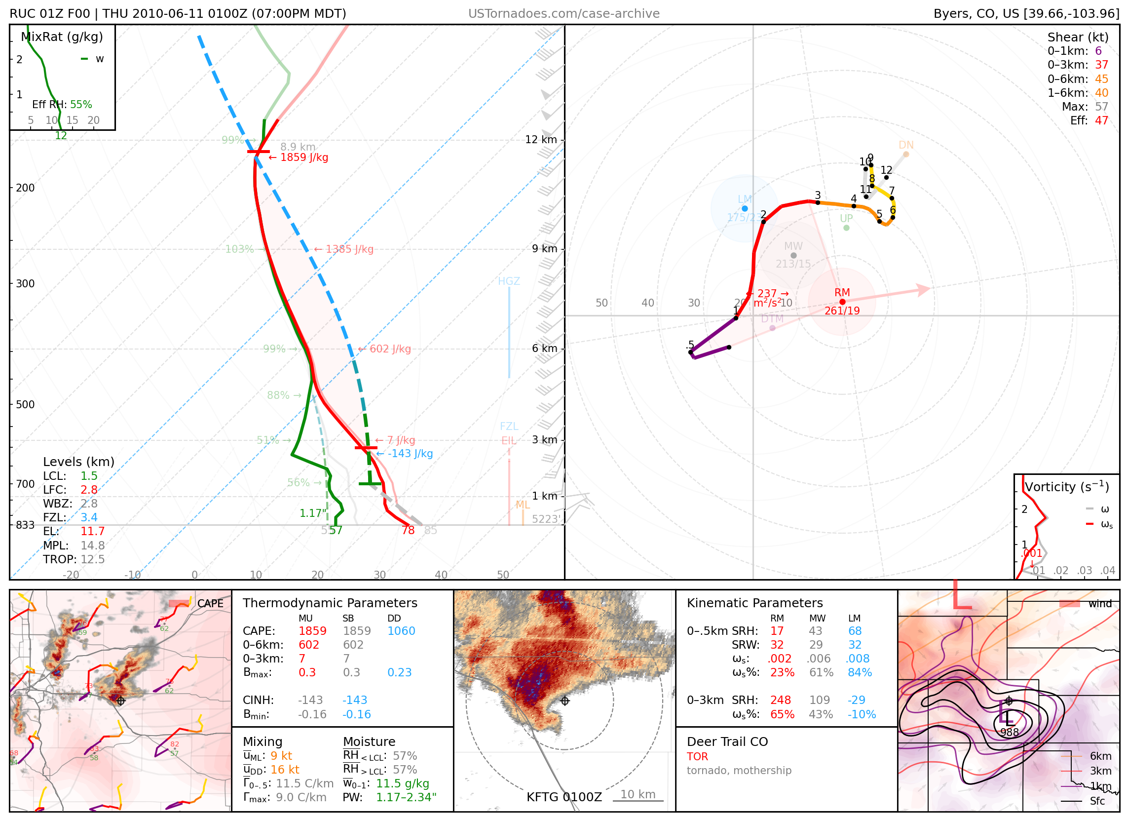
June 10, 2010: Last Chance, Colorado
Particularly photogenic supercell and tornado.
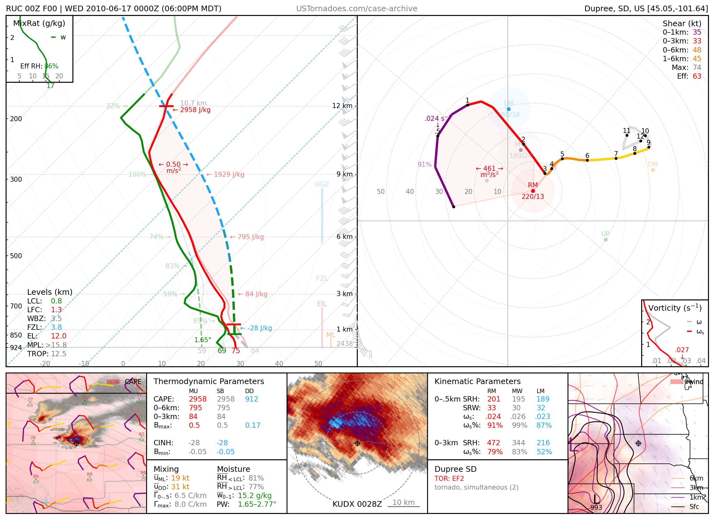
June 16, 2010: Dupree, South Dakota
Particularly cyclic, stationary supercell with reports of over 12 tornadoes (up to EF2) occurring in rapid succession, many simultaneously.
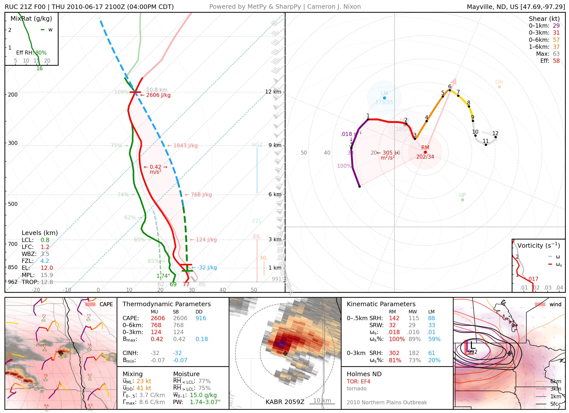
June 17, 2010: Holmes, North Dakota
Photogenic EF4 tornado, part of a large-scale tornado outbreak
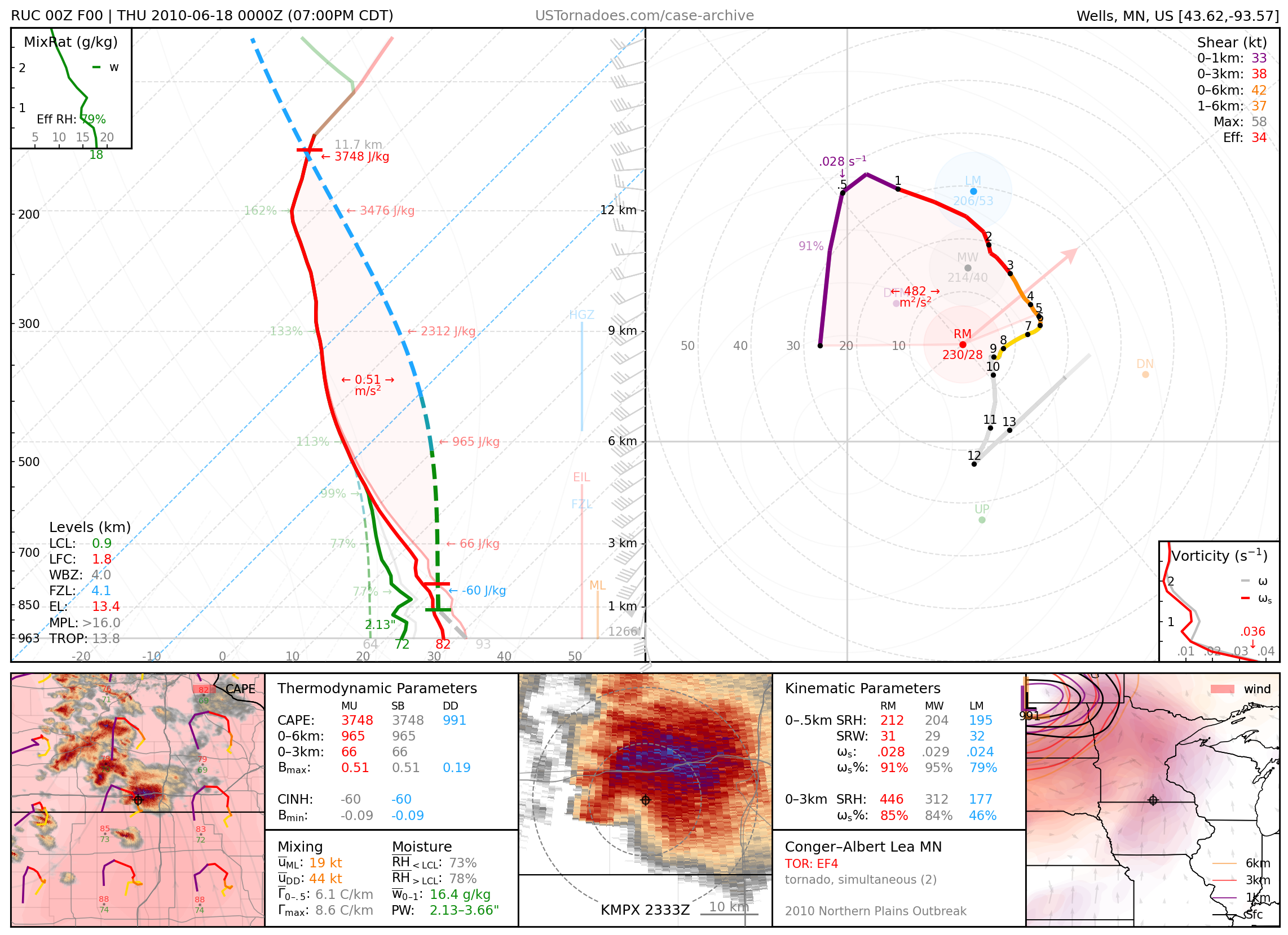
June 17, 2010: Albert Lea, Minnesota
EF4 tornado from a cyclic supercell, part of MN’s largest tornado outbreak on record.
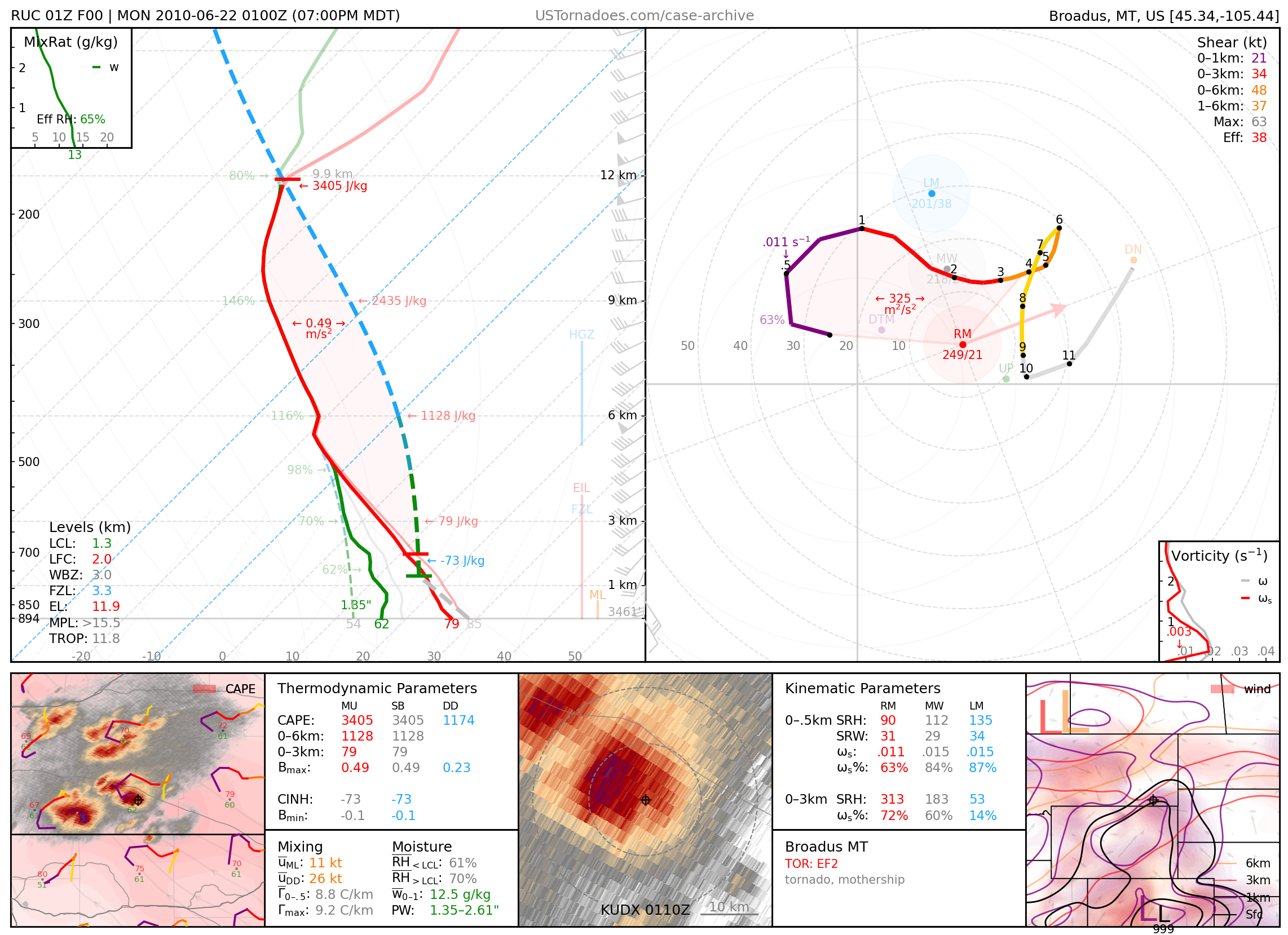
June 21, 2010: Broadus, Montana
Particularly photogenic supercell and tornado.
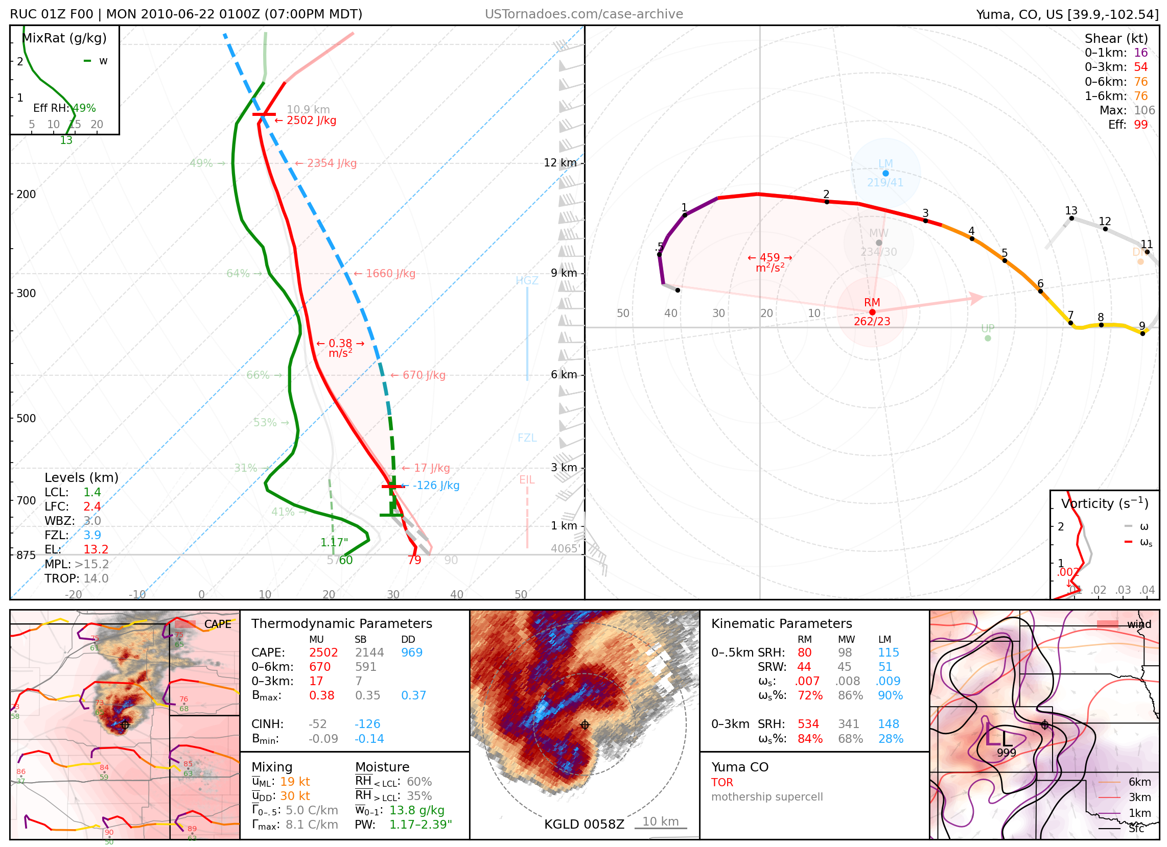
June 21, 2010: Yuma County, Colorado
Massive high-precipitation “mothership” supercell.
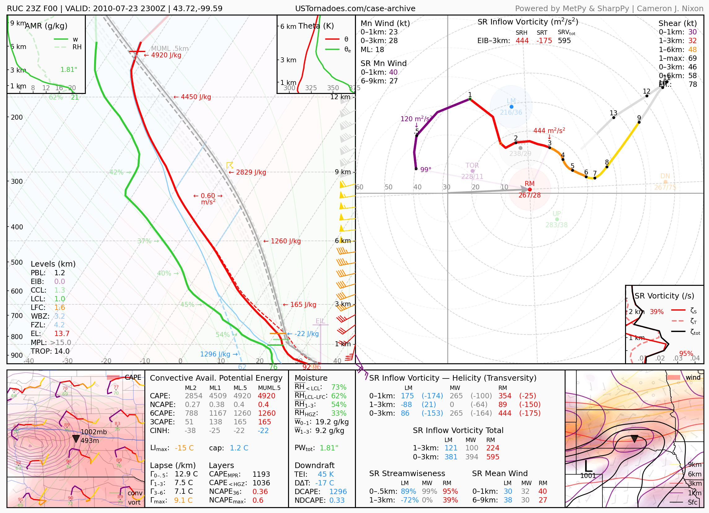
July 23, 2010: Vivian, South Dakota
World record hail-producing supercell, with the largest observed hailstone measuring 8.0” in diameter and 1.93 lb.
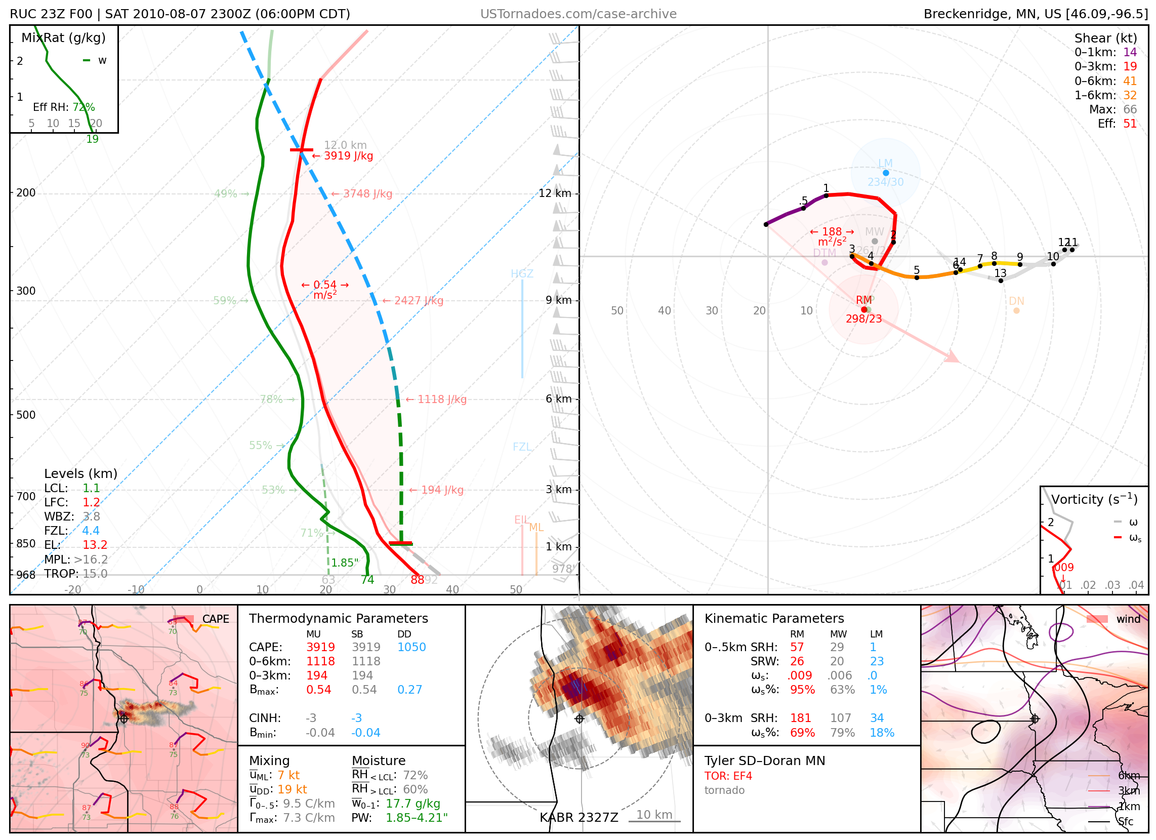
August 7, 2010: Tyler, North Dakota / Doran, Minnesota
Particularly photogenic EF4 tornado.
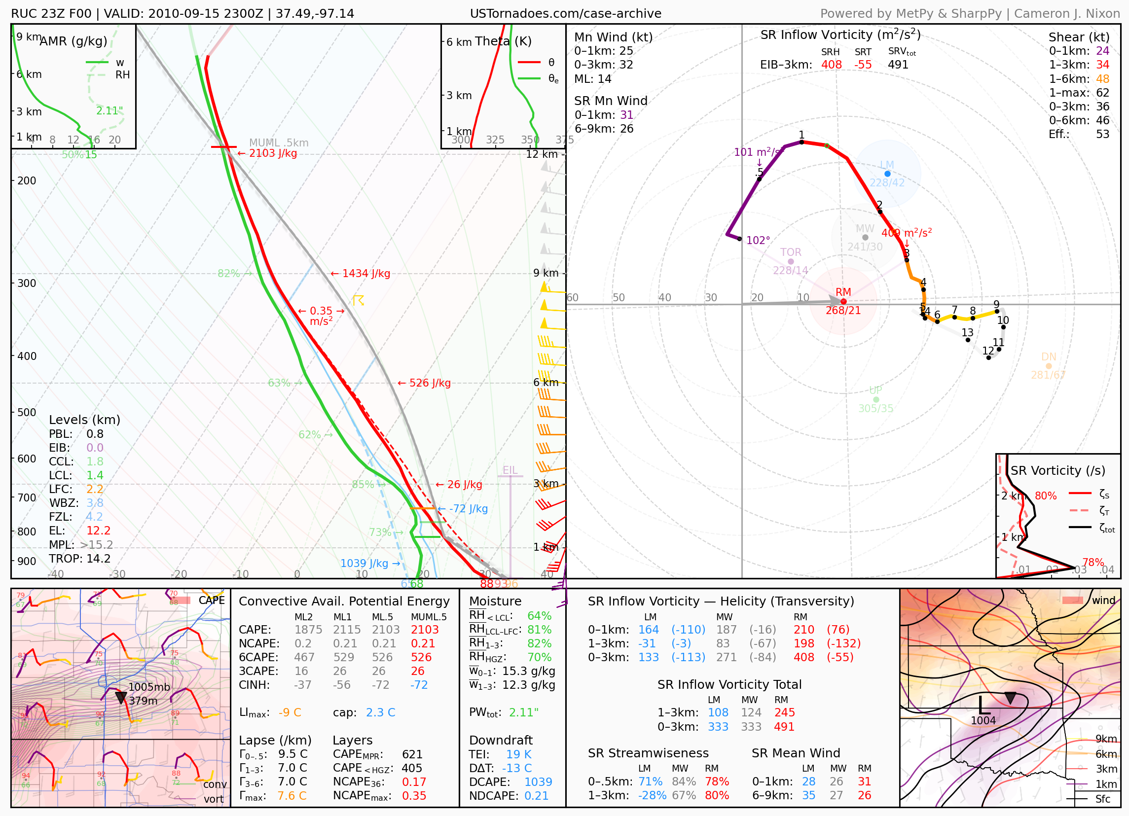
September 15, 2010: Wichita, Kansas
Kansas state record hailstone, measuring 7.75 inches.
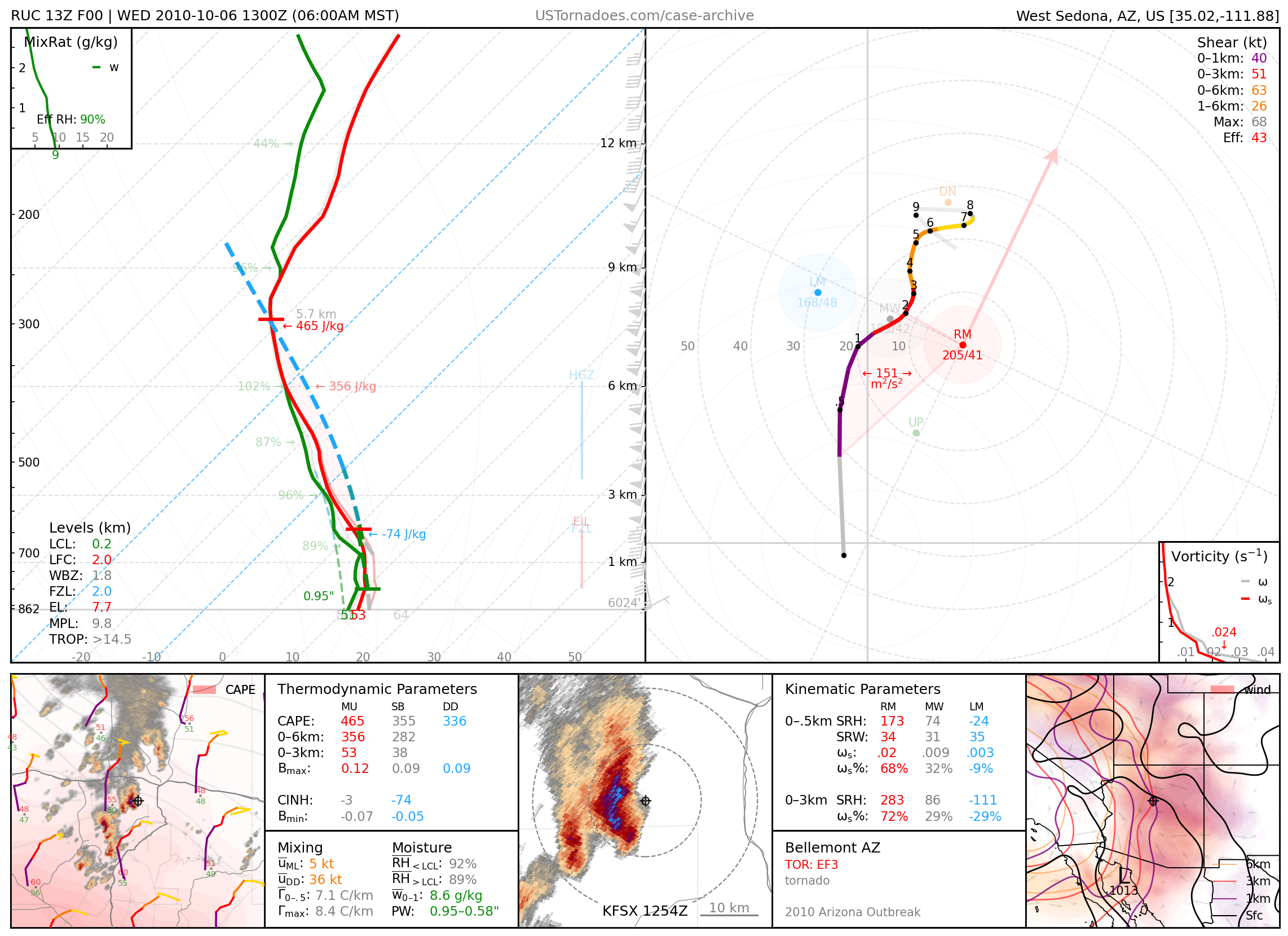
October 6, 2010: Bellemont, Arizona
Long-tracked, EF3 wedge tornado, part of the largest tornado event in AZ on record.
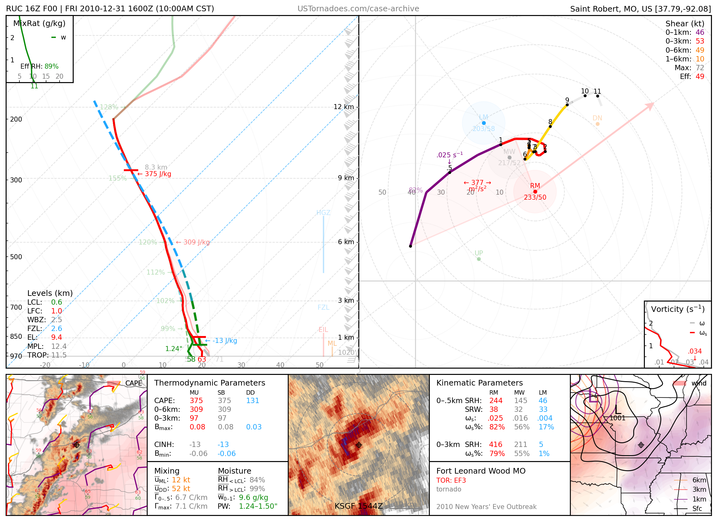
December 31, 2010: Fort Leonard Wood, Missouri
EF3 tornado, part of the New Years’ Eve tornado outbreak.
2011
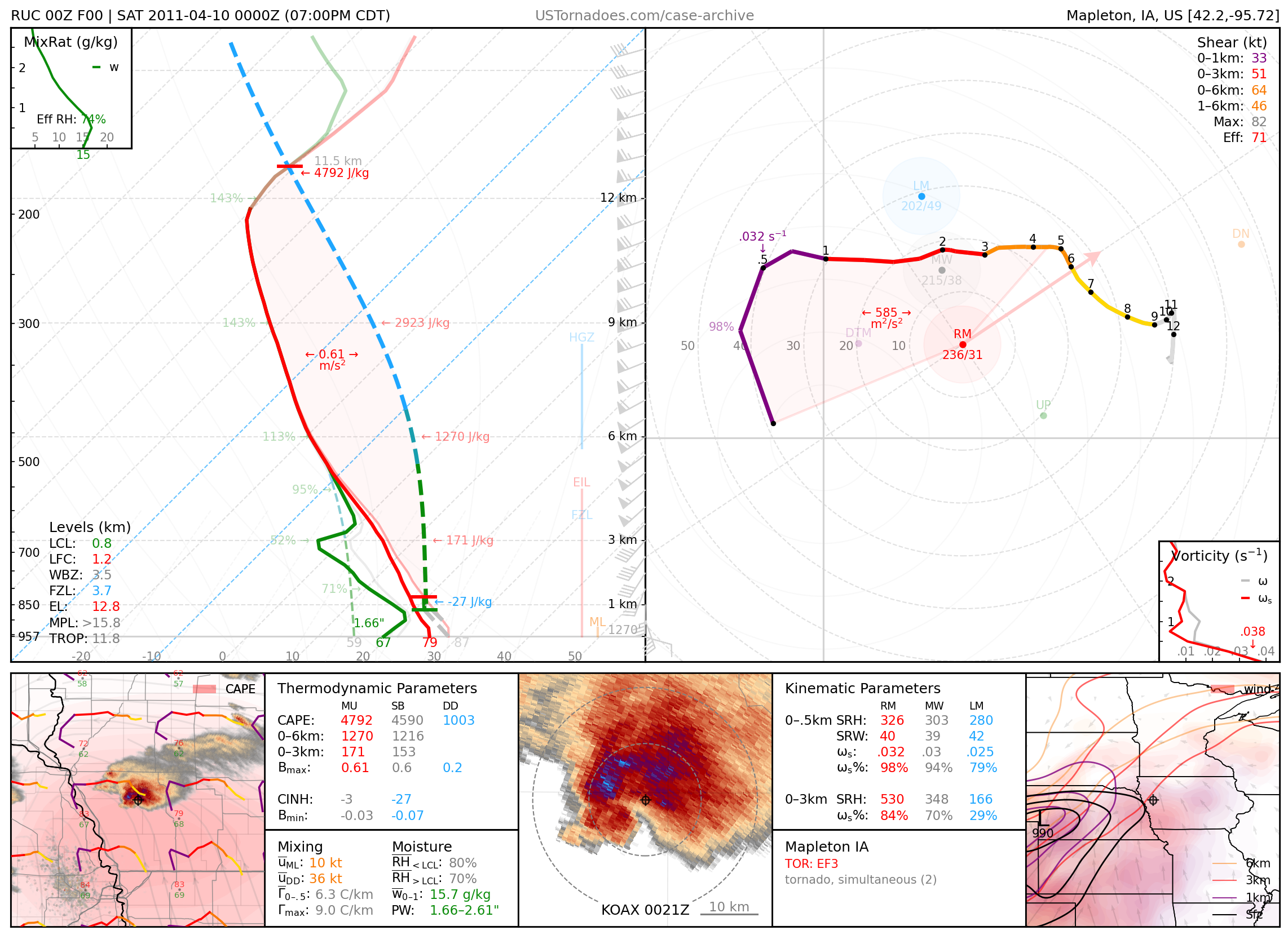
April 9, 2011: Mapleton, Iowa
Cyclic tornadic supercell that produced 17 tornadoes up to EF4 across northwest Iowa.
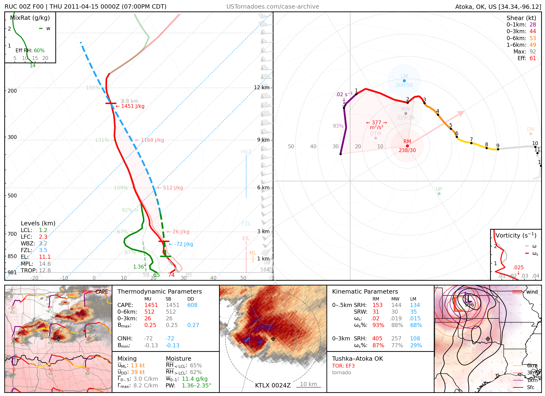
April 14, 2011: Tushka, Oklahoma
EF3 tornado, part of an outbreak of tornadoes across OK and AR.
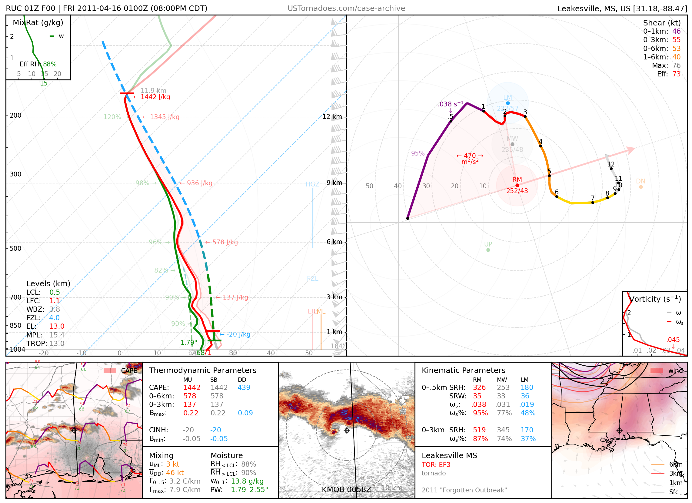
April 15, 2011: Leakesville, Mississippi
EF3 tornado, part of an outbreak of tornadoes across MS and AL.
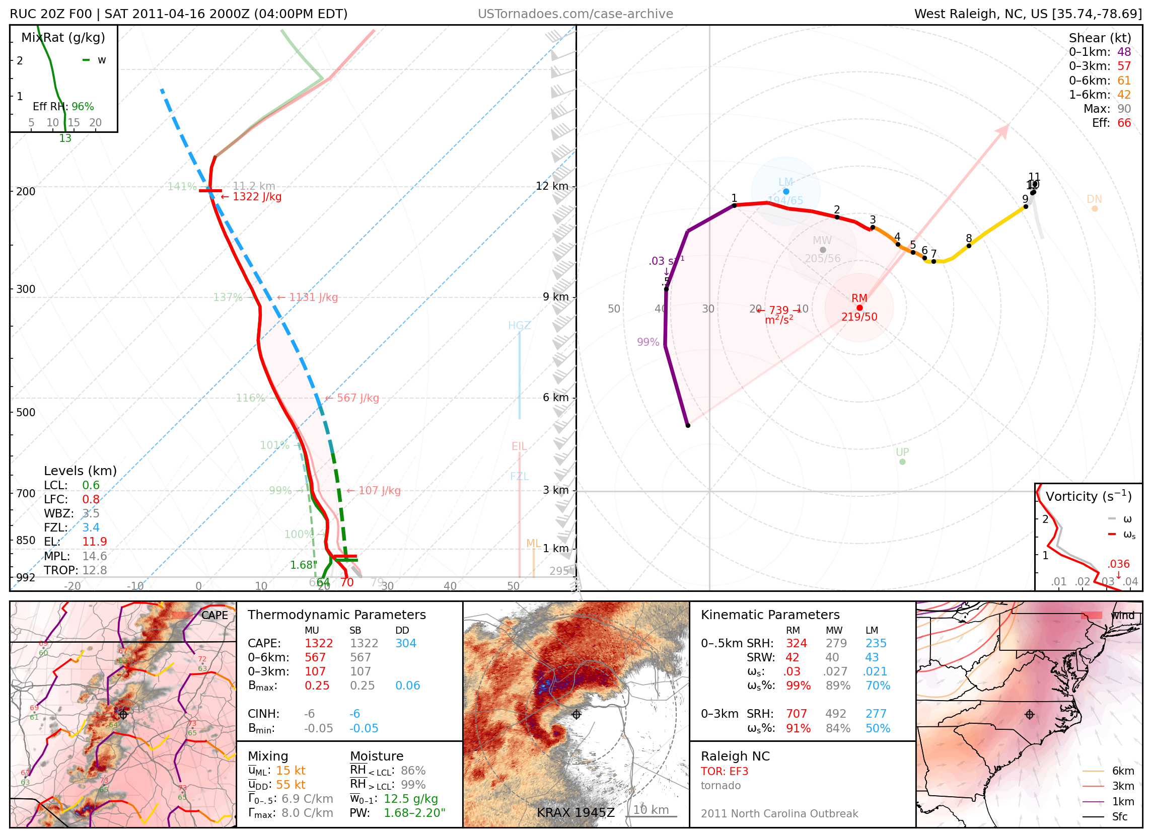
April 16, 2011: Raleigh, North Carolina
Long-tracked EF3 tornado, part of North Carolina’s largest tornado outbreak on record.
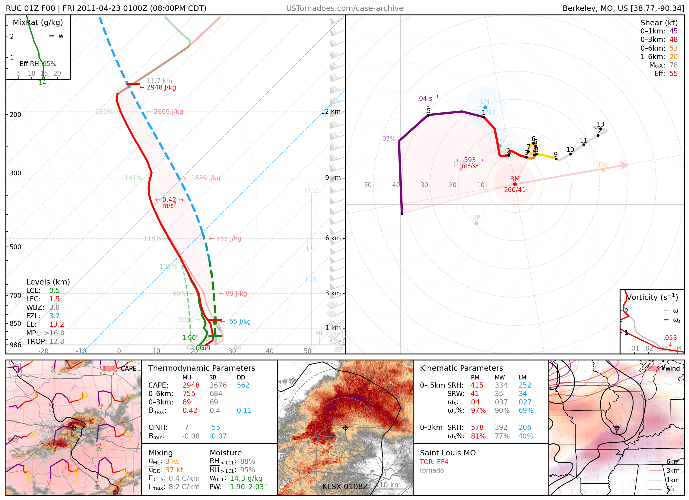
April 22, 2011: St. Louis, Missouri
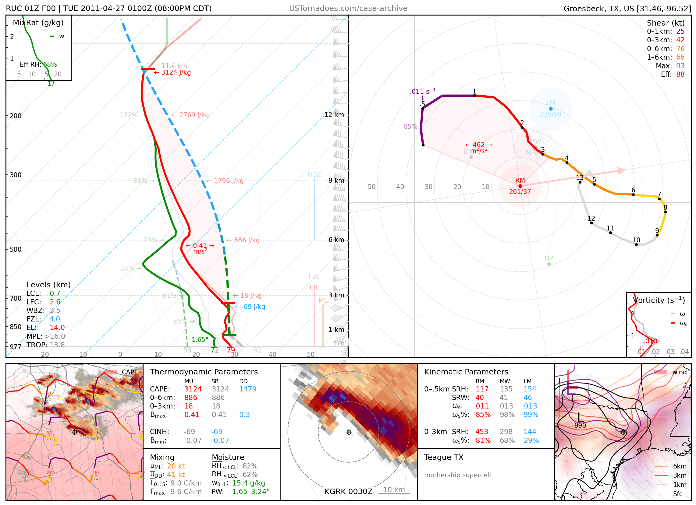
April 26, 2011: Teague, Texas
Particularly photogenic supercell, especially for the area and time of year.
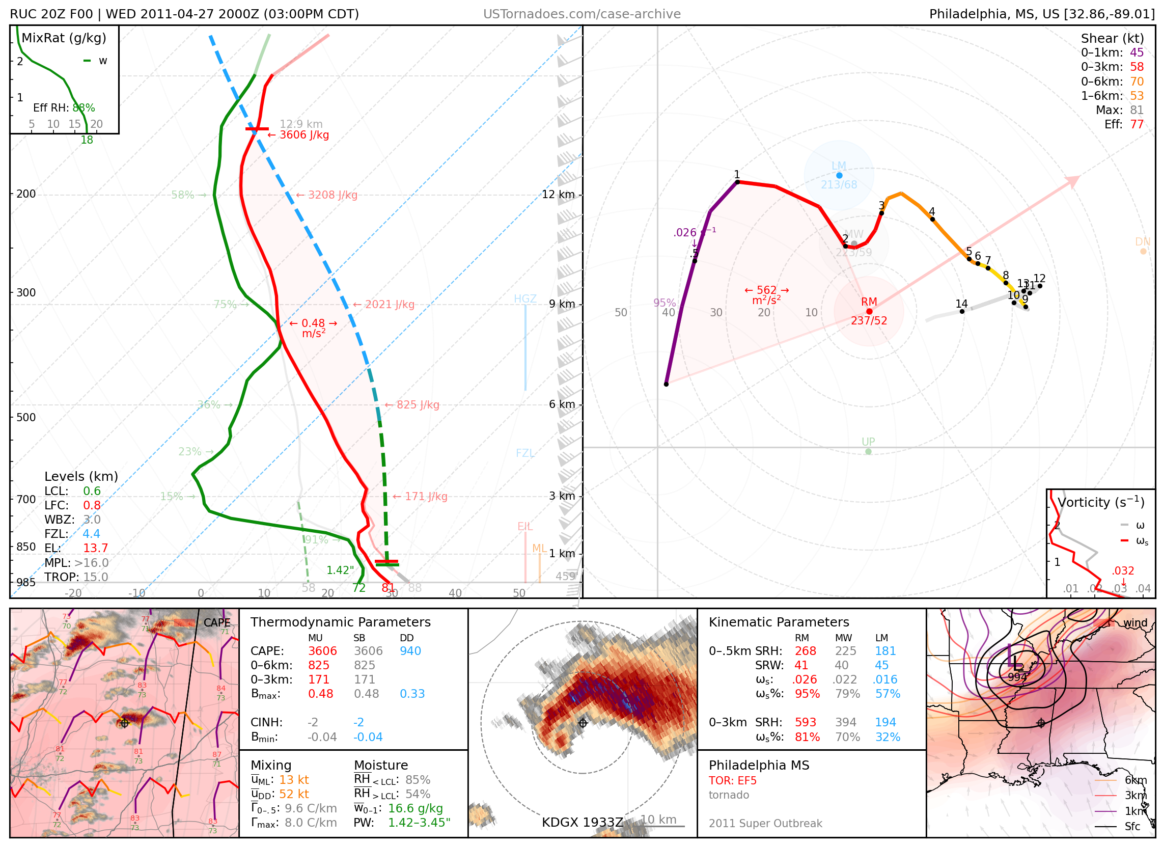
April 27, 2011: Philadelphia, Mississippi
EF5 tornado from a particularly photogenic supercell for the area that killed 3 people. Part of the 2011 Super Outbreak.
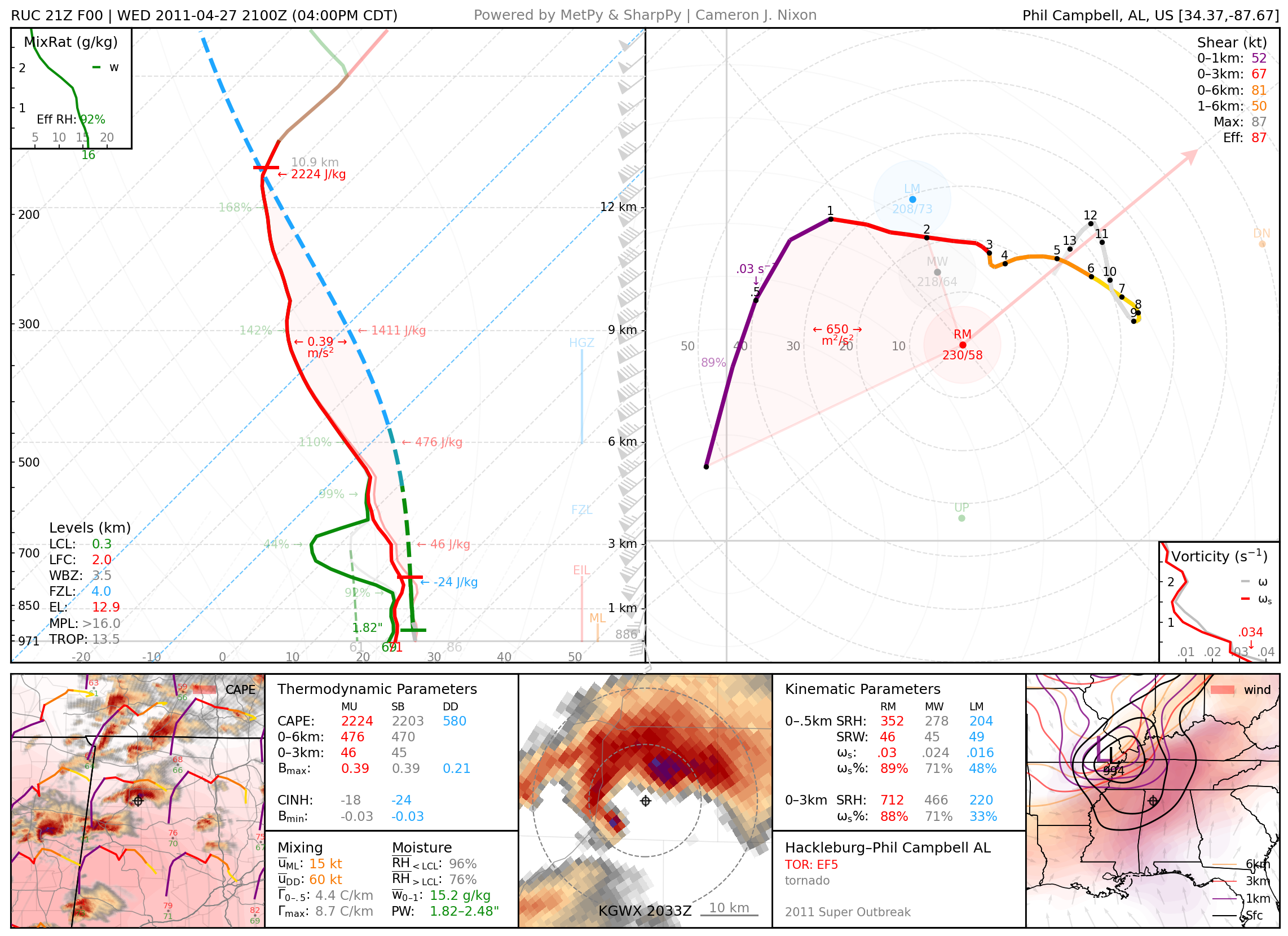
April 27, 2011: Hackleburg and Smithville, Alabama
Two long-tracked EF5 tornadoes from separate supercells that, together, killed 95 people. Part of the 2011 Super Outbreak. The latter tornado is often thought to be among the strongest of recorded tornadoes.
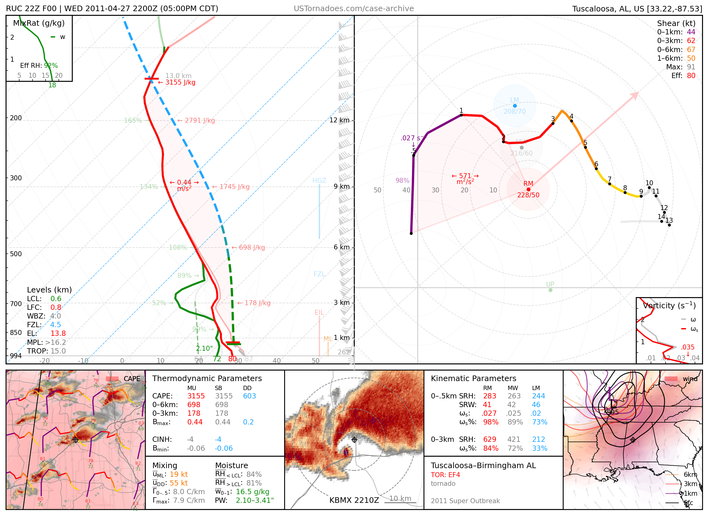
April 27, 2011: Tuscaloosa / Birmingham, Alabama
Long-tracked EF4 tornado that killed 64 people and was infamously covered on air. Part of the 2011 Super Outbreak.
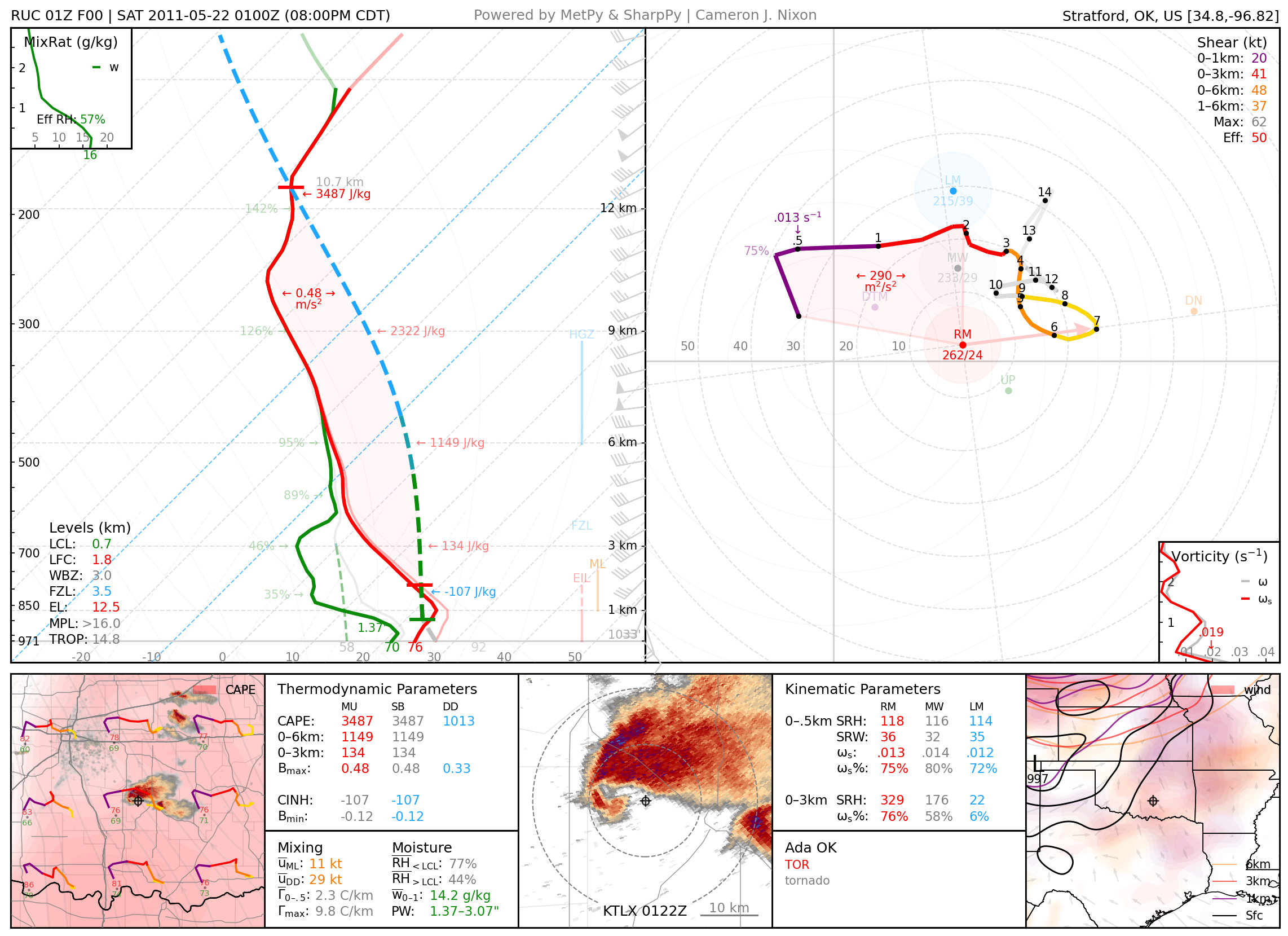
May 21, 2011: Ada, Oklahoma
Particularly photogenic tornado from well-structured supercell.
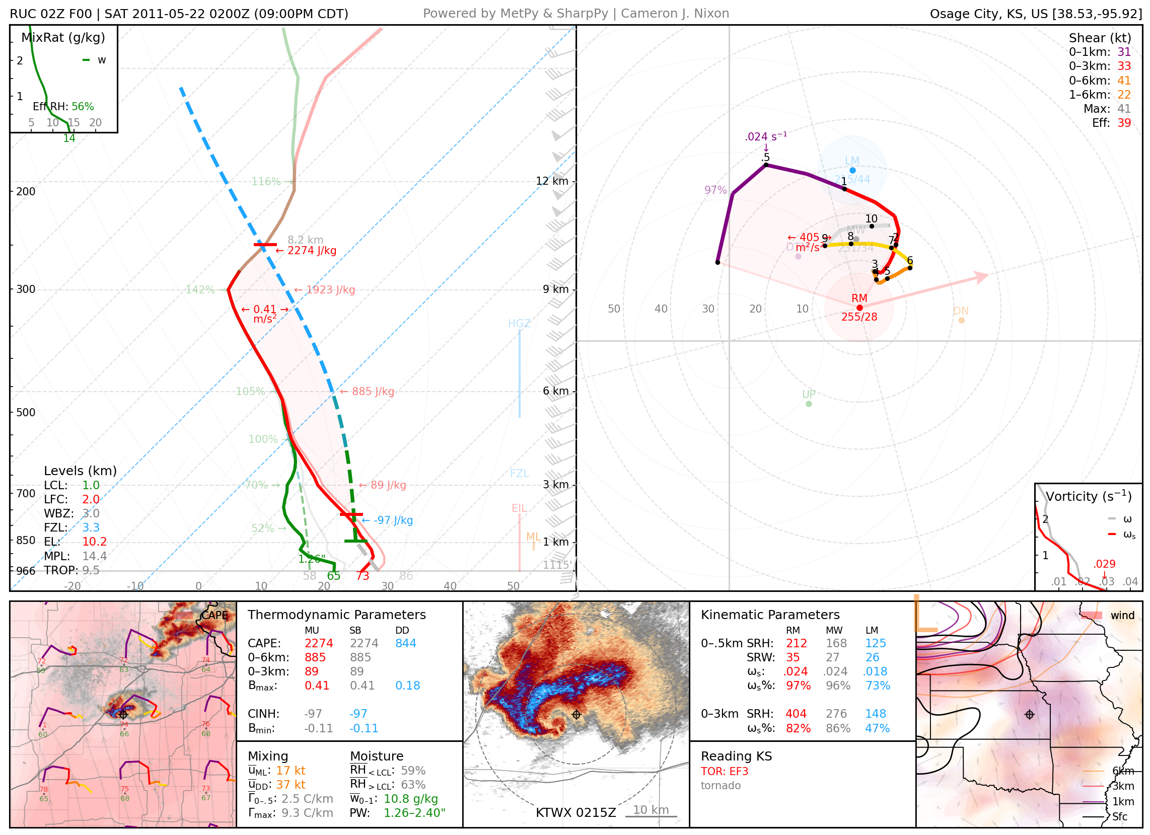
May 21, 2011: Reading, KS
Photogenic EF3 tornado.
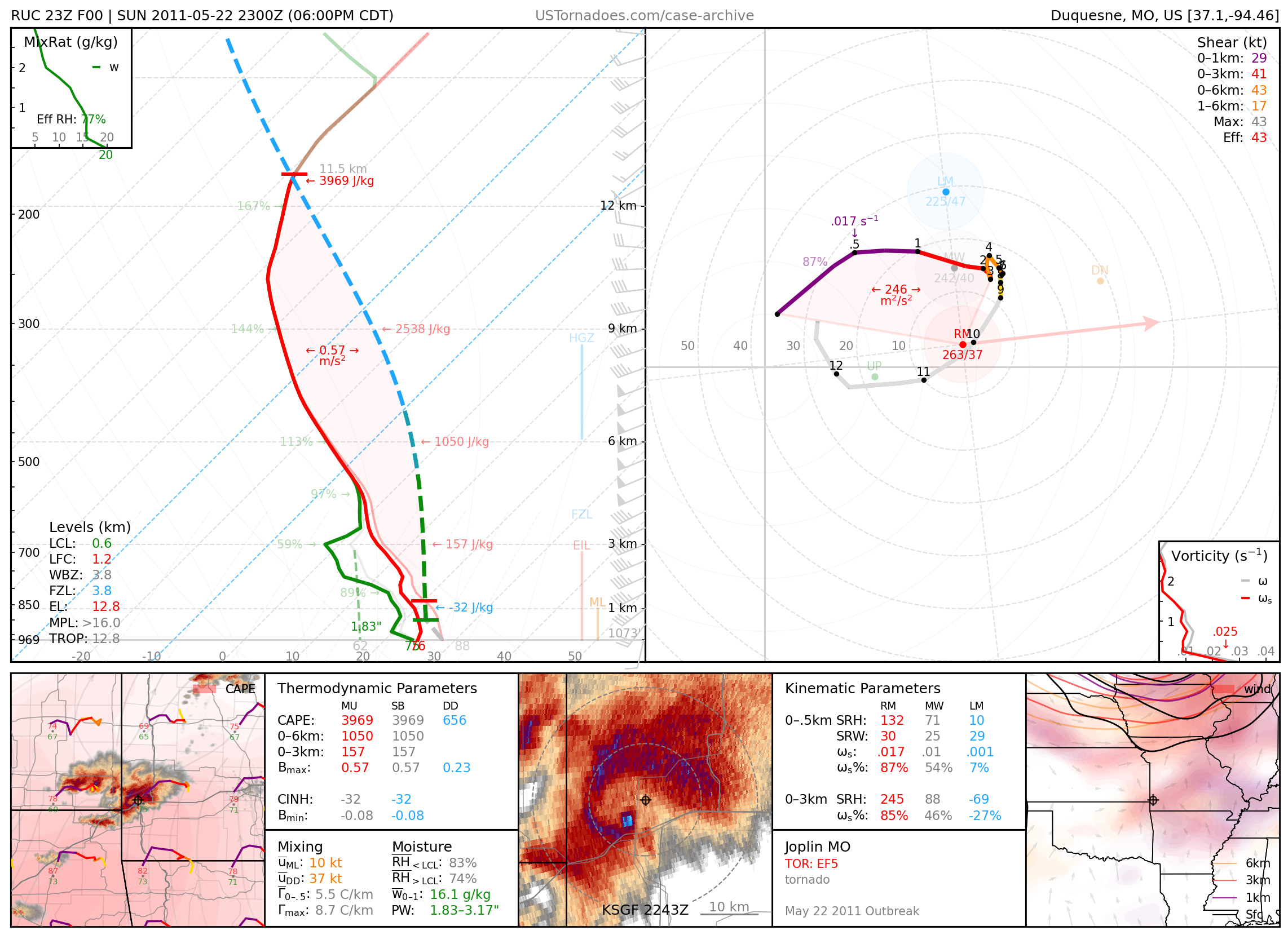
May 22, 2011: Joplin, Missouri
EF5 tornado, one of the U.S.’s deadliest on record due especially to a particularly rapid evolution, killing 158 people.
May 23, 2011: Gotebo, Oklahoma
Oklahoma record hailstone, measuring 6 inches.
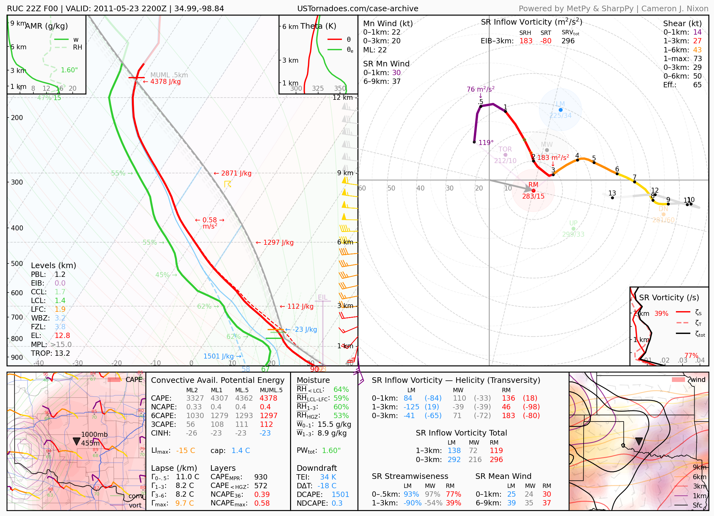
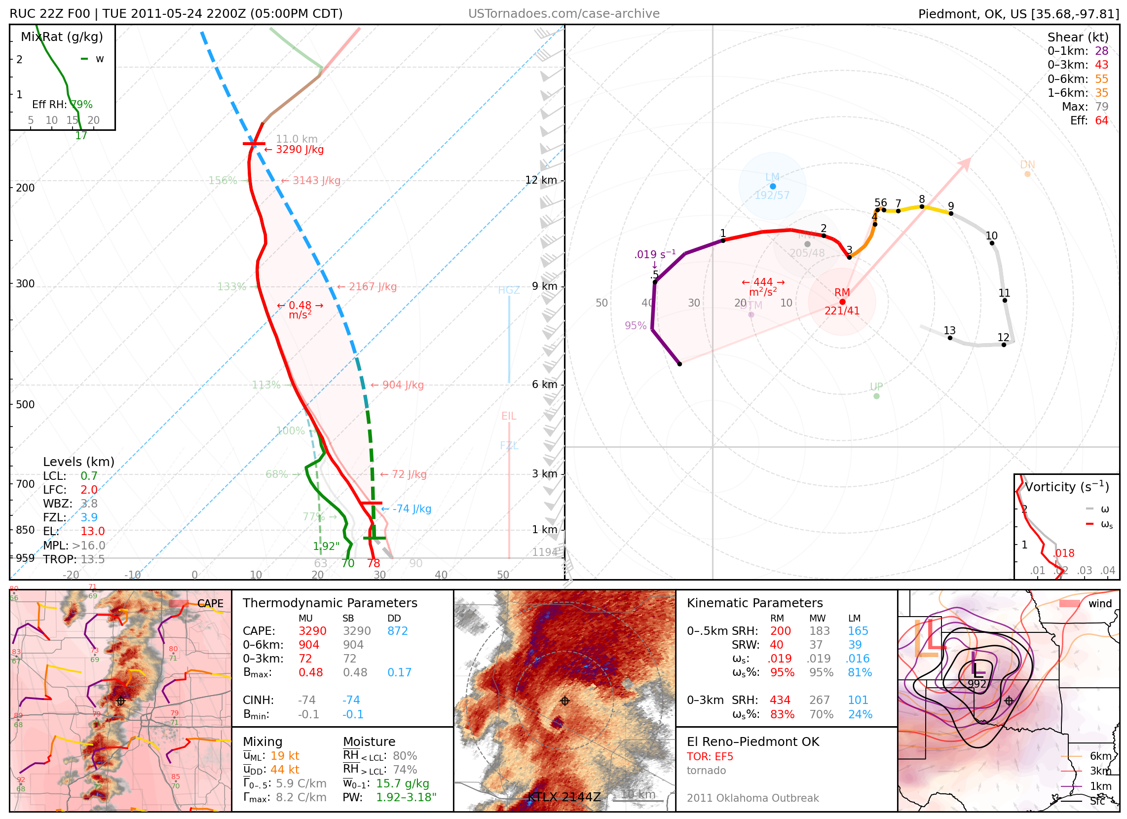
May 24, 2011: El Reno / Piedmont, Oklahoma
Long-tracked, EF5 wedge tornado that killed 9 people, part of an outbreak of tornadoes across the central Plains.
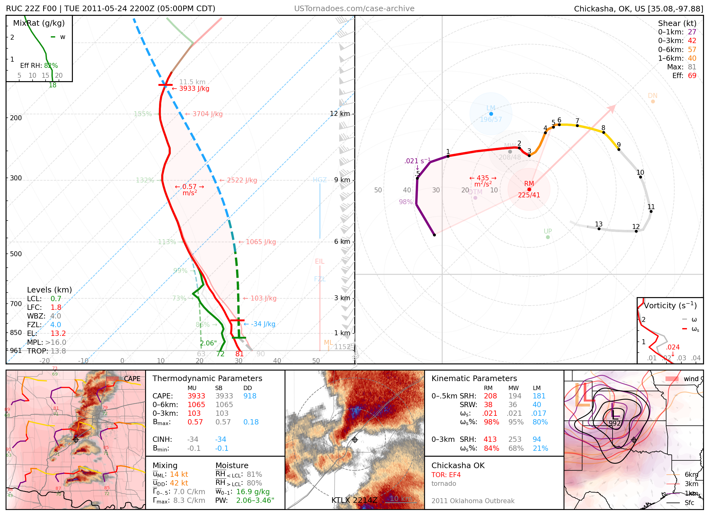
May 24, 2011: Chickasha / Newcastle, Oklahoma
Long-tracked, EF4 tornado, part of an outbreak of tornadoes across the central Plains.
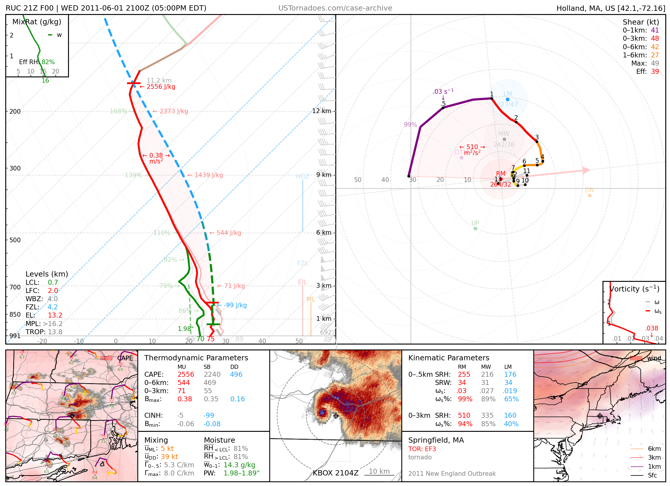
June 1, 2011: Springfield, Massachusetts
Long-lived EF3 tornado that killed 3 people.
June 19, 2011: McCook, Nebraska
Particularly photogenic “tidal wave”-like supercell.
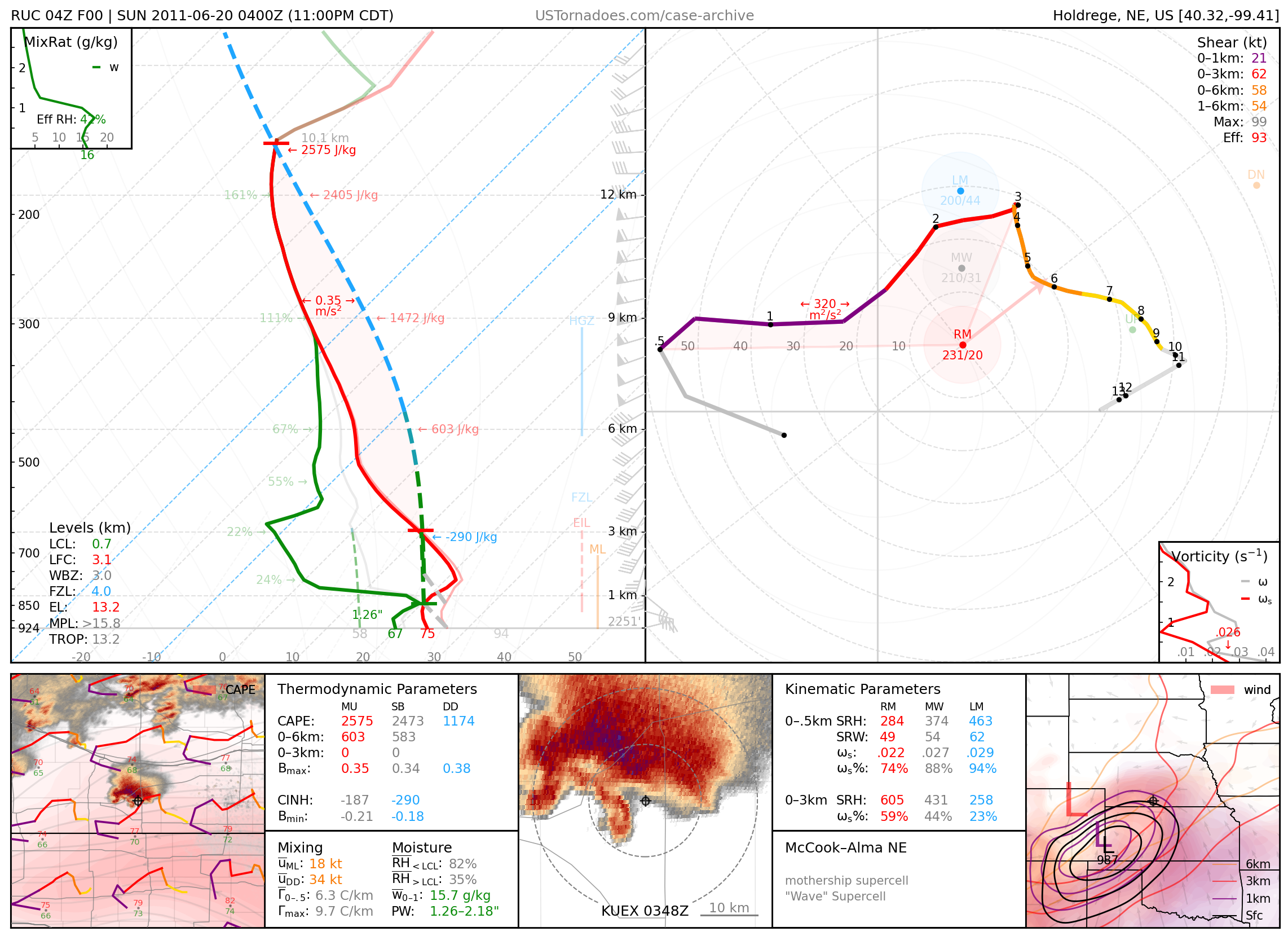
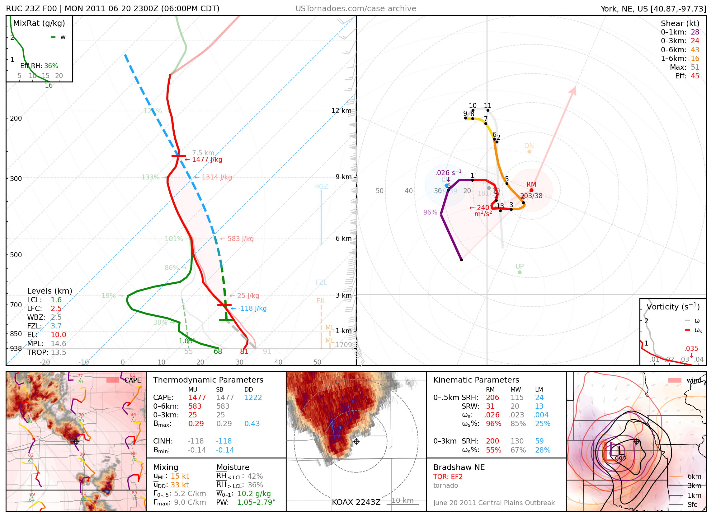
June 20, 2011: Bradshaw, Nebraska
Particularly photogenic tornado, part of a “cold-core” outbreak of tornadoes across south/central NE.
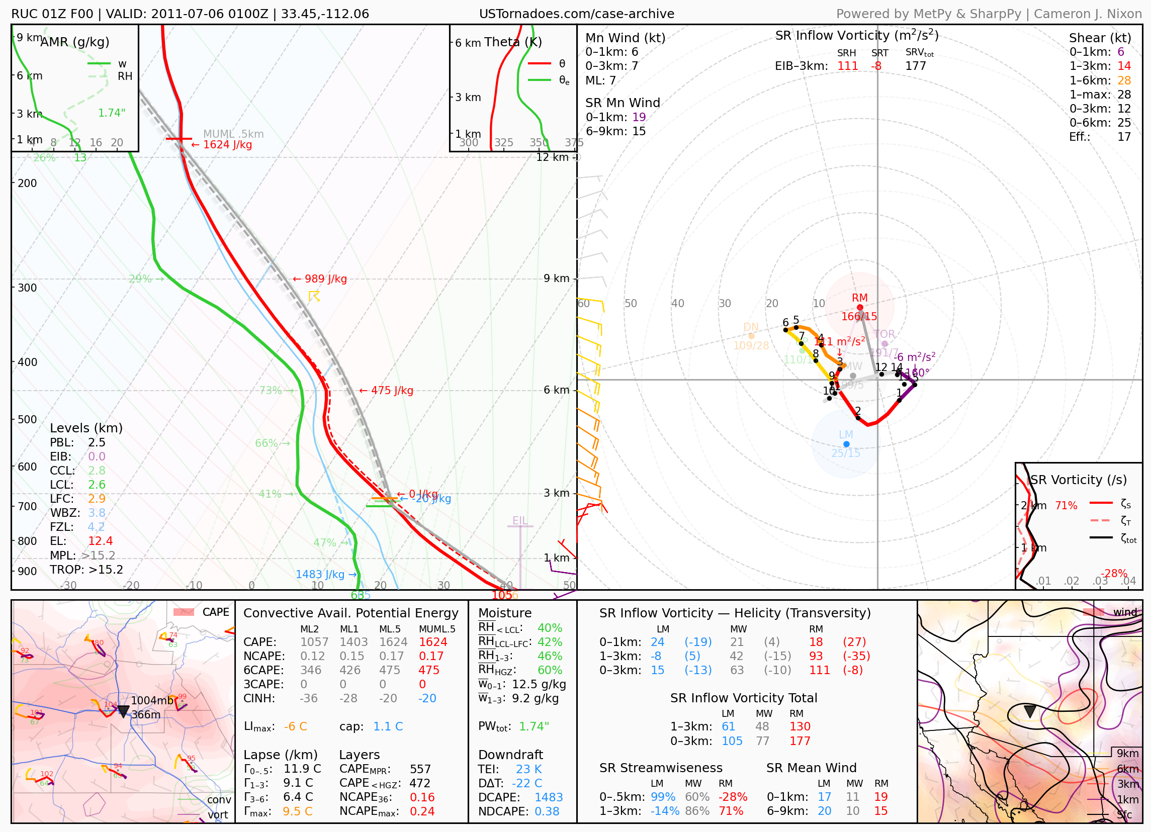
July 5, 2011: Phoenix, Arizona
Massive thunderstorm-triggered haboob that lasted over 2 hours and 100 miles. Often regarded as the “gold standard” for dust storms for the Phoenix area.
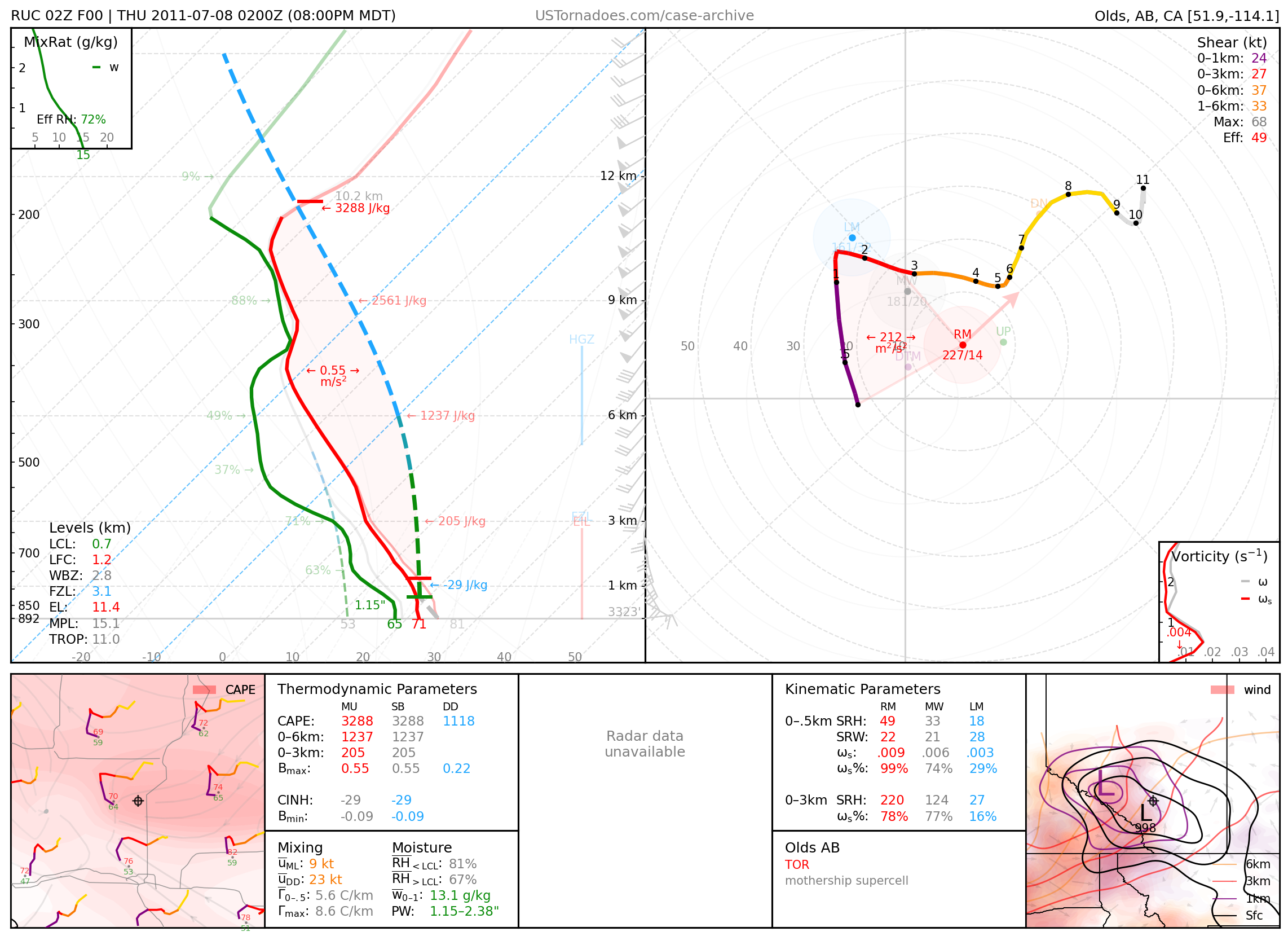
July 7, 2011: Olds, Alberta
Particularly photogenic “mothership supercell” that produced a couple of tornadoes.
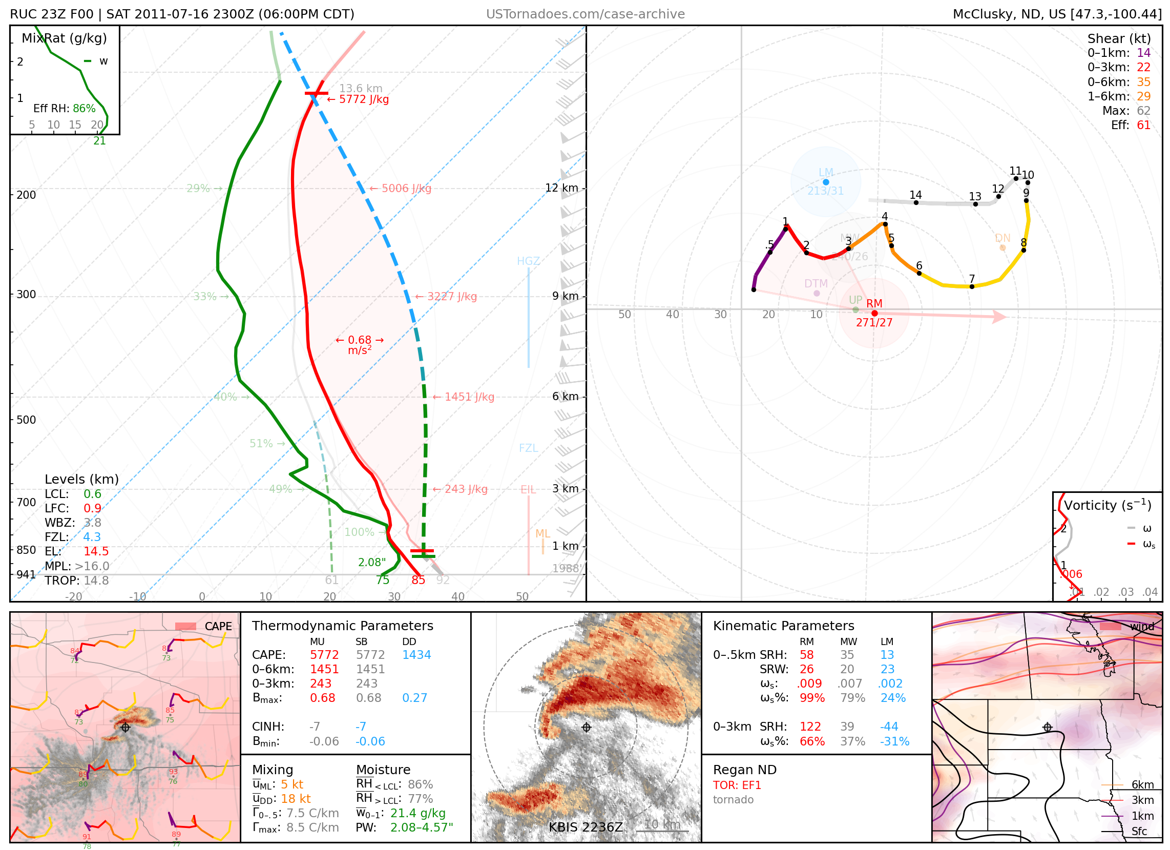
July 16, 2011: Regan, North Dakota
One of several weakly-rated but photogenic tornadoes.
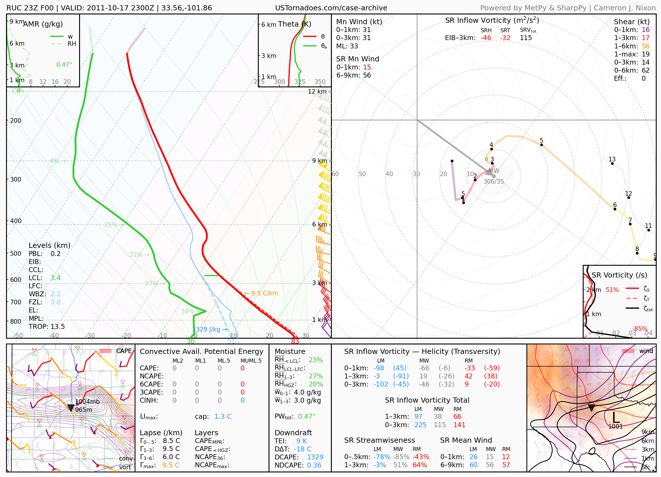
October 17, 2011: Lubbock, Texas
Massive cold front-driven haboob that lasted over 2 hours and traveled 100 miles. Often regarded as the “gold standard” for recent dust storms for the west Texas area.
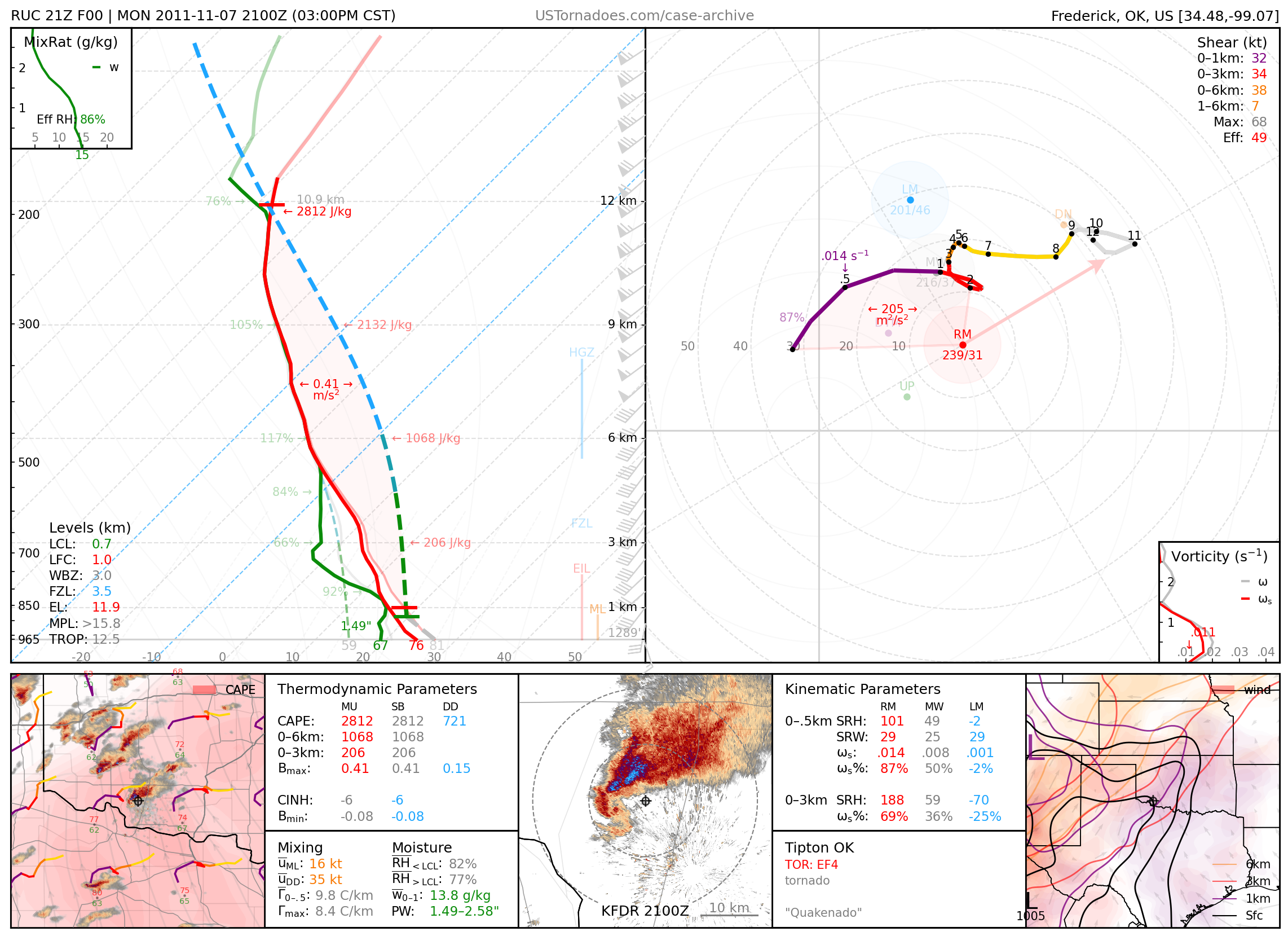
November 7, 2011: Tipton, Oklahoma
Particularly photogenic EF4 tornado from a cyclic supercell that produced 9 tornadoes across SW OK. Also known as “quakenado” due to the magnitude 4.7 earthquake which occurred on the same day.
2012
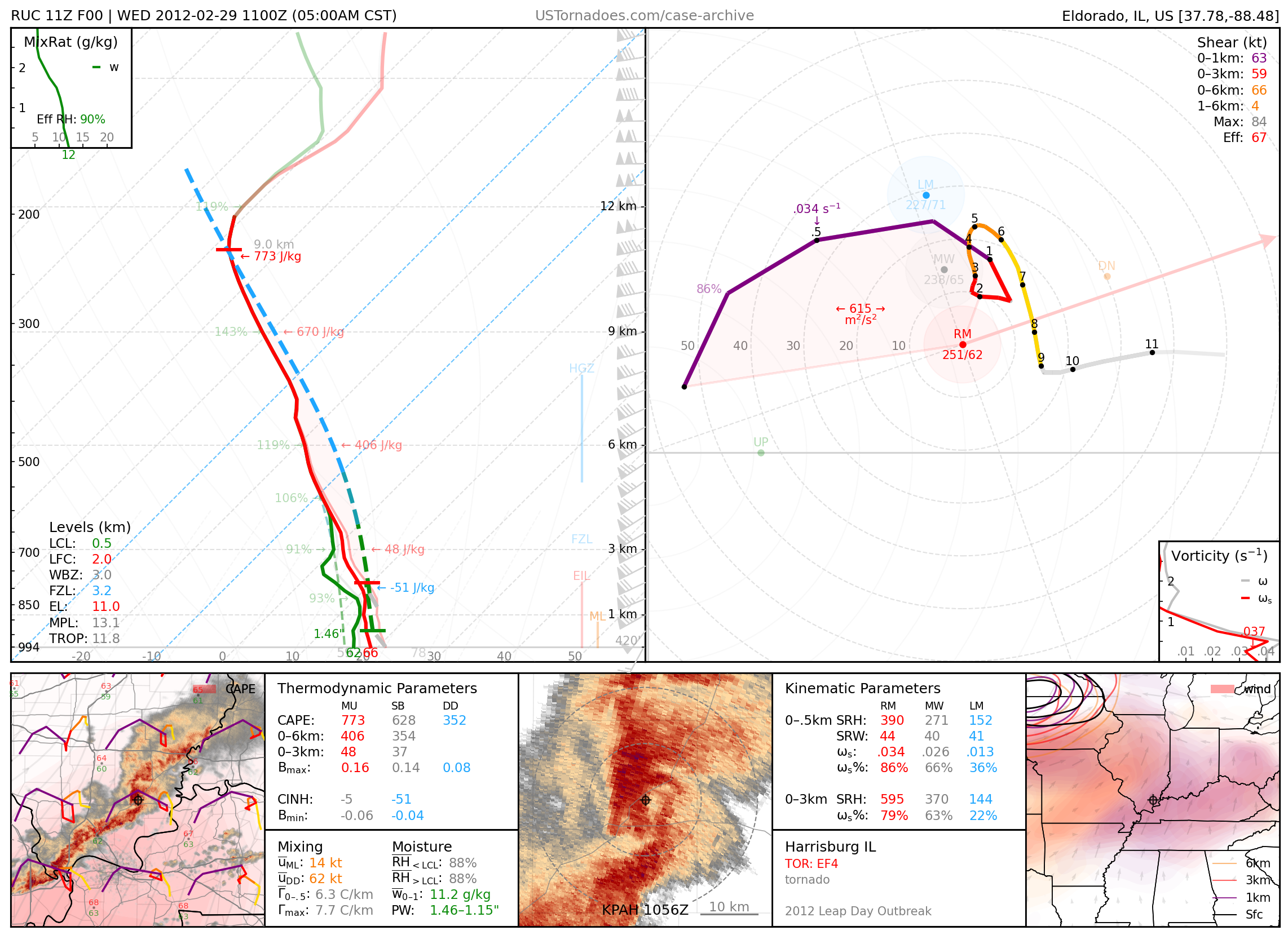
February 29, 2012: Harrisburg, Illinois
EF4 tornado that killed 8 people as part of the Leap Day tornado outbreak.
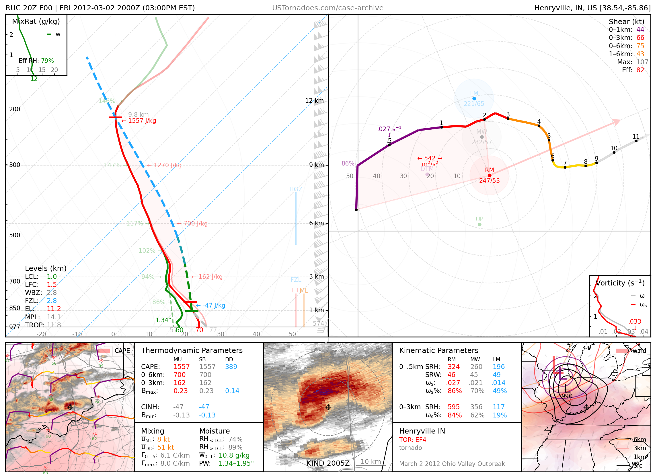
March 2, 2012: Henryville, Indiana
Long-tracked, EF4 tornado that killed 11 people as part of a large-scale tornado outbreak across the Ohio Valley.
March 2, 2012: West Liberty & Salyersville, Kentucky
Long-tracked, EF3 tornadoes, part of a large-scale tornado outbreak across the Ohio Valley.

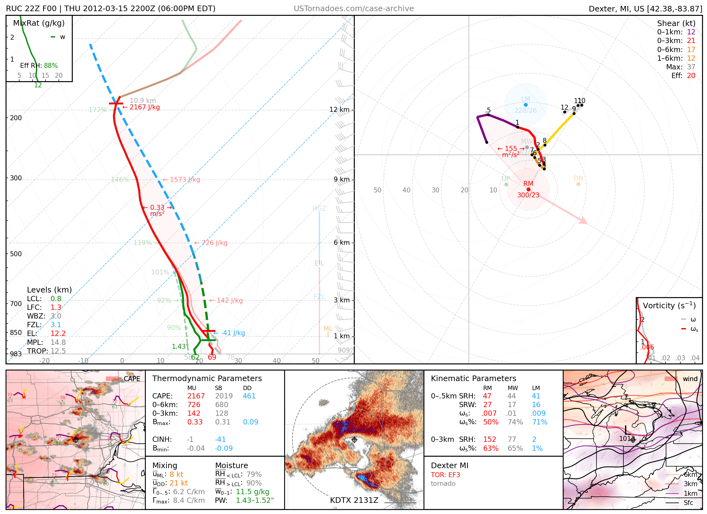
March 15, 2012: Dexter, Michigan
EF3 tornado that was largely unanticipated.
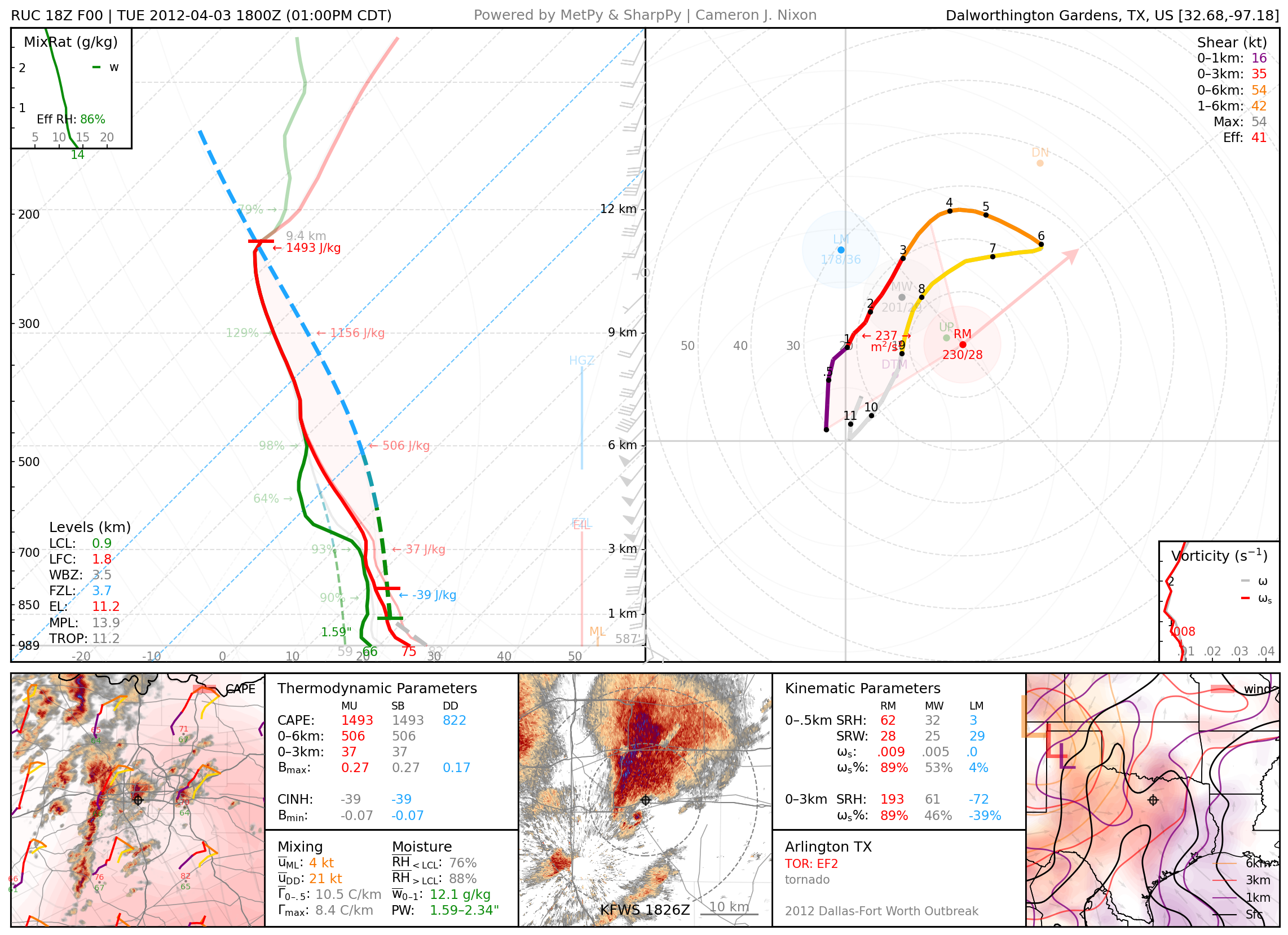
April 3, 2012: Arlington, Texas
EF2 tornado, part of a local tornado outbreak around the DFW metro.
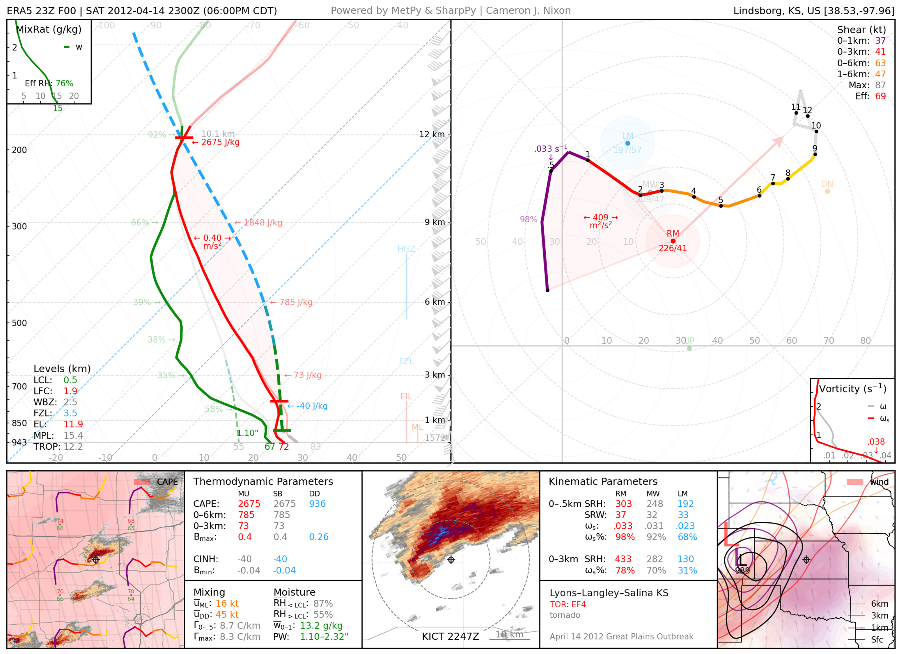
April 14, 2012: Lyons / Salina, Kansas
Long-tracked and particularly photogenic EF4 tornado. Part of an outbreak of tornadoes across the central Plains.
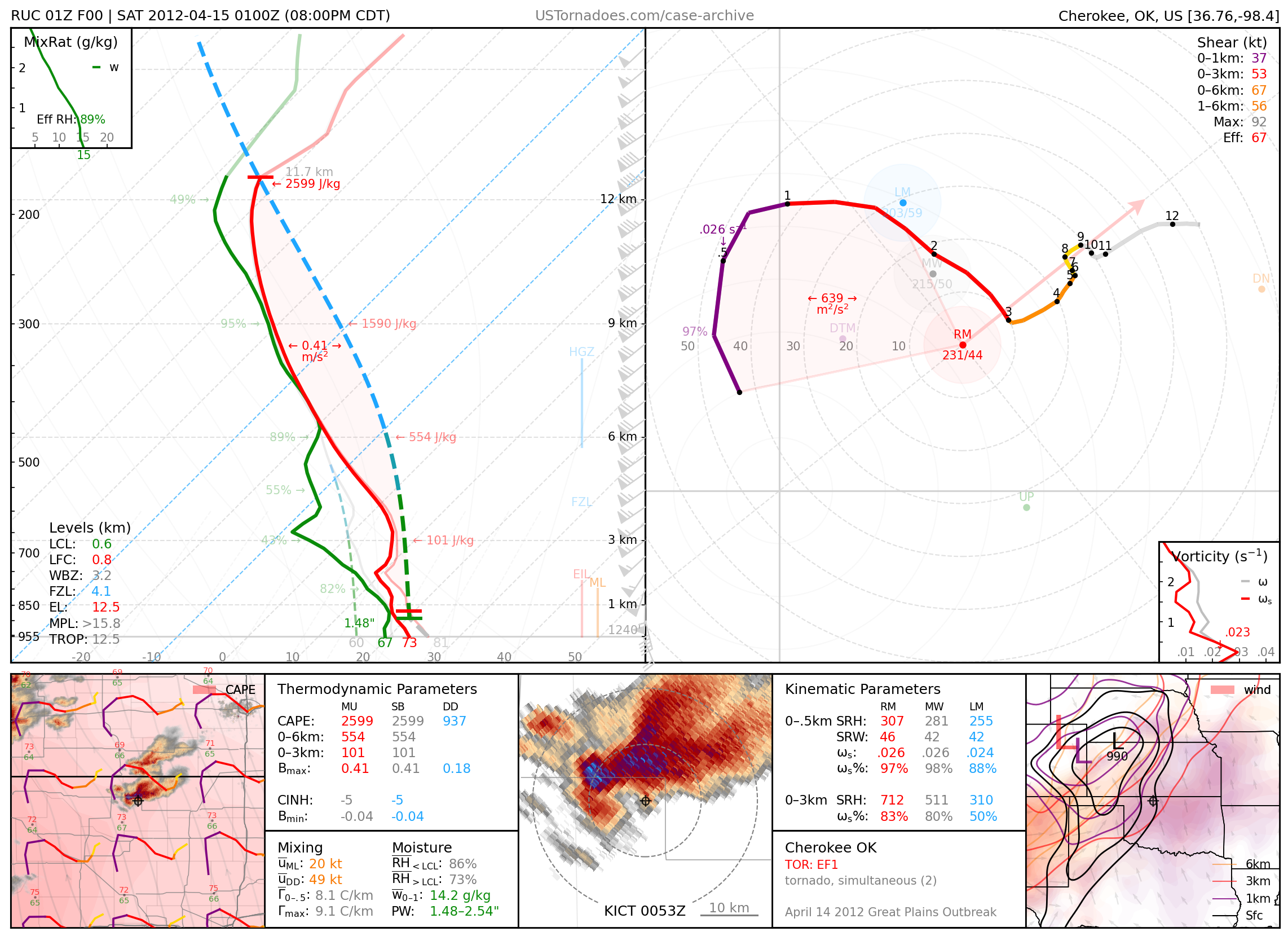
April 14, 2012: Cherokee, Oklahoma
Particularly cyclic supercell that produced over 20 tornadoes up to EF3 in strength, including two at once at times. Part of an outbreak of tornadoes across the central Plains.
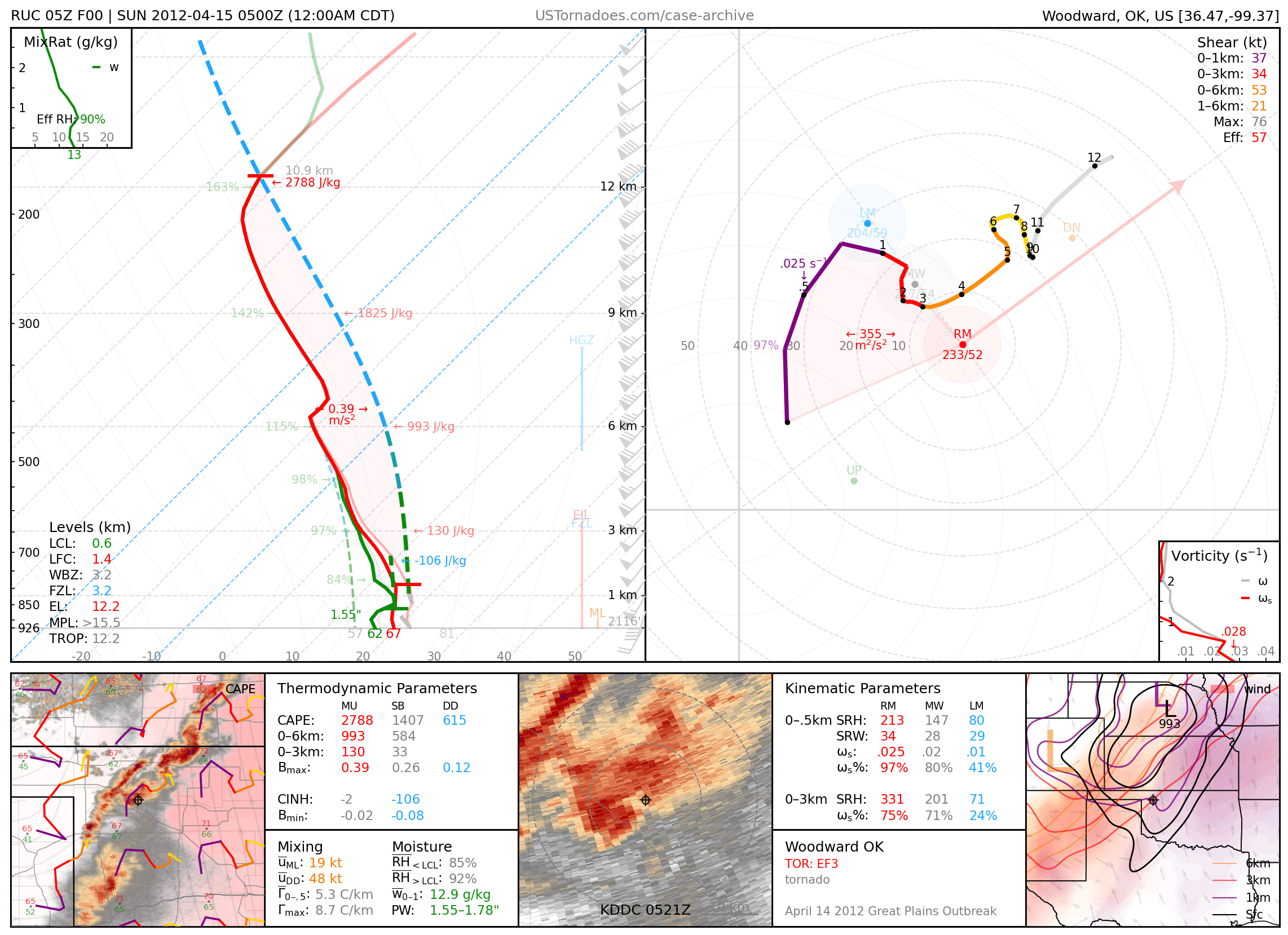
April 14, 2012: Woodward, Oklahoma
EF3 tornado that killed 6 people. Part of an outbreak of tornadoes across the central Plains.
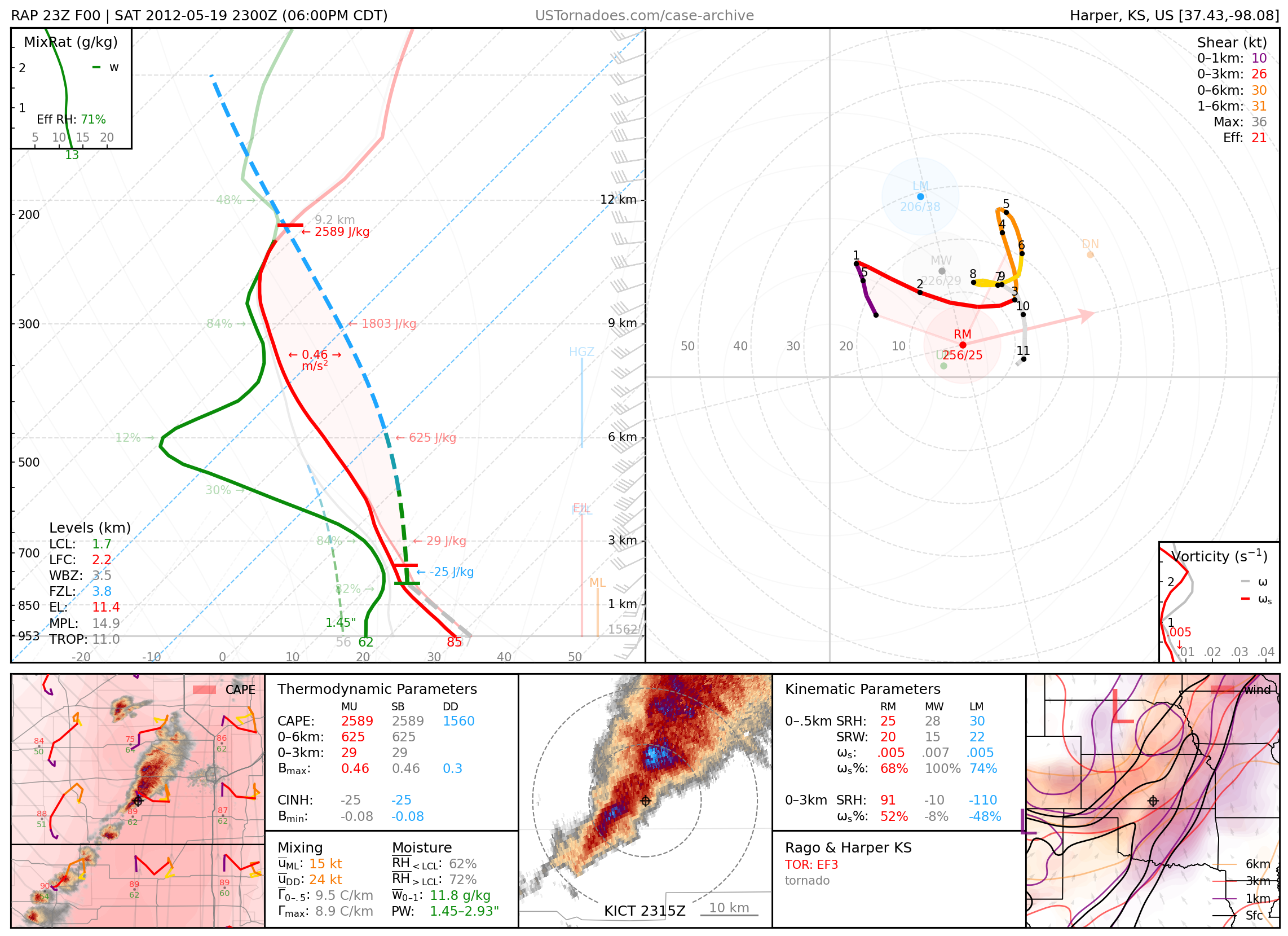
May 19, 2012: Kingman / Harper Counties, Kansas
Several particularly photogenic landspout tornadoes up to EF3.
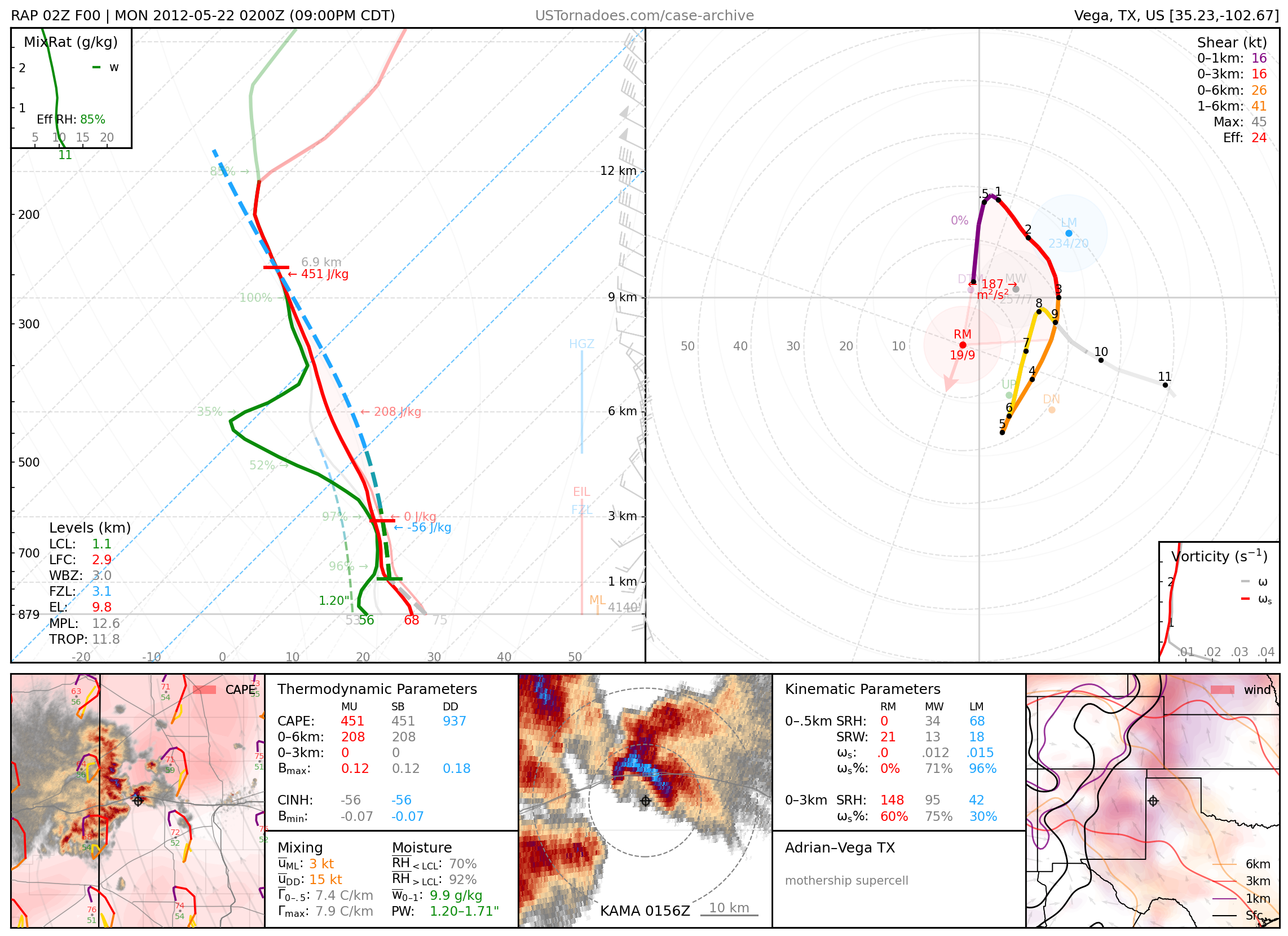
May 21, 2012: Vega, Texas
Particularly photogenic “UFO-like” supercell.
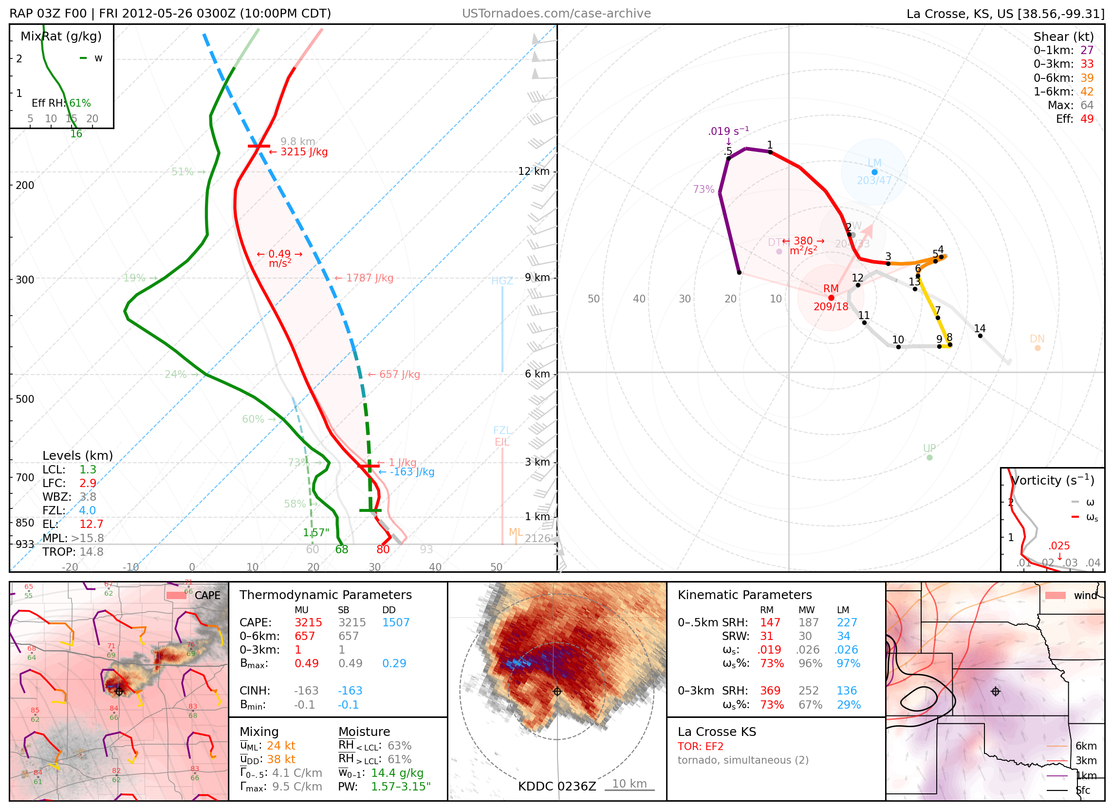
May 25, 2012: La Crosse, Kansas
Particularly cyclic supercell that produced several tornadoes, up to EF2, in rapid succession.
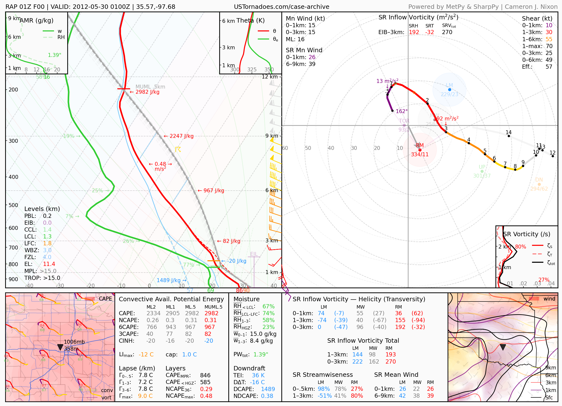
May 29, 2012: Piedmont, Oklahoma
Supercell that produced hail as large as 5 inches.
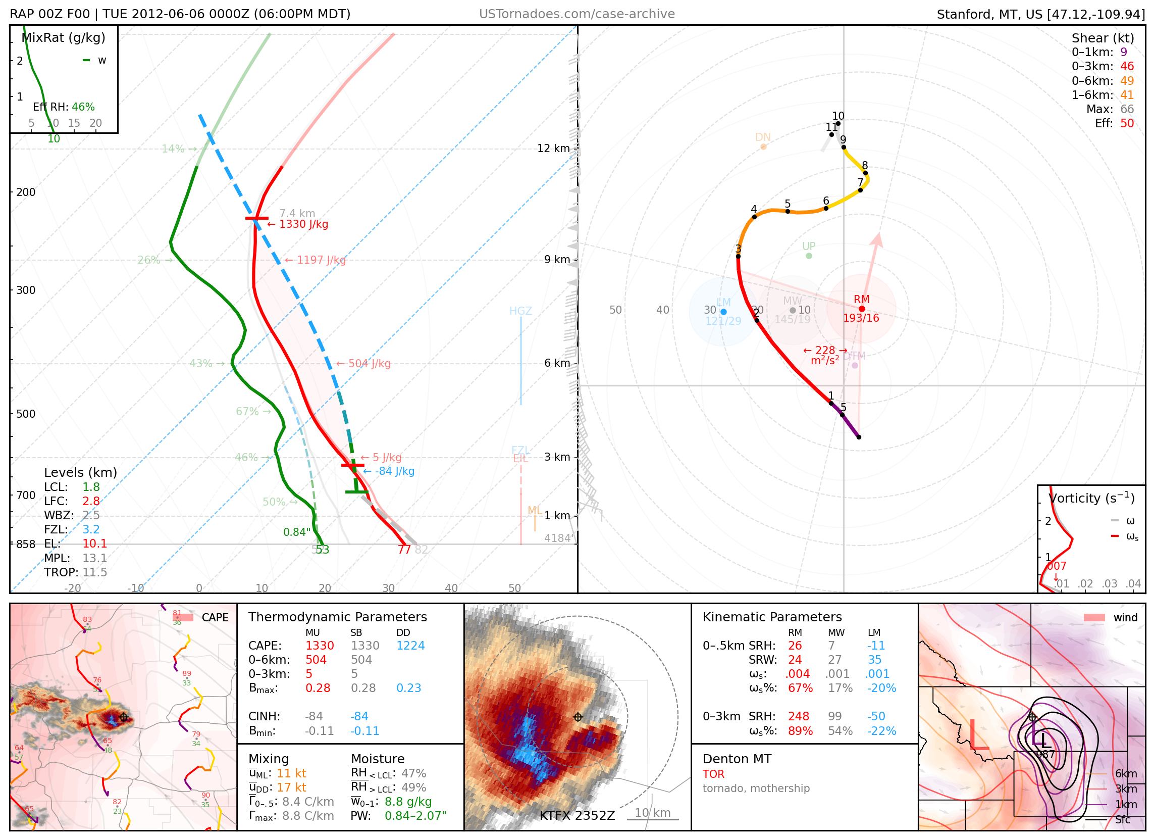
June 6, 2012: Denton, Montana
Particularly photogenic supercell and tornado.
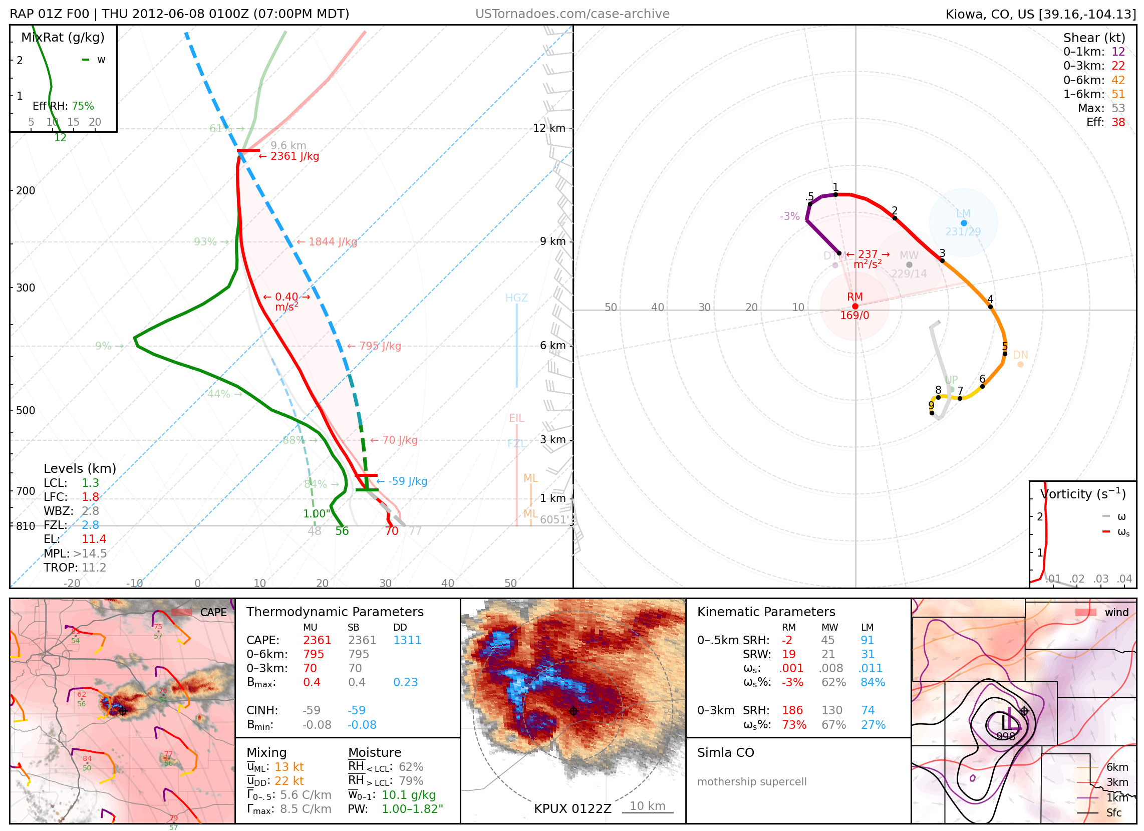
June 7, 2012: Simla, Colorado
Massive, high-precipitation supercell.
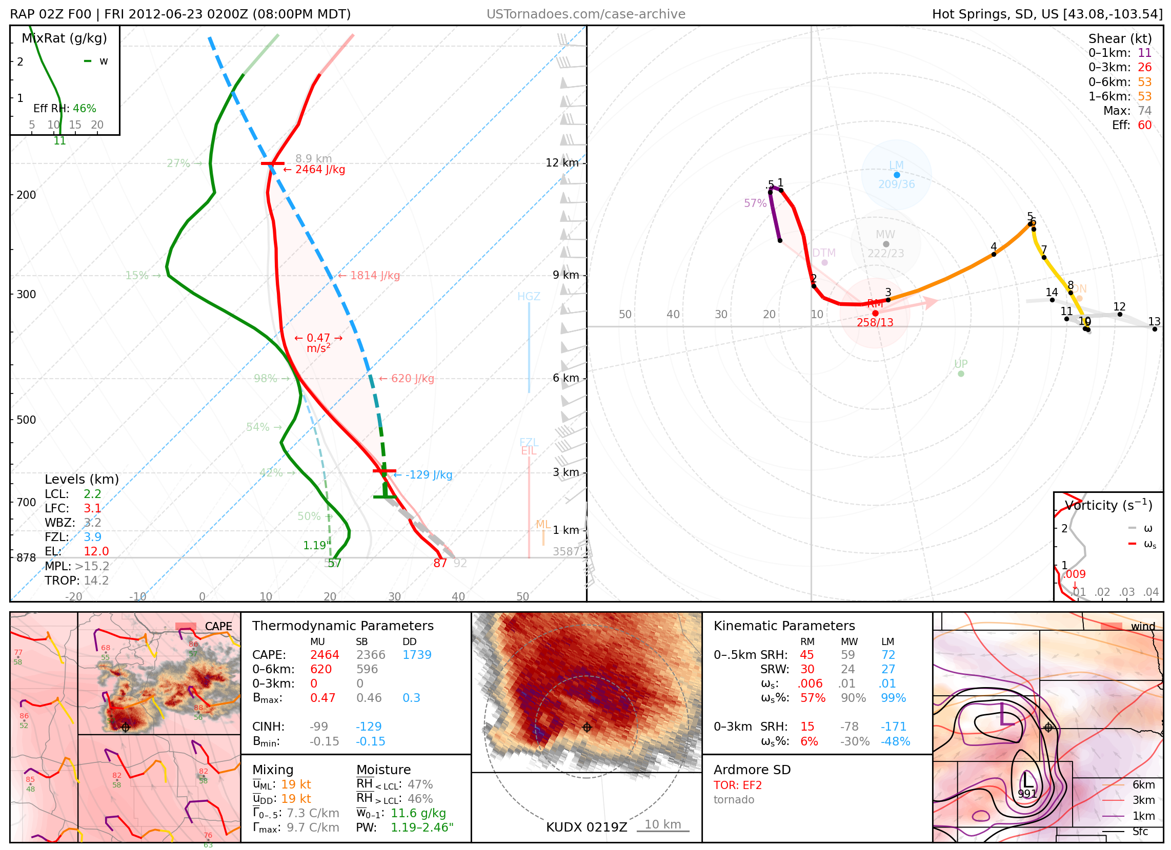
June 22, 2012: Ardmore, South Dakota
Particularly photogenic EF2 tornado.
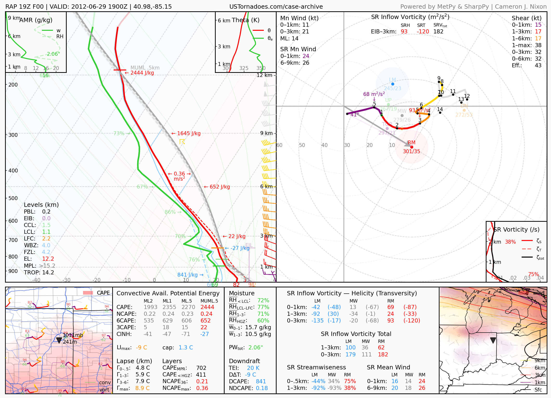
June 29, 2012: Fort Wayne, Indiana
Infamous U.S. derecho that travelled 800 miles over 18 hours, killing 22 people and resulting in an estimated $2.9 billion in damage.
2013
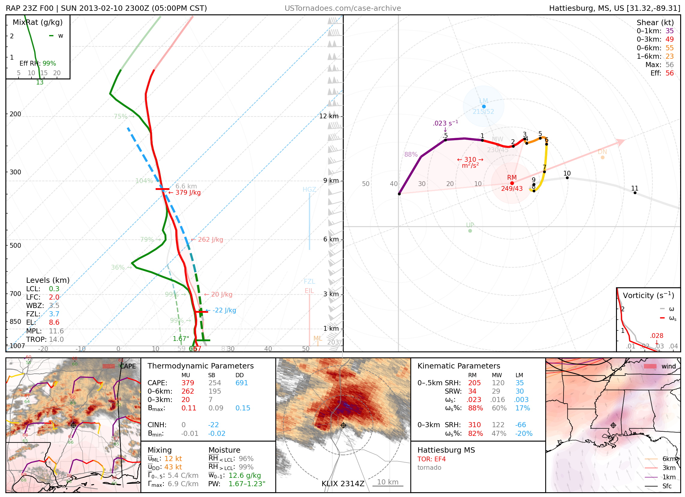
February 10, 2013: Hattiesburg, Mississippi
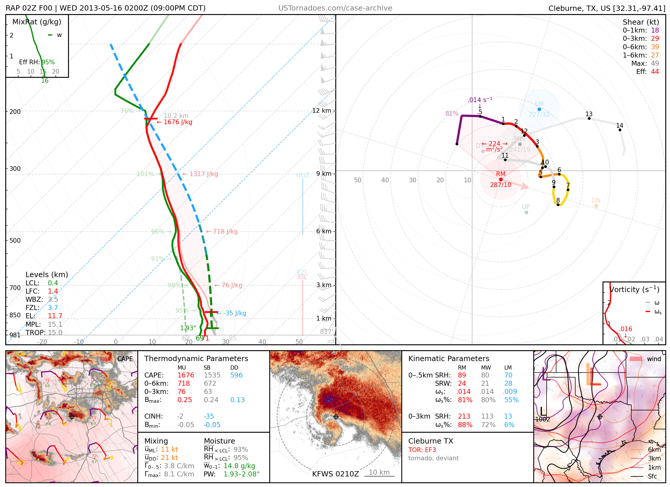
May 15, 2013: Cleburne, Texas
EF3 tornado that took a highly deviant left turn, part of a local outbreak of tornadoes across north Texas.
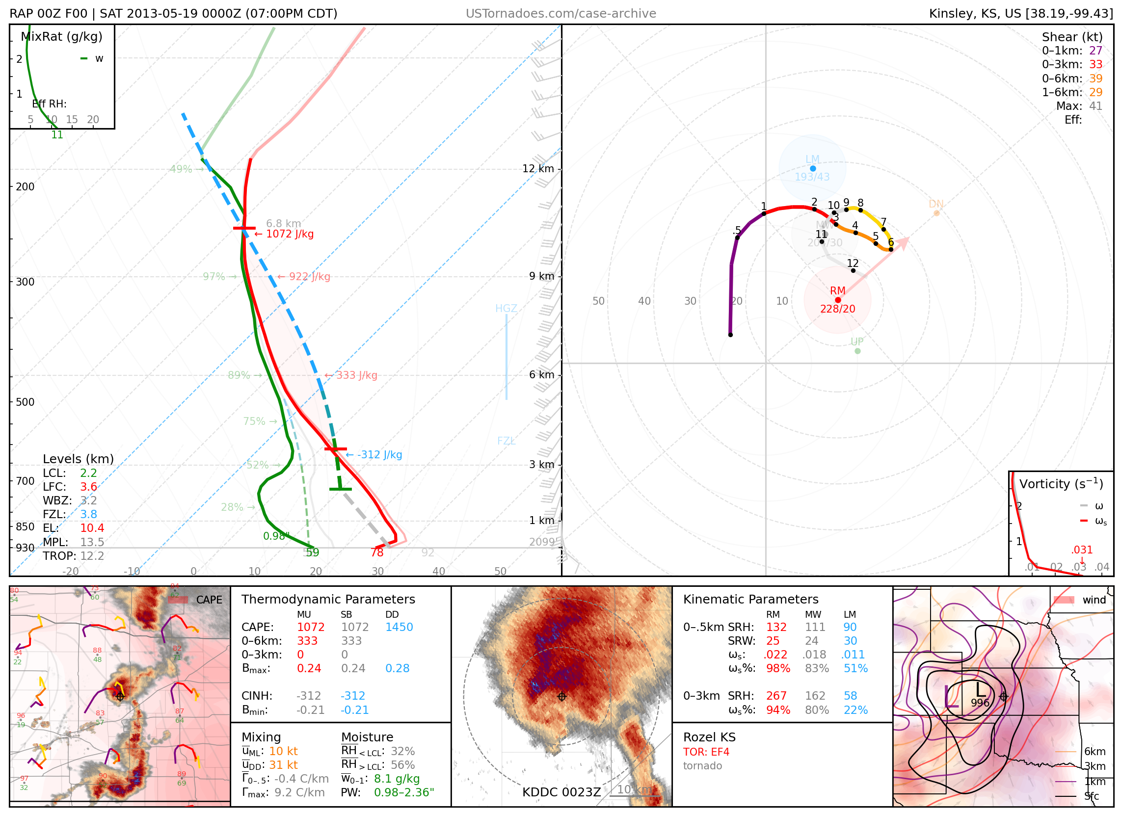
May 18, 2013: Rozel, Kansas
Particularly photogenic EF4 tornado.
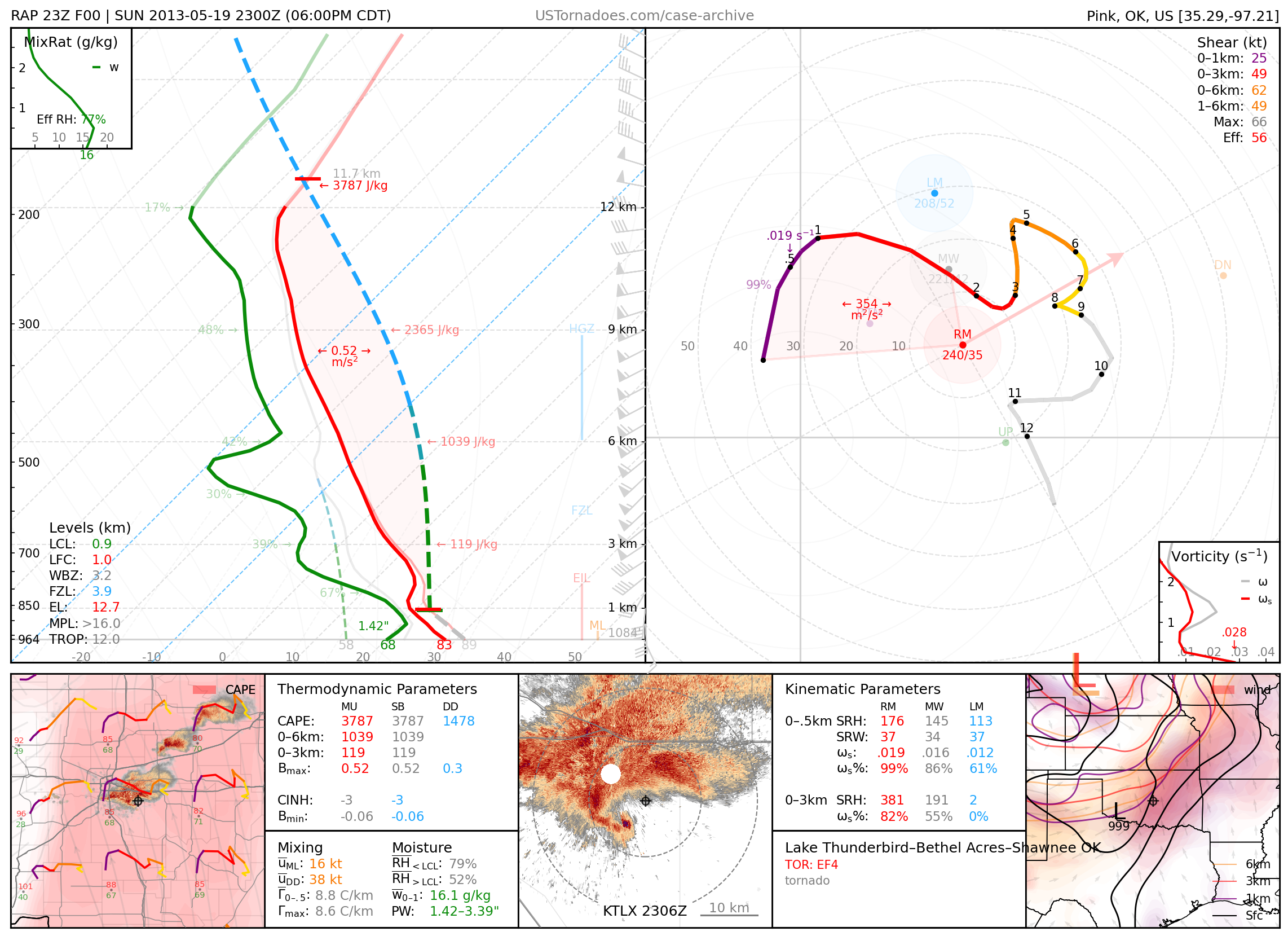
May 19, 2013: Lake Thunderbird / Shawnee, Oklahoma
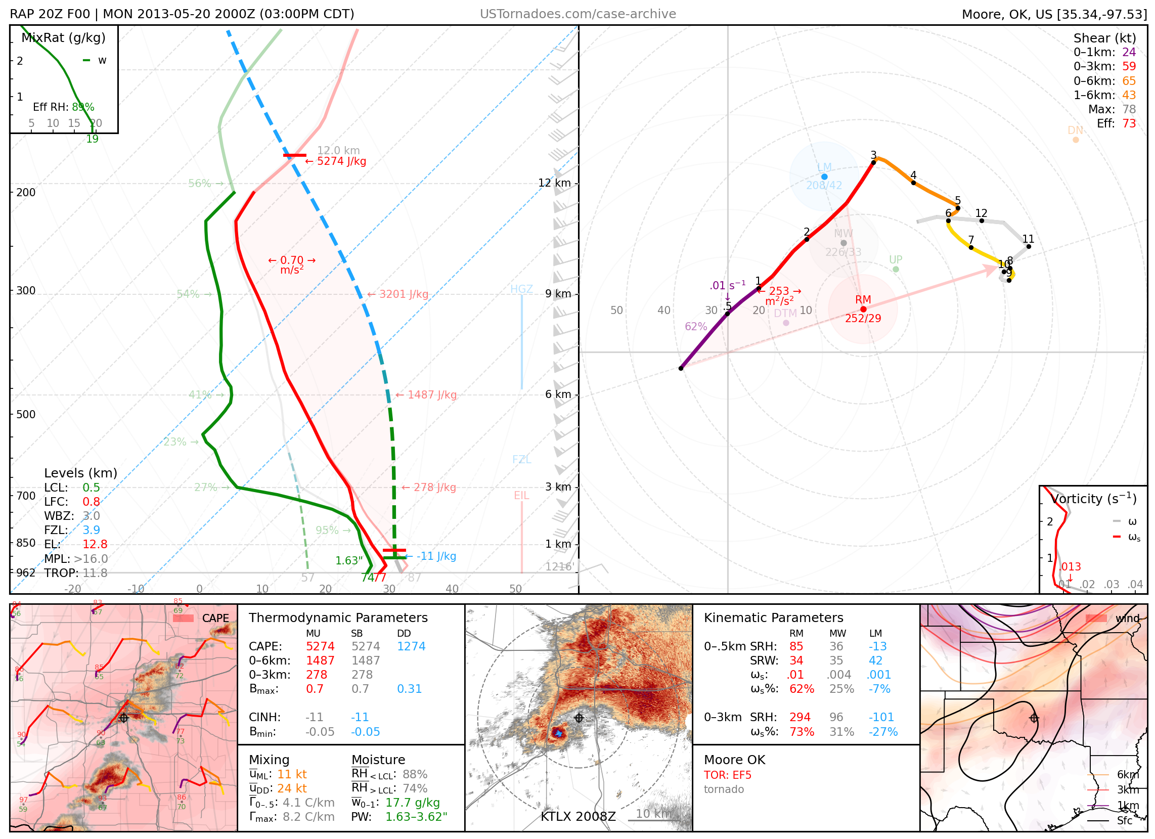
May 20, 2013: Moore, Oklahoma
Infamous EF5 tornado that killed 24 people.
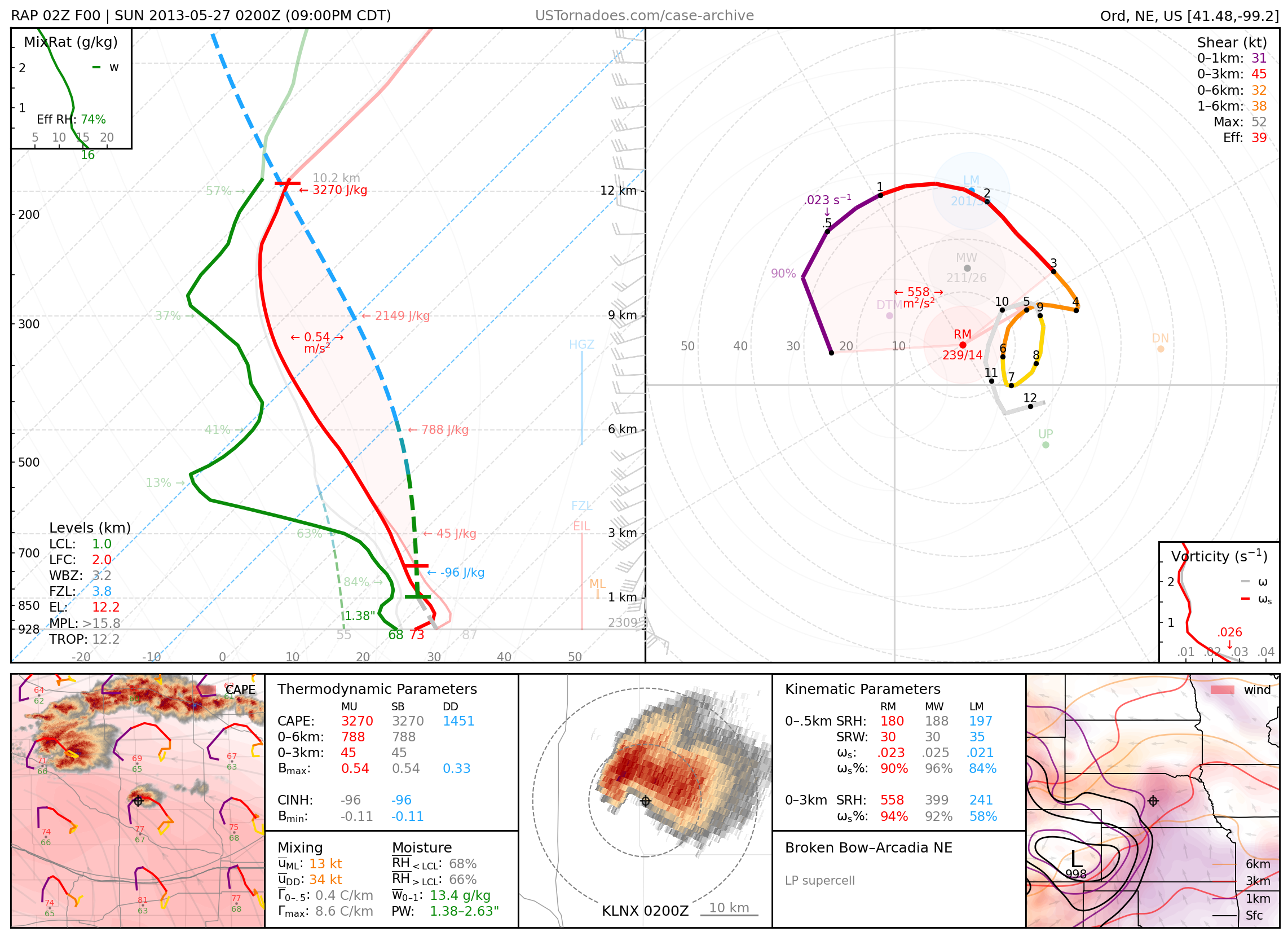
May 26, 2013: Arcadia / Ansley, Nebraska
Particularly photogenic low-precipitation “barberpole” supercell.
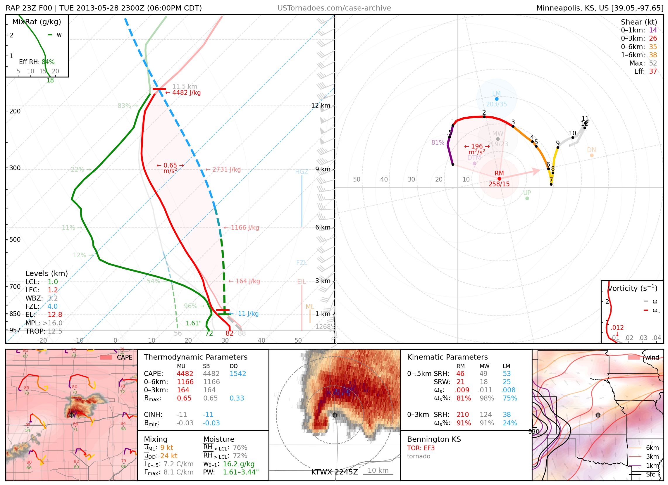
May 28, 2013: Bennington, Kansas
Slow-moving, nearly stationary at times, EF3 (but likely stronger) wedge tornado regarded with particular fondness by many storm chasers, due to its lasting over an hour with no physical harm done to civilization; also known as Bennington I.
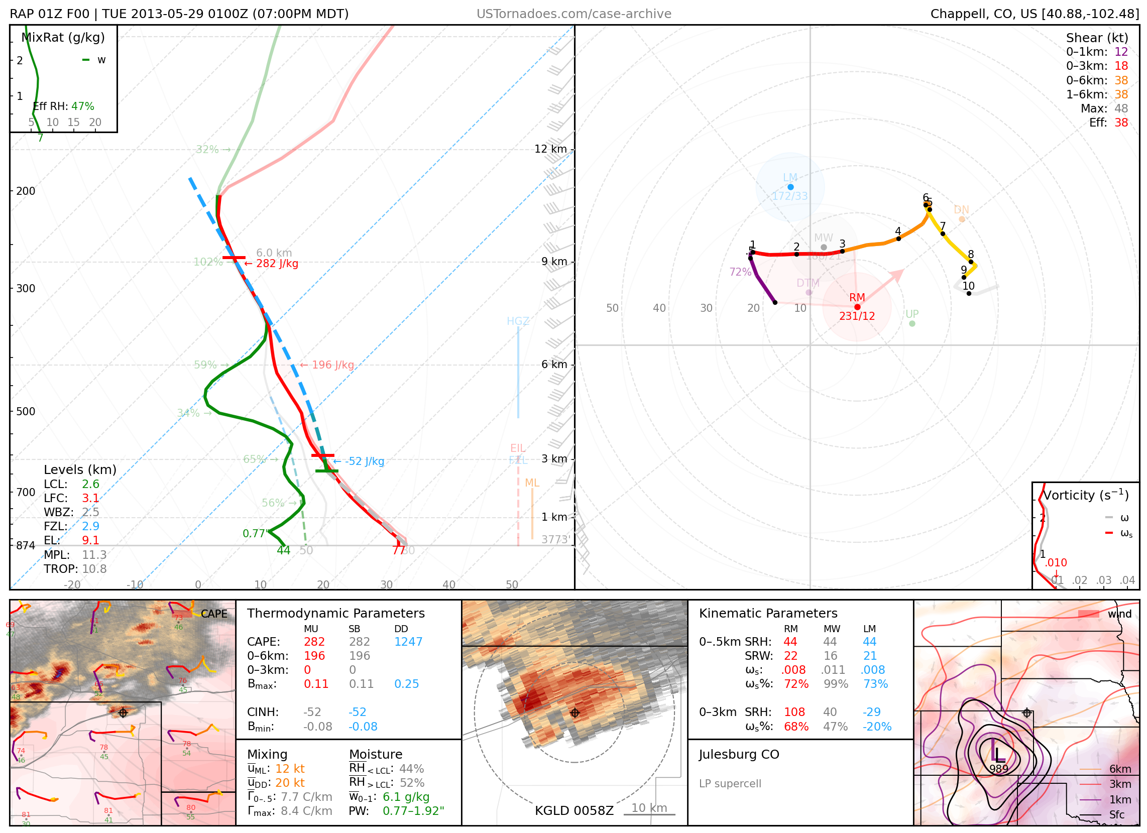
May 28, 2013: Julesburg, Colorado
Particularly photogenic “mothership” supercell, regarded as a “consolation prize” for storm chasers who missed the Bennington, KS tornado.
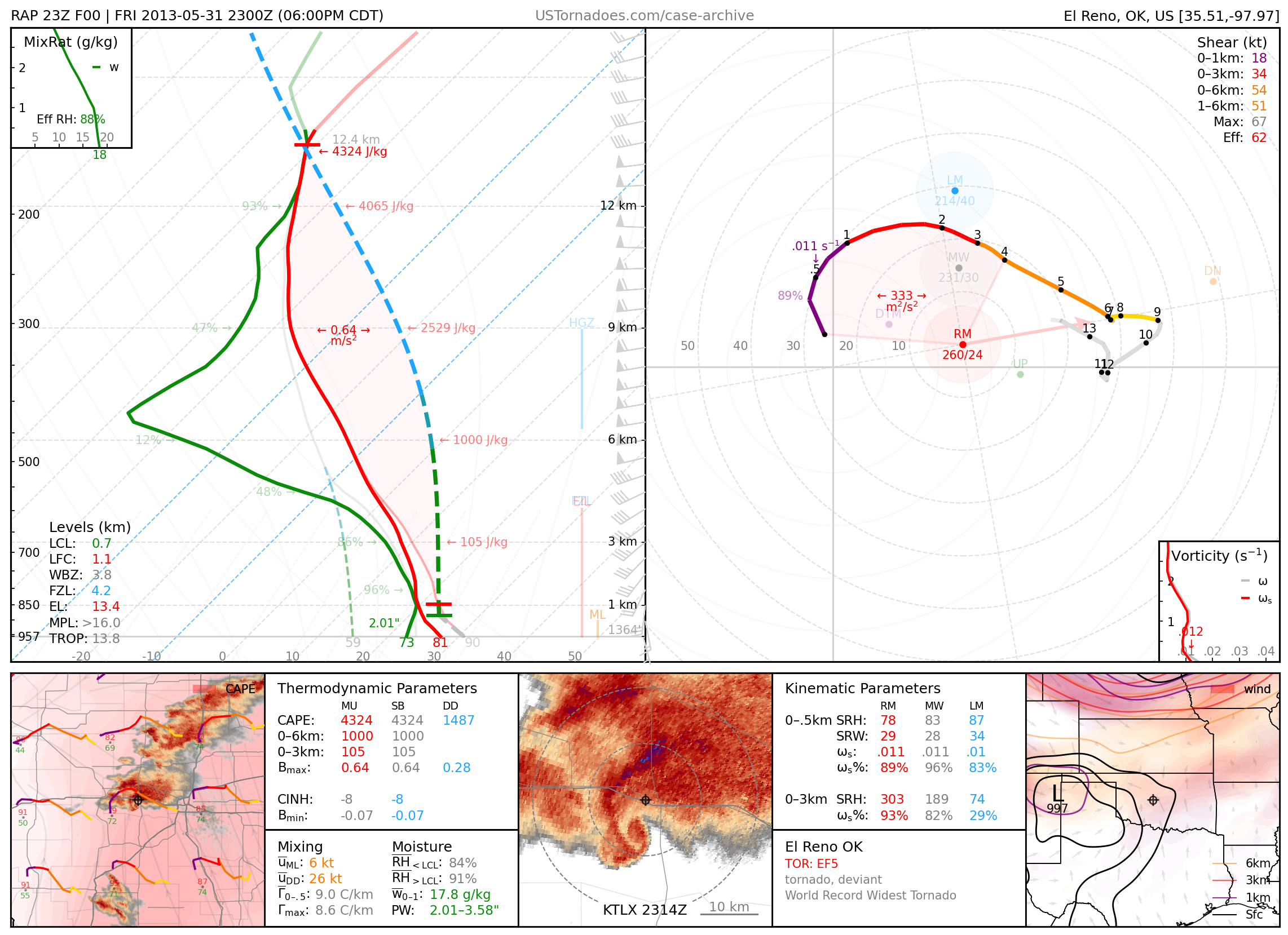
May 31, 2013: El Reno, Oklahoma
Widest and strongest recorded tornado on Earth, at 2.6 miles wide and 302 mph winds measured by mobile radar, that exhibited particularly erratic motion and killed 8 people, including storm chasers and 3 members of the TWISTEX research team. Its official EF3 rating is widely held as highly controversial.
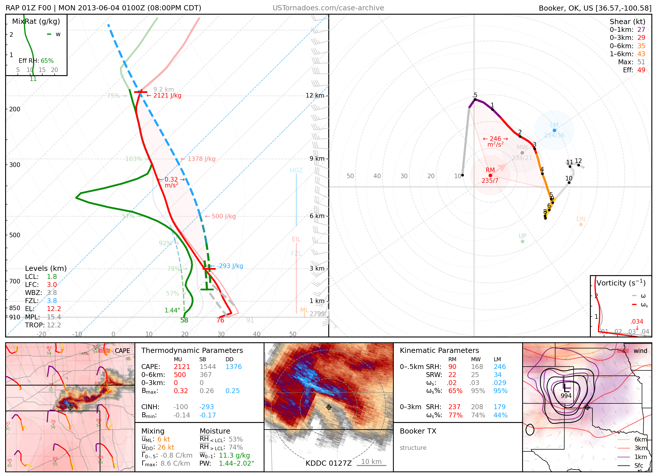
June 3, 2013: Booker, Texas
Particularly photogenic supercell.
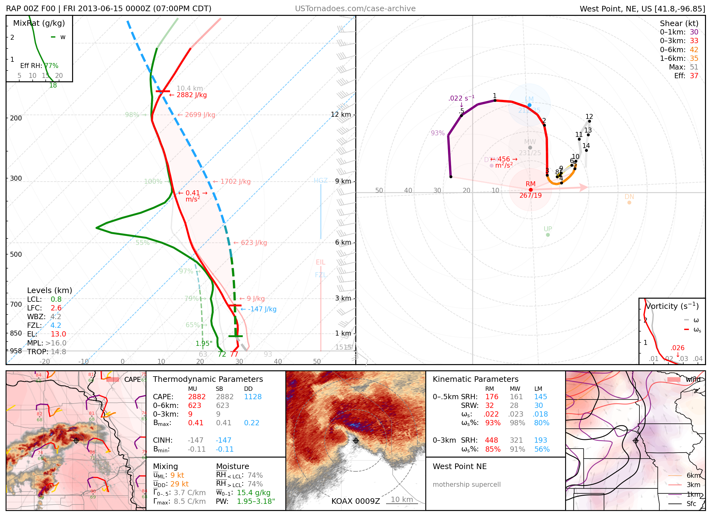
June 14, 2013: West Point, Nebraska
Particularly photogenic “mothership” supercell.
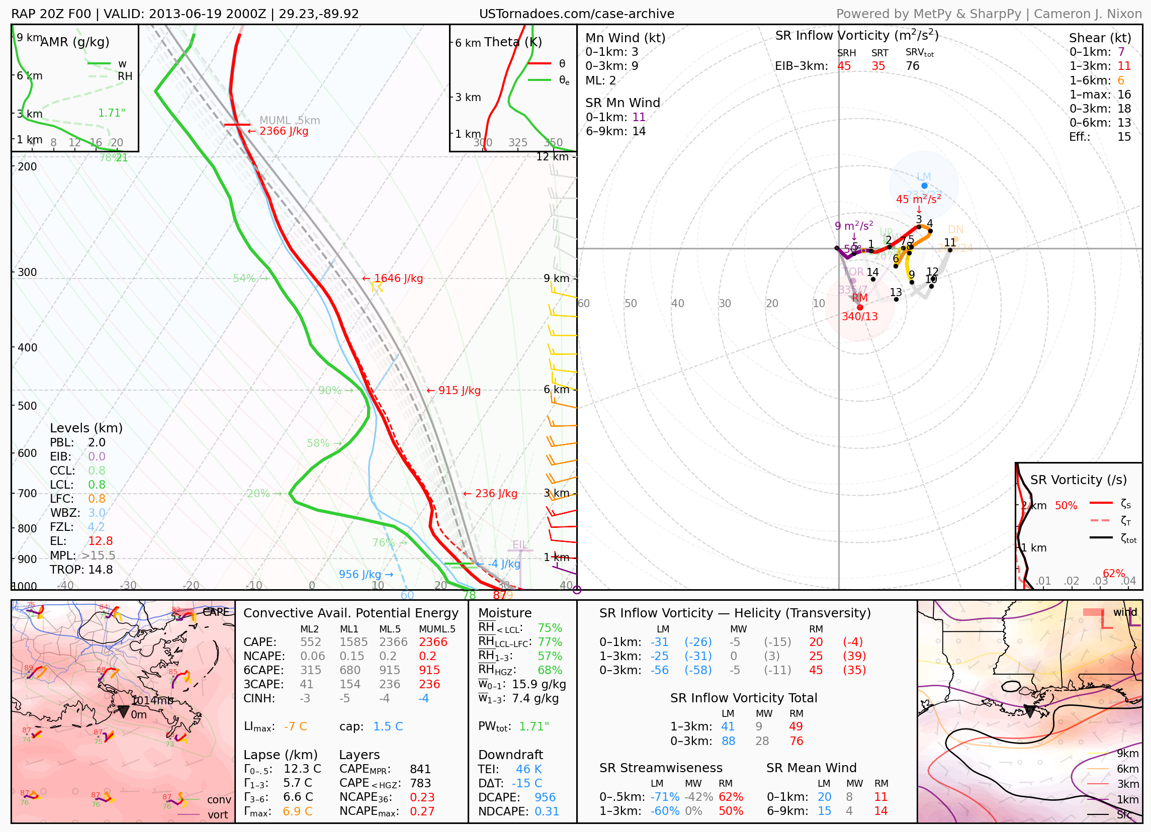
June 19, 2013: Grand Isle, Louisiana
Particularly photogenic waterspout.
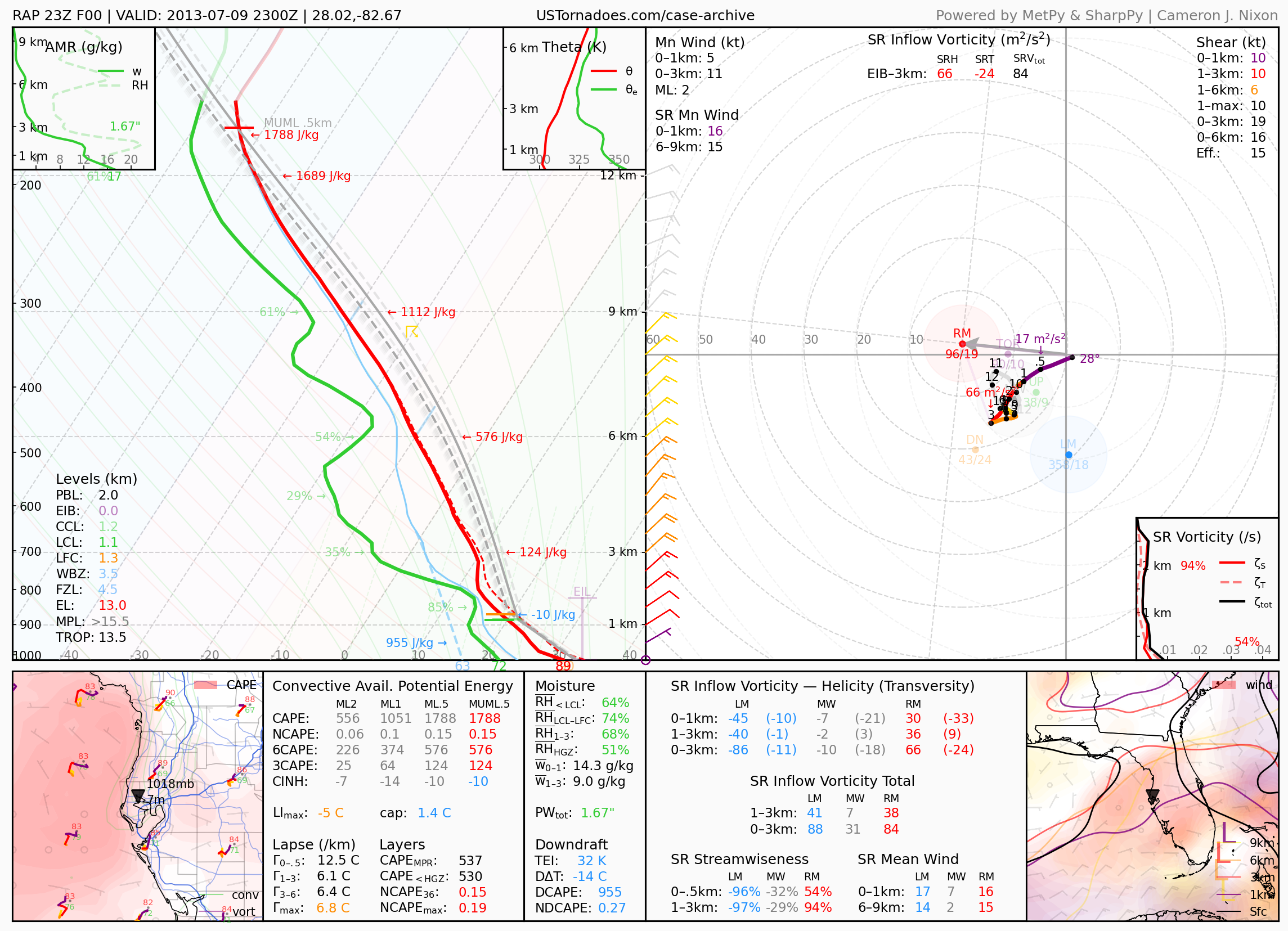
July 9, 2013: Tampa Bay, Florida
Particularly photogenic waterspout.
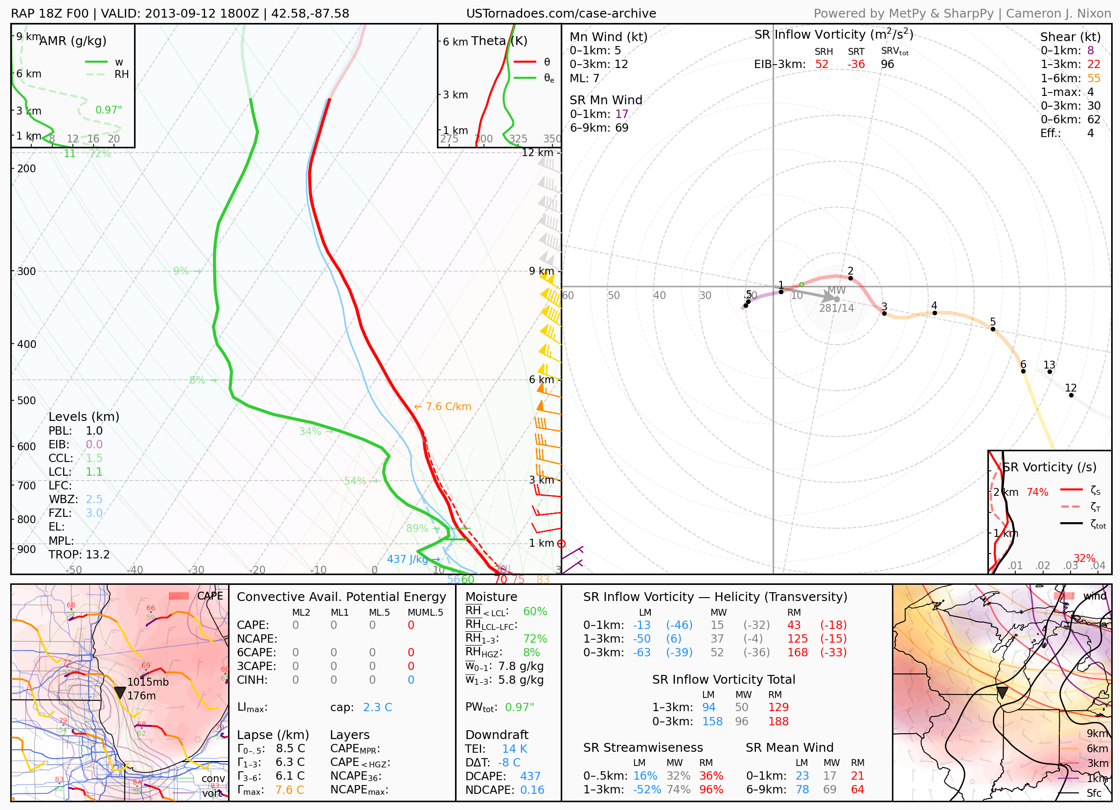
September 12, 2013: Kenosha, Wisconsin
Pair of photogenic tornadic waterspouts over Lake Michigan.
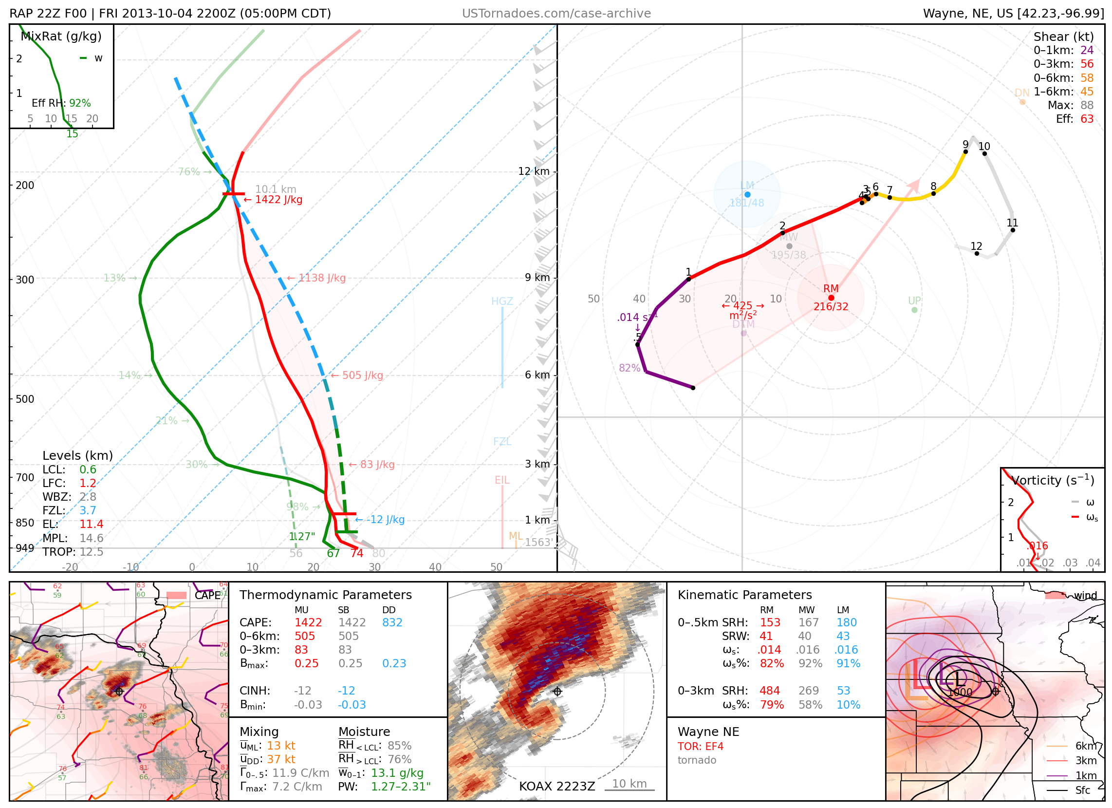
October 4, 2013: Wayne, Nebraska
Long-tracked EF4 wedge tornado.
November 17, 2013: Washington, Illinois
Long-tracked EF4 tornado that killed 3 people as part of the largest November IL tornado outbreak on record.

2014
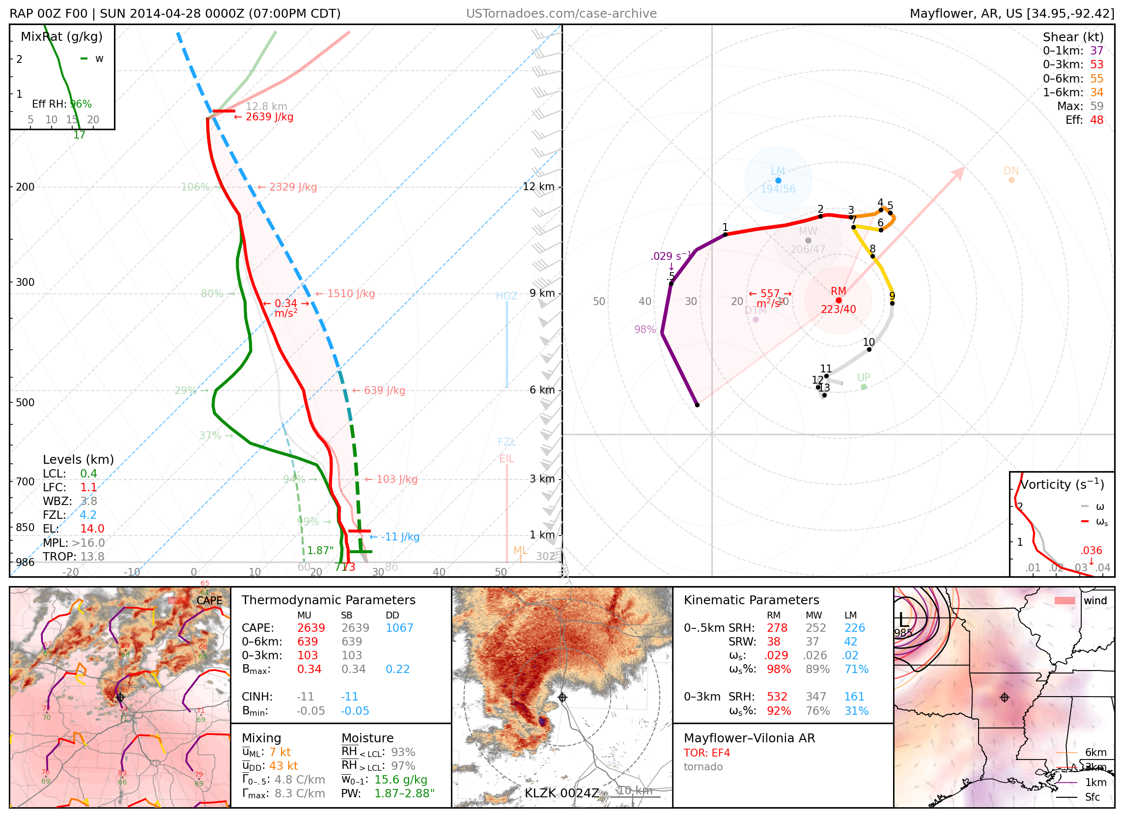
April 27, 2014: Mayflower / Vilonia, Arkansas
Long-tracked EF4 tornado that killed 16 people
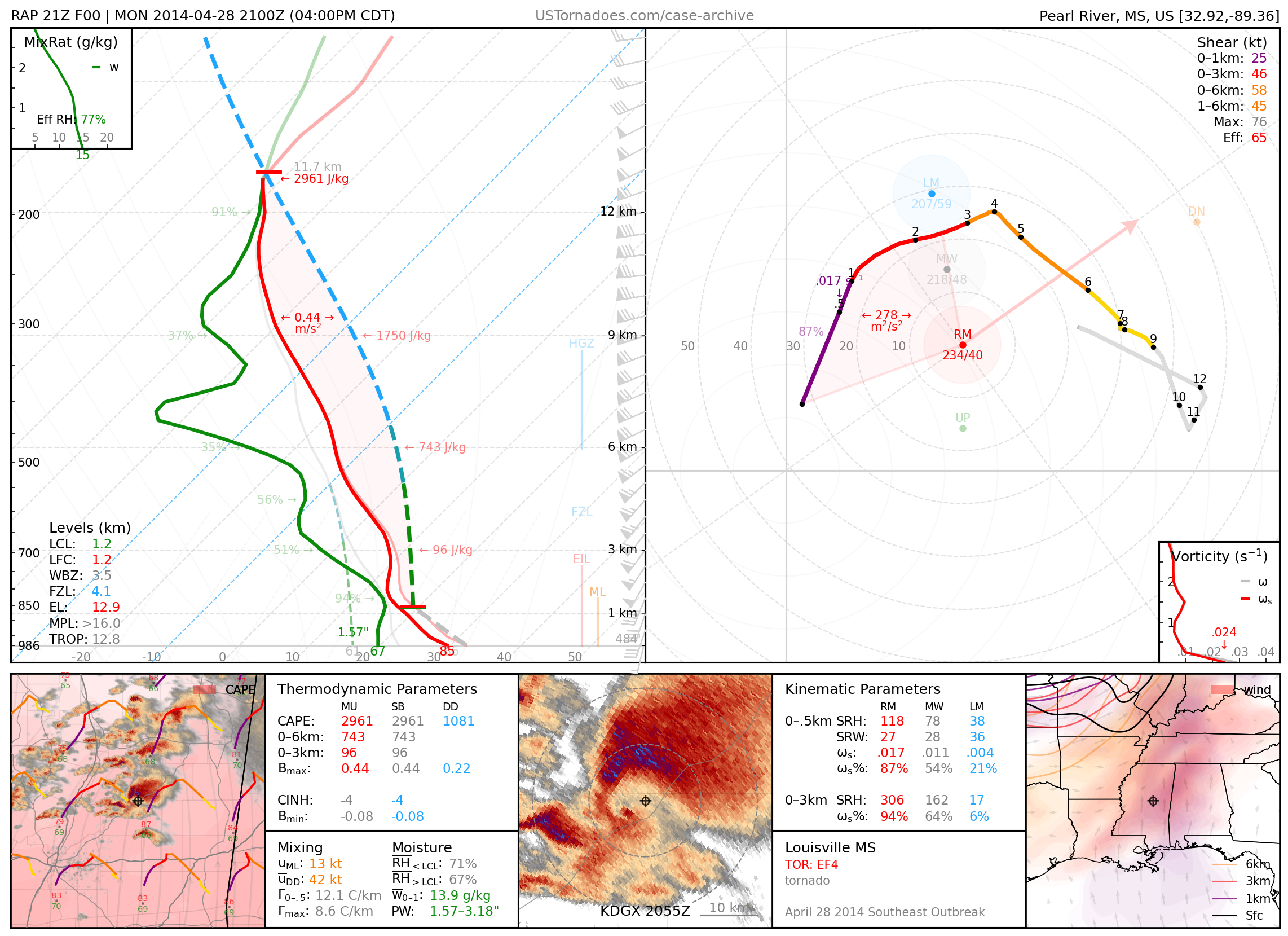
April 28, 2014: Louisville, Mississippi
Long-tracked EF4 tornado that killed 10 people.
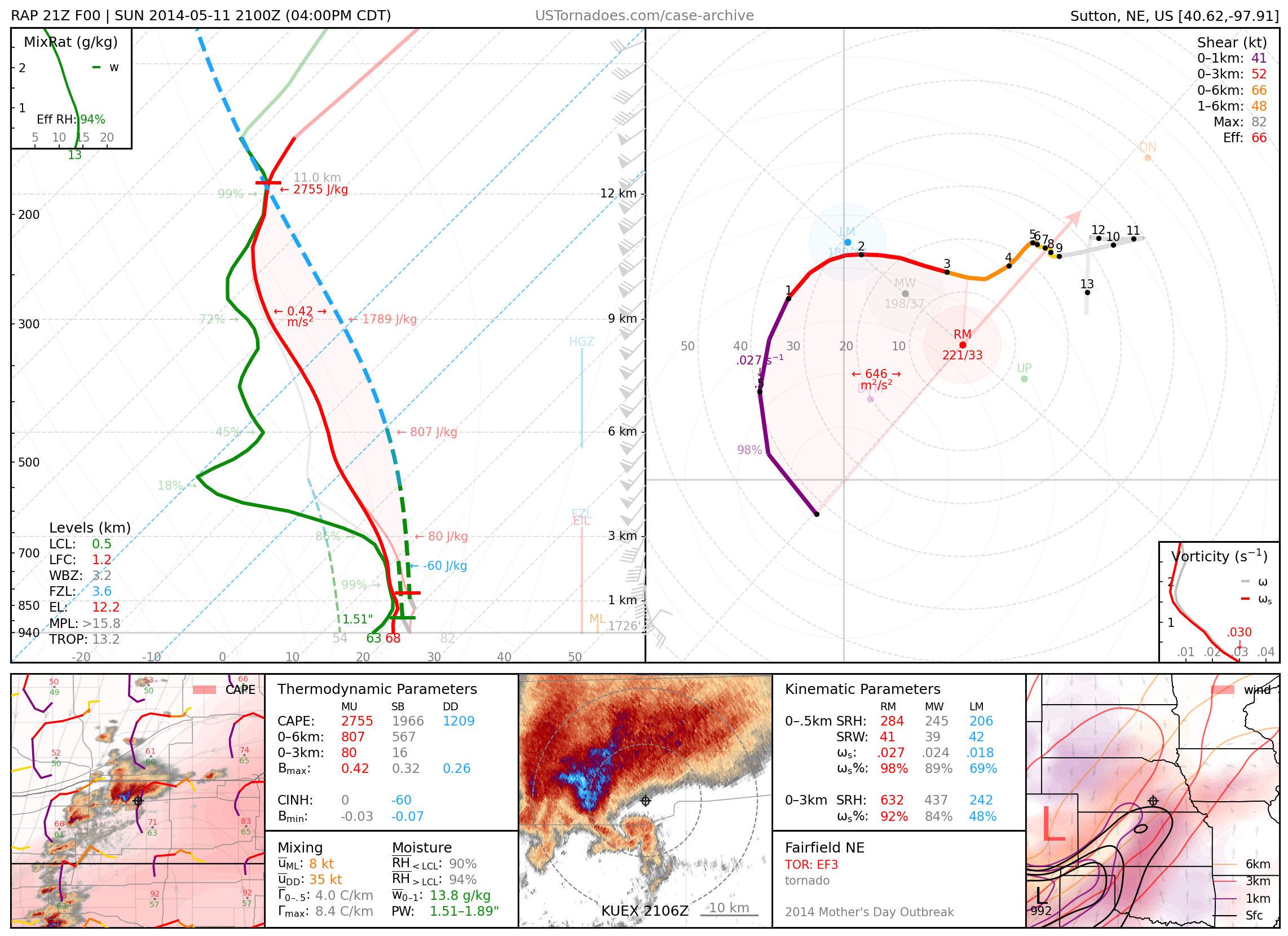
May 11, 2014: Fairfield, Nebraska
EF3 tornado from a cyclic and high-precipitation supercell that produced 8 tornadoes across southeast NE during a “Mother’s Day” tornado event.
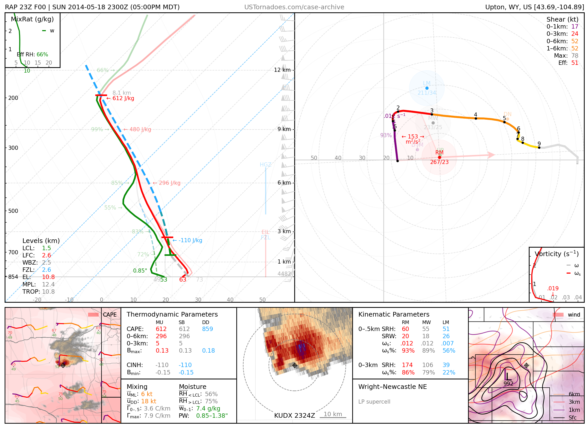
May 18, 2014: Wright / Newcastle, Wyoming
Particularly photogenic low-precipitation supercell.
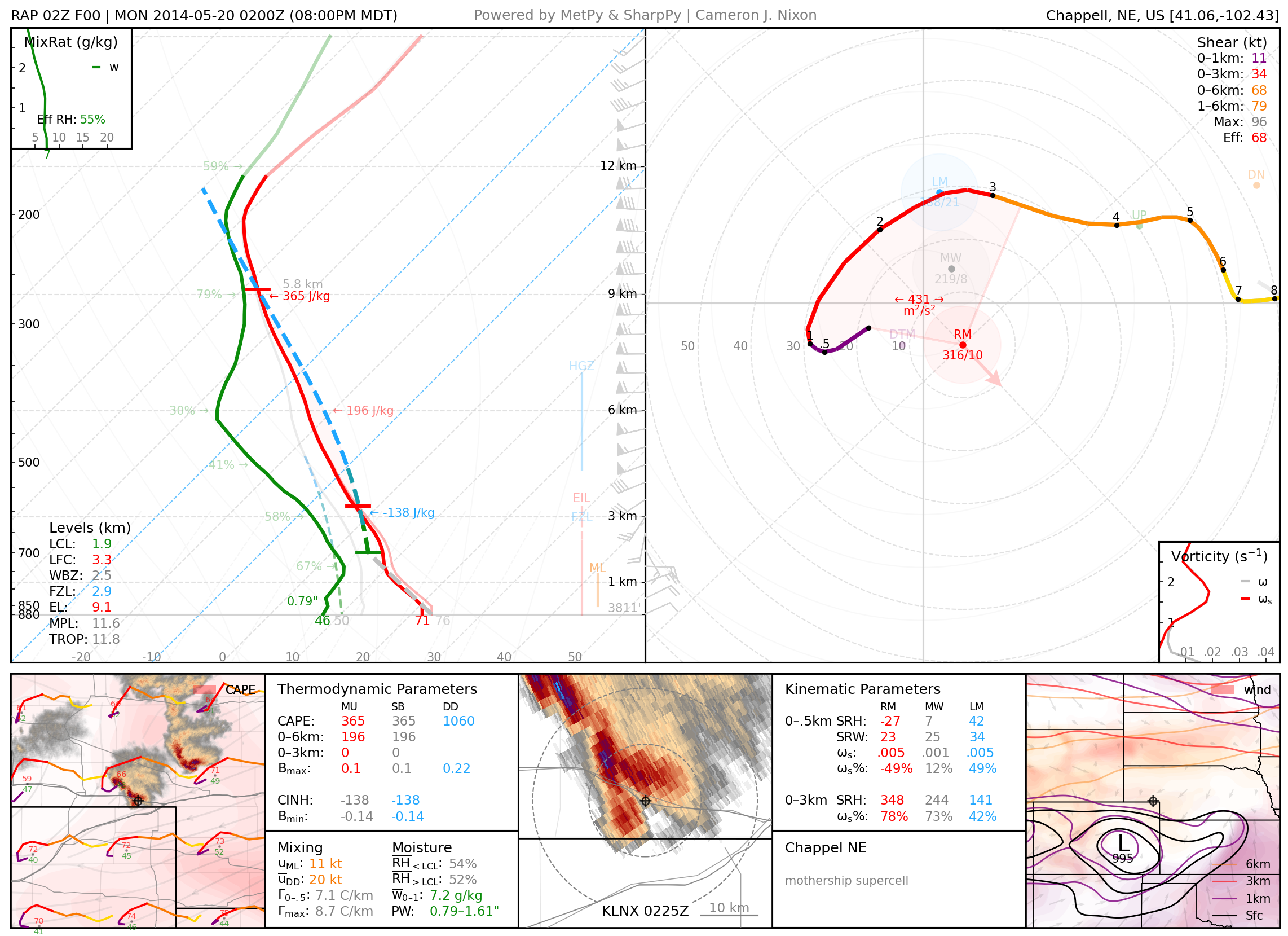
May 20, 2014: Chappel, Nebraska
Photogenic UFO-like supercell that dealt a swath of wind-driven significant-severe hail
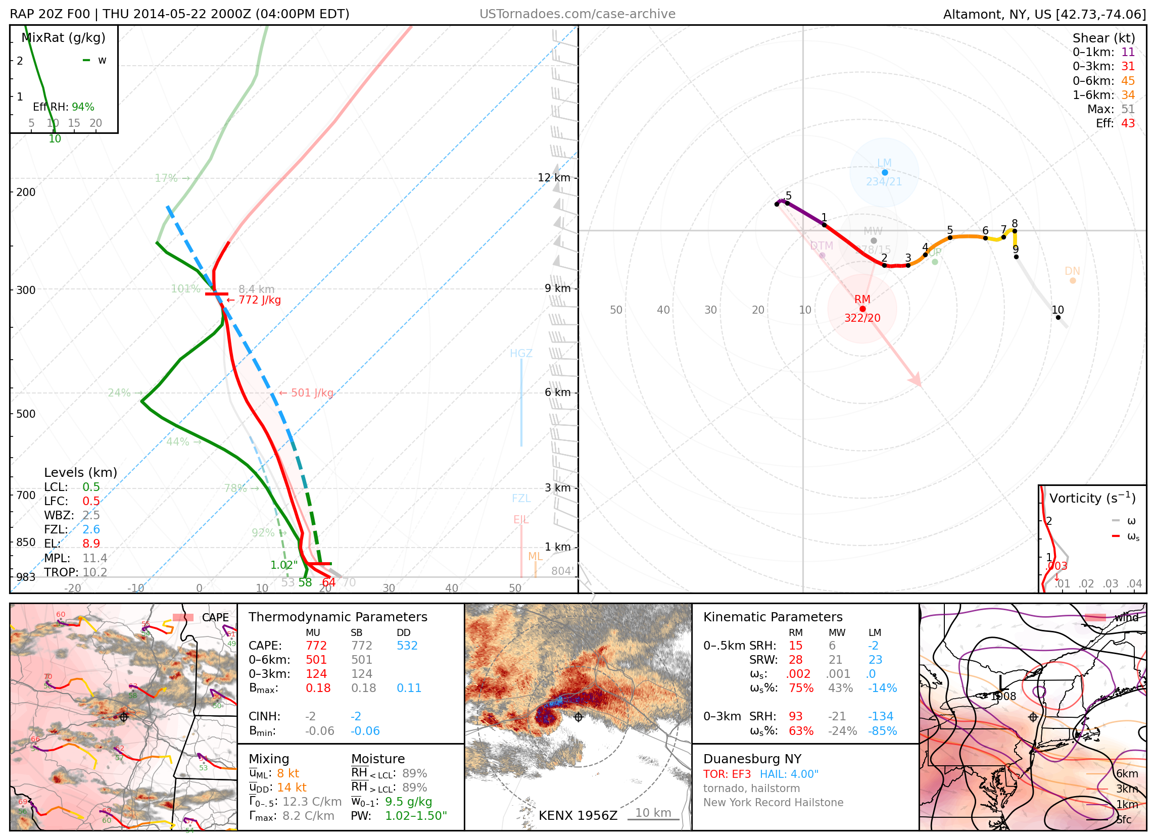
May 22, 2014: Duanesburg, New York
EF3 tornado, largely regarded as a “surprise” event.
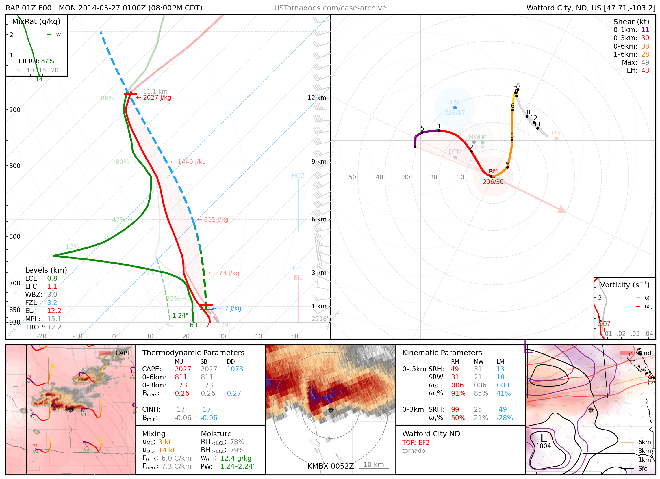
May 26, 2014: Watford City, North Dakota
Photogenic and dusty EF2 tornado that hit an oil workers’ camp.
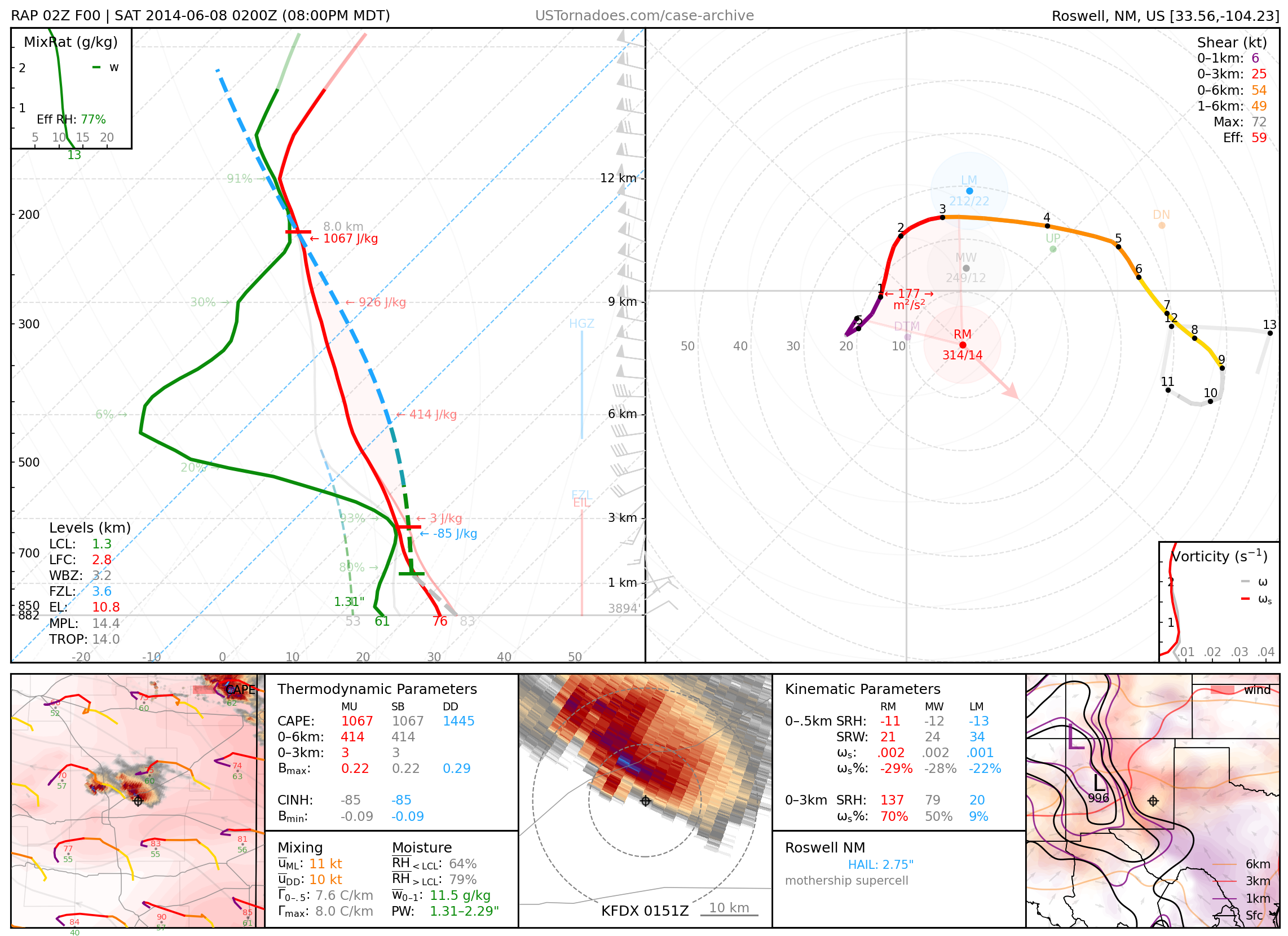
June 7, 2014: Roswell, New Mexico
Particularly photogenic “mothership” supercell.
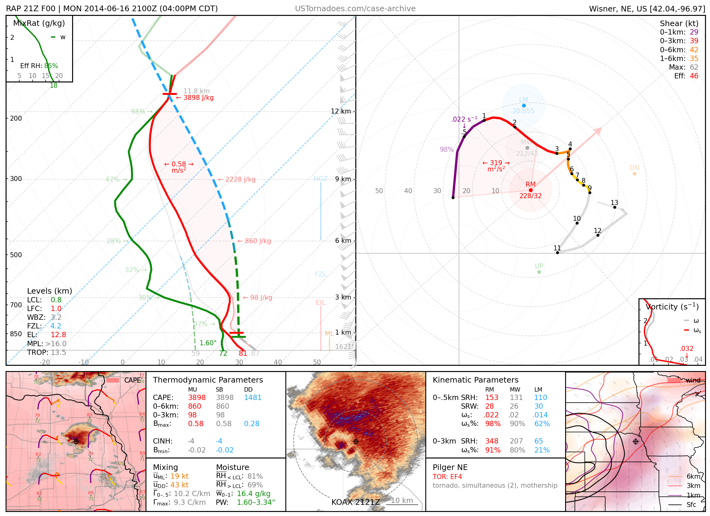
June 16, 2014: Pilger, Nebraska
Infamous “twin” EF4 tornadoes from a supercell which produced 5 tornadoes, 4 of which were rated as EF4.
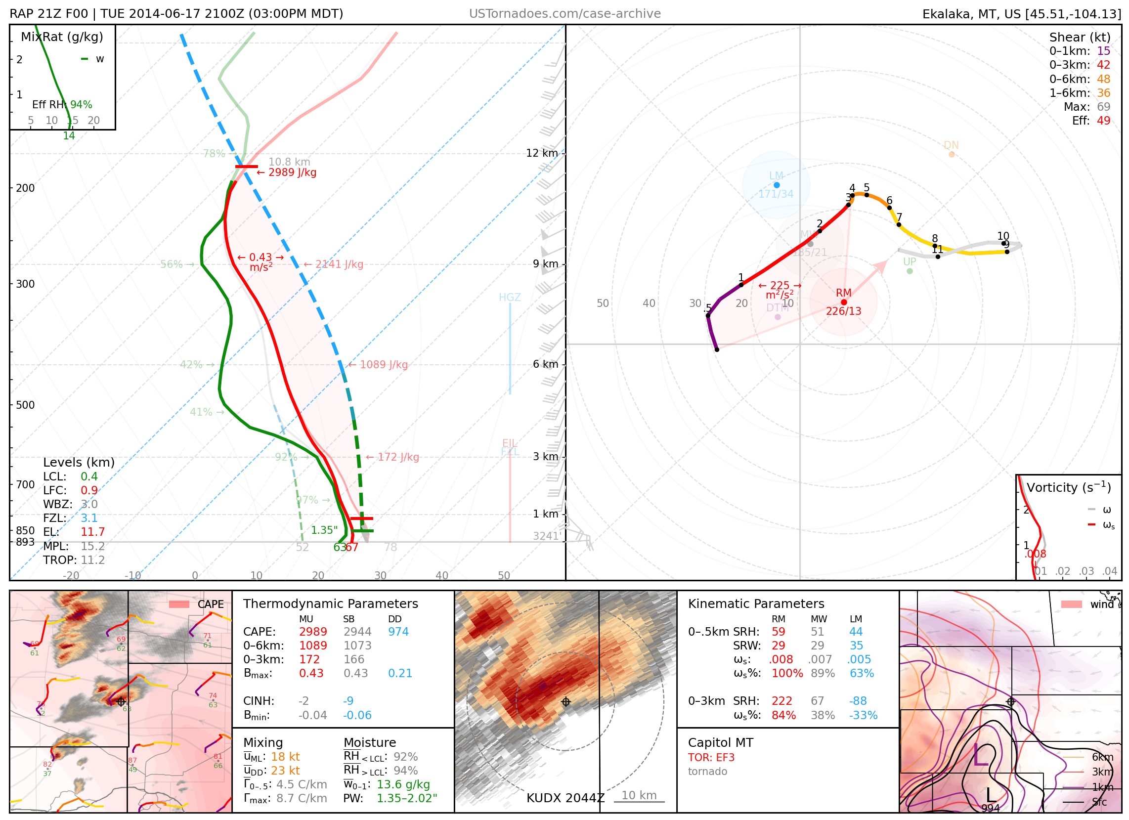
June 17, 2014: Capitol, Montana
Long-lived EF3 tornado, the strongest recorded in southeast MT.
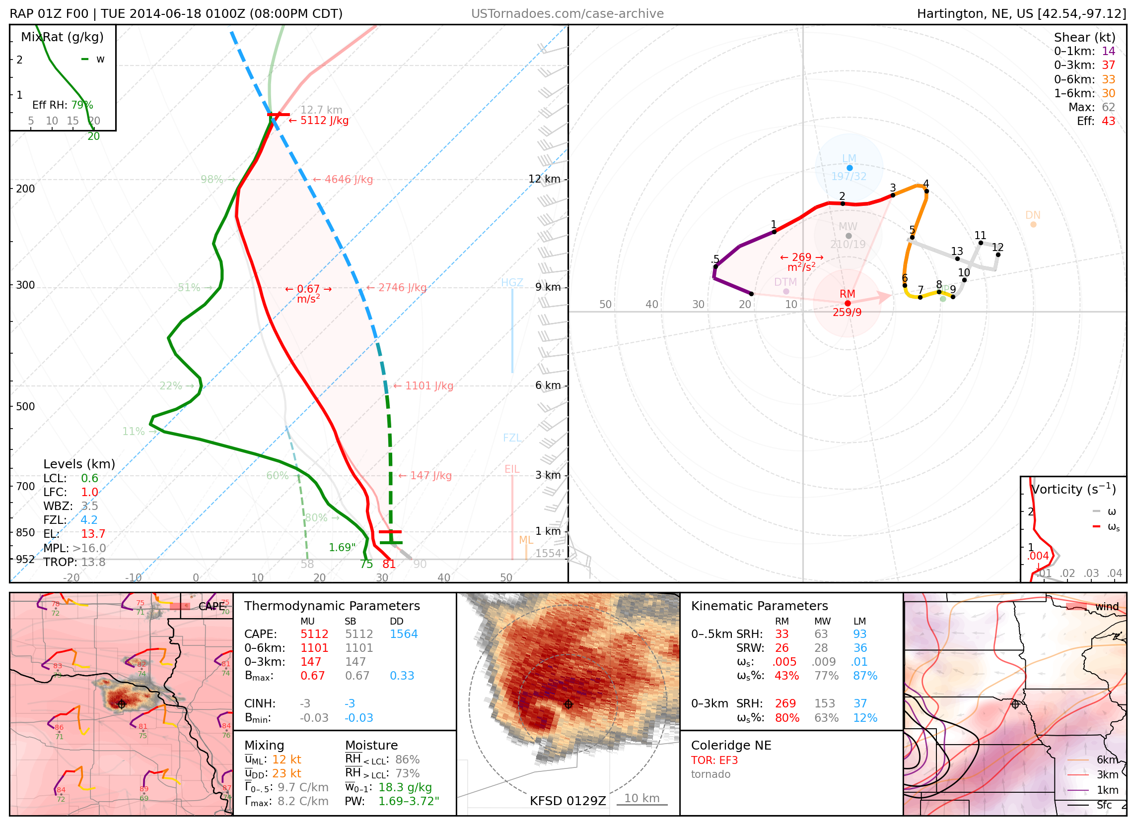
June 17, 2014: Coleridge, Nebraska
Long-lived, nearly stationary EF3 wedge tornado.
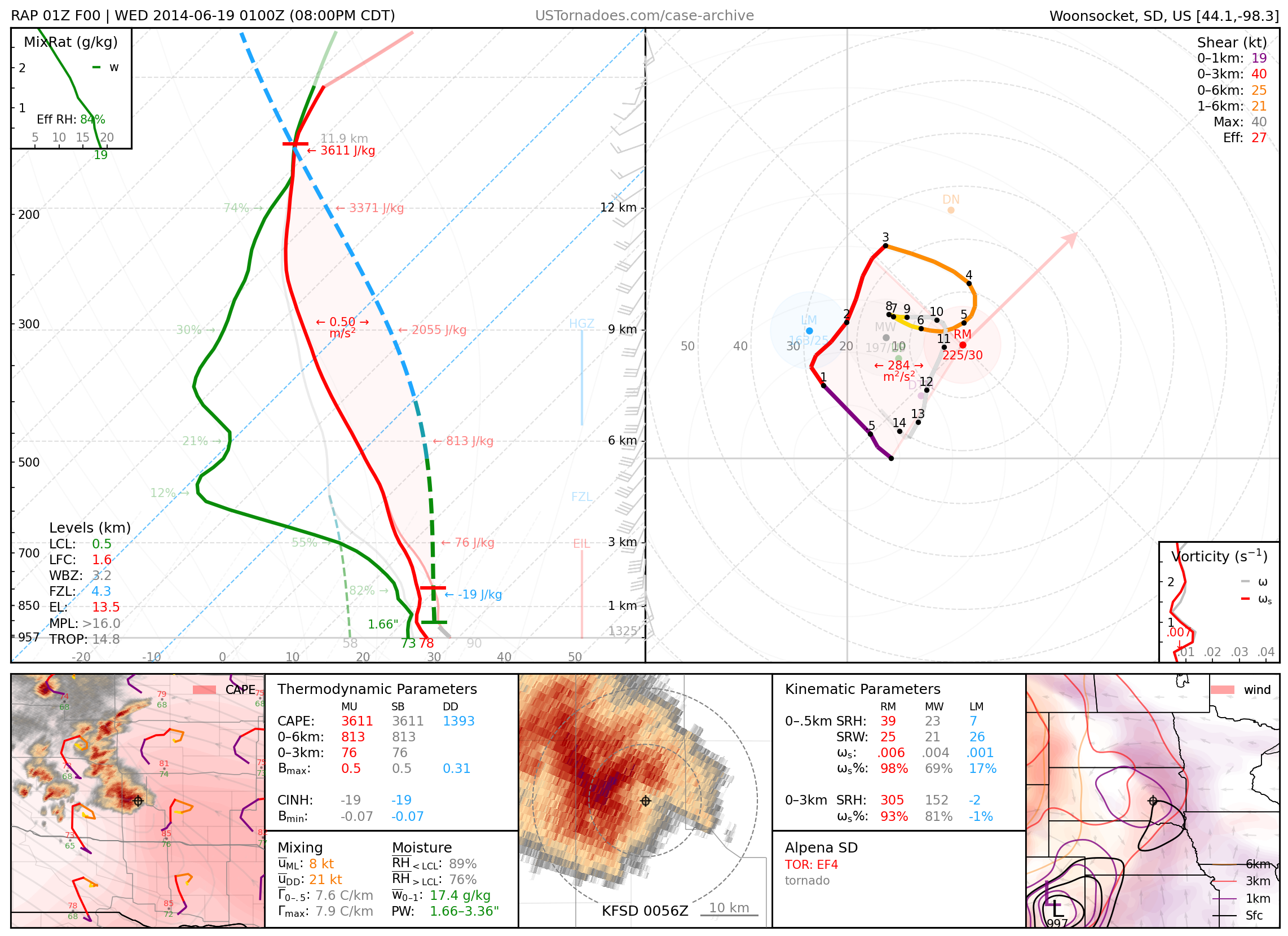
June 18, 2014: Alpena, South Dakota
Photogenic EF4 tornado.
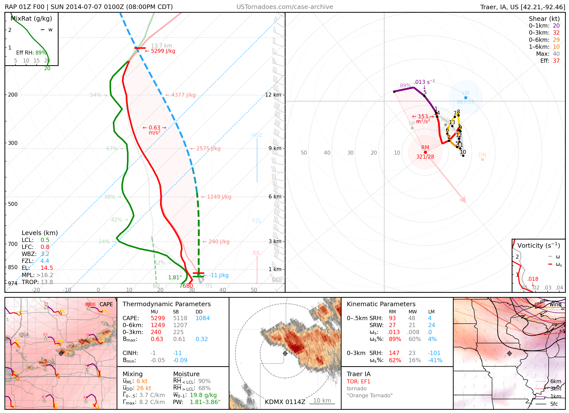
July 6, 2014: Traer, Iowa
Particularly photogenic orange “carrot” tornado.
2015
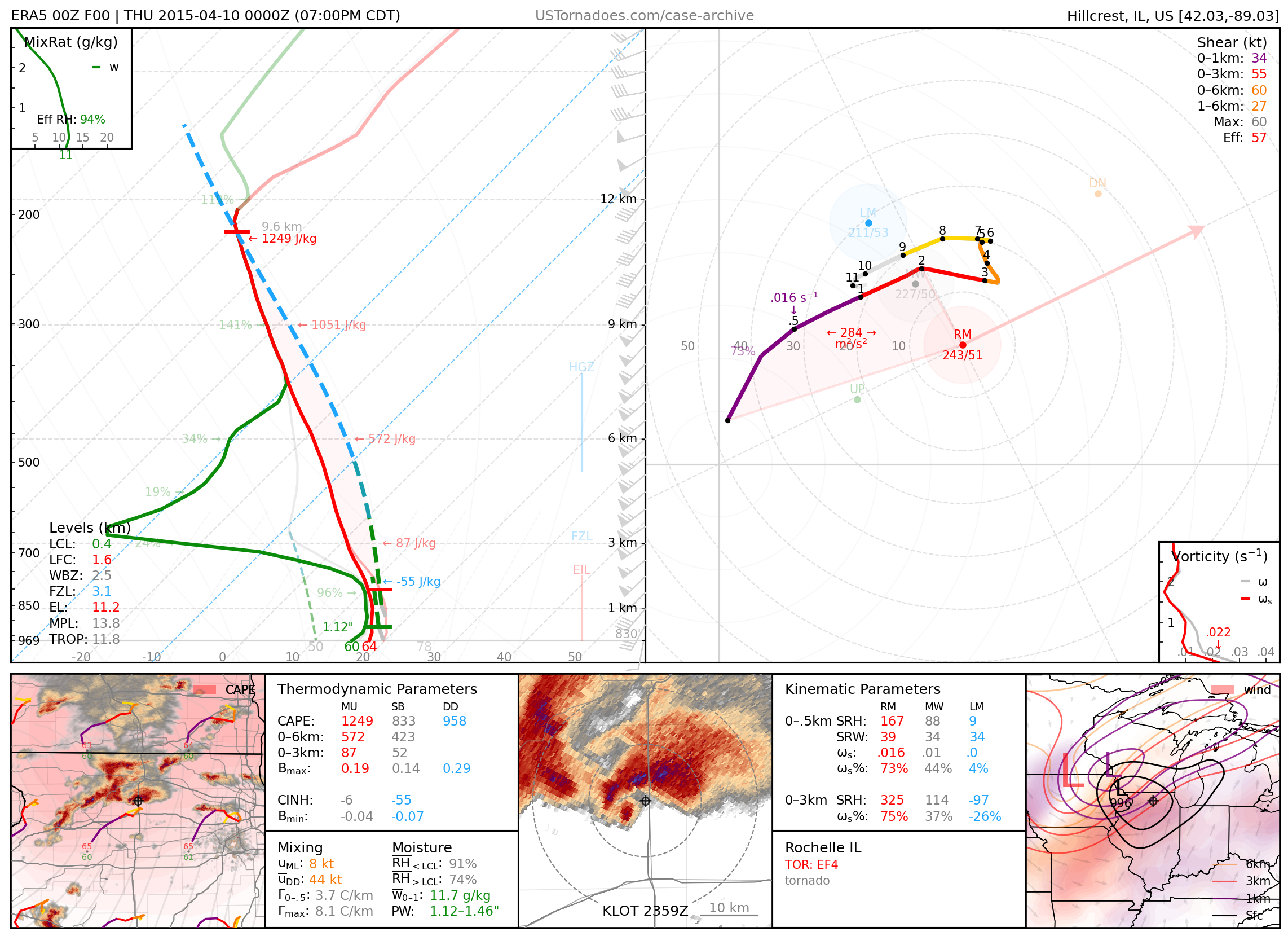
April 9, 2015: Rochelle / Fairdale, Illinois
Long-lived EF4 tornado.
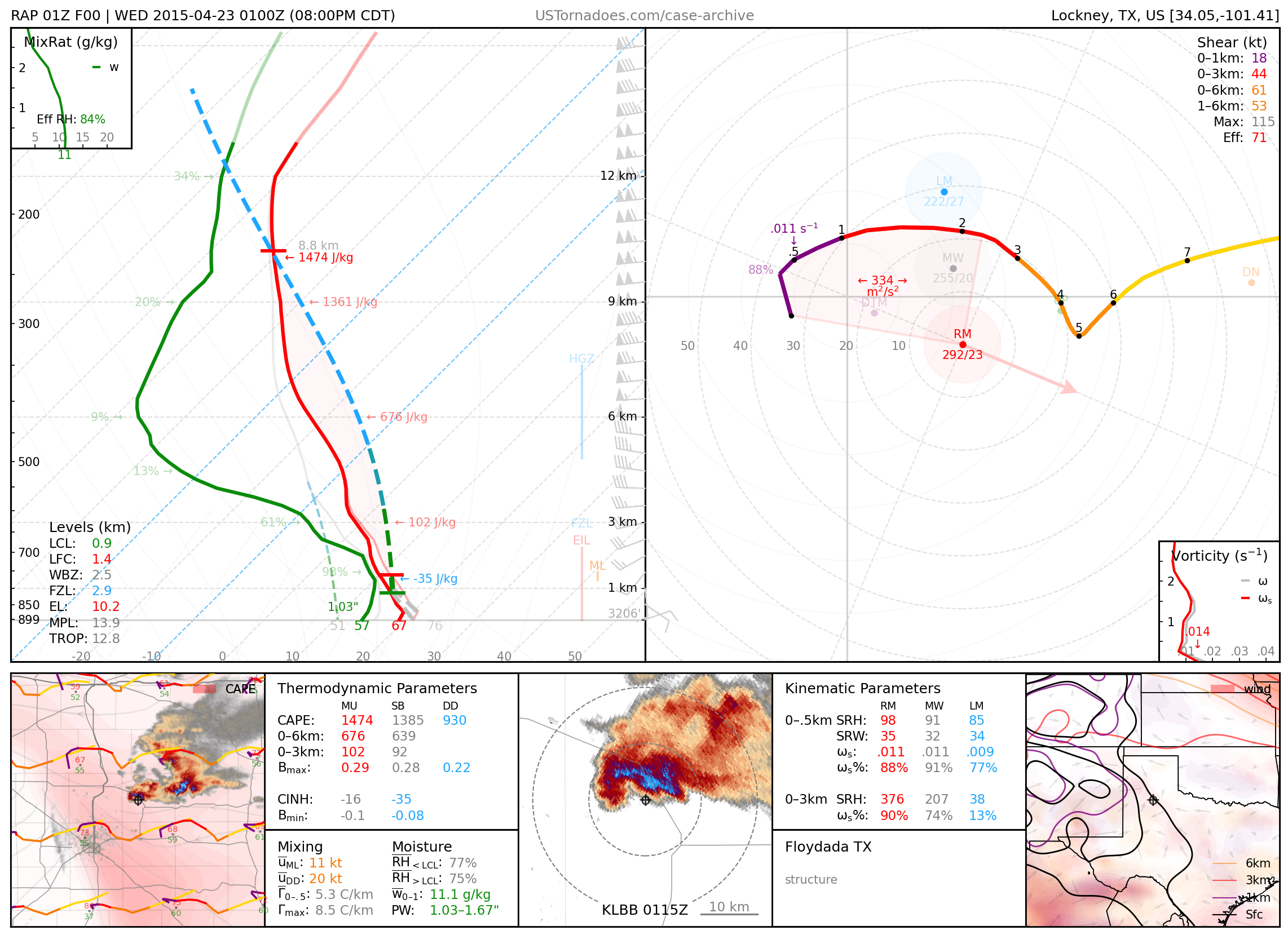
April 22, 2015: Floydada, Texas
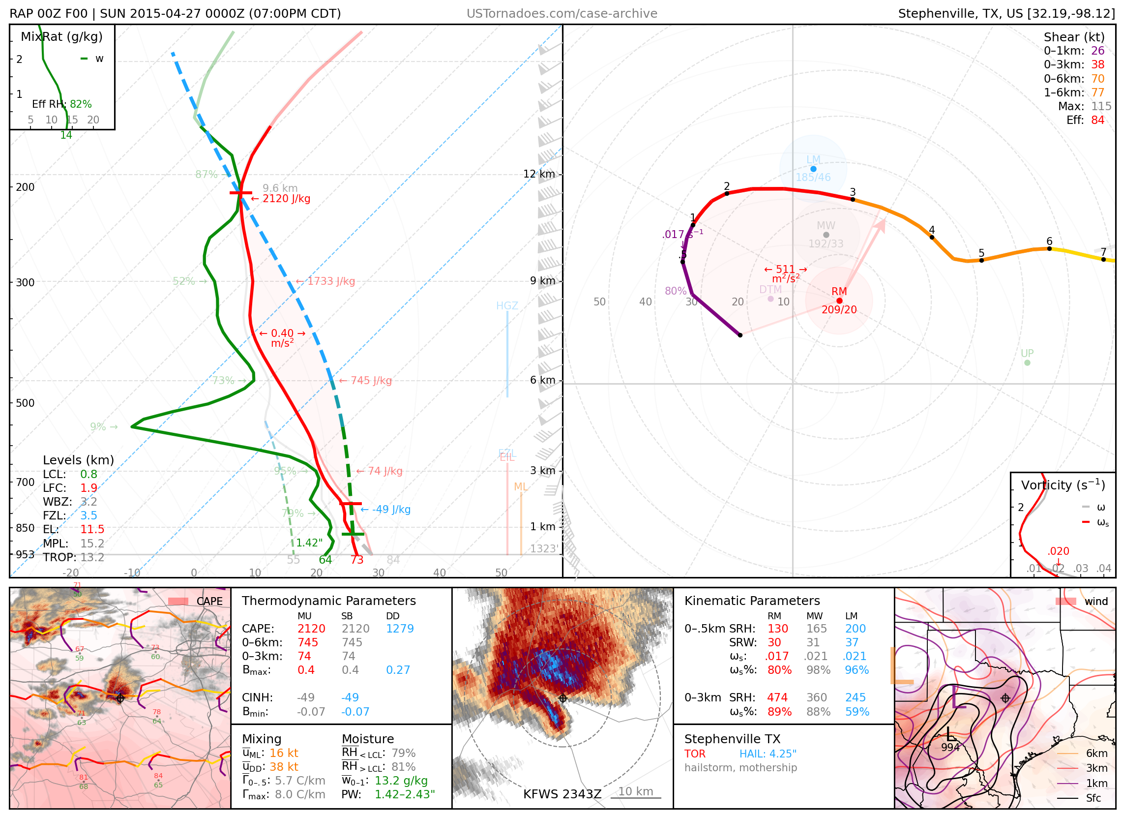
April 26, 2015: Hico & Stephenville, Texas
Photogenic supercells that produced hail up to 4.25 inches and a couple tornadoes.
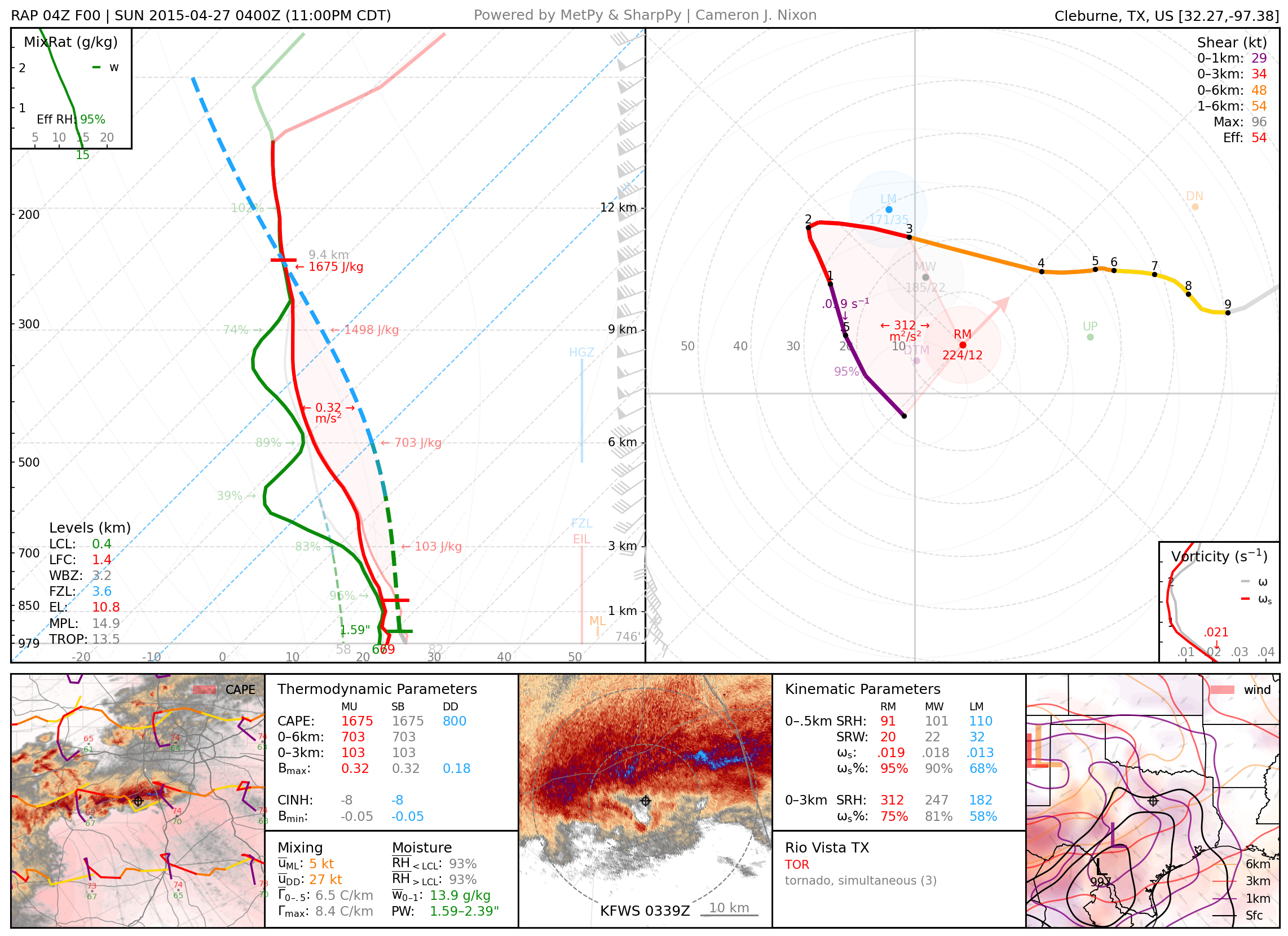
April 26, 2015: Rio Vista, Texas
Chaotic supercell that produced several weak tornadoes, some simultaneous, including a large wedge.
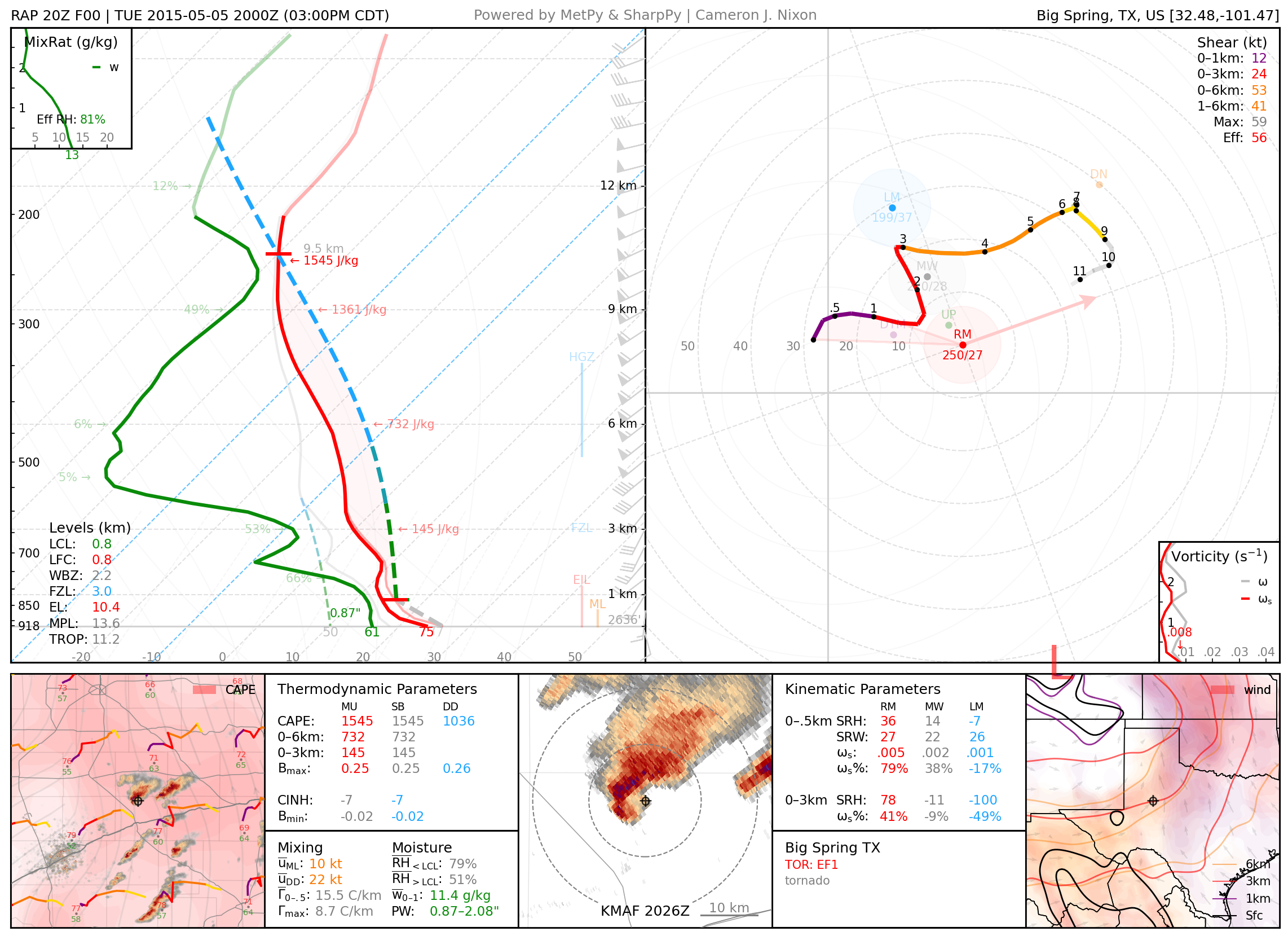
May 5, 2015: Big Spring, Texas
Particularly photogenic tornadoes from a rather atypical cold core-like setup for the area.
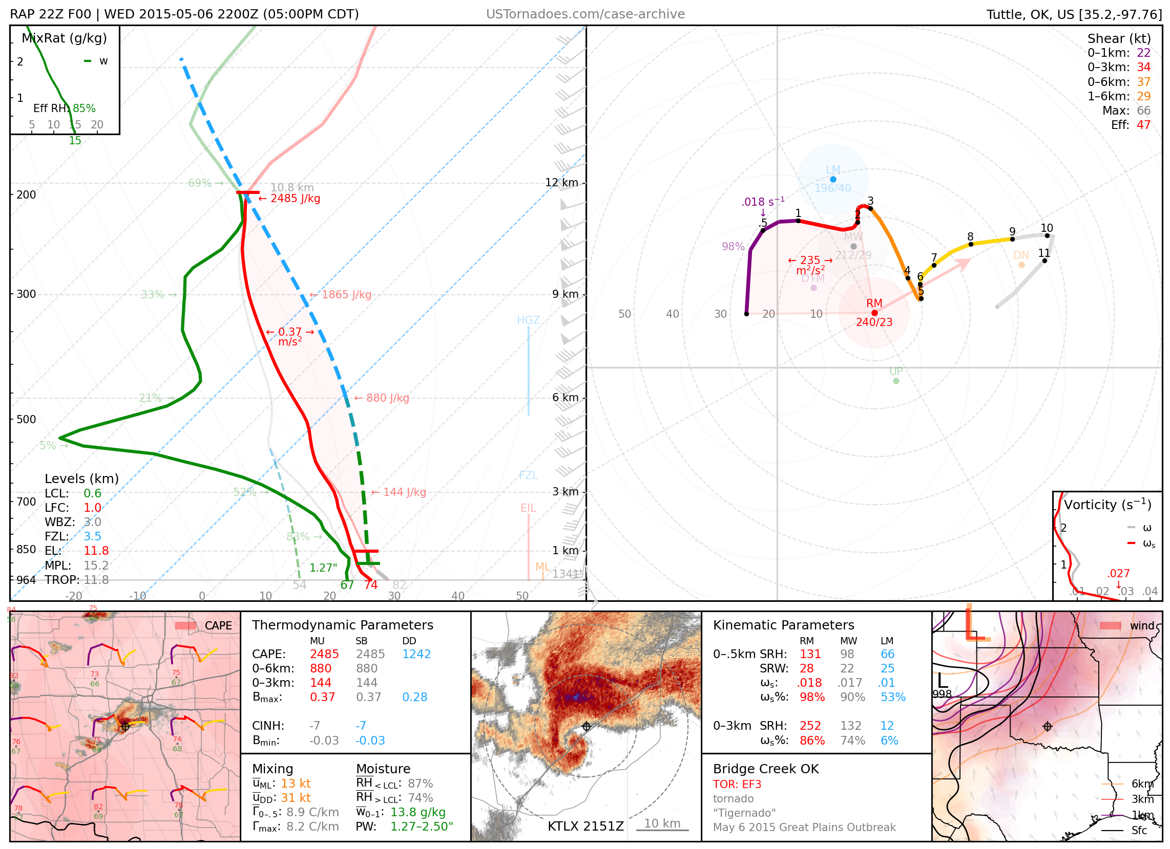
May 6, 2015: Amber / Bridge Creek / Norman, Oklahoma
EF3 tornado and others from cyclic, high-precipitation supercell.
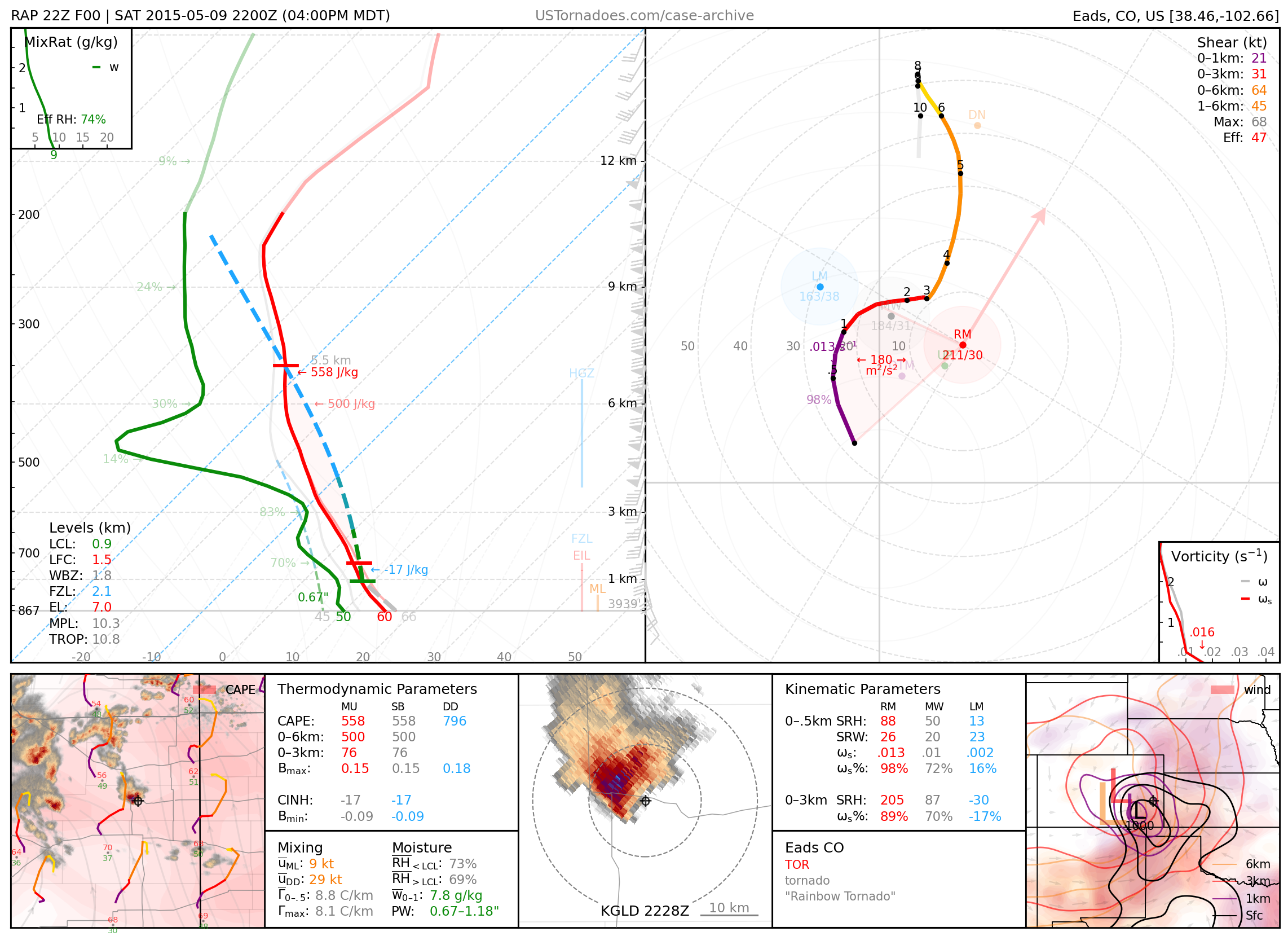
May 9, 2015: Eads, Colorado
Particularly photogenic tornadoes, part of a “cold core” tornado outbreak across eastern CO and western KS.
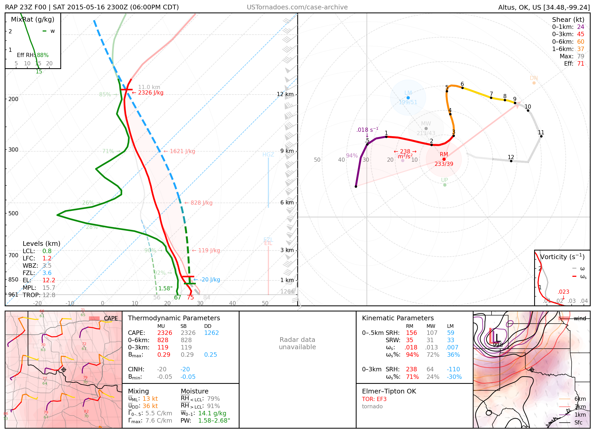
May 16, 2015: Elmer / Tipton, Oklahoma
Long-lived EF3 tornado (though measured by mobile radar to be stronger) from a high-precipitation supercell.
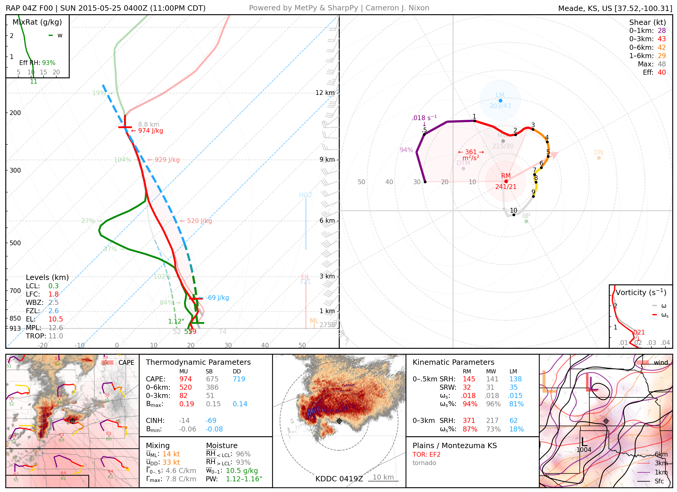
May 24, 2015: Plains / Montezuma, KS
Nocturnal cyclic supercell that produced multiple large tornadoes, at times hidden by fog.
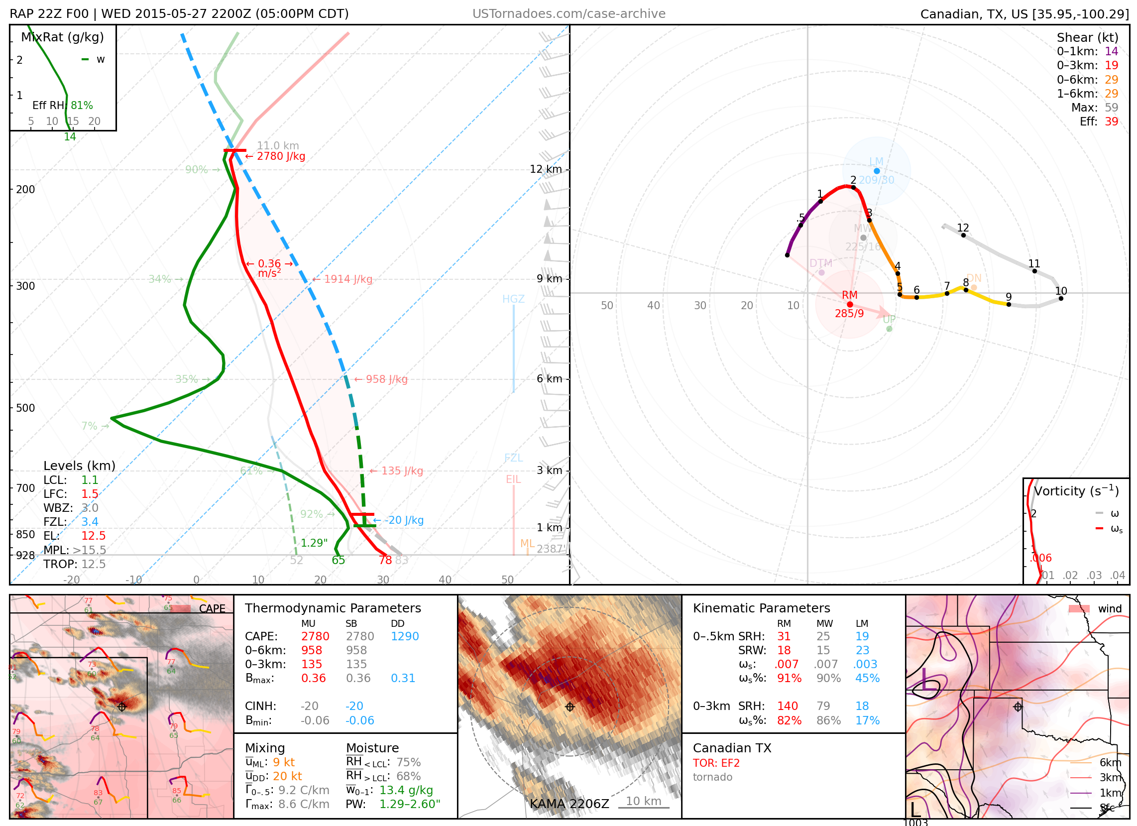
May 27, 2015: Canadian, Texas
EF2 tornado, one of several produced by a slow-moving supercell.
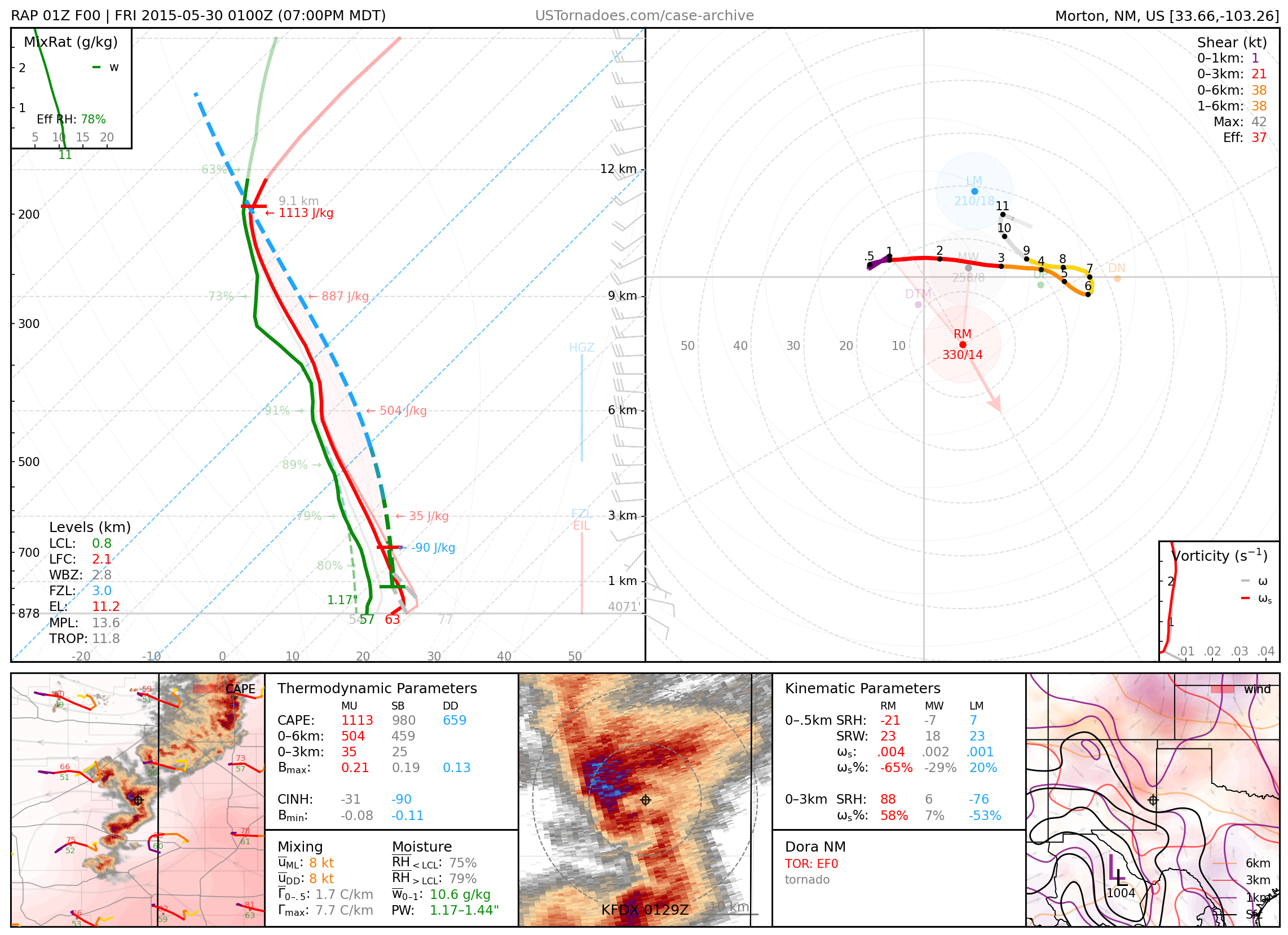
May 29, 2015: Dora, New Mexico
Particularly photogenic tornado.
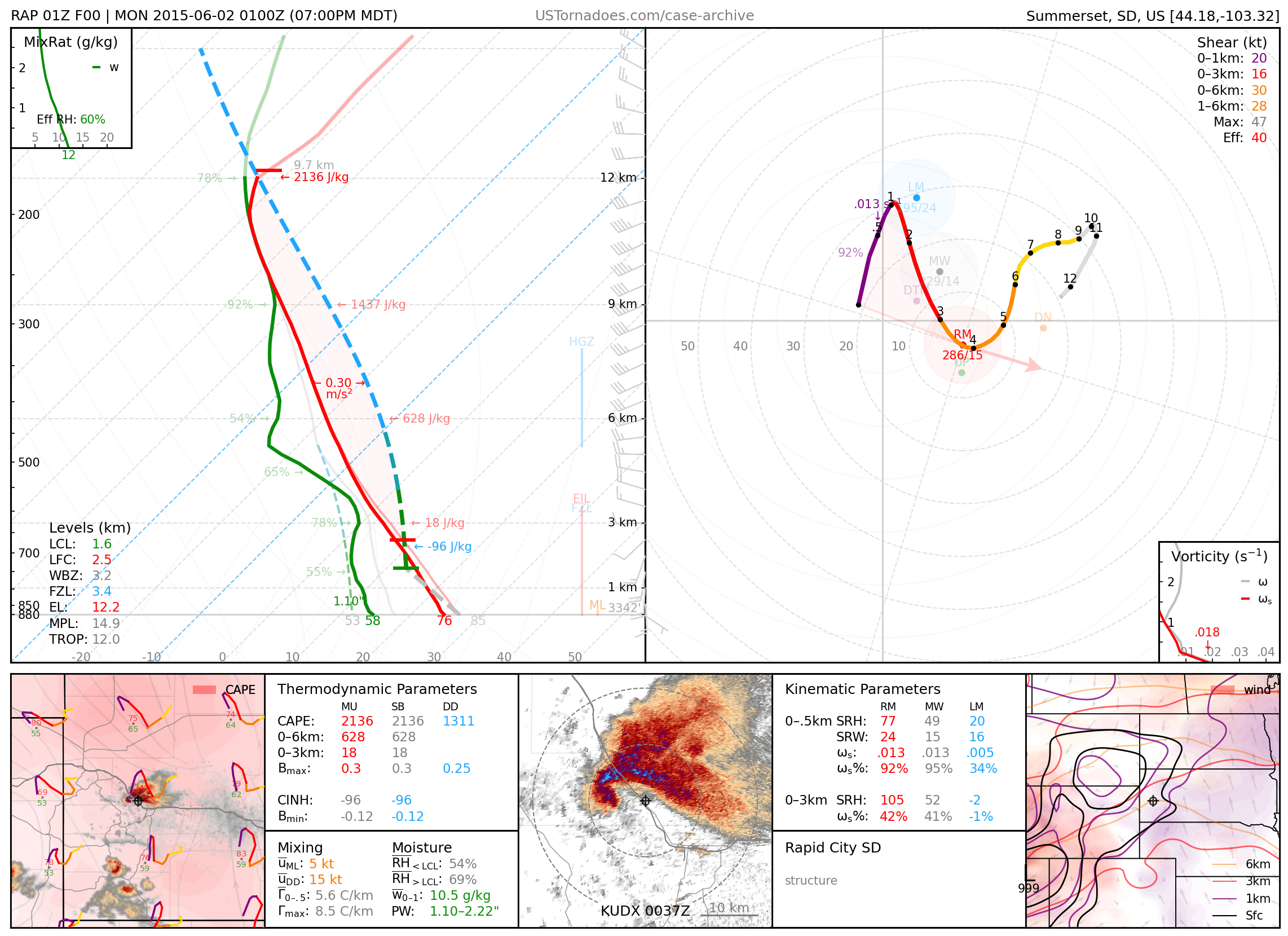
June 1, 2015: Rapid City, South Dakota
Particularly photogenic supercell.
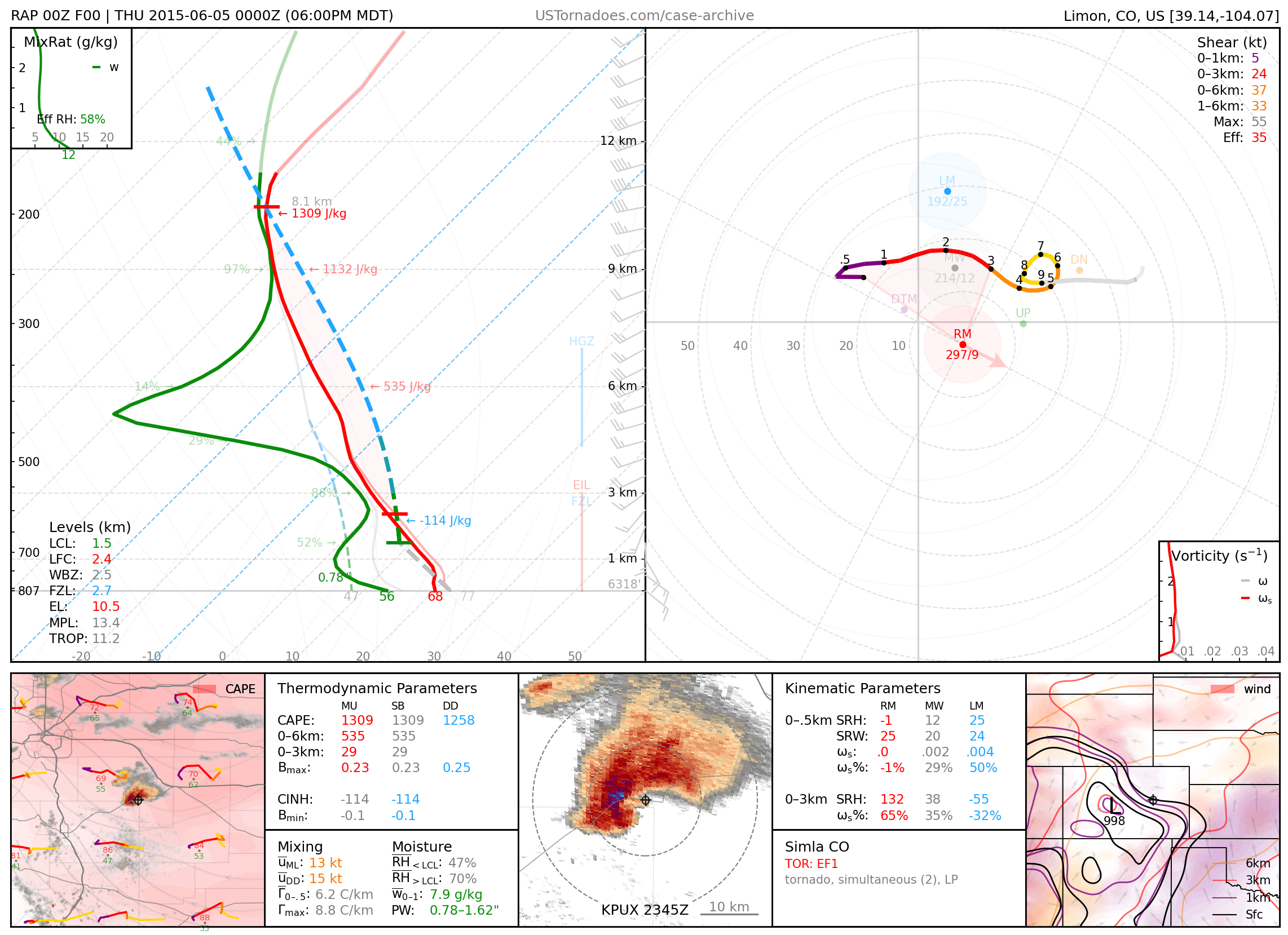
June 4, 2015: Simla, Colorado
Particularly photogenic supercell that produced both a cyclonic and an anticyclonic tornado simultaneously.
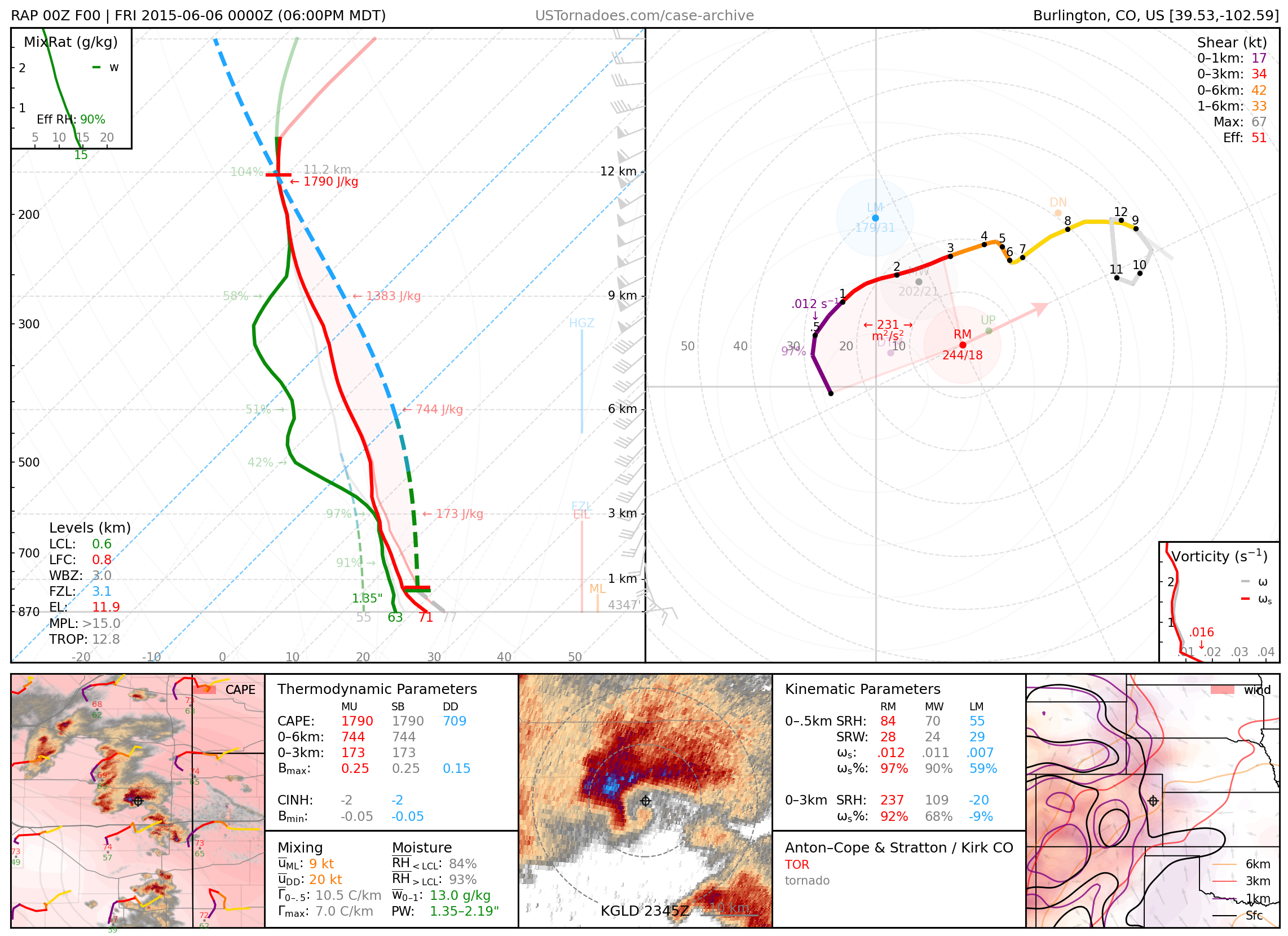
June 5, 2015: Anton / Cope / Kirk, Colorado
Several tornadoes produced by a cluster of cyclic supercells in rapid succession.
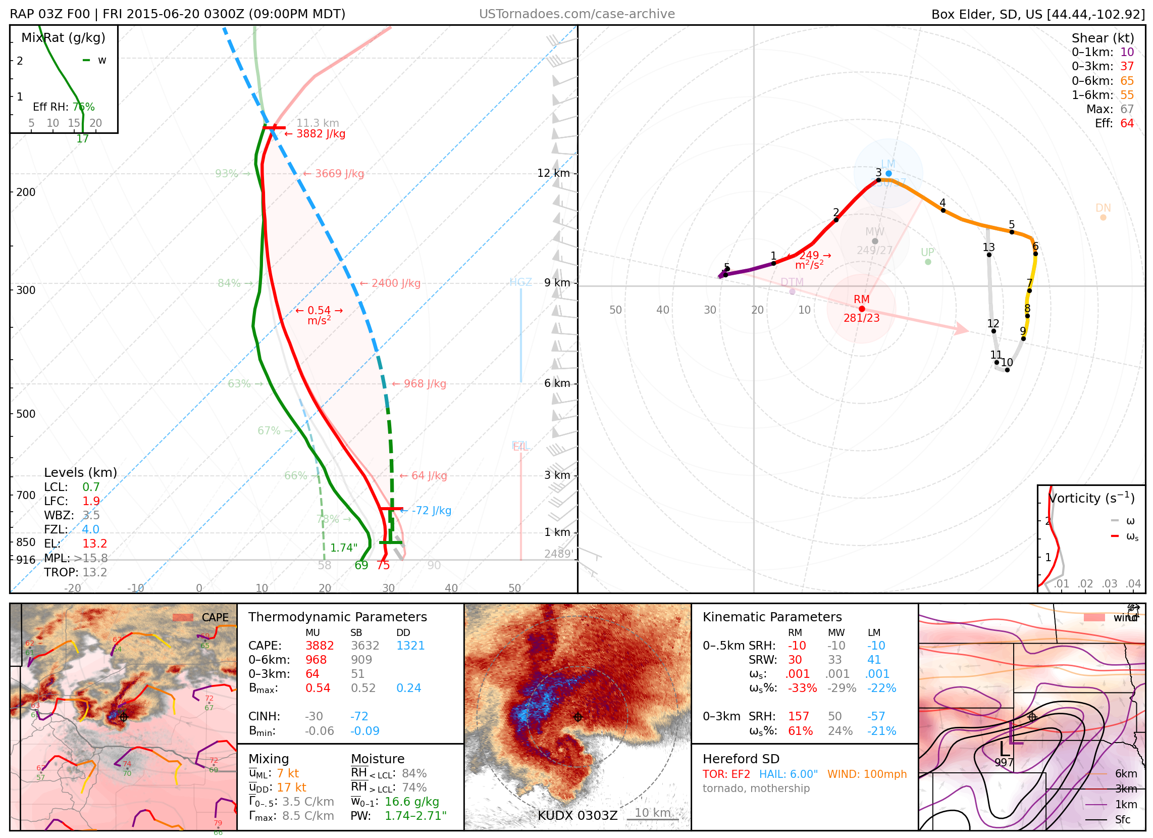
June 19, 2015: Hereford, South Dakota
Massive and particularly photogenic “crown-shaped” supercell that also produced a rain-wrapped EF2 tornado.
June 22, 2015: Woodhaven Lakes / Sublette, Illinois
EF2 tornado, one of 10 tornadoes (up to EF3) produced by a cyclic, high-precipitation supercell that tracked across northern IL.

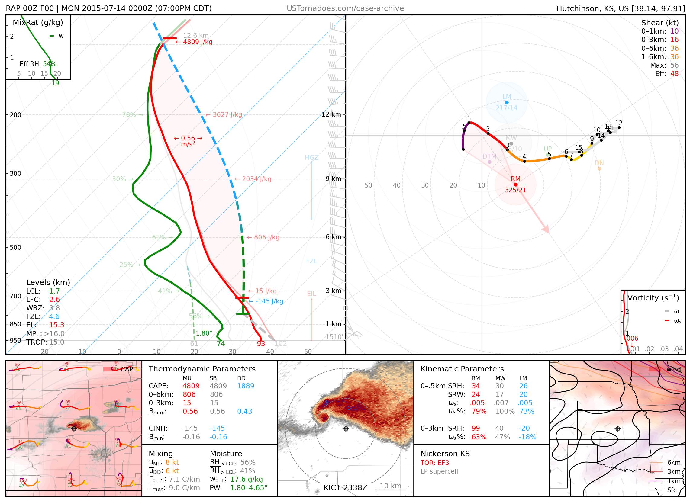
July 13, 2015: Nickerson / Hutchinson, Kansas
Particularly photogenic EF3 tornado.
July 27, 2015: Tilston, Manitoba, Canada
One of the longest-lived tornadoes on record, lasting 2.5 to 3 hours, rated EF2 (though likely stronger), a wedge tornado from a high-precipitation supercell.

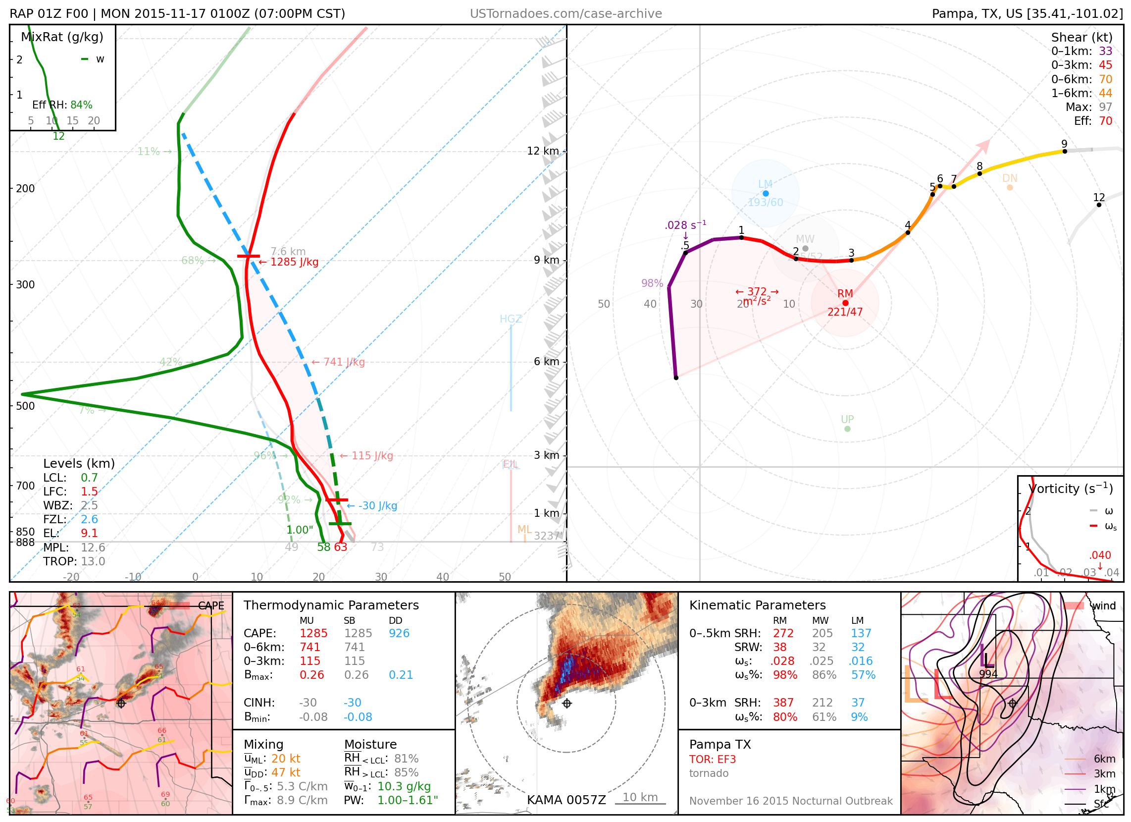
November 16, 2015: Plains, Kansas and Pampa, Texas
Long-tracked EF3 tornado near Plains, and two EF3 tornadoes, including one wedge tornado, in close proximity to Pampa. Part of an outbreak of particularly photogenic nocturnal tornadoes, unprecedented for the time of year for the area.
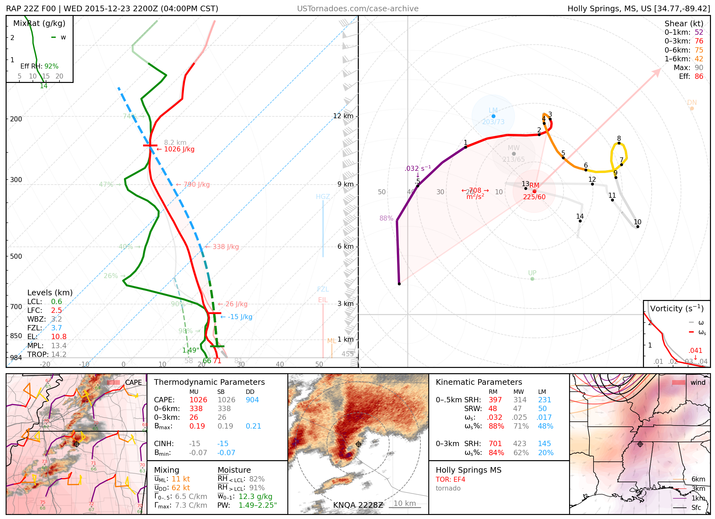
December 23, 2015: Holly Springs, Mississippi
Long-tracked EF4 tornado that killed 9 people.
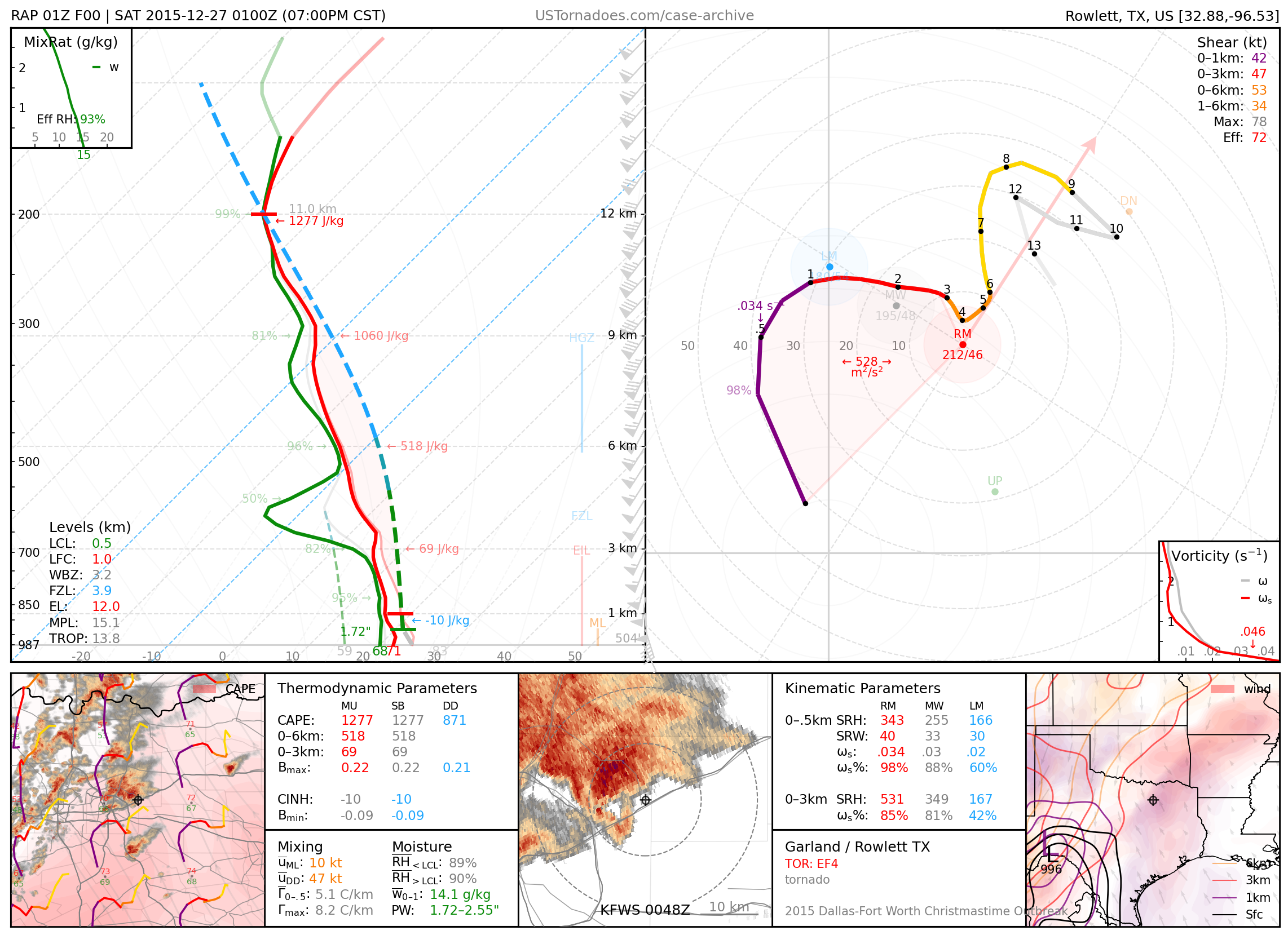
December 26, 2015: Rowlett, Texas
EF4 tornado that killed 9 people after impacting an elevated highway bridge.
2016
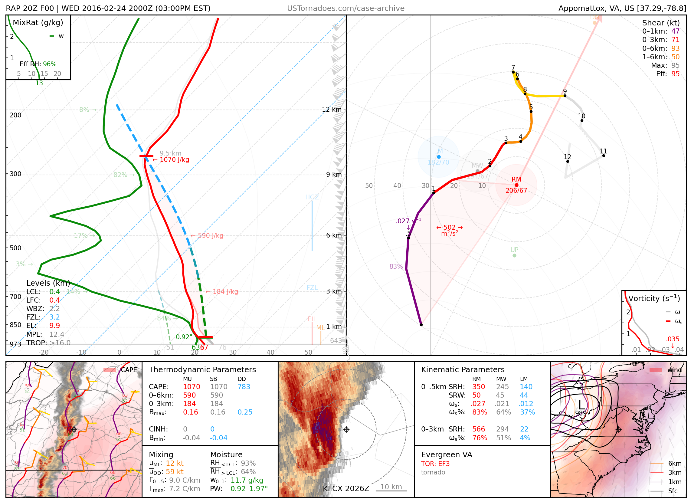
February 24, 2016: Evergreen, Virginia
Long-tracked EF3 tornado, part of an unusual tornado outbreak for the time of year.
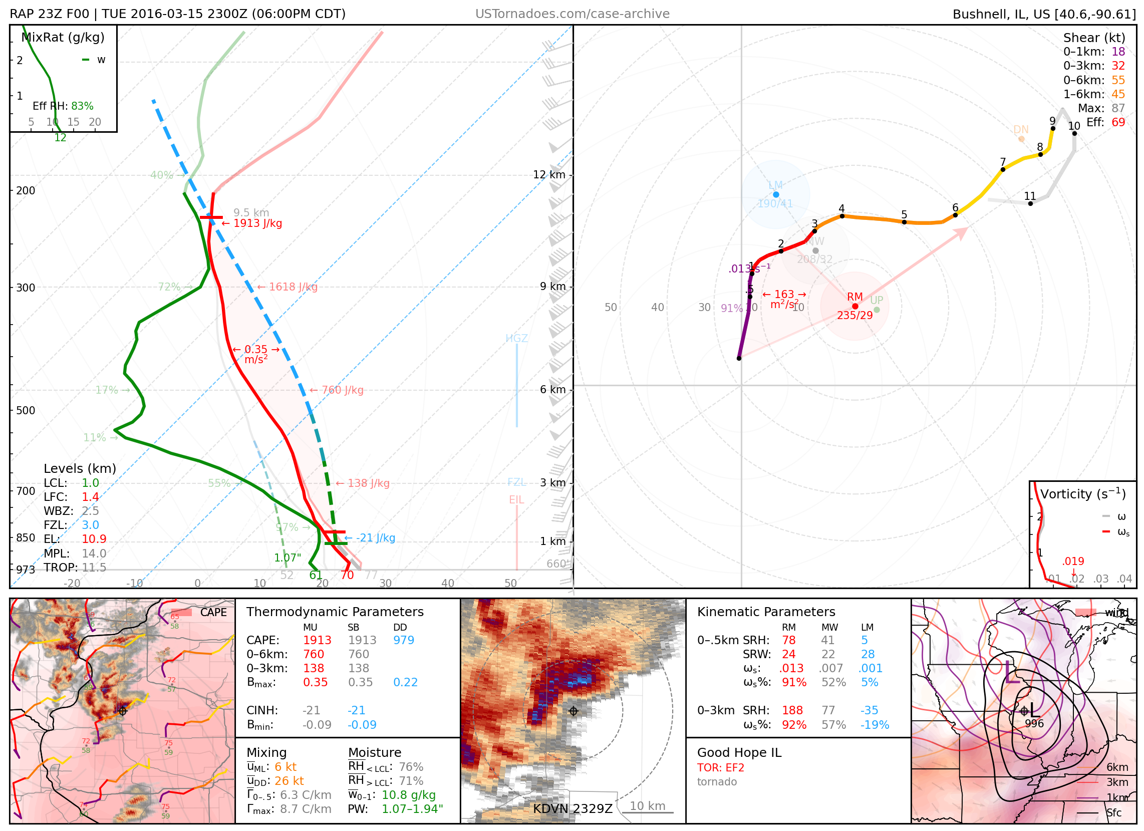
March 15, 2016: Good Hope, Illinois
Uncondensed EF2 tornado.
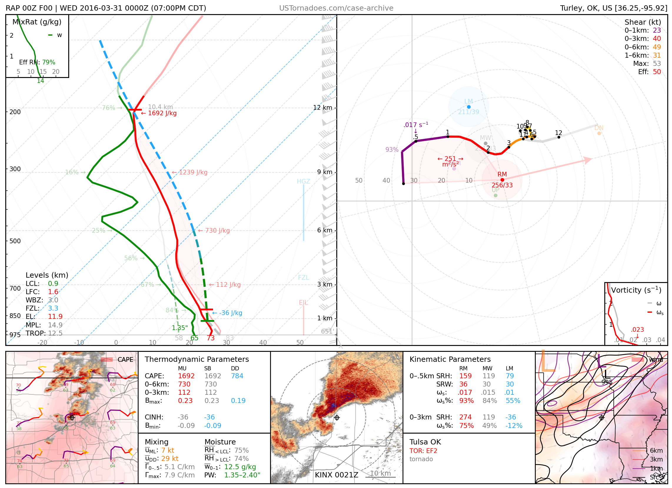
March 30, 2016: Tulsa, Oklahoma
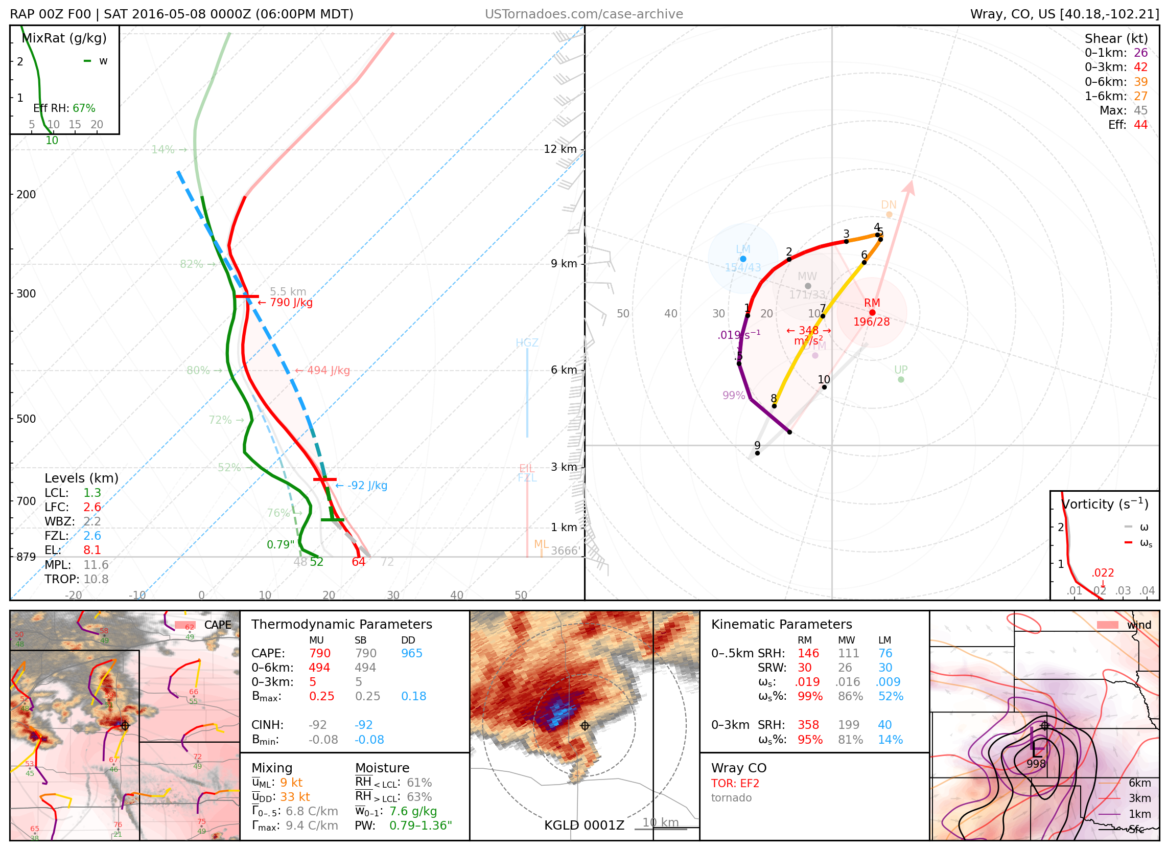
May 7, 2016: Wray, Colorado
Particularly photogenic EF2 tornado.
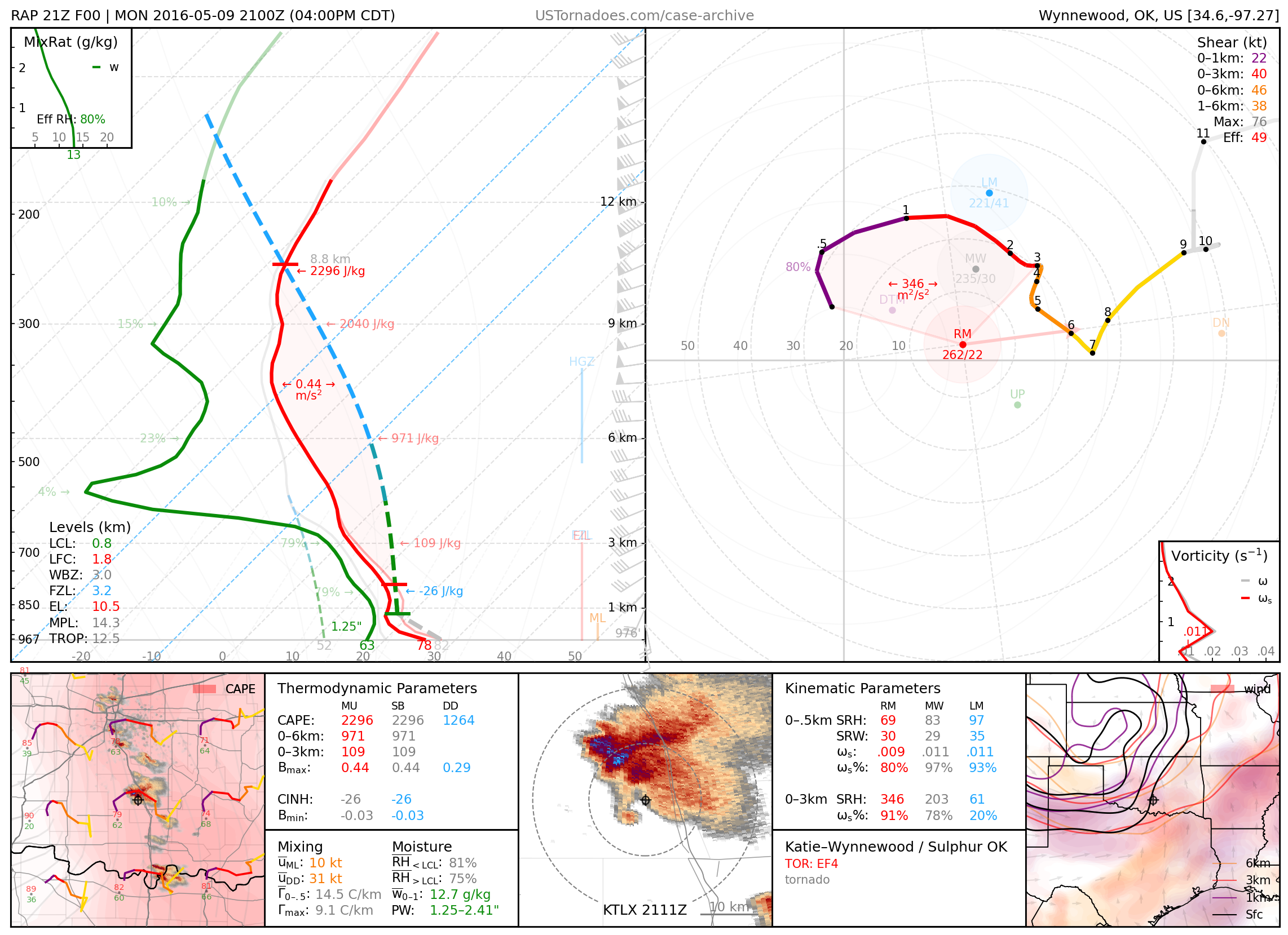
May 9, 2016: Katie / Wynnewood / Sulphur, Oklahoma
Two tornadoes, the first a particularly photogenic EF4, and the second an EF3 wedge tornado with winds measured by mobile radar to be over 200 mph.
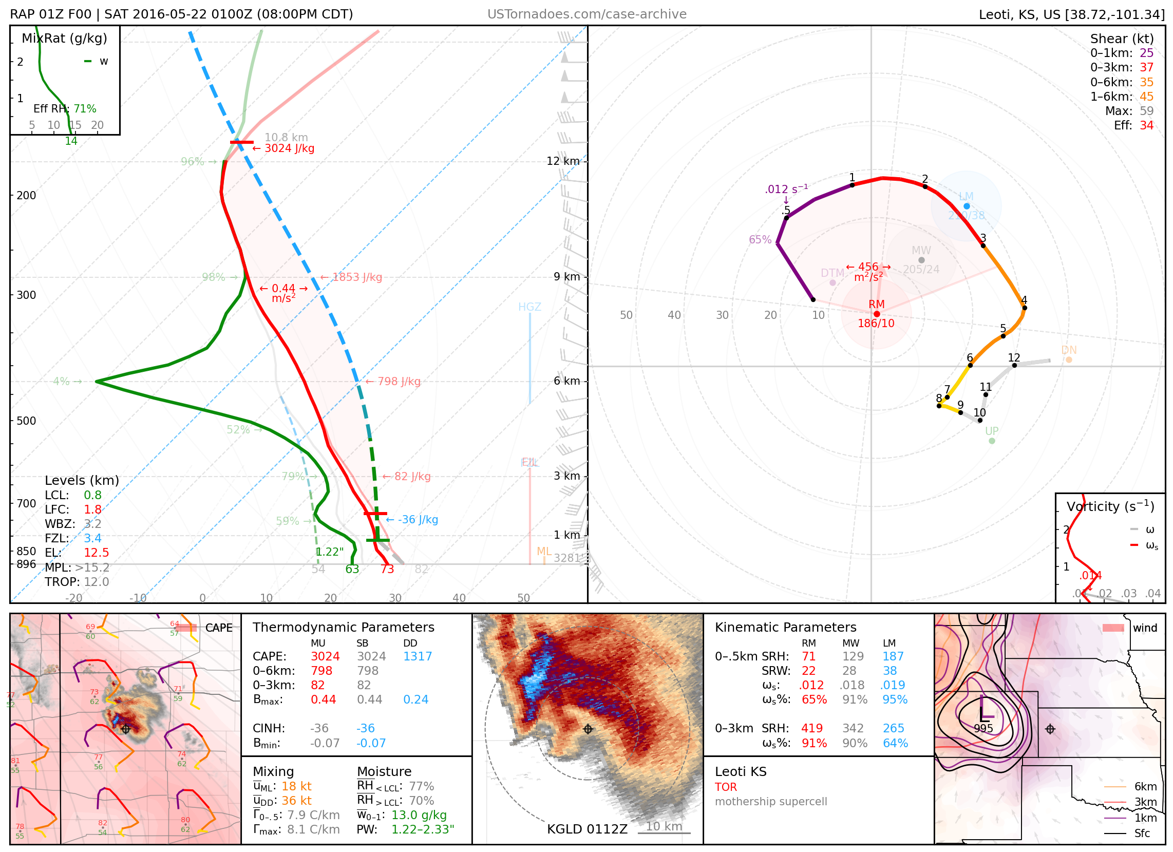
May 21, 2016: Leoti, Kansas
Particularly photogenic, stationary supercell that produced a few brief tornadoes.
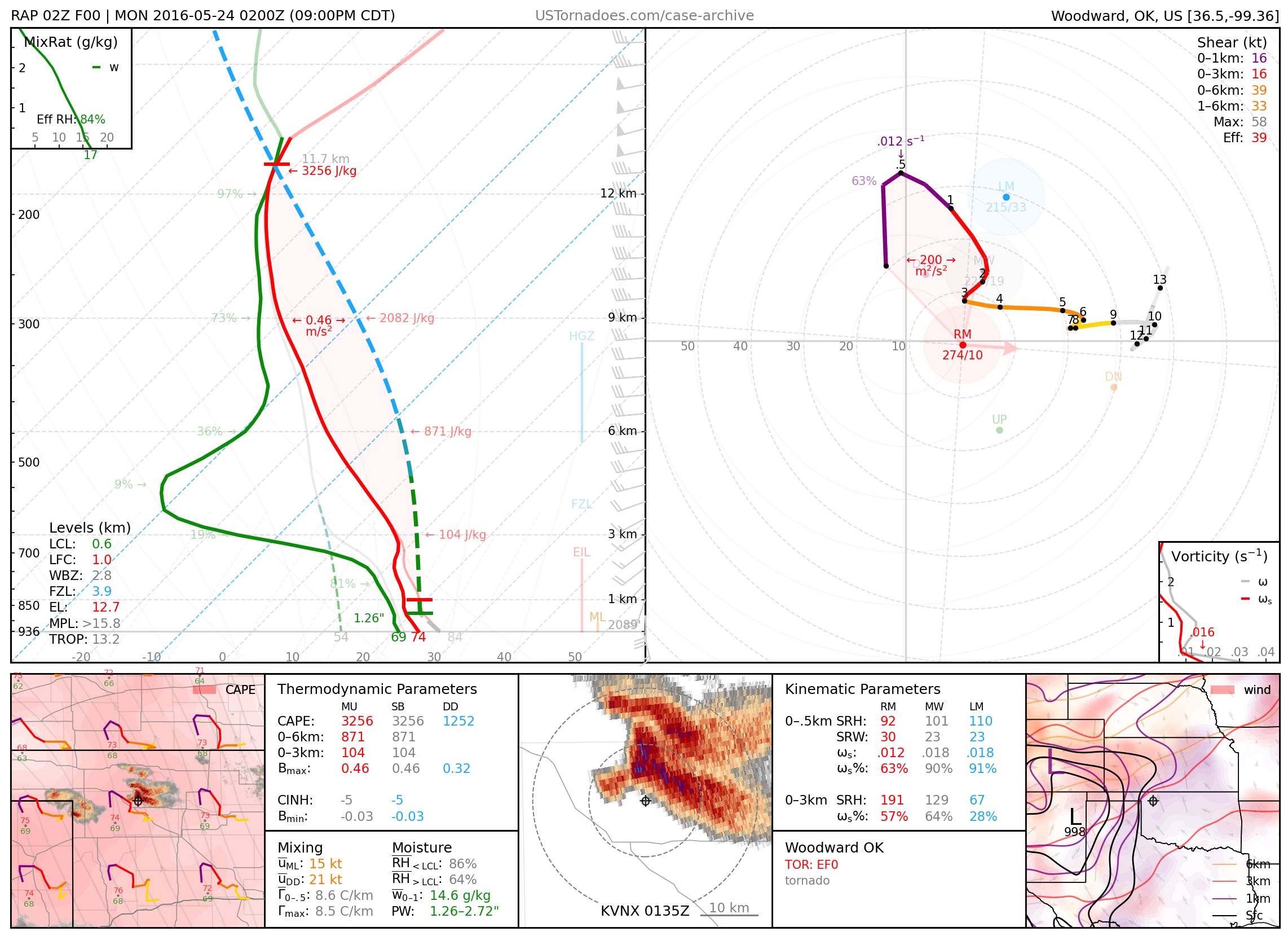
May 23, 2016: Woodward, Oklahoma
Weak, nearly stationary tornado.
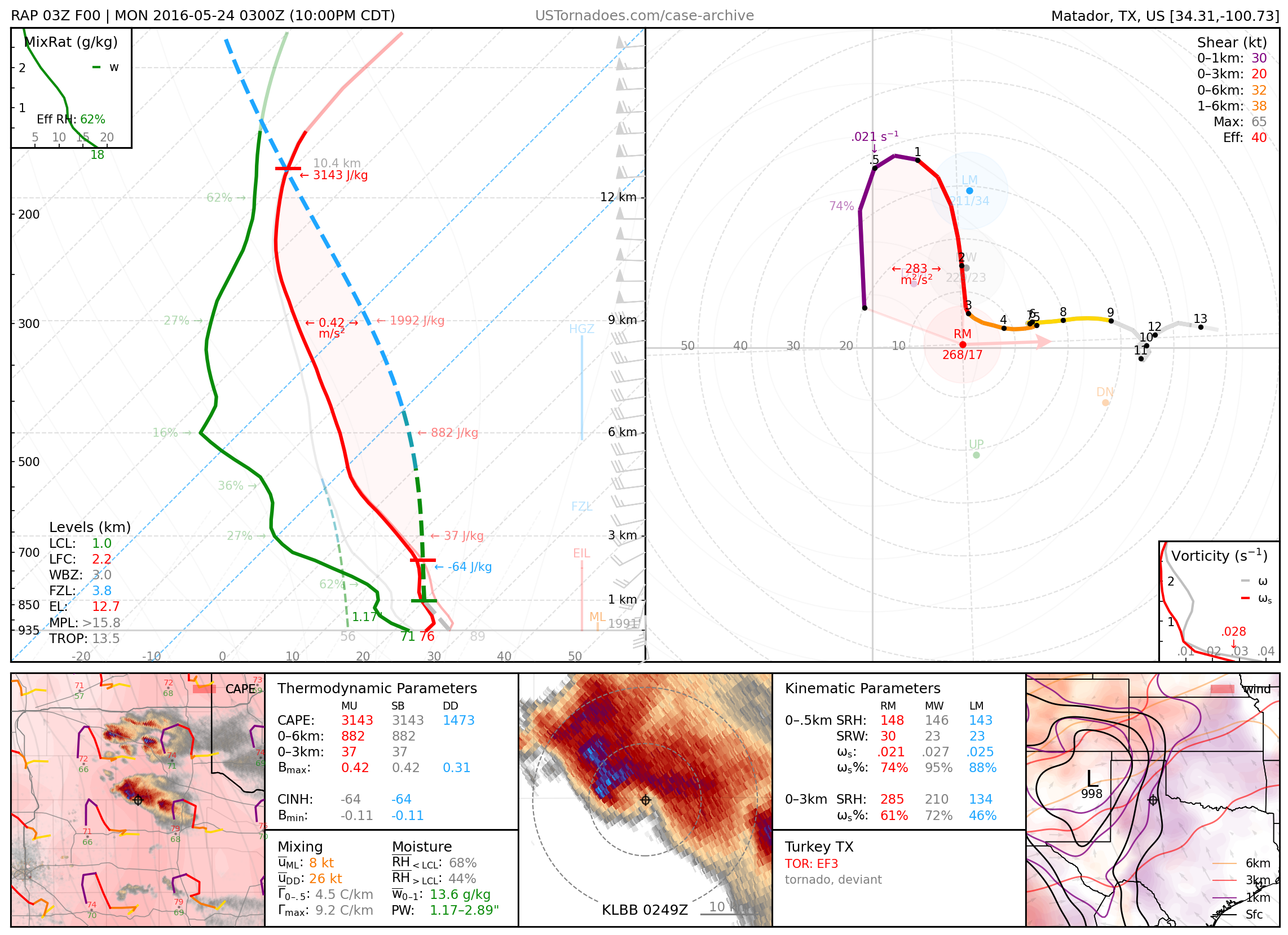
May 23, 2016: Turkey, Texas
Particularly photogenic low-precipitation “barberpole” supercell that later produced an EF3 wedge tornado that took a highly deviant northwest motion.
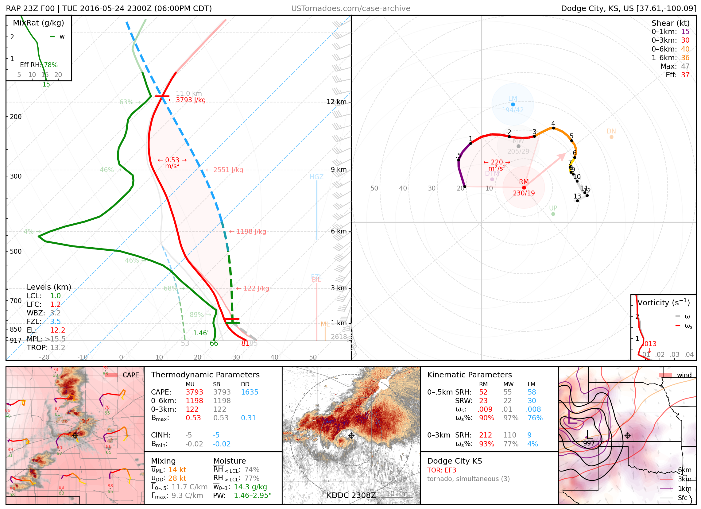
May 24, 2016: Minneola / Dodge City, Kansas
Prolific tornadic supercell producing 13 often-photogenic tornadoes (up to EF3), with three documented simultaneously, in a localized area. Often regarded as one of the greatest days of modern storm chasing.
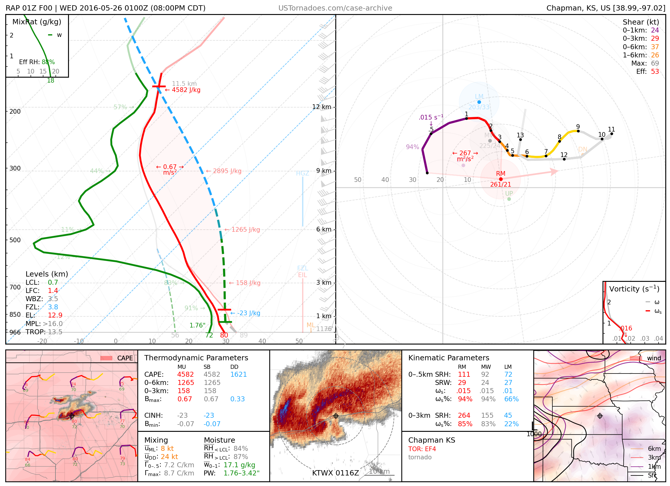
May 25, 2016: Chapman, Kansas
Slow-moving EF4 wedge tornado lasting over 90 minutes, often referred to as Bennington II.
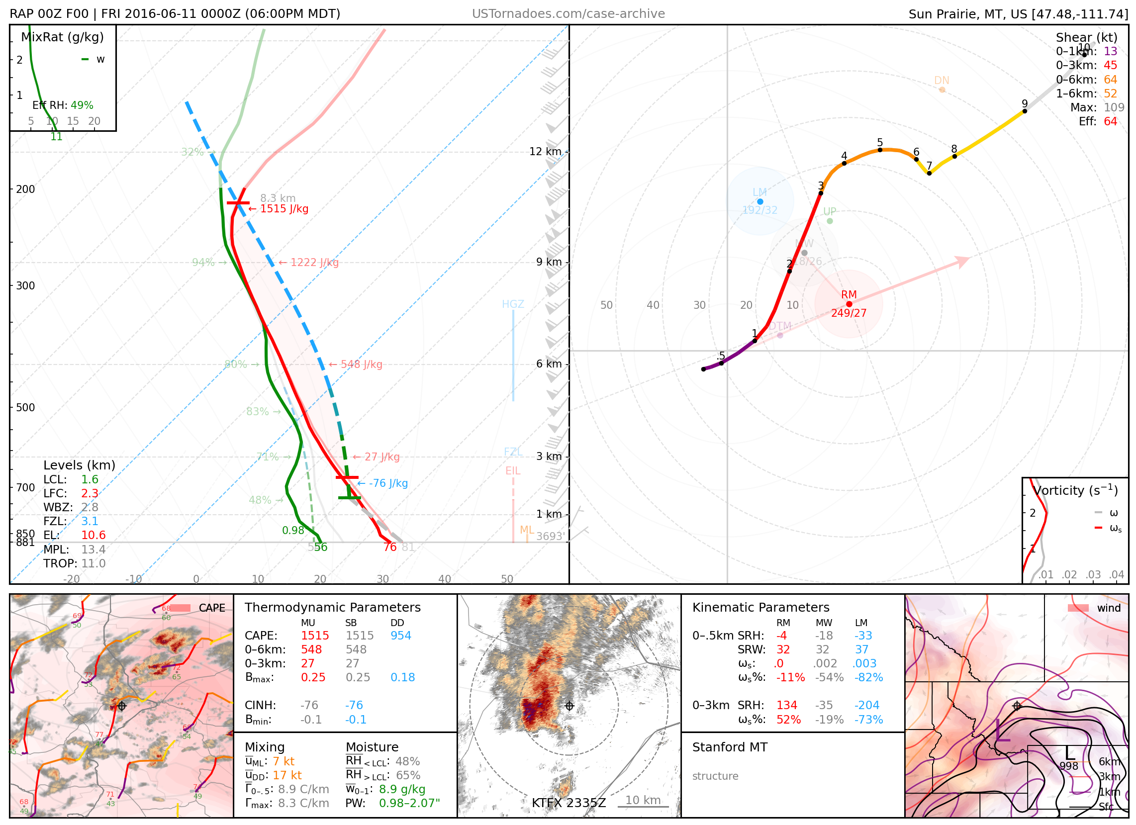
June 10, 2016: Stanford, Montana
Long-lived and photogenic supercell that tracked across central MT.
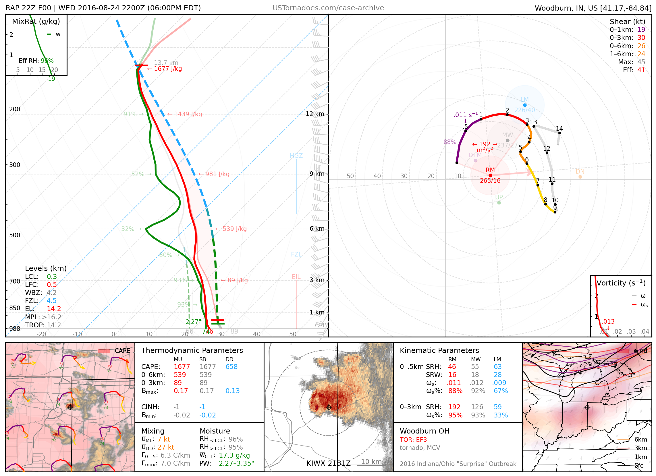
August 24, 2016: Woodburn, Ohio
EF3 tornado, part of a “surprise” outbreak of 24 tornadoes (up to EF3) produced by mini-supercells across northern IN and OH that went largely unforecast.
2017
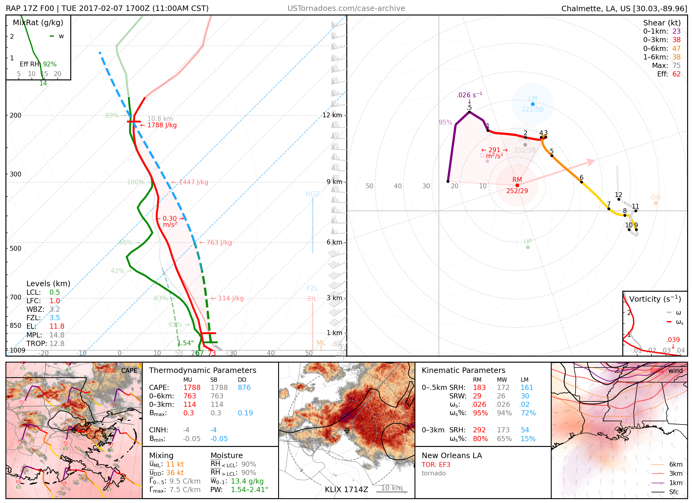
February 7, 2017: New Orleans, Louisiana
EF3 tornado, the strongest recorded tornado to hit New Orleans.
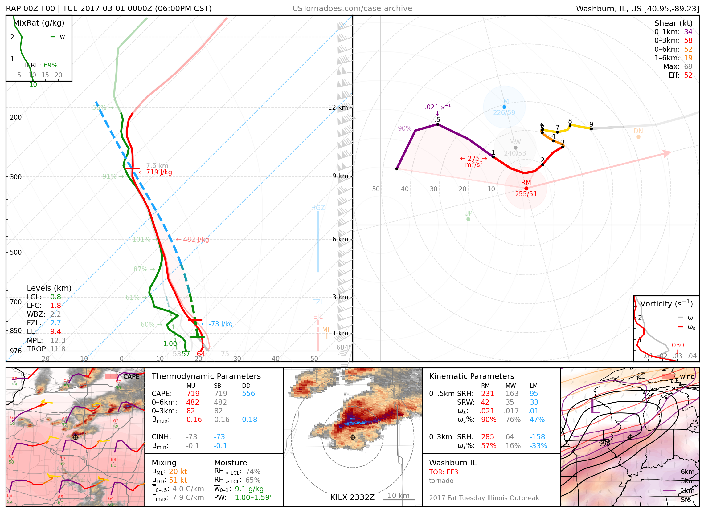
February 28, 2017: Washburn, Illinois
Particularly photogenic dusty EF3 tornado, part of an outbreak of tornadoes across IL and the Ohio Valley.
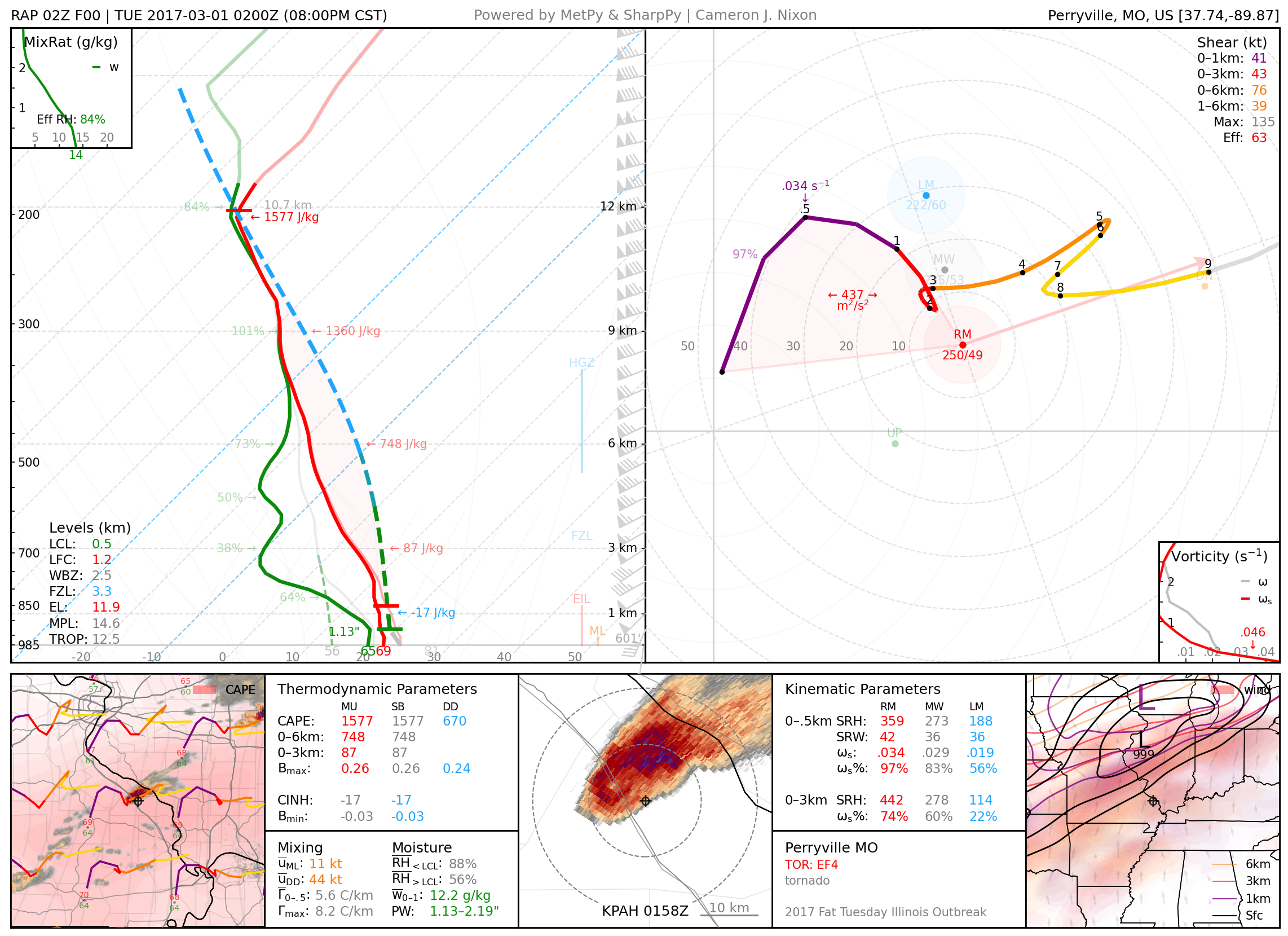
February 28, 2017: Perryville, Missouri
Long-tracked EF-4 tornado, part of an outbreak of tornadoes across IL and the Ohio Valley.
April 14, 2017: Dimmitt, Texas
Prolific cyclic and nearly stationary high-precipitation supercell that produced several tornadoes, including an EF3 wedge; this was a largely “surprise” event.

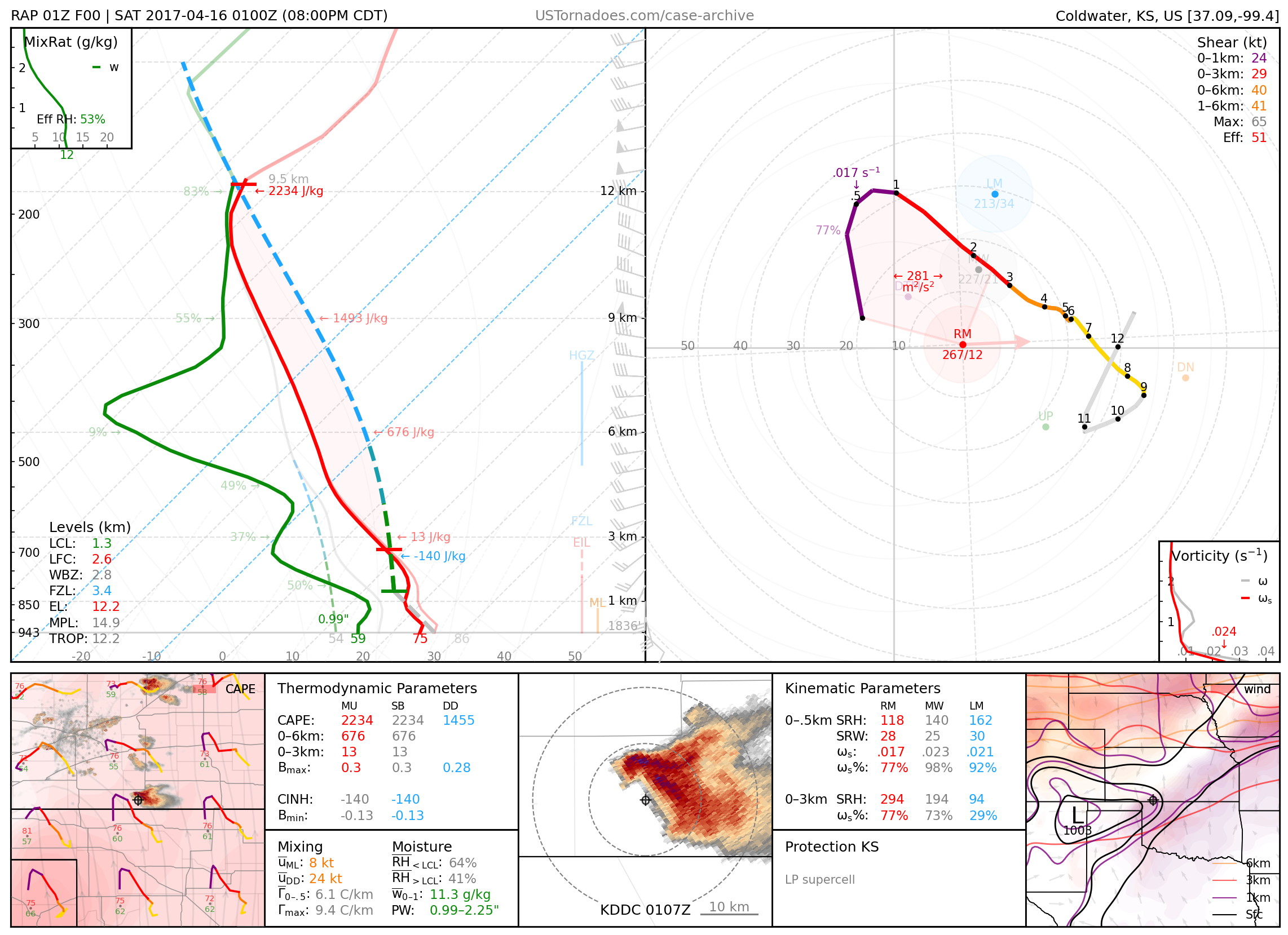
April 15, 2017: Protection, Kansas
Photogenic low-precipitation supercell
April 29, 2017: Canton, Texas

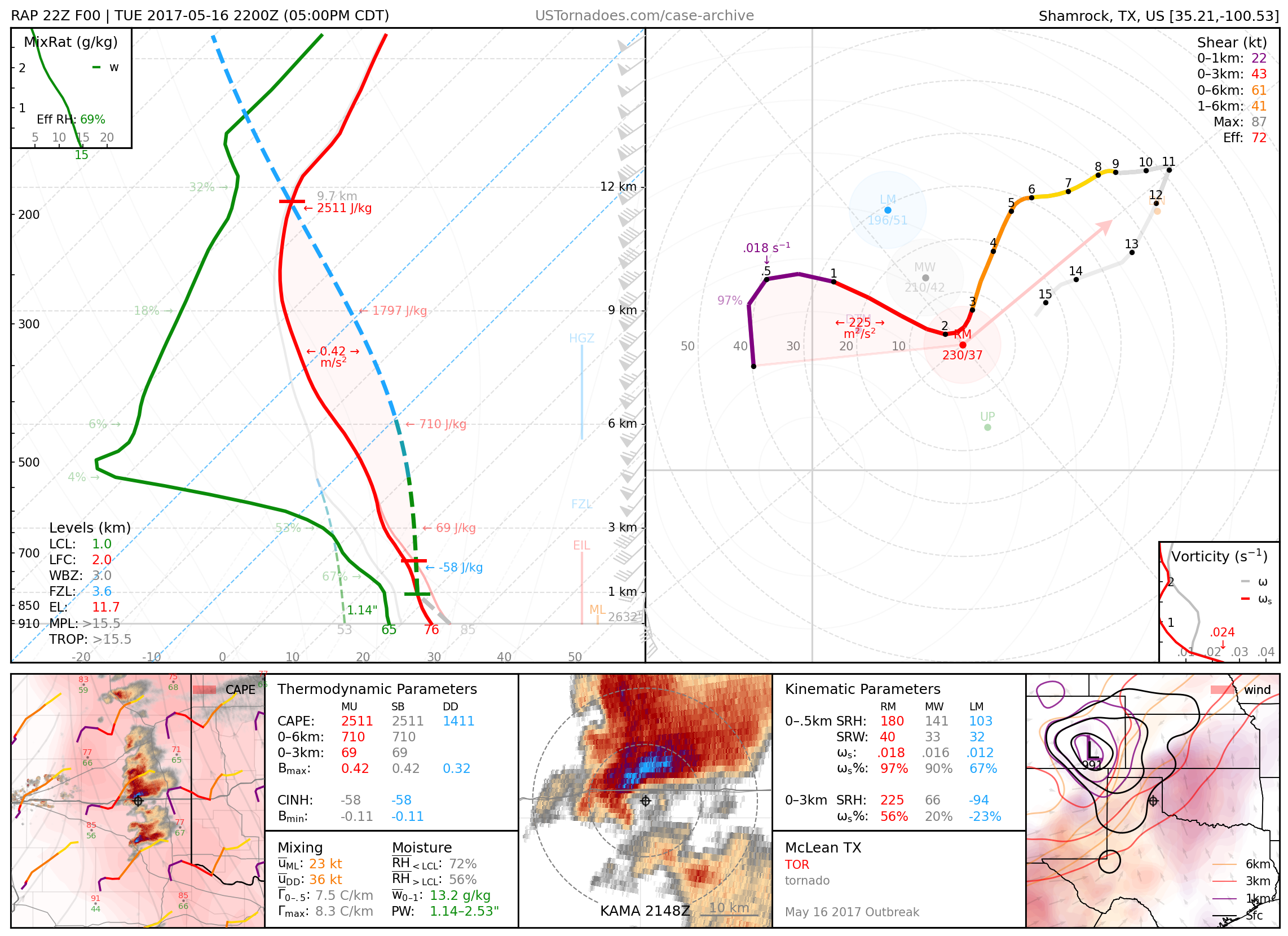
May 16, 2017: McLean, Texas
One of multiple tornadoes produced by a cyclic supercell.
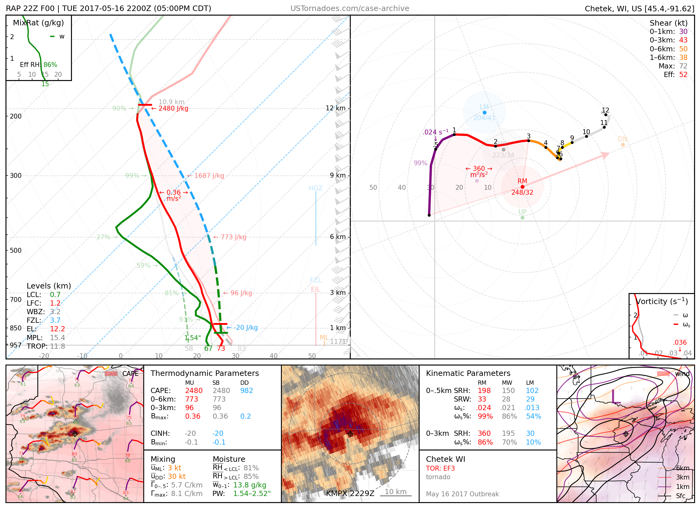
May 16, 2017: Chetek, Wisconsin
Nearly 2.5-hour duration EF3 tornado from high-precipitation supercell, the longest-tracked tornado recorded in Wisconsin.
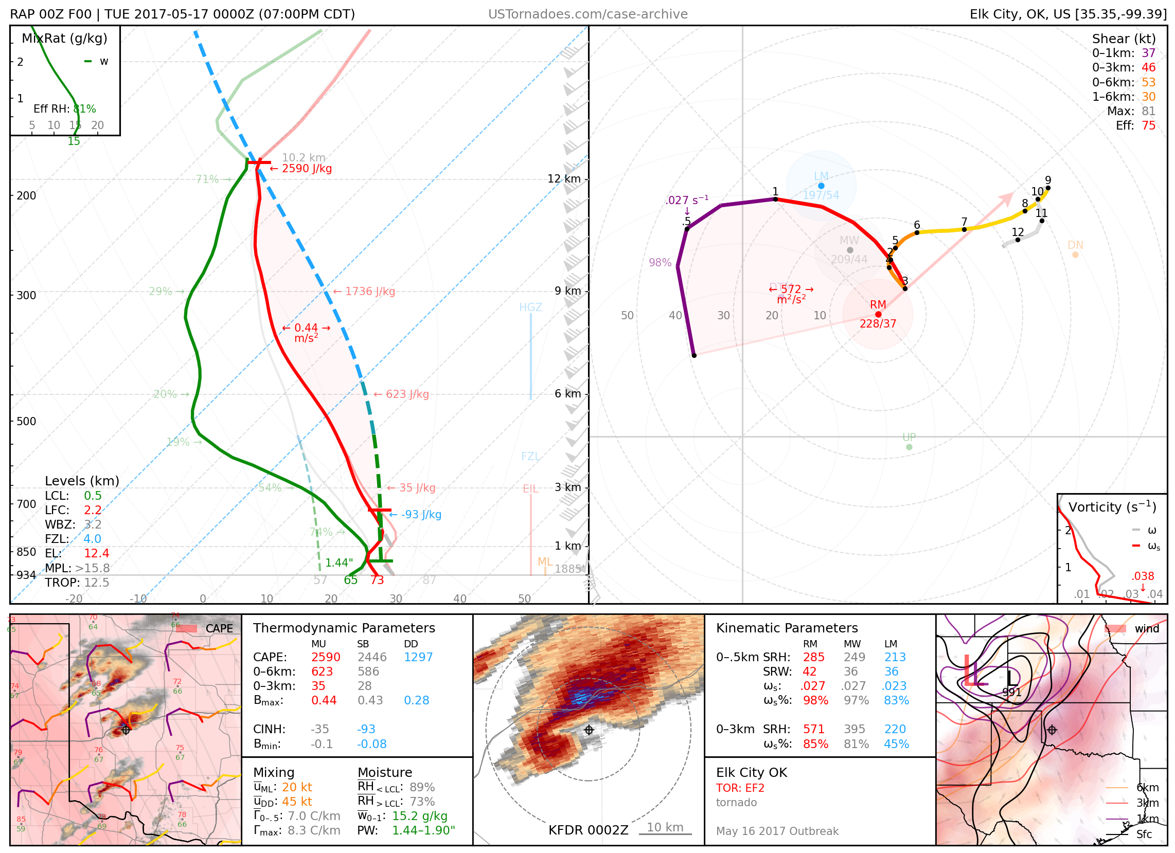
May 16, 2017: Elk City, Oklahoma
Rain-wrapped EF2 wedge tornado.
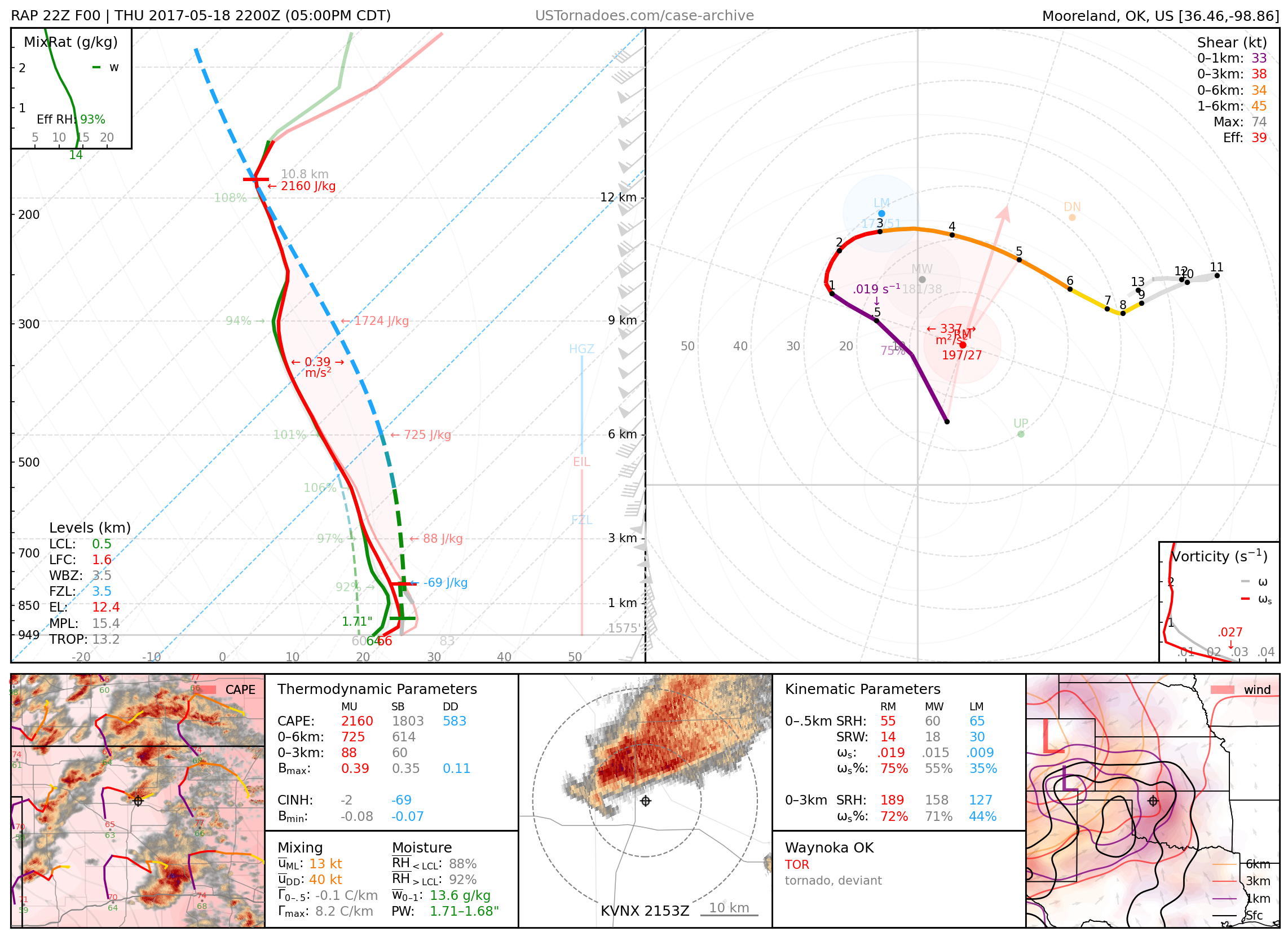
May 18, 2017: Waynoka, Oklahoma
Weak, photogenic tornado that served as the “consolation prize” for storm chasers in a High Risk event that many regarded as a “bust.”
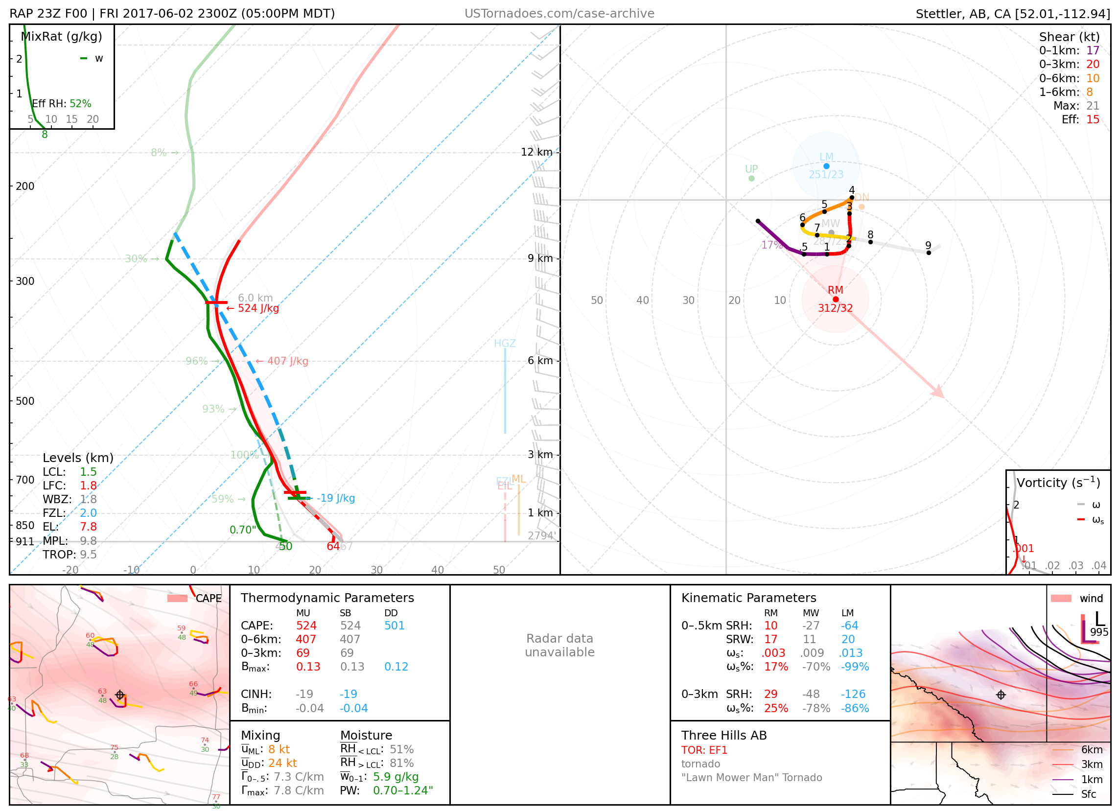
June 2, 2017: Three Hills, Alberta, Canada
Known as the “lawnmower man” tornado, thanks to a viral and nonchalant photo.
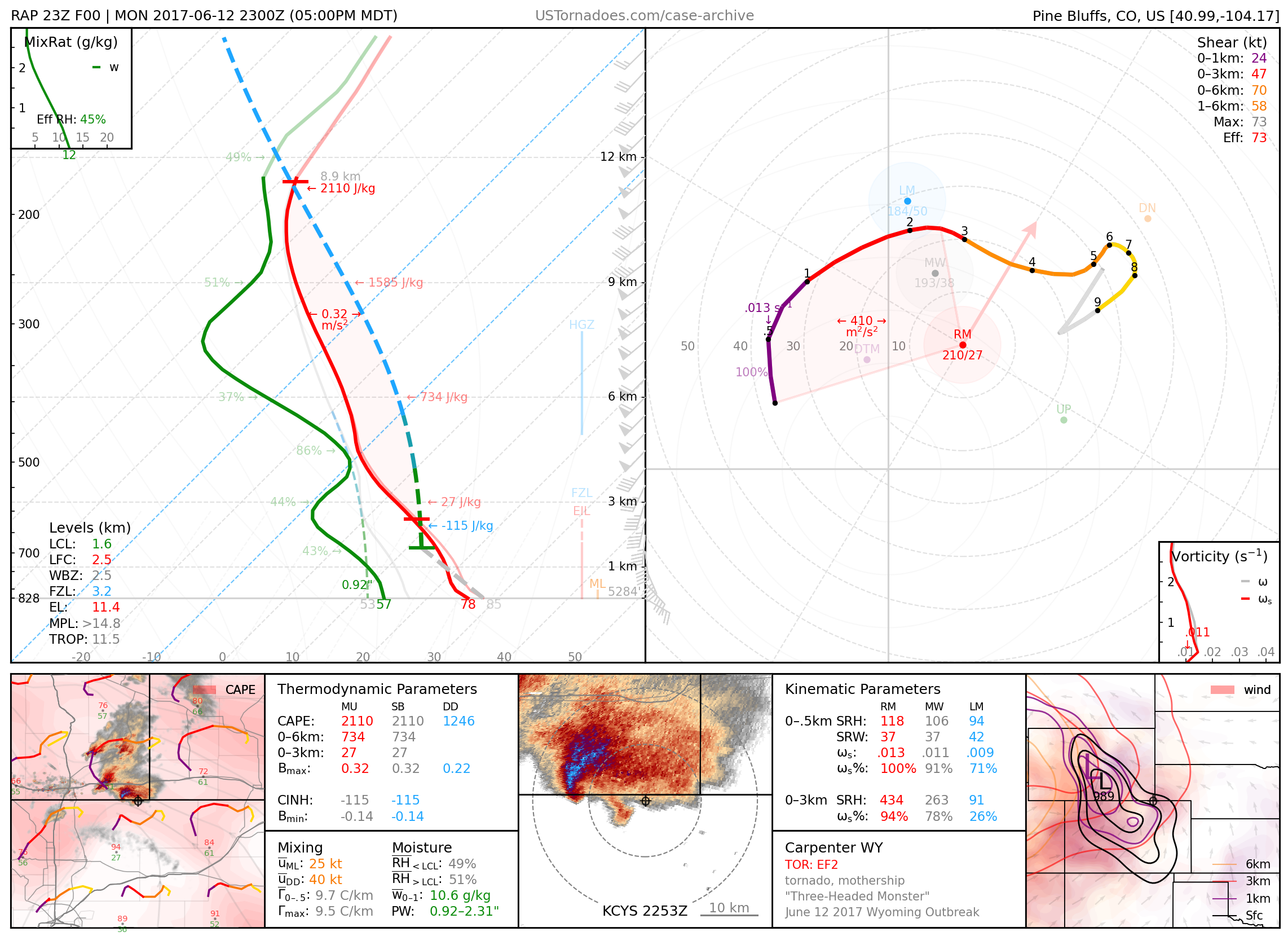
June 12, 2017: Carpenter, Wyoming
The first of several tornadoes from a particularly photogenic and cyclic “mothership” supercell, part of an unusual outbreak of tornadoes across WY into the NE panhandle.
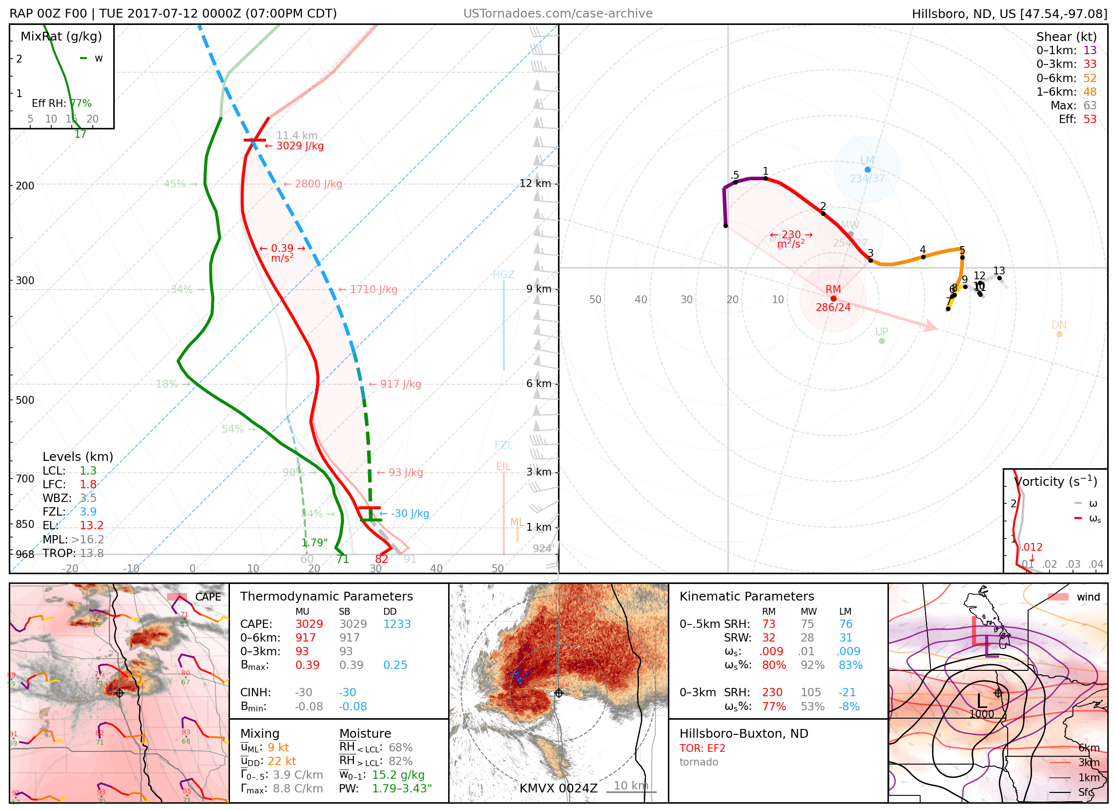
July 12, 2017: Mayville/ Buxton, North Dakota
Long-lived EF2 tornado from an HP supercell with northwest flow. Also featured a rather large “eye” on radar at peak intensity.
2018
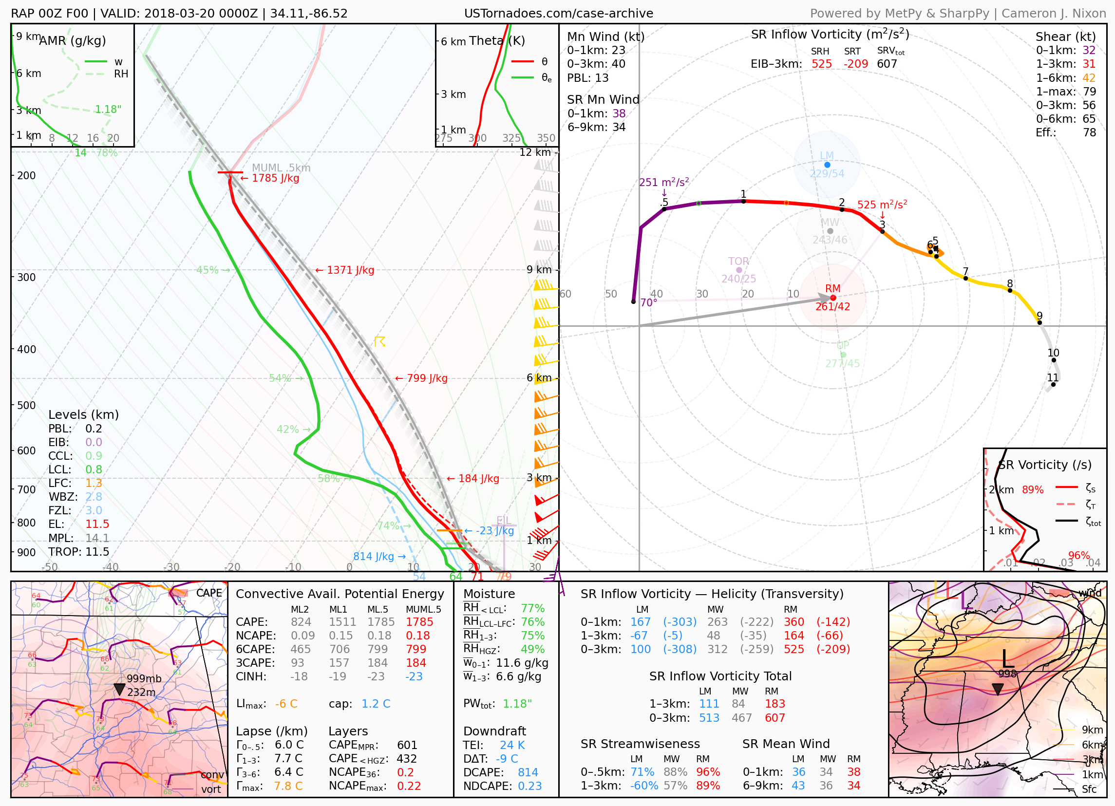
March 19, 2018: Cullman, Alabama
Alabama record hailstone at 5.38″.
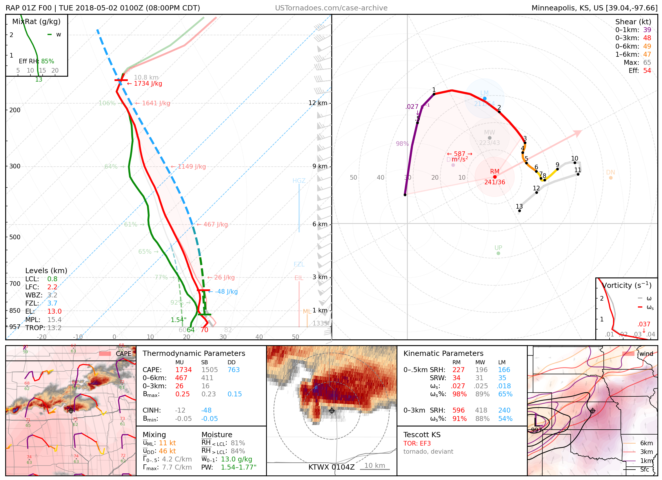
May 1, 2018: Tescott, Kansas
EF3 wedge tornado, also known as Bennington III.
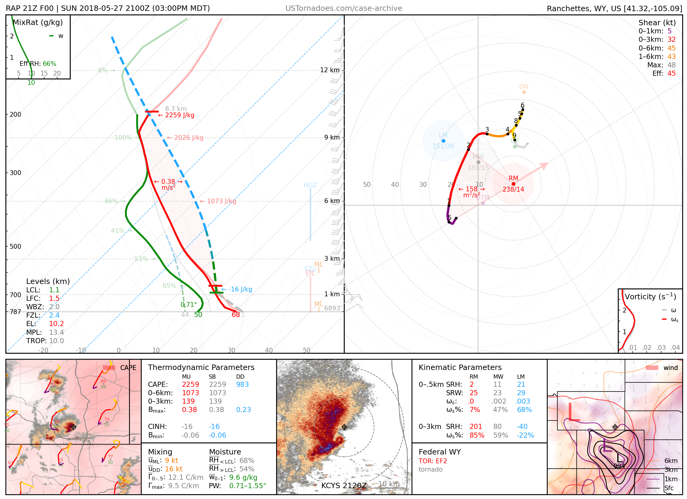
May 27, 2018: Federal, Wyoming
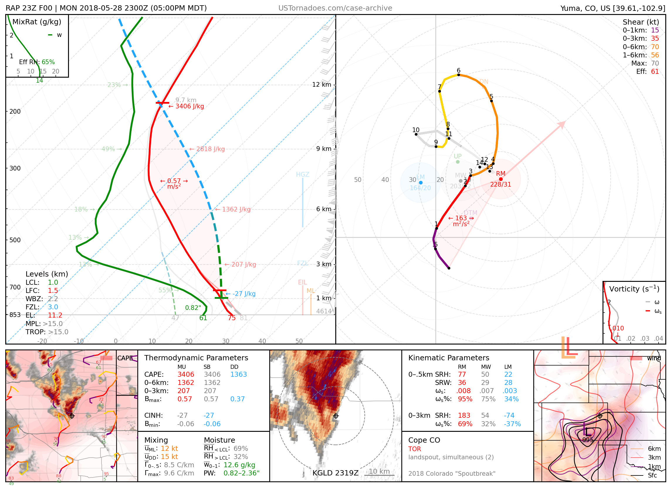
May 28, 2018: Cope, Colorado
Over a dozen landspout tornadoes.
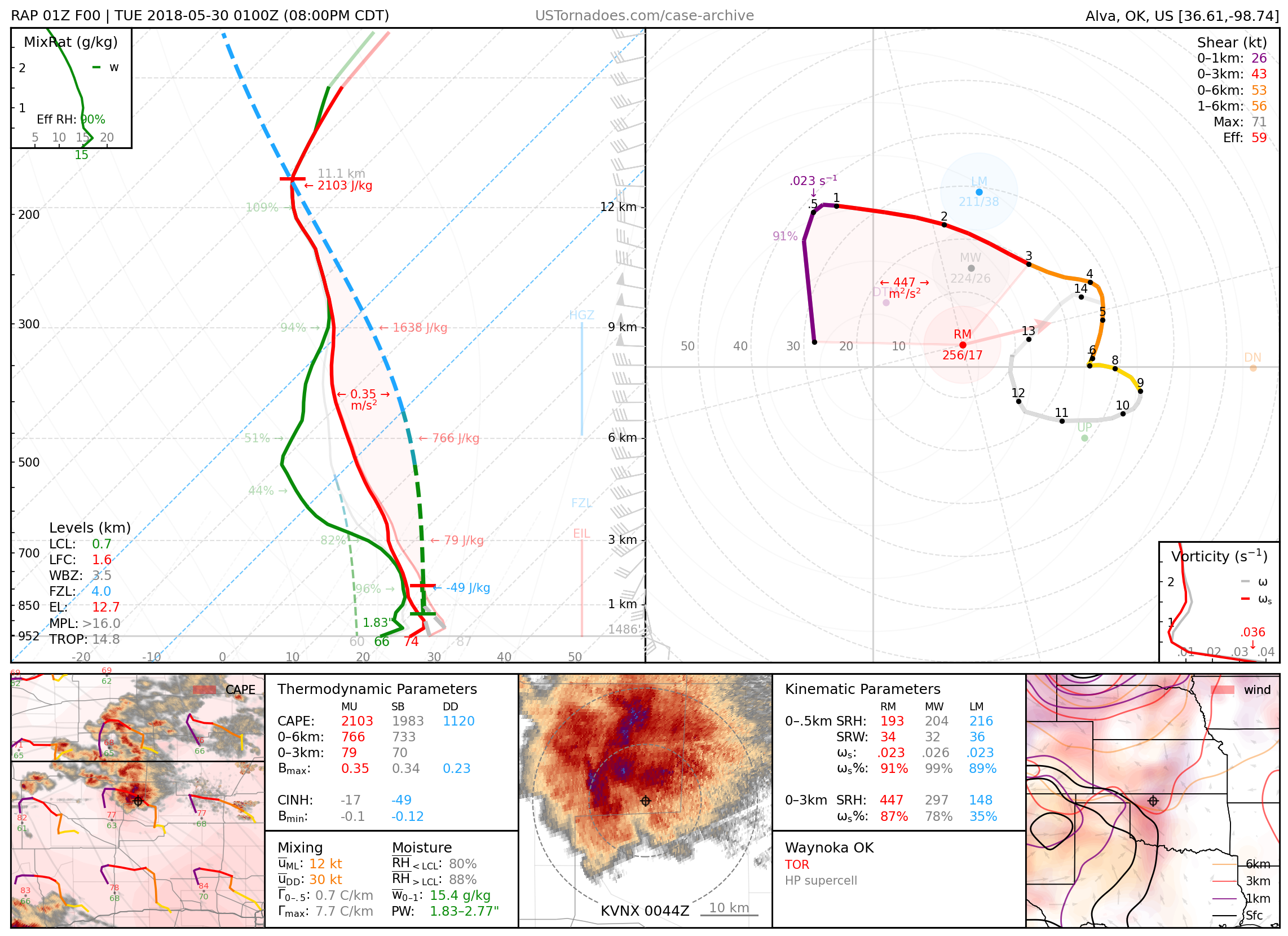
May 29, 2018: Waynoka, Oklahoma
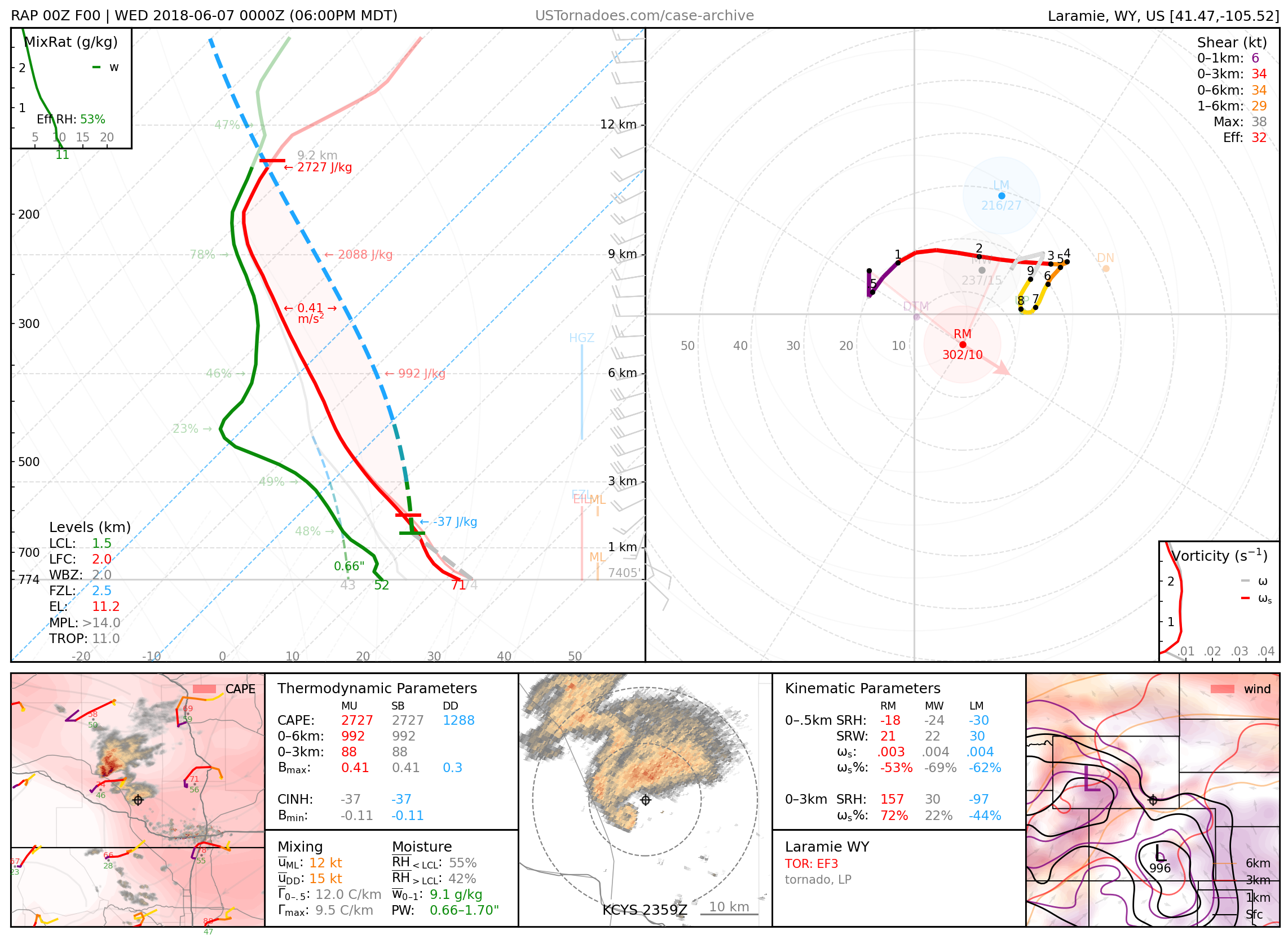
June 6, 2018: Laramie, Wyoming
Particularly photogenic and long-lived EF3 tornado with an EF2 satellite tornado.
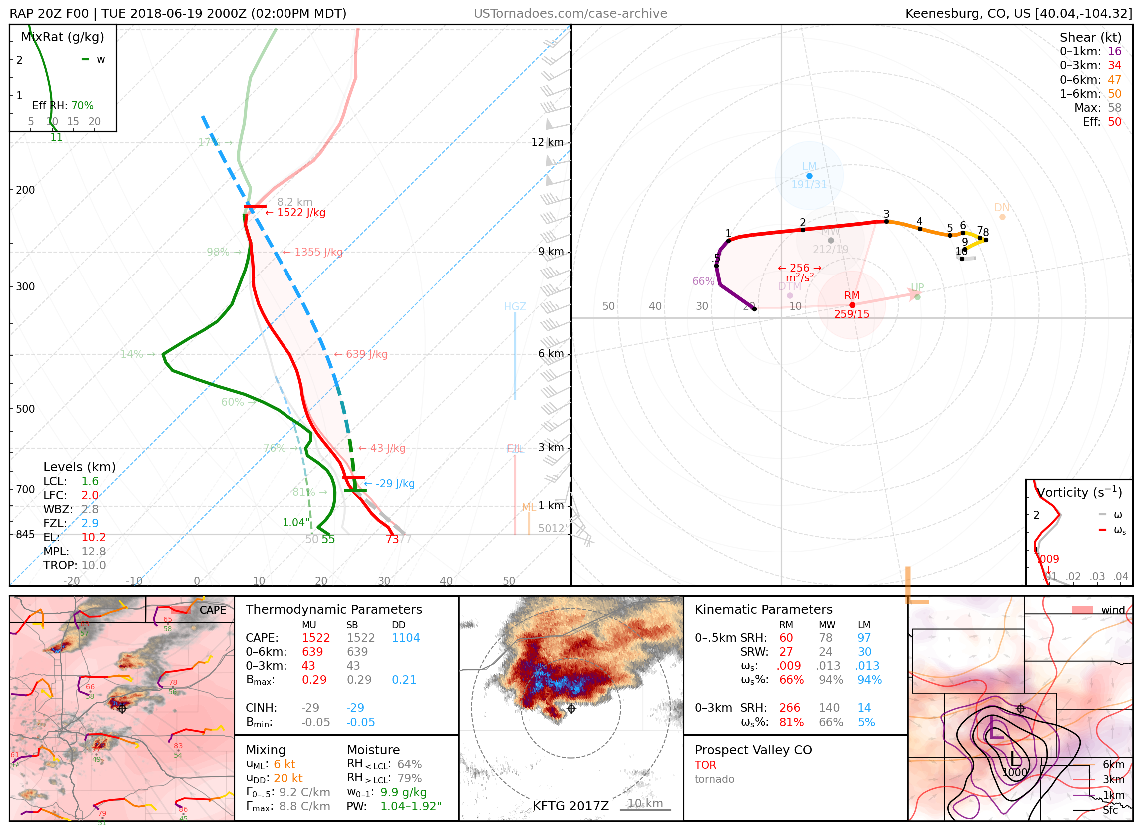
June 19, 2018: Prospect Valley, Colorado
Particularly photogenic rope tornado.
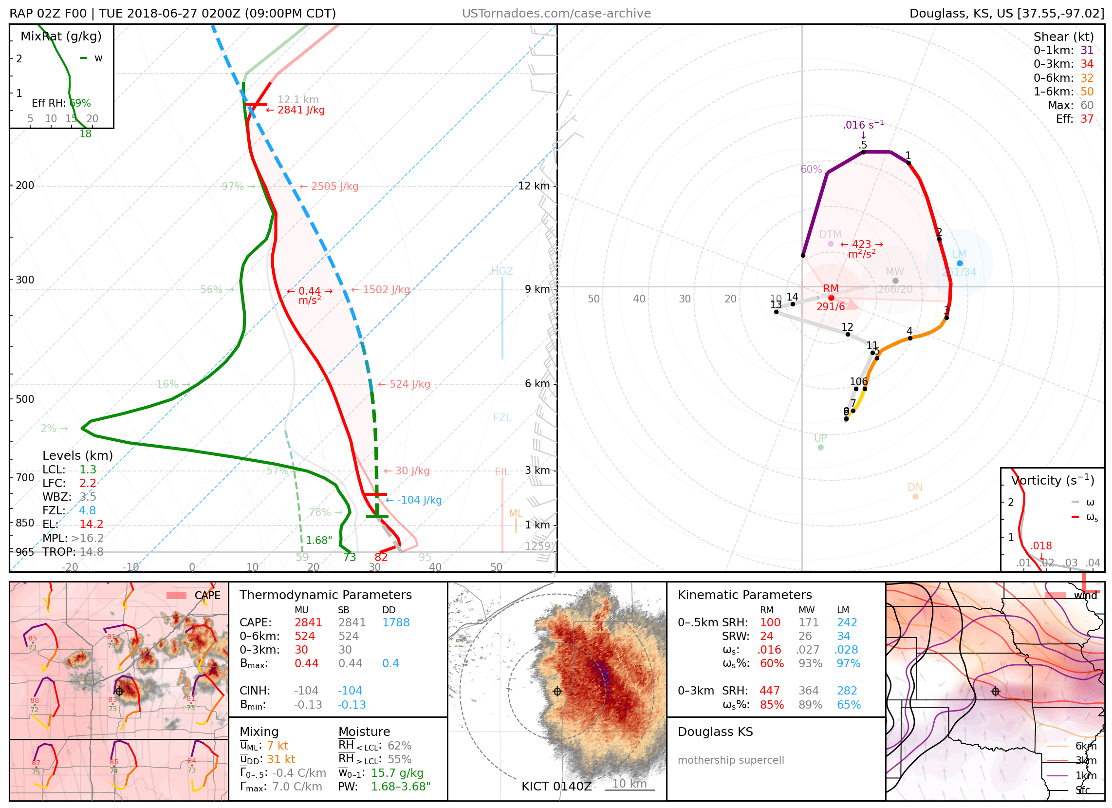
June 26, 2018: Douglass, Kansas
Particularly photogenic “mothership” supercell.
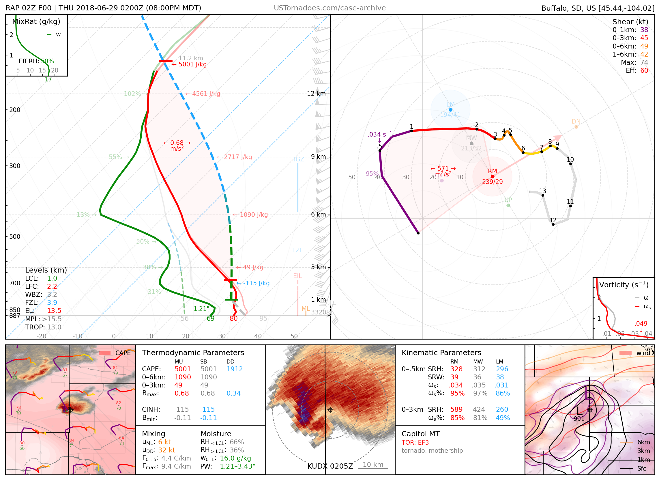
June 28, 2018: Capitol, Montana / Camp Crook, South Dakota
Particularly photogenic and cyclic supercell that produced several tornadoes up to EF3.
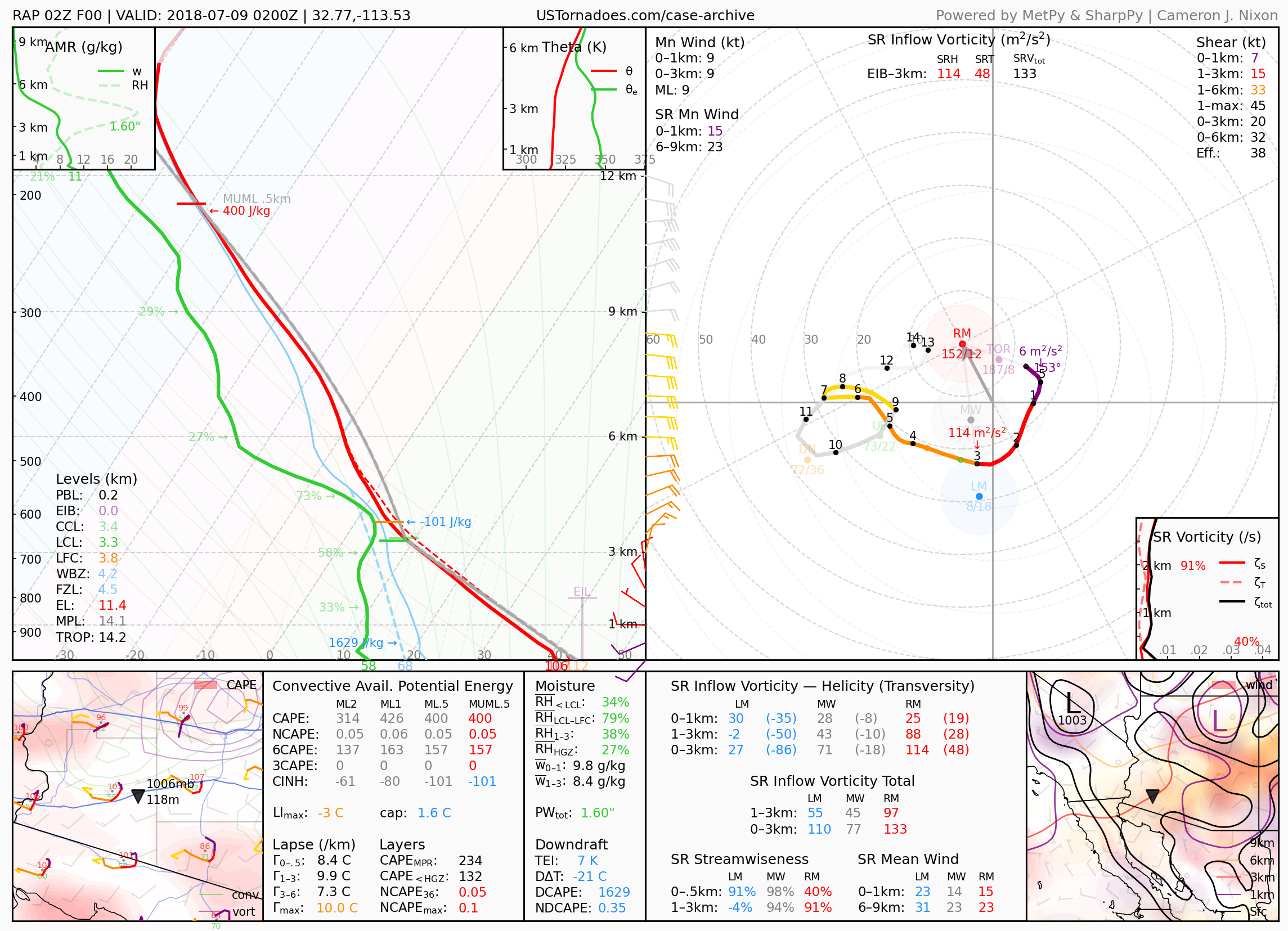
July 8, 2018: Interstate 8 / Southwest Arizona
Particularly photogenic haboob that traveled around 200 miles across the Sonoran Desert.
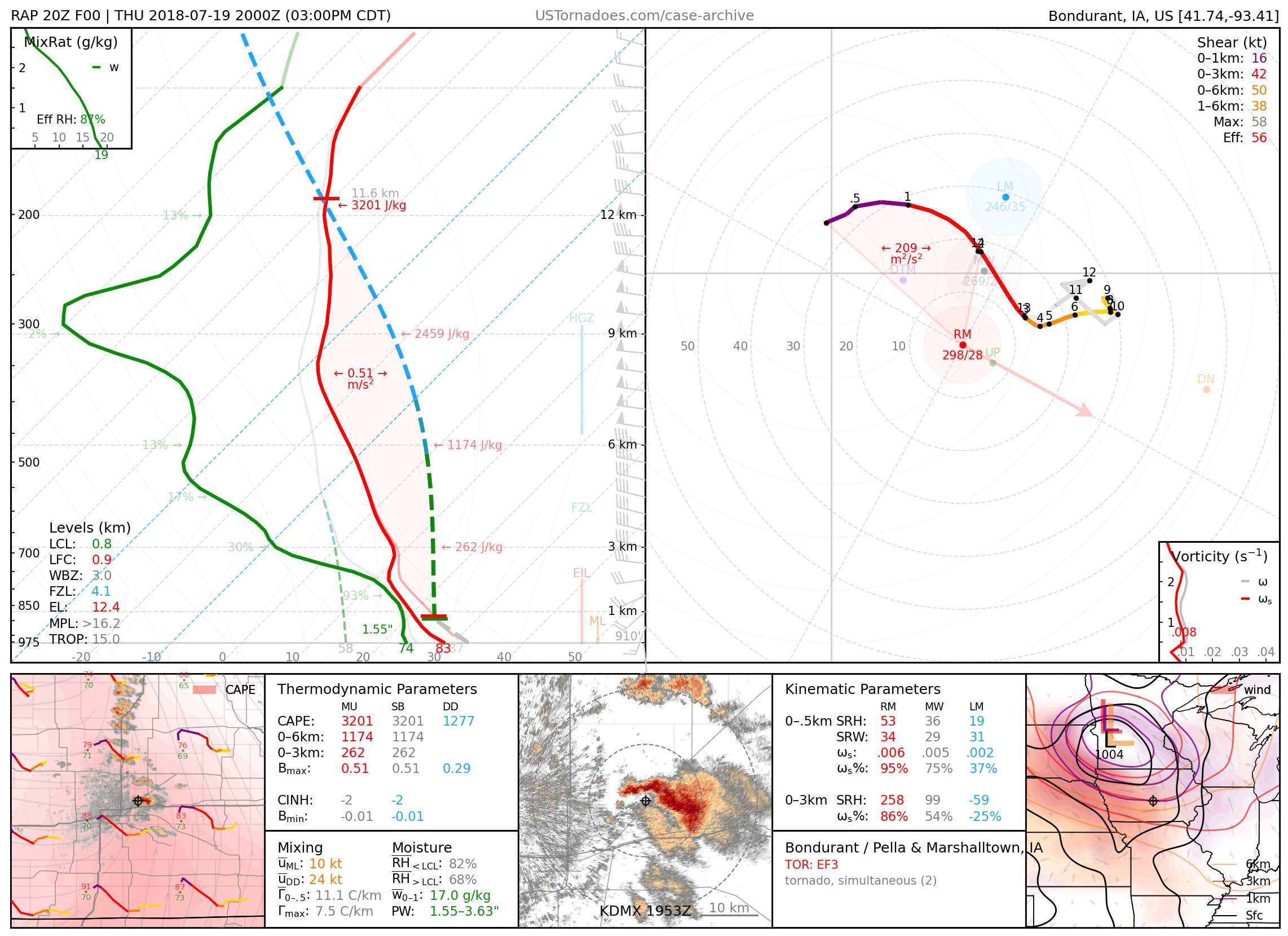
July 19, 2018: Bondurant, Marshalltown, and Pella, Iowa
Localized outbreak of tornadoes (up to EF3), including 2 simultaneous EF2 tornadoes across central IA. An event that was largely a “surprise” (especially in magnitude) until later in the forecast period.
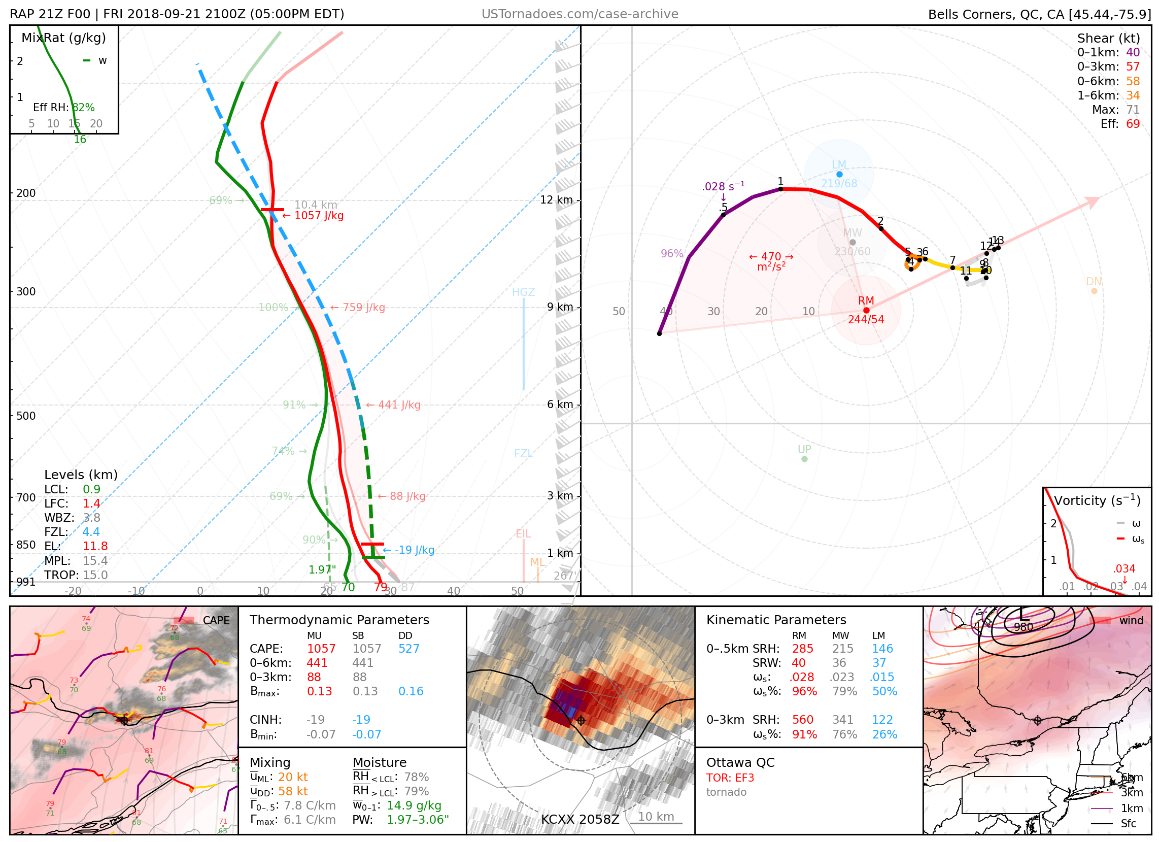
September 21, 2018: Dunrobin / Gatineau / Ottawa, Ontario, Canada
Long-tracked EF3 tornado.
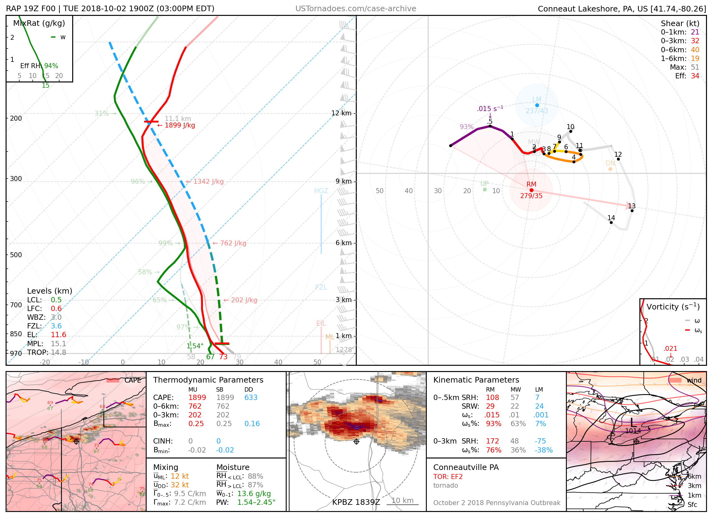
October 2, 2018: Conneautville, Pennsylvania
EF2 tornado, the first tornado of the largest October tornado outbreak in Pennsylvania on record.
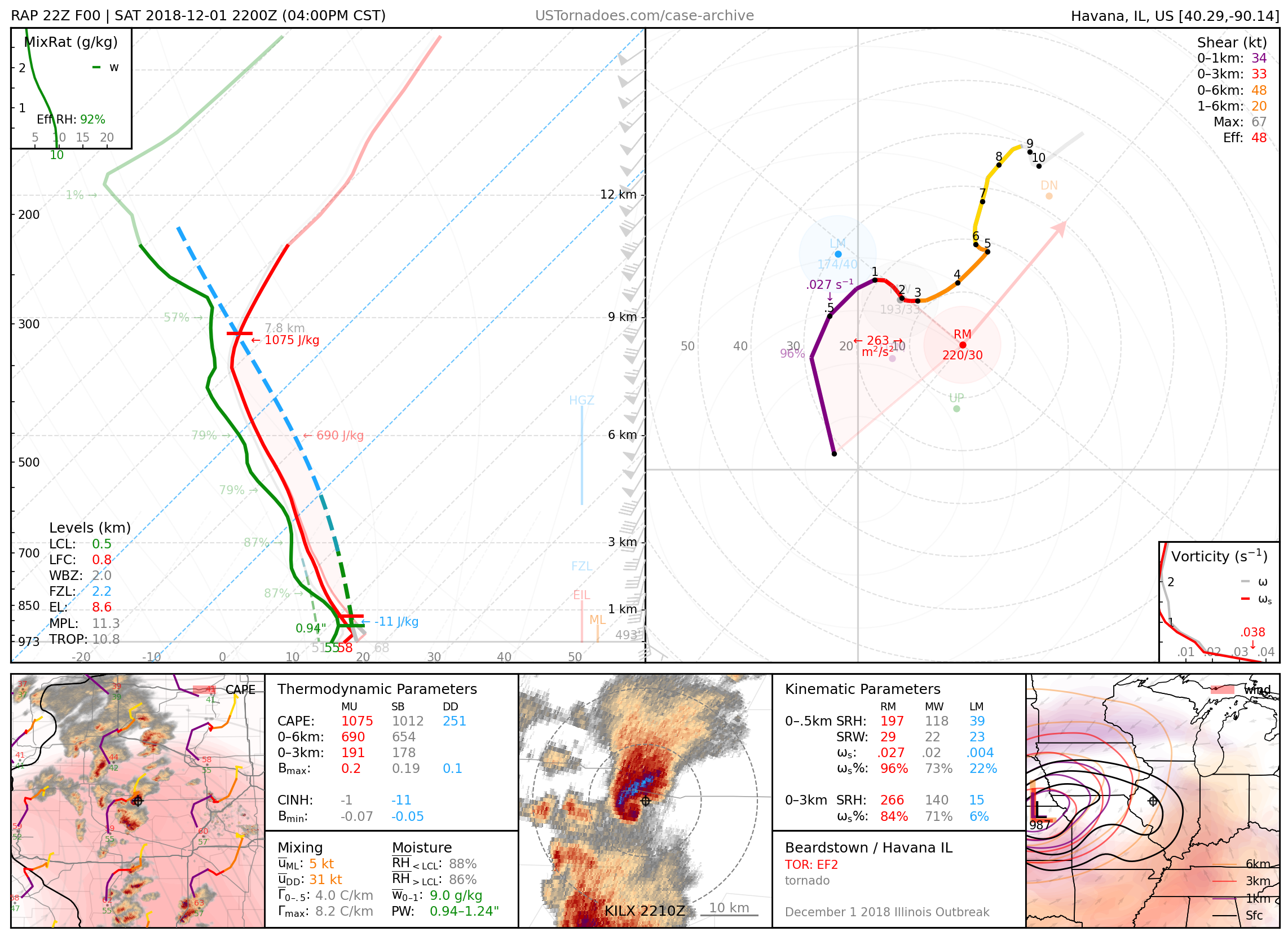
December 1, 2018: Havana and Taylorville, Illinois
A couple of several tornadoes (up to EF3) produced by photogenic and cyclic “cold-core” supercells, part of the largest December tornado outbreak in Illinois on record.
2019
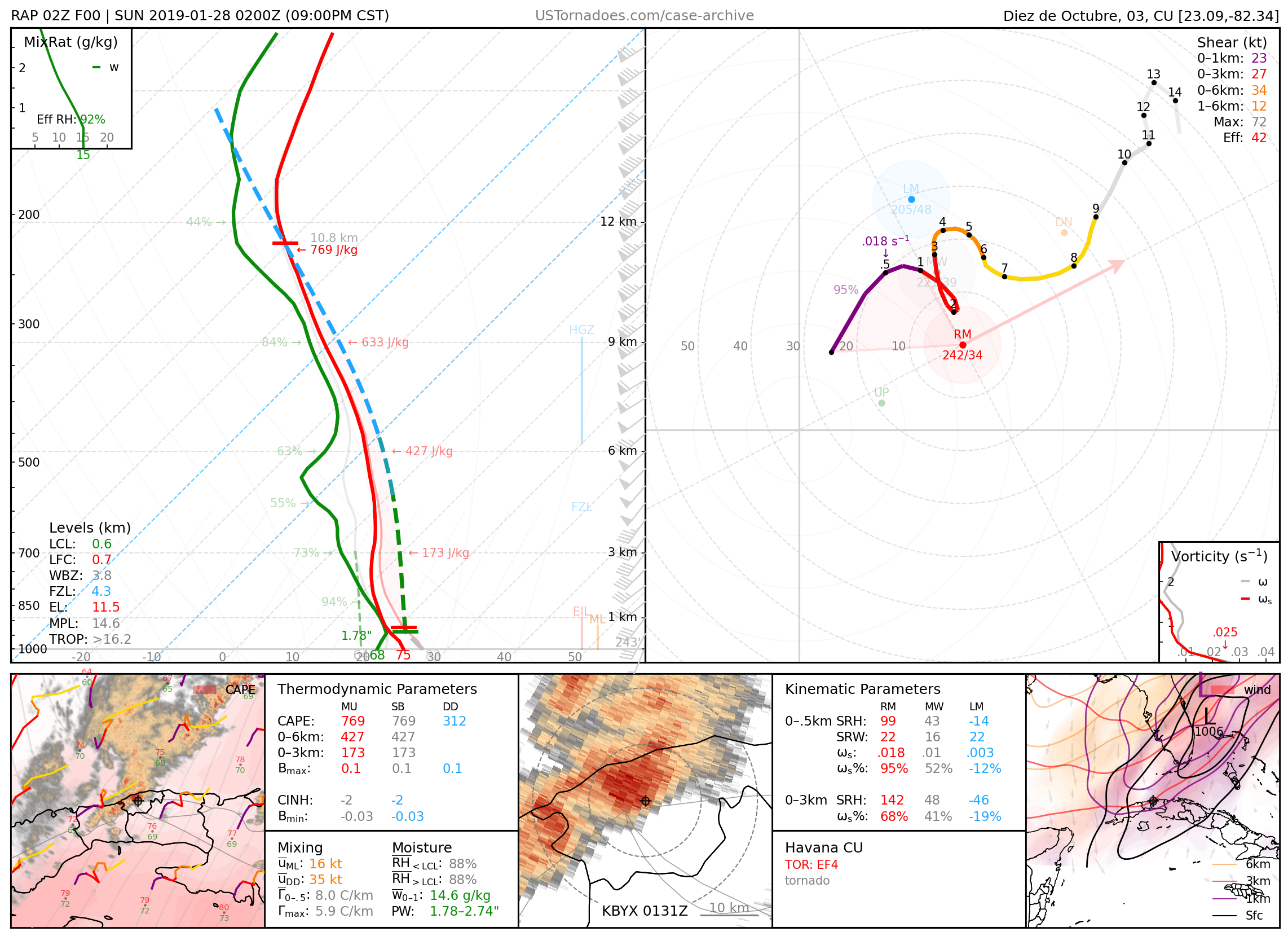
January 27, 2019: Havana, Cuba
EF3–EF4-equivalent tornado that killed 6 people, highly unusual for the area.
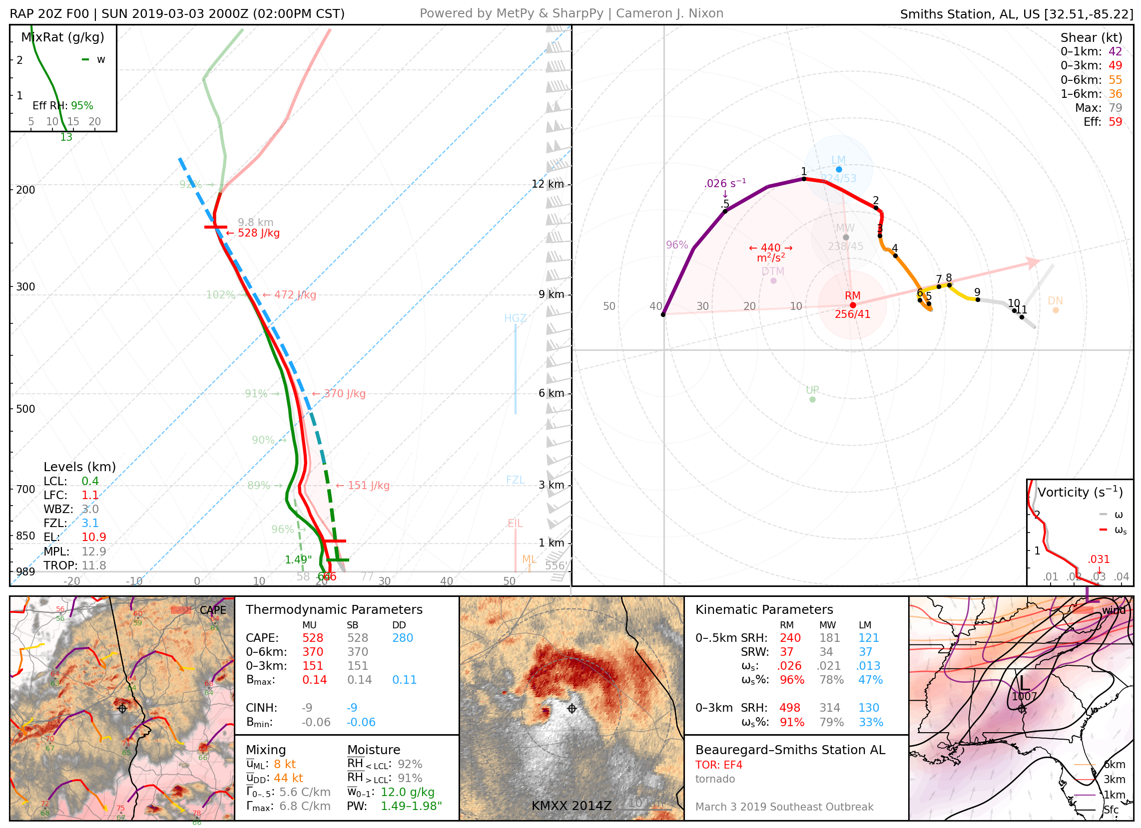
March 3, 2019: Beauregard–Smiths Station, AL
EF4 wedge tornado that killed 23 people.
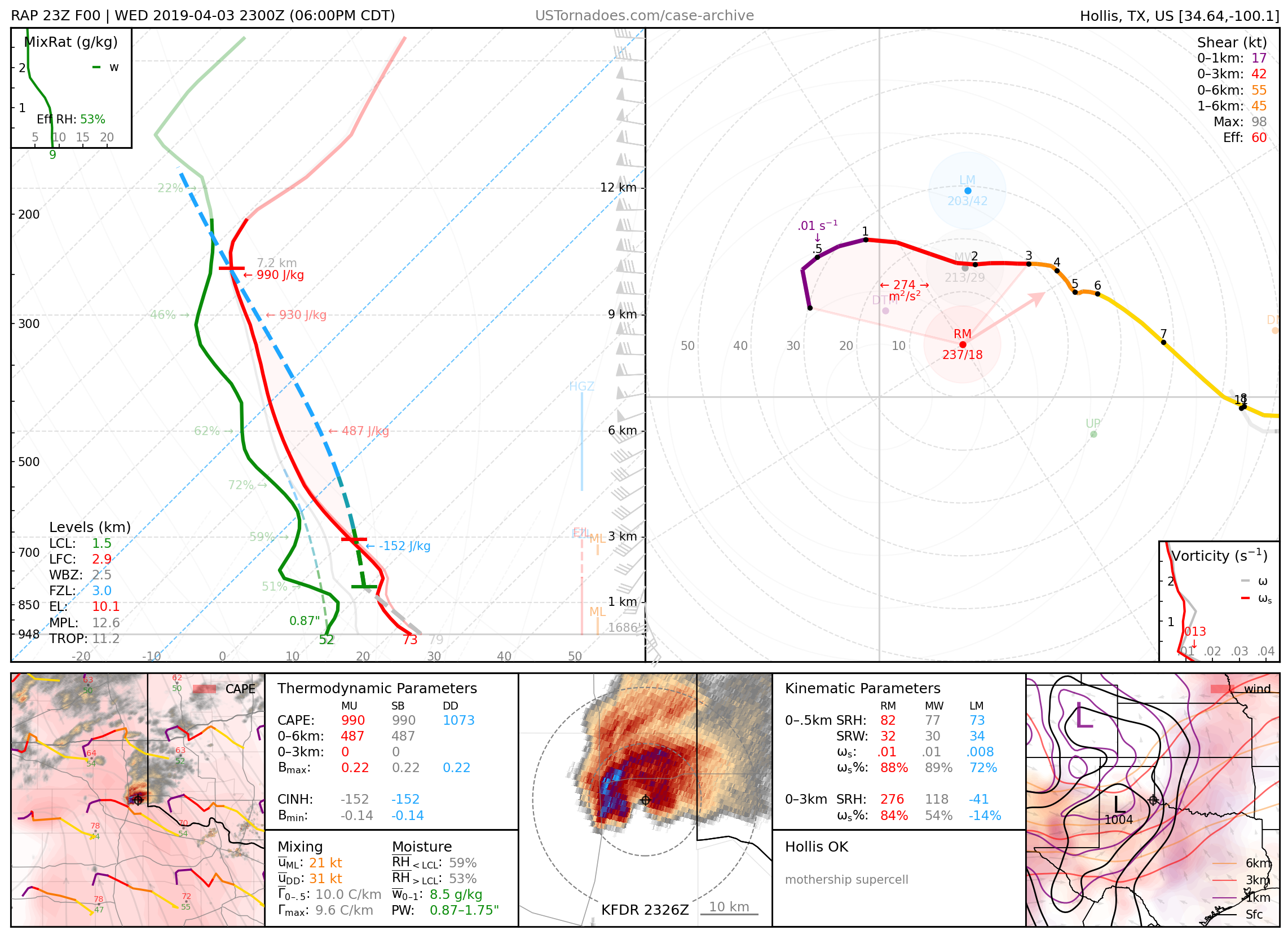
April 3, 2019: Hollis, Oklahoma
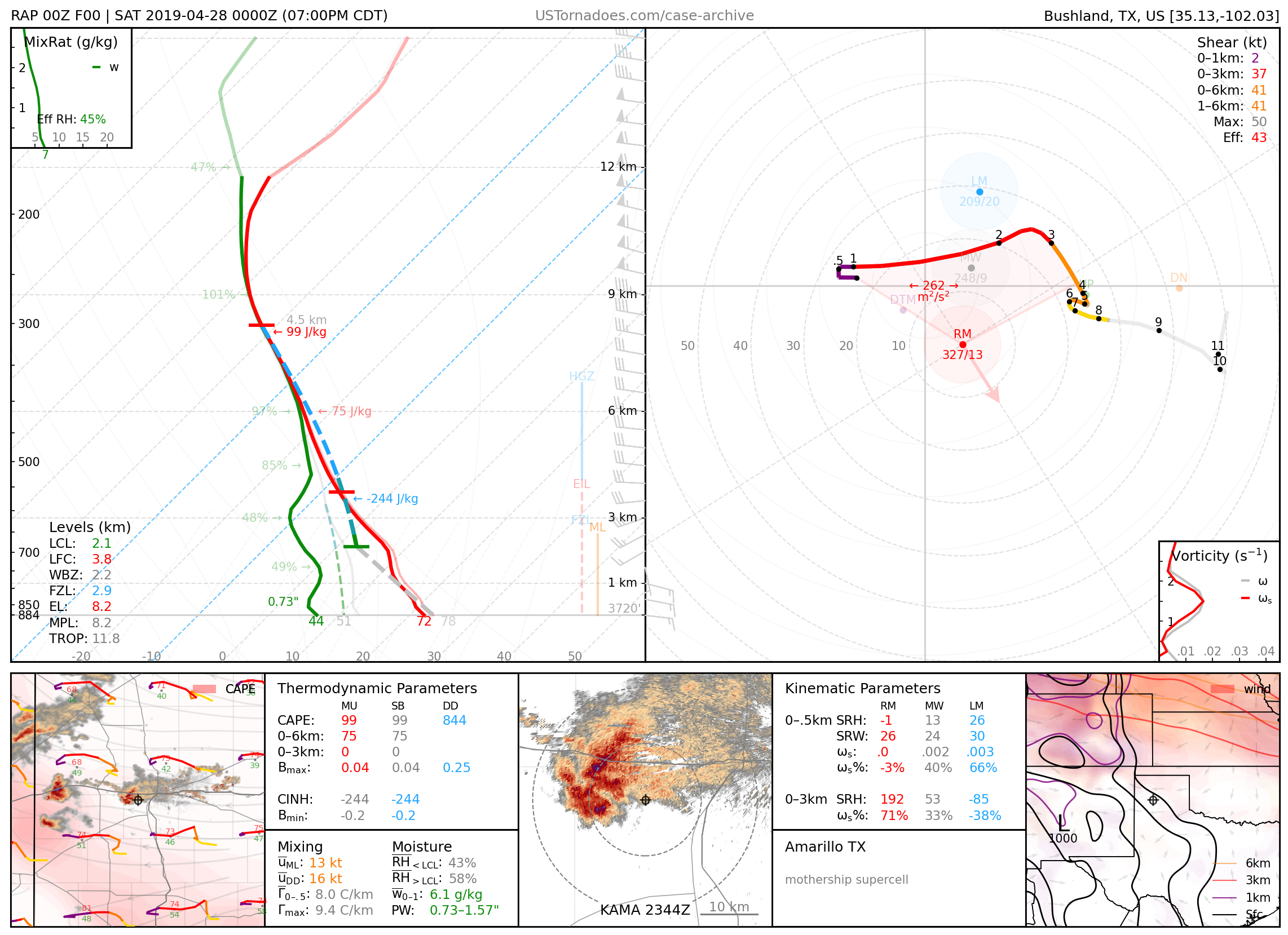
April 27, 2019: Amarillo, Texas
Particularly photogenic “flying saucer”-like supercell.
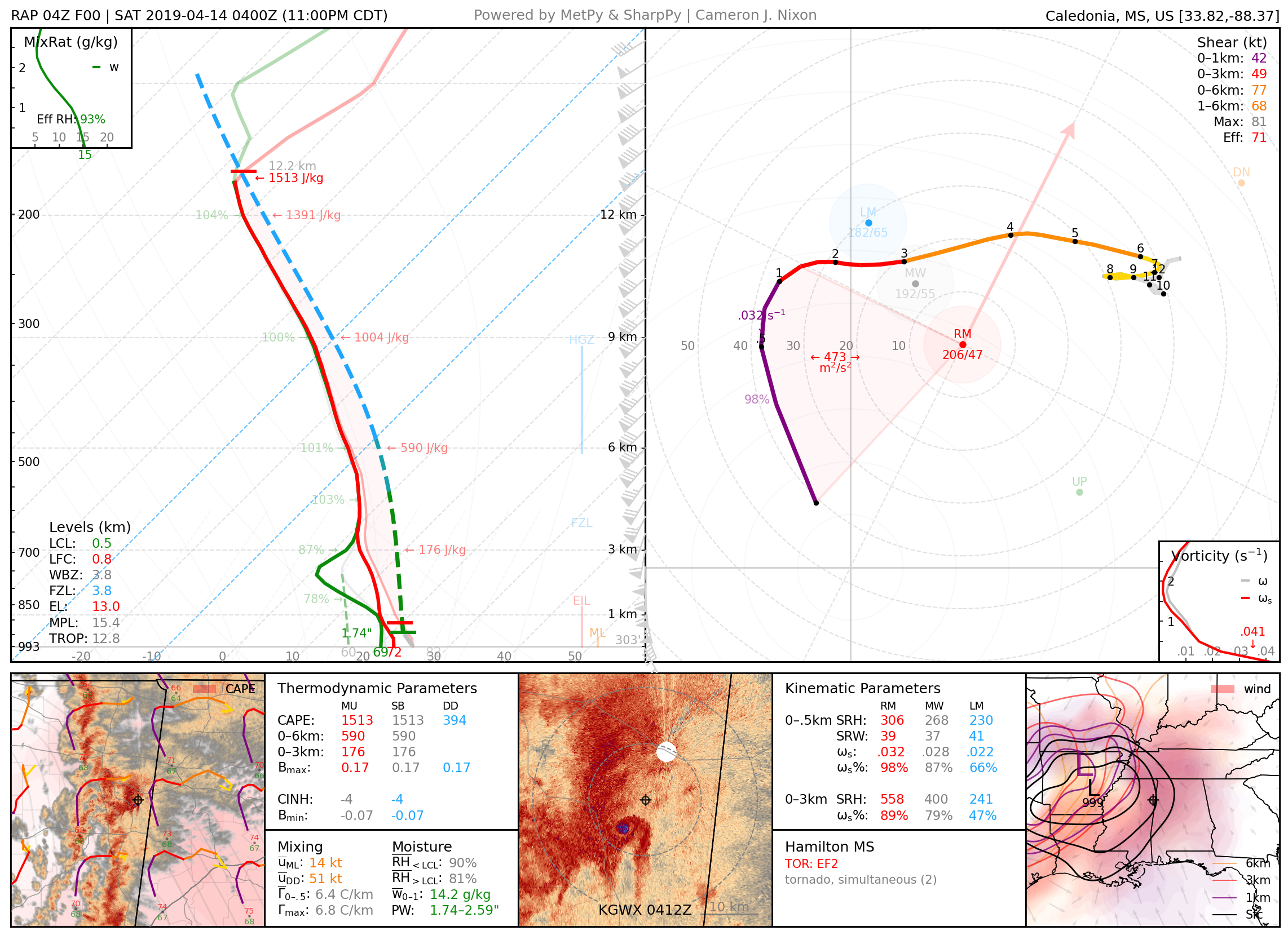
April 13, 2019: Hamilton, Mississippi
A pair of large and intense tornadoes, both rated EF2, that formed in quick succession, narrowly missing the KGWX radar.
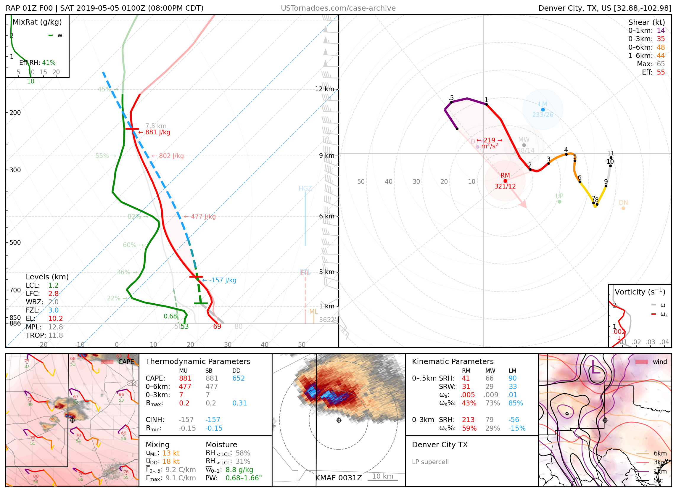
May 4, 2019: Denver City, Texas
Particularly photogenic low-precipitation supercell.
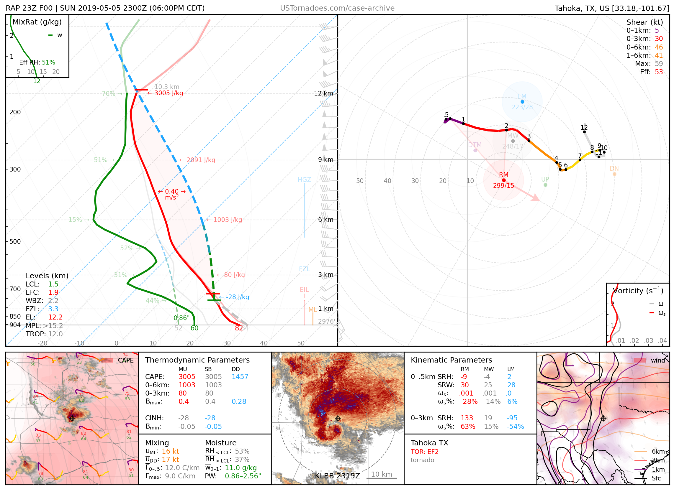
May 5, 2019: Tahoka, Texas
Long-lived, dusty, and nearly stationary EF2 tornado.
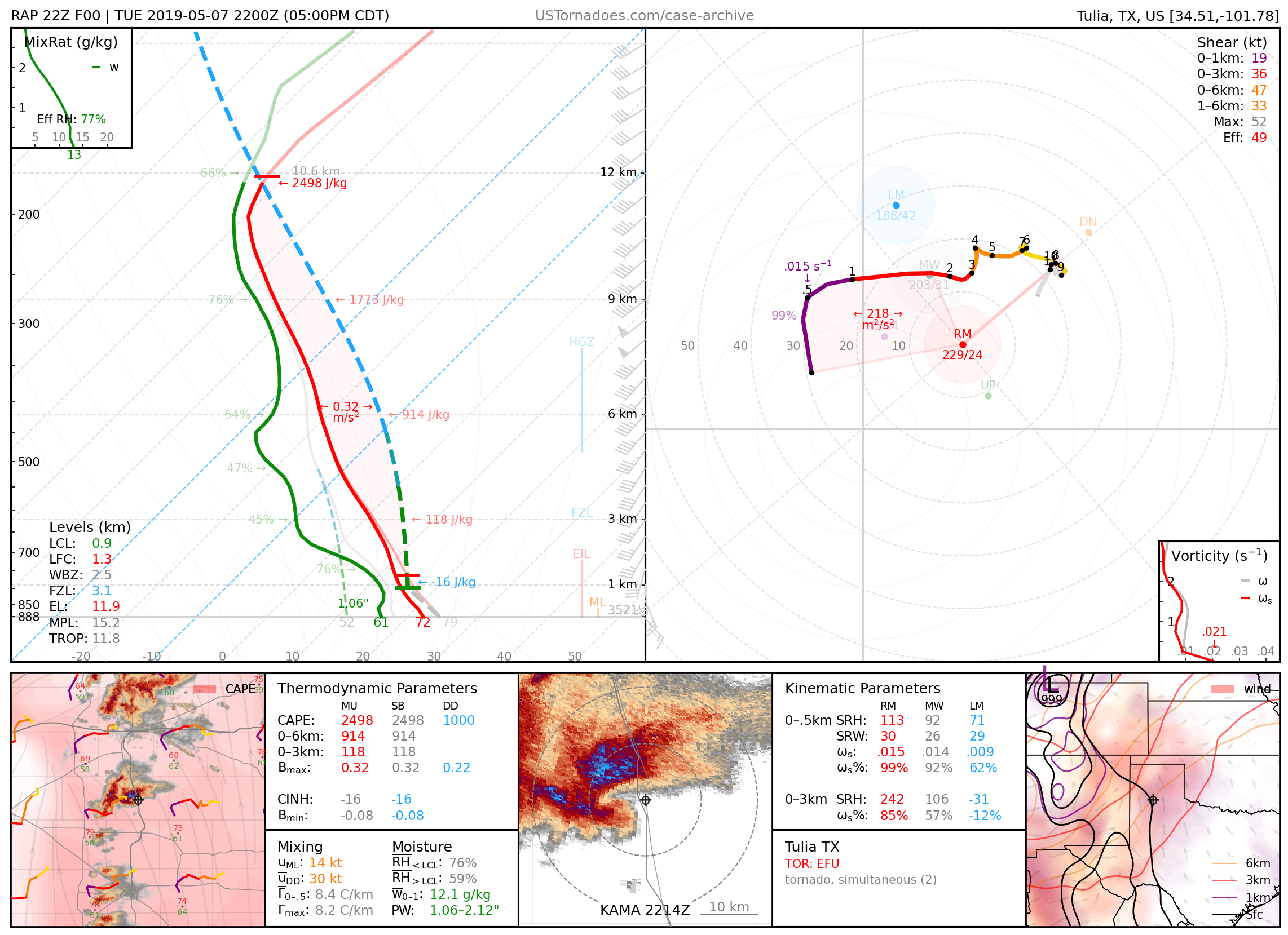
May 7, 2019: Tulia, Texas
High-precipitation, cyclic supercell that produced multiple weak tornadoes.
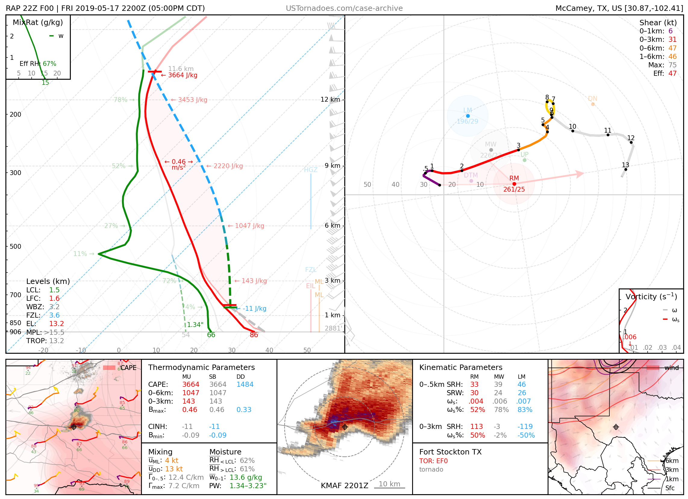
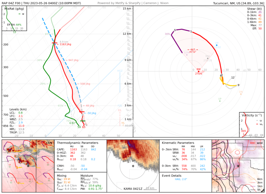
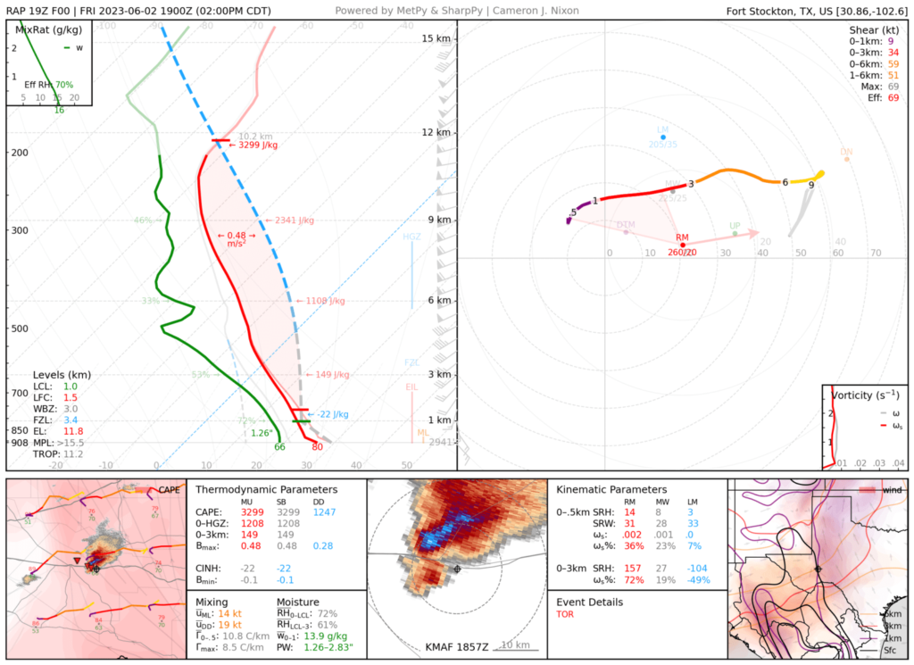
May 17, 2019: Fort Stockton, Texas
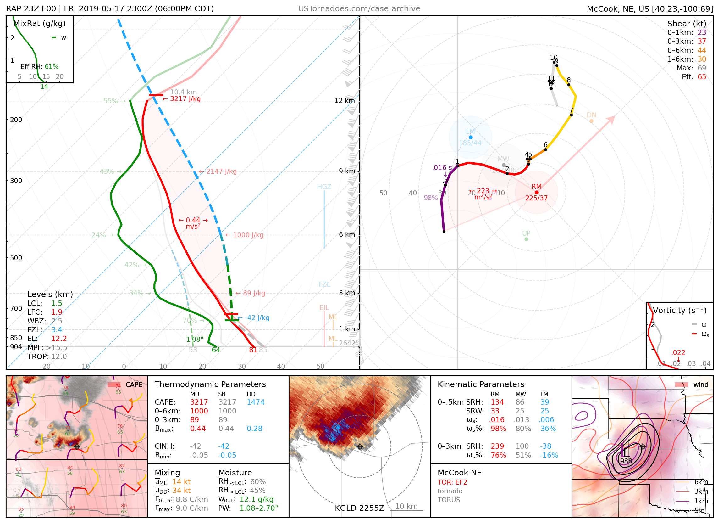
May 17, 2019: McCook, Nebraska
Photogenic EF2 tornado from a cyclic supercell that produced tornadoes up to EF3.
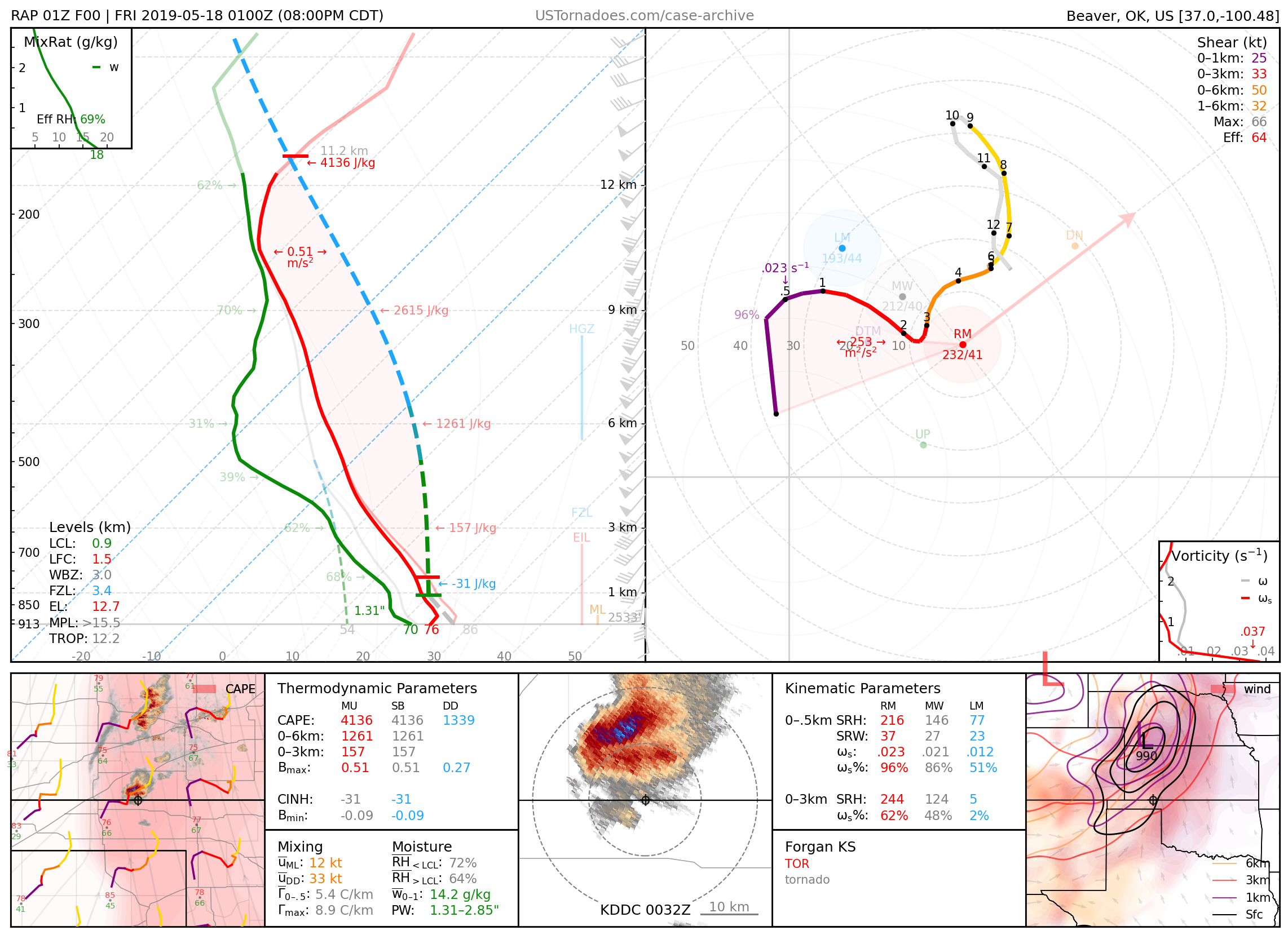
May 17, 2019: Forgan, Oklahoma
Particularly photogenic tornado, the first of multiple (up to EF3) from a cyclic supercell.
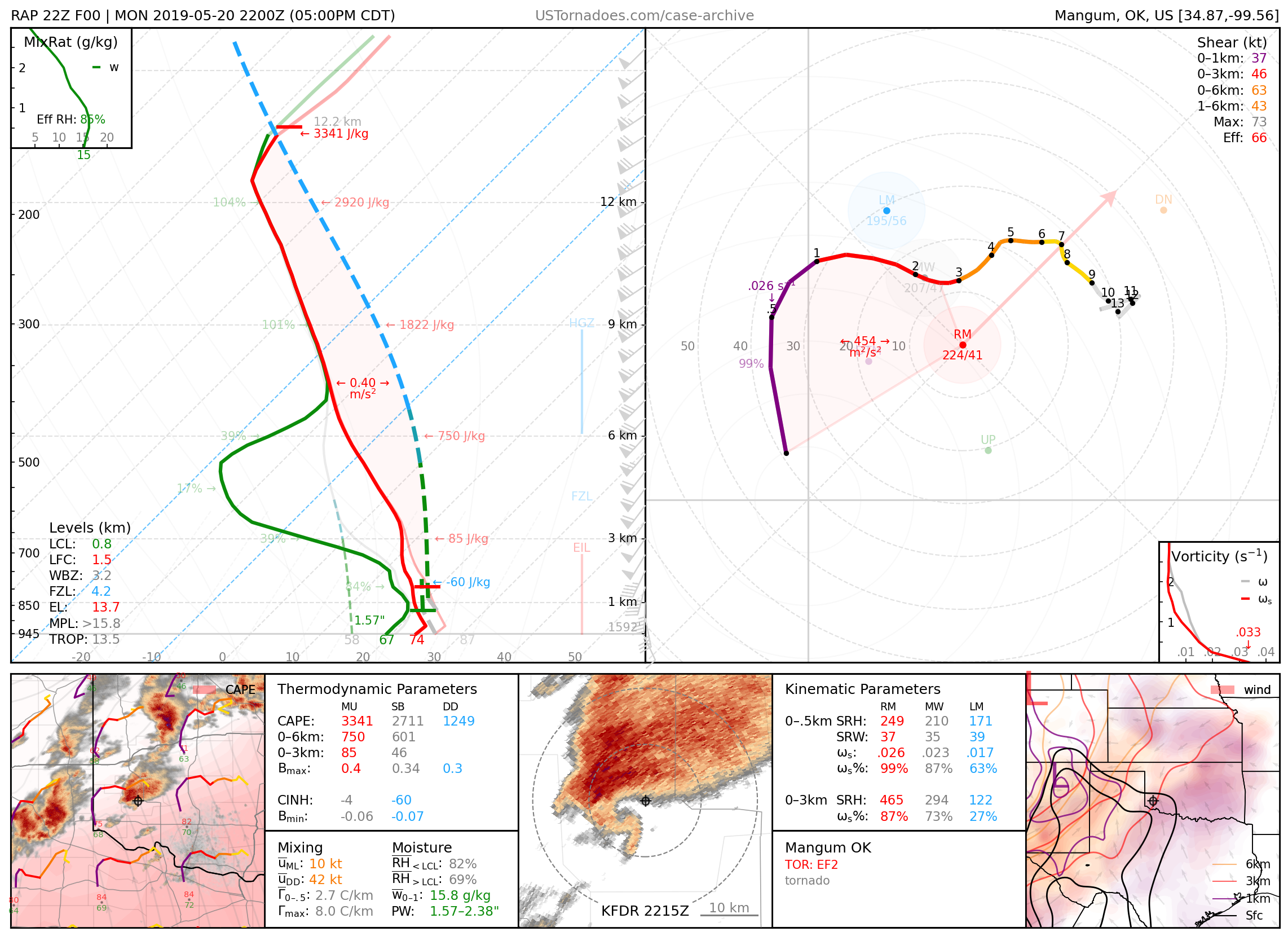
May 20, 2019: Mangum, Oklahoma
Wedge tornado produced by high-precipitation supercell, with recorded winds up to 212 mph, though rated an EF2. Part of a High Risk event regarded by some as a “bust” due to a lack of intense tornadoes across Oklahoma.
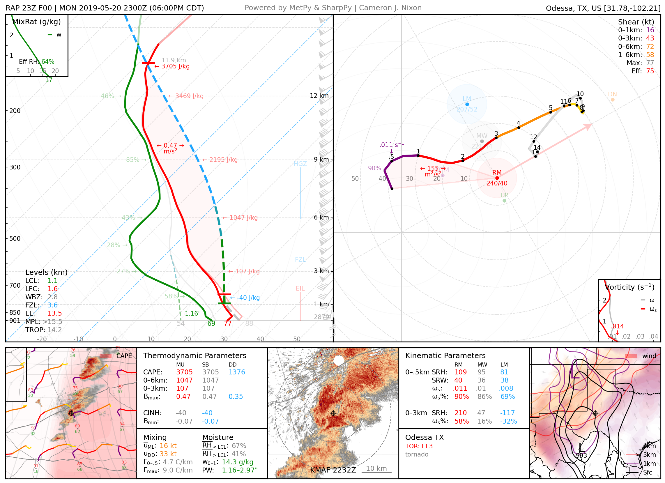
May 20, 2019: Midland–Odessa, Texas
Particularly photogenic EF3 tornado.
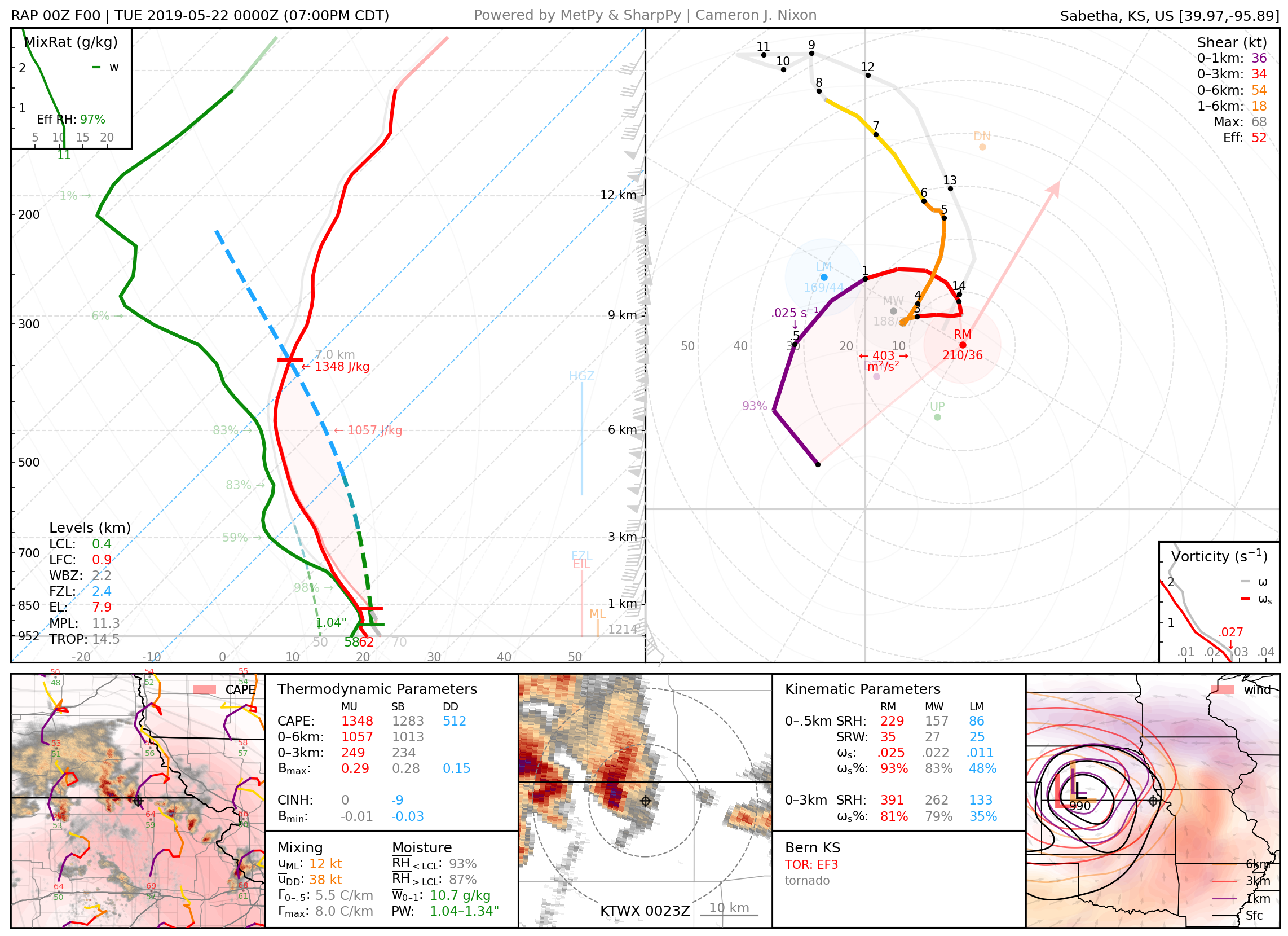
May 21, 2019: Bern, Kansas
Photogenic cold-core EF3 tornado.
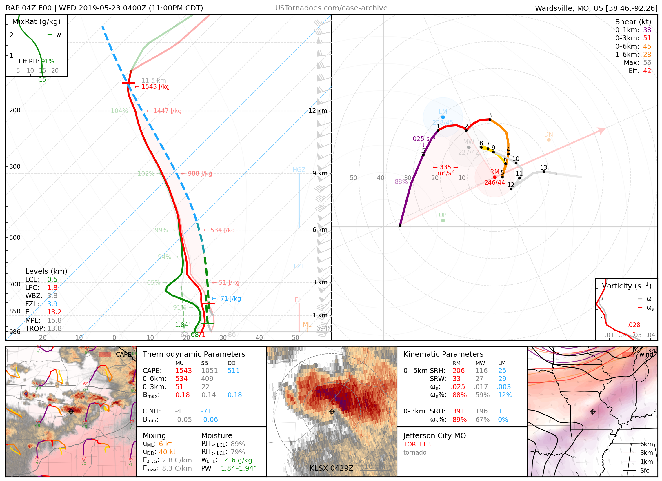
May 22, 2019: Jefferson City, Missouri
Long-lived EF3 tornado.
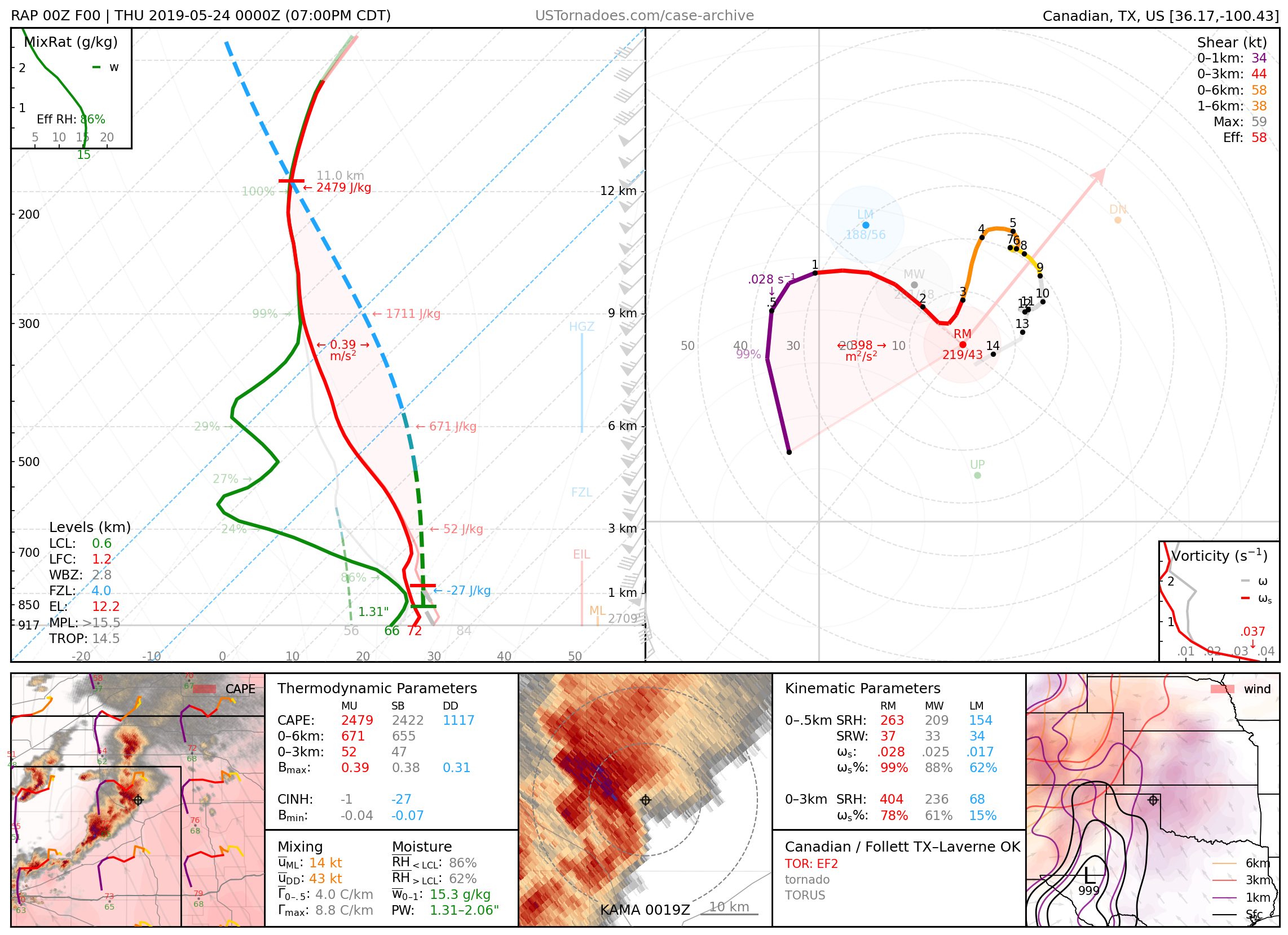
May 23, 2019: Canadian and Follett, Texas – Laverne, Oklahoma
EF2 and EF3 wedge tornadoes from the same supercell
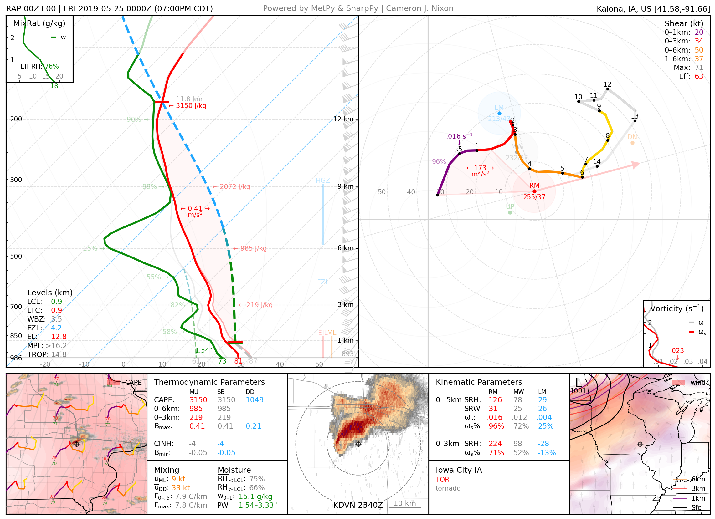
May 24, 2019: Iowa City, Iowa
Long-lived and photogenic tornado.
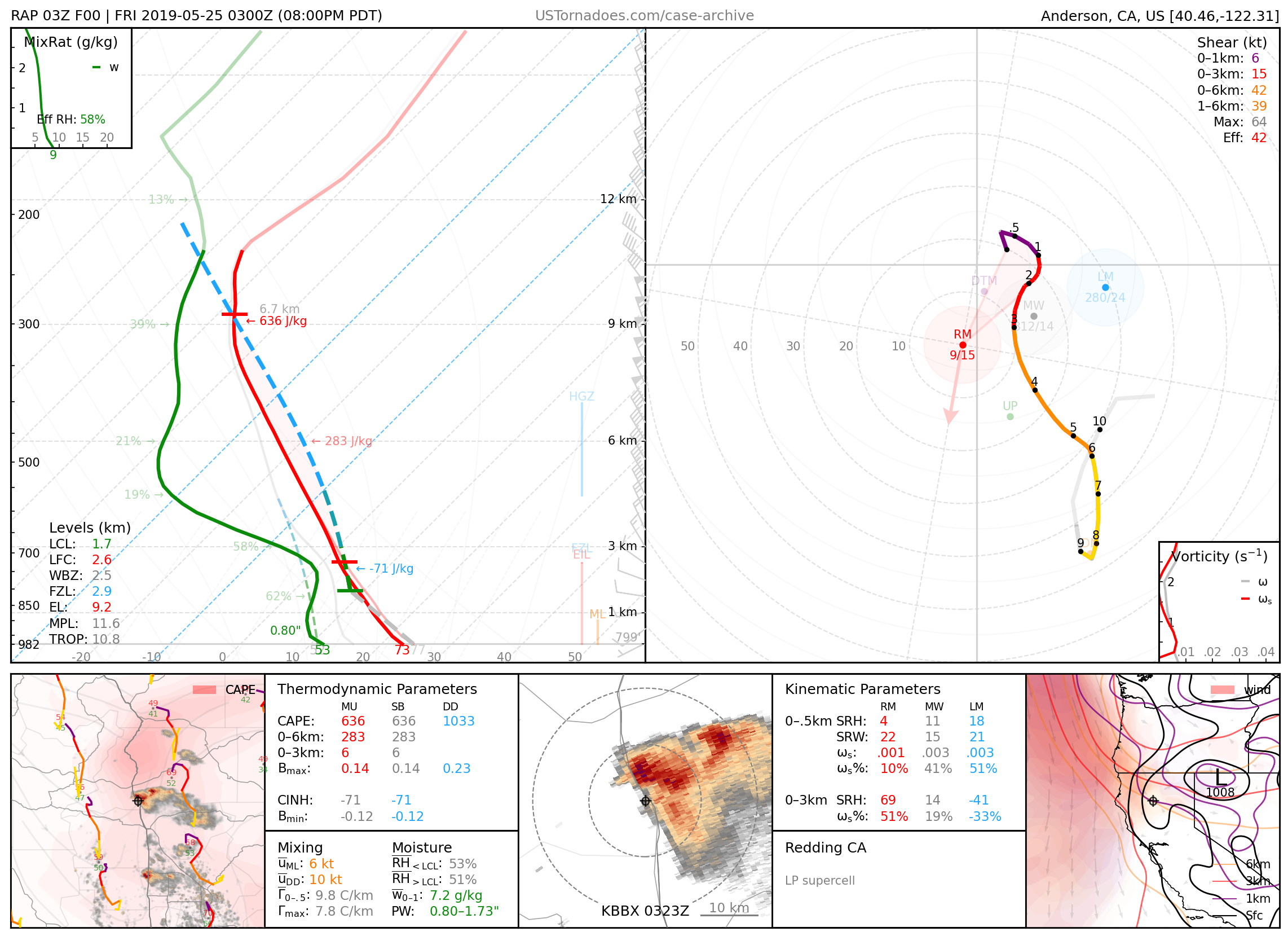
May 24, 2019: Redding, California
Particularly photogenic supercell, especially for the northern California region.
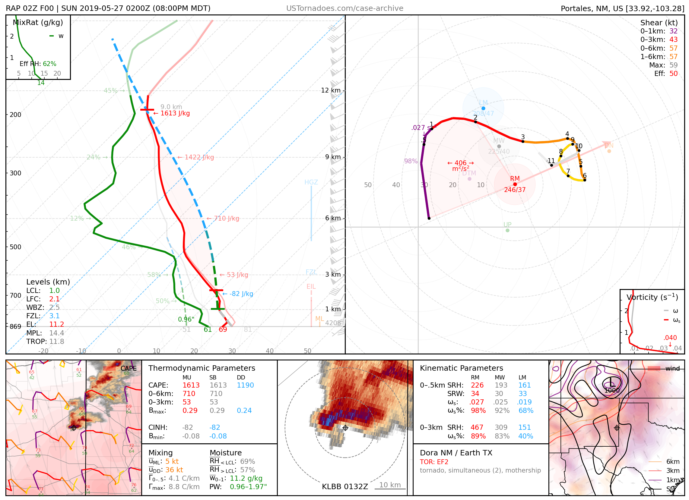
May 26, 2019: Dora, New Mexico
Particularly photogenic, cyclic supercell that produced several tornadoes up to EF2.
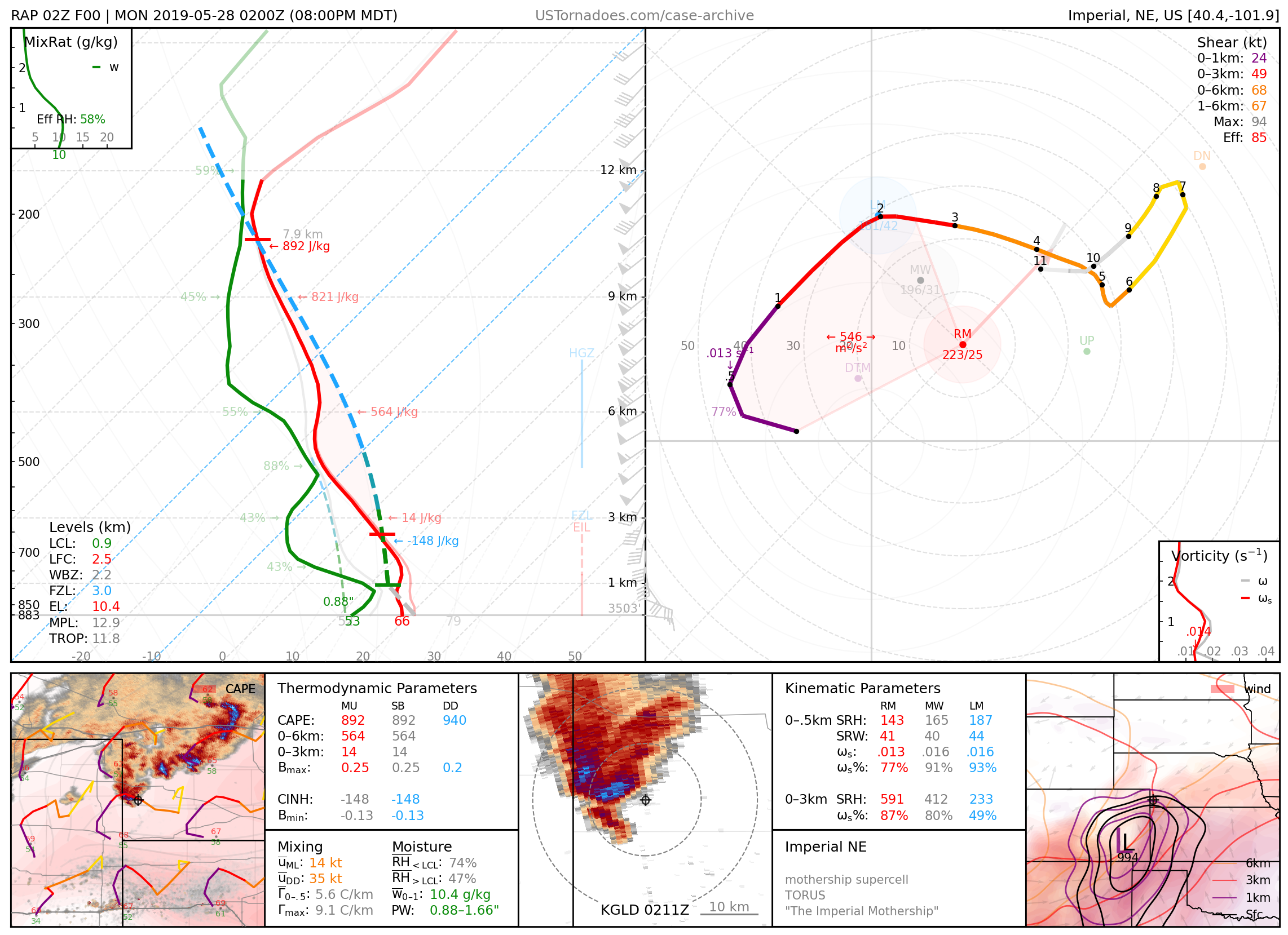
May 27, 2019: Imperial, Nebraska
Massive and particularly photogenic “mothership” supercell.
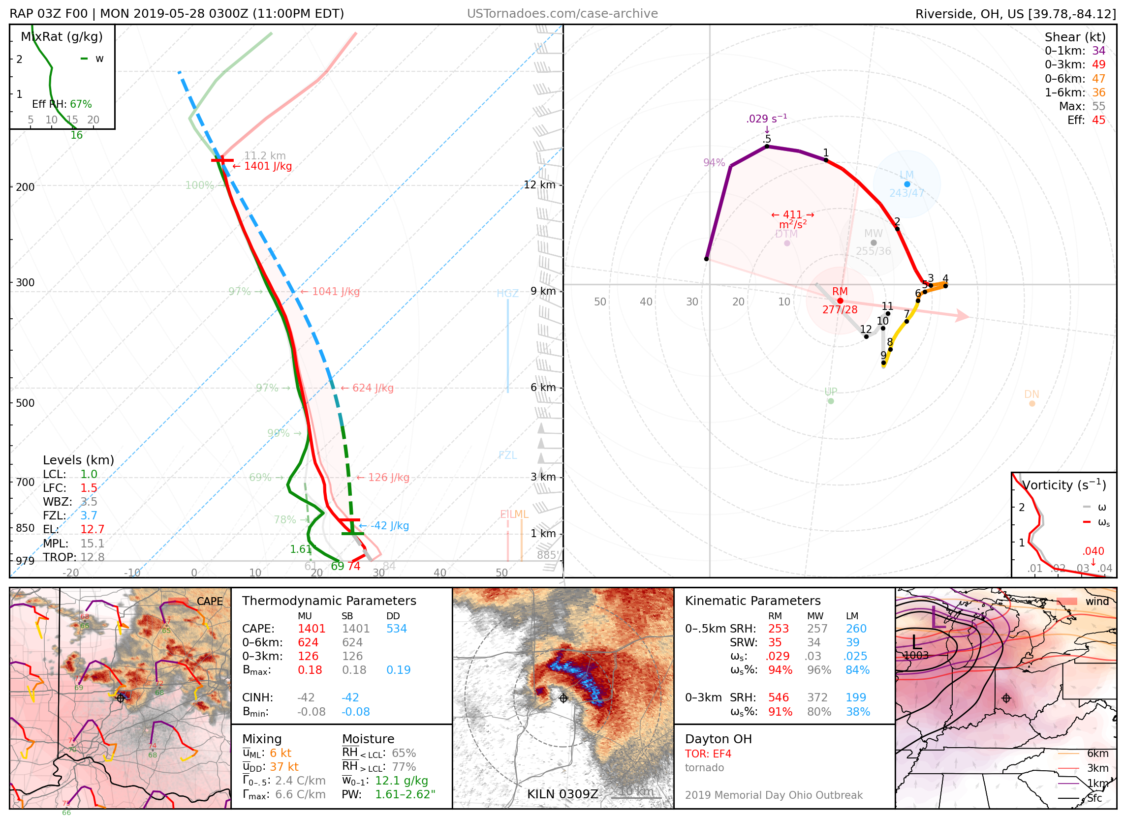
May 27, 2019: Dayton / Trotwood, Ohio
Long-lived EF4 tornado, part of an outbreak of tornadoes across IN and OH. The OH extent of the event was largely a “surprise” until late in the forecast period.
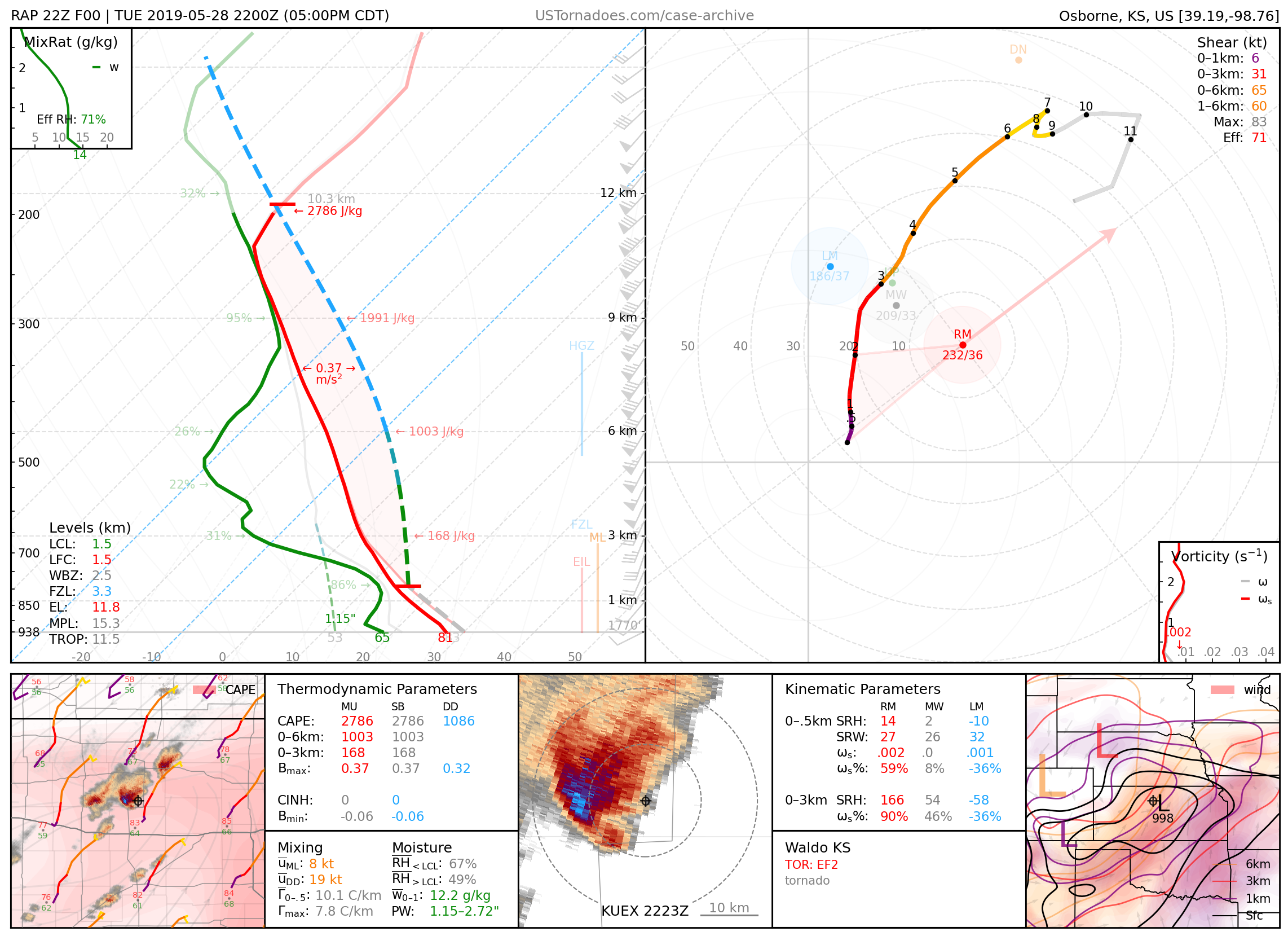
May 28, 2019: Waldo / Tipton, Kansas
EF2 tornado, one of multiple photogenic tornadoes from a cyclic supercell.
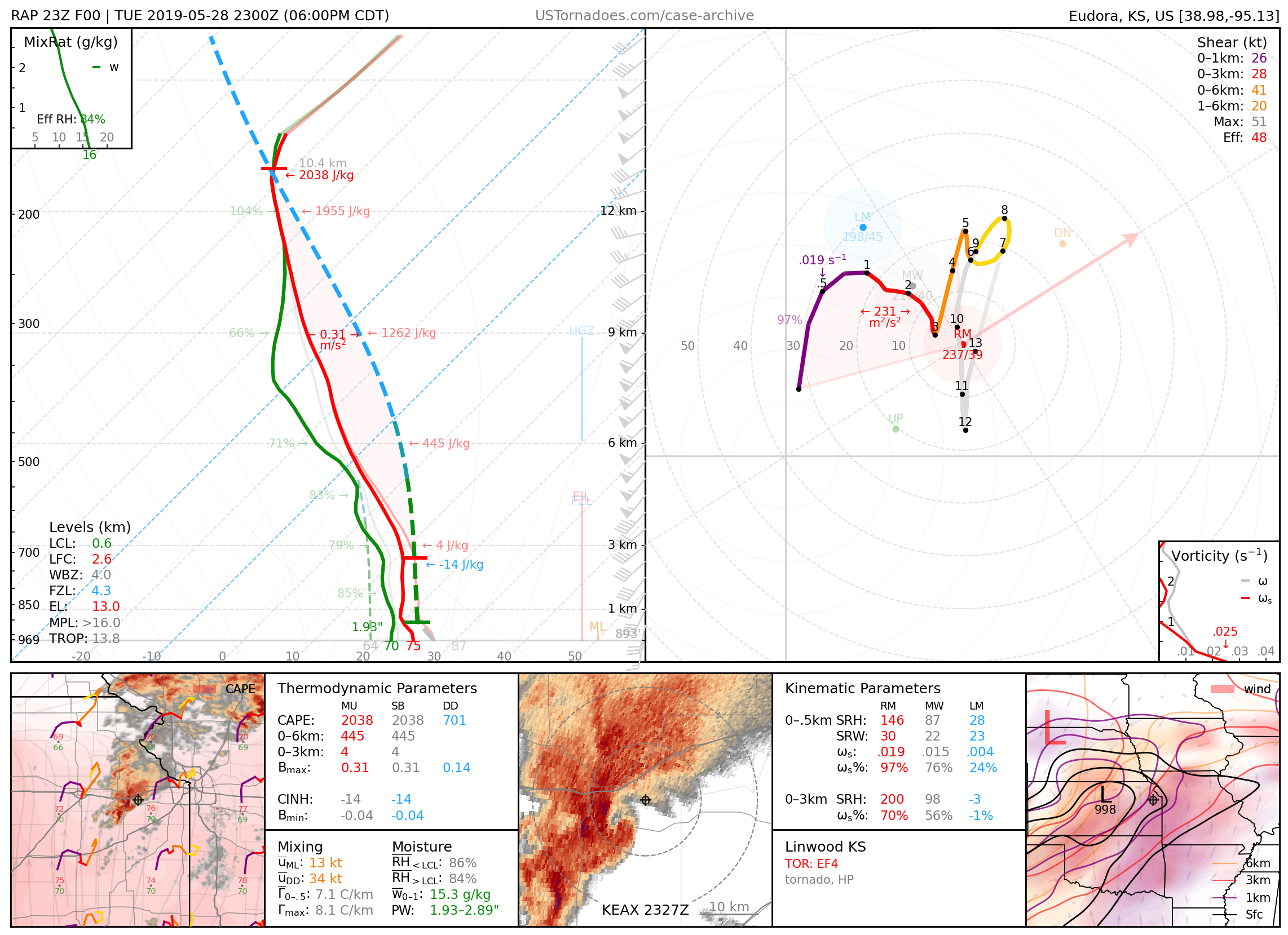
May 28, 2019: Linwood, Kansas
Long-lived, heavily rain-wrapped EF4 tornado.
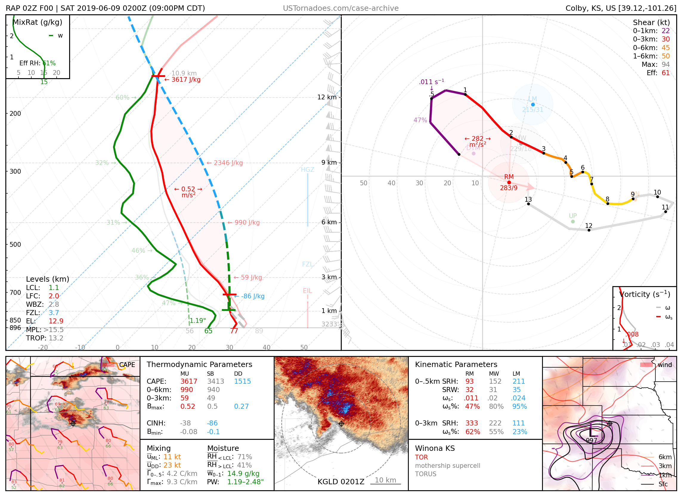
June 8, 2019: Winona, Kansas
Particularly photogenic supercell that produced an anticyclonic tornado amongst others.
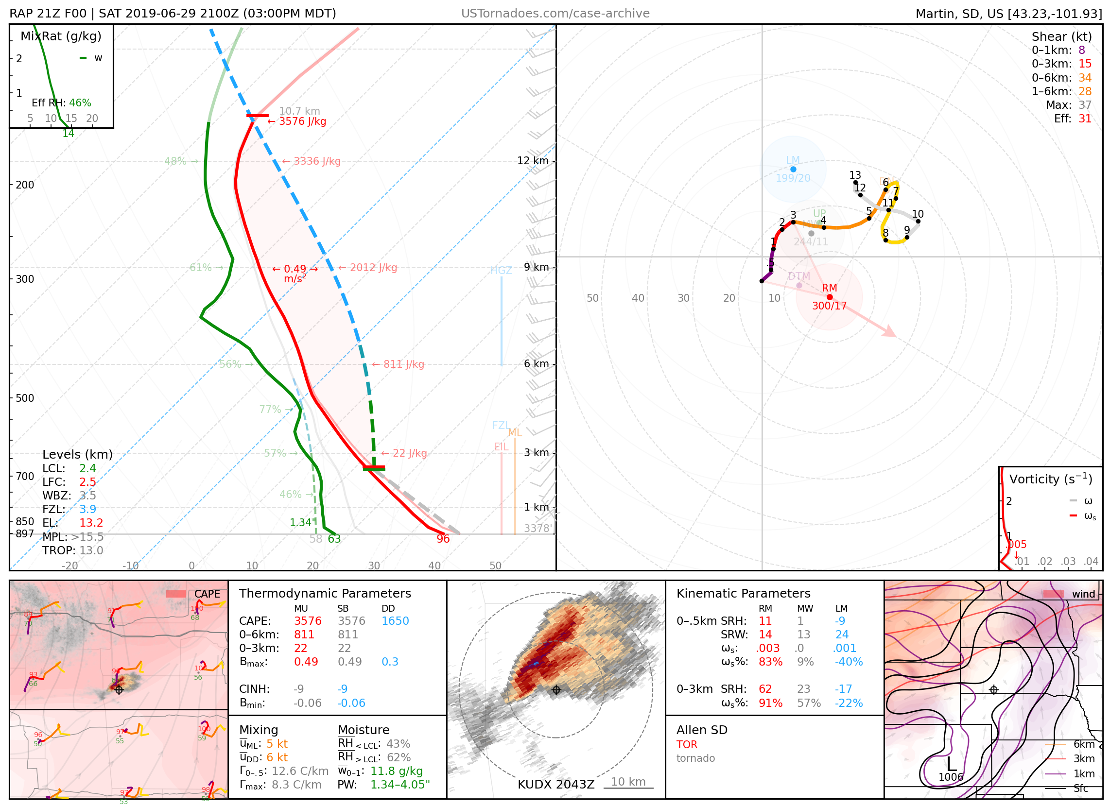
June 29, 2019: Allen, South Dakota
Particularly photogenic “surprise” tornado.
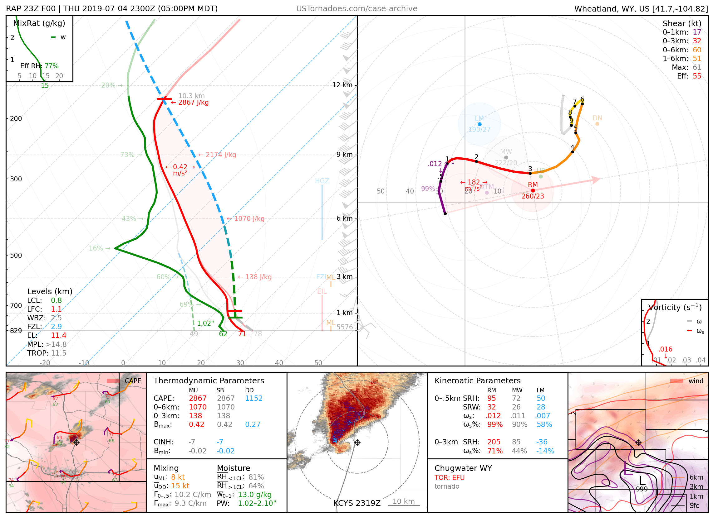
July 4, 2019: Chugwater, Wyoming
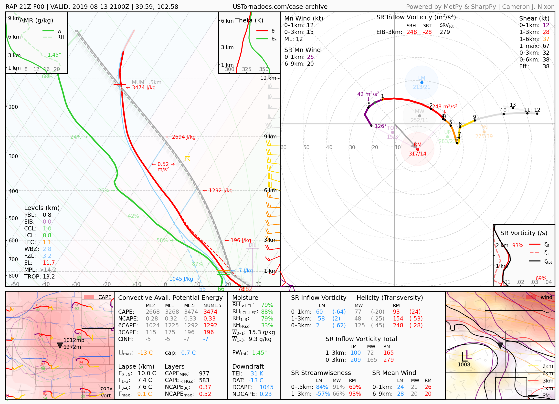
August 13, 2019: Bethune, Colorado
Colorado record hail, measured at 4.83 inches, and twin tornadoes.
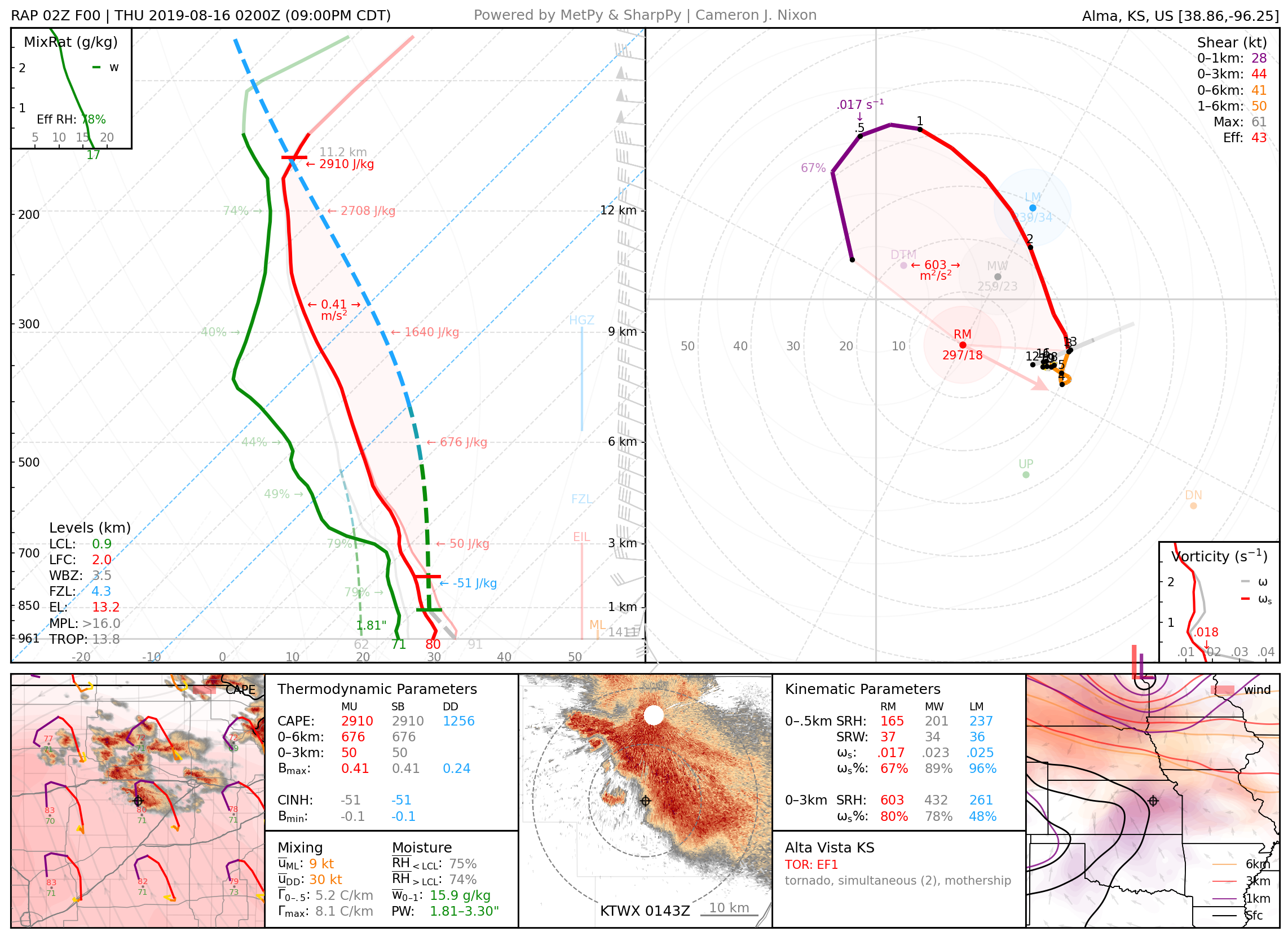
August 15, 2019: Alta Vista, Kansas
Cyclic “mothership” supercell that produced multiple brief tornadoes in quick succession
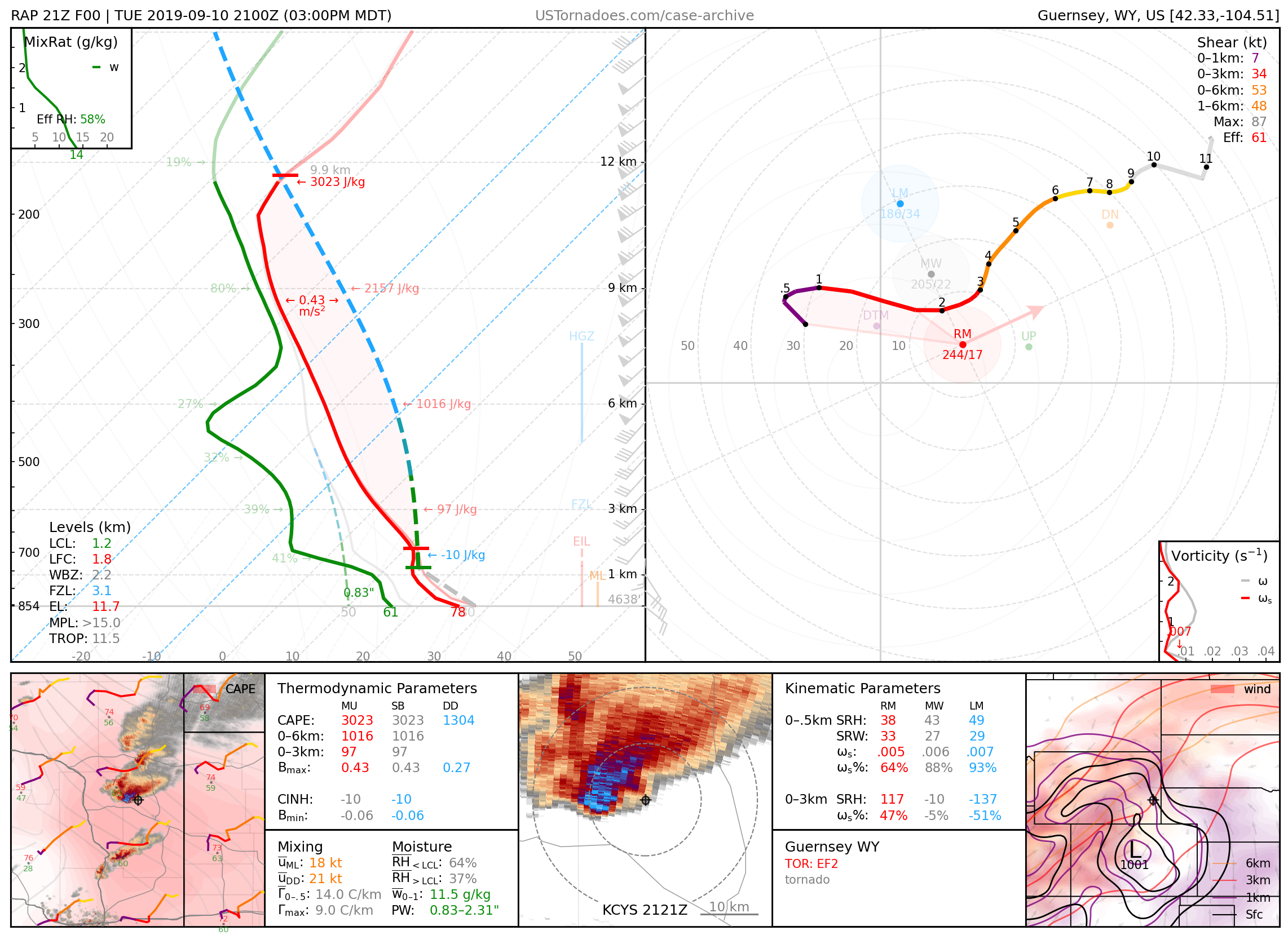
September 10, 2019: Guernsey / Lingle, Wyoming
Multiple tornadoes up to EF2.
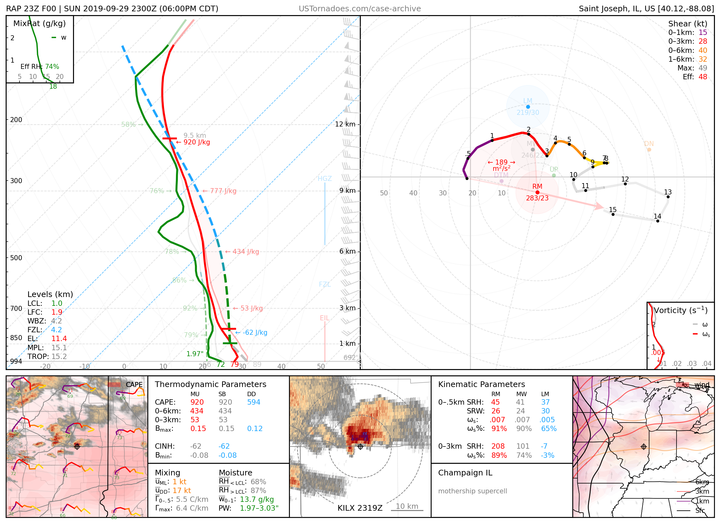
September 29, 2019: Champaign County, Illinois
Photogenic “mothership” supercell.
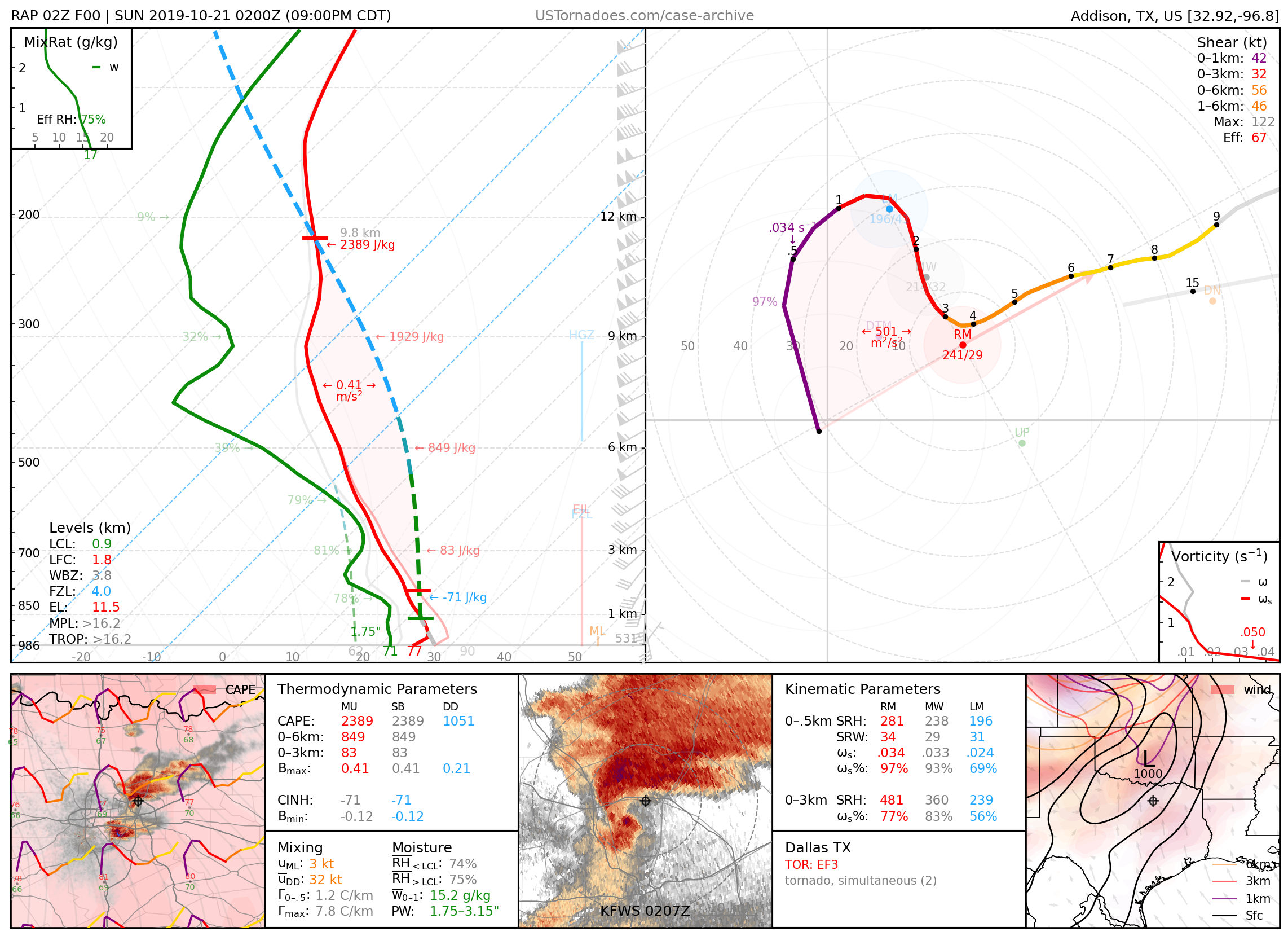
October 20, 2019: Dallas, Texas
EF3 tornado, highly-visible for the area and time of occurrence.
2020
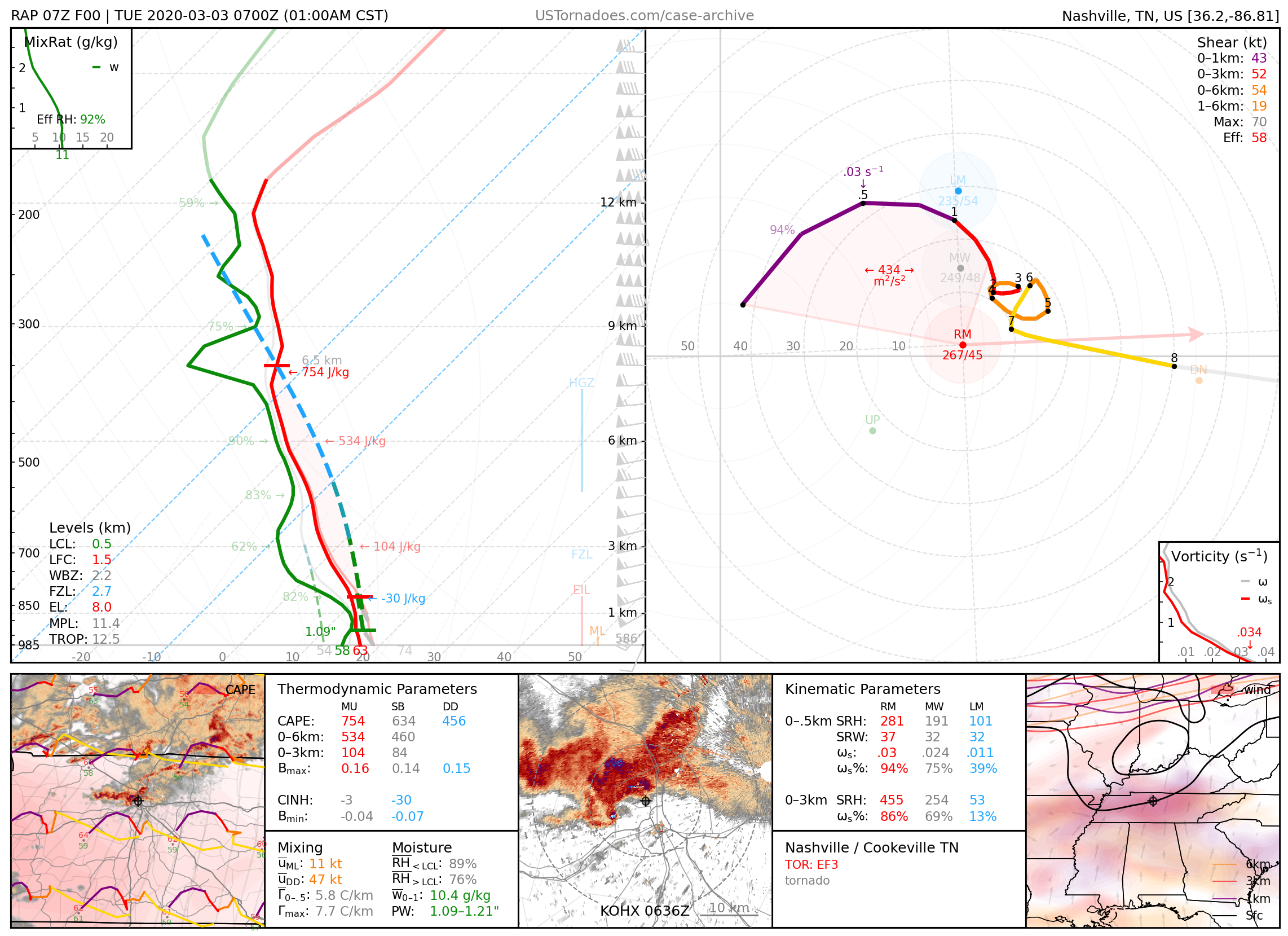
March 2, 2020: Nashville / Cookeville, Tennessee
EF3 and EF4 tornadoes, the former long-tracked and killing 5 people, the latter killing 19 people. Two of 10 tornadoes produced by a cyclic supercell, part of an event with an eastern extent and intensity that was largely a “surprise.”
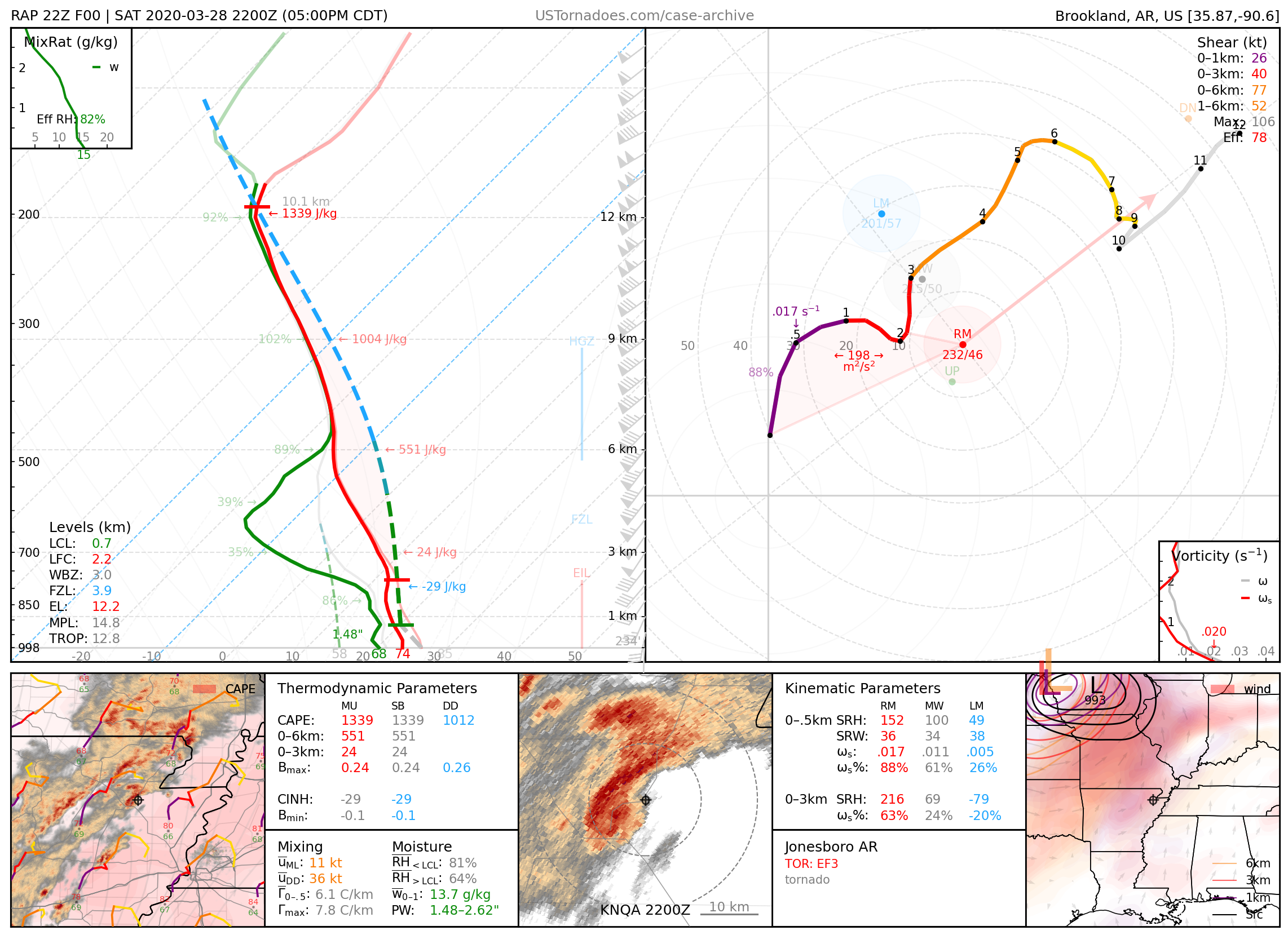
March 28, 2020: Jonesboro, Arkansas
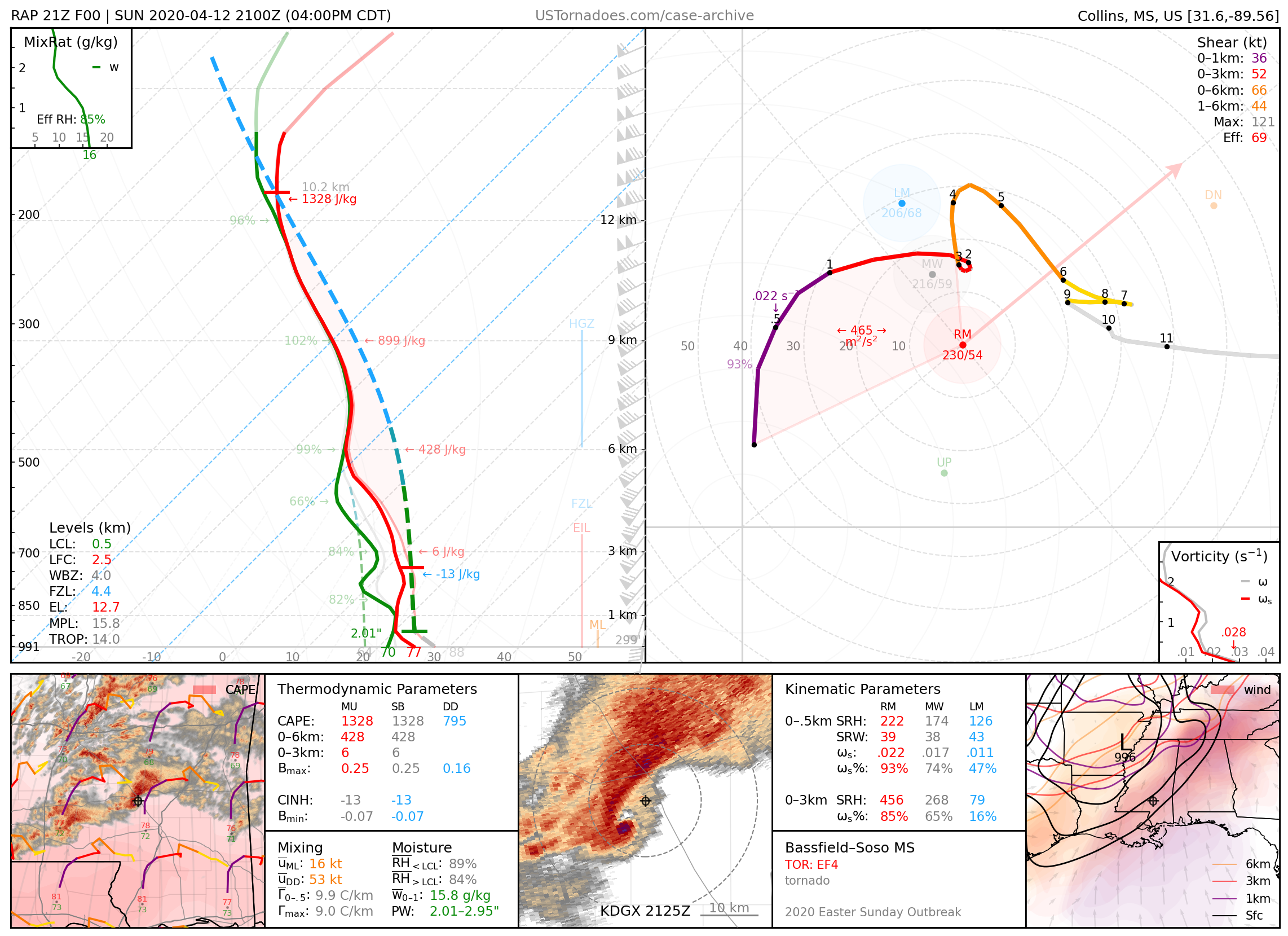
April 12, 2020: Bassfield / Soso, Mississippi
Long-tracked EF4 tornado that became the third widest on record at 2.25 miles, and killed 8 people. It followed an EF4 tornado from the same supercell, and was followed from behind by an even longer-tracked EF3 tornado ongoing simultaneously from a different supercell. All were part of the 2020 Easter Sunday tornado outbreak.
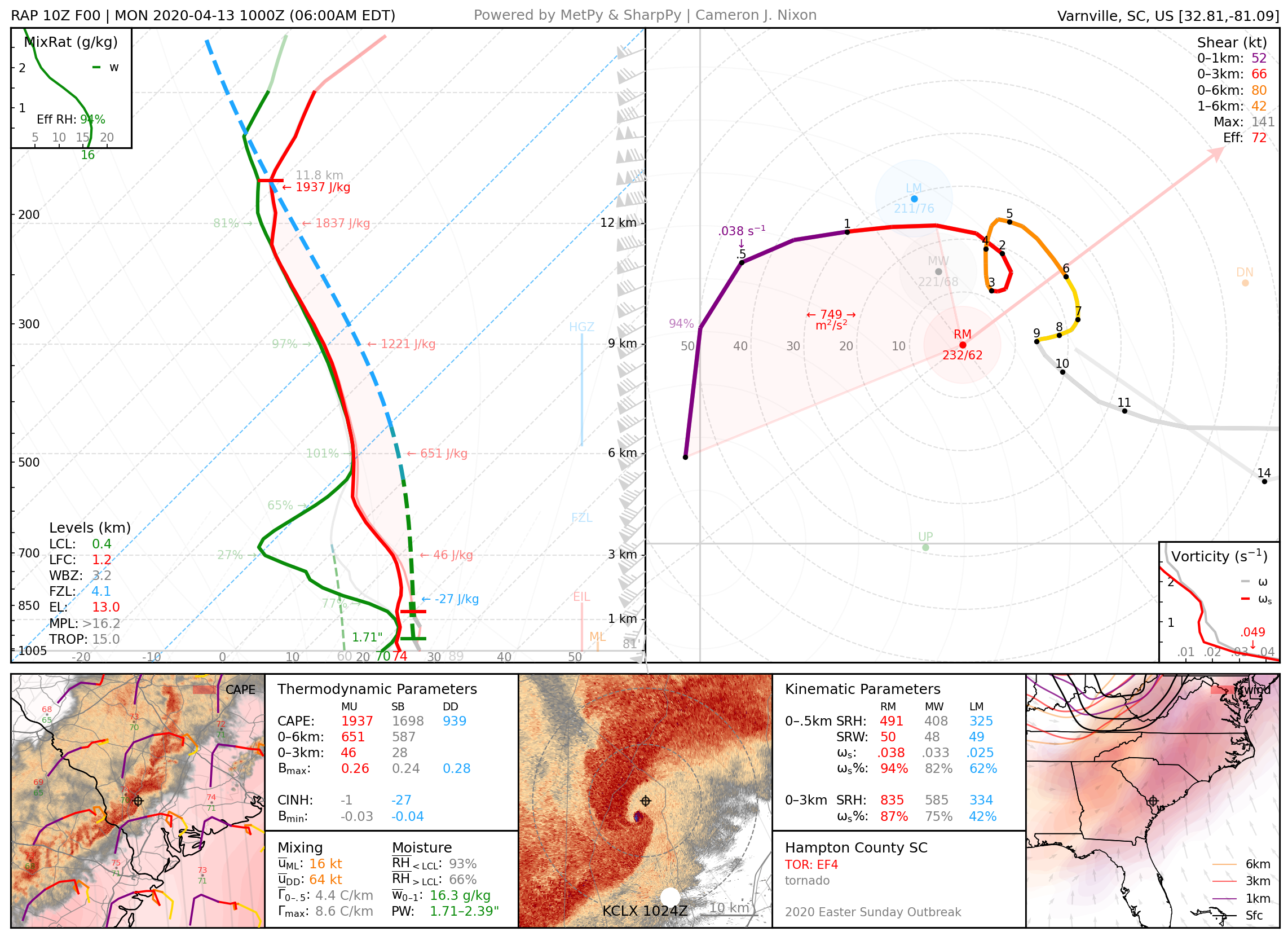
April 13, 2020: Hampton County, South Carolina
Long-tracked EF4 tornado, part of a prolific QLCS that produced multiple intense tornadoes simultaneously.
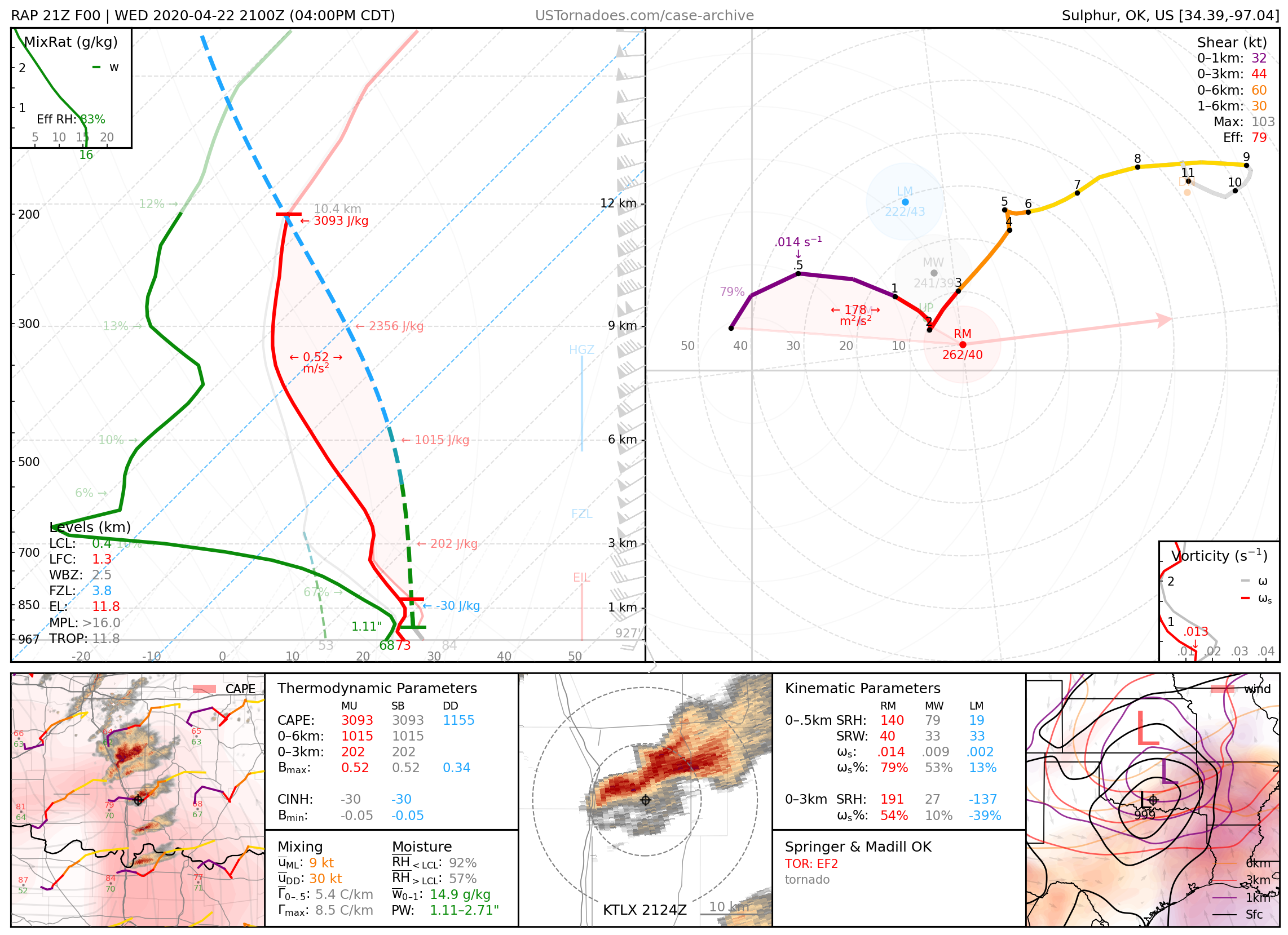
April 22, 2020: Madill / Springer, Oklahoma
Photogenic “cold-core” EF2 tornadoes occurring close to each other both in location and time, from two separate supercells.
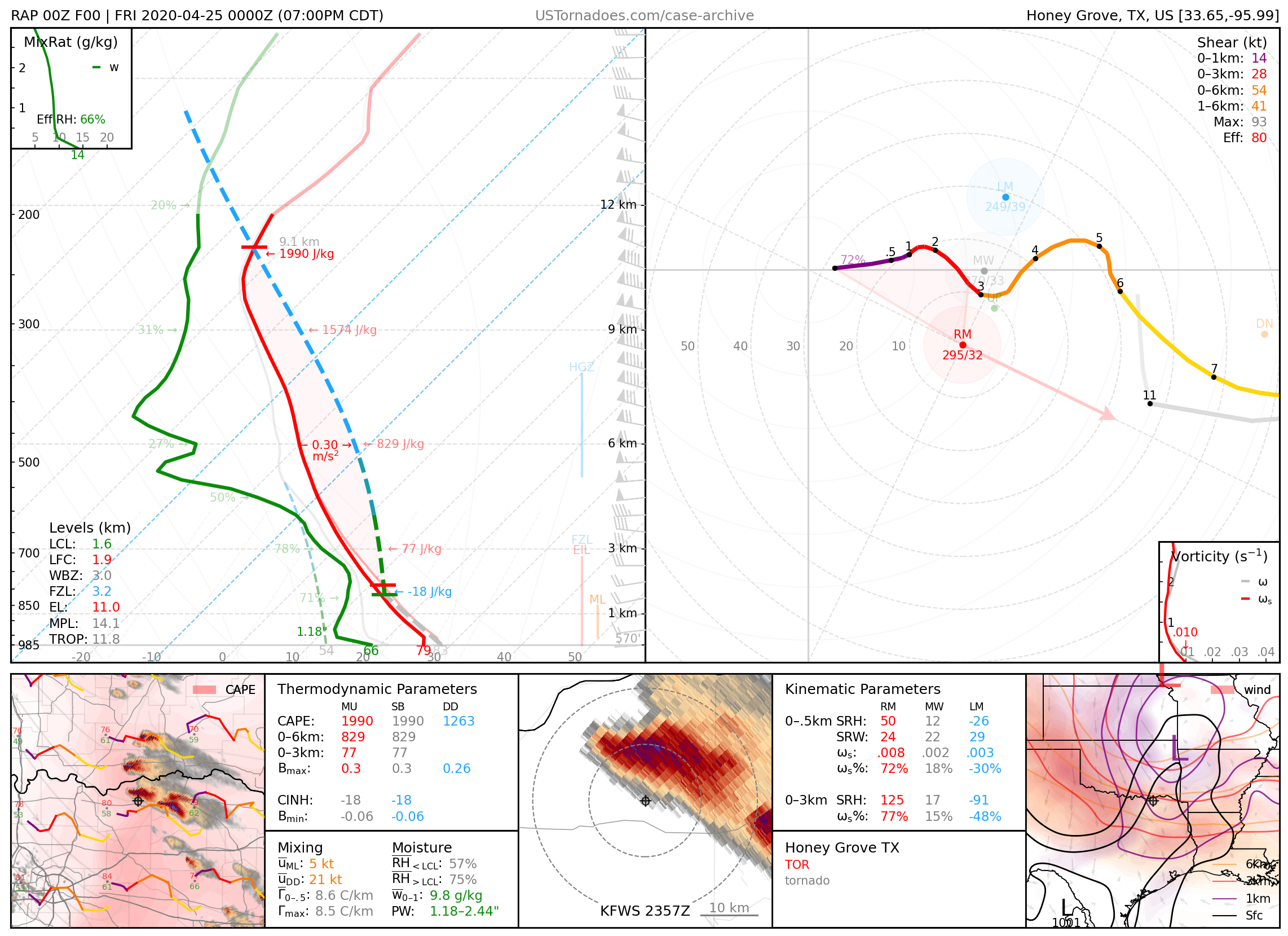
April 24, 2020: Honey Grove, Texas
Particularly photogenic tornado, especially for the area.
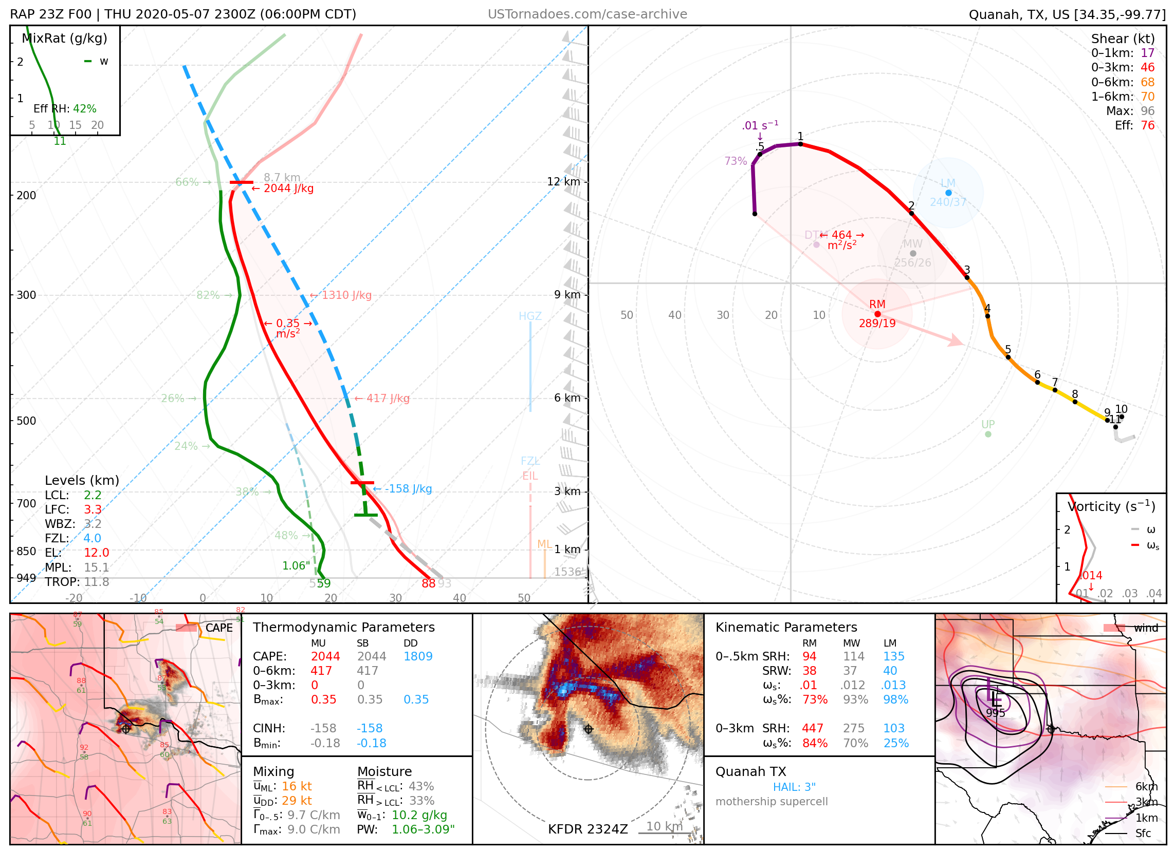
May 7, 2020: Quanah, Texas
Photogenic supercell that produced a swath of hail up to 3.25 inches.
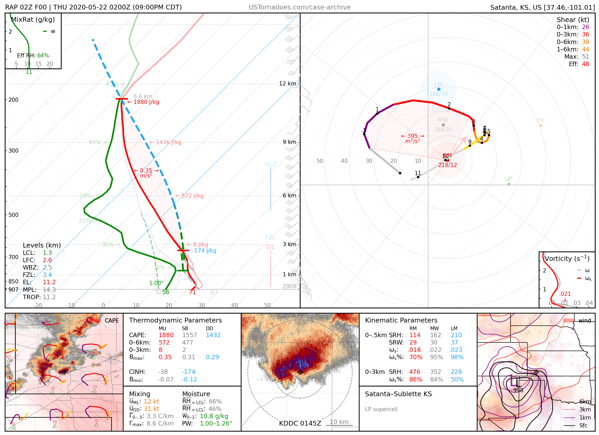
May 21, 2020: Sublette / Satanta, Kansas
Pair of particularly photogenic LP “mothership” supercells.
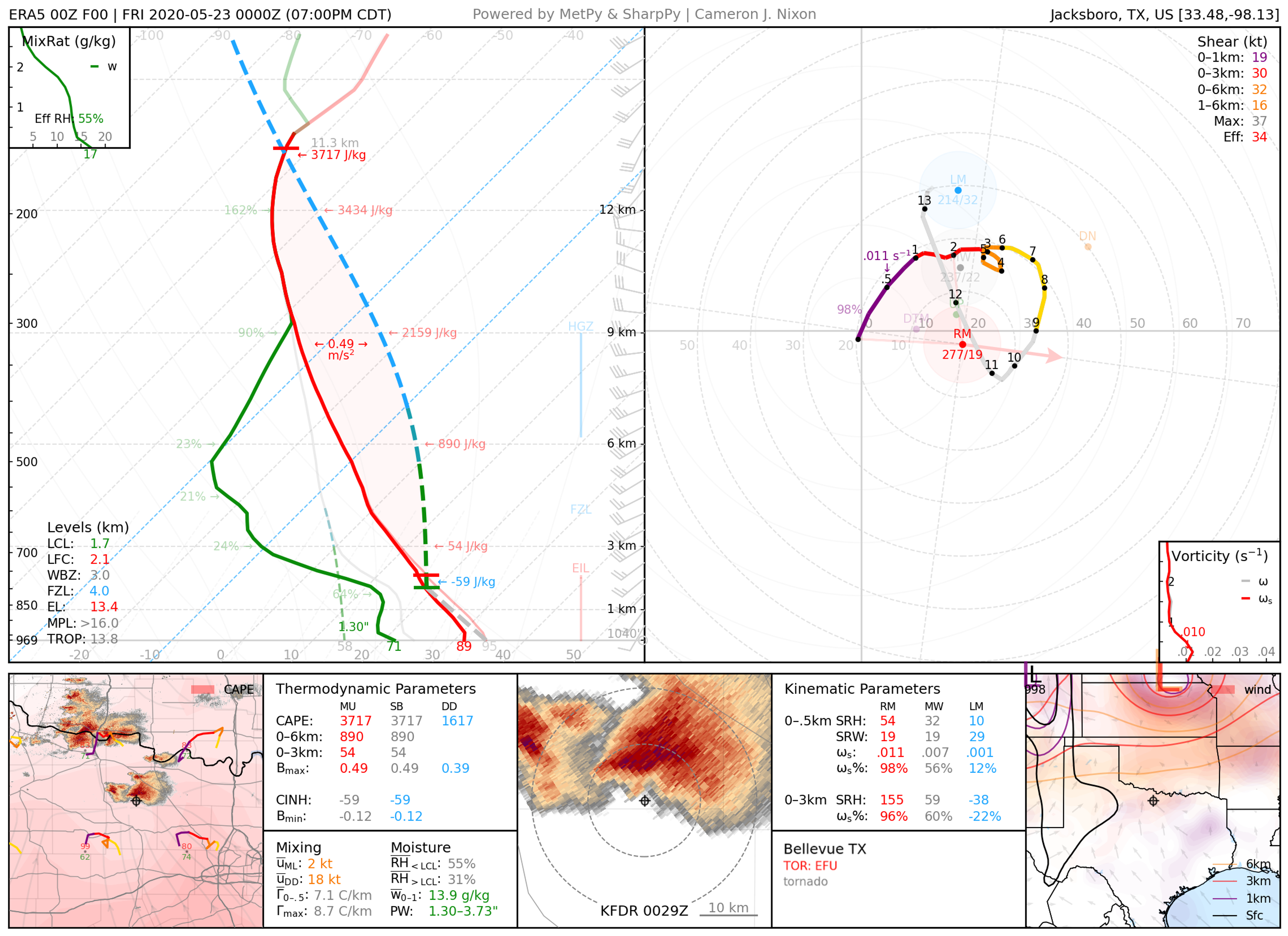
May 22, 2020: Bellevue, Texas
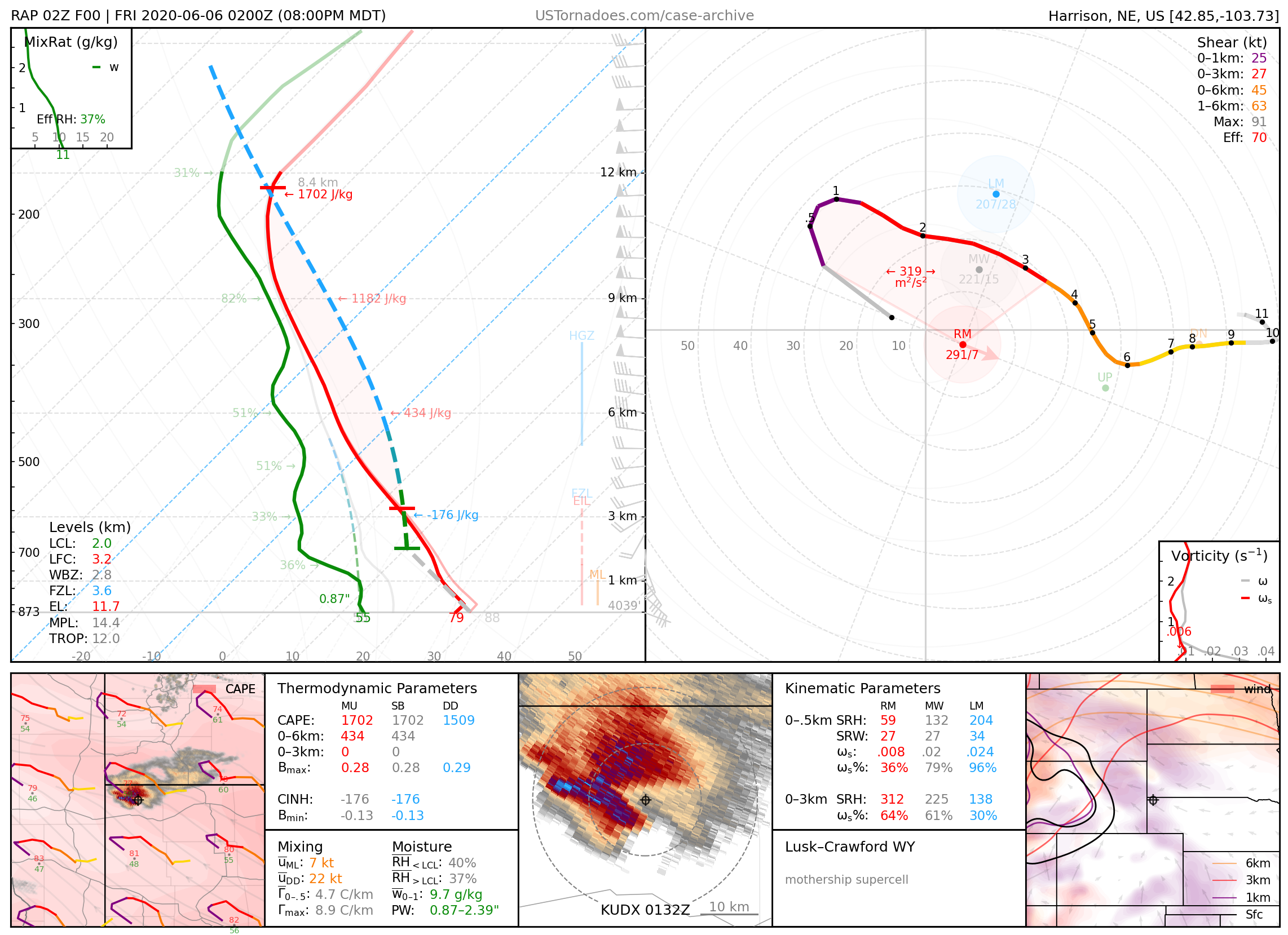
June 5, 2020: Lusk, Wyoming
Particularly photogenic supercell.
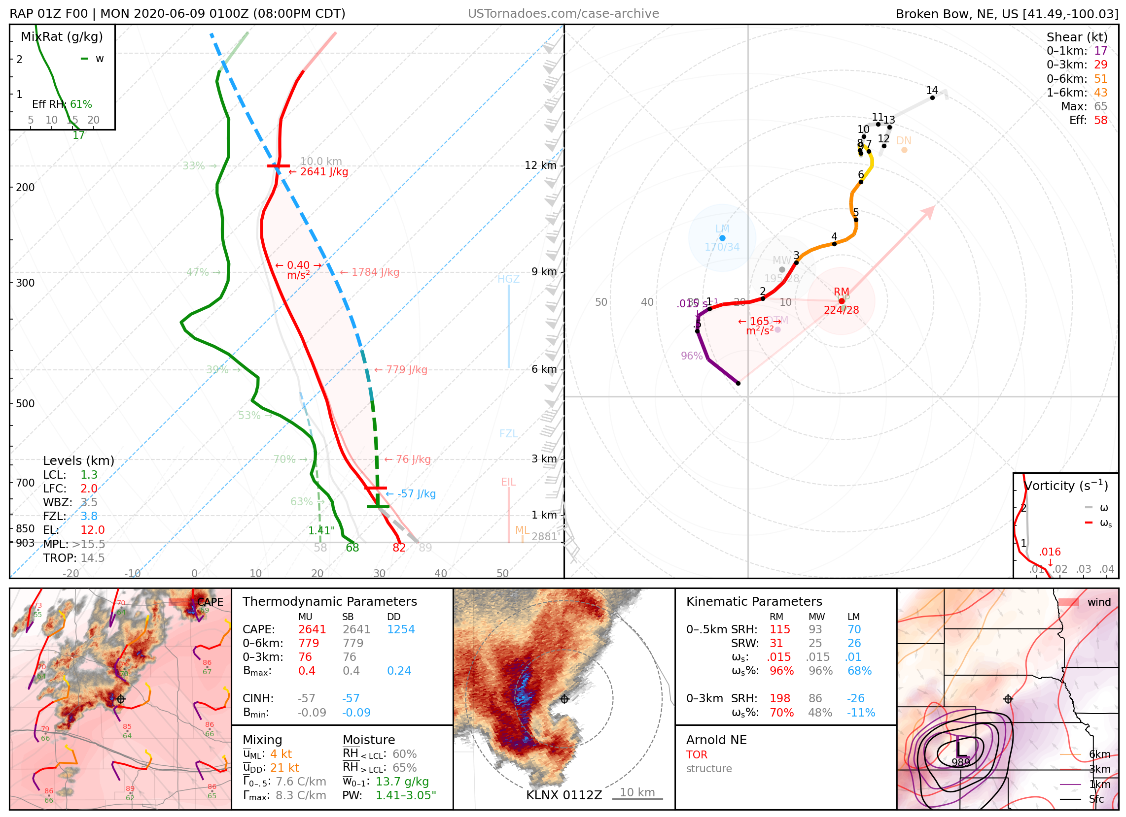
June 8, 2020: Arnold, Nebraska
Photogenic supercell that produced a few tornadoes.
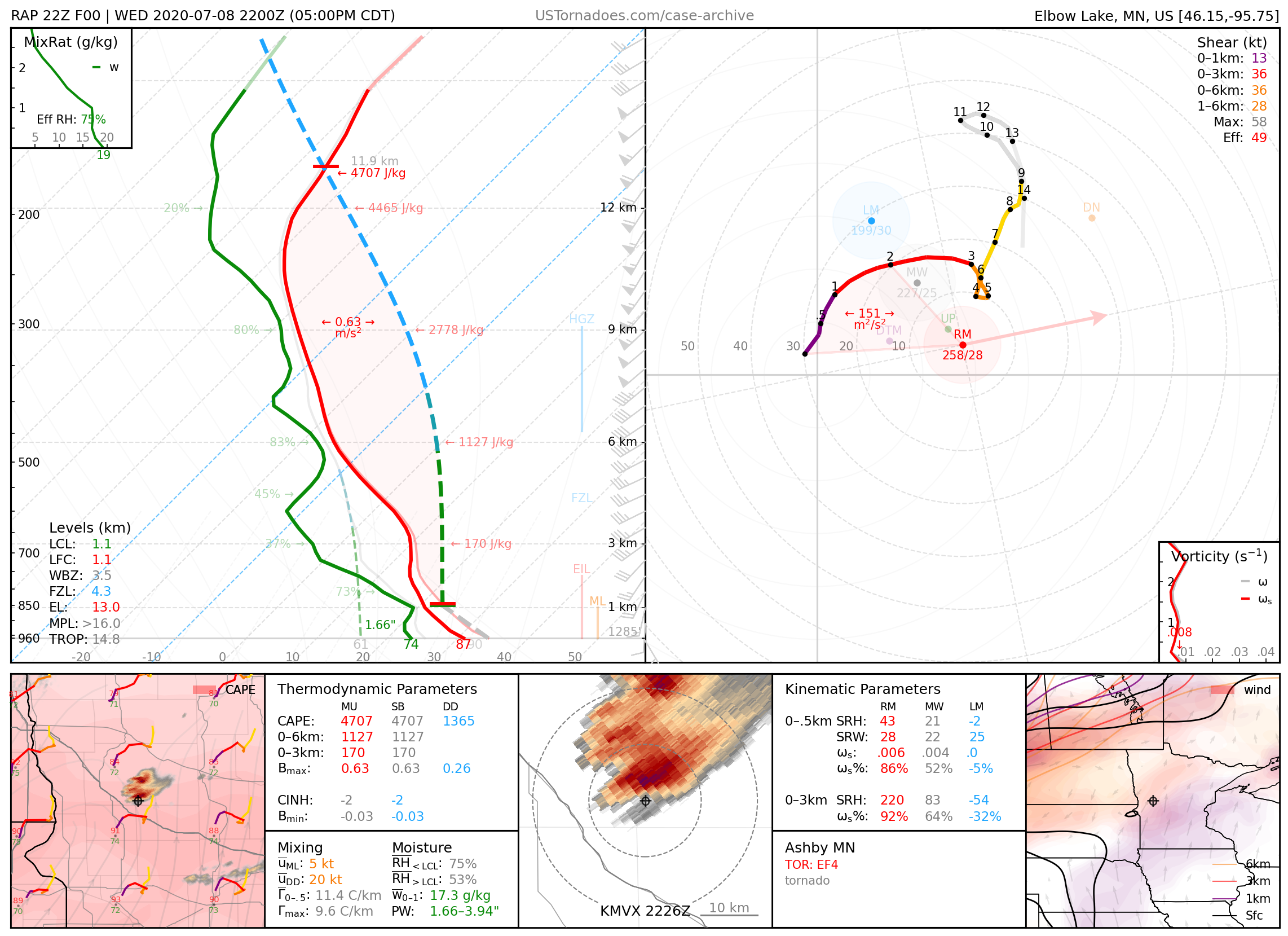
July 8, 2020: Ashby / Dalton, Minnesota
Particularly photogenic EF4 tornado.
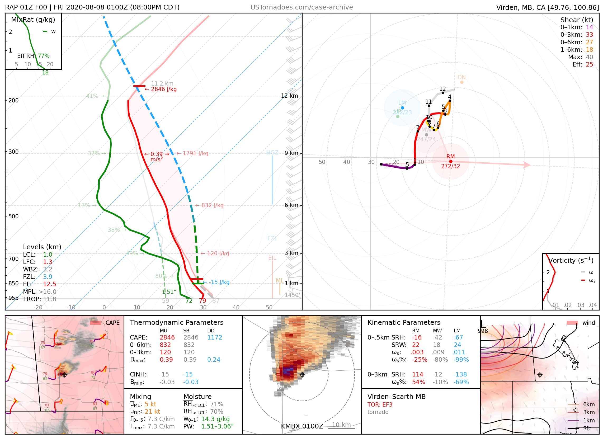
August 7, 2020: Virden / Scarth, Manitoba, Canada
Particularly photogenic EF3 tornado that killed two teens driving.
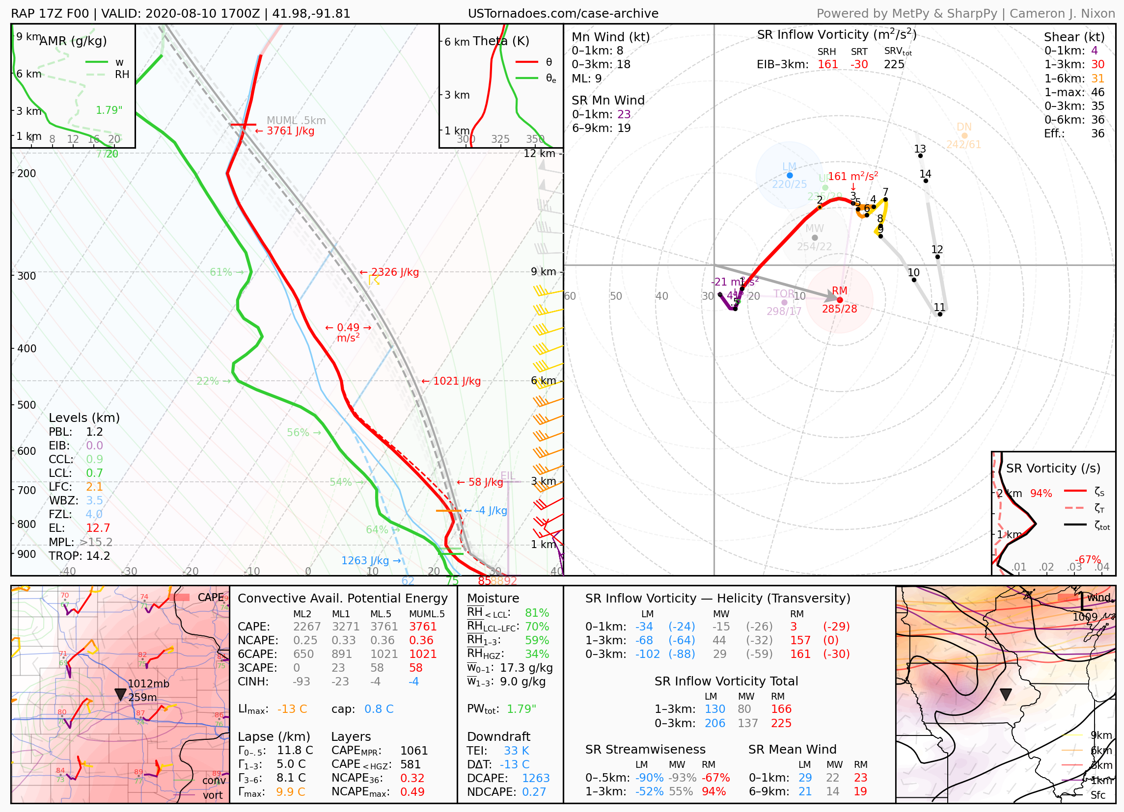
August 10, 2020: Cedar Rapids, Iowa
One of the costliest severe thunderstorm events in U.S. modern history at an estimated $11 billion. A derecho that damaged over 850,000 acres of crops across eastern IA and destroyed over 1,000 homes in Cedar Rapids alone, where a gust of 126 mph was recorded nearby.
2021
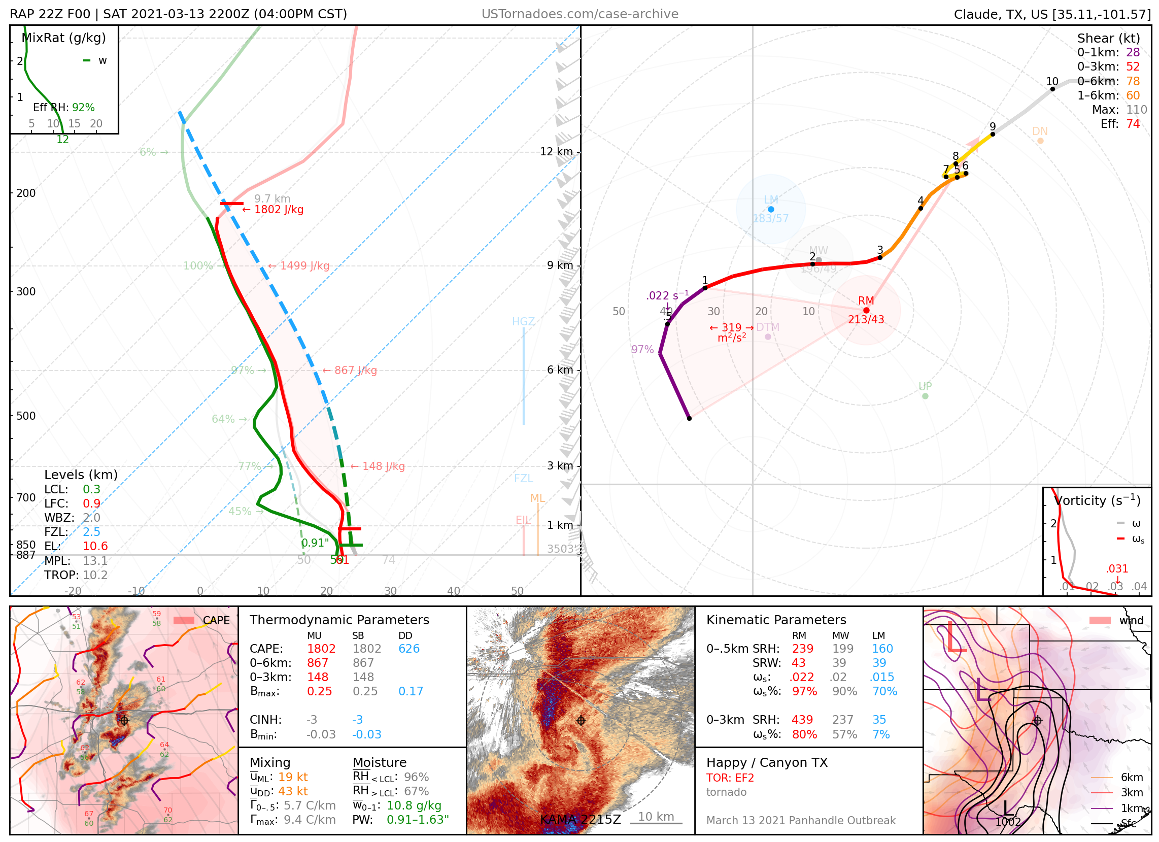
March 13, 2021: Happy / Canyon, Texas
A few tornadoes (up to EF2, though likely stronger) occurring primarily from the same supercell in rapid succession (with a brief period of two simultaneous tornadoes), part of a local outbreak in and around the Texas panhandle.
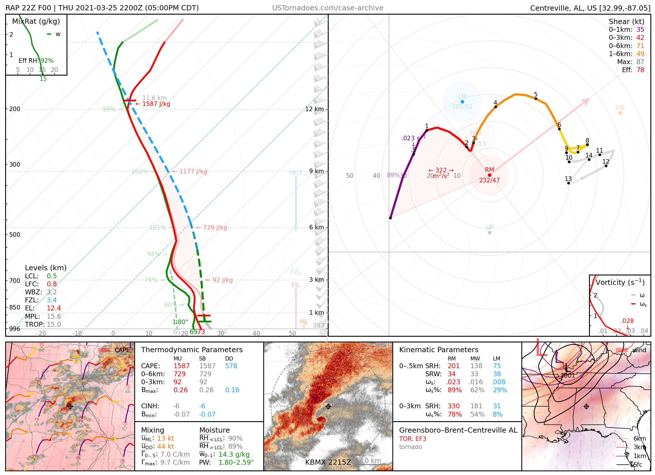
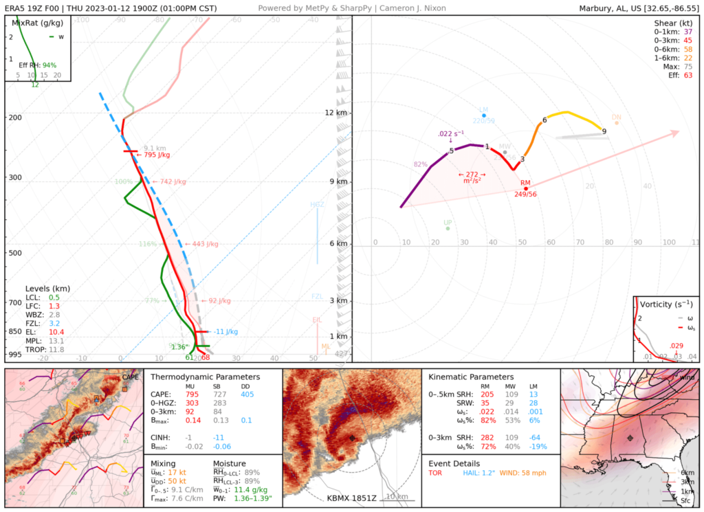
March 25, 2021: Greensboro / Centreville, Alabama
Very long-tracked EF3 tornado that lasted over an hour and a half.
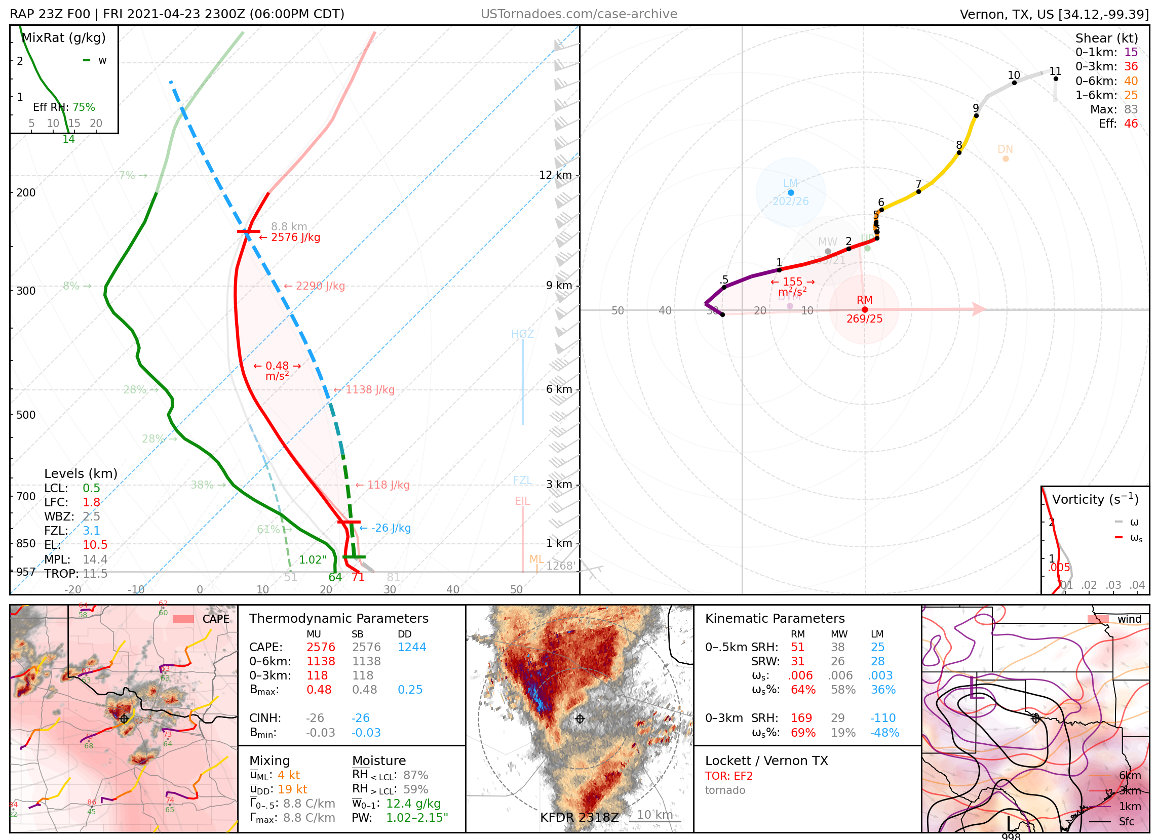
April 23, 2021: Lockett / Vernon, Texas
Multiple particularly photogenic tornadoes (rated up to EF2) from the same supercell.
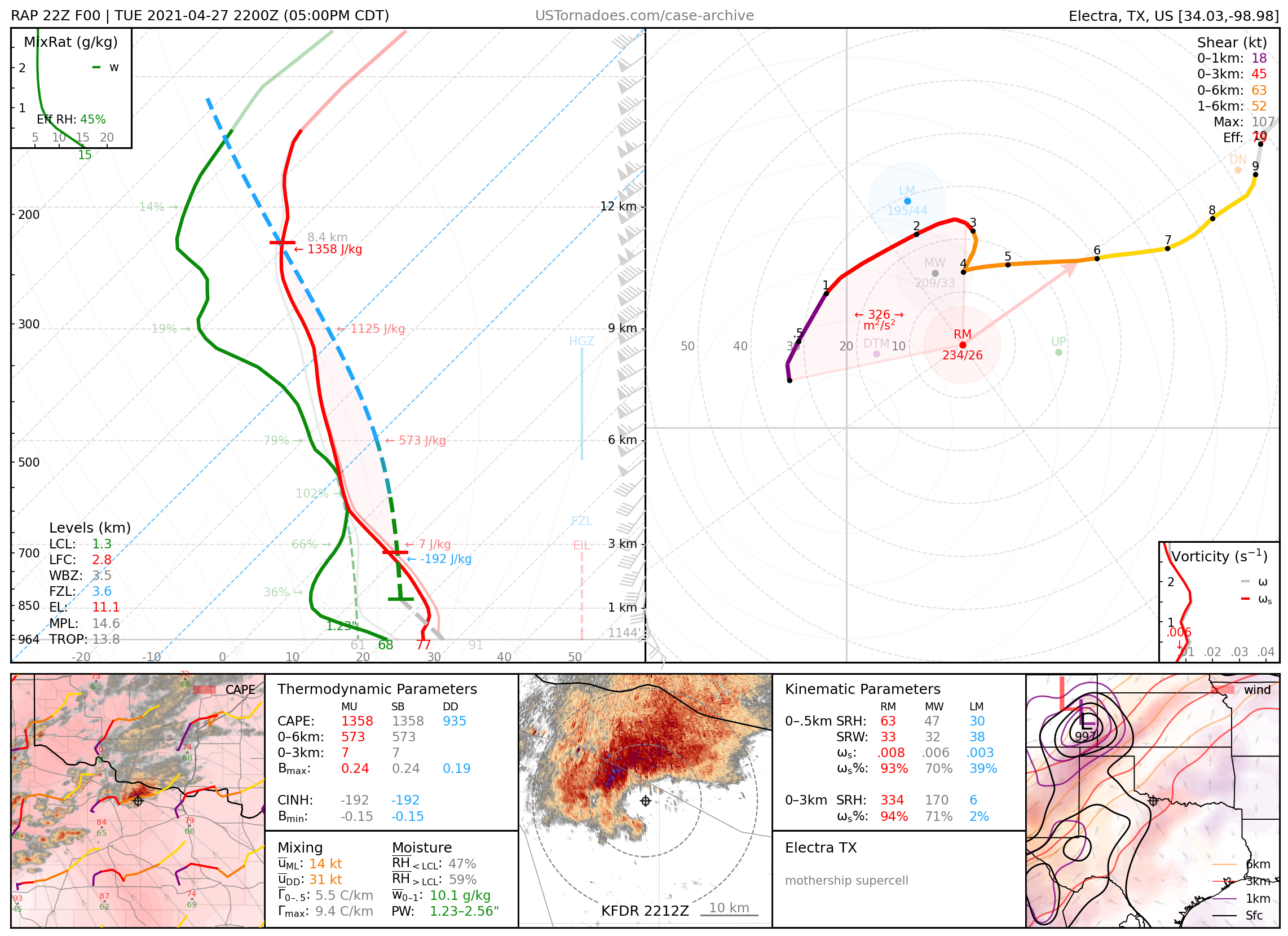
April 27, 2021: Truscott / Benjamin / Electra, Texas
Supercell that produced a large wedge EF3 tornado before acquiring a particularly photogenic “mothership” structure.
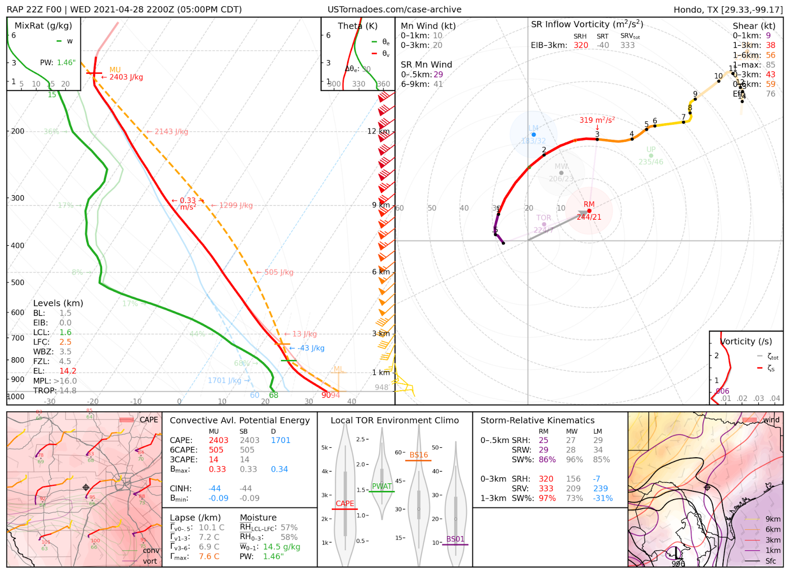
April 28, 2021: Hondo, Texas
Texas State record hailstone measured at 6.4” diameter, produced by a particularly massive supercell storm.
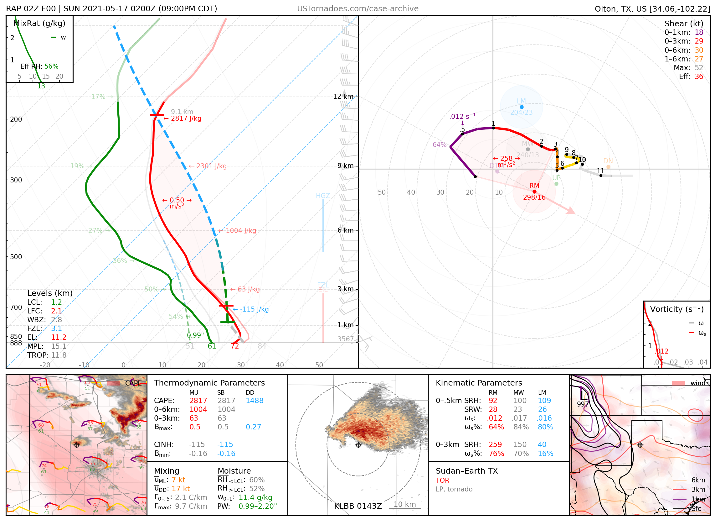
May 16, 2021: Sudan / Earth, Texas
Particularly photogenic tornado from low-precipitation “mothership” supercell.
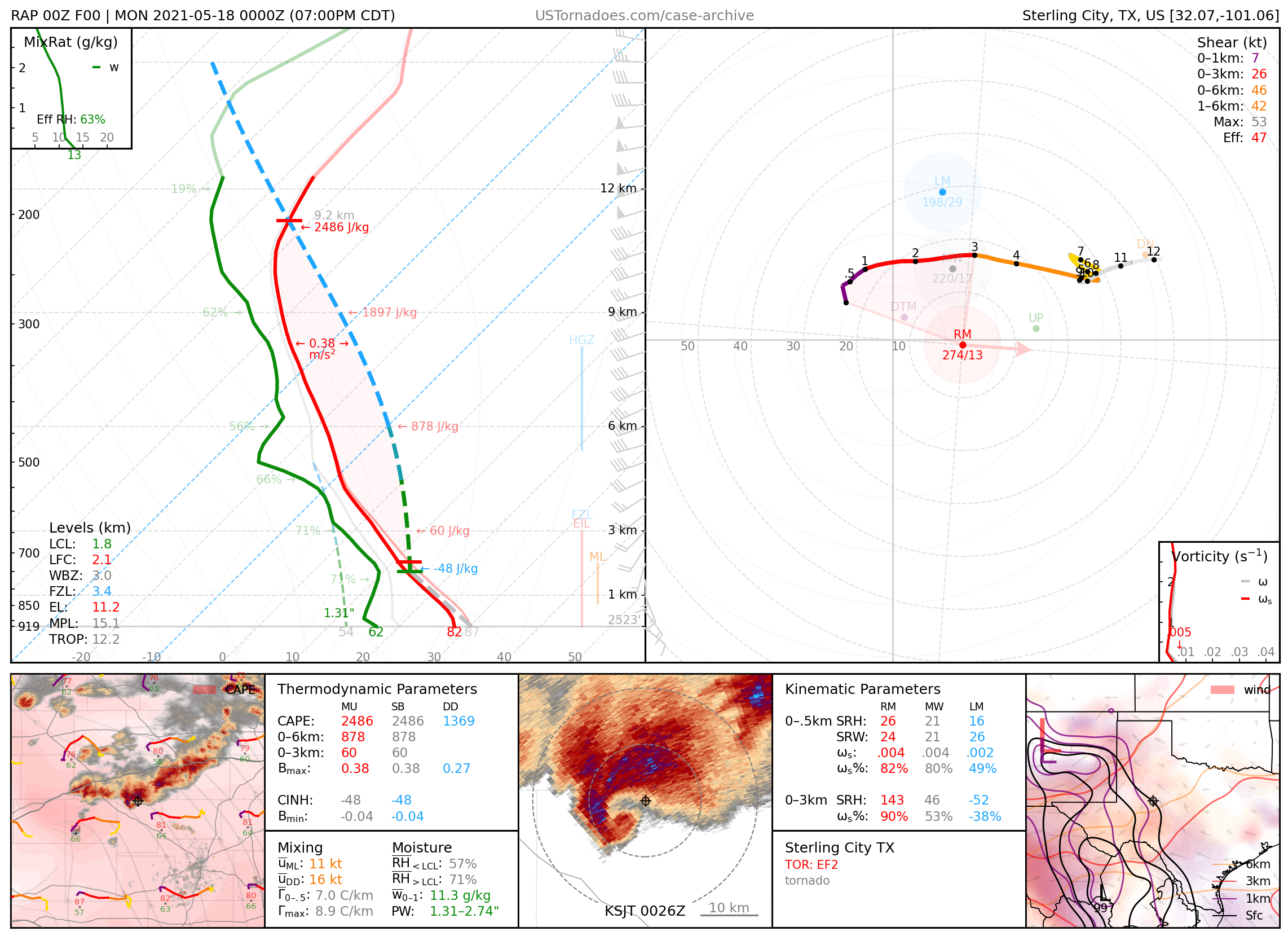
May 17, 2021: Sterling City, Texas
Truncated cone tornado rated EF2 that damaged a gas plant.
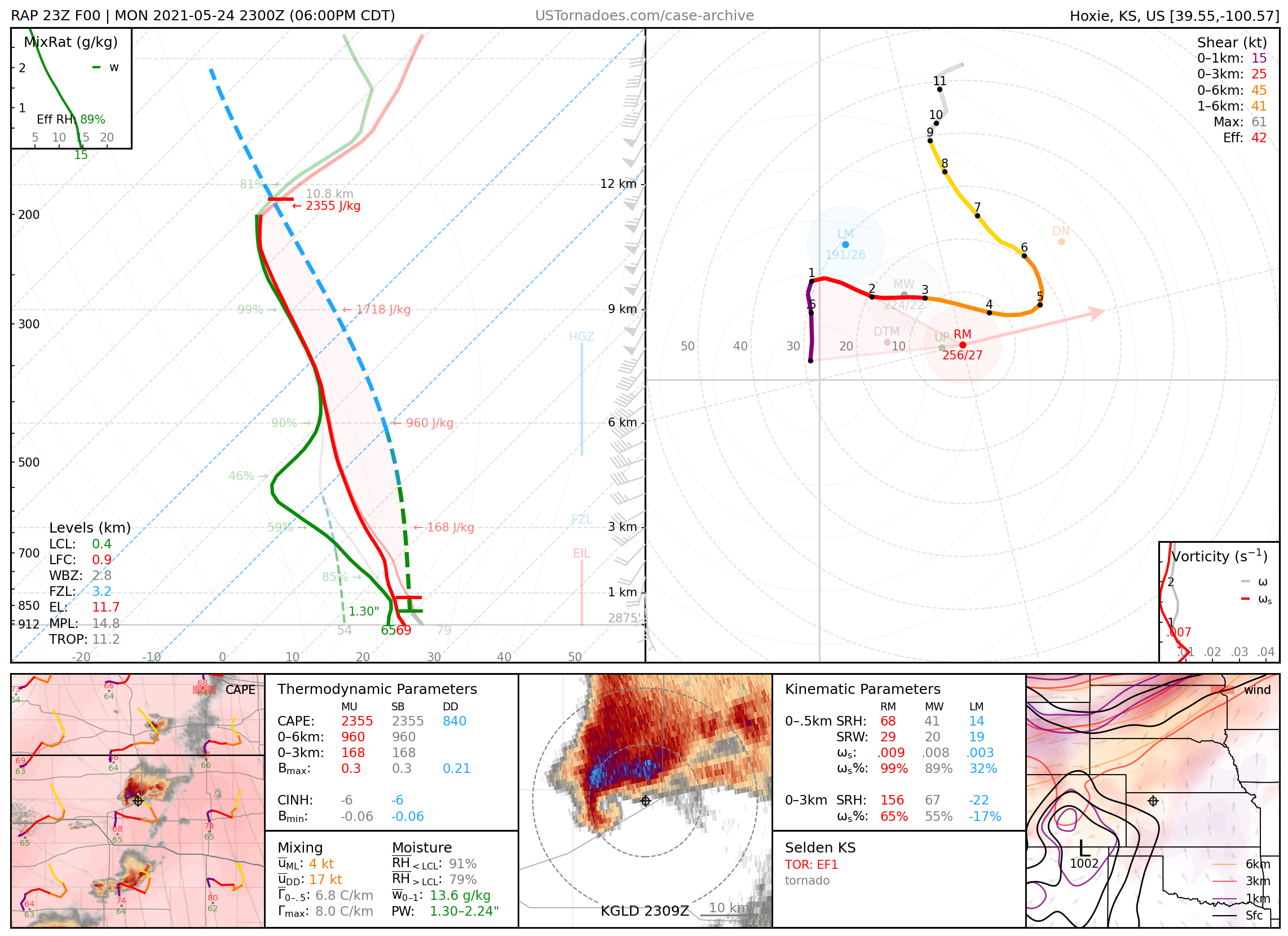
May 24, 2021: Selden, Kansas
Photogenic EF1 tornado that damaged parts of town.
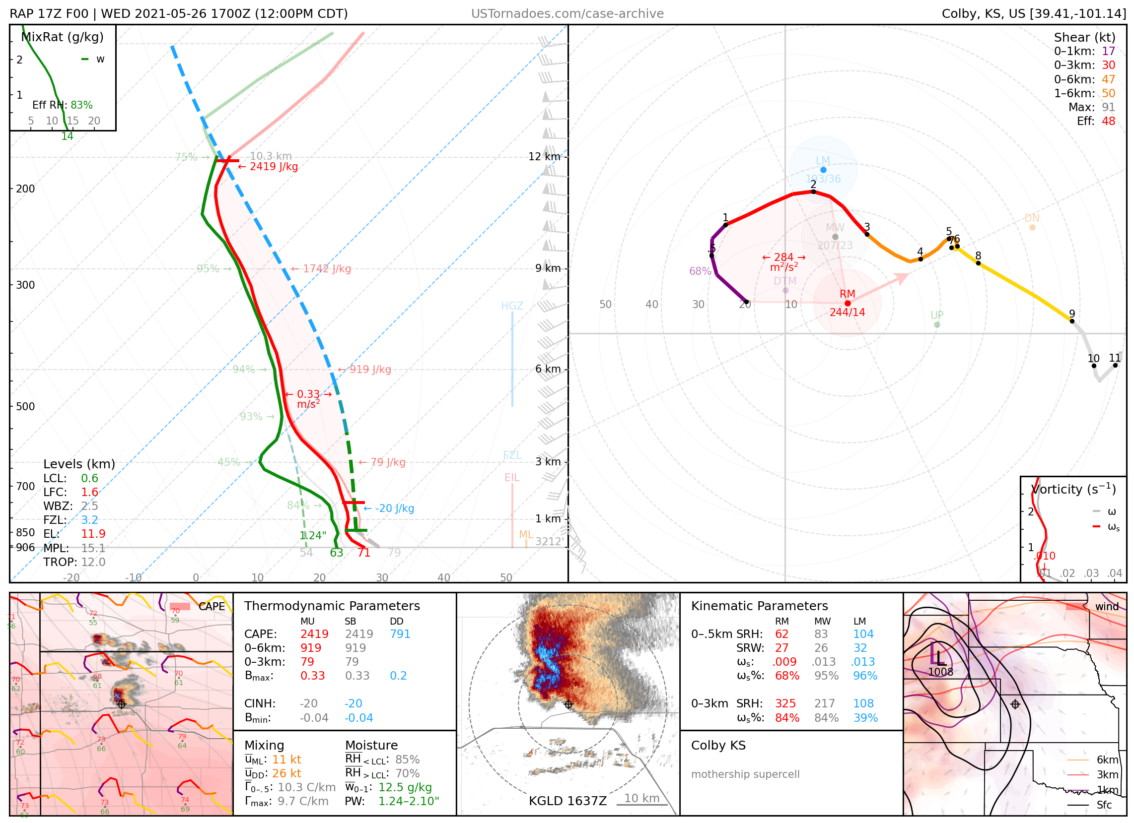
May 26, 2021: Colby, Kansas
Particularly photogenic “surprise” morning “mothership” supercell.
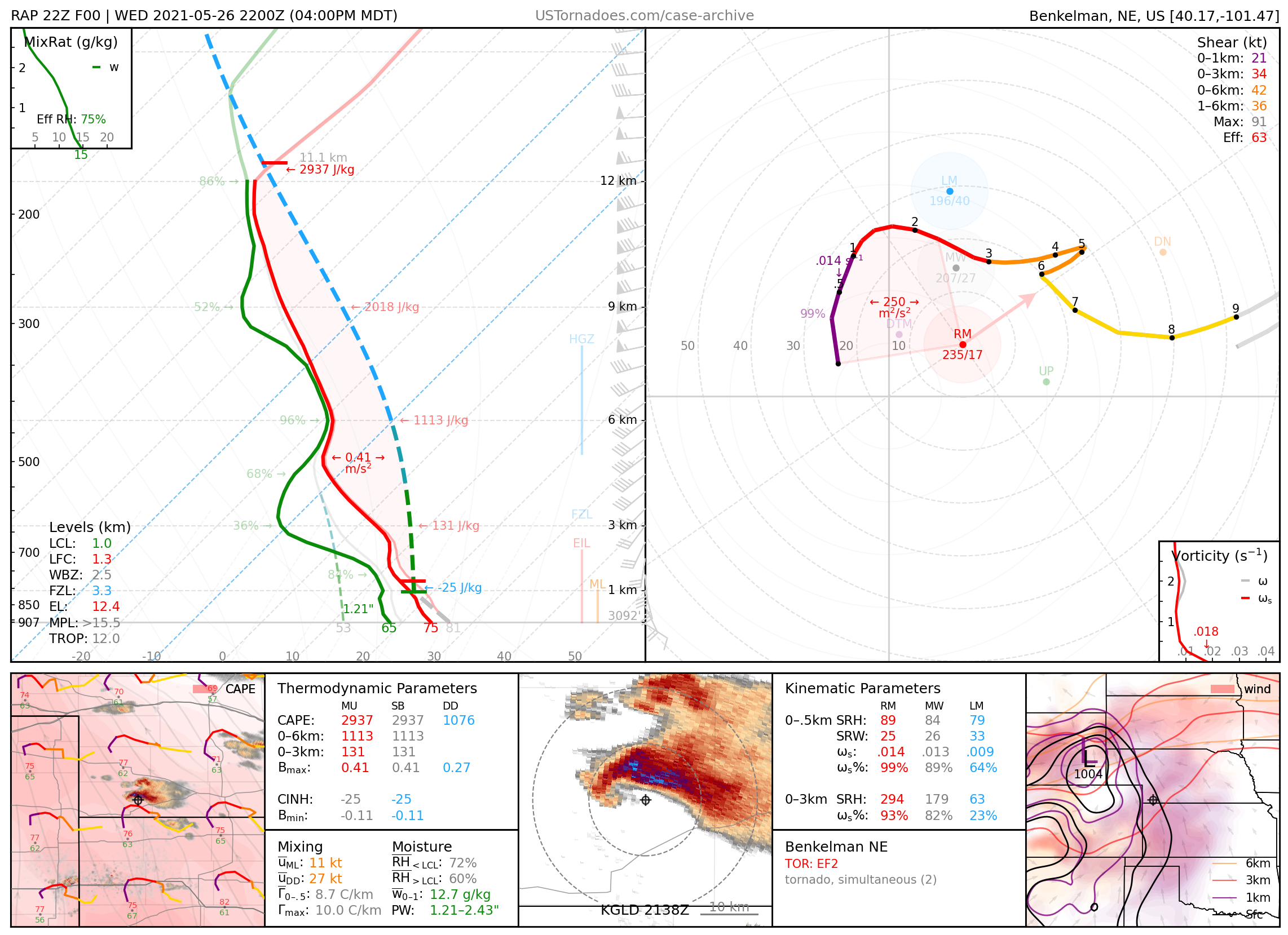
May 26, 2021: Benkelman, Nebraska
Particularly photogenic EF2 tornado, one of multiple (mostly EFU) produced by a few supercells.
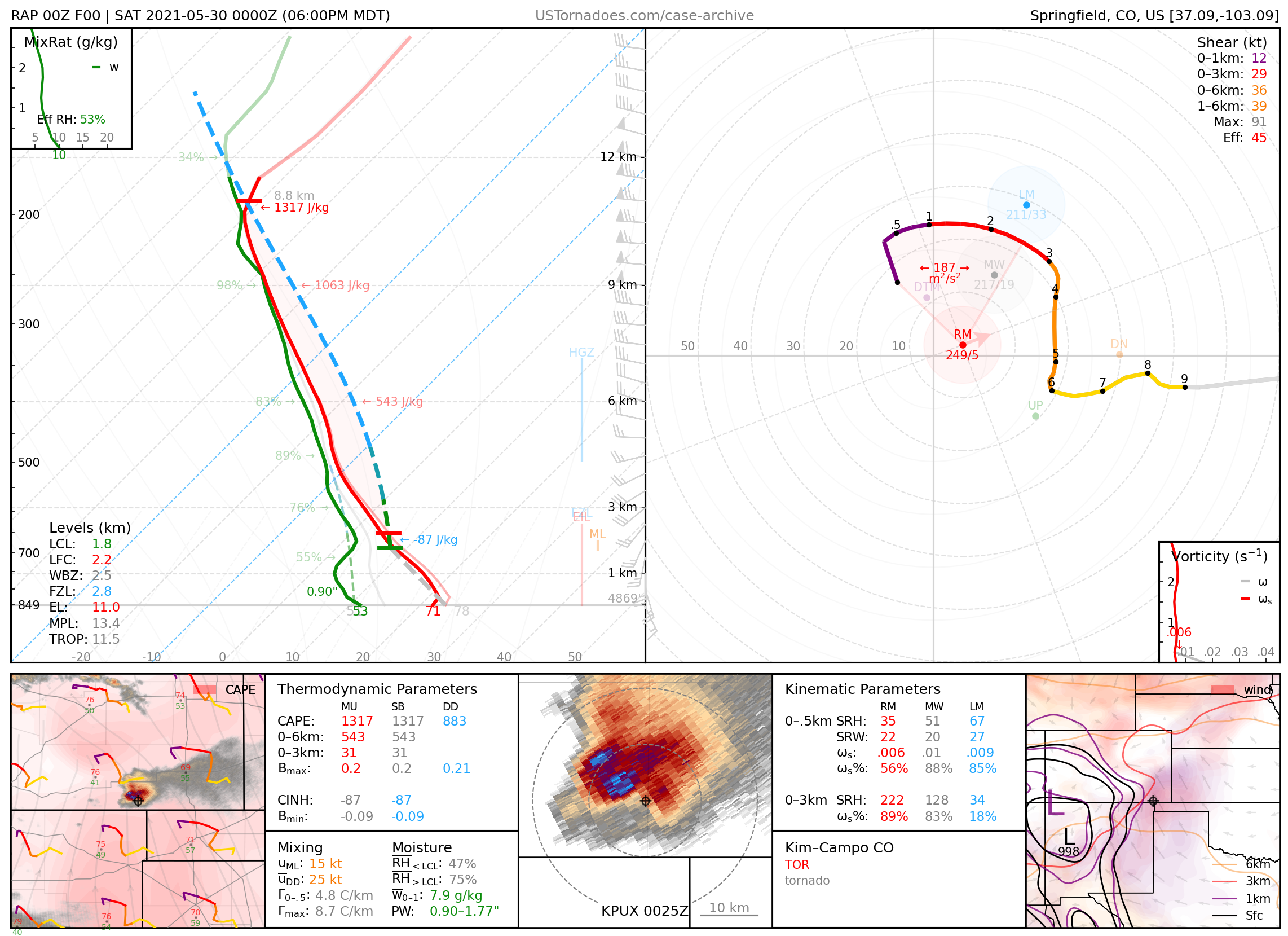
May 29, 2021: Kim / Campo, Colorado
Widely-photographed cone tornado produced by nearly stationary supercell.
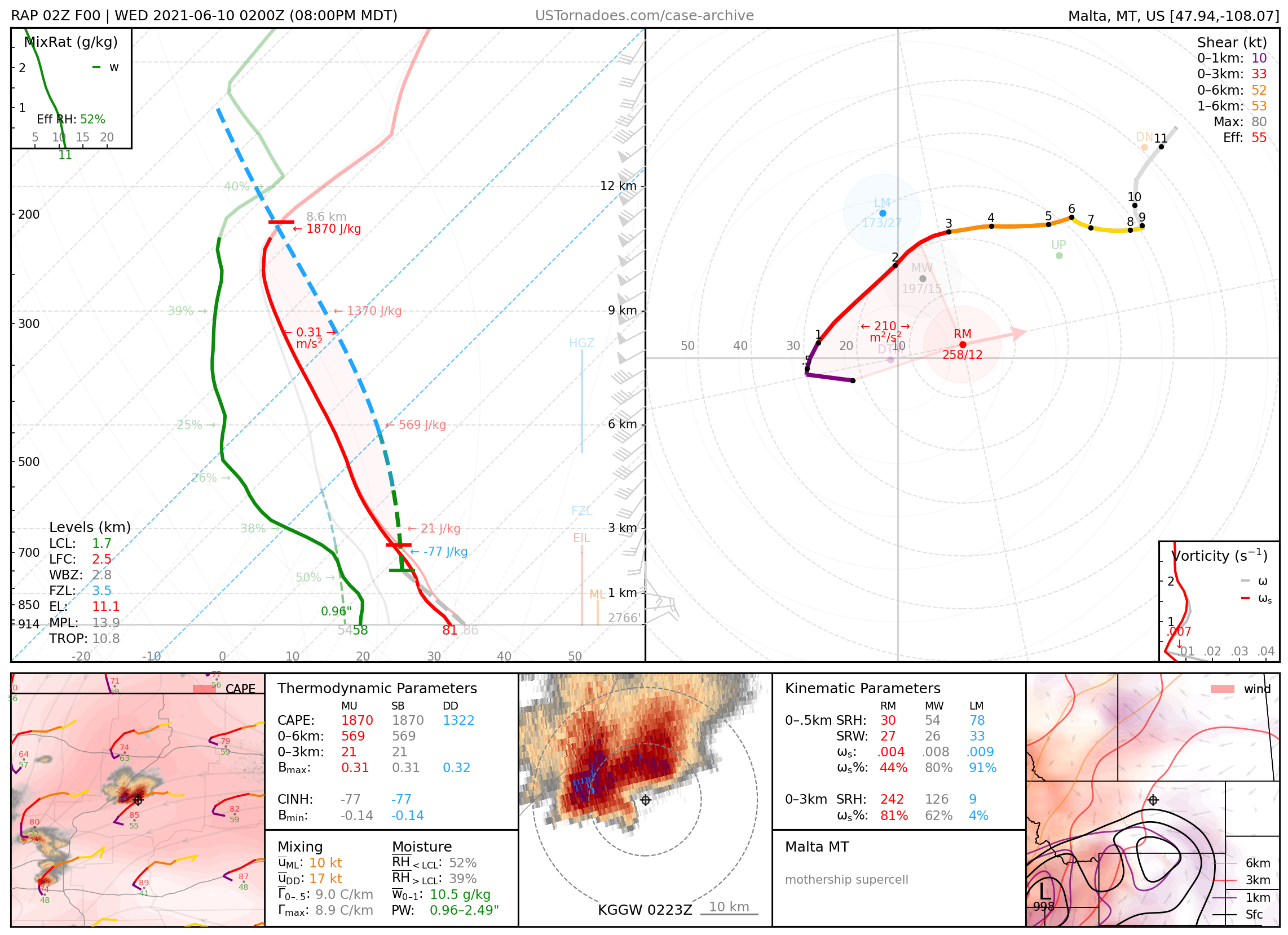
June 9, 2021: Lodge Pole, Montana
Particularly photogenic “mothership” supercell.
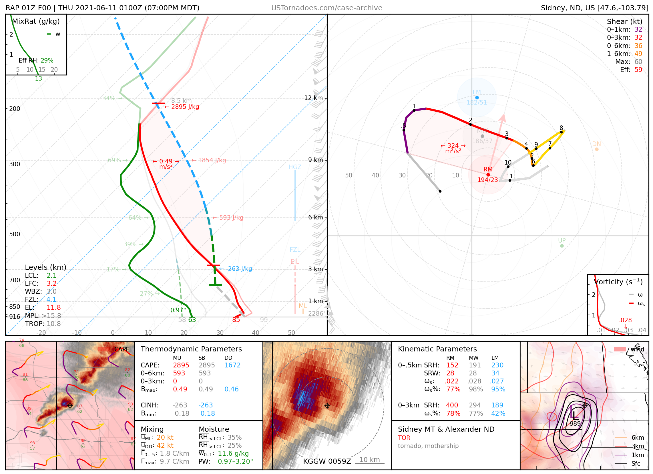
June 10, 2021: Sidney, Montana & Alexander, North Dakota
A series of two almost mirror-image photogenic “mothership” supercells, both of which produced tornadoes.
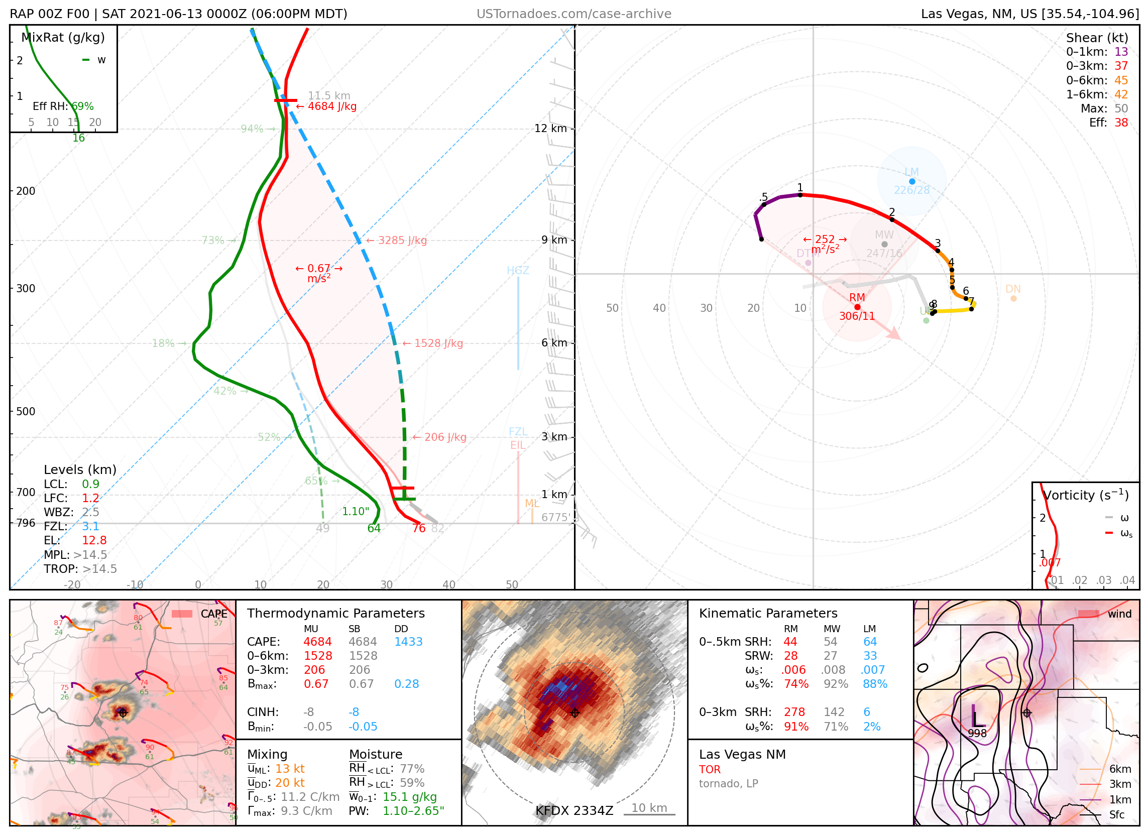
June 12, 2021: Las Vegas, New Mexico
Photogenic tornado produced by supercell in an anomalously unstable environment in the high terrain of NE NM.
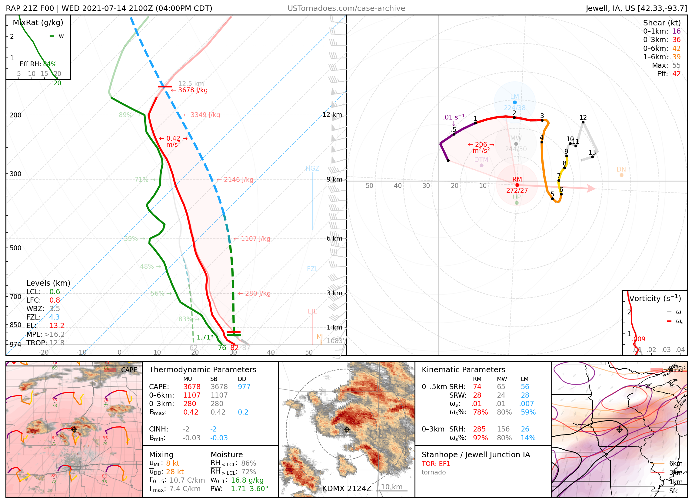
July 14, 2021: Jewell Junction / Stanhope, Iowa
A series of particularly photogenic tornadoes, some well-documented at a close range, part of a local outbreak of tornadoes up to EF3.
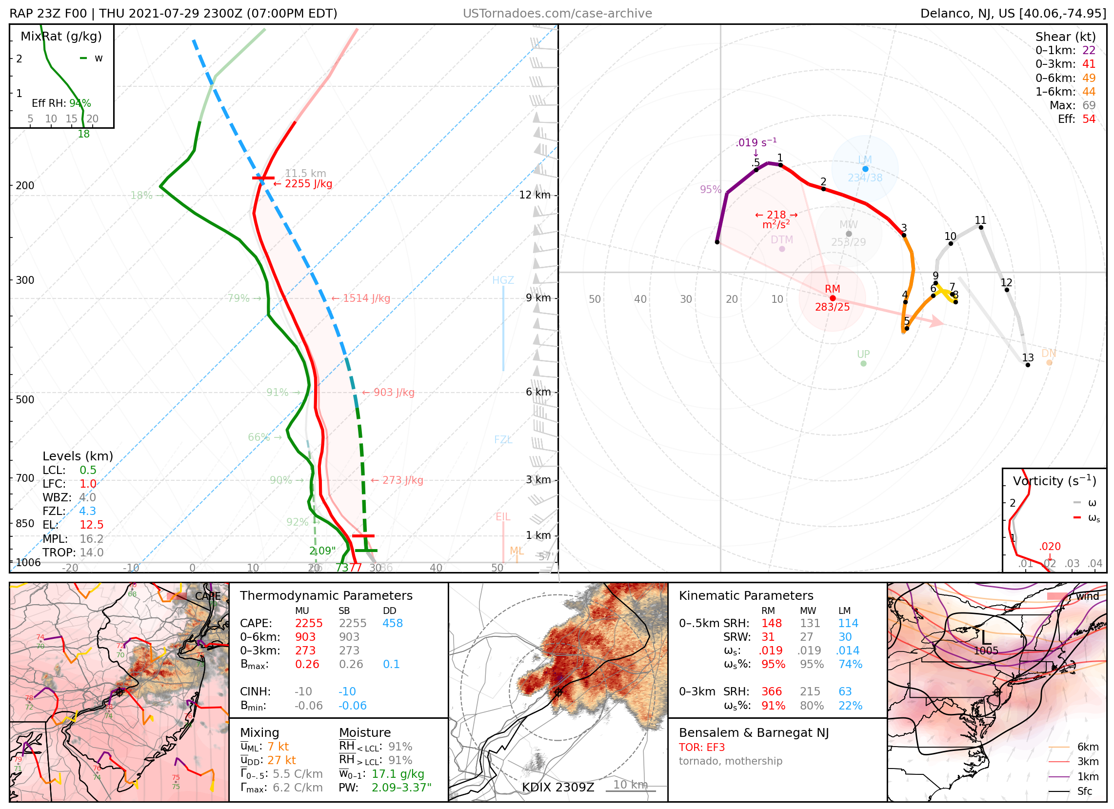
July 29, 2021: Bensalem / Barnegat, New Jersey
Cyclic supercell that produced multiple tornadoes (rated up to EF3) and later acquired a particularly photogenic “mothership” structure, part of an anomalous and Plains-like severe weather outbreak for the area.
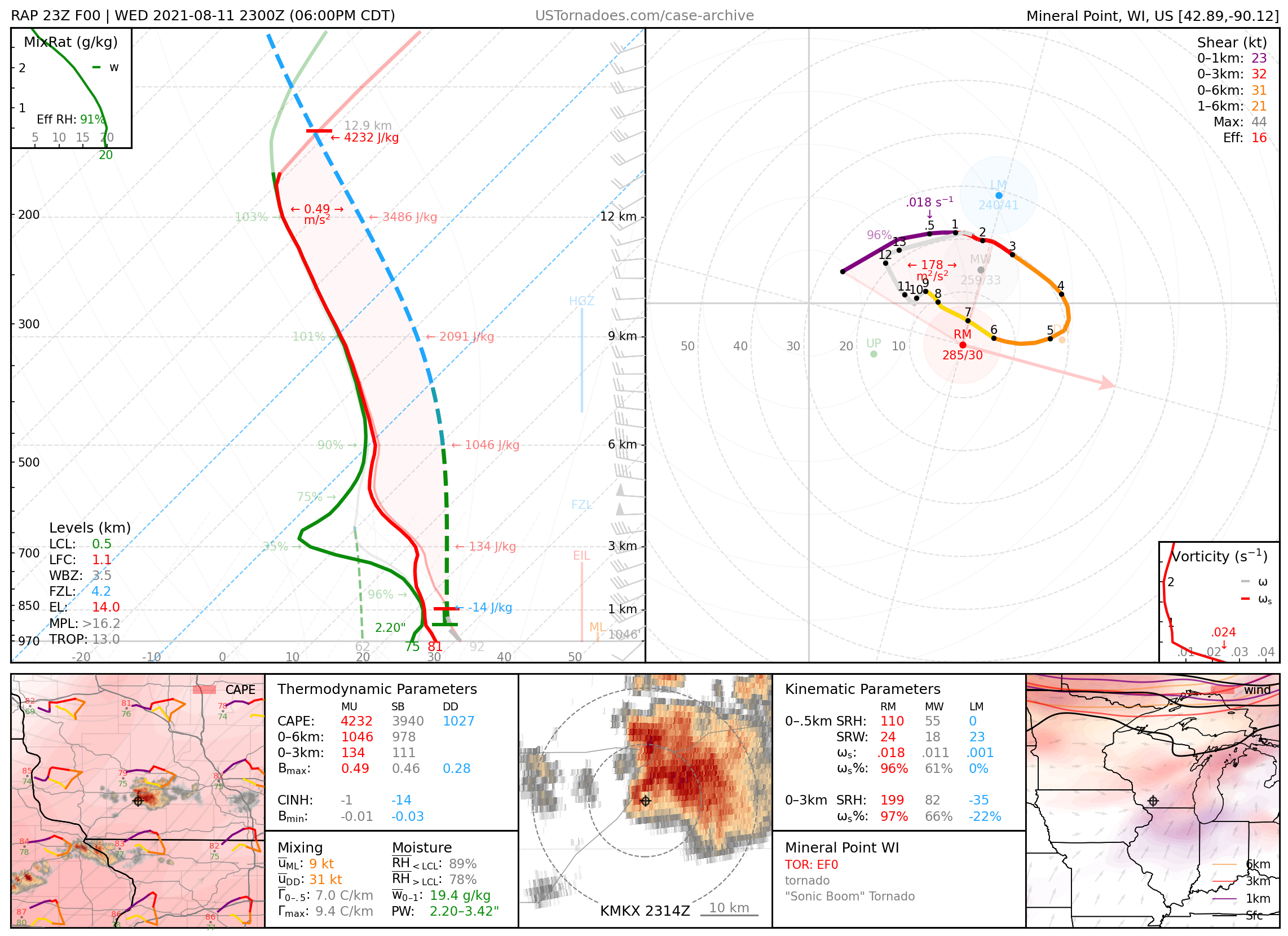
August 11, 2021: Mineral Point, Wisconsin
Tornado which made what was likely the first recorded tornadic sonic boom upon dissipation.
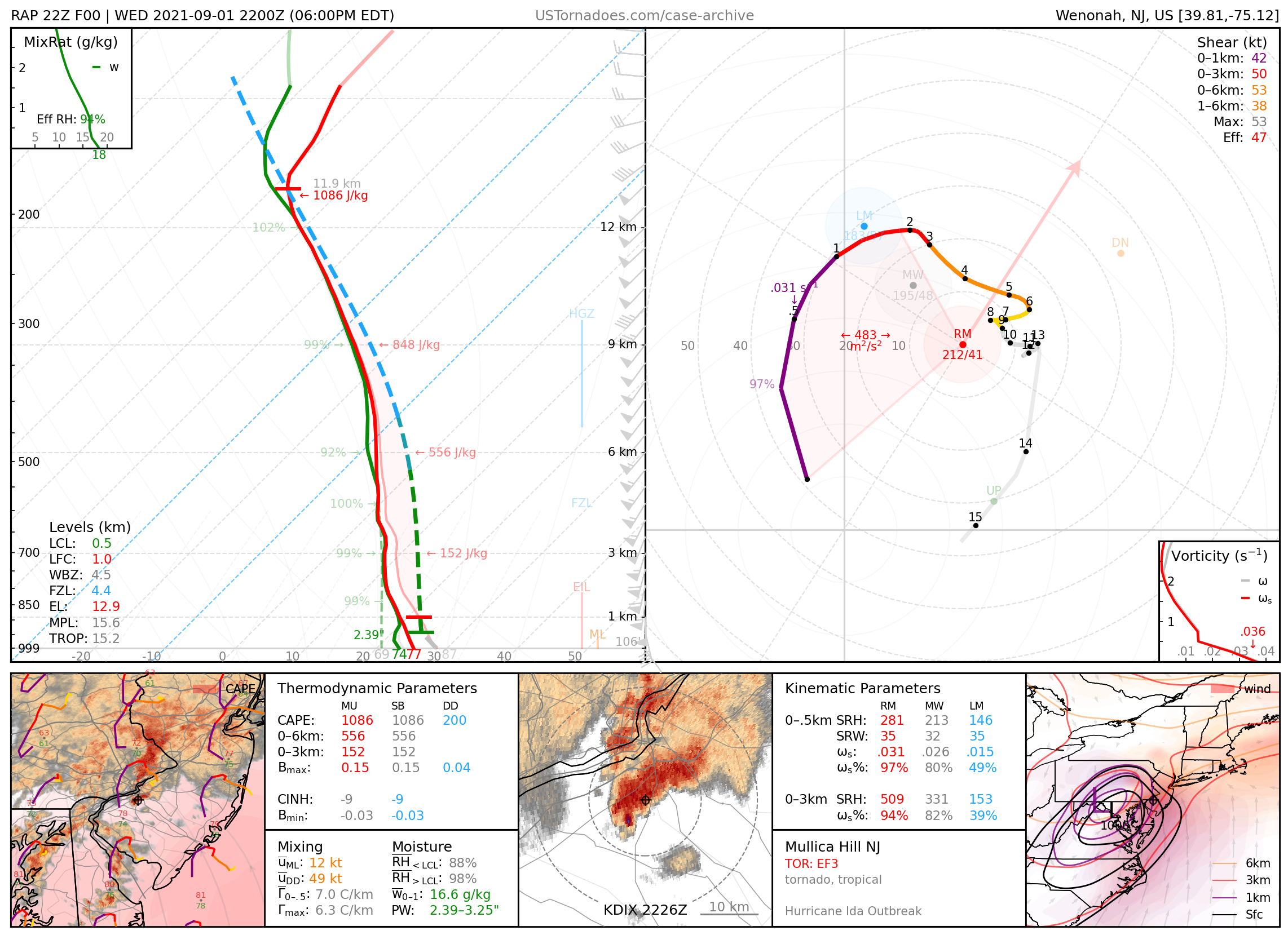
September 1, 2021: Mullica Hill, New Jersey
EF3 tornado, part of several tornadoes produced by the remnants of Hurricane Ida.
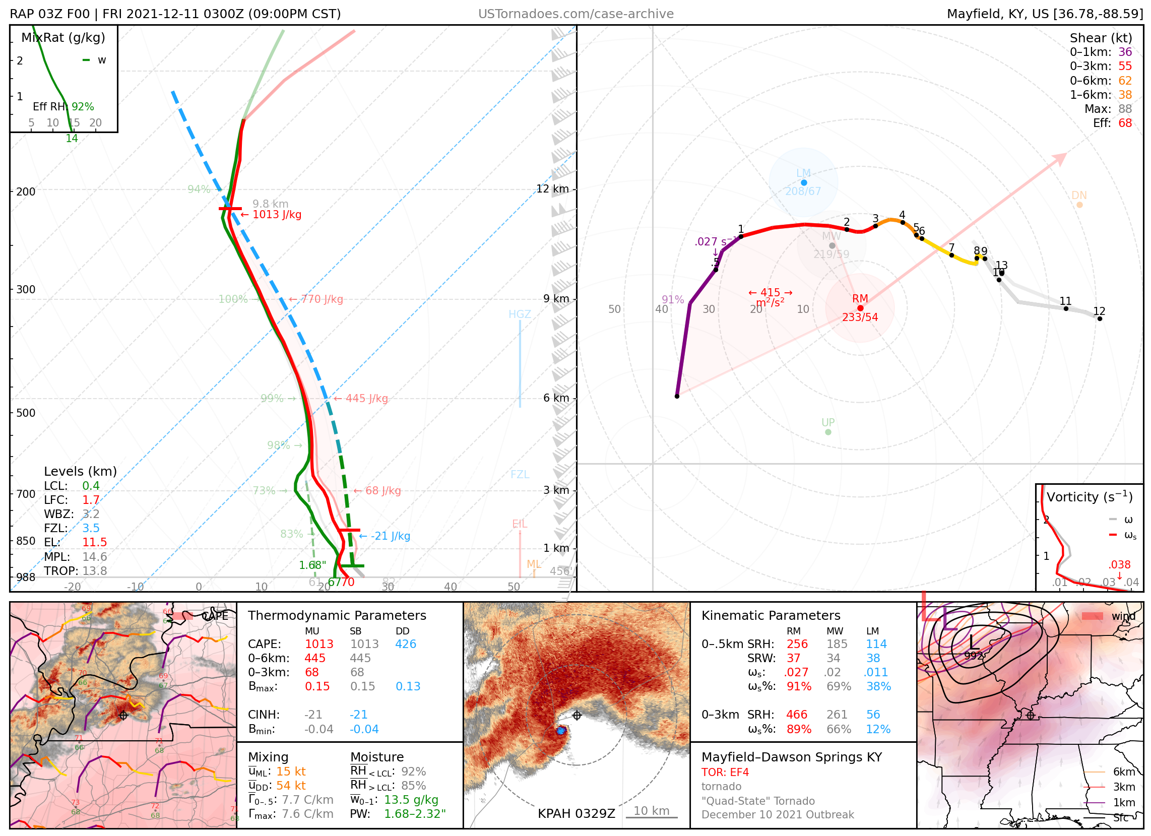
December 10, 2021: Mayfield–Dawson Springs, Kentucky
A series of two EF4 tornadoes, one of which was extremely long-tracked, that quickly became colloquialized as the “Quad-State Tornado”, though surveys found a significant break in damage. This tornado family killed 65 people, leveled large portions of multiple towns along its path, and along with another tornado this day, stirred controversy over workplace preparedness.
2022
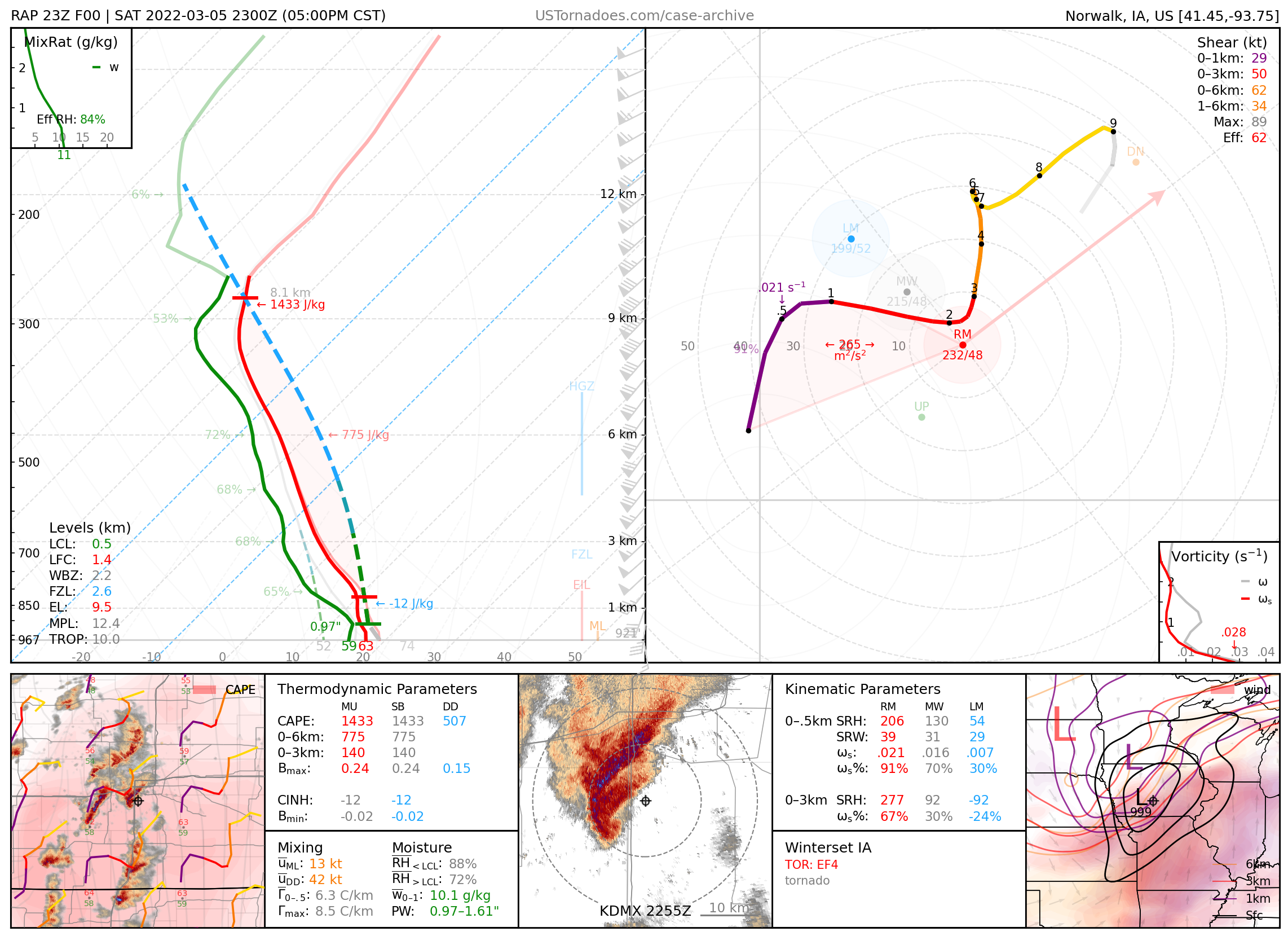
March 5, 2022: Winterset, Iowa
Long-lived EF4 tornado.
March 21, 2022: Round Rock & Elgin, Texas
A local outbreak of well-documented and significant tornadoes.

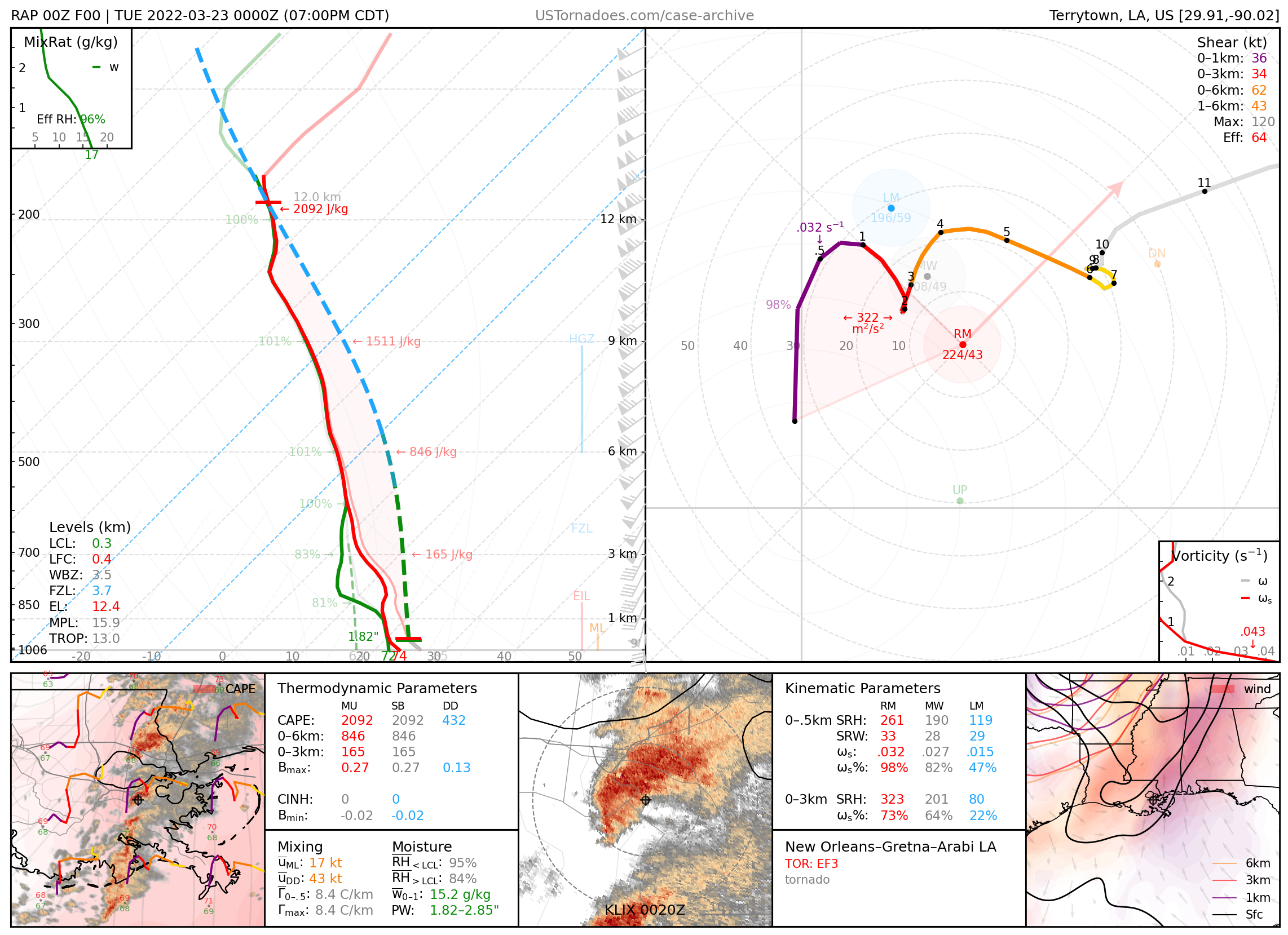
March 22, 2022: New Orleans–Arabi, Louisiana
EF3 tornado that struck parts of metro New Orleans.
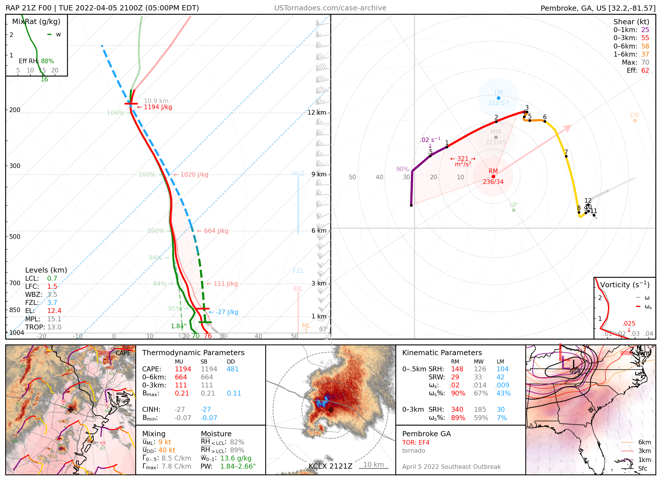
April 5, 2022: Pembroke, Georgia
EF4 tornado, part of an outbreak of tornadoes in the Southeast U.S.
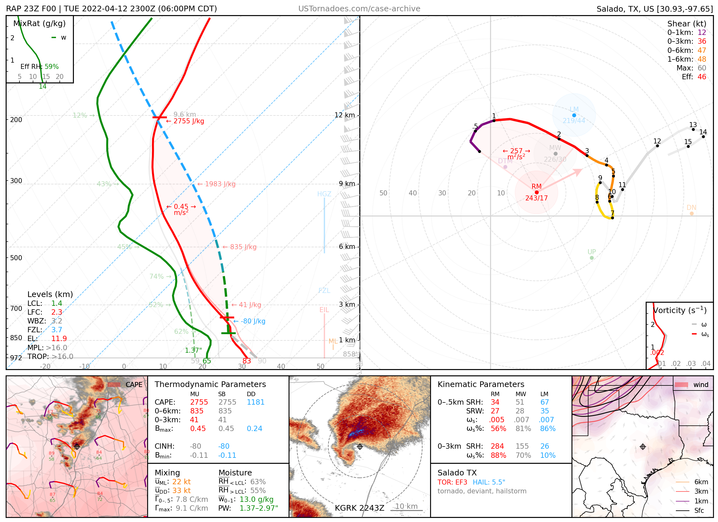
April 12, 2022: Salado, Texas
Photogenic and long-lived EF3 tornado that took a particularly abrupt northward jog, narrowly missing downtown.
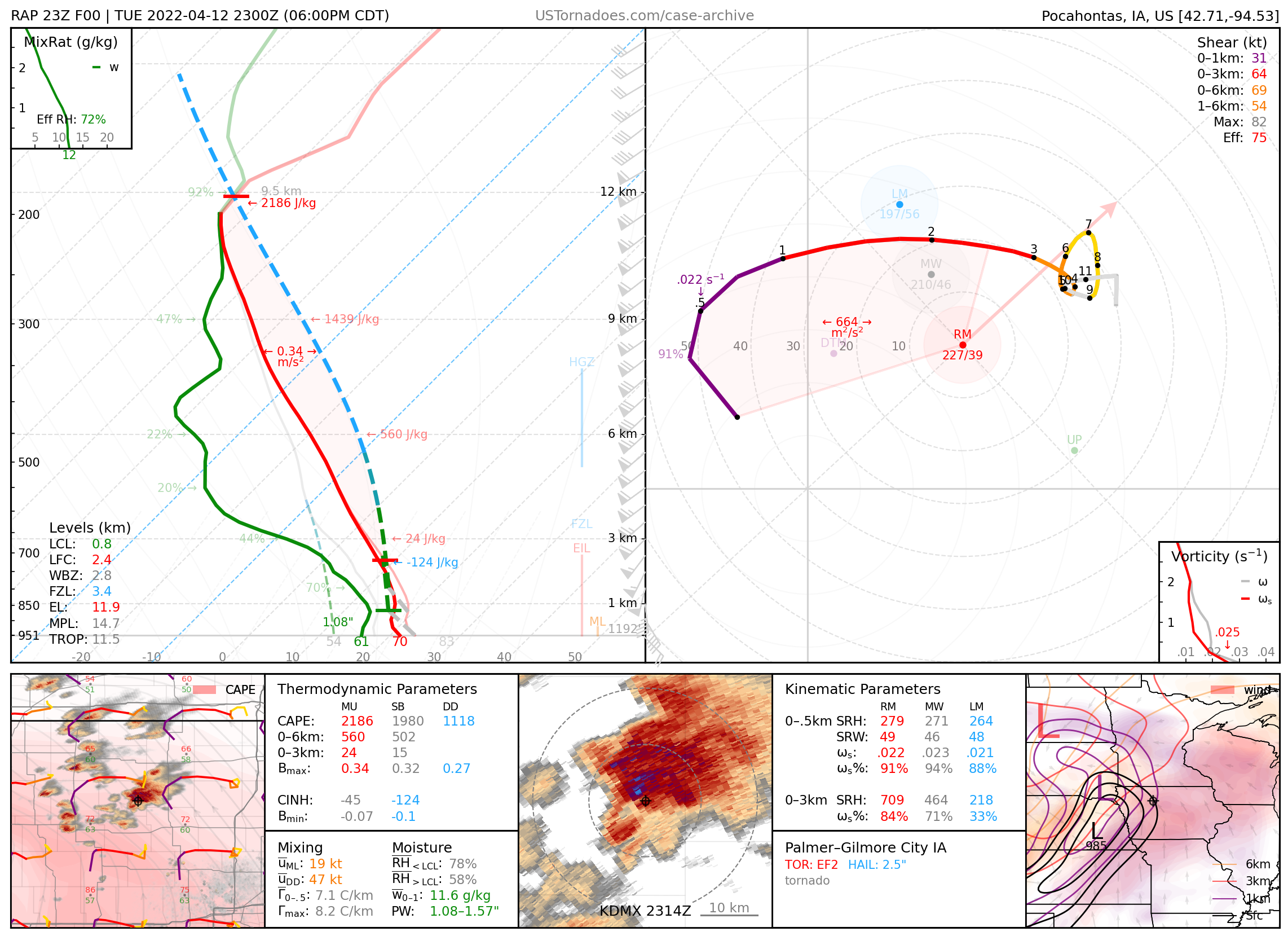
April 12, 2022: Palmer–Gilmore City, Iowa
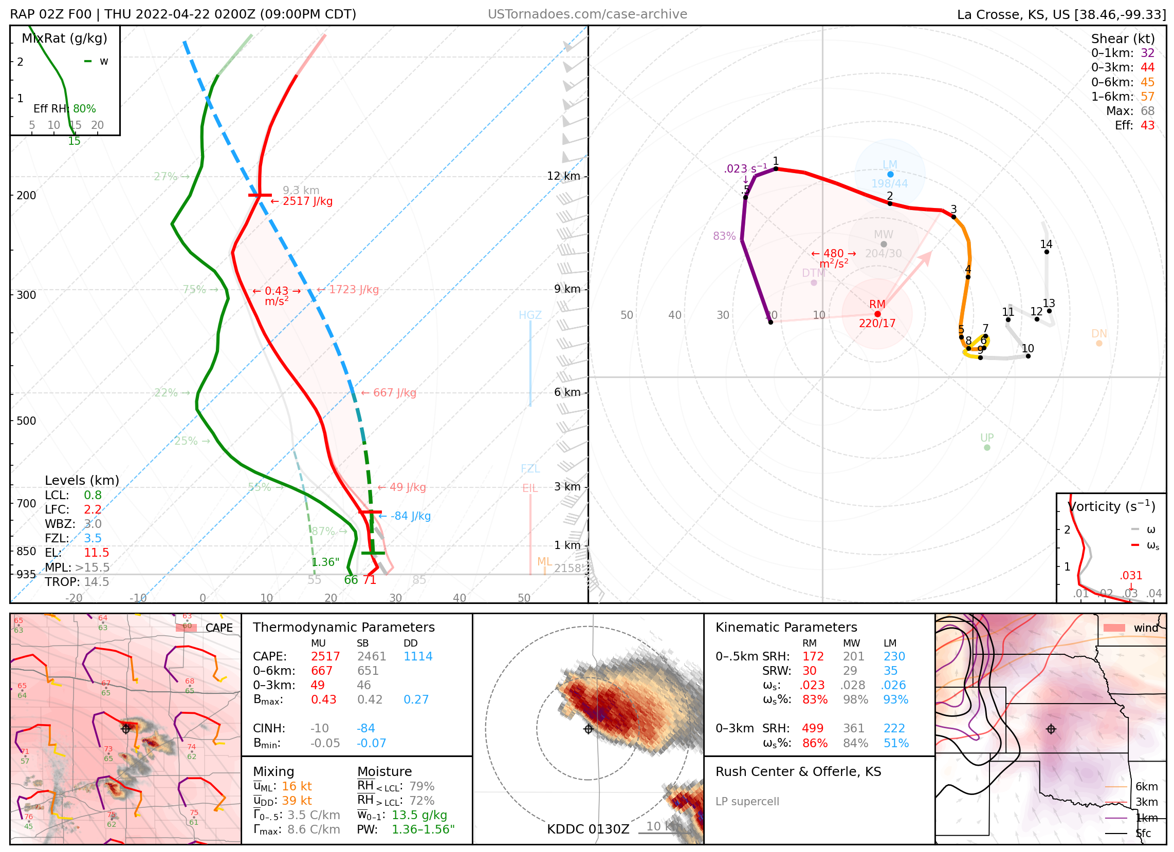
April 21, 2022: Rush Center & Offerle, Kansas
Photogenic LP barberpole supercells.
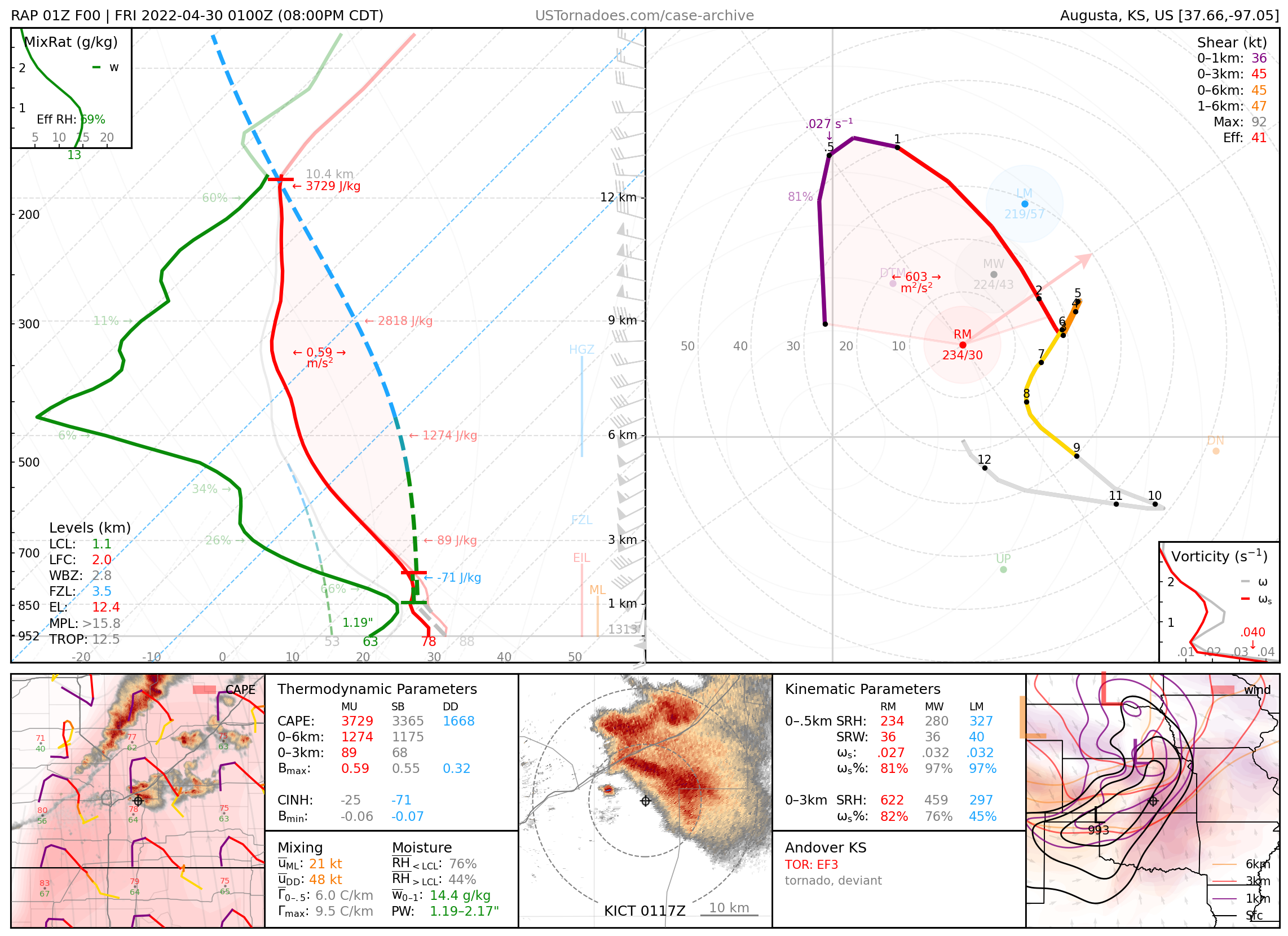
April 29, 2022: Andover, Kansas
Particularly photogenic EF3 tornado with well-documented and mesmerizing sub-vortex dynamics.
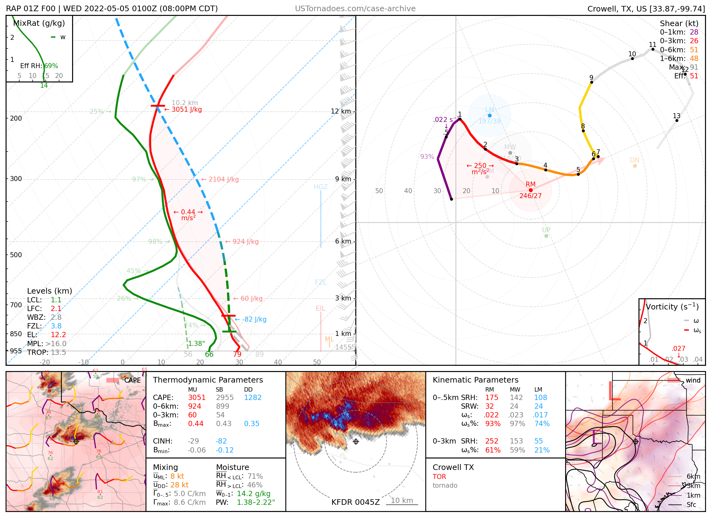
May 4, 2022: Crowell, Texas
Photogenic and dusty tornado that weaved through a field of wind turbines.
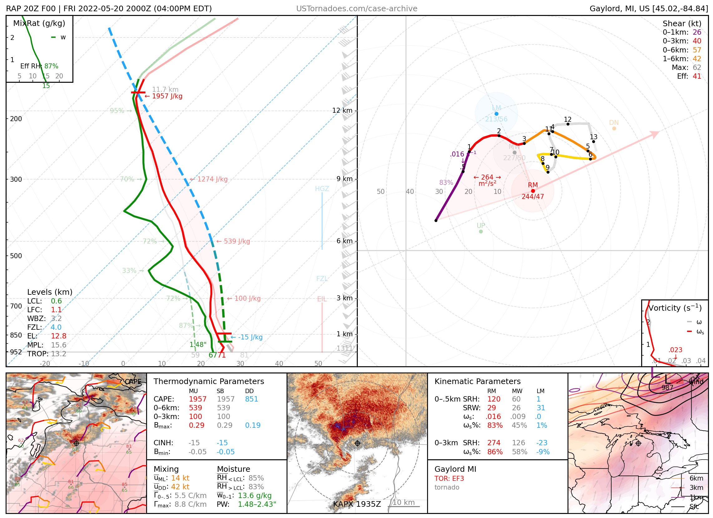
May 20, 2022: Gaylord, Michigan
EF3 tornado, a rarity for the area.
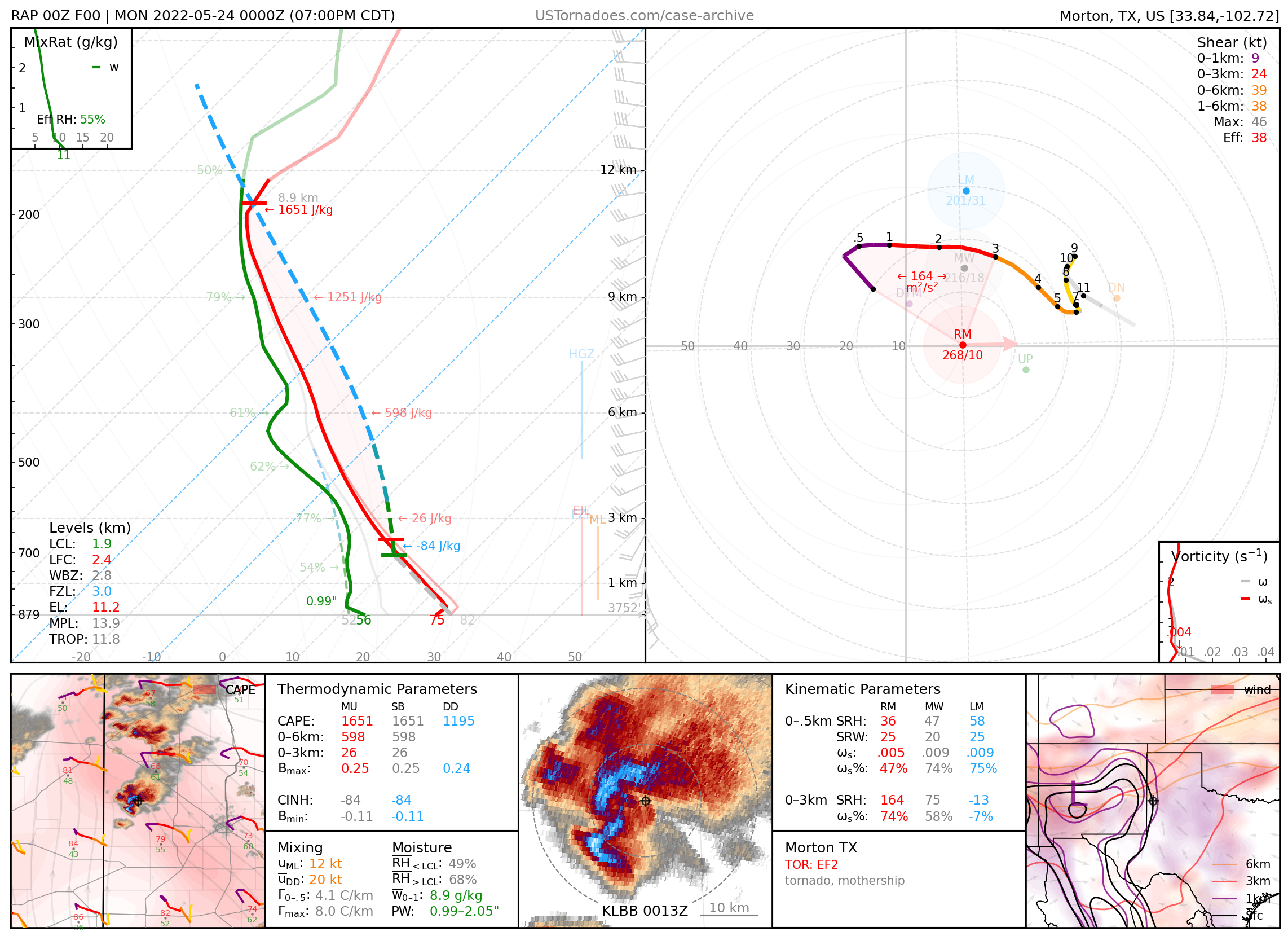
May 23, 2022: Morton, Texas
Cyclic supercell that produced multiple tornadoes, including a large, dust-wrapped, and particularly photogenic wedge tornado.
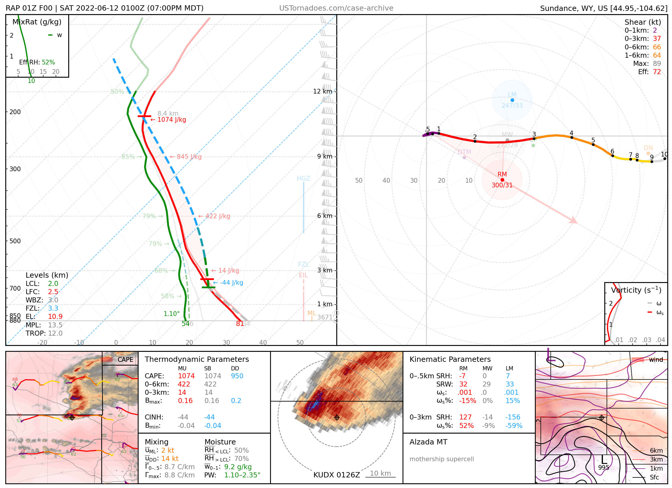
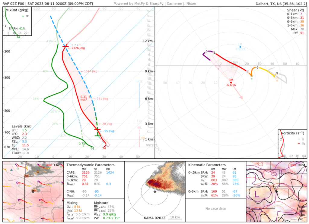
June 11, 2022: Alzada, Montana
Photogenic and well-structured supercell.
June 12, 2022: Gold Hill, Virginia
Photogenic and plains-like supercell, part of a multi-day montage of mothership storms.

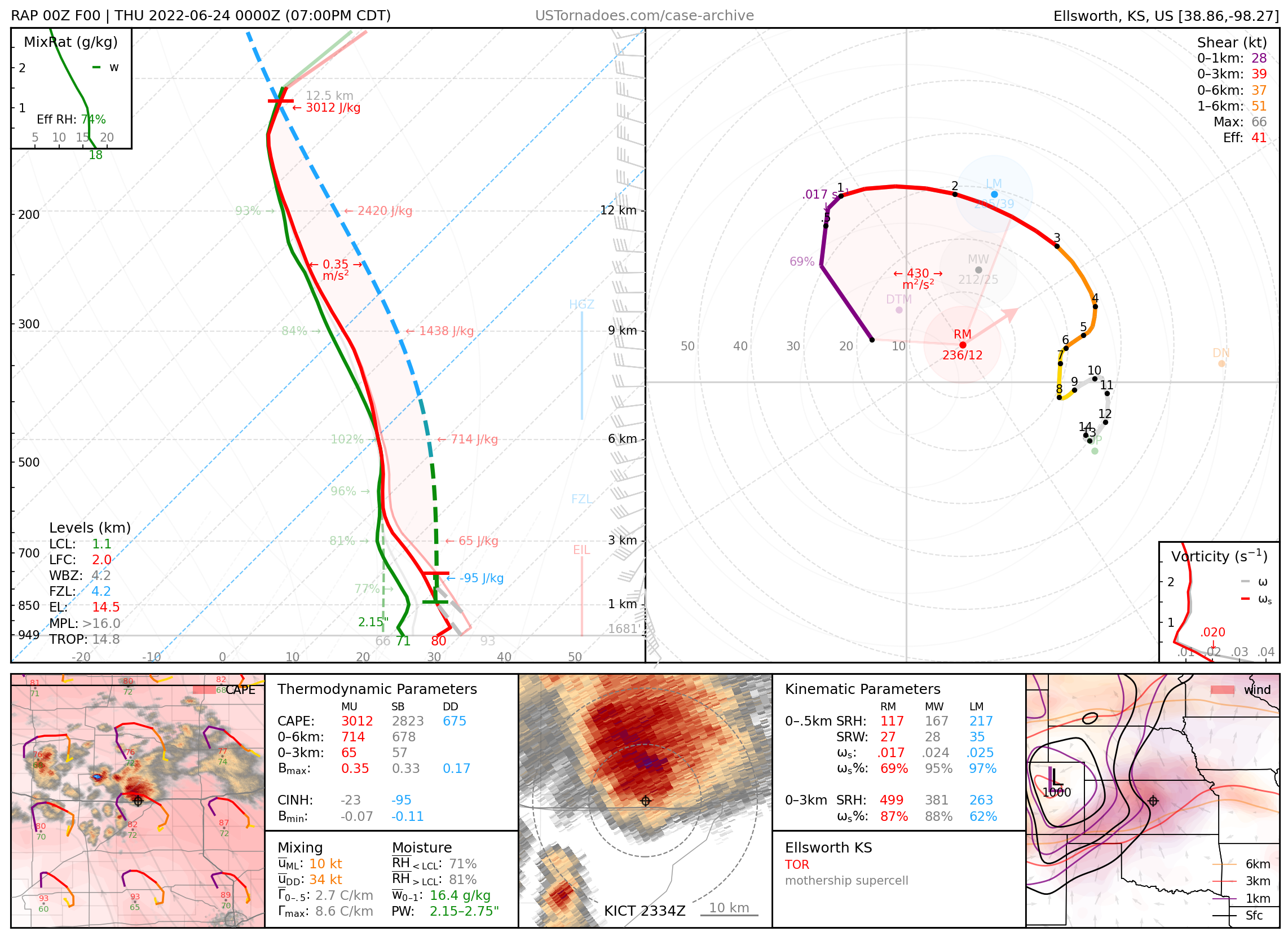
June 23, 2022: Ellsworth, Kansas
Photogenic and tornadic “mothership” supercell
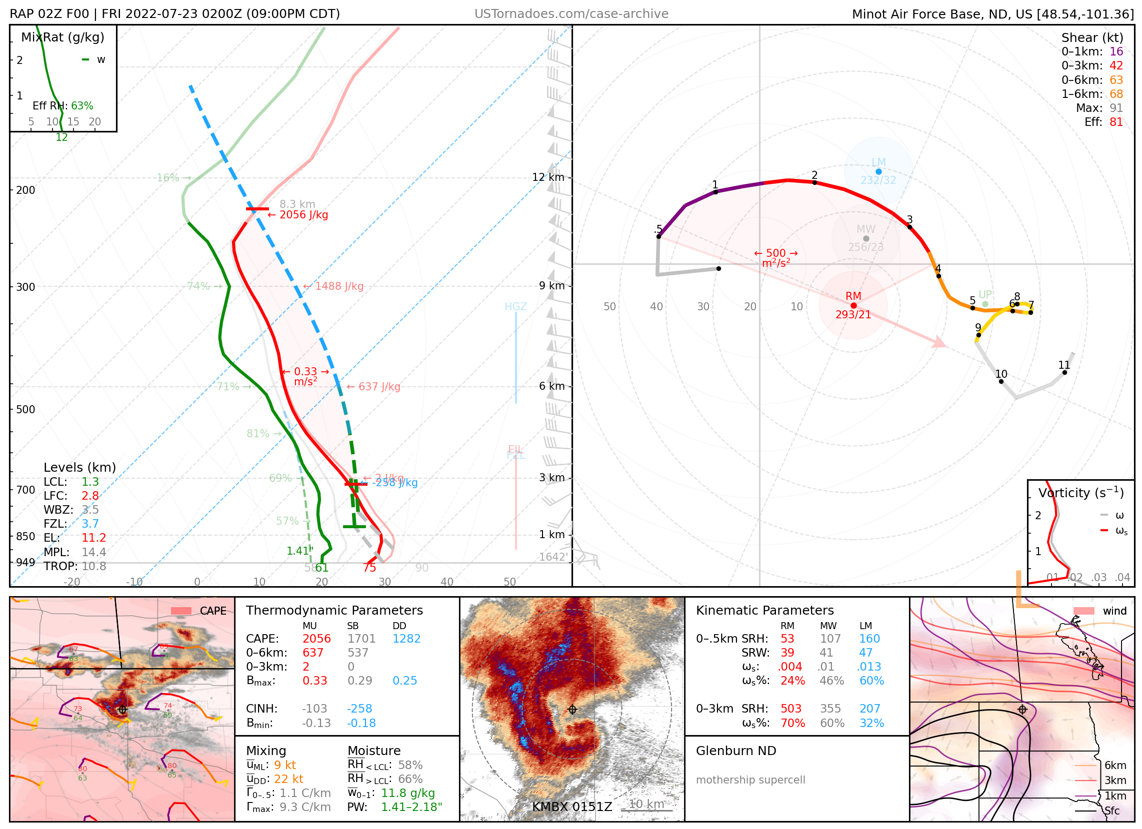
July 23, 2022: Glenburn, North Dakota
Immaculately-structured mothership supercell that evaded all but a few lone chasers.
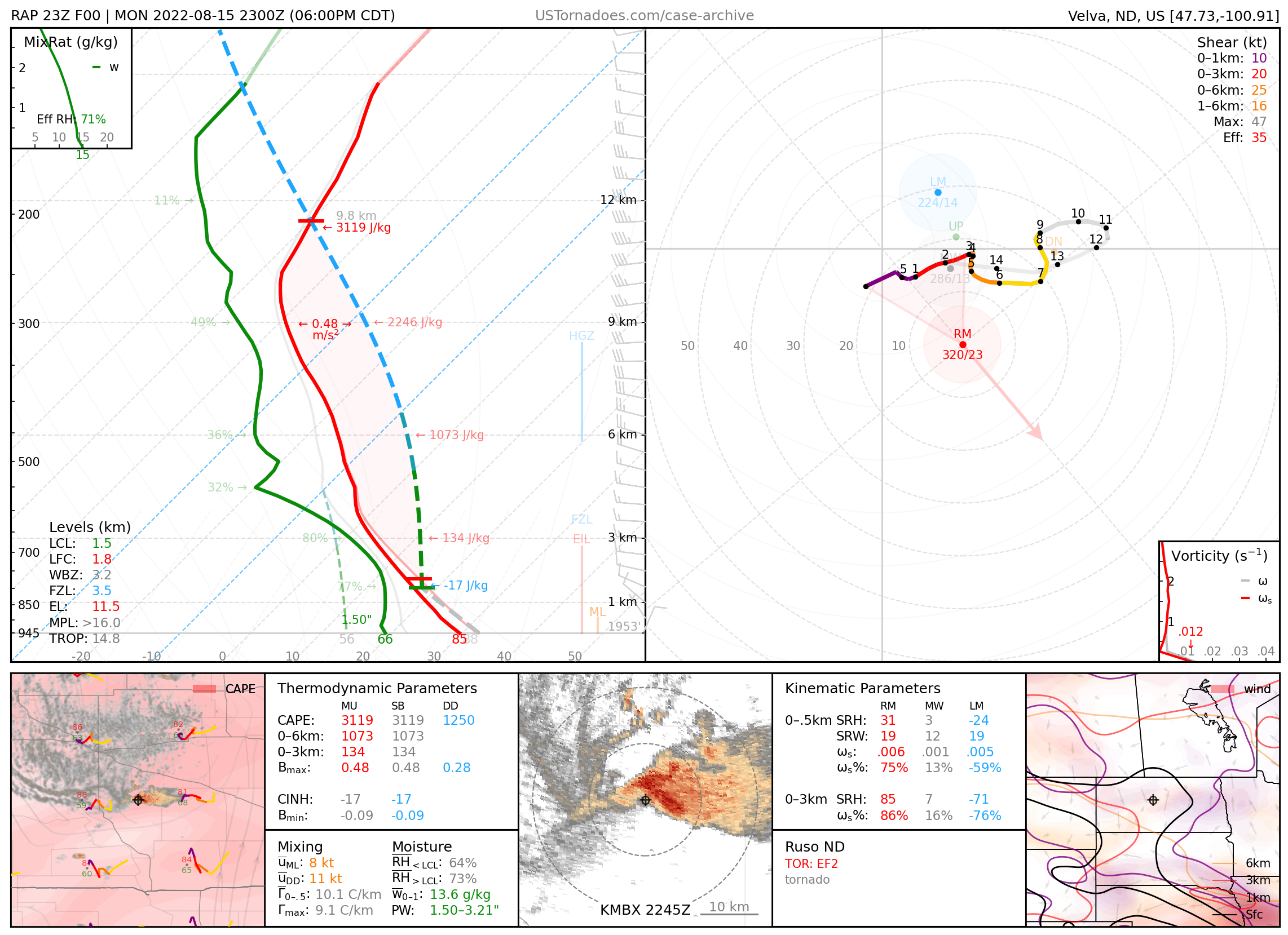
August 15, 2022: Ruso, North Dakota
Pair of particularly photogenic tornadoes.
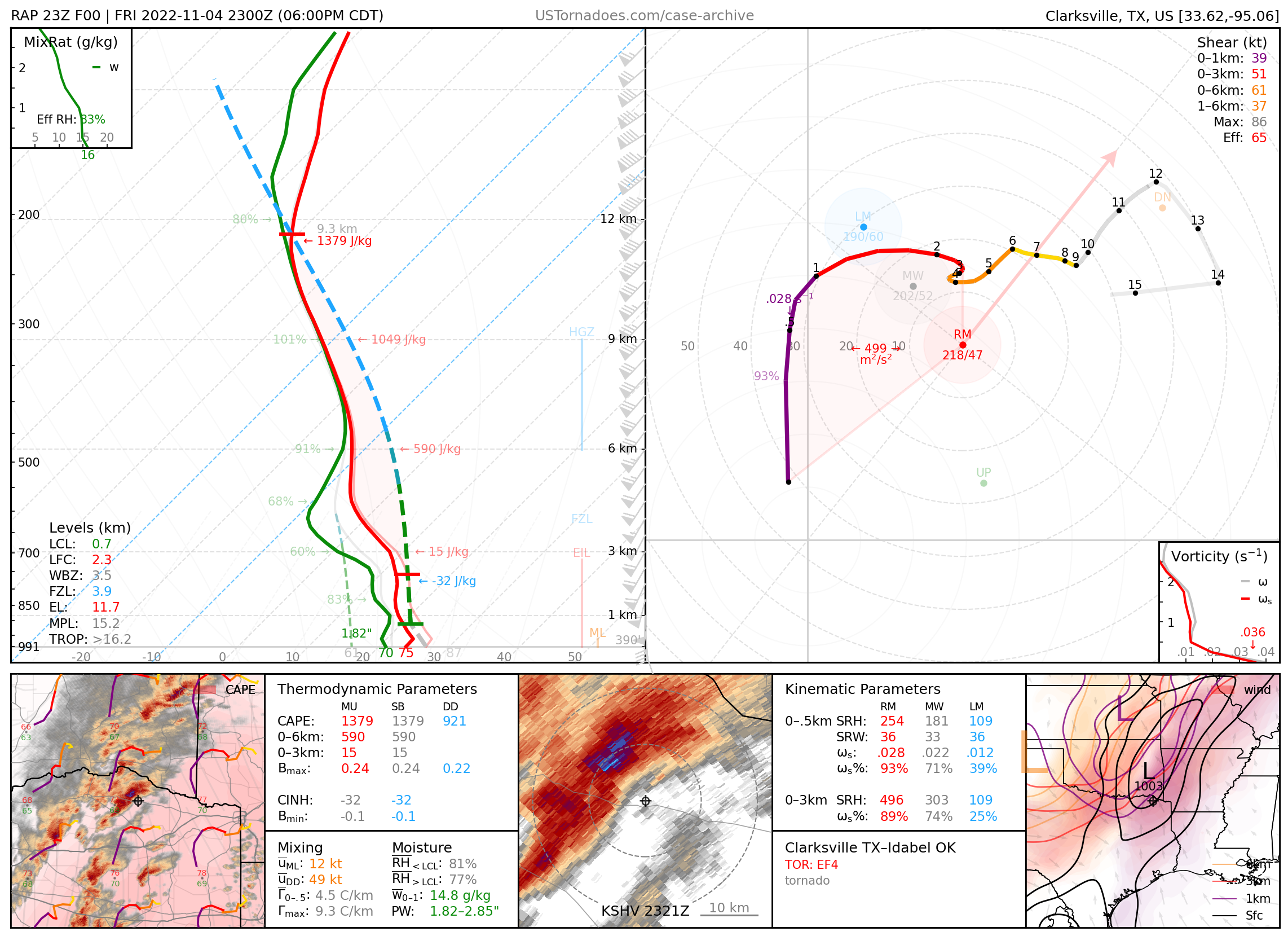
November 4, 2022: Clarksville, Texas – Idabel, Oklahoma
Long-tracked EF4 tornado, part of a local outbreak of intense tornadoes in the ArkLaTex.
2023
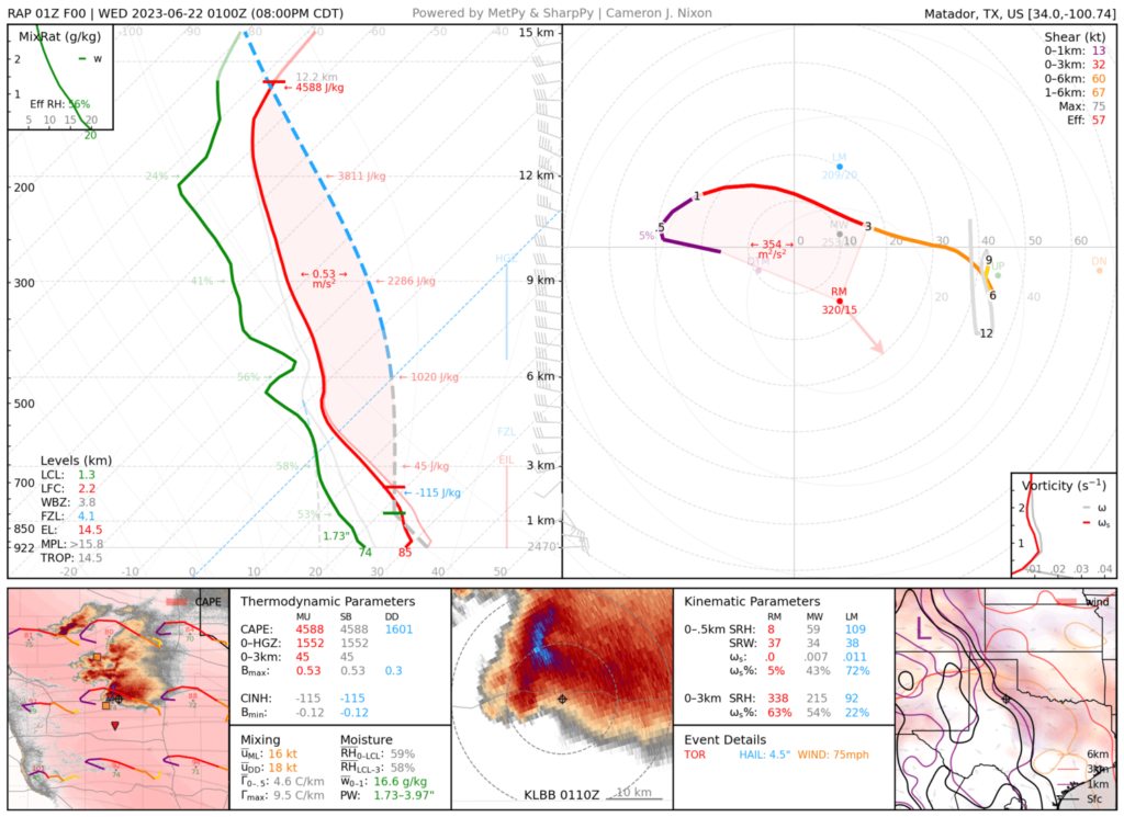
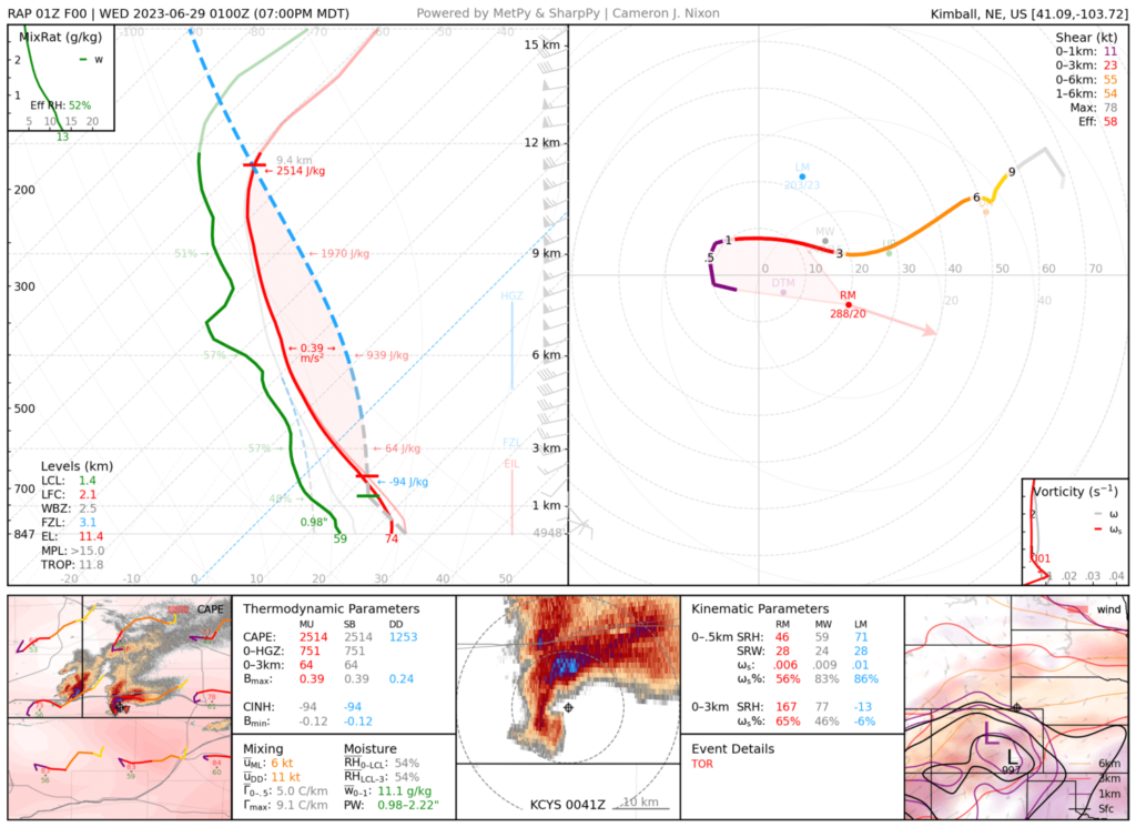
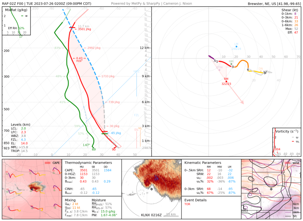
Disclaimer
Neither RAP nor ERA5 will not perfectly represent the observed environment.
In general (especially prior to 2021), RAP has a bias toward warm, dry surface conditions and weak low-level shear, especially on drier days. ERA5 has a bias toward cool surface temperatures and weak buoyancy. Soundings were not adjusted for observed surface variables or storm motions.
Certain artifacts are inevitable. RAP soundings will often display saturation aloft that masks otherwise drier profiles near convection. RAP may also feature unrealistic low-level moisture distributions, such as high surface dewpoints in otherwise dry boundary layers. ERA5 soundings are occasionally marked by an incongruent disconnect in the low-level thermodynamic profile.
For educational use. If any info here is re-used please cite author (Cameron Nixon) and web page (https://www.ustornadoes.com/case-archive/).