Highlights of the week of June 15-21, and a brief look ahead.
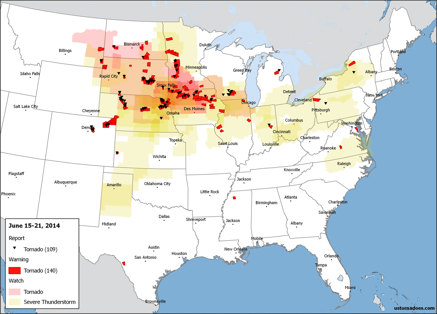
Unlike the first two weeks of June, this one did not include tornado reports every day. But three days went big, with one going huge.
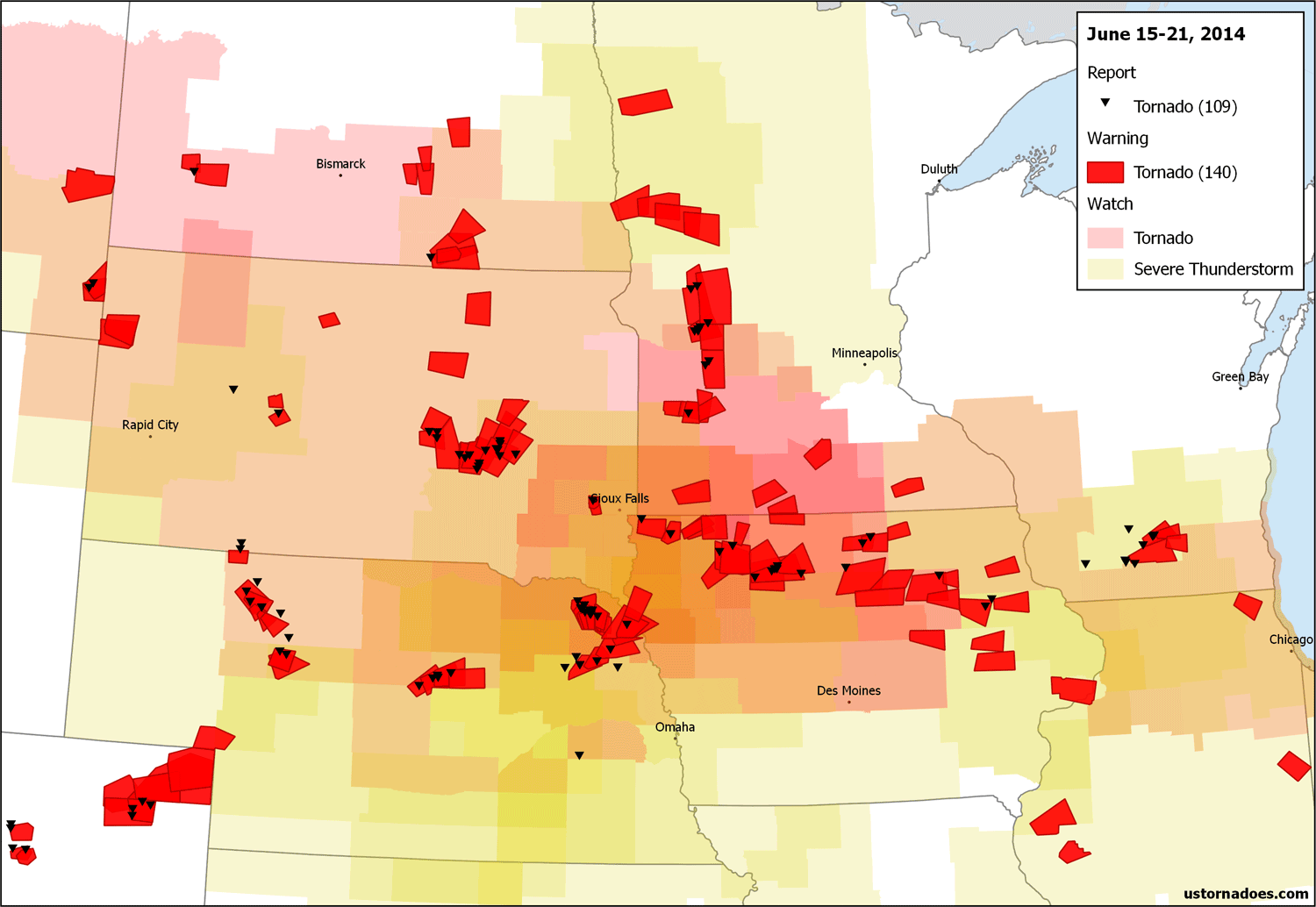
June 16 was the largest regional outbreak of June 16-18 outbreaks, with multiple cells dropping a handful or more tornadoes into the night from the Plains into the Midwest. Four of those tornadoes were rated violent, with the now famed Nebraska twins creating Hollywoodesque visuals. June 17 and June 18 were no slouches either.
There’s now little to no doubt we’ll remember June 2014 as an active tornado month, especially given the year was running so quiet prior. Some chance we pull out another set of events before the month comes to as close…
June 16: The Plains and Midwest, highlighting Nebraska
SPC has raised tornado probabilities to 15% in northeast Nebraska, MOD risk for tornadoes. http://t.co/IdRk4i80j9 pic.twitter.com/G0UtkgXSil
— U.S. Tornadoes (@USTornadoes) June 16, 2014
The moderate risk for tornadoes on June 16 in Nebraska was the first moderate risk for tornadoes from the Storm Prediction Center since May 11 across parts of the same state and Iowa. The environment was ridiculous — great shear and extreme instability. It didn’t take long to see the results in northeast parts of the state:
Large tornado near Stanton Nebraska #tornadohunter @ChittickChris @forbesricky @spann pic.twitter.com/qB3lqHjwS8
— Greg Johnson (@canadogreg) June 16, 2014
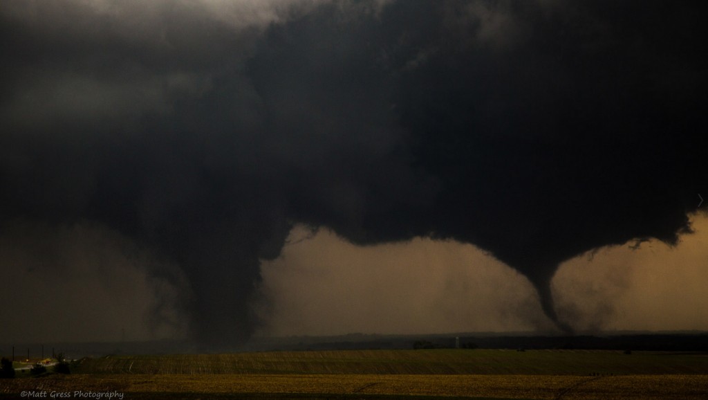
If one big tornado wasn’t enough sign just what the ingredients available could cause, two simultaneous beasts did do the job. Something that was truly amazing:
Can't recall seeing two large tornadoes stable so close to eachother. Still ongoing in NE. https://t.co/myWl5dMrpQ pic.twitter.com/3CtEn6A1nQ
— U.S. Tornadoes (@USTornadoes) June 16, 2014
2 tornadoes went through Pilger, NE! I Pray everyone is okay! #prayers @stormpics @weatherchannel @reedtimmerTVN pic.twitter.com/YoS4JvdCNh
— Shalyn Phillips (@ShayJo13) June 16, 2014
Hopped out of the car and grabbed these twins. too bad I missed focus on the holy grail. @Slchunters pic.twitter.com/pbRiMuWN3k
— Brian Miner (@BDMphoto) June 17, 2014
With all the focus on northeast Nebraska, another cell to the west was also busy dropping tornadoes (at least five according to NWS North Platte).
Beautiful tornado near Burwell, NE! pic.twitter.com/aJ4l27p8No
— Gabe Garfield (@WxGabe) June 17, 2014
The Pilger area tornadoes were both rare in the “twin” nature at times, but also due to the fact that the first four tornadoes produced by the storm were all rated as violent tornadoes, with one still in the running to ultimately be assessed an EF5.
In addition to the Nebraska tornadoes, others were reports further east into the night, including 8 that touched down in Wisconsin surrounding midnight. One southwest of Madison was an EF3, with several other strong twisters confirmed including one in the capital city.
Selected videos…
Multiple tornadoes from Stanton to Wayne County NE. Video via skyinmotion.com/Brett Roberts.
Twin tornadoes near Pilger, NE. Video via Basehunters.
Tornado moving through Pilger, NE. Video via TVNweather/Dick McGowan.
June 17: Nebraska again, and other spots like Montana
Shear was a little less compared to Monday, but extreme (and in some cases absurd) instability remained entrenched over the central United States. The combo again proved explosive, with multiple-tornado producing supercells developing in several spots across a large region. For the second day in a row, the focus was on Nebraska. The strongest tornado in the state was one that touched down near Coleridge, producing at least (assessment still being finalized) EF3 damage.
Large wedge tornado half mile north of Coleridge nebraska @NWSOmaha pic.twitter.com/Tgl1nlo722
— Dick McGowan (@stormpics) June 18, 2014
Wedge tornado near Laurel, NE pic.twitter.com/n6sqzkmO68
— Ryan Sandberg (@RyanJSandberg) June 18, 2014
Tornadic supercells at sunset in the Plains, via @coreburn #NEwx pic.twitter.com/OnirAMvVZj
— U.S. Tornadoes (@USTornadoes) June 18, 2014
Further west, one of only a handful of EF-3s ever recorded in Montana touched down just west of the South Dakota border earlier in the day. It was ominous and imposing.
Awesome tornado/structure on MT side of MT/SD border Tues, via Roger Hill/Silver Lining Tours http://t.co/zmwnM9auSV pic.twitter.com/0A6w4Z8MtU
— U.S. Tornadoes (@USTornadoes) June 18, 2014
And in between, a set of storms near and south of the South Dakota border dropped a number of photogenic EF0 tornadoes in the very rural sandhills of Nebraska.
The Sandhill Screwdriver – tornado yesterday in Cherry County, Nebraska near Merriman. #NEwx pic.twitter.com/LtqYiJ008W
— Chad Cowan (@stormtimelapse) June 18, 2014
Mullen, NE tornado 6/17/14 #newx pic.twitter.com/w5YVJ3XYl9
— Kendra Reed (@KendraReed69) June 18, 2014
Selected videos…
Tornado near Coleridge, NE. Video via Shalyn Phillips.
Tornado near Coleridge, NE. Video via Live Storms Media/Jason Cooley.
Tornadoes in the sandhills of NE. Video via Brandon Ivey.
June 18: South Dakota
Not a huge change in the pattern, so more big tornadoes, right? Right. This time the zone of focus shifted north a bit into South Dakota. A tail-end supercell in a marginal shear environment was able to take in copious instability and cycle through a number of tornadoes across south central parts of the state. One EF2 impacted Wessington Springs head on. Another tornado near Alpena from the same storm has yet to be rated and is also believed to have been strong.
Large tornado on ground near Wessington Springs, SD #SDwx [via @BrandonIveyWX] WATCH LIVE: https://t.co/V8qHv3HzKn pic.twitter.com/jJqCtuzuh5
— Jacob DeFlitch (@WxDeFlitch) June 19, 2014
@USTornadoes woonsocket south dakota pic.twitter.com/GLz1kRYvQ7
— derek foos (@teamarcticcat14) June 19, 2014
Another photo of the rope tornado yesterday south of Alpena, SD! @stormpics @reedtimmerTVN @SeanSchoferTVN pic.twitter.com/t2tsHKBYmC
— Shalyn Phillips (@ShayJo13) June 19, 2014
Selected videos…
Multiple tornadoes from SD supercell, including Wessington Springs. Video via Brandon Ivey.
Tornado near Woonsocket, SD. Video via TVNweather/Dick McGowan.
Tornado near Alpena, SD. Video via StormChasingVideo.
A quieter week, maybe turning more active as it goes
Few if any synoptically evident significant tornado events appear likely over the next several days. Preferred spots for potential tornado activity should be in the upslope regions overall, and even there it doesn’t appear to be a big threat.
As we get toward the end of the work week, signs of another trough pushing into the west and then moving out into the Plains remain consistent if blurry on details.
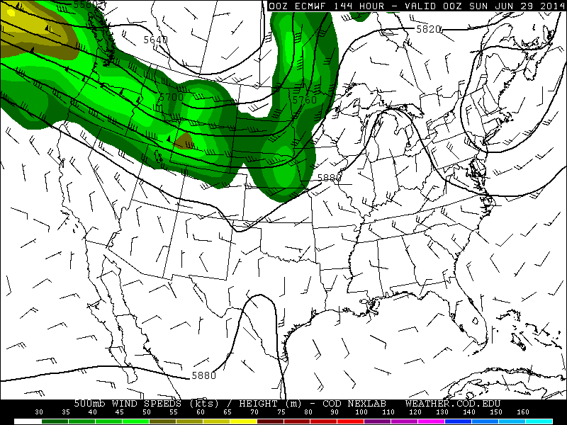
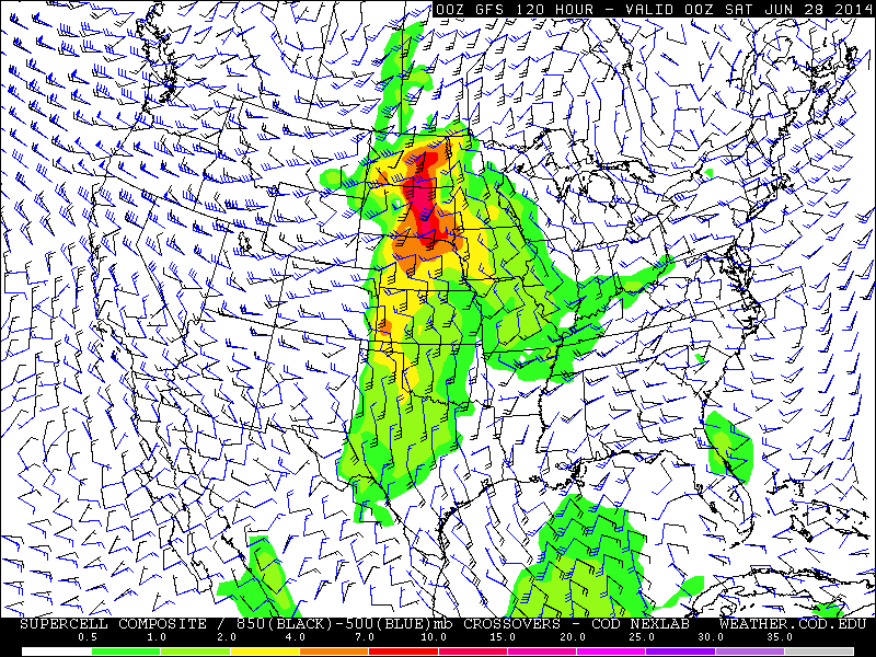
There’s certainly no reason to assume we’ve got a repeat of this past week in the offing given its very high end nature with some tornadoes. But, we’ll want to keep watch as we close over the next few days given potentially anomalous mid-level winds for so late in the year, and high to extreme instability yet again forecast.
Latest posts by Ian Livingston (see all)
- Tornado outbreaks: April, May and June peak-season primer - April 27, 2025
- Busy March for twisters to end with another multi-day event - March 28, 2025
- Everything but locusts: NWS shines in apocalyptic weather - March 17, 2025
