
The map above shows county-level impacts of U.S. tornadoes from 1950-2011. In this analysis, if one tornado crosses multiple counties, we have included it as an individual tornado for each county hit.
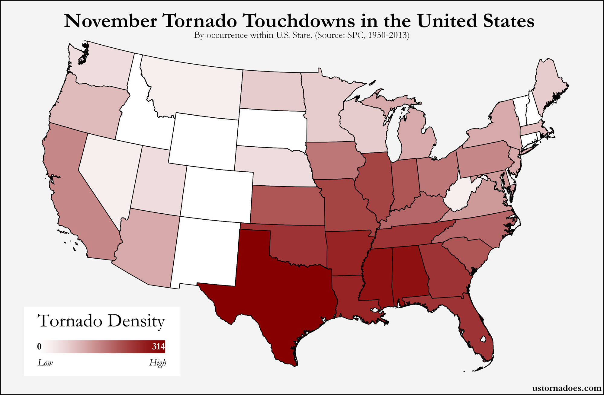
Moving through May, we see a significant amount of activity centered on the southern and central Plains, with the classic Tornado Alley entering into the beginning of its peak yearly period for tornadoes as the Southeast U.S. moves past peak. Almost every state in the contiguous 48 states has seen a May tornado, and tornadoes are most numerous in the record during this month.
Weld County, Colorado led the way during the period with 58 tornado impacts in May. A sampling of other counties that also fall into the highest tornado count for the month includes: Caddo County, Oklahoma with 55; Barton County, Kansas with 46; Finney County, Kansas with 46; Hale County, Texas with 43; and Oklahoma County, Oklahoma with 43.
View interactive map » (pops up in sized window — works best in Firefox)
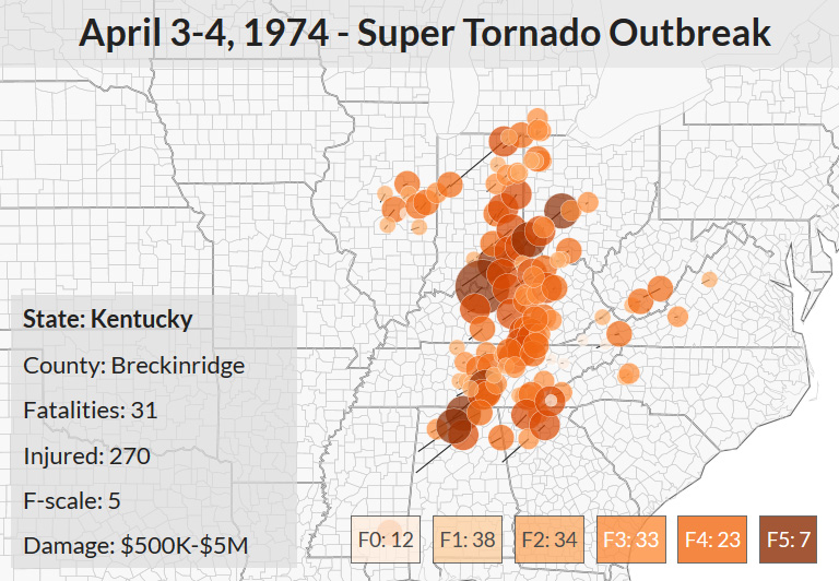
Map: April Tornadoes in the United States
Map can be viewed larger by selecting. Data obtained through the Storm Prediction Center. Get updates on U.S. Tornadoes on Twitter and Facebook.
Katie Wheatley
Latest posts by Katie Wheatley (see all)
- March 29-31, 2022 tornado outbreak - April 3, 2022
- March 25, 2021 tornado outbreak - March 25, 2021
- May 3-4, 1999 tornado outbreak and the Bridge Creek-Moore F5 - May 3, 2019
2 thoughts on “Map: May Tornadoes in the United States”