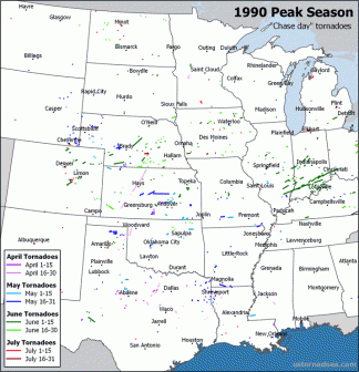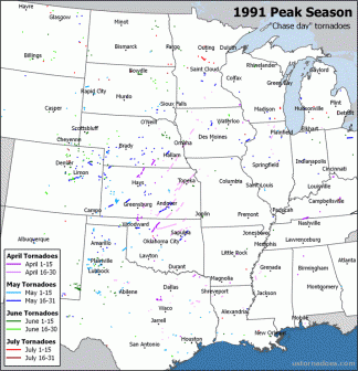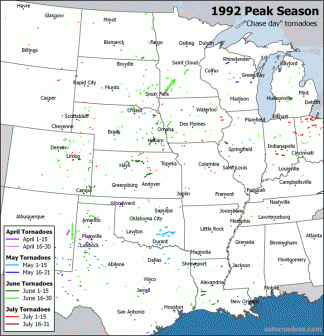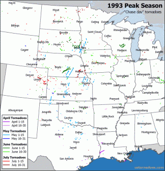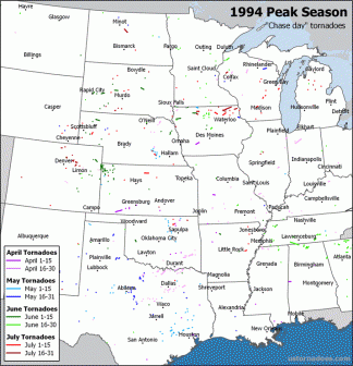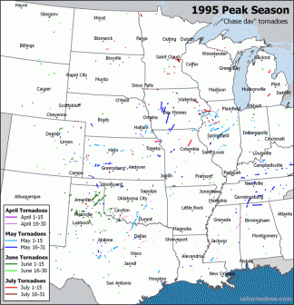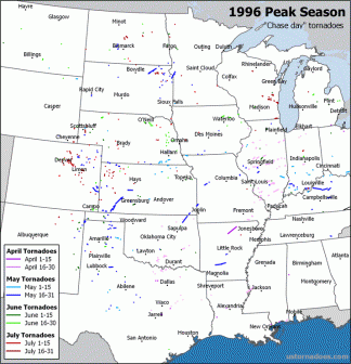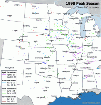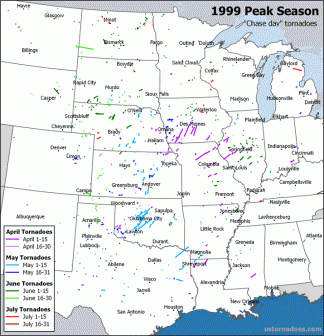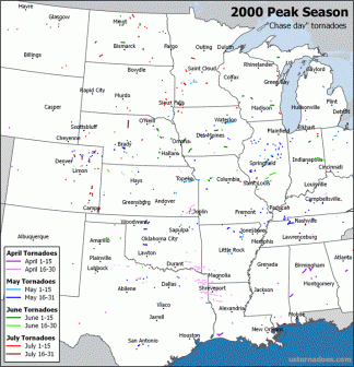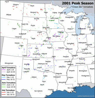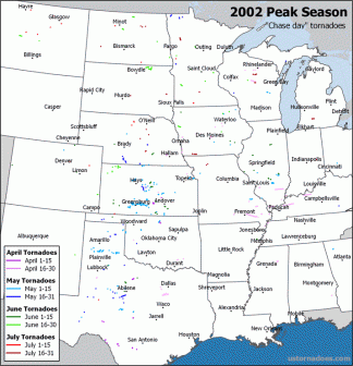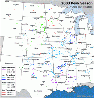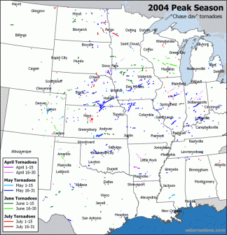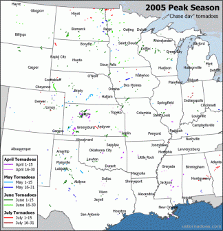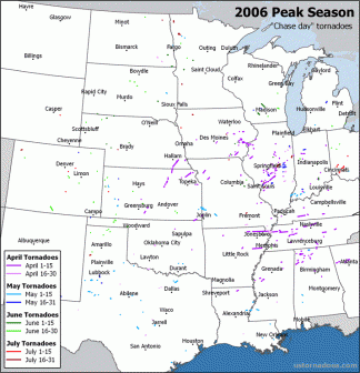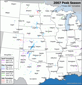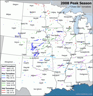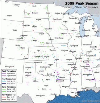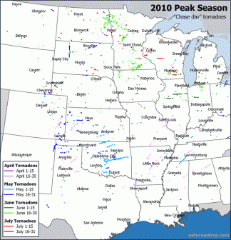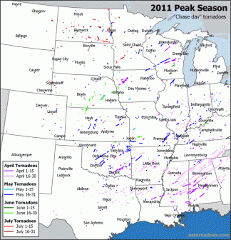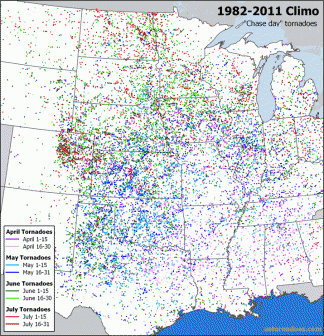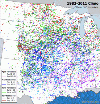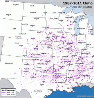
No two tornado years are completely alike, but some have likenesses, or similar periods within them. There are also general rules of tornado climatology such as their zone of occurrence tends to climb north and west as spring moves to summer.
The maps and info in this post focuses on April through July, because those are the top producing tornado months over history, plus it is when tornado activity is more likely to at least semi-regularly occur in the “preferred” chase zones.
Notable chaseable events have happened before April (like March 1990) and after July (fall is known to produce). Even if you’re a local or a die-hard, these are likely the months you are doing most of the chasing in the Plains or adjacent tornado country.
The map area is arguably too large or too small. However, it encompasses the main corridor of violent tornado activity in the country. And in recent years, storm chasing has spread to all parts of the region — though some spots are notoriously unfriendly for such.
One thing seen in many years is the lack of consistent activity. A slow early season might still end up active, and an active season early may not produce all the way through.
(Jump to Year Maps | Jump to Climo Maps)
Methodology
In this look, I’ve used some time constraints as not to include tornadoes that are unlikely targets of a chase. Of course this assumes that all daytime (or near daytime) tornadoes are “interceptable.” That’s probably not the case — surprises happen, and many of these tornadoes are brief/weak.
In order to keep this from being a much longer initial project (especially since it might still need work, please let me know!), I have set the time constraints on purely a monthly basis. Each month’s time period is based on sunset in the middle of the month at a central location to that month’s tornado threat climatology as shown very nicely on the Storm Prediction Center web site.
For April I’ve based off Little Rock, AR. In May, I’ve gone with Alva, OK. June is Colby, KS and July, O’Neill, NE. The specific time constraints on the maps are as follows: April, 10a-9p; May, 12p-10p; June and July, 12p-10:30p.
All times are CDT (as is much of the map), which may miss some tornadoes during “chase time” (after 9:30 MDT) in places like Colorado and the western Dakotas.
Below is a gallery of re-sized maps you can cycle through from 1990-2011 (will add 2012 once available from SPC). Links before images lead to large-size images. (Jump to Climo Maps)
Chase maps by year (full size): 1990 | 1991 | 1992 | 1993 | 1994 | 1995 | 1996 | 1997 | 1998 | 1999 | 2000 | 2001 | 2002 | 2003 | 2004 | 2005 | 2006 | 2007 | 2008 | 2009 | 2010 | 2011
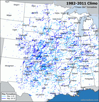
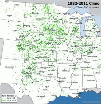
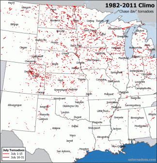
Below is a gallery of re-sized maps you can cycle through showing overall climatology for a 30 year period ending 2011, and month-specific maps (will add 2012 once available from SPC). Links before images lead to large-size images. (Jump to Year Maps)
Chase climatology map (full size): Touchdown map | Track map | April tornadoes | May tornadoes | June tornadoes | July tornadoes
Brief epilogue
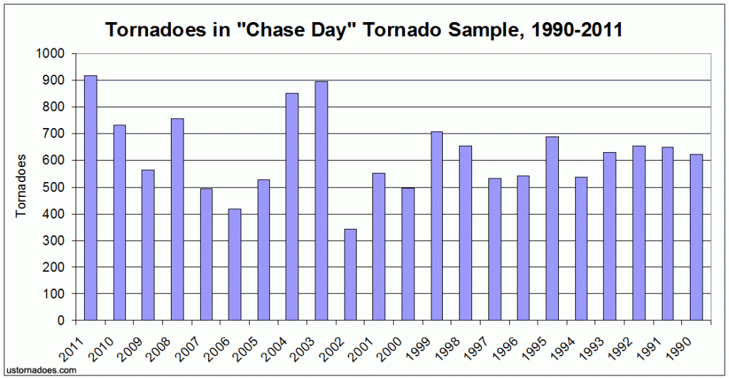
The numbers on the yearly peak season tornado chase maps above range from a high of 916 tornadoes in 2011 to a low of 344 tornadoes in 2002. The average for the 1990-2011 period was 625 tornadoes.
Grayed out states partially shown on the map are excluded from the counts, but all other states on the map are included in full, even if the entire state is not shown on the map.
Using the same periods as shown in the maps, the greatest chase day tornado totals are as follows:
Apr 1-15: 162 (2011)
Apr 16-31: 288 (2011)
May 1-15: 331 (2003)
May 16-31: 380 (2004)
Jun 1-15: 212 (2005)
Jun 16-30: 216 (1992)
Jul 1-15: 108 (1993)
Jul 16-31: 99 (1996)
While these numbers might not truly capture your ideal Plains chase season, they do generally line up with how that season progressed (just ask chasers about 2002 and 2006). 2011 is of course very heavily skewed to one mega outbreak and some almost-mega outbreaks.
As someone who does travel with dates booked months in advance, this is a topic of great interest to me — i.e., looking for the best way to game the system. I’d love to hear any thoughts as I continue to look at this aspect of tornado-ology.
All tornado data within maps comes from the Storm Prediction Center GIS page. Track data is incomplete in many years, so many single points would have had noticeable tracks. The tornadoes in all maps and data above are a sampling of the overall tornado activity in the period as detailed in the text. Special thanks to Brett Roberts, Amos Magliocco, Kathryn Prociv and Mark Ellinwood for input during the process of developing this idea.
Latest posts by Ian Livingston (see all)
- Top tornado videos of 2023 - January 1, 2024
- March 31, 2023 tornado outbreak videos - March 31, 2023
- Top tornado videos of 2022 - December 31, 2022
