It was a pretty active week — for this year. That was mainly because of a mini tornado outbreak that occurred in North Carolina on Friday, April 25. Several supercells tracked across eastern parts of the state dropping a number of tornadoes.
Other than that, just a few scattered instances of tornado activity on a few days. Hardly even a story for this time of year.
Alas, we are in late April and closing in on the peak of the spring season, and quite a few tornadoes appear to be just around the corner.
April 20 – Northwest Texas
Chaser paradise! A weekend and a beautiful storm over open countryside. Moisture was a bit lacking for much in the way of tornado activity, but the terrain was great and the storms were gorgeous. At least one brief tornado touchdown was noted near the Oklahoma and Texas borders.
Rope #Tornado near north of Kirkland, TX…video coming in. @NWSNorman @TWCBreaking pic.twitter.com/a0ZSPBXww0
— Brett Adair (@AlaStormTracker) April 20, 2014
Amazing supercell along the Red River #okwx #txwx pic.twitter.com/dfkQV3fN4h
— Ben Holcomb (@wx8ben) April 20, 2014
Near el dorado okla now pic.twitter.com/62pJqTks4m
— WesternOkChaser (@westernokchaser) April 21, 2014
April 23 – High Plains
No tornadoes, but a classic high Plains supercell day. Another one with a moisture issue, but it had plenty of stunning supercells. Who doesn’t love structure?
South of Meade ks #wxks #weather pic.twitter.com/hsLpUK7rRp
— Alex Heimberger (@TAStormChasing) April 23, 2014
A beautiful storm near Duke, OK – pic.twitter.com/is9hOCuiy6
— Mike Olbinski (@MikeOlbinski) April 23, 2014
Storm that passed thru Minneola still has a solid updraft #kswx pic.twitter.com/ZFj8xsq7SZ
— Beth Bowdoin (@skewy11) April 24, 2014
April 24 – Mississippi
A few supercells developed over Mississippi during the evening. There was general belief that a tornado or two occurred, but as of now there has been no confirmation.
7:36pm CT: TDS radar signature confirming #tornado SE of Belzoni, #Mississippi. Take shelter immediately! #MSwx pic.twitter.com/e2yKQDsyjI
— TWC Breaking (@TWCBreaking) April 25, 2014
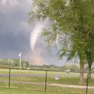
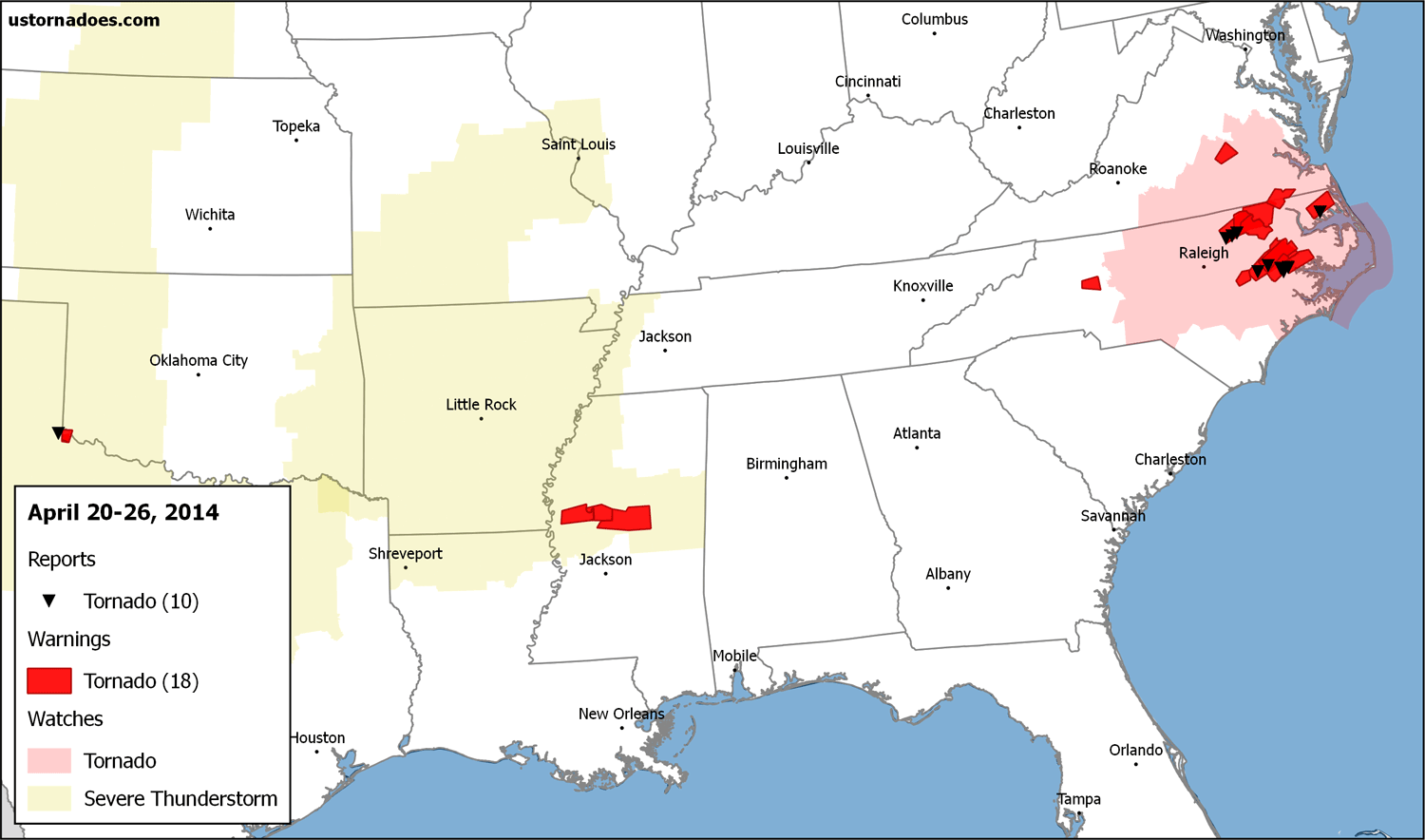
April 25 – North Carolina
This is the time of year for bigger tornado events in the Carolina Piedmont and coastal counties. We saw that to some degree on Friday the 25th. Unlike many other threats in 2014, this one reached potential and then some. At least 7 tornadoes have been confirmed thus far, five of which were rated as strong.
The season’s first EF-3 also was recorded in this event, almost a month later than the previous latest in the calendar year.
Note swirl of dust. Many tornadoes don't have full funnel. RT @USTornadoes @wxrjm TORNADO on the ground in Wayne Co. pic.twitter.com/pR6Kaz3DiR
— Kevin Myatt (@KevinMyattWx) April 25, 2014
438pm Greene County NC tornado warned storm @wxbrad @nsj #NCWX pic.twitter.com/ji9pnMpoWZ
— Ricky Matthews (@wxrjm) April 25, 2014
Rotating pic.twitter.com/6CUFWPXRgR
— Matt Engelbrecht (@EngelWX) April 25, 2014
Shelmerdine, NC. Looking toward Greenville.
April 26 – Plains
This was slated as the possible beginning of a multi-day significant severe weather episode. Forcing came in a bit slow for much to happen. A few severe storms did develop, but mainly not until near and after dark. No tornado activity was reported.
Storm now entering Oklahoma is severe warned for large hail. Golfball hail possible. #okwx pic.twitter.com/PfJCfCqvKn
— TornadoTitans.com (@TornadoTitans) April 27, 2014
Outbreak?
A slow-moving upper level system will help spawn day after day of higher end severe weather starting this afternoon across the Mid South. The peak of the activity starts today and perhaps lasts through Tuesday. Tornadoes are likely on each day. Some should be strong, and perhaps even violent.
Related: Tornado Threat Forecast: April 27-30
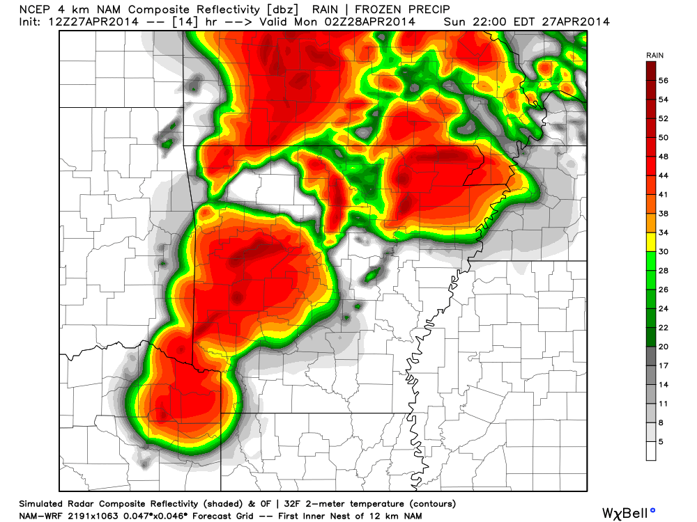
Here’s a NAM4k radar simulation over Arkansas this evening, showing several large storms over the region which lies about in the middle of the Storm Prediction Center’s moderate risk:
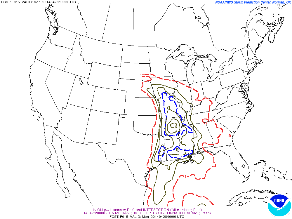
Around the same time, SPC SREF shows very high significant tornado parameter values:
A bumpy ride ahead, and one that may roll through the night tonight bringing extra dangers along with.
Originally posted at 11:35 a.m.
Latest posts by Ian Livingston (see all)
- Tornado outbreaks: April, May and June peak-season primer - April 27, 2025
- Busy March for twisters to end with another multi-day event - March 28, 2025
- Everything but locusts: NWS shines in apocalyptic weather - March 17, 2025