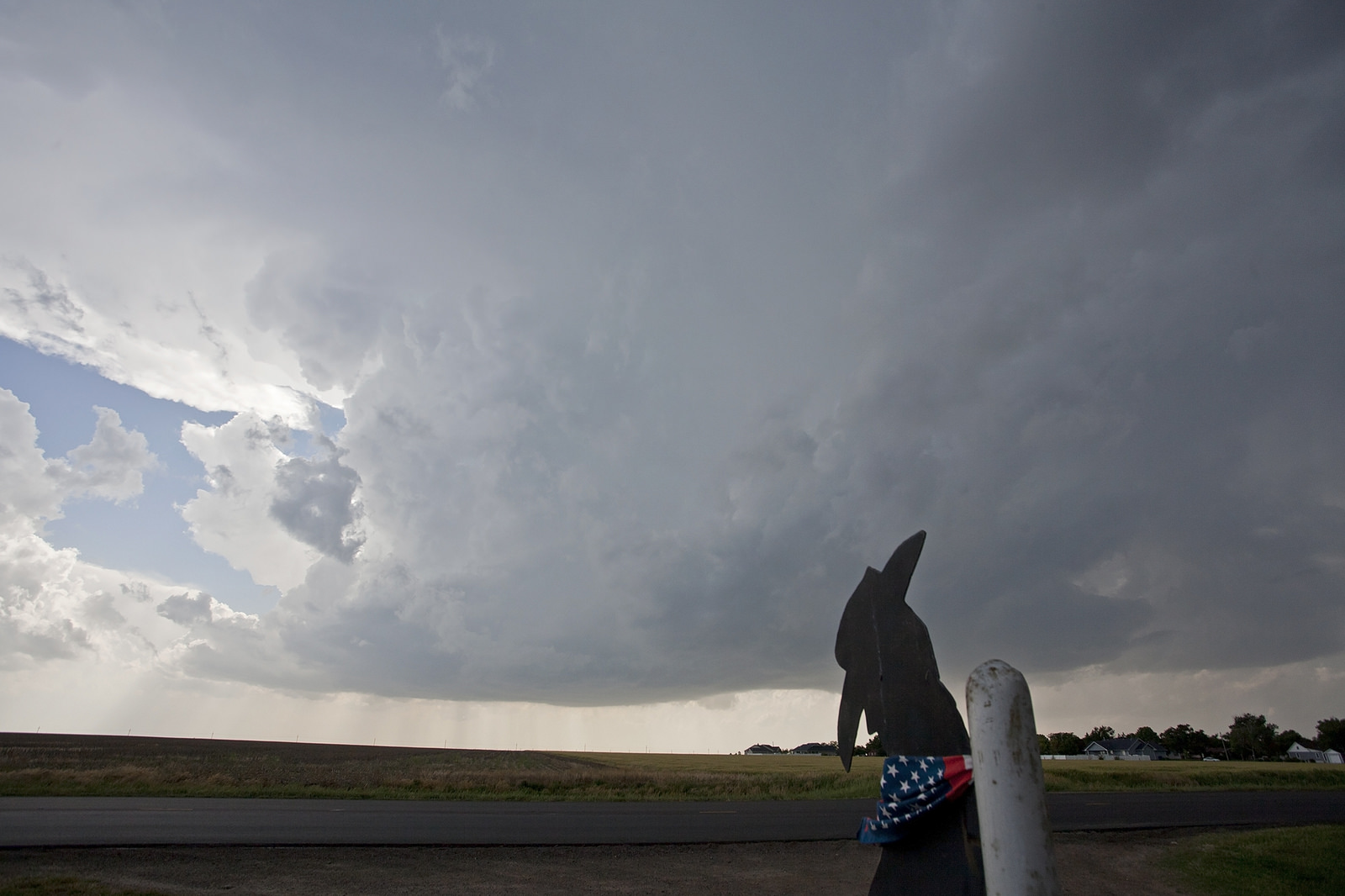
On June 16, 2014 a family of tornadoes dropped from a parent supercell moving over northeast Nebraska. It was only the beginning of a multi-day tornadic event in the region. But the supercell near Pilger, NE was the most dramatic of the event and arguably the supercell of the tornado season.
First let’s talk about the large scale meteorological setup. On the 16th, an upper level storm system moving in from the pacific ocean fueled an area of lower pressure on the east side of the Rocky mountains. These two systems, combined with their slow movement, made for a mix of atmospheric ingredients that was favorable for supercells and tornadoes for multiple days. These ingredients, namely instability and wind shear we’re known well in advance and were highlighted by National Weather Service forecast offices, the Storm Prediction Center and our tornado threat forecast.
The Setup
On Monday morning the Storm Prediction Center, known as the SPC, issued their morning outlook for the day ahead. They mentioned a moderate risk for the Eastern Nebraska area saying that
“The severe threat ultimately may be greatest from Northern Kansas into Central/Eastern Nebraska…” and “Given the potent combination of buoyancy and shear in this region…significant hail and tornadoes could occur.”
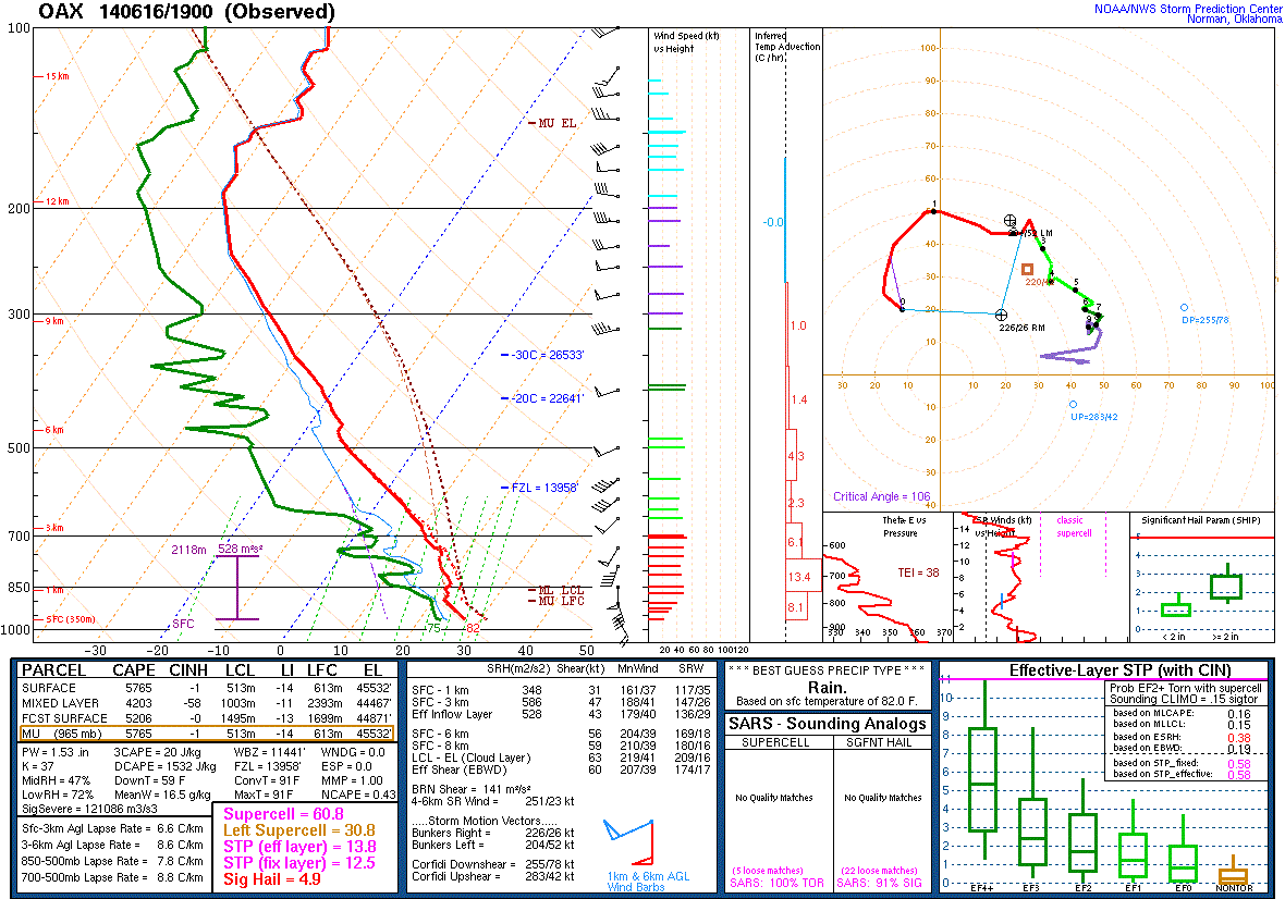
At 2 p.m. CDT the National Weather Service Forecast Office in Omaha, Nebraska released a weather balloon to measure the potential for severe thunderstorms and tornadoes. The data that came back was astounding. According to the Tornado Environment Browser, the amount of instability, wind shear, and helicity (spin) in the air that day was nearly 1.5x the average amount (for all three) needed, in that part of the country, to produce a significant (EF-3 +) tornado.
Based on this new data the SPC upgraded their outlook an hour later to include a higher chance of significant tornadoes for Eastern Nebraska.
Tornado #1 (Stanton)
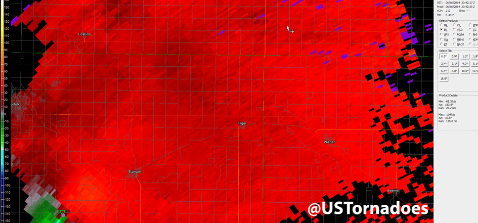
At around 3 p.m. a group of thunderstorms began to form 15 miles south of the town of Norfolk, NE or near Madison, NE. By 3:26 p.m., radar data shows the top of the storm had exploded to 60,700 feet in height. At 3:41 p.m. the first tornado warning went out from the Omaha National Weather Service (NWS) office, this included the ill-fated town of Pilger. 2 minutes later at 3:43 p.m., a law enforcement officer reported a tornado between Norfolk and Stanton, NE. This was violent tornado number one of four that would be spawned from this storm.
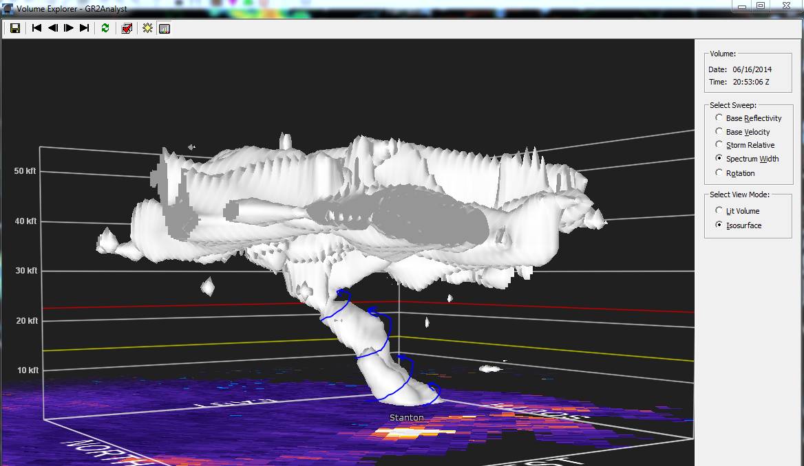
Based on damage collected from ground surveys done by the Omaha NWS office, the damage caused by the tornado in the beginning was fairly weak with damage in the EF0 to EF1 range (65-110mph). After the storm passed 2.5 miles west of Stanton, the tornado became stronger producing EF3 and later EF4 damage to a farm houses. At this point the tornado was fully rotating the entire thunderstorm as illustrated in this 3D radar below image shows.
Tornado number one finally dissipated at 4:11 p.m. In all, tornado onw lasted 29 minutes and traveled 12.21 miles. At about this same time, a new circulation was forming on the southeast side of the thunderstorm cluster. This would become the tornado that destroyed Pilger.
Tornado #2 (Pilger)
According to the survey conducted, the 1st Pilger tornado formed at 4:00 p.m. Tornado one and tornado two were on the ground at the same time for 11 minutes. While the Pilger tornado was fairly weak to start, toppling powerpoles and tin sheds, as the tornado moved into Pilger proper itself, it seemed to have strengthened both based on video and by the damage it imparted on the town.
[youtube http://www.youtube.com/watch?v=Vs3EdtV-kwg?t=7s&w=600&h=450]Via Nebraska Emergency Management Agency (NEMA) on YouTube.
As the video above shows, the tornado took a track that was just off center to Pilger’s “Main Street” following the path that the old railroad was. It clipped the south-west residential part of town before strafing the business district and taking out multiple grain bins stored in the center of town. Located in the center of town near the grain bins is the local Co-Op store. Videos from the store’s security camera system show the tornado approaching. (Skip ahead to 1:40 to see the tornado’s approach.)
[youtube http://youtu.be/L4ITAO_1Y9Q?t=1m40s;w=450&h=400]Via Ryan Kruger on YouTube.
Eventually it ends up tearing up the inside of the store. The store’s occupants hid in a freezer and can be seen walking out a few minutes later. The tornado then exited the town on the northwest side, destroying homes and a church. In this way perhaps Pilger is relatively lucky, if the tornado has strafed right or left of the center of town it could have taken out a more residential area. Grain bins can be replaced, lives cannot.
After hitting Pilger, it moved off to the northeast, hitting a few farmsteads with significant but not catastrophic damage.
Tornado #3 (Pilger East)
This is where it gets rather interesting. Just as tornado two roared through Pilger, another tornado formed about 2.5 miles to the southeast of tornado two and started to produce damage in the EF1 to EF2 range. What is interesting about these two tornadoes, is that they were close together and rotating in the same direction. Video shows that both tornadoes were rotating counter-clockwise, which is normal for tornadoes in the northern hemisphere.
The issue arises with the proximity to each other. This interaction creates a scenario in which both tornadoes must have their winds blowing against each other while in parallel. This normally leads to one tornado weakening or dying. But in this case, both tornadoes kept their strength!
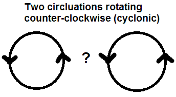
The two tornadoes then started to interact with each other. Having two strong tornadoes battling for control over the same thunderstorm wasn’t going to last forever. After about 4 miles, tornado three started to lose out. It started to become “sucked in” to tornado two in what meteorologists call binary interaction. While this effect is rare, it is not unprecedented. It also occurs when two hurricanes get close to each other, and is called the Fujiwhara effect.
This effect is seen by following the tracks of the tornadoes, as seen in this animation. Tornado three starts to move / get “sucked in” towards tornado two and eventually moves ahead of it before wrapping around as tornado #2 passes by. Just after this, tornadoes two and three died out.
Purple: Tornado#1
Gold: Tornado#2 (Pilger)
Dark Green: Tornado#3
Light Blue: Short lived satellite tornado of Tornado #2
Pink: Tornado #4
Tornado #4 (Wakefield)
Just after the twin tornadoes died, a fourth tornado formed.
Unlike this previous tornadoes, this tornado was producing EF2 damage right from the beginning. Tornado four would have a fairly un-eventful life after this, tracking on a northerly heading over mostly open farm land for 16 miles with it itself being the only tornado.
Tornado four however did take a swipe at a few farmhouses, with three farm houses about half-way through it’s life taking a direct hits and suffering EF4 damage. After this tornado, the storm started to dissipate, as a result of moving into a more stable air mass as it neared the South Dakota border.
Two or Three Tornadoes at a time?
One question that was raised in the meteorological community after the fact was if there was two or three tornadoes on the ground at the same time.
The official ruling from the National Weather Service office in Omaha, who conducted the tornado survey’s, is that there were only two tornadoes on the ground at the same time. However, a video emerged a few days after the storm taken by storm chaser Dan Melby that shows brief third ground circulation next to tornado two and three. Current thinking in the storm chaser community believe that this is a brief re-spin up of tornado one.
[youtube https://www.youtube.com/watch?v=uU7vastcuM0#t=13;w=600&h=450]Via Dan Melby on YouTube.
When USTornadoes resident meteorologist asked NWS Omaha about the video, they maintained that there was no evidence of three tornadoes at a time.
@markellinwood No evidence of 3 concurrent tracks. Our analysis of tracks is posted here: http://t.co/OO7yMal7lQ
— NWS Omaha (@NWSOmaha) June 20, 2014
Either way, the Pilger tornado set will be one that the meteorological community, the storm chasing community and the residents in northeast Nebraska will not soon forget. In the National Weather Service’s official findings, all four tornadoes mentioned in this article were rated with an EF4 rating.
Meanwhile in Pilger, the cleanup and rebuilding continues.
James Hyde
Latest posts by James Hyde (see all)
- The Natchez, Mississippi tornado of 1840 - May 7, 2017
- Understanding advanced tornadic radar signatures - March 28, 2017
- Breaking down the Pilger tornadoes of June 16, 2014 - July 16, 2014