Tornado highlights covering the week of April 19-25, and a brief look ahead.
Despite lacking a huge outbreak — of course the Ill. EF4 happened on a big day — April 2015 has continued to produce tornadoes on the regular.
Last week was the most active of the year, and this week is already off to another active beginning as the final wave in the current train of storms moves east across the country.
After today and perhaps tomorrow, we may need to wait a little while to get things going again.
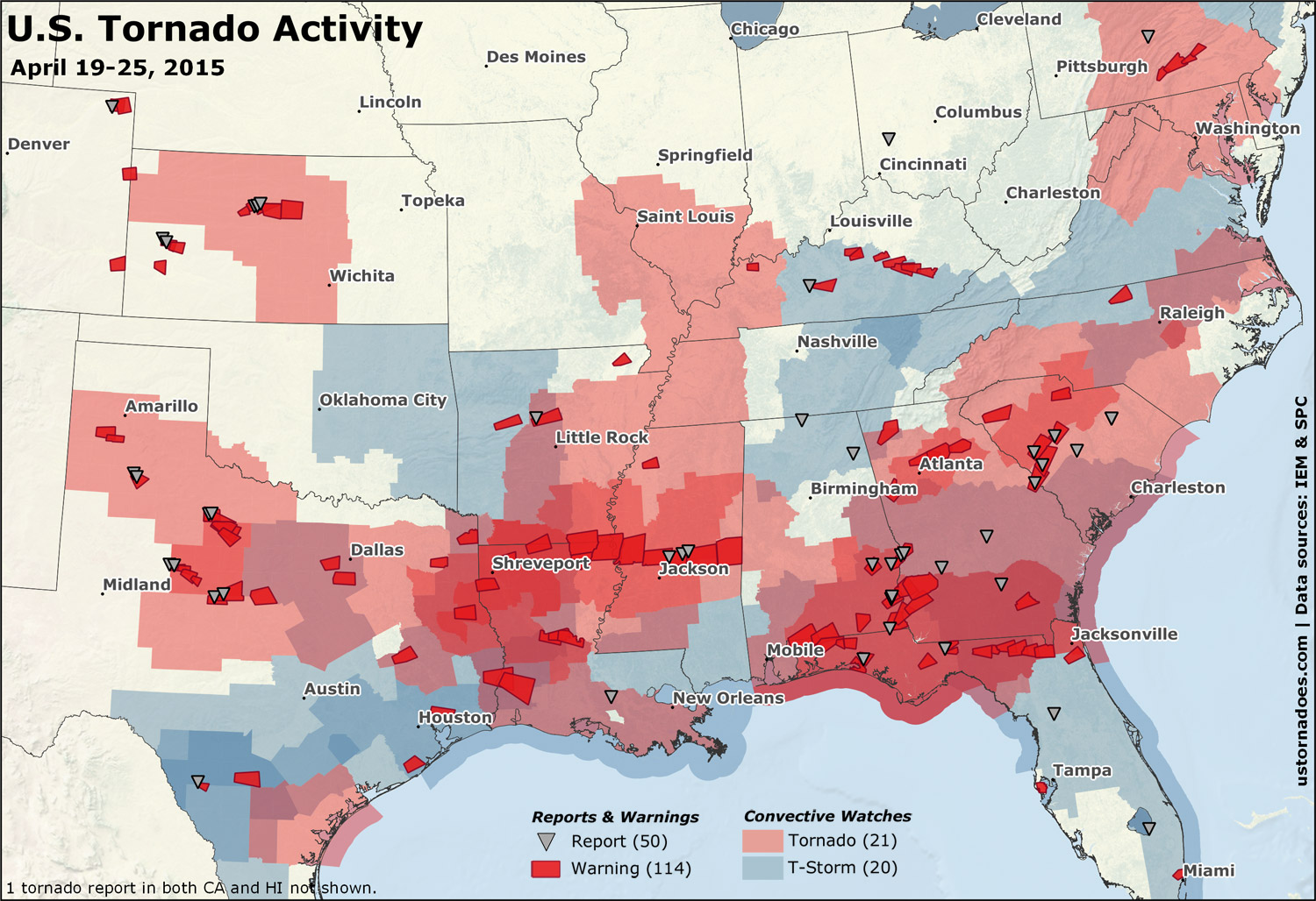
As far as overall numbers, April 19-25 goes down as the most active week of the year thus far. 41 convective watches were issued, with tornado watches making up a majority of the count at 21.
When it comes to tornado warnings, we saw 114 issued. At least 50 preliminary and filtered reports have been filed as of publish.
Based on preliminary reports to the Storm Prediction Center, we are probably around 150-175 tornadoes for April now. Closing in on average, and a notable uptick compared to the first three months of the year that were running near record lows.
Related: Tornado Digest archives
April 19: Southeast
April 19 ended up one of the bigger tornado days of the year so far, and to minimal fanfare considering.
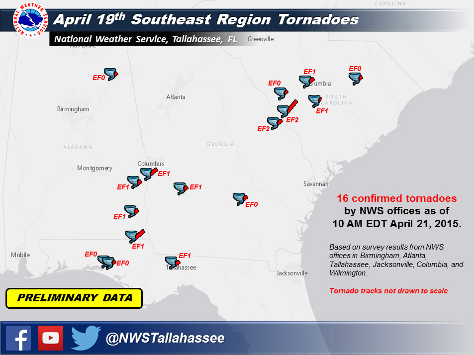
At least 16 tornadoes touched down across the Southeast, among 25 reports on the day. Fortunately most were relatively weak and tornado damage was not widespread.
April 20: Mid-Atlantic
April 20 is perhaps not really even worth a mention here because it didn’t do all that much for many in the region it impacted. But D.C. was in the zone among others.
Tornado watch issued for D.C. area, in effect until 10 p.m. http://t.co/cXwcpWnIux pic.twitter.com/QzPU8X79Th
— Capital Weather Gang (@capitalweather) April 20, 2015
An EF1 tornado touched down in Pennsylvania (as did a weak one in FL). The PA tornado was the first this early in the season since March 23, 2011.
April 21: Southern California
A landspout occurred in the eastern portion of the Southern California desert. As we’ll see below, this was the week of the landspout.
Amazing shot of the Desert Center tornado yesterday from Russell Fischer! #CAwx pic.twitter.com/tYkwnjoH8z
— Rob Bradley (@WxRobBradley) April 22, 2015
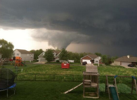
April 22: Texas
Several supercells formed in the Texas panhandle and traveled southeast for hours. Brief tornadoes were reported at several points.
#Meso over Muncy, #TX. #txwx @JimCantore pic.twitter.com/p0nspAd8wk
— Tornado Trackers (@tornadotrackers) April 23, 2015
Amazing structure on this supercell near Floydada, #Texas. #txwx @NWSLubbock @SaintCajun @dodgrizz46 @reedtimmerTVN pic.twitter.com/mvhp5QKZ39
— Mark Mondier (@DamagedSky) April 24, 2015
Video: Daniel Shaw, via YouTube
The tornado picture of the year may have emerged in the “tractor chase” (note: he wasn’t really chasing) picture so very reminiscent of Twister.
Photo cred: Scotty Bailey from his tractor in West Texas@TxStormChasers @OMAStormChasers @PrairieChasers @stormpics pic.twitter.com/NvnI8wpWwF
— super bopr (@superbopr) April 23, 2015
April 23: Hawaii
Hawaii is not a total stranger to tornadoes, but we often don’t include it in tornado stats on the site because they’re not a terribly common occurrence. It was the week of the landspout, so it landspouted.
Rare twister spotted Thursday afternoon over central Oahu http://t.co/pjXaA04wby pic.twitter.com/VfWVpLODBv
— Michelle Broder Van Dyke (@MBVD) April 24, 2015
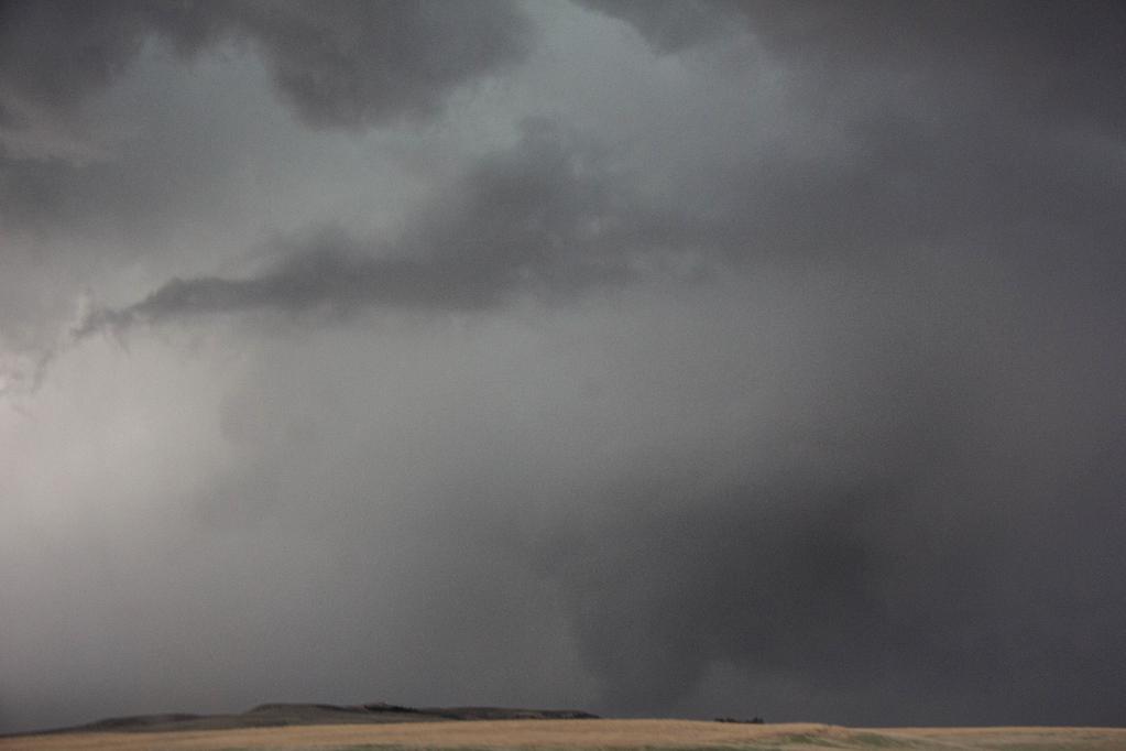
April 24: Kansas and Texas
Two risk areas for tornadoes were highlighted for the day, with a notable strong tornado threat across parts of northeast Texas and into Louisiana as well as a sliver of Arkansas. The other was up in Kansas near the triple point.
If you want to see (or try to see while they dance in and out of the rain) tornadoes, the triple point is often the place to be.
#kswx pic.twitter.com/iR5bYnW1vJ
— Rocky (@rocky_firelaw) April 24, 2015
Possible #tornado from north or northeast of Victoria KS bout 45 mins ago… #stormchase #kswx pic.twitter.com/C6j1WixQYt
— Travis Farncombe (@tjfarncombe) April 24, 2015
Landspouts ruled the day, again. Out in western Kansas there were even triplenadoes for a time.
Impressive shot from Andrew Michael in Scott City, KS posted to @KAKEnews Facebook page. pic.twitter.com/XQUpoW2Vf0
— Tim Ballisty (@IrishEagle) April 24, 2015
https://twitter.com/stormpics/status/591762494181363712
The southern zone largely failed to produce much in the way of tornadoes, thanks to plentiful clouds and rain during the day. Still, a strong squall with brief spin up tornadoes impacted the DFW area.
https://twitter.com/islivingston/status/591743707617087488
April 25: Southeast and Mid-South
A tornado threat moved east into the Southeast and Mid-South, but abundant cloud cover and rain generally tempered the risk. Several tornado reports came in across Kentucky, and a tornado watch was put up for the St Louis area.
12:57pm CDT #SPC_Watch WW 112 TORNADO IL IN KY MO 251755Z – 260100Z, http://t.co/PcvgXsEwkX pic.twitter.com/ybCi27VcAT
— NWS Storm Prediction Center (@NWSSPC) April 25, 2015
Timeout
The days ahead are unlikely to add much to tornado counts
A system that moved out into the Plains yesterday and is spawning more severe weather along the Gulf Coast is probably just about it for this week when it comes to large-scale severe weather.
Behind this system, high pressure along with cooler and drier air takes over most of the country. There really shouldn’t be a whole lot of weather across much of the nation other than perhaps coastal system off the East Coast. Not a pattern very conducive to thunderstorms.
As we get toward next weekend, moisture should begin to stream back north out of the Gulf of Mexico into the central U.S. That could bring about a general increase in the odds of storms. But for now, there’s nothing of significance that is apparent through the period.
Latest posts by Ian Livingston (see all)
- Tornado outbreaks: April, May and June peak-season primer - April 27, 2025
- Busy March for twisters to end with another multi-day event - March 28, 2025
- Everything but locusts: NWS shines in apocalyptic weather - March 17, 2025