The most memorable tornado during the week of May 22-28.
May 25 was a day without a lot of tornadoes yet one extremely notable one. It had huge potential thanks to an air mass that was chock full of moisture, which featured the key ingredients of an effective warm front chilling in the region and just enough winds aloft for supercell formation.
Dubbed “Bennington 2.0,” due to the expectation of a possible repeat of the Bennington tornado in 2013, in many ways this tornado outdid its predecessor by quite a bit.
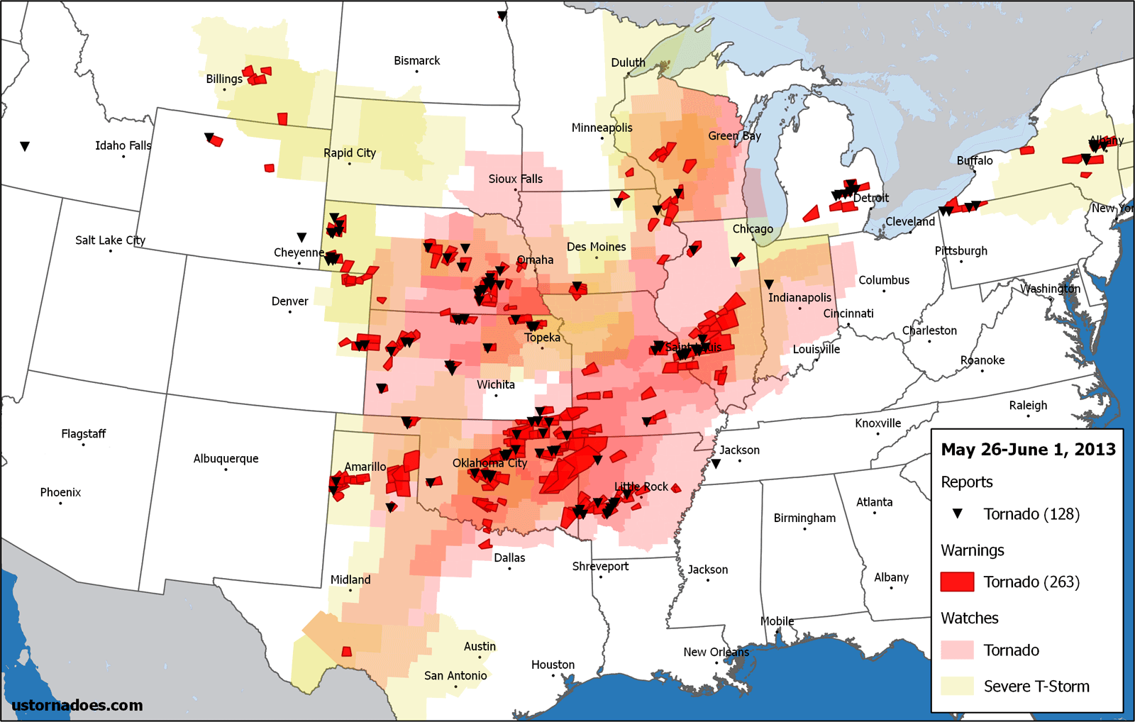
[May 25 is the day with the most tornadoes on record]
This was the largest tornado of a group of four, and it surpassed its early billing by becoming the second violent twister of the year with its EF4 rating. It also thankfully managed to miss population centers.
No serious injuries were reported, and no one was killed. A rarity for such a strong and long-lasting tornado.
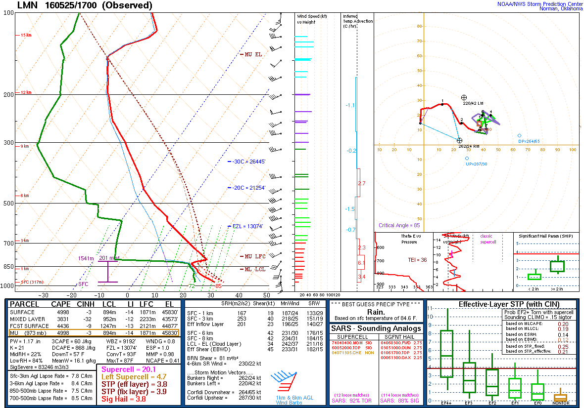
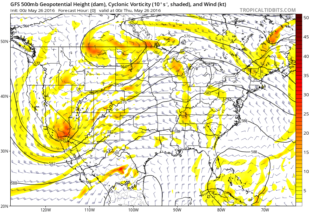
Late May is peak tornado season and it focuses on the Plains. In general, this means that a big setup is not really needed for big things to happen. The May 25 setup was a typical one for tornadic activity, but it was rather subtle and nuanced.
The day began with a weak area of low pressure hanging out over western Kansas. To the east of the low, a moisture rich air mass streamed north.
Dew points that started the morning in a near 60-degree zone crept up to near and past 70 during the day. Southeast winds helped pump in that moisture and also acted as the low level turning with height needed for tornadoes.
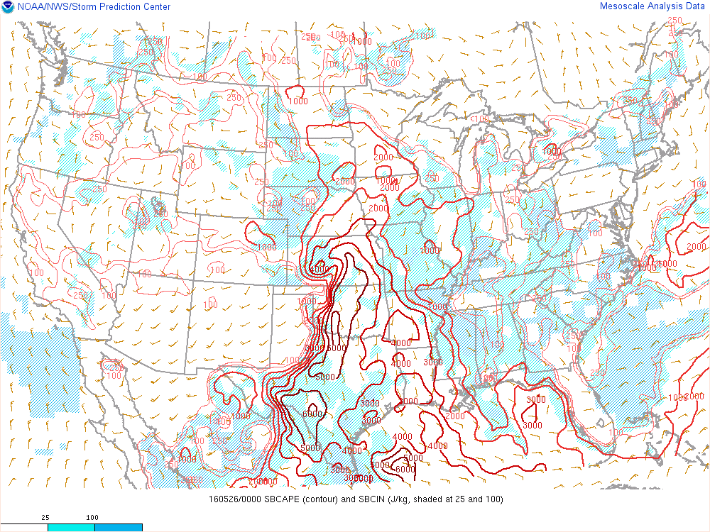
By late day, CAPE values were pushing extreme levels of 6,000 J/kg at the surface. This kind of potential energy for storms can overcome a lack in shear or other storm ingredients. Soundings showed a very volatile atmosphere just ready to pop.
A loaded gun.
As with days prior, including during the incredible Dodge City area cyclic supercell the day before (which I thought would be tornado of the week — I will come back to analyze that event separately in the future), the main trough was still buried in the southwest U.S. Even with the trough hanging back, a broad southwesterly mid-level flow streamed over the Plains. A necessary ingredient for tornado development across the region much of the time.
[Chasecation 2016, Day 7: Kansas does it again]
That flow, mixed with the low-level shear, was more than sufficient to create supercells from any storms that formed.
By early evening, two areas of storminess started to develop east of I-35 in Kansas. One was in the Minneapolis/Bennington area of northeast Kansas. Another was near and east of Wichita.
Given the lack of huge forcing, this was a day that would feature a few storms at most. As such, decisions were to be made by chasers on which to go for. Not everyone chose correctly because the ingredients actually appeared to be better to the south. But they were also sufficient to the north.
The northern cell that would eventually drop the massive tornado took off quite nicely while the southern one near Wichita tended to struggle. This was probably partly because the northern storm was able to latch onto the frontal boundary/remnant outflow boundary, and that eventually helped it go nuts. The southern cell on the other hand, came off the boundary and never really punched its cloud tops as high up.

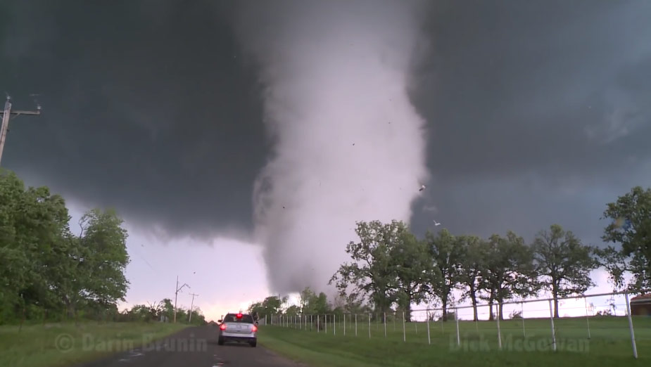
The main event was a particularly long-lived tornado. It touched down around 7:10 p.m. near Niles, KS. From there it largely tracked east just to the north of I-70, by Solomon and Abilene. Eventually it took a dive across the highway and just barely missed Chapman.
EF4 (or EF5) violent tornadoes often kill people. Part of the reason is is it usually takes a hit to population to get such a high rating. This time, despite damaging and destroying a number of houses, no one died. Quite remarkable given the ferocity of the storm.
The tornado took on many shapes during its life. It started off in a classic way, with a skinny tornado dropping out of a well-formed wall cloud.
Tornado in progress just northeast of New Cambri, KS 7:11 p.m. #kswx @nwstopeka pic.twitter.com/NPLF5qcI1P
— Quincy Vagell (@stormchaserQ) May 26, 2016
The tornado quickly grew in size, eventually becoming a wedge at times.
https://twitter.com/islivingston/status/735628562523389952
It shape-shifted a bit during its life. At times it appeared it was roping out but rather it became a stovepipe.
Following that, the tornado exhibited a stunning rear flank downdraft occlusion.
About as classic a view as it gets of a violent #tornado. Backside of mesocyclone/RFD clear slot visible. #KSwx pic.twitter.com/PS4Xk1AI5P
— Michael Charnick (@charnick_wx) May 26, 2016
And it wedged out again near Chapman before finally dying off.
My visual on the wedge today near Chapman, KS. @TheWeatherNetUS @StormhunterTWN @georgekourounis #stormhunters pic.twitter.com/gSXocYJLAU
— Jaclyn Whittal (@jwhittalTWN) May 26, 2016
All told, this was a tornado for the ages. Thankfully it caused relatively minimal impact to life and property considering what it was. This is a day chasers will be talking about forever.
Latest posts by Ian Livingston (see all)
- Tornado outbreaks: April, May and June peak-season primer - April 27, 2025
- Busy March for twisters to end with another multi-day event - March 28, 2025
- Everything but locusts: NWS shines in apocalyptic weather - March 17, 2025