This is part three of a six part series on tornado outbreak sequences. If you haven’t yet, you might want to start at the beginning with how they come together.
The 1917 case is perhaps the most relentless of all the outbreak sequence events that that will be covered in this series.
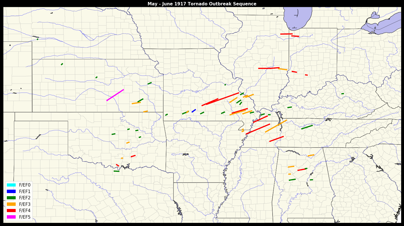
Along with the 1896 onslaught discussed in detail in the last entry, it’s another strong contender for the title of “worst tornado outbreak sequence on record.” It struck the central and southern United States in the tail quarter of May. Strong (F2+) tornadoes are documented to have occurred on seven out of eight days from May 25 until June 1.
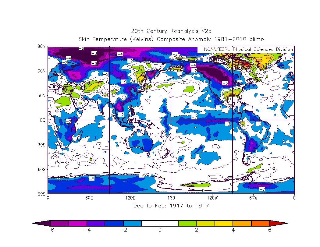
A significant La Nina event is known to have been present during the winter of 1916-1917. This cooling of the equatorial Pacific waters leads, through atmospheric response, to a strengthened polar jet stream and ridging over the southeastern United States. If the latter continues into spring it can mean higher levels of moisture and warmth across the Gulf of Mexico. In addition, the enhanced polar jet can elevate wind shear values for severe weather outbreaks.
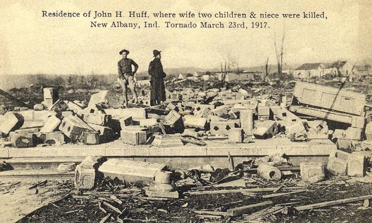
An unusually active March, with several tornado episodes, contributed to elevated casualties before peak severe season 1917 even arrived. Most notable of these were the F4s that struck the Indiana towns of New Castle on March 11 and New Albany on March 23, claiming a total of 70 lives between them.
In contrast to the activity in March, April was significantly quieter. Of the known events, only eight tornadoes rated F2 or higher occurred during the month, none of which rated F4+. The first three quarters of May were similar, with only one F2 tornado in the period between April 18 and May 20.
An unfavorable upper level pattern is noted for this period across the United States, with pronounced low pressure “troughing” over the eastern third of the country. Moisture from the Gulf and Caribbean was not freely returning into the central United States. This left little chance for destabilization and severe weather.
A modest event took place on May 20-22 from the Plains to the East Coast, perhaps hinting at what was to come. This included the second tornado in a magically horrid dose of luck for Codell, KS. The city was affected by tornadoes on May 20 for three consecutive years (1916-18), with the F4 strike in 1918 being by far the worst. This incredible occurrence is unsurprisingly included in a Ripley’s Believe It or Not! issue of the time. Changes in the large scale pattern across the United States followed as the upper level system responsible for the May 20-22 episode shifted gradually northeast towards Atlantic Canada.
By May 23-24, a large upper level trough had begun to amplify in the western U.S. as a jet streak across the North Pacific rounded the apex of a strong upper ridge of high pressure north of Hawaii. This would form the “cog” for smaller scale disturbances to rotate around in the succeeding days. Broad ridging also began to take over the southeastern United States as seasonally rich moisture returned northward into the central Plains and Midwest.
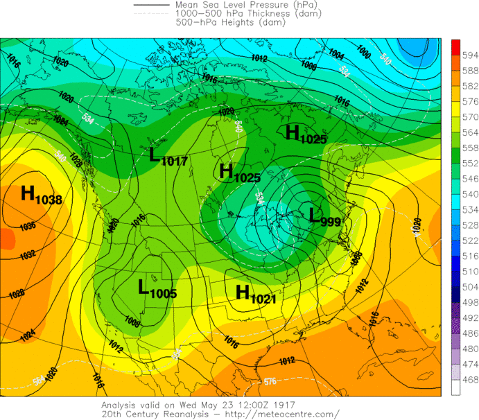
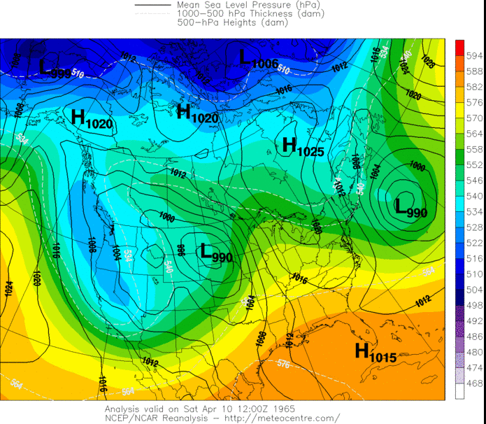
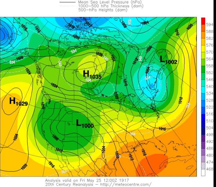
May 25 brought the first destructive day of the sequence as a lee cyclone settled itself in eastern Colorado by 7 PM central time. This is a classic position for severe weather events in the central and southern Plains. A sharp dryline stretched across the southern Plains and arced into southwestern Nebraska. This type of orientation suggests winds out of the south-southeast or southeast near the surface veering strongly to southwesterly in the mid levels.
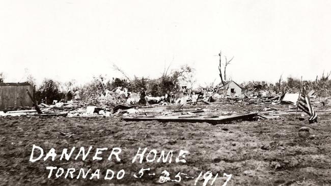
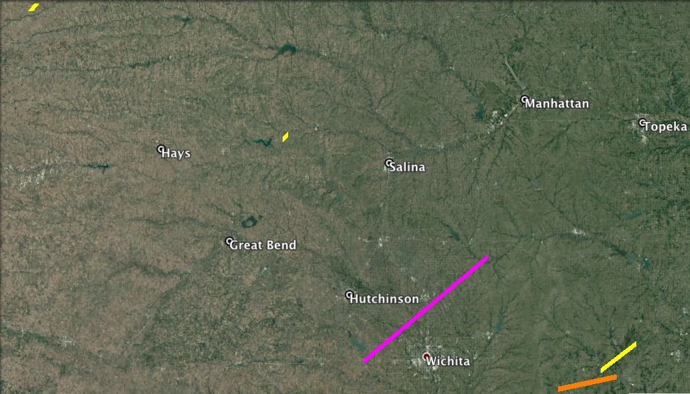
Scattered storms began to develop by mid afternoon across Kansas and progressively matured into supercells. The first tornado, rated F2, developed northwest of Jennings around 1:30 p.m. and caused damage to two barns. Farther southeast a couple of hours later, a major tornado tracked northeast for at least 65 miles between Hutchinson and Wichita. The towns of Andale and Sedgwick suffered intense damage from this storm, with 20 fatalities confirmed between them. Multiple homes and businesses were swept away in these locations. Over 100 structures were destroyed by the tornado along its extensive path, which averaged nearly 3/4 of a mile wide. This is the only F5-rated tornado of the sequence, despite the likelihood that there were further candidates. 23 deaths and around 70 injuries are associated with it.
At least four other F2-3 tornadoes occurred in Kansas and Nebraska before the day wound to a close. One further death resulted on a farm north of Howard, Kansas. Fortunately, the Wichita area was sandwiched in between the zones of tornadic supercells, which likely prevented further increases of the casualty count.
The larger scale trough responsible for the May 25 event split into two distinct shortwave troughs early on May 26. Assuming a positive tilt on the larger (longwave) scale, this has historically been a pattern favorable for Great Lakes/Ohio Valley tornado events. The lead shortwave trough generally approaches this region, while the trailing one remains in the southwest. An elongated, strong belt of mid/upper level flow across the central United States is the result.
Generally in this type of configuration, west-southwesterly flow in the mid levels, southwesterly flow at 850 mb and southerly flow near the surface are in place. With enlarged hodographs and strong low level/deep layer shear, tornadic supercells become increasingly likely. Of course, this is reliant on adequate thermodynamics. In an outbreak sequence scenario, this is usually already a given. Add in the dynamic support offered by the vorticity maximum shifting east-northeast, and storm development becomes more of an inevitability than a question.
The attendant surface low to the lead shortwave trough shifted east-northeastward towards the Great Lakes on May 26. A volatile scenario unfolded near the warm front from eastern Missouri, through central Illinois and into Indiana. Here, enhanced low level shear was present to aid mesocyclone maintenance.
A vigorous, long-tracked supercell formed during the early afternoon in this very region and progressed E at around 40 mph. While it is not known exactly how many tornadoes this supercell spawned, the results were unfortunately disastrous. The villages of Modesto and Westervelt, Illinois suffered significant damage and seven deaths from separate tornadoes.
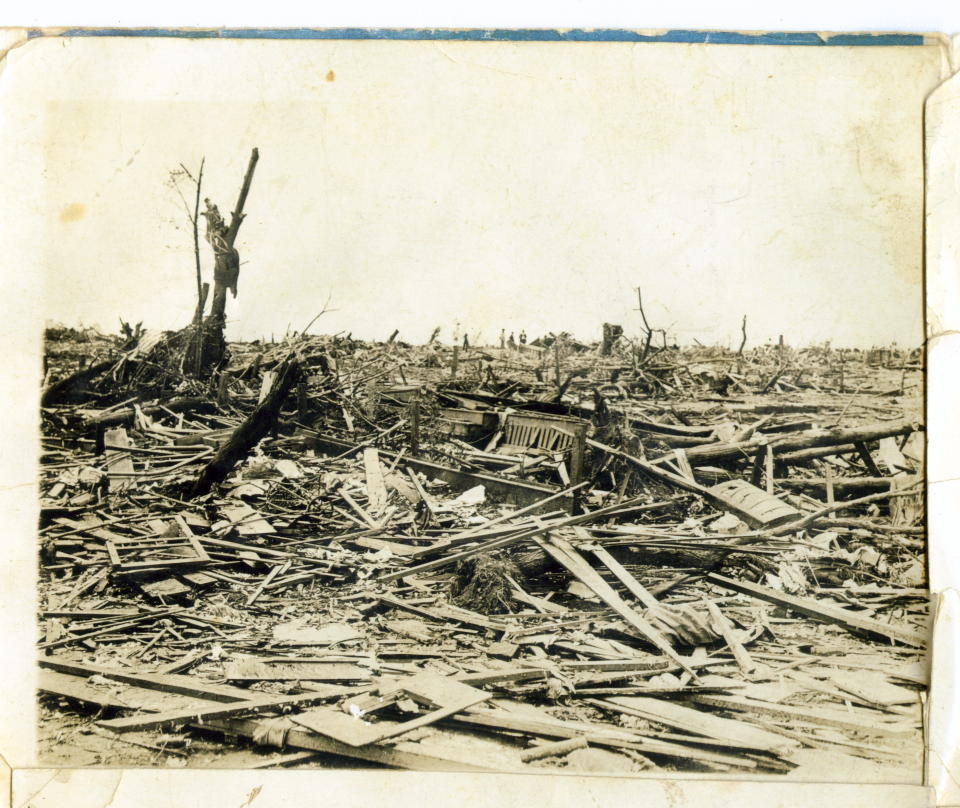
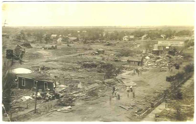
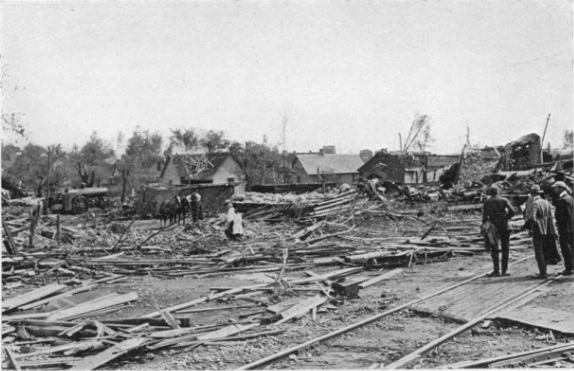
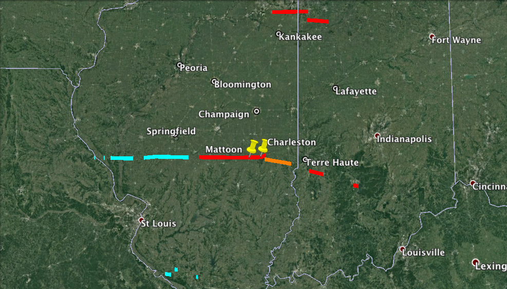
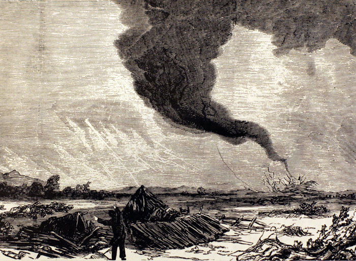
To the east, the storm reorganized and produced an intense tornado that smashed into Mattoon in Coles County, Illinois. The north side of town was left as a twisted heap of shattered wood and shredded trees. Here, 53 people were killed and nearly 500 homes demolished, in addition to countless others damaged. Debris from Mattoon showed up dozens of miles away in Indiana, usually one of the hallmarks of a higher-end event.
Several eyewitnesses reported a lack of a generic funnel-shaped cloud associated with the tornado. A low “boiling mass” was instead described, somewhat reminiscent of the Tri-State disaster eight years later. The lifted condensation levels (generally the cloud base) typically are quite low in the vicinity of the warm front. This tends to lead to more of a wedge/barrel-shaped appearance with any larger tornado.
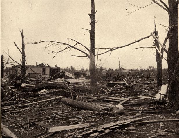
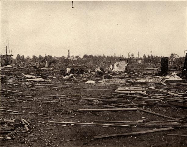
The F4 tornado rolled on, destroying farms before reaching the city of Charleston. Nearly 500 further structures were severely damaged or destroyed here, with 38 fatalities, despite better construction than in Mattoon. An additional two deaths near Embarrass brought the death toll from this violent tornado to at least 93, with over 570 injured. It remains the third deadliest single tornado in Illinois’ history, following the 1896 East St. Louis and Tri-State tornadoes.
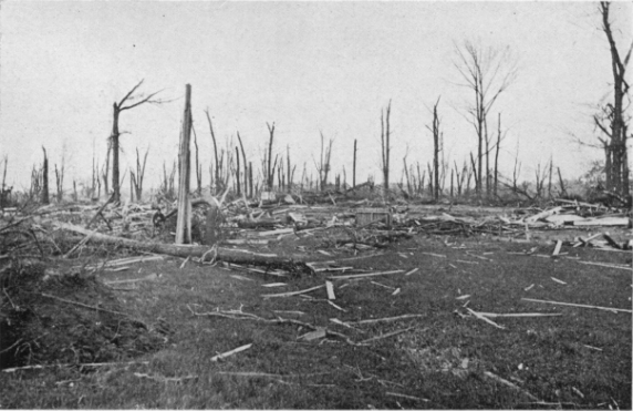
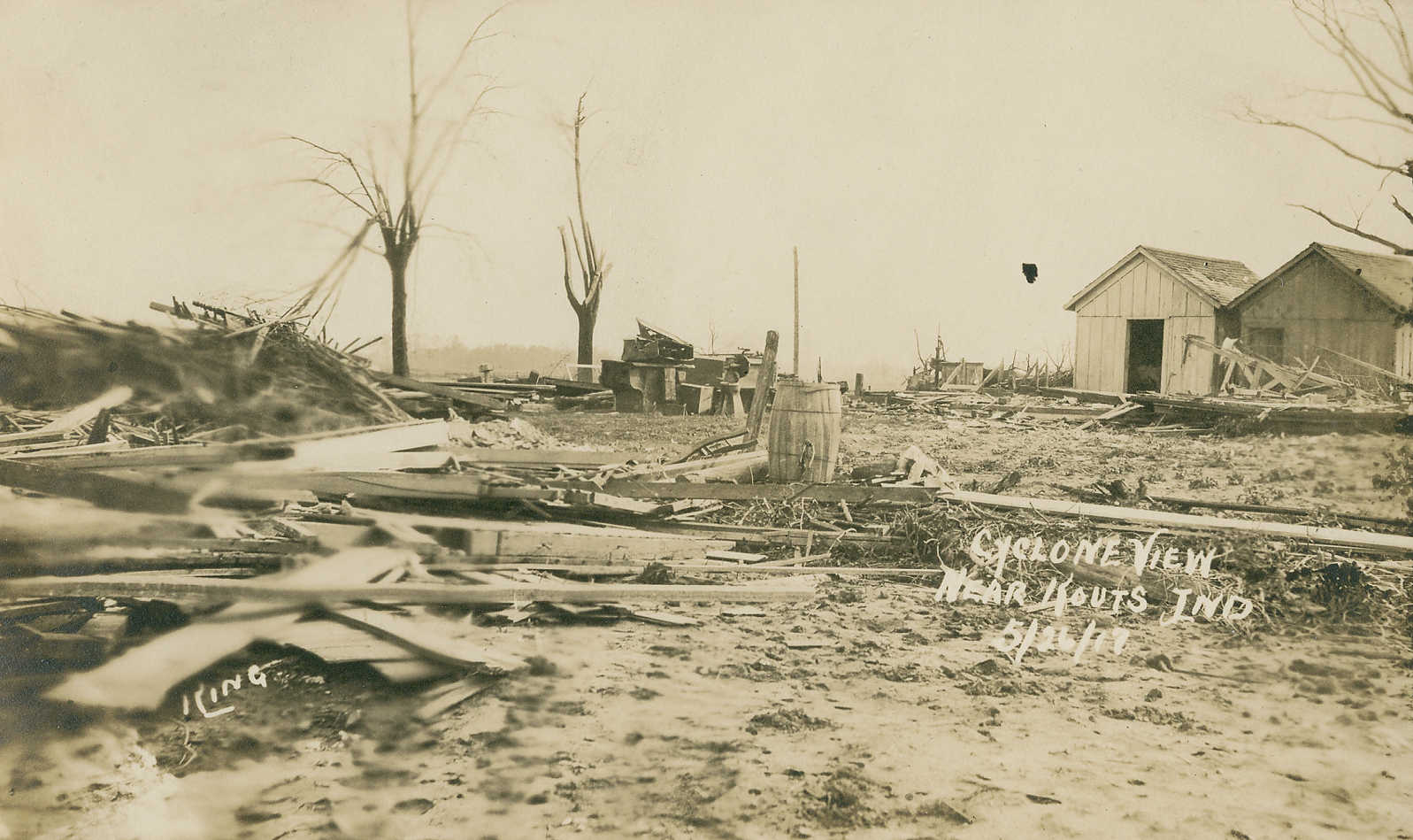
The supercell continued into Indiana and produced two additional F4 tornadoes south of Terre Haute and on the south side of Bloomington. Two deaths are credited to the first of this pair. Overall, the storm took more than 100 lives and injured over 600 in a nearly 300 mile swath across the Midwest. A separate supercell developed in the early evening hours over the southern reaches of the Chicago metro and led to two major tornadoes. Seven fatalities occurred between these, mostly on farms near Manhattan and Crown Point, Illinois and Kouts, Indiana.
Short-lived tornadoes also occurred south-southeast of St. Louis in southern Illinois, although with far less consequence. Nearly 140 people are listed as dead as a result of the first two days of this sequence. The Mattoon/Charleston tornado obviously dominates this count, although its fury would soon be challenged.
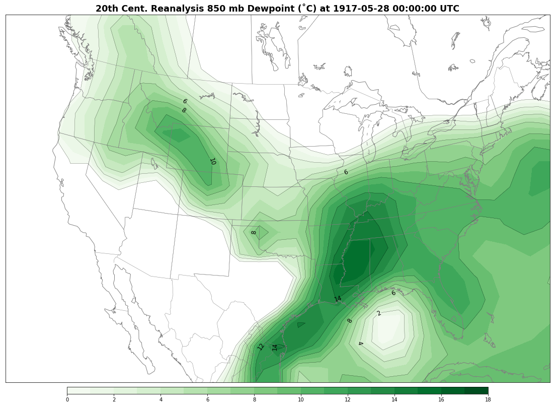
Rolling forward to May 27, the lingering shortwave trough in the southwest shifted eastward. A new surface low anchored itself over the Mid-South and amplified the low level flow. Atop this, westerly 500 mb winds in excess of 60 kts again created a favorable environment for supercells. As opposed to the previous two days, this event was to be more widespread, covering at least five states. Rich boundary layer moisture with 850 mb dewpoints of >12˚C entrenched itself over the Lower Mississippi, Lower Ohio and Tennessee Valleys.
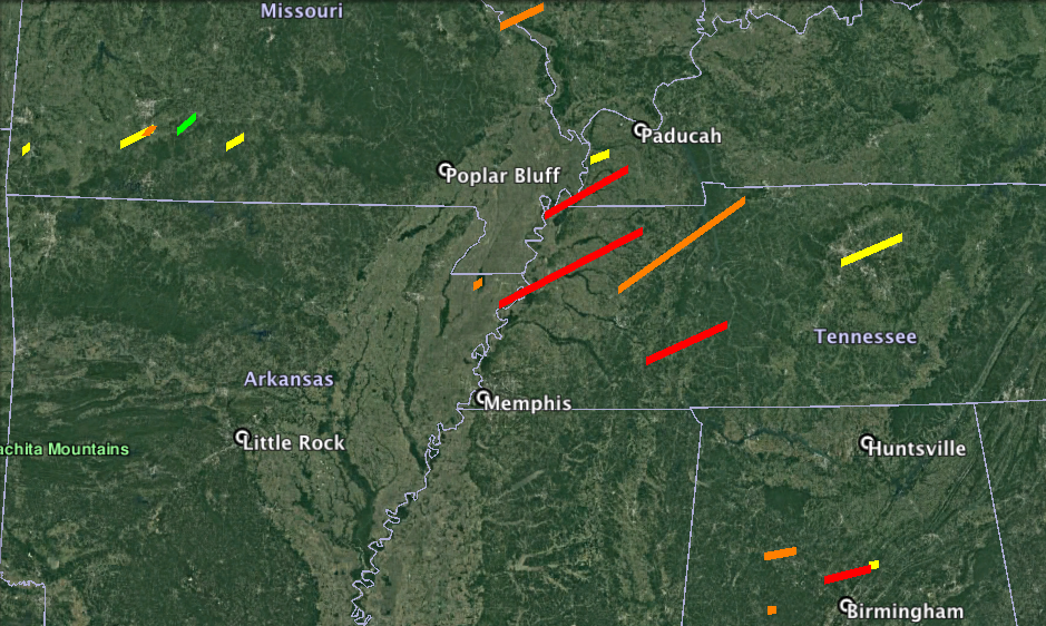
Early in the afternoon, at least four separate tornadoes developed in Missouri as an outbreak began to unfurl across the region, with one death taking place in Webster County. More vigorous storms quickly took over to the south in Arkansas and Tennessee. Several long-tracked tornadoes or tornado families were fostered by these supercells and yielded widespread damage. One of these, an F4, sliced a path from near Blytheville, Arkansas to near Gleason, Tennessee. On the Arkansas side of the Mississippi River, six deaths resulted when several homes were reduced to kindling. A further twelve people were found dead in the latter of the two states, seven of these on the south side of Dyersburg where even large homes became piles of rubble.
Worse still was the vicious, half-mile wide tornado that initially killed two people in Lake County, Tennessee. Crossing the state-line into Kentucky, entire plantations were decimated along a 50-mile track to near Dublin. In Fulton County alone, 42 perished, with 21 of them near the community of Bondurant. The southeastern portion of Clinton in Hickman County endured tremendous damage and an additional 17 deaths. Becoming the second deadliest in Kentucky’s history, this F4 tornado also stands as the second deadliest of the outbreak sequence as a whole, with 67 fatalities and nearly 350 additional injuries. Only the infamous Louisville cyclone on March 27, 1890 led to a higher human toll within the state’s borders.
Significant tornadoes continued to strike the Mid South through the early evening leading to 23 further deaths. A pair of F3 tornadoes claimed six lives each near Manila, Arkansas and Trezevant, Tennessee. Also in Tennessee, an F4 ran rampant through several counties SE of Jackson, leaving five dead and nearly 70 injured. The same supercell produced another killer tornado on the outskirts of the Nashville area towards dusk.
The ambush spread southeast into Alabama later in the evening into the early morning hours of the 28th. A trio of destructive F3 tornadoes struck the communities of Carbon Hill in Walker County (nine dead), Windham Springs in Tuscaloosa County (five dead) and New Hope in Madison County (six dead). The worst storm to strike the state was an F4 that may have been two or more tornadoes (or may have displayed multiple vortex characteristics) in Jefferson and Blount Counties. Numerous homes were torn to shreds in the small towns of Sayre and Bradford leading to 26 fatalities and at least 100 injured. Tragically, an infant died in the community of Village Springs, Blount County as well.
By the end of the night, 50 fatalities were counted in the unusually late-season event for the state. No deadlier tornado event has struck Alabama in May since. The next F4+ tornado to occur this close to summer in the state didn’t strike until 1973, oddly also on May 27.
A respite from the extreme activity occurred through the remainder of the 28th and into the 29th. The upper level trough responsible for the widespread event on the 27th shifted towards the Atlantic and a new jet streak aloft arrived in the west to fill the void. Shortwave ridging between these two features enabled a continued stream of deep moisture into the Mid Mississippi Valley and Ozarks. By the time the clock reached midnight and chimed in Memorial Day (then known as “Decoration Day”), ingredients for another severe weather outbreak already had shifted into place.
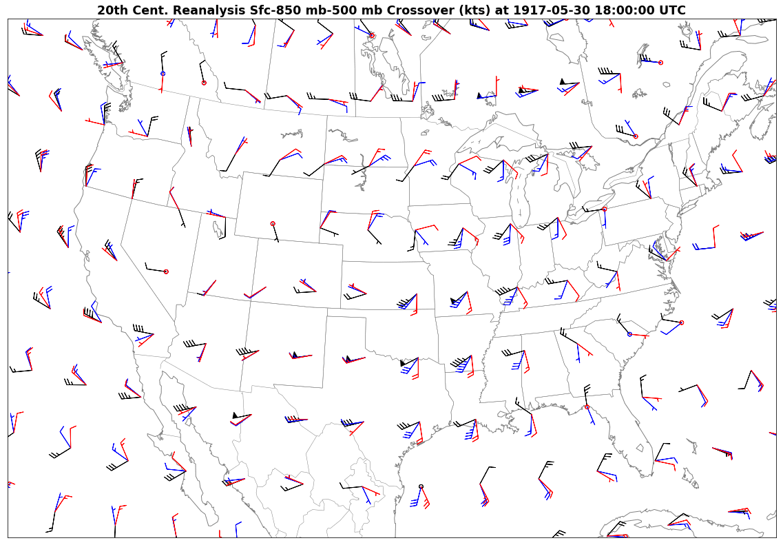
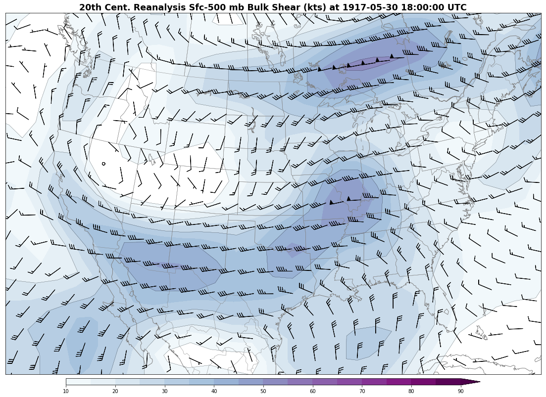
At 12z May 30, the upper trough carved out by the aforementioned jet streak covered much of the western US. A strong low level jet, with 850 mb winds in excess of 40 knots, developed in response over the Ouachitas and shifted east through the day. The developing surface low shifted east-northeast from Kansas at 18z May 30 to northern Missouri by 00z May 31. Focusing on southern Missouri, south-southeasterly surface winds yielded ample low level shear east of the low.
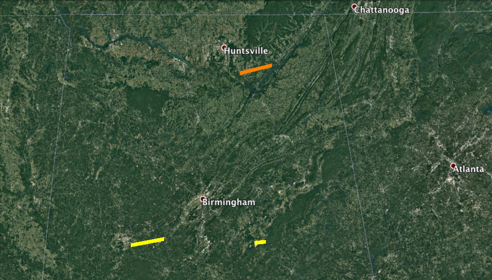
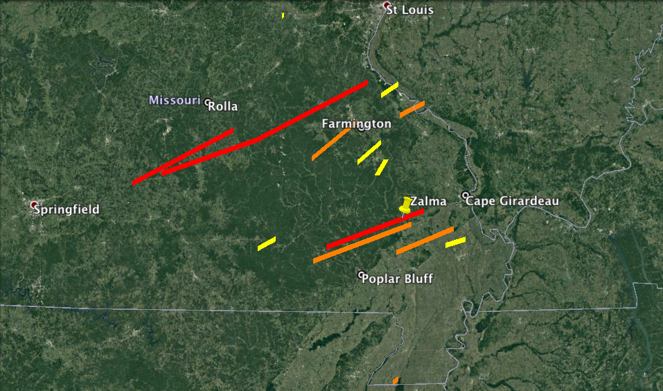
Southeastern Missouri was to be the flashpoint for this particular saga in the sequence. The resulting aerial coverage was certainly not at the level of the 27th, but it lacked none of its violence. A pair of long-lived F4s, each causing 10 deaths and on nearly parallel tracks, were the first of the afternoon. The northern storm carved its way from Wright to Dent County. While it generally remained in rural areas, four people were killed as a single home was enveloped near Hazelton. To the south, the second tornado (more likely a tornado family) tracked for over 100 miles. It wrought substantial damage on the town of Mineral Point, especially in the northern section, where four died.
Several hours later, more significant tornadoes sped through the area. The worst of these trampled a 50 mile path through Dongola and Zalma in Bollinger County, inflicting formidable devastation. Nearly eradicating the former town and levelling the southern half of the latter, 16 people were killed. Accounts from the area indicated that little was left standing in the F4 tornado’s trail, including trees. Two additional fatalities and at least 200 injuries are documented as a result of this storm.
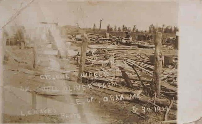
Replicating the scenario from earlier, another long-tracked F3 tornado materialized immediately to the south. Given reports, it is likely that the two parent supercells merged near the end of the former tornado’s lifecycle. Seven of eight deaths caused by this new tornado occurred in a single dwelling near Chaonia in Wayne County. Three other F3s claimed 15 lives between them, one destroying entire farms in and around Zeta, Ardeola and Oran. In all, at least 65 deaths occurred in southeastern Missouri on Decoration Day, with several hundred further wounded. It was the worst tornado event to strike the area until a decade later, when a catastrophic storm laid waste to Poplar Bluff.
In a repeat of the 25th and 26th, the larger scale trough across the west split into two sections and left the final shortwave in the sequence over the southwest. To bring the sequence full circle, the penultimate and concluding days once again targeted the southern Plains. Surface dewpoints in the upper 60s and 70s continued to characterize the warm sector of an elongated surface low centered over south Texas.
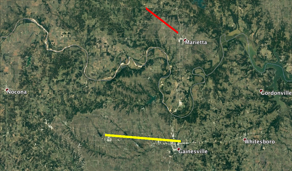
On the evening of May 31, a southeastward-moving F4 tornado destroyed several homes near Marietta and Pittman, Oklahoma. This was the first killer tornado in the state of the sequence, with three perishing. One other F2 struck south of the Red River near Lindsay, Texas. A pair of F2 tornadoes also occurred in the morning hours of June 1. One of them tracked through downtown Lexington, Kentucky, although it yielded relatively minimal impacts. The full brunt of the pattern that had yielded major tornadoes for days wouldn’t arrive until the afternoon.
The shortwave deamplified as it ejected east-northeast in the morning hours of June 1. Despite this, 50+ knot west-southwesterly 500 mb flow provided sufficient deep layer shear for a last outburst of supercells. When blended with the unrelentingly moist air mass that had fuelled the carnage over the prior week and a plume of steep mid level lapse rates emanating from the Desert Southwest, the stage became set for Oklahoma and south Kansas.
Unlike several of the previous days, most of the tornadoes that occurred on June 1 were shorter-lived. Unfortunately, scattered through these shorter tracks were several towns. Around 4:15 PM CDT near Drake in Murray County, an F3 killed five in a single residence. A schoolhouse nearby was also struck and demolished, thankfully a storm cellar protected the lives of the students attending.
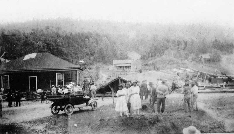
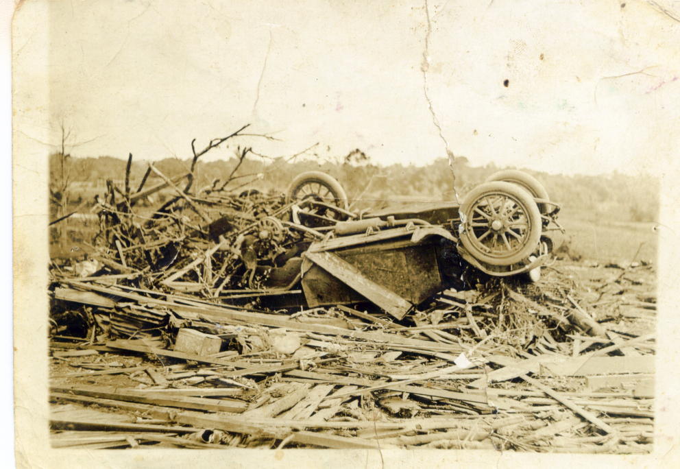
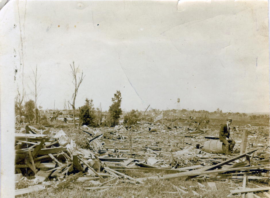
At around 5:20 PM, a powerful tornado formed near Clarita in Coal County. Proceeding eastward and then curving to the north (perhaps in the process of occlusion), it ripped through the western portion of Coalgate. Hundreds of homes suffered considerable damage or essentially vanished. This F4 storm resulted in perhaps the clearest photographic evidence of higher end damage, aside from the Mattoon/Charleston event, that the sequence provided. 14 fatalities and at least 100 injured was the human toll. Many of these were likely maimed by scattering boards as the tornado obliterated coal miner dwellings, largely made of wood.
An F3 became the third killer tornado of the day and the final deadly tornado of the sequence as it passed through Coffeyville, Kansas, leaving three dead. Multiple homes and businesses were destroyed as it skirted just north of downtown. The extended violence mercifully came to a close when the final tornado dissipated after 7:30 PM CDT in Cherokee County, Kansas. However, despite the sequence itself coming to an end, the quiet was short lived. Just four days later, another significant tornado outbreak affected the Plains. Destructive tornadoes also struck Michigan the following day.
In eight days, dozens of tornadoes brought adversity across portions of no less than eleven states. Meteorologically, this is perhaps the most impressive of the case studies that will be covered here. No less than 15 F4-5 tornadoes are evaluated by Grazulis as a part of this sequence. Over 380 people lay dead in its wake, with thousands injured and thousands of buildings destroyed.

Much like 1896, largely due to this sequence, 1917 ranks in the annals as one of the deadliest tornadic years in United States history with greater than 500 fatalities. Now a century later, most memories of it have faded. Perhaps this can be attributed to the fact that a large city was not the epicenter like with St. Louis in 1896. Further outbreak sequences would affect a similar region to this one later in the twentieth century, particularly in May, 1995. This 1917 assault serves as yet another reminder of how frightening such a barrage of severe weather must’ve been before modern communication.
For the next in the series, we focus on the Plains for the early May, 1930 tornado outbreak sequence.
Sources/Other Recommended Material:
Oklahoma History, “This and That” News – October 2006: http://www.oklahomahistory.net/newsletters/ttnewsOCT06.html
ESRL (CIRES) 20th Century Reanalysis: https://www.esrl.noaa.gov/psd/data/20thC_Rean/
News and Tribune -> New Albany tornado article: http://www.newsandtribune.com/archives/twister-looking-back-at-the-tornado-that-decimated-new-albany/article_50ac3570-a7df-55c6-a3e0-355a22ea081c.html
UQAM Reanalysis (derived from 20th Century and NCEP/NCAR Reanalyses): http://meteocentre.com/reanalyses/get_reanalyses.php?lang=fr&mod=20cr&area=na
Gen Disasters Andale tornado article: https://www.gendisasters.com/kansas/13293/andale-ks-tornado-may-1917
NWS Central Illinois Mattoon/Charleston tornado page: https://www.weather.gov/ilx/mto1917
The Central Illinois Tornado of May 26, 1917 (J.P. Carey): https://www.jstor.org/stable/207291?seq=1#page_scan_tab_contents
Porter County’s Past on the Kouts tornado: http://www.porterhistory.org/2016/04/weather-beaten-hebron-kouts-tornado-of.html
Account of the 5/30/1917 Bollinger County, Missouri tornadoes: http://www.usgennet.org/usa/mo/county/bollinger/history/history-03.htm
Gen Disasters 5/30/1917 tornadoes article: https://www.gendisasters.com/missouri/14544/mineral-point-jedberg-mo-tornadoes-may-1917
NCAR/UCAR Research Data Archive (for 20th Century Reanalysis): https://rda.ucar.edu/datasets/ds131.2/
You should include the series of tornadoes that occurred in Lower Michigan on June 2, and 6th 1917 here in Lower Michigan. These were some of the most intense tornadoes that we experienced prior to the 1920s.