On April 14, 2012, an upper-level low pressure trough rolled east from the Rockies and encountered a moist and unstable air mass ahead of a sharpening dry line. The Storm Prediction Center issued a High Risk for severe thunderstorms on its Day 2 outlook, one day earlier than what would normally be expected, indicating an unusually high confidence of significant severe weather.
From the archives: Videos from the outbreak | Map of the outbreak
When all was said and done, 86 tornadoes touched down on April 14 alone, from Oklahoma north to Iowa in one of the largest Great Plains tornado outbreaks on record. Some highlights from the day include:
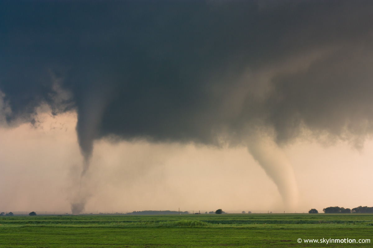
- A high-contrast, violent EF4 near Marquette, KS, well-documented by chasers.
- A long-track supercell that exhibited high-end radar signatures near the Kansas/Oklahoma border. It went on to produce a destructive EF3 over southeast Wichita.
- A powerful nocturnal supercell that produced two 1+ mile wide tornadoes between Greensburg and St. John, KS.
- The killer tornado that struck Woodward, OK overnight.
- An unexpected warm-front tornado that tore through the middle of Creston, IA.
A time graph of the tornadoes shows how multiple rounds of tornadoes propagated over the same general areas, especially in Kansas.
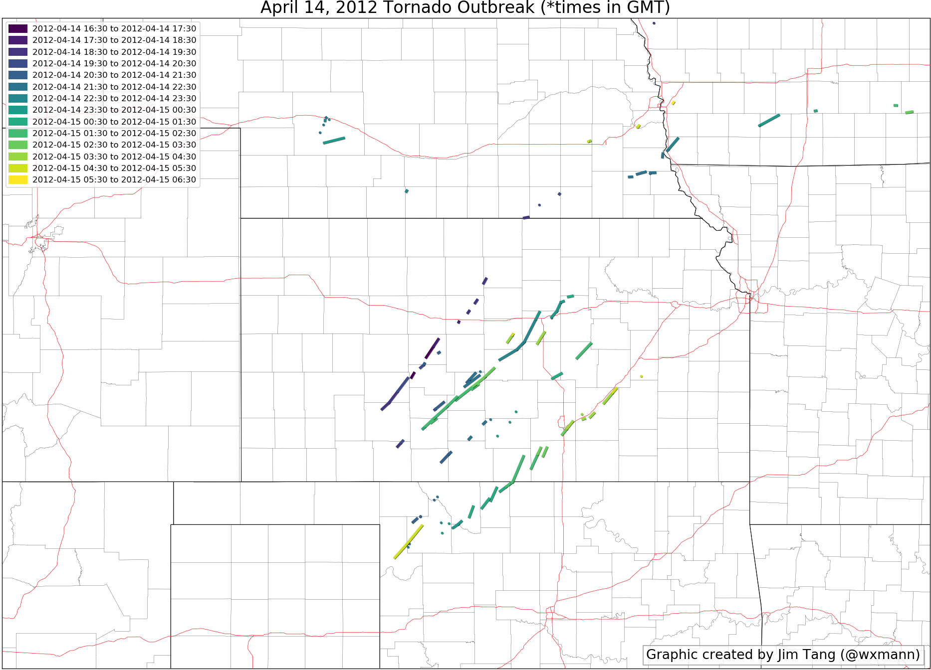
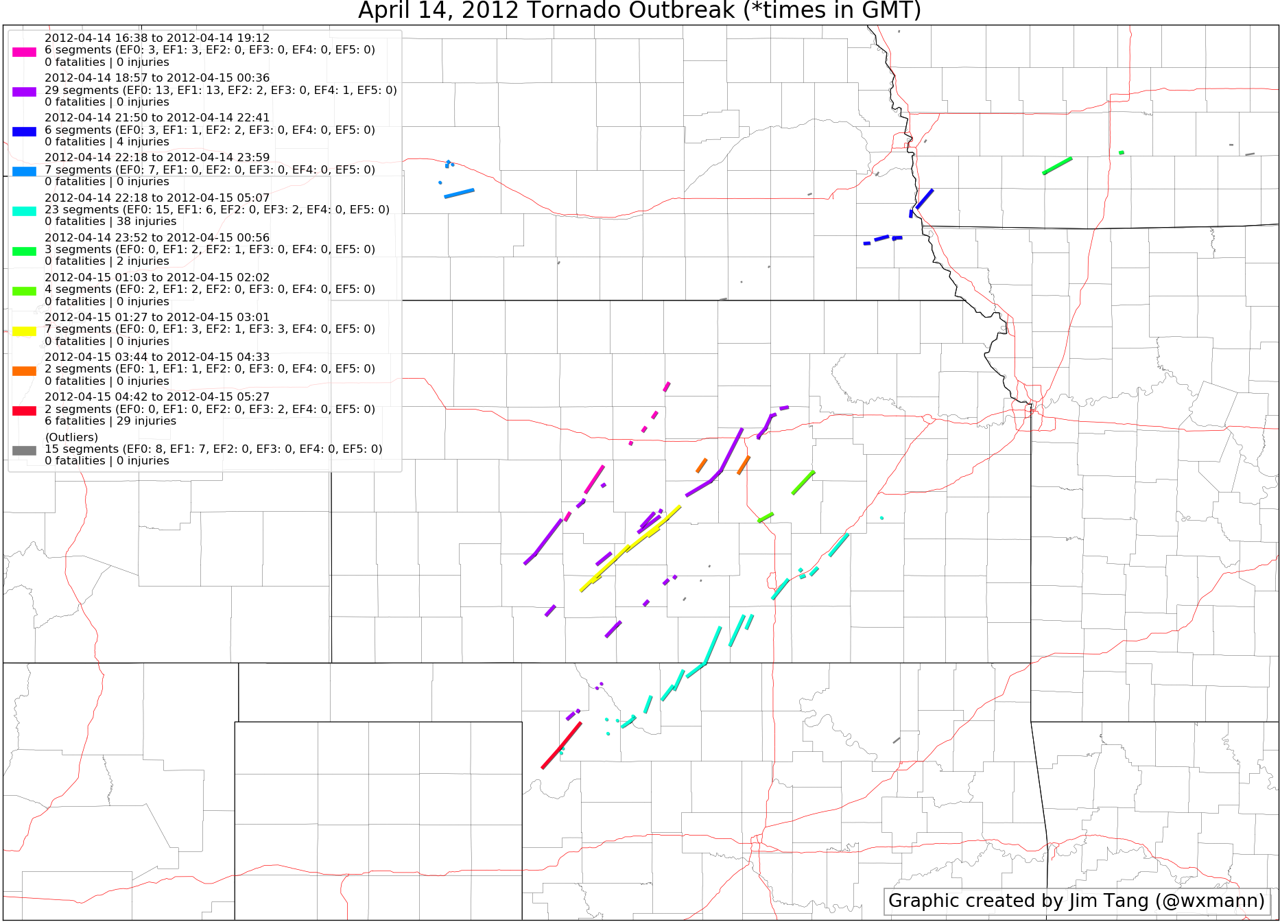
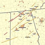
Applying our clustering methods described in Part 1 and Part 2 of my clustering series to analyze this outbreak yields this map (The clustering parameters I used here are eps_km=60, eps_min=60, min_samples=15.)
Here’s a long loop of the main body of the event, with tracks shown as the clusters happen.

For the rest of this post, I’ll focus on the clusters that impact Oklahoma and Kansas, which make up the meat of the outbreak.
Early afternoon supercell east of Hays
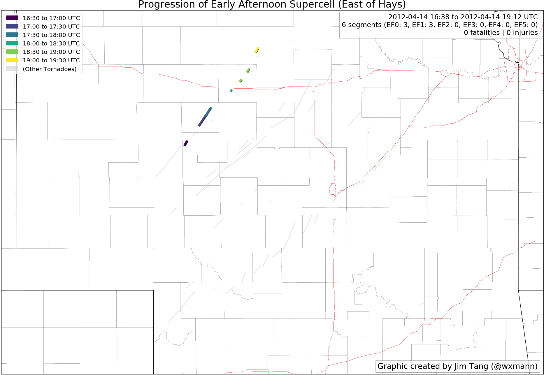
This was the first cluster of tornadoes of the outbreak, spawned from a morning supercell that managed to root in the boundary layer. These tornadoes were weak and not very noteworthy.
Afternoon “String of Pearl” Supercells
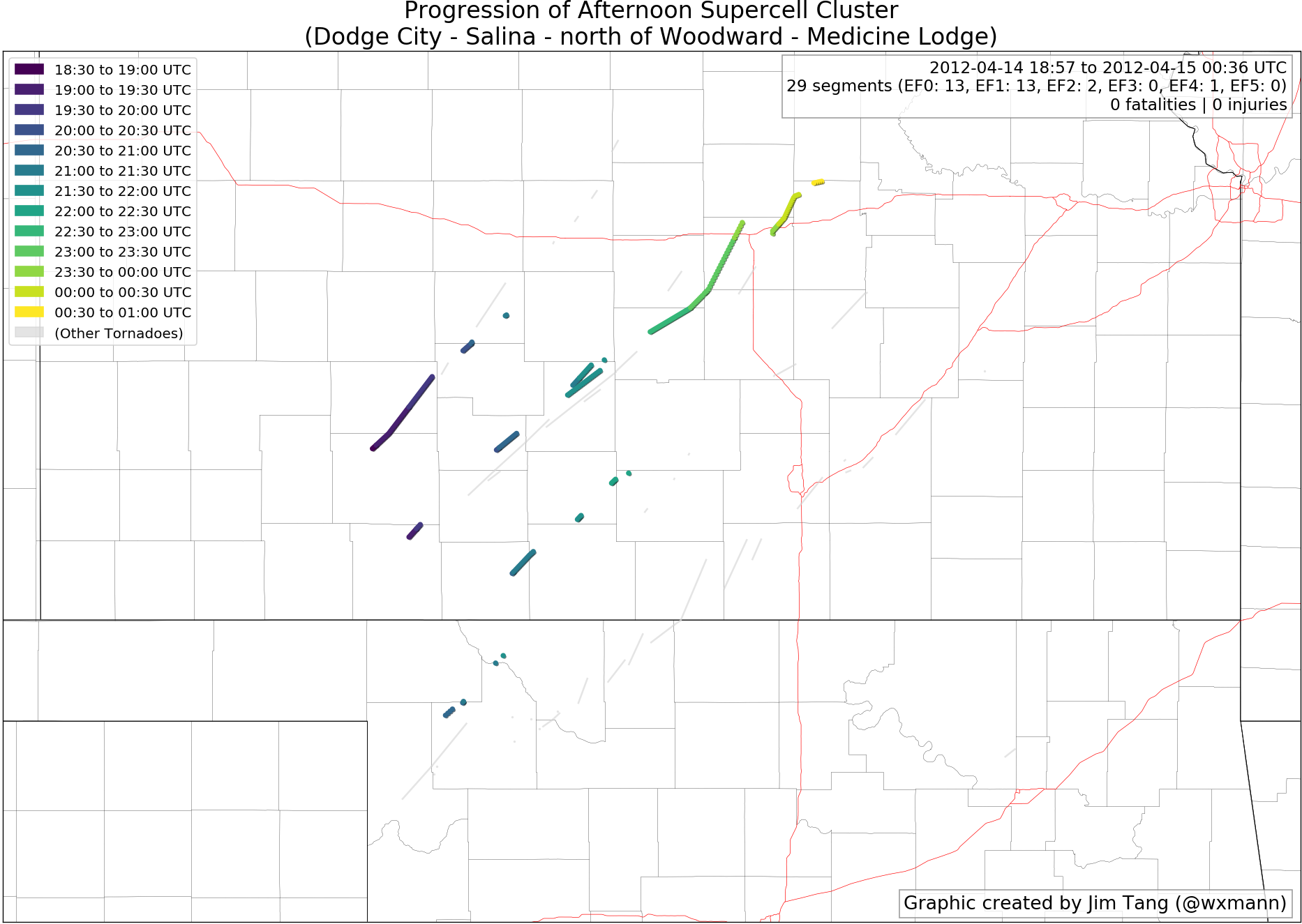
A series of supercells initiated on the dryline between Dodge City, KS and the northeast Texas Panhandle between 18-20Z. These kicked off the first significant cluster of tornadoes, starting with a long-track tornado just north of Dodge City. This first series of radar images shows the maturation of these initial storms.
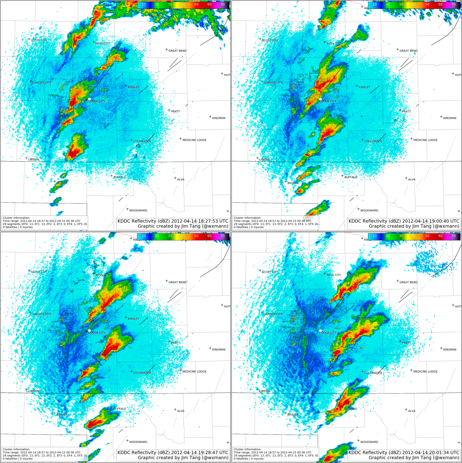
By 20:30Z, a distinct “string of pearls” can be clearly seen on radar.
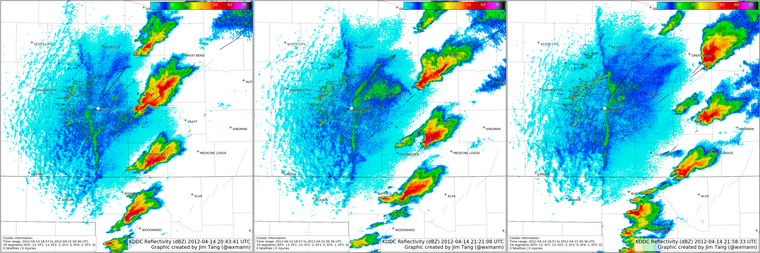
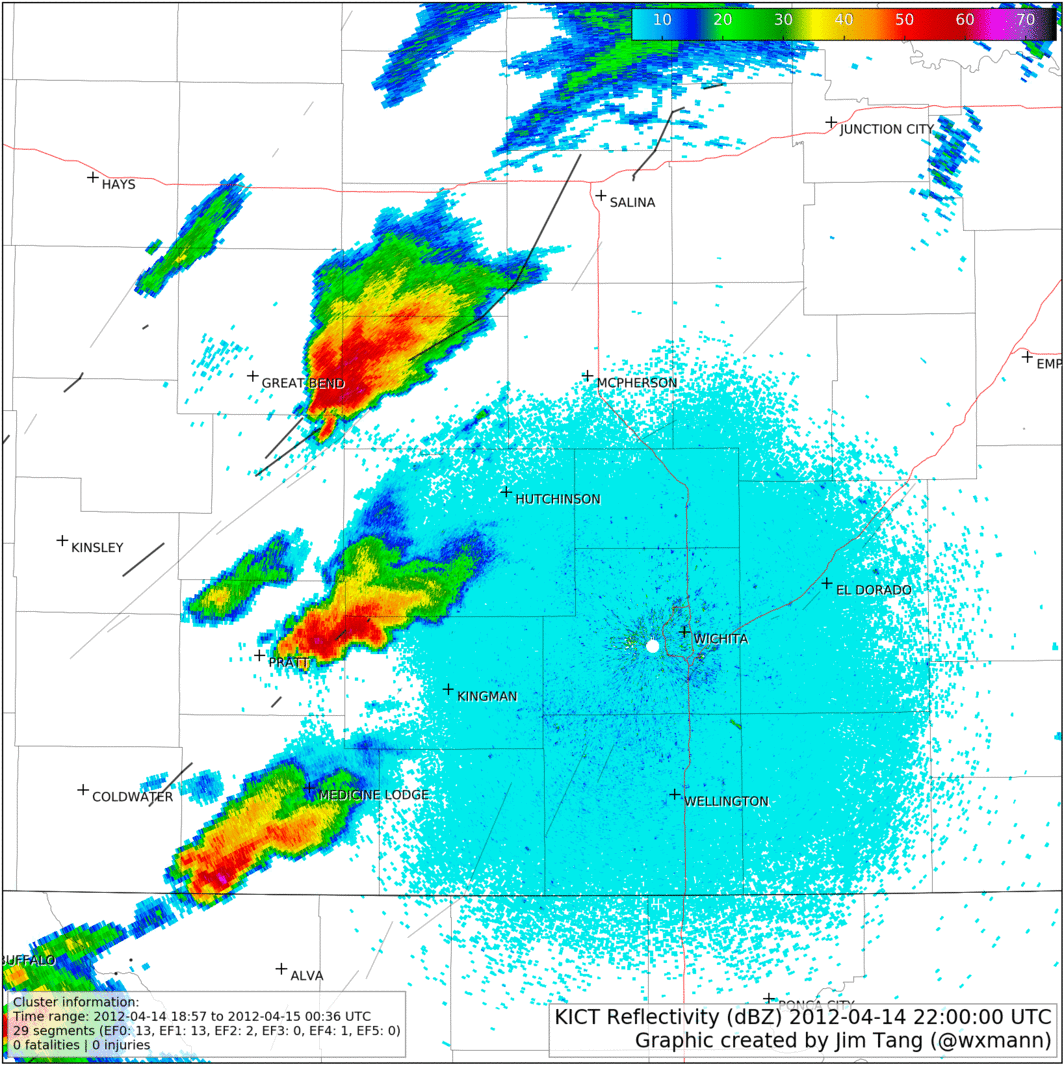
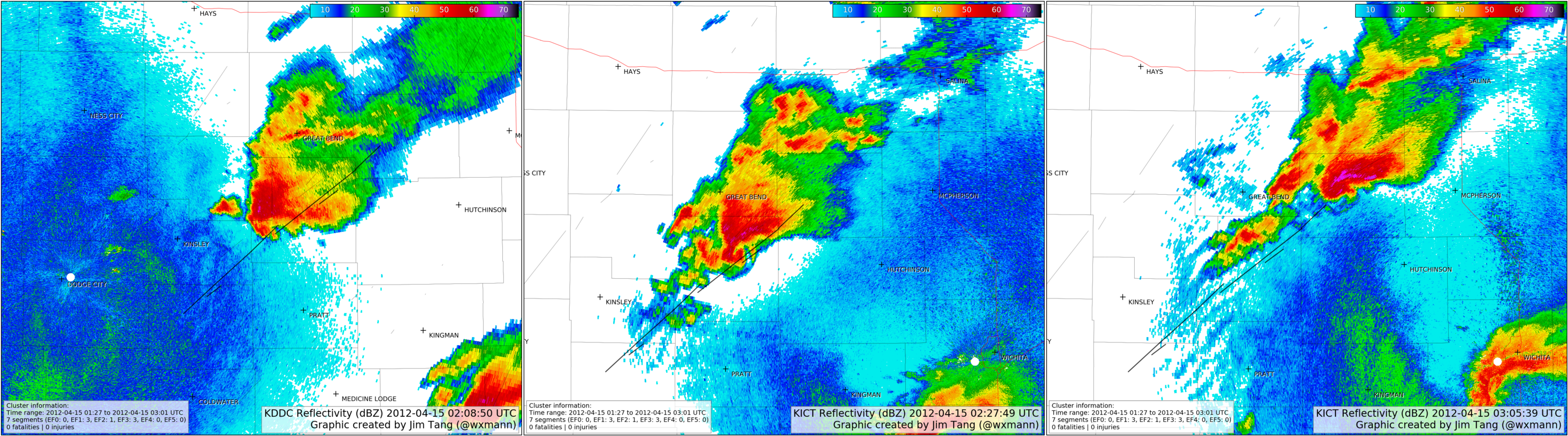
The Dodge City cell had weakened, but the three southernmost cells would produce intermittent, weak tornadoes over the next couple of hours through multiple cycling phases. But by 22Z, the characteristics of the supercells began to change. A series of competing updrafts near Great Bend finally coalesced. Meanwhile, the southern cells near Pratt and southwest of Medicine Lodge lost some of their organization, perhaps choked off by new development west of Woodward. Compare the following panels.
What followed was the most well-documented and the most violent event of the outbreak. Now in a stable state, the northern supercell spawned a long-track EF4 between Marquette and Salina, KS.
The southern supercells meanwhile continued to weaken and stopped producing tornadoes. Because of the break in tornado-minutes south of the Salina supercell, additional cells further south are considered part of a new cluster.
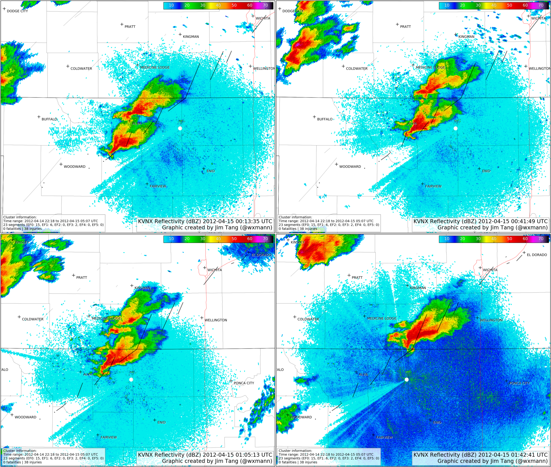
Long-Track Woodward-Wichita Supercell
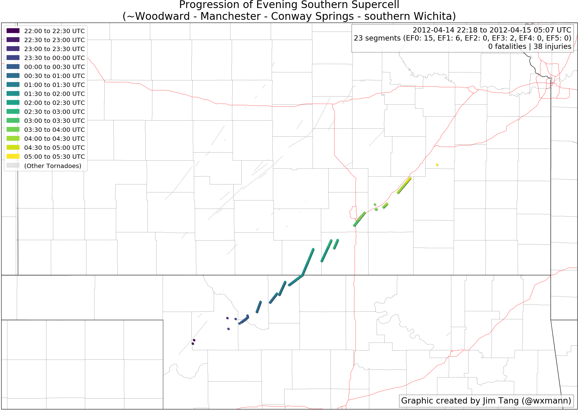
Even as supercells organized between Dodge City and Salina, the dryline remained active to the south and continued to spit out new cells. Over the course of two hours, these cells coalesced into two supercells, initially only producing brief tornado touchdowns.
From ~0Z onward, the southern of the two supercells intensified and took over, cycling again and again, producing tornado after tornado. At times a debris ball was visible, especially when the cell crossed the OK-KS state line. That tornado near Manchester, OK was rated an EF1, but could have been stronger given the intense radar signatures.
After crossing Kansas, the supercell entered more populated areas. It spawned two EF3 tornadoes — one near Conway Springs and one that inflicted $500 million worth of property damage to the Wichita metropolitan area, and injured 38. Fortunately, no fatalities were reported.
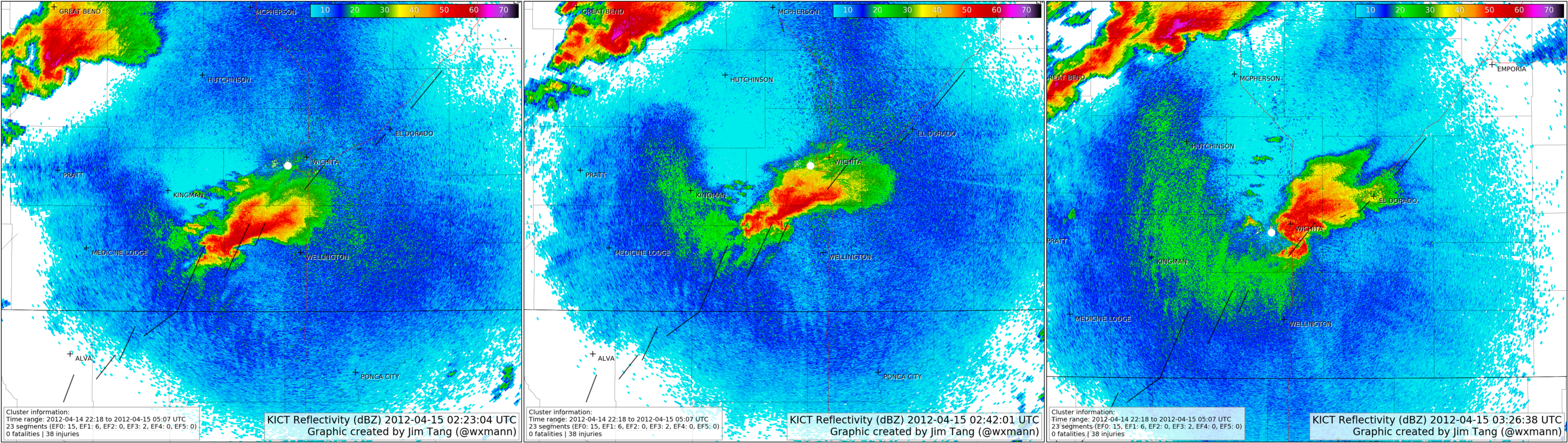
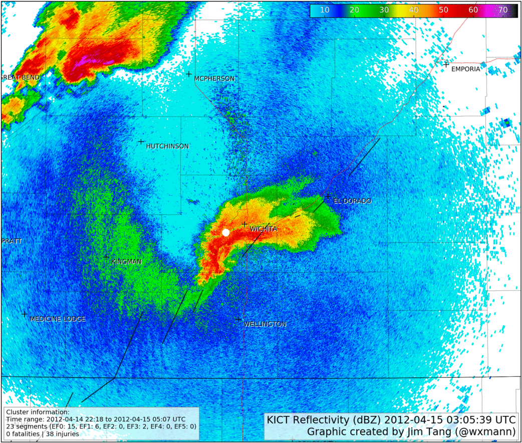
After leaving Wichita, the cell continued to spit out tornadoes near and northeast of El Dorado, but gradually lost strength as increasing convective inhibition took its toll.
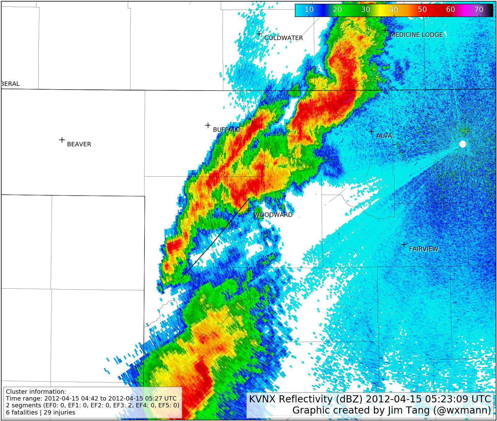
Radar loop KVNX
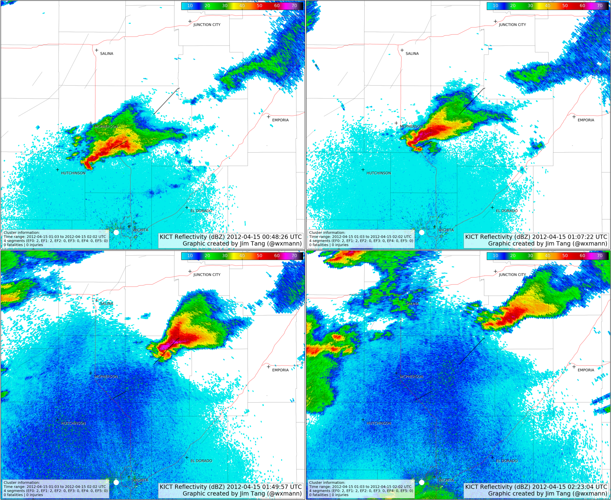
Radar loop KICT
Reborn the Supercell: Hesston to Marion, KS
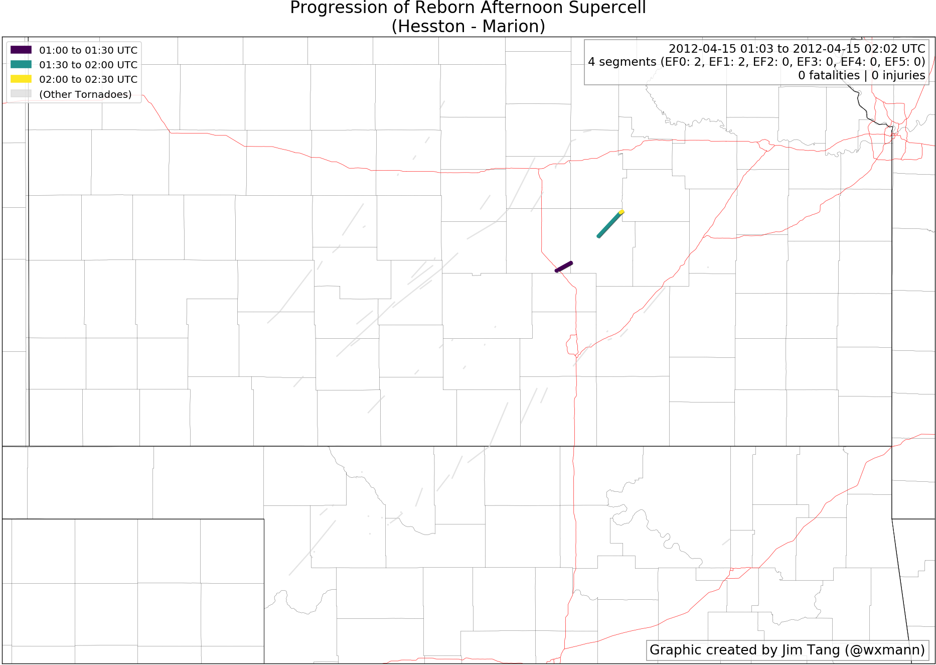
The radar loop from Wichita, KS from the string-of-pearls cluster cuts off with a struggling supercell east of Hutchinson, KS. However, with decreasing storm competition and a strengthening low-level jet, the supercell managed to re-intensify east of I-135.
At one point, three storms, including the Wichita region supercell and this supercell, were tagged as “particularly dangerous” by the NWS. Because of the spacing and gaps, this is considered a new tornado cluster.
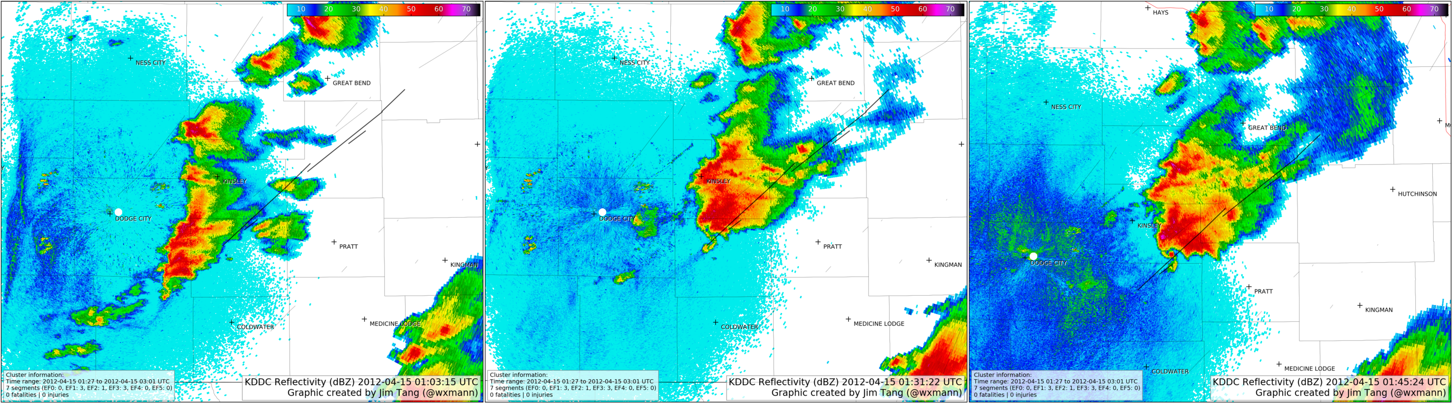
Western Kansas Monster Nocturnal Supercell
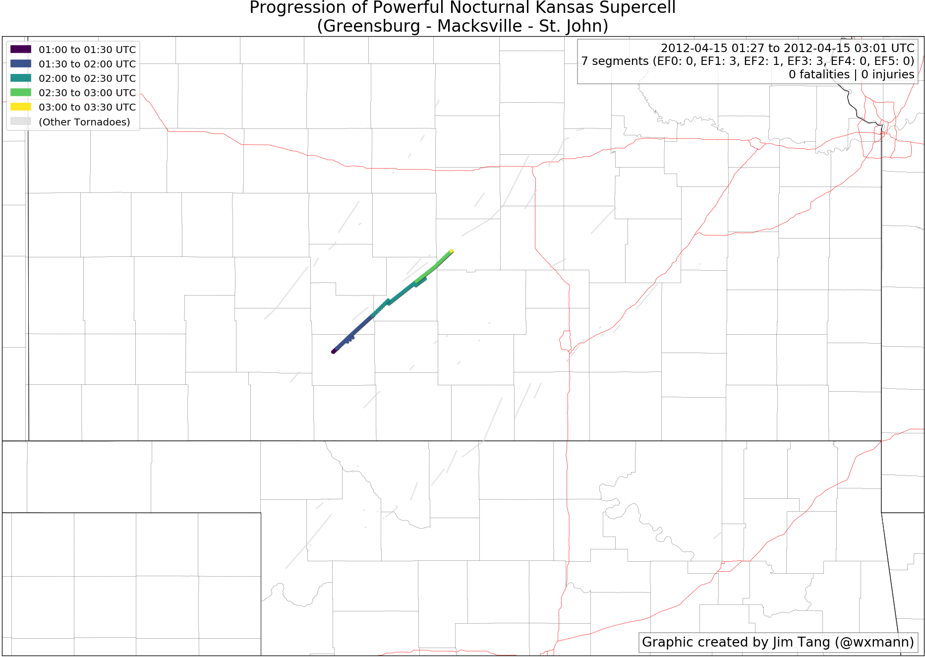
After the first round of supercells during the daytime, the region of dryline south of Dodge City remained active. A new cluster of storms formed near the Kansas-Oklahoma Panhandle border and merged into a single supercell.
The two strongest tornadoes it spawned, both rated EF3, each had widths in excess of one mile and tracked for over 35 miles.
This supercell followed an eerily similar path as the one that spawned the Marquette, KS EF4 just hours earlier. Fortunately, the most tornadic phase of the storm narrowly missed the path of the earlier EF4.
Radar loop KDDC
Radar loop KICT
Salina, KS Area Nocturnal Tornadoes
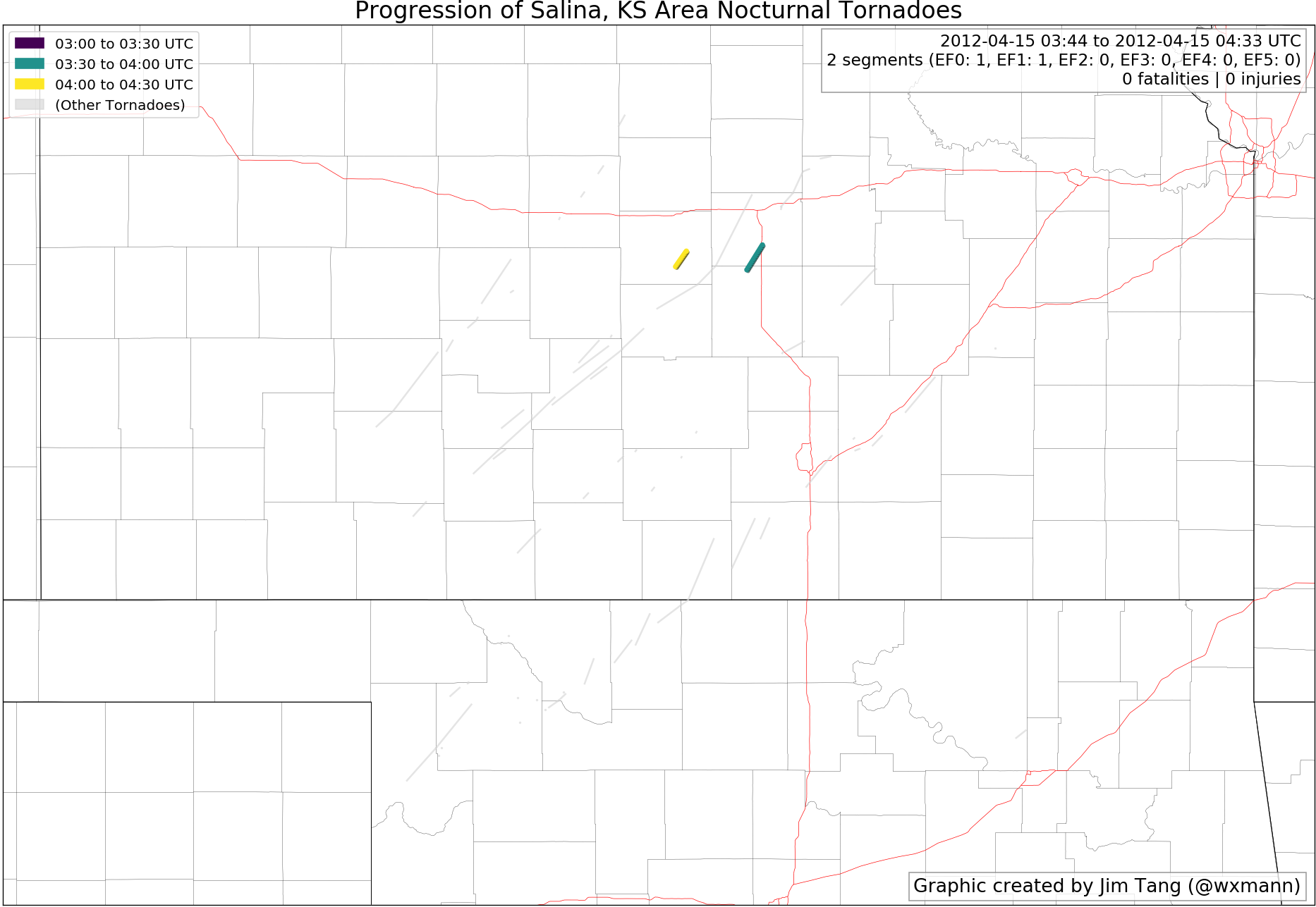
The supercell responsible for the massive tornadoes as part of the previous cluster continued northeast and became progressively elevated, but it managed to spawn one final tornado just south of Salina. Because of the gap between the tornadoes, this is part of a new cluster. Additionally, a weak tornado touched down from the developing QLCS to its west after 0400Z.
Woodward, OK Deadly Tornado
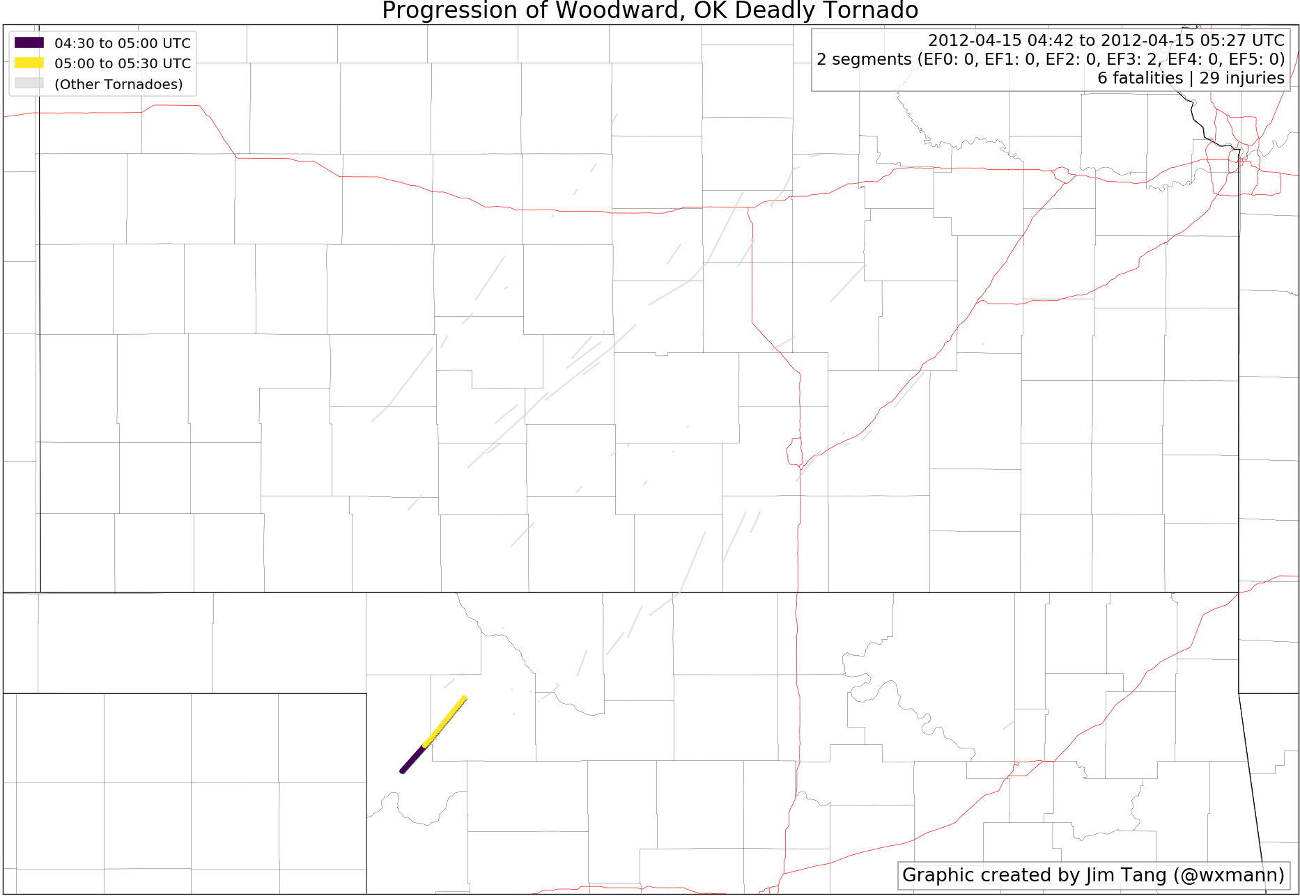
Shortly before midnight, a supercell sprung up near the Oklahoma-Texas Panhandle border on the fringes of a developing QLCS. As it approached Woodward, it spawned a EF3 tornado that slammed into a mobile home park, tragically killing six. This was the only deadly tornado of the outbreak.

Conclusion
Overall, the clustering technique performed very well for this outbreak. It separated out the well-known modes of the outbreak:
- The daytime tornadoes in Kansas.
- The long-track supercell that impacted Wichita.
- The deadly nighttime tornado in Woodward.
- The rebirth of one of the supercells near Hesston.
Do you have memories of this outbreak? Let us know in the comments or on Twitter or Facebook!
Jim Tang
Latest posts by Jim Tang (see all)
- A comprehensive radar examination of the April 14, 2012 tornado outbreak - April 14, 2018
- When is the best time of year to schedule a storm chasing vacation? - March 30, 2018
- Rethinking how we conceptualize tornado days - March 27, 2018
Need some information on the Creston Iowa tornado of April 14th 2012. It was very nice in southern Iowa till that storm hit and the updrafts we’re near 100 miles an hour by 500 in the evening ef 3 tornado destroyed the green valley aea hospital and south of the middle school in creston