Tornado highlights covering the week of April 5-April 11, and a brief look ahead.
As anticipated, last week was the most active of the season so far when it comes to severe weather. While parts of the severe weather episode did not perform as expected, others did and then some.
Among the barrage of about two dozen tornadoes April 8-9, the first violent twister of the 2015 season touched down to the northwest of Chicago on April 9, killing 2.
The upcoming week shouldn’t be a total snoozer, but it seems rather unlikely to produce anything quite on the level of events we just went through.
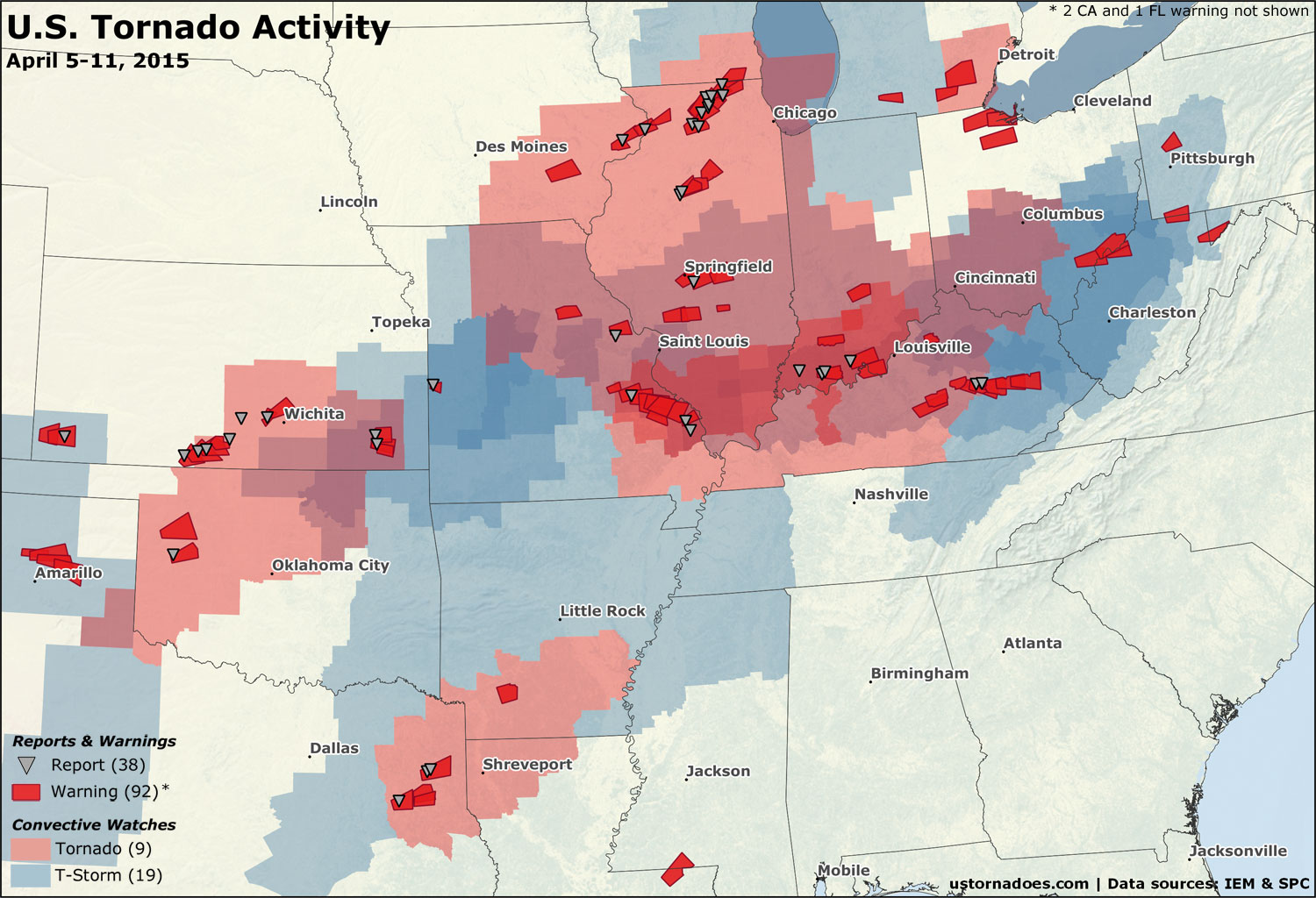
28 convective watches were issued during the week, up 10 from the week prior. Tornado watch issuance jumped by five to nine. Tornado warnings were more than double the week prior, as were tornado reports. Main impacts were across the southern Plains into the Lower Great Lakes and Midwest.
April 7: Plains, Midwest and California
A number of rotating storms passed through parts of the Midwest during the afternoon of April 7. Four EF1s touched down across Illinois, and two brief weak tornadoes also struck central Kentucky.
Heres a time lapse of the storm in Richmond moving through Garrard. Shows the rotation. @IanOliverWX @Kentuckyweather pic.twitter.com/O73A2FI5EE
— jackson (@jackson_moss) April 7, 2015
@reedtimmerTVN @JimCantore Possible tornado near my place in Madison County,ky south of Richmond pic.twitter.com/smCQMOFFpN
— Scott Browning (@scottbrowning29) April 7, 2015
Several tornado warnings were also issued in California near the capital region of the northern Central Valley. A few funnel clouds dotted the area.
Amazing storm structure near tornado warning in Glenn County!!! #cawx @NWSSacramento pic.twitter.com/iO4z8THYGm
— Jeff Boyce (@Negative_Tilt) April 7, 2015
Check out this shot from about 15 minutes ago taken from our offices on S St. Woo hoo for some rain! pic.twitter.com/o62z6AC1vO
— SMUD (@SMUDUpdates) April 7, 2015
Near nightfall, a handful of supercells formed in Kansas and Missouri. One or two brief tornadoes were reported.
Big tornado warned supercell just east of the KS/MO border in western Missouri. pic.twitter.com/E16gOa4ld5
— U.S. Tornadoes (@USTornadoes) April 8, 2015
April 8: Mostly Kansas
April 7 was expected to be “the day before the day” (in which some tornadoes occur ahead of the main event). In the end, April 8 may have ended up the day before the day.
.@NWSSPC update now has 15% tornado zone. MOD risk for tornadoes. Hatched=best odds of strong http://t.co/vw2DJrdOVU pic.twitter.com/rupAZwG31r
— U.S. Tornadoes (@USTornadoes) April 8, 2015
The second moderate risk of the year, and the first for tornadoes (15% probabilities or higher), was issued by the Storm Prediction Center. Several tornadoes occurred, but it was much tamer than many expected overall. (sidenote: Mark Ellinwood was bearish enough I thought he might bust, but he did quite well with the forecast here).
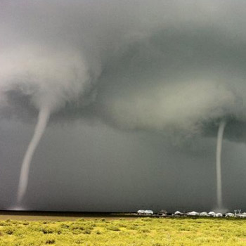
Although a number of supercells formed across western Oklahoma and into Kansas late in the day, it was mostly one storm near the triple point in Kansas that did much in the way of producing tornadoes. Even then, most tornadoes were short-lived and weak, but several were quite photogenic.
Confirmed tornado on the ground SE of Protection KS.#kswx #okwx pic.twitter.com/1KB6amY2YM
— Jeff Piotrowski (@Jeff_Piotrowski) April 8, 2015
. @MPrendergastTX shot this photo of a #tornado around 7:00PM near Dearhead, #KSwx. pic.twitter.com/DsKIqXDf4w
— Velocity Storm Chasing (@VelocityChasing) April 9, 2015
Here’s some video of one of the longer-lived tornadoes near Medicine Lodge, Kansas from Skip Talbot.
It was a beautiful day for storm structure as well.
Beautiful structure w/ wall cloud near Medicine Lodge, KS on tornado warned storm short while ago. @SeanSchoferTVN pic.twitter.com/XcTcRFYKoo
— Jodi Mair (@JodiMair) April 9, 2015
Brief but incredible updraft and overall structure with this supercell near Leedey, OK yesterday afternoon! pic.twitter.com/jttgJfjnQy
— Charles (@CharlesLubensky) April 9, 2015
April 9: Illinois and the Midwest
What Wednesday (Apr 8) lacked in higher-end activity, Thursday (Apr 9) easily made up for.
While the risk level remained enhanced, which was a step down compared to the day prior, there was still high odds of a tornado event, one which could include strong tornadoes.
Tornado probabilities now 10% (w/ strong tor poss) N IL parts of IA/MO. Chicago area included. http://t.co/pMXsKogDCj pic.twitter.com/QPVblen48j
— U.S. Tornadoes (@USTornadoes) April 9, 2015
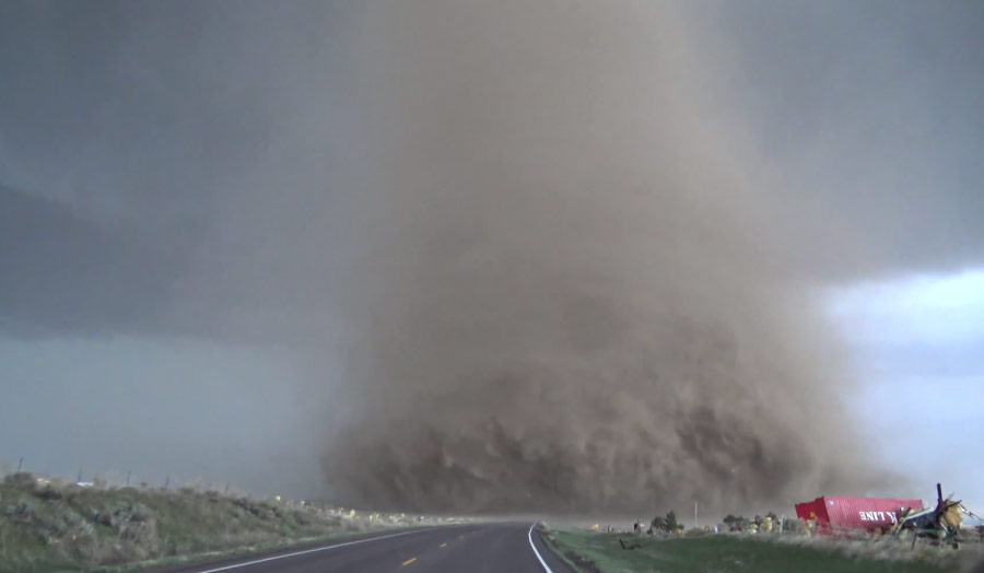
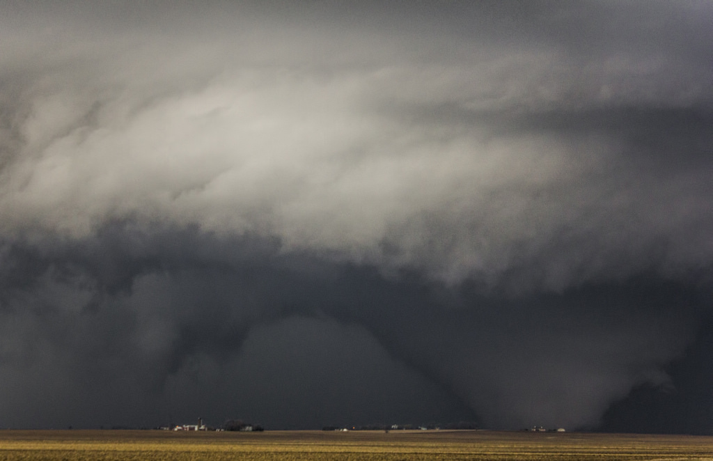
In Illinois alone, at least eight tornadoes occurred. One was the now very well-known Rochelle/Fairdale EF4. Two people were killed by this tornado which traveled for 28.7 miles. Its wind speeds were estimated to peak at 180 to 200 mph.
These pictures show how fast a tornado can develop into a massive wedge tornado. @fox32news pic.twitter.com/HA78y6lBvF
— Bill Bellis FOX 32 (@BillBellis) April 10, 2015
Hats off to the fine folks @NWSChicago and @NWSQuadCities. Great job with the warnings today. pic.twitter.com/KCUiaWfkZ3
— Walker Ashley (@WalkerSAshley) April 10, 2015
Videos of the violent tornado tell quite the firsthand tale. It was a beast.
The scene afterward was difficult to see, as it always is when a powerful tornado makes contact with civilization.
Fairdale, IL from above after a tornado swept through yesterday. h/t @MaxTsaparis pic.twitter.com/1hbyOEZKsJ
— U.S. Tornadoes (@USTornadoes) April 10, 2015
April 11: Southern High Plains
This one’s barely even worth a mention, but it was an early-season weekend chase day in the High Plains. And you just have to love the High Plains!
Yeah, I'm not going in there right away pic.twitter.com/GA56i415Sr
— Matt Mahalik (@MahalikWx) April 11, 2015
Wow great structure. What a beast pic.twitter.com/K7kmvLhTor
— Matt Mahalik (@MahalikWx) April 12, 2015
https://twitter.com/NWSKansasCity/status/587098487415672832
Mixed signals
A return to the pattern of old?
This week is starting off fairly quiet for tornado activity. Numerous severe thunderstorms did fire up across the country — focused across the Plains — on Sunday, but they were mainly wind and hail producers. More severe weather is anticipated today, again with a relatively low tornado threat.
Eyes now turn toward a slow-moving upper-level storm system slated to “cut off” over the four corners region midweek, before eventually moving out across the country toward the weekend. SPC has put up a marginal risk for Wednesday already on this system.

Systems like this, that are big and lumbering, are notoriously difficult to forecast.
Once the center of the upper low makes it to the 4 corners or east by Wednesday or Thursday (at least based on current expectations), there’s probably a daily chance of at least a little wave sparking off thunderstorms amidst at least marginally favorable wind shear.
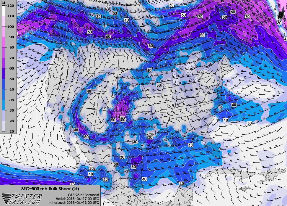
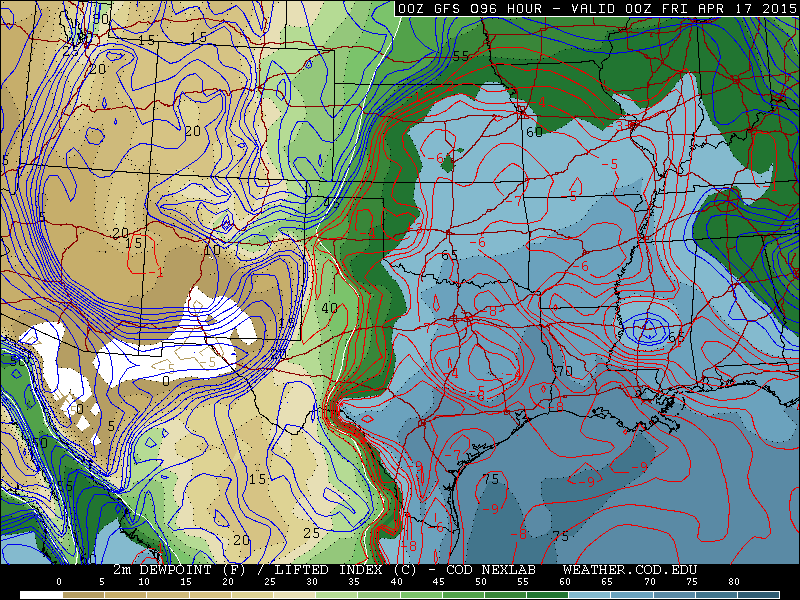
From here, it looks like one big problem for widespread activity might be moisture availability. It seems Texas or into Oklahoma would be the favored region, though the southern High Plains more generally could face a severe or even tornado threat depending on how the system moves out.
Eventually, severe weather risks may progress east as we get into the weekend. Nothing is screaming big event at this point.
Latest posts by Ian Livingston (see all)
- Top tornado videos of 2023 - January 1, 2024
- March 31, 2023 tornado outbreak videos - March 31, 2023
- Top tornado videos of 2022 - December 31, 2022