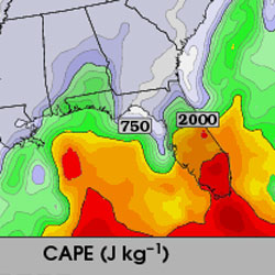
A significant tornado outbreak is expected today in the Plains and western Midwest as strong shear, moderate to high CAPE and very strong upper-level dynamics combine into a rare setup that could prove to be devastating for those living within the risk area. Please pay very close attention to the weather today if you are at risk for severe weather.
This morning’s forecast update from the SPC is very concerning, with high tornado probabilities in the central Plains:

A 45% tornado risk indicates that there is a 45% chance that a tornado will occur within 25 miles of a point. The hatched zone indicates a 10% or greater probability of EF2-EF5 tornadoes within 25 miles of a point.
To put this into perspective, here are some of the recent High Risk tornado probabilities and their respective tornado reports (all within hatched risk zones):
March 2, 2012: 30%, 160 tornado reports
May 25, 2011: 30%, 127 reports (though several reports were in CA)
May 24, 2011: 45%, 57 reports
April 26, 2011: 30%, 126 reports
October 26, 2010: 15%, 57 reports
May 19, 2010: 30%, 25 reports
May 10, 2010: 30%, 42 reports
May 1, 2010: 30%, 42 reports
April 27, 2011 was not included because it was a highly-anomalous, once in a 50-year event (approximately), the likes of which is a step (or two) above the other High Risk days.
My previous discussion in the Thursday update remains mostly relevant to the situation, though at this point I have less reservations about the overall risk. There are still some issues to be worked out regarding storm coverage and the overnight risk, but the potential is there for the forecast to verify.
The SPC forecast discussion is quoted below.
This environment is expected to be conducive for a significant outbreak of severe storms…that may impact portions of the central and southern Plains through much of the period. This may include several tornadic supercells…and perhaps…by tonight… the evolution of a substantial squall line.
…Nebraska…
North and east of the dry line wrapping into the deepening surface cyclone…into the vicinity of the warm front…conditions appear likely to become very conducive to the formation of discrete tornadic supercells…as the exit region of the cyclonic mid/upper jet overspreads the region. This could occur as early as 18-21z…if not before…across parts of southwest into central Nebraska…before developing eastward and increasing in coverage across central into eastern Nebraska through the remainder of the afternoon. This is where low-level hodographs are expected to become large and clockwise curved…and supportive of long-lived supercells capable of producing strong tornadoes.…Kansas and Oklahoma into north central/northwest Texas…
Barring complications from residual early day convective development…the warm sector environment ahead of the dry line across much of central/eastern Kansas and Oklahoma probably will still be capable of supporting long-lived supercells capable of producing strong tornadoes. However…concern exists that the potential coverage of discrete supercell storms may remain somewhat sparse…prior to squall line evolution this evening as a cold front overtakes the dry line and surges eastward across the plains. Once this occurs…damaging wind and large hail may become the primary severe threat.
Latest posts by Mark Ellinwood (see all)
- Spring 2023 seasonal tornado outlook - March 1, 2023
- Spring 2022 seasonal tornado outlook - March 1, 2022
- Spring 2021 seasonal tornado outlook - March 1, 2021