The forecasts have returned, and there is stuff to talk about in early June! Imagine that. Still can’t manage to get any persistent, more traditional activity, though. Oh well. We must play with the cards we are dealt. Tuesday looks nice if storms can latch onto the warm front and go nuts.
1-3 Day
Monday
Southern Kansas, northern Oklahoma — TORNADO RANGE: 0-2 — CONFIDENCE: High
Expected Tornado Hotspot: None
Pros: Moderate to high instability, good directional shear
Cons: Poor low to mid-level speed shear, questionable storm coverage/mode/intensity, somewhat-high LCLs, steady/rising heights, lack of a major lifting mechanism
Tuesday
Nebraska, far northern Kansas, mid-Mississippi Valley — TORNADO RANGE: 3-10 — CONFIDENCE: Normal
Expected Tornado Hotspot: Central Nebraska/along the warm front
Pros: Strong speed and directional shear, moderate to high instability, good upper-level dynamics
Cons: High to very high LCLs south of the warm front, questionable storm coverage south of the warm front during the afternoon and early evening, storms turn into an overnight MCS
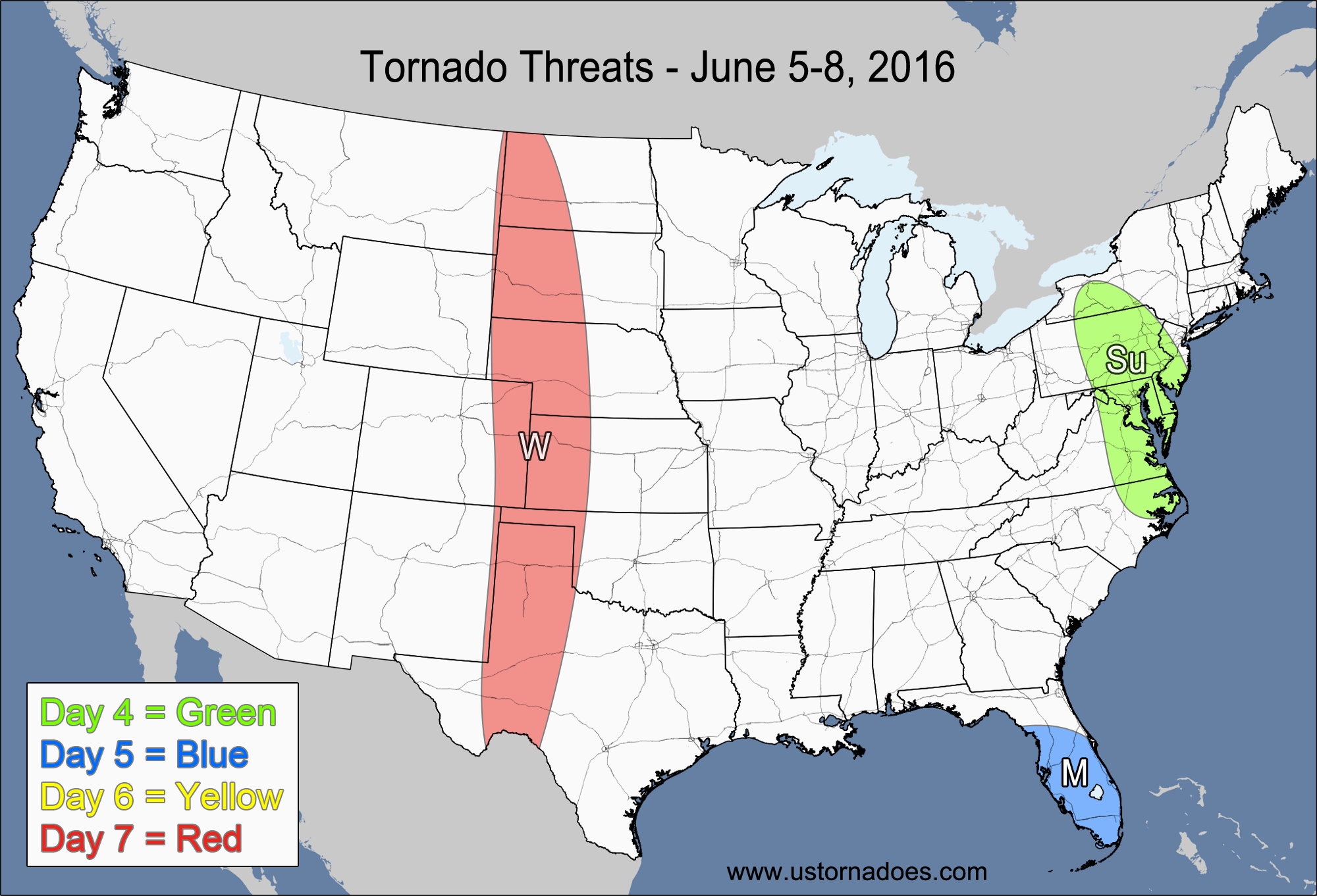
Wednesday
Northern and central High Plains — TORNADO RANGE: 0-3 — CONFIDENCE: Normal
Expected Tornado Hotspot: None
Pros: Some directional shear with upslope, low to moderate instability, some upper-level dynamics
Cons: Weak speed shear, fairly high LCLs
Southern Midwest, Ohio Valley — TORNADO RANGE: 1-5 — CONFIDENCE: Normal
Expected Tornado Hotspot: None
Pros: Moderate to high instability
Cons: Mostly linear/quasi-linear storm mode, unidirectional flow aloft, weak mid-level lapse rates
4-7 Day
Thursday
Central High Plains — TORNADO RANGE: 0-2 — CONFIDENCE: Normal
Expected Tornado Hotspot: None
Pros: Some directional shear with upslope, low to moderate instability
Cons: Weak speed shear in the low to mid levels, somewhat high LCLs
Eastern Carolinas — TORNADO RANGE: 0-1 — CONFIDENCE: Normal
Expected Tornado Hotspot: None
Pros: Moderate instability, decent speed shear, low LCLs
Cons: Weak directional shear, unidirectional flow aloft
Friday
Central Plains — TORNADO RANGE: 1-5 — CONFIDENCE: Low
Expected Tornado Hotspot: None
Pros: Moderate instability, good directional shear, decent speed shear
Cons: Weak low-level speed shear, capping concerns
Saturday
Central Plains, mid-Mississippi Valley — TORNADO RANGE: 2-7 — CONFIDENCE: Low
Expected Tornado Hotspot: None
Pros: Moderate to high instability, decent/good speed and directional shear
Cons: Questionable storm coverage in the area with the best atmosphere, high LCLs possible
Sunday
Southern Midwest, Tennessee Valley — TORNADO RANGE: 1-5 — CONFIDENCE: Low
Expected Tornado Hotspot: None
Pros: Low to moderate instability, some low-level directional shear, decent speed shear, decent/good upper-level dynamics
Cons: Mostly unidirectional flow aloft, mediocre lapse rates, cold front forcing more linear storm mode
Latest posts by Mark Ellinwood (see all)
- Spring 2023 seasonal tornado outlook - March 1, 2023
- Spring 2022 seasonal tornado outlook - March 1, 2022
- Spring 2021 seasonal tornado outlook - March 1, 2021