We’ve already seen an active winter, with a few tornado outbreaks across the country. As we are now into meteorological spring, it seems there are decent odds we’ll continue to see active times ahead.
It’s our first spring outlook favoring above average tornado activity in recent years, and the reasons are several.
Details
This winter produced a couple strong low pressure systems that brought a slew of tornadoes to the South and Southeast. This includes a record-breaking five tornadoes in Maryland, doubling the state’s monthly tornado count since 1950.
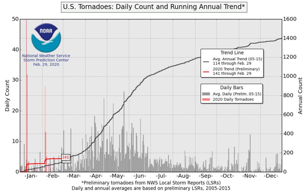
While a pair of strong storm systems in the first two months of the year is not a metric for how active spring will be, it is worth noting that the overall pattern that helped foster these system could linger, at least into the early spring months. In other words, there could be some more potent systems to watch.
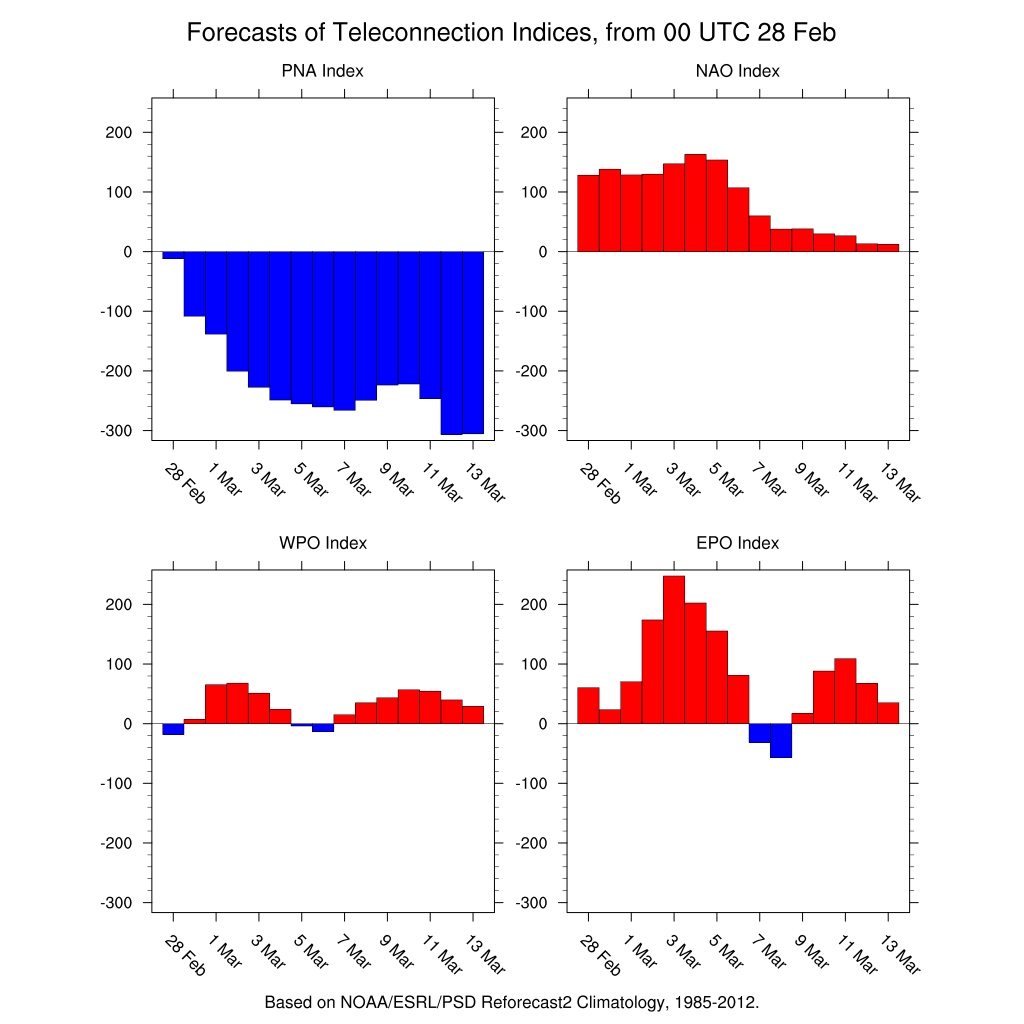
One thing that has been rather persistent all winter is a raging +AO (Arctic Oscillation) and +NAO (North Atlantic Oscillation).
This means much of the coldest air and associated storminess has been bottled up in the Arctic. Underneath, a jet stream carving through the country has been a primary driver in making winter 2019-2020 warmer than normal across a vast majority of the Continental U.S. These features have been coupled with -PNA and a mostly positive EPO and WPO, which further enhances the warmer temperatures over the Lower 48.
So how does the above relate to tornado production?
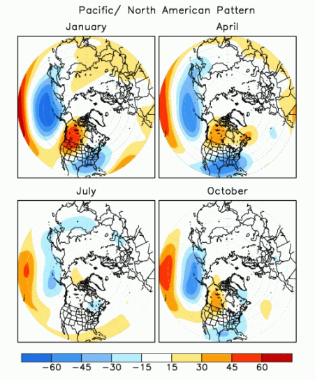
The -PNA (opposite of the +PNA pattern in the image above) helps bring storm systems further south as they enter the western U.S. in the winter, which also works to build an upper-level ridge of high pressure over the southeastern U.S.
The +AO/+NAO helps lock a more active and warmer weather pattern over the U.S.
So, we have a bunch of the so-called teleconnections giving us warmer than normal temperatures, and the upper-level ridge over the southeastern U.S. helps draw moisture from the Gulf of Mexico into the U.S. With the -PNA steering systems further south over the western U.S., these disturbances are able to tap into the Gulf moisture, ultimately producing rounds of severe thunderstorms and tornadoes.
Seeing as this overall pattern of teleconnections hold their relative positive and negative signals as we head into March, it seems logical that the pattern will remain favorable for tornadic storm systems in the first month of climatological spring.
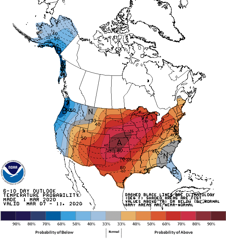
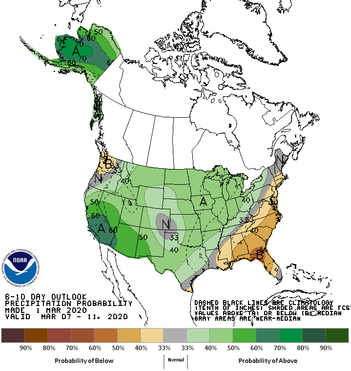
With much of early March in the CPC’s latest 6-10 day outlook, it is pretty easy to see that the clash of cooler air in the western U.S. and warmer air in the central U.S. coupled with a wetter than normal forecast is a good signal that we have conditions favorable for an active early spring in terms of severe weather and tornadoes.
Note that while the overall pattern may be more favorable for tornado production, that does not guarantee that it will actually produce more tornadoes than normal, especially this early in the season.
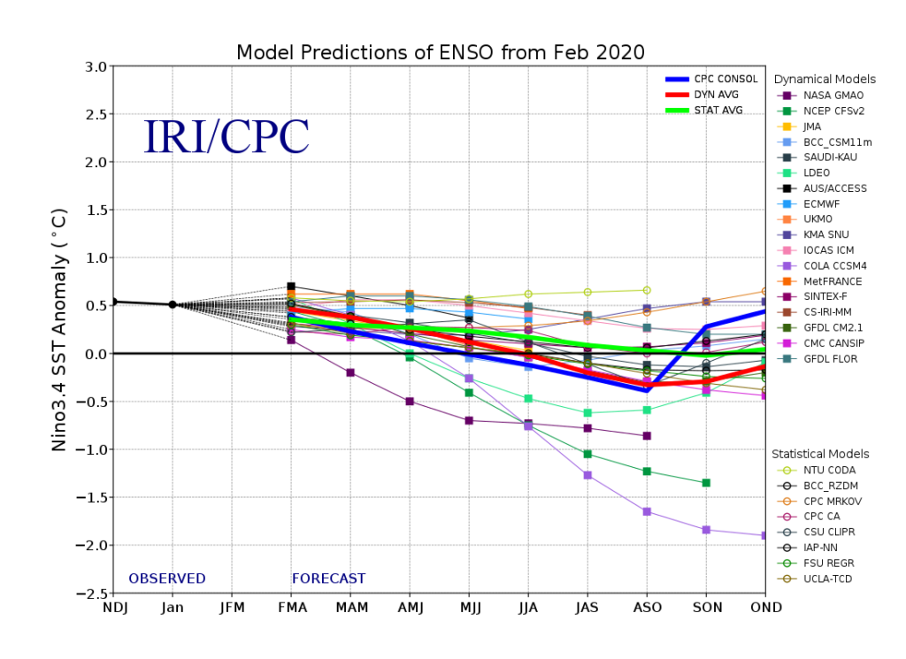
As the teleconnection forecasts become less reliable beyond 2 to 3 weeks into the future, longer-range signals like the El Niño Southern Oscillation (ENSO) become more valuable. This past winter experienced borderline weak El Niño conditions, with ENSO anomalies forecast to trend closer to neutral levels as we progress into spring and summer. This can be an important factor when piecing together analog years.
In addition to ENSO, I used a combination of the positive anomalies in the Atlantic Multidecadal Oscillation (+AMO), the weakly negative Pacific Decadal Oscillation (-PDO), and a neutral and falling Quasi-biennial Oscillation (QBO) to come up with a rough list of analogs for this spring.
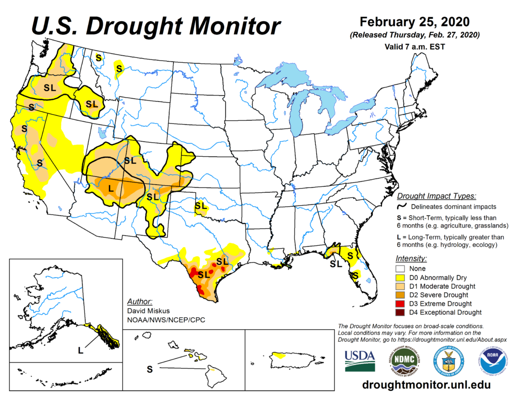
While I did consider the current drought conditions in my forecast, ultimately there is not significant or widespread enough drought over the U.S. to raise any red flags in terms of potentially lowering the overall tornado count this spring.
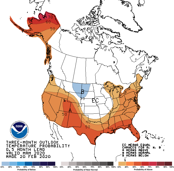
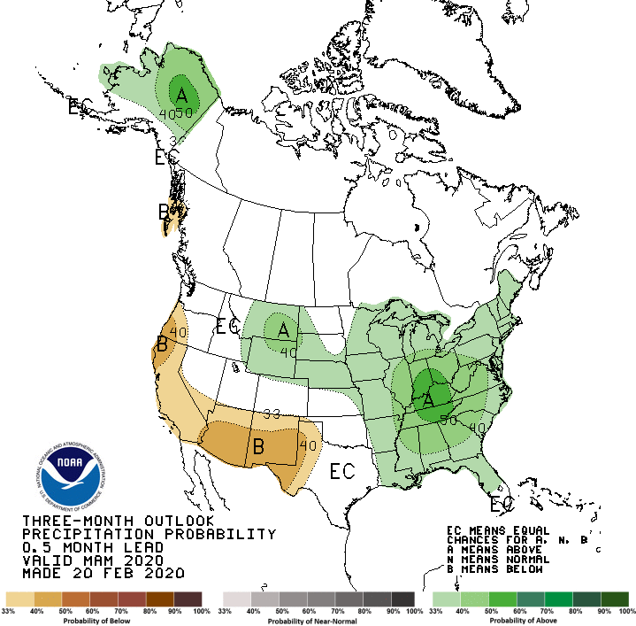
The Climate Prediction Center‘s latest forecast for March through May shows an overall persistence of the recent long term pattern, with some variations.
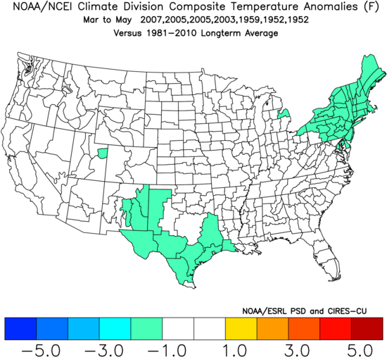
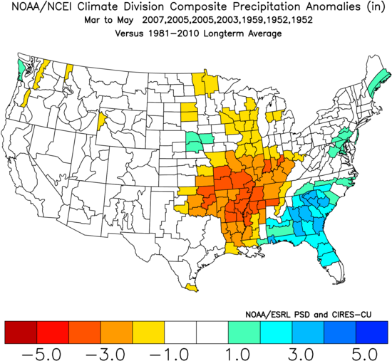
Using strictly the weighted analog years of 2007, 2005, 2003, 1959, and 1952, a different picture emerges.
While not much correlation can be found within the overall temperature pattern, a notably dry Mississippi Valley and wet Southeast can be seen. The precipitation pattern suggests that while parts of the Mississippi Valley may have a less active storm pattern, the Southeast could make up for it with more frequent storm activity. However, given this winter’s overall storm track favoring wetter than normal conditions in the Mississippi Valley, the pattern suggested by the analogs may not ring true in 2020.
Bottom Line
There were some active tornado years within the analog list, with 2007 standing out as a heavy hitter in the early season. Overall, the analogs favor a normal to active April and May.
Given the analogs and the favorable large-scale pattern as March approaches, it appears that the pieces are in place for this spring to be more active than normal.
Odds of the tornado count ending up below/near/above the normal off 511 tornadoes (1991-2010 average) for meteorological spring:
Below normal: 20% (less than 470 tornadoes)
Near normal: 35% (between 470 and 550 tornadoes)
Above normal: 45% (above 550 tornadoes)
Long term forecasts, while generally providing added value to climatology, are still very broad-brush outlooks and do not offer a very consistent level of skill. This forecast only hopes to capture some of the most reliable information available to provide a best guess as to what spring may bring.
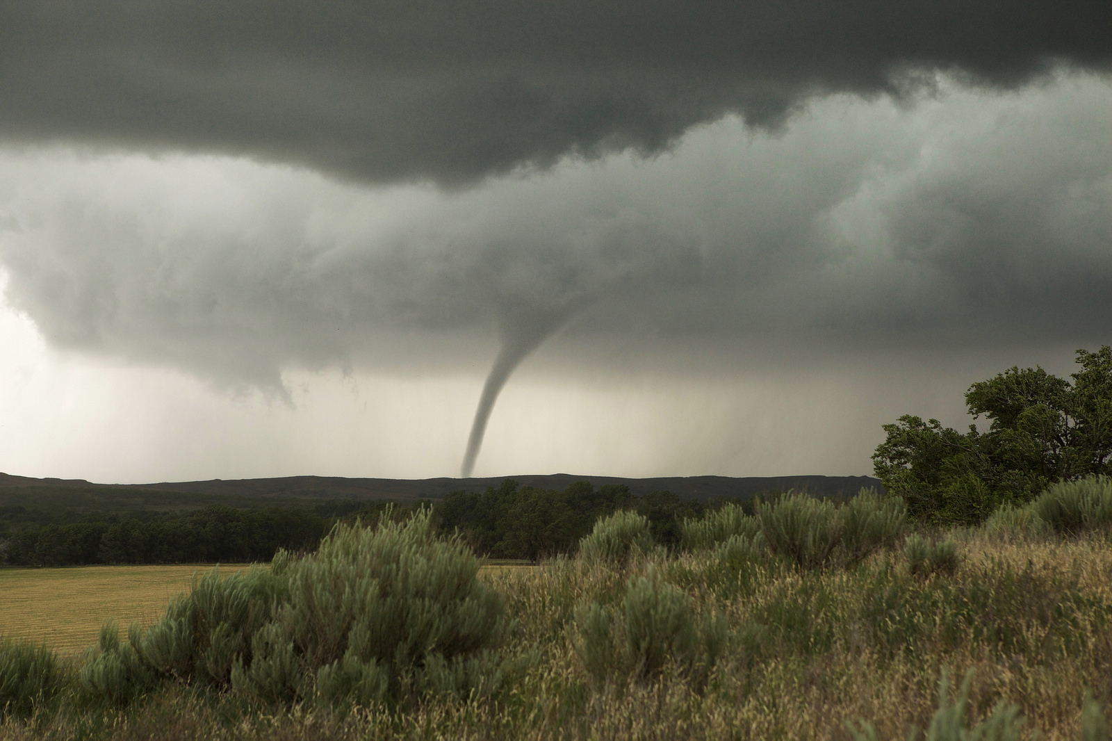
Featured image taken by Jessica Moore, Eads, CO 2015
Latest posts by Mark Ellinwood (see all)
- Spring 2023 seasonal tornado outlook - March 1, 2023
- Spring 2022 seasonal tornado outlook - March 1, 2022
- Spring 2021 seasonal tornado outlook - March 1, 2021
Stay safe you brave storm chasers!
Nita is backed off these monsters so have at it. Just please don’t get too ‘caught up’ in the desire to get a close up shot!
When will you start the daily outlooks from the week ahead because those are very helpful.
Whenever we start having a regularly-active tornado pattern, which has typically been around late March or early April.
It’s about time! We’ve had mild tornado seasons these past few years.
test