Whew boy, what a year we have had so far. I have been mostly MIA due to having a newborn to raise in addition to dealing with all of the COVID-19 chaos forcing my wife and I to work from home with no daycare.
So what to expect from the tornado threat forecast going forward? I am going to try my best to post forecasts for individual storm systems/sequences, but the 7 day forecasts are no longer happening due to the time I have available nowadays. They will typically be issued when Day 1 or Day 2 has a notable tornado threat.
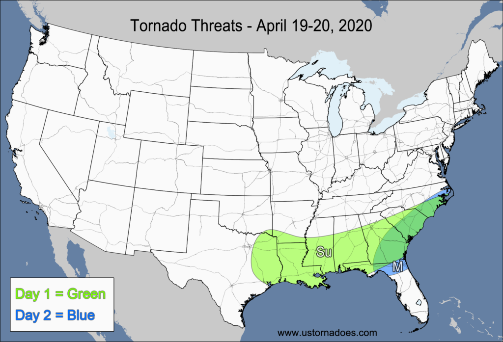
Monday – ArkLaTex, Gulf States, Carolinas
NUMBER OF TORNADOES EXPECTED: 30-70 – CONFIDENCE: Normal
Tornado Hot-spot: None
Pros: Moderate instability, good/excellent speed shear, good low-level directional shear near the warm front and surface low, good upper-level forcing.
Cons: Mid-to-upper level winds are unidirectional, early-day convection and cloud cover could inhibit the northern extent of the tornado threat, low-level directional shear isn’t that great for the warm sector that is not near the warm front or surface low.
Tuesday – Eastern Southeast
NUMBER OF TORNADOES EXPECTED: 6-14 – CONFIDENCE: Normal
Tornado Hot-spot: Eastern Carolinas
Pros: Low to moderate instability, good/excellent speed shear, ongoing QLCS likely, good low-level directional shear in the Carolinas, good upper-level forcing.
Cons: Mid-to-upper level winds are unidirectional mostly unidirectional low-level flow in Georgia and northern Florida, limited time for tornadic activity across most of the risk area between 12-17z (8am-1pm) before the cold front pushes the storms offshore.
Latest posts by Mark Ellinwood (see all)
- Spring 2023 seasonal tornado outlook - March 1, 2023
- Spring 2022 seasonal tornado outlook - March 1, 2022
- Spring 2021 seasonal tornado outlook - March 1, 2021