The active severe weather pattern across the South continues as a disturbance progresses from the southern Plains into the Southeast over the next two days. Both today and Thursday have good tornado potential, but there’s a few hang-ups that could limit the overall tornado count.
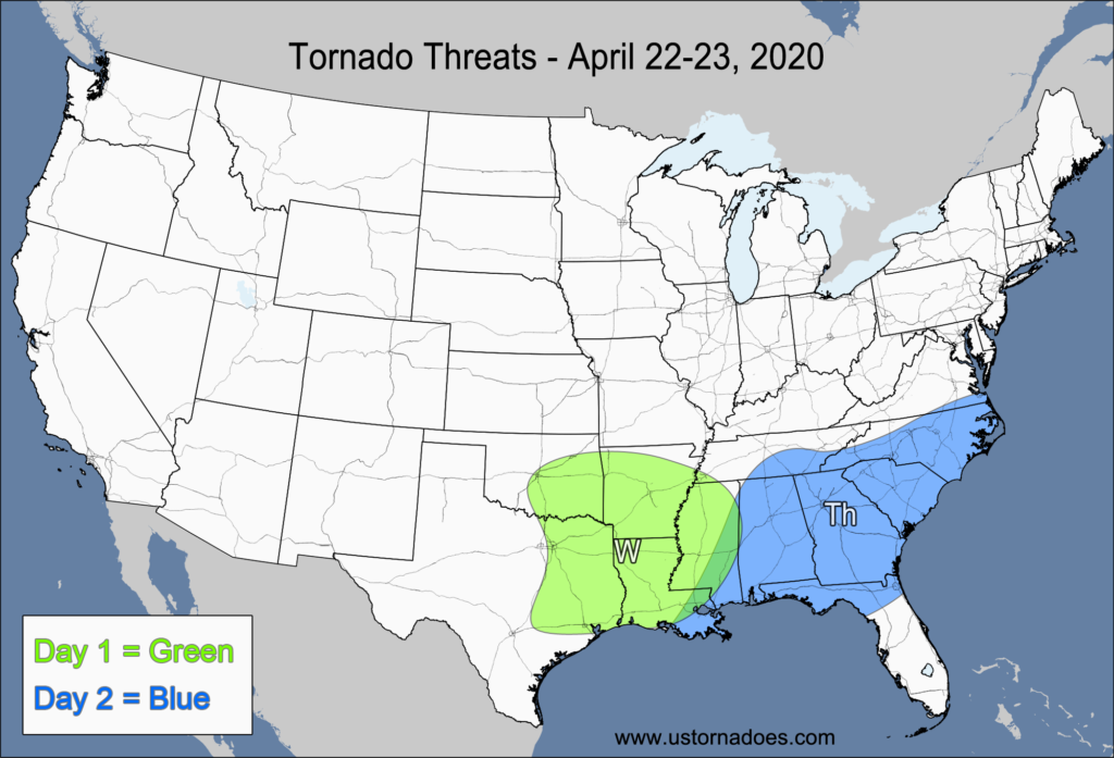
Monday – Southern Plains, Lower Mississippi Valley
NUMBER OF TORNADOES EXPECTED: 15-40 – CONFIDENCE: Normal
Tornado Hot-spot: None
Pros: Moderate to high instability, good/excellent speed shear, good/excellent low-level directional shear, good upper-level forcing.
Cons: Fairly unidirectional flow in the mid-to-upper levels, extensive cloud cover and “crapvection” over the risk area, storm mode could grow upscale and have more clusters and linear storms in the evening and overnight.
Tuesday – Southeast
NUMBER OF TORNADOES EXPECTED: 10-25 – CONFIDENCE: Low
Tornado Hot-spot: None
Pros: Low to moderate instability, good/excellent speed shear, decent/good low-level directional shear, good upper-level forcing.
Cons: Fairly unidirectional flow in the mid-to-upper levels, extensive cloud cover and “crapvection” over the risk area, potential storm mode issues with more clusters and linear segments.
Latest posts by Mark Ellinwood (see all)
- Spring 2023 seasonal tornado outlook - March 1, 2023
- Spring 2022 seasonal tornado outlook - March 1, 2022
- Spring 2021 seasonal tornado outlook - March 1, 2021