Northeastern Ohio, western Pennsylvania, Upstate New York and Ontario, Canada are generally not the first places you would think of when hearing the phrase “major tornado outbreak.” However, on the final day of May in 1985, residents of this region suffered one of the most intense tornado events in North American history, as a powerful storm system brought destruction from the skies in a manner unprecedented this far east on the continent.
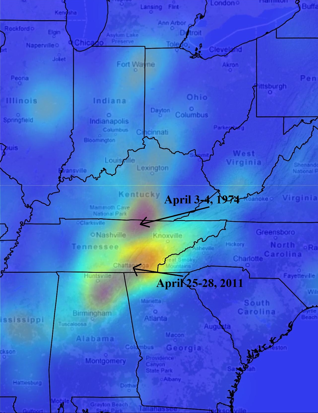
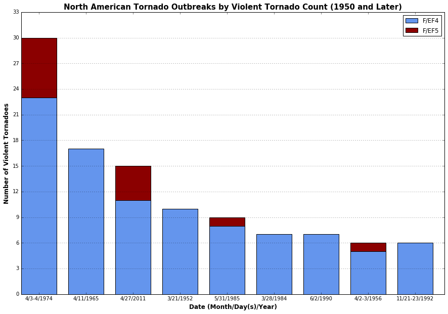
The May 31, 1985 outbreak is staggering in many ways in addition to its unusual geographic location. The count of violent F4/F5 tornadoes it produced outnumbers all but four tornado events since 1950, and its death toll exceeds everything else in the period between the two massive outbreaks of April, 1974 and April, 2011. At this longitude in North America, only two tornado events have led to a comparable or greater number of deaths in at least the last 125 years; the Worcester, Massachusetts tornado on June 9, 1953 and the Appalachians tornado outbreak on June 23, 1944. It is also one of the only known North American tornado events to produce significant tornadoes in both the United States and Canada on the same day, making it a truly “international” event.

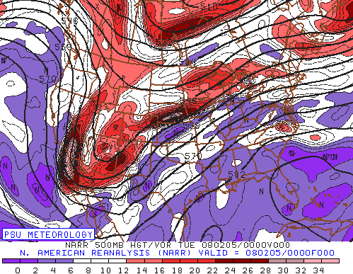
Meteorologically, despite the location of the event, all of the classic ingredients required for a high-end severe weather event were in place in abundance on May 31. A strong and progressive upper level trough tracked from the northern Plains towards the Great Lakes during the morning and afternoon hours, bringing a jet streak of over 70 knots at 500 mb. This provided the strong deep layer shear necessary for organized severe storms.

As this was occurring, an elevated mixed layer, shown as crucial by Banacos and Ekster 2010 to northeastern United States severe weather events, was being advected over the area in the mid levels. It served to prevent storm initiation prior to stronger forcing for ascent arriving later in the day. This elevated mixed layer allowed temperatures at the surface to rise into the upper 70s to 80s and was coupled with rich moisture featuring dewpoints in the upper 60s to low 70s. The combo resulted in a substantial build-up of instability within an increasingly highly sheared warm sector, as a west-southwesterly low level jet of 40-50 knots at 850 mb pushed in by 00z June 1 (8 p.m. EDT).
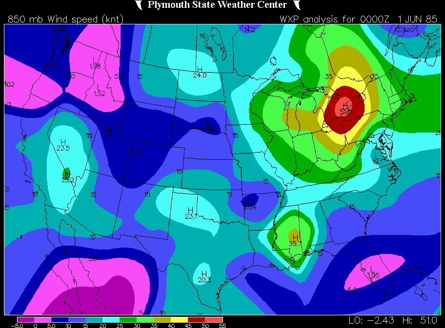
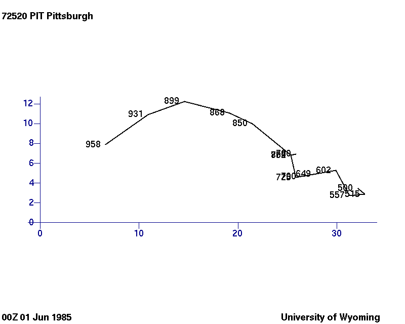
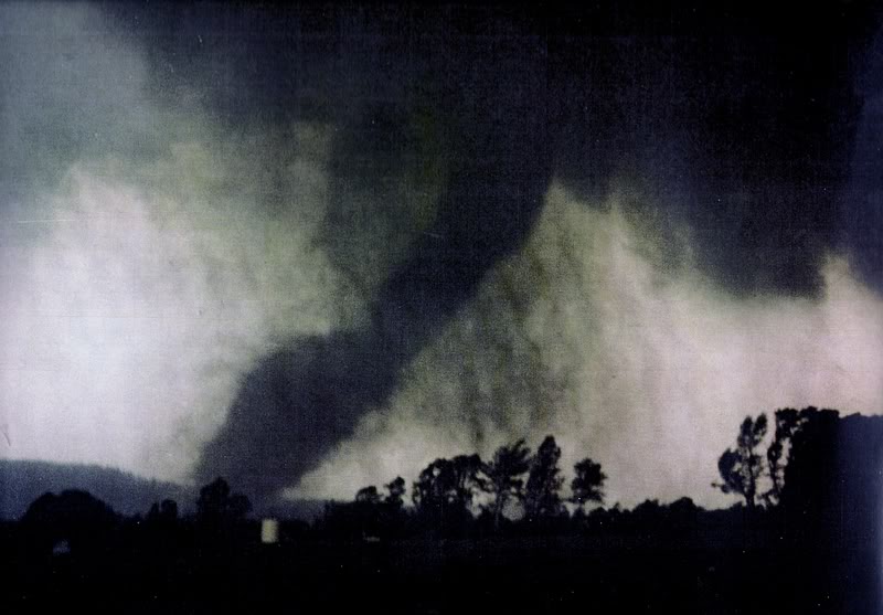
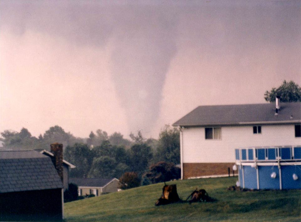
As the sub-990 mb surface low — unseasonably deep for the time of year — moved east, its trailing cold front served as the initiation source for storms into the mid-and-late afternoon hours. These storms, essentially forming in a zipper-like north to south progression, encountered the aforementioned volatile conditions and very rapidly became severe while moving at 35 to 50 mph. Strongly veering wind profiles with height in the lowest three kilometers encouraged rapid mesocyclone development and tornadoes quickly developed. The 00z June 1 sounding at Pittsburgh shows the veering nicely, with a large, clockwise-curving hodograph below 700 mb, favorable for supercells.
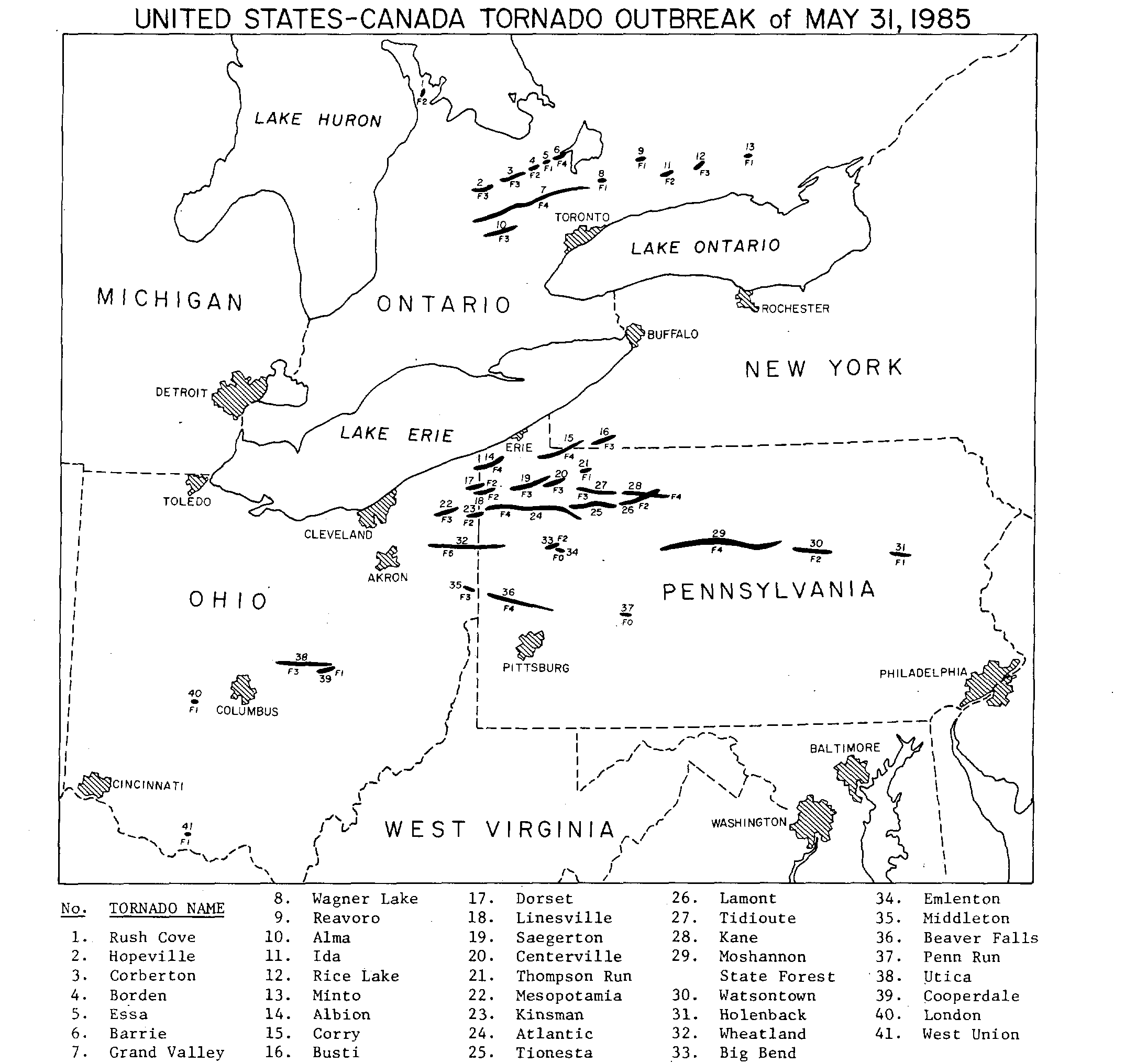
The first location to suffer the outbreak’s wrath was north of the border in southern Ontario.
A cluster of potent supercells produced multiple significant tornadoes in what was to become one of the most destructive tornado events in Canadian history, causing nearly $400 million in damages. Most destructive of these was an F4 that devastated sections of the city of Barrie at around 5 p.m. local time on the shores of Lake Simcoe, killing eight and injuring over 150 others. The longest tracked Canadian tornado on record, also rated F4, followed a path to the south and caused major damage in the town of Grand Valley. On the ground for at least 62 miles (possibly over 70), it claimed four lives to bring the death toll in Canada to 12.
South of the border, the outbreak began in earnest as the first violent tornado formed in far eastern Ohio at around 5 p.m. EDT and crossed into Pennsylvania. It was the first of many that Pennsylvania would endure over the succeeding hours. In Erie County, the F4 tornado ripped through Albion, leading to 9 fatalities in town and extensive damage over a corridor approximately 2 blocks wide and 10 blocks long. A total of 12 deaths and over 80 injuries are attributed to this tornado over its path.
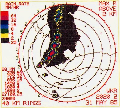
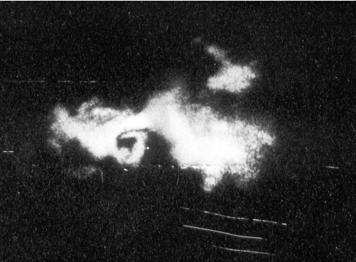
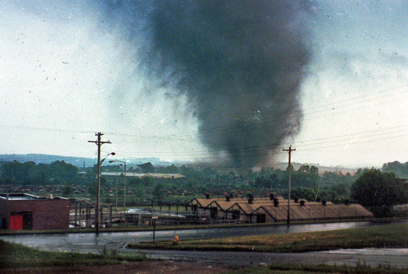
Following the Albion tornado, and over the next several hours, a swarm of strong/violent tornadoes, nearly unparalleled in the modern era in their ferocity and intensity, ravaged the vicinity around Lake Erie. Among the notables was a long-tracked F4 tornado that formed in Trumbull County, Ohio and claimed 16 lives while plowing through several townships in western Pennsylvania over a 56 mile path. Hardest hit included Atlantic (five dead) and Cherry Tree (five dead). An enormous tornado, over a mile wide at times, tore a nearly 70 mile path through the Moshannon State Forest north of Interstate 80. Mowing down tens of thousands of trees, the enhanced radar returns showed up on the WSR-77 radar in State College as a primitive tornado debris signature or “debris ball”. Fortunately, the massive funnel remained mostly in rural areas, leading to no direct casualties.
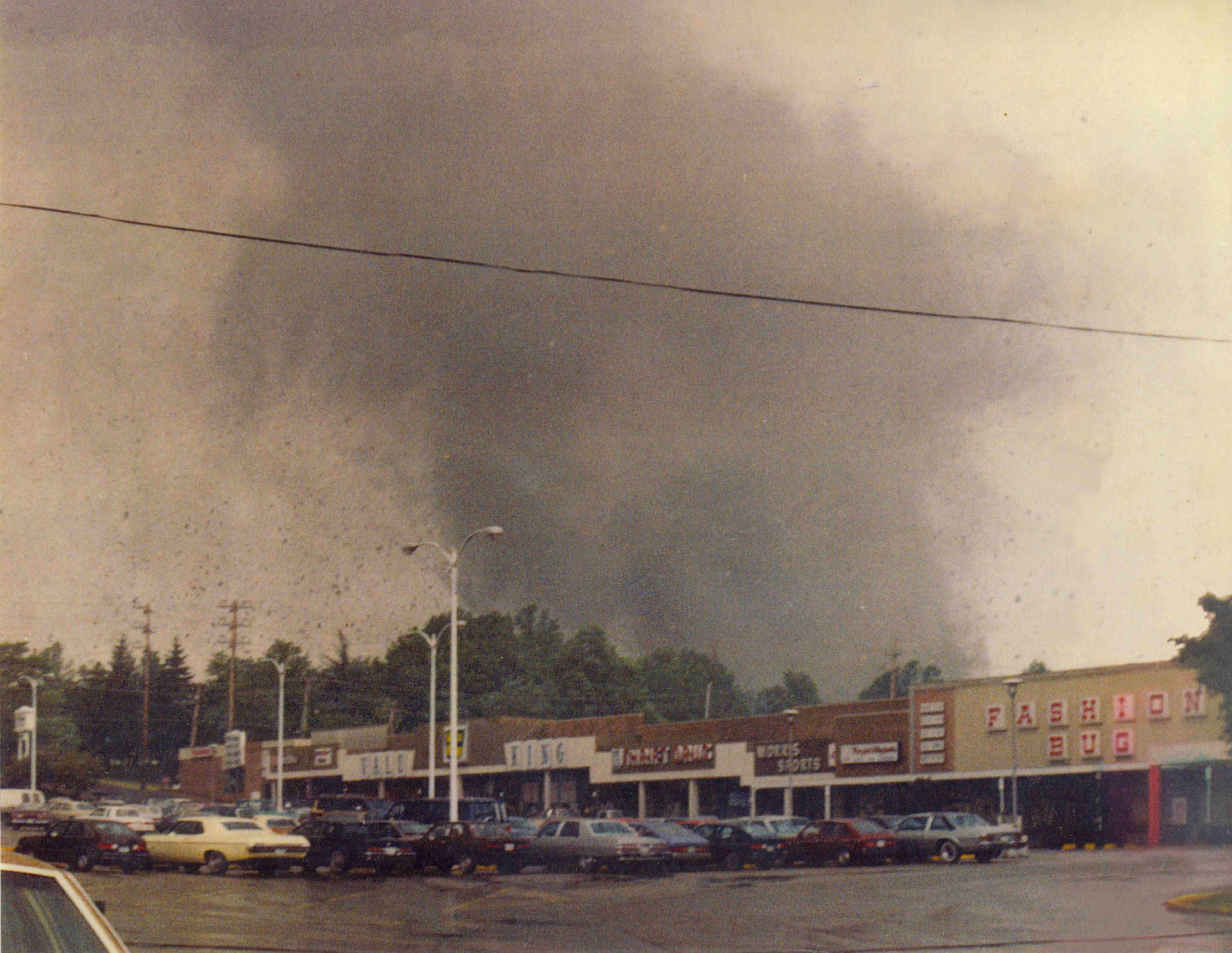
Yet another F4 tornado killed seven as it moved through the German Hill area along the southern fringe of the Allegheny National Forest, while an F3 tornado passed to the north of Pittsburgh, causing nine deaths and over 100 injuries in Butler and Beaver Counties. Two of these fatalities were at a shopping center that was destroyed near Beaver Falls. Numerous vehicles were also damaged or destroyed. Two of the tornado tracks crossed into New York from Pennsylvania, although no deaths occurred in that state.
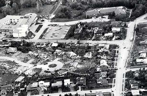
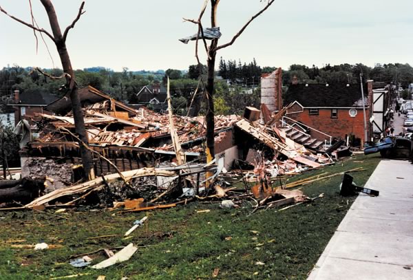
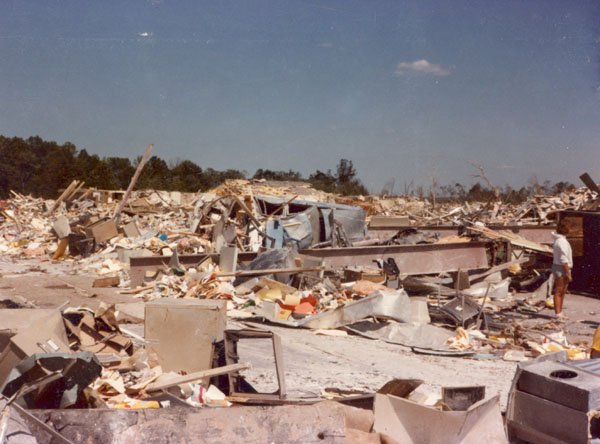
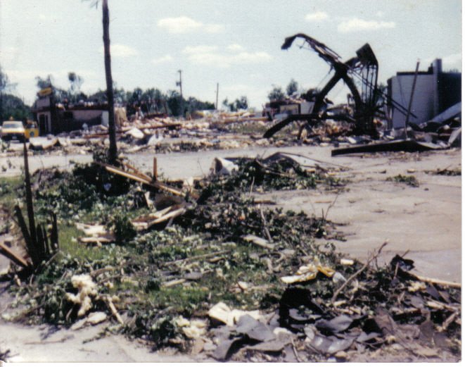
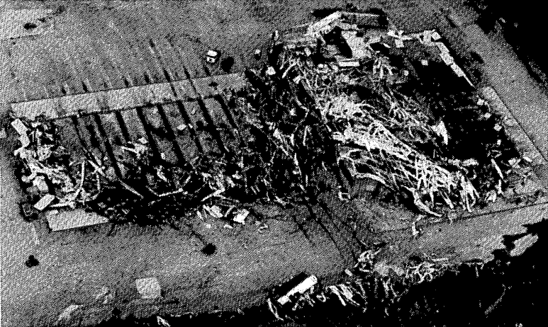
At around 6:30 p.m. EDT, the only F5 tornado of the day was unleashed upon the cities of Newton Falls and Niles, Ohio in the Greater Youngstown area and then smashed into the small town of Wheatland, Pennsylvania across the state line. Possibly the strongest of the 1980s as a whole, this exceptionally violent tornado wiped out numerous homes and the Niles Park Plaza shopping complex in the second location and flattened much of the latter, including a steel frame trucking plant that was demolished and partially swept away. Asphalt was scoured out of a parking lot nearby to this location as well. 18 people perished and 310 others were injured by the tornado along its 47 mile track. It was the deadliest of the outbreak and also the only F5 tornado to ever strike Pennsylvania.
By the time the outbreak brought itself to a close into the late evening hours, at least 41 tornadoes tore across the landscape, forever etching themselves into the memories of the survivors. A total of around 90 fatalities were confirmed, 65 of those in Pennsylvania, making it by far the deadliest tornado event in the state’s history. Coincidentally, the devastating Johnstown Flood in 1889 also occurred on May 31 in Pennsylvania. One of the worst disasters in United States history, it killed over 2,200 people. The outbreak was the most destructive and second deadliest in Ontario’s history as well, the latter statistic only exceeded by a violent tornado in Windsor in 1946. The Niles/Wheatland tempest is, as of this date, the furthest east F/EF5 tornado surveyed in North America since 1950.
The extraordinary nature and location of this outbreak highlights the fact that tornadoes can strike anywhere and at any intensity given the right conditions. Tornado historian Thomas Grazulis calculated in 2001 that the odds of another event of this potency in North America this far north and east is about 1 in 75,000, which likely leads to a longer average return interval than an event of the caliber of the two “super” outbreaks in 1974 and 2011 in a more traditional location. It was a classic setup, in a not-so-classic region.
Hopefully, the lessons learned from this event thirty years later can be put to good use the next time a tornado outbreak of this magnitude strikes in the Northeast, although it is possible nearly all memory will have faded by then. Two significant events in late May (strangely also on May 31) and early June, 1998 brought destruction to a similar part of the United States, although not of the same magnitude as the 1985 storms. Radar technology has vastly improved since the WSR-77 days along with advanced warning (despite the fact that the tornado watches and warnings were very well organized for the time on May 31, 1985, which likely saved many lives), so with luck the casualty count next time around will not be so inflated. As always with this type of event, even if exceedingly rare: it’s not a matter of if, it’s a matter of when.
Sources/Other Recommended Material:
NWS Cleveland, Ohio Outbreak Page: http://www.erh.noaa.gov/cle/office/localinterest/1985Tornado/1985Tornado.php
NWS State College, Pennsylvania Outbreak Page: http://www.weather.gov/ctp/TornadoOutbreak_May311985
Plymouth State Reanalysis: http://vortex.plymouth.edu/upcalc-r.html
Pennsylvania State University NARR: http://mp1.met.psu.edu/~fxg1/NARR/index.html
University of Wyoming Atmospheric Soundings: http://weather.uwyo.edu/upperair/sounding.html
Facebook page dedicated to the outbreak: https://www.facebook.com/groups/may311985tornadooutbreakremembered/
Account of the Beaver County, Pennsylvania tornado: https://stormcsr.wordpress.com/2010/04/15/may-31-1985-tornado-outbreak-twenty-five-years-later/
Southern Ontario Tornado History (includes info on the Barrie and Grand Valley tornadoes): http://www.americanwx.com/bb/index.php/topic/45390-southern-ontario-tornado-history/
Account of the Pennsylvania tornadoes: http://www.pahighways.com/features/may31tornadoes.html
Interactive map of US tornadoes in the outbreak: http://www.tornadohistoryproject.com/tornado/1985/5/31
Sharon Herald article: http://www.sharonherald.com/news/local_news/few-visible-scars-remain-of-that-friday-night-in/article_3943bf03-2677-51ba-a2eb-0e8547f9f494.html
Well documented. You folks did your homework with regard to this outbreak that has hit close to home with my family and the area where our heritage and history lives on.
Thank you so very much ; )
Standing on the Main Street of Polk borough PA, around 7 in the evening – all of our EMS and medical personnel stationed near our closest hospital, we where waiting near the fire hall, debris sifted gently down around us, a piece of an order for building materials from someplace near Youngstown allowed me to pluck it from the air.
My husband, a newly certified Emergency Medical Technician was gone for 24 hours, helped to rescue and treat the wounded from Cherrytree. A completely surreal experience for us both.
I can remember in the immediate days right after this tornado out break in ’85 having several days off from work and driving to many of the areas in NW Pennsylvania to view the incredible destruction the tornadoes left in its wake. One scene that always stuck in my mind that I never forgot was seeing a single blade of a piece of hay about a foot long that had been picked up by the F5 tornado (EF5 today) that swept through Niles, Ohio and Wheatland, PA and flung through the air and driven deep into the bark of large tree that was still standing. Amazing!