Most of Wednesday was spent waiting. And waiting. We drifted from Ogallala, Nebraska to Julesburg, Colorado in case something popped early… we could run north back into Nebraska, or south to Wray. The storms near Wray went up just east of town, and by then we decided that we did not want to drop south and chase it, which would get us more out of position for today’s storms.
We eventually gave up on the day and went to dinner back in Ogallala. Showers with some embedded lightning were heading our way, but we did not pay much attention as we ate.
Coming out of the restaurant, the back side of a beautiful thunderstorm greeted us, and we rushed back to the hotel to grab our cameras. These storms did not exist or were supposed to be tiny showers, according to the models.
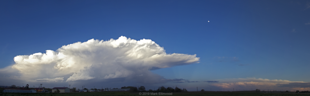
The back of the parking lot at our hotel proved to have a great view of the storm to our east as the sun set. We could even still see the high clouds of the storms that we would have been on if we had dropped south to the Kansas/Nebraska border.
The models seems to be struggling with the storm potential around this area, as what has developed over the past couple of days has been bigger and longer-lived than any of the guidance has shown. We hope to see that again today as we remain in western/central Nebraska, hopefully with more shear and higher dew points to help make the storms even prettier.
Latest posts by Mark Ellinwood (see all)
- Spring 2023 seasonal tornado outlook - March 1, 2023
- Spring 2022 seasonal tornado outlook - March 1, 2022
- Spring 2021 seasonal tornado outlook - March 1, 2021